
Leaderboard


Popular Content
Showing content with the highest reputation on 02/27/20 in all areas
-
12Z GFS has upper 60s to low 70s here next Friday. Yes please.4 points
-
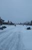
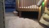
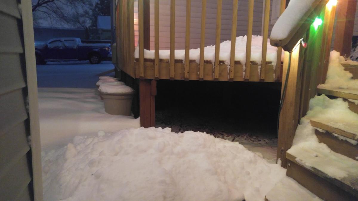
Was about to go measure when I realized the snow doesn't want to say goodbye to Macomb County just yet, rates picked back up. Here's the deck currently.
 4 points
 -
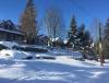
Right when the snow had started Wed AM. Was briefly in a lull b4 the moderate to hvy snow moved in by late am.
 2 points
 -
I think it’s time to move on To spring!2 points
-
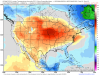
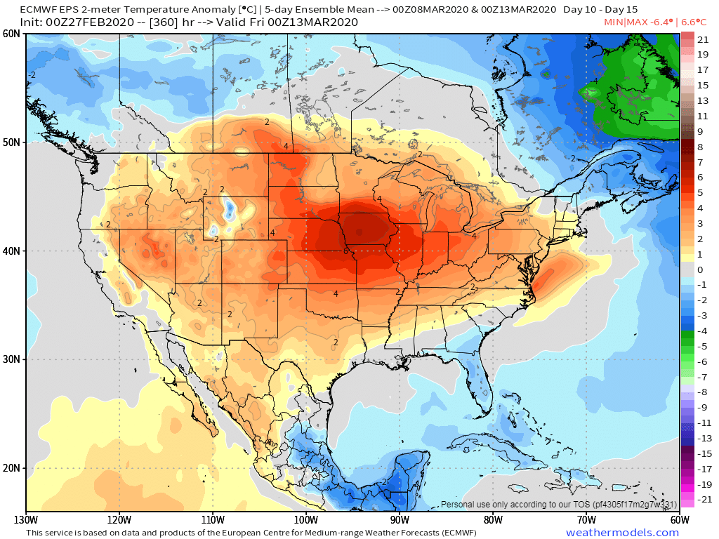
Both the JMA/CFSv2 weeklies are showing an anonymously warm CONUS east of the Rockies this month.... JMA Week 1-4...warm and wet for the OHV/GL's/MW???
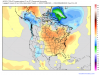 2 points
 -
Still snowing w temps at 23F. As for accumulations, will have to measure tomorrow. If I had to guess, I would say somewhere between 4-8"2 points
-
Well, here we are, only a few days away from met Spring and for some of you it has already felt like Spring has arrived early this year. What will this month entail? Is Severe Wx going to come out of the gates hot this year??? Is there a durable Spring tease on the horizon??? I'm sure I speak for many on here and most would like an early Spring this year compared to previous years. Given the nature of our pattern this season, I'm almost certain there will be plenty of severe wx chances this month but how far north is the question. Let's dive in... Last night's 00z EPS suggesting a large scale warm spell starting around the 7th or so while the 00z GEFS are suggesting the cold will try and press. There is a storm system brewing to open up the first week of the month and could be the first one to produce some possible severe wx across the S MW/OHV. Them models are showing a very wet signal and may be a tell-tale sign of where this year's Spring pattern is heading.
 1 point
 -
PV isn’t coming down this late winter/spring. It will weaken and die. Look for a normal to slightly AN spring. This isn’t last year1 point
-
The 18z GFS has nine straight days of 50s and 60s here, from day 8 to 16.1 point
-
Quite the forecast for Watertown NY the next couple of days, up to 45" in the point forecast This AfternoonSnow. The snow could be heavy at times. Areas of blowing snow. High near 28. Windy, with a west wind around 28 mph, with gusts as high as 55 mph. Chance of precipitation is 100%. Total daytime snow accumulation of 6 to 10 inches possible.TonightSnow. The snow could be heavy at times. Areas of blowing snow. Low around 19. Windy, with a west wind 24 to 28 mph, with gusts as high as 55 mph. Chance of precipitation is 100%. New snow accumulation of 11 to 17 inches possible.FridaySnow. The snow could be heavy at times. Areas of blowing snow. High near 24. Breezy, with a west wind 17 to 21 mph, with gusts as high as 43 mph. Chance of precipitation is 100%. New snow accumulation of 9 to 13 inches possible.Friday NightSnow. The snow could be heavy at times. Low around 10. West wind 7 to 14 mph, with gusts as high as 24 mph. Chance of precipitation is 100%. New snow accumulation of 3 to 5 inches possible.1 point
-
Im thinking by mid March, Winter precip its done! But then again, who knows.1 point
-
Yep, looks very marginal, if that. Unless we get a "Surprise" from Ma Nature outta nowhere.....1 point
-
Added 6.8" to the snow dept from this last snowstorm and makes my new snowfall tally 43.6". Considering it was a very mild Winter, I'm surprised Ive gotten this far w snow totals.1 point
-
Yeah, the models are increasingly suggesting we're largely done with winter. The Euro is pretty torchy at the end of its range. Bring on the 50s and 60s!1 point
-
Nice snow coming down. Too bad it is now 34 degrees. https://nebraska.tv/weather/camera-network/holdrege1 point
-
Late winter is delivering a blizzard of Mt.Cedar! Allergies are pegging the chart and I feel like warmed up spit. It's been a bad year for allergies here as we didn't get the deep cold. Could have used a little snow. Instead we got rain and the cedars were in happyville. Thus the misery index is topped out. Blehhhh!
 1 point
 -
March 4th storm looks to be strong just no cold anywhere around.1 point
-
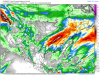
The CFS has been steadily trending very wet across most of the MW/OHV and mainly dry across the Plains states...1 point
-
That was a decent storm. Winds ~ 45mph throughout, with plenty of vivid lightning strikes, then the precipitation flipped over to mostly graupel or hail during the second half of it. A very pulsy wind, like a sine wave.1 point
-
Wall of wind coming out of the mountains. Let’s see how much mixes down..lowest few thousand feet are stable at the moment so CAA will have to scour that out.1 point
-
It will end up an east coast special. 100%.1 point
-
Impressive PRELIMINARY LOCAL STORM REPORT NATIONAL WEATHER SERVICE GRAND RAPIDS MI 752 PM EST WED FEB 26 2020 ..TIME... ...EVENT... ...CITY LOCATION... ...LAT.LON... ..DATE... ....MAG.... ..COUNTY LOCATION..ST.. ...SOURCE.... ..REMARKS.. 0630 PM SNOW 3 SSE CLARK LAKE 42.08N 84.31W 02/26/2020 E8.5 INCH JACKSON MI PUBLIC LAKE COLUMBIA.1 point
-
Was at 4.5" imby as of 7 pm. As expected (and all too common this winter) there was a ton of melting on concrete due to the 3 day torch beforehand. Shoveled my driveway which had 3" over 1/2" of slush. Salted streets/roads had much less than that even. Not complaining ofc, especially with so many of our Sub Peeps getting shafted by the models.
 1 point
 -
Remember the post I made where I said temps were too warm? Yeah, well.... Temps have dropped sharply. The slush on the roads that was previously not an issue flash froze, and snow is falling on top of that. Roads are a disaster here. 23°F.1 point
-
The total @ TOL today so far is 2.8". We'll add to that but it may not be much1 point
-
Wowza! URGENT - WINTER WEATHER MESSAGE National Weather Service Buffalo NY 1258 PM EST Wed Feb 26 2020 NYZ006>008-270200- /O.UPG.KBUF.LE.W.0004.200227T1200Z-200229T2300Z/ /O.NEW.KBUF.BZ.W.0001.200227T1200Z-200228T2100Z/ Oswego-Jefferson-Lewis- Including the cities of Oswego, Watertown, and Lowville 1258 PM EST Wed Feb 26 2020 ...BLIZZARD WARNING IN EFFECT FROM 7 AM THURSDAY TO 4 PM EST FRIDAY... * WHAT...Blizzard conditions expected. Total snow accumulations of 3 to 4 feet across the Tug Hill Plateau, and 1 to 2 feet for surrounding lower elevations. Winds gusting as high as 50 to 60 mph will result in severe blowing and drifting snow. * WHERE...The Eastern Lake Ontario Region. * WHEN...From 7 AM Thursday to 4 PM EST Friday. * IMPACTS...Travel could be very difficult to impossible. Areas of blowing snow will produce near zero visibility. The hazardous conditions will impact the morning and evening commutes Thursday and Friday. Strong winds could cause some tree damage and scattered power outages.1 point
-
Coming down moderate to hvy at times, blowing snow as well. Not sure I can tell from my window, but looks like more than 3 inches have fallen and counting. I will measure lata on tanite......Im thinking 6" or better should be doable by the time it all ends by midnight. We will see. Complete Winter Wonderland out there! Winds are gusty as well. Temp at 27F.1 point
-
1 point
-
I was aware of the situation and hoping it did not escalate to this, but now, this is frustrating as hell.....I was informed by neighbors of mine there (Chios Island) Greece that camps were built almost near my home area. Wish I was there to fight the police and use some of my weapons to kick em out (refugees also who have no right to take others land or even borrow). Told them to notify me if any tents are built on my property there and if they dare to do so, they will not live to see the next day. All out war there! https://news.yahoo.com/greek-islanders-strike-migrant-camp-row-intensifies-111314680.html https://www.nytimes.com/2019/10/31/world/europe/migrants-greece-aegean-islands.html Cant believe citizens are being shot by police, power n electricity has been cut OUT despite high percentage of elderly population...and why would they do that. Because citizens are protesting the condition of the refugee camps on those islands. We will absolutely not tolerate that!!!1 point
-
Here is another look at the snow band from NWS Twitter. Really cool to look at both of these. https://twitter.com/NWSHastings/status/1232697861000687617?s=201 point
-
Let's call this...THINGS YOU WILL NEVER HEAR ME SAY: WINTER EDITION! 1. "WOW...the heavy snow was supposed to hit Minnesota but it buried MBY instead!" 2. "The models locked me into the heavy snow track five days ago and totally delivered!" 3. "CRAZY...our official snow forecast called for 1-3" but we ended up with 14" instead!"1 point


This leaderboard is set to Vancouver/GMT-07:00