Leaderboard
Popular Content
Showing content with the highest reputation on 08/26/20 in all areas
-
The sooner you realize the “scientists” are out for the same thing (money) the “oil execs” are, the sooner you’ll start to piece things together. And when you finally figure out which side lies more to get their way you’ll finally get it. Oh and there is this one small detail that doesn’t give a crap how many people there are. It’s called the sun.4 points
-
To say it has been dry in Central Nebraska so far in August, is an understatement. Top 2-3 driest Augusts' in 125 years. https://twitter.com/NWSHastings/status/1298639446749802496?s=204 points
-
Unfortunately, no. It was quite a show of constant lightning, but the good cell to my NW sank south as it approached and I got only 0.10". I also missed out on the Lake Co. storm just north of me the previous day. I've had barely a half inch of rain since July 15 despite several opportunities. I have 2+" crevices opening up IMBY.3 points
-
Laura just went through an eyewall replacement. Now there's really nothing keeping it from strengthening. Down to 969mb, down from 973 just 90 minutes ago. Good news is that the wind field doesn't look to be that big. Hurricane force winds won't extend far from the eye wall.3 points
-
2 points
-
I've always found tornado warnings during a major hurricane to be ironic, as usually the winds on the tornado are less intense than the winds of the hurricane itself. Anyways, here's the first of probably many tornado warnings:2 points
-
NWS Lake Charles has been evacuated. NWS Brownsville (who is normally a backup office as their normal CWA is only 6 small counties) is covering for them now.2 points
-
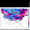
Generally speaking, Arctic temps this past Summer have been hovering near normal up until recently when norms begin the seasonal cooling, arctic temps have stayed AN. If you look at the tail end, however, temps are now beginning to slide south as the Autumn pattern takes shape way up north across the Arctic regions. http://ocean.dmi.dk/arctic/plots/meanTarchive/meanT_2020.png I looked at several models and the overall theme as we open up met Autumn is for the Arctic regions to cool off quickly, more importantly, the northern parts of Canada are expected to build up an early season cold pool as the North American Vortex takes shape...AGAIN! It has been a repeating pattern these past few years and something that I'm curiously looking into to see if this is a general climatic shift. Anyhow, as the saying goes..."If you build it, it will come"...like in years past, if you build the glacier the cold will come. Its nice to see the GFS and CFS model jumping on the idea of snow falling early and often across our neighbor to the north. It also appears likely that Eurasia will have a significant increase in snow cover as Summer quickly transitions into Winter across Siberia. All those forest fires up in the Arctic regions this past summer in parts of Siberia will be a thing of the past once the Snow begins to fall and spread throughout the region. I've been watching the CFS model over the past few weeks and its been lock steady showing an expansion of snow cover. Today's run provides us an example of what we may see in the coming weeks as the new pattern evolves. My personal belief is that this year something different is happening over the northern latitudes. October 1st... On our side of the Pole, the theme has been for widespread snowfall across Canada and the NW Territories. October 1st... Looking ahead, I'm keeping a close eye on the models and their handling of blocking in the extended. The trend among the models has been stronger blocking where we need it most for those who want to see a solid winter (like many of us do as winter wx enthusiasts). Could the blocking be a head fake?? Sure, just like what happened in recent years but I got a funny feeling this may be THE year. Finally.2 points
-
Nice eyewall formation on Laura. Exact tracks are hard to nail down this far out. Good chance that we won't have a better idea until tomorrow. Right now, a westward shift in the track seems likely. Growing up in Houston, I went thru 2 hurricanes. Rita and Ike.2 points
-
Nice. Managed .07" from a couple showers this evening. Really hoping Friday delivers more.1 point
-
What a monster of a storm! Hoping most everyone got out of the way of this hurricane.1 point
-
1 point
-
Clearly you can see the "Warm-Front" over my area in SEMI w that long, white streak of cloudiness, stretching right into southern parts of Canada. Just north of me, temps were in the 70s, while south of that front, temps soared in the upper 80s.1 point
-
Cat5 hitting the coastline of LA is a real possibility. This has definitely surpassed "Rita" from back in 2005. Anyone still there (that has not evacuated) will have a very rough nite.1 point
-
Moved ashore around noon as the wind picked up. It’s been particularly windy in the coastal areas since the heat wave ended for some reason. The warm SSTs haven’t done much to keep MB sunny.1 point
-
1 point
-
Yup, I’m interested to see how these storms spin up next week and all of September in the Bearing Sea! Those crab fisherman gonna be rocking and rolling the high seas!1 point
-
"cough" ..... check out that Aleutian blob too. Not going to have any problem with dynamics or spin in the atmosphere thats for sure.1 point
-
This hurricane has now been classed as a Cat 4 of 140 mph. God help them. Not good history. What models aren't accounting for is that this hurricane is also going to be traveling inland over some of the most fully saturated ground I've seen in decades. Its a self-sustaining atmosphere. I'm in for trouble all the way up here.1 point
-
Indeed...and it's leaning towards an east-based Nina which bodes well....1 point
-
1 point
-
1 point
-
Temper or mental, going to be a winter, thats for sure. Don't know if its ever been cold and warm in the same winter here before. Sounds like the plains in winter. Lol. They DO have the cold anchored in the central CONUS though and warm on West coast. I'll give them that.1 point
-
Good stuff Tom as usual!! You always get me pumped up for the winter, I love your research and hopefully we can all score a fast start to winter!1 point
-
Laura needs to make a NNW turn soon if the Houston area wants to be spared from hurricane force sustained winds.1 point
-
1 point
-
Its pouring here imby. Had a few rumbles of thunder and lightning, but no biggie. Temp is currently at a very pleasant 64F. It stays unsettled until Saturday, so definitely some needed rainfall.1 point
-
1 point
-
Yesterdays official low of 72 at Grand Rapids tied 1948 for the record warmest minimum for August 25. Here at my house I recorded 0.16" of rain yesterday that is more then the airport where only 0.04" fell. At this time it is 68 here and at last report it was 69 out at the airport with cloudy skies.1 point
-
Noisy thundershower this morning as the front is passing through. 72°F.1 point
-
Days are getting noticeably shorter now.1 point
-
Light rain reported at Lompoc last night. Fogust is back.1 point
-
1 point
-
1 point
-
Now, my question here is, does this become a "Cat4." Maybe. It all depends on how quickly it intensifies.1 point
-
Low blow friend! Lol. Ouch!Keep the gloves up. That's getting personal right there. You can call me an idiot all you want to, but quit fuffing with my snow! Thems fightin' words man. Lol I thought we were only here to find the one person we disagreed with and write assumptions at them. Guess I was mistaken.... Is "longer-term, wavelength-driven, possibly apocalyptic, covid-19, possibly Trump-induced climactic pattern shift" a better and more acceptable term or should I tailor it a bit? I'm seriously ready for fall. Very very much. It's gonna be "yuuuge". Your post was still more worthy of a response.1 point
This leaderboard is set to Vancouver/GMT-07:00

