
Leaderboard


Popular Content
Showing content with the highest reputation on 09/27/20 in all areas
-
I picked up a decent 0.39" of rain today, better than what models were predicting.3 points
-
Ended up with a decent 0.44” here. For awhile it looked like l’ld get quite a bit more, but the last hour or two of rain was lighter than it appeared on radar similar to the onset of this event. Maybe more dry air was working in aloft again. Looks like Washington (approx. 15 miles south) got almost another time as much.2 points
-
Why we really need one over our way..
 2 points
 -
Talk about flipping a pattern switch! Overnight we go from endless summer sunshine and benign repeat to active, active, active. Things that are in my AFD for this week: Up to 1" rain, classic autumn stratiform type Brisk north winds High temps 10-15F below normal Cold core thunder Likely waterspouts Lows in the 30s Possible frost1 point
-
Man, if the GFS is not really as progressive or warm, as its future indicates, the block over the SW and PNW won't migrate east. There's nothing to really cut down this semi-permanent feature. Only approach that could reestablish it any farther east is if a storm undercuts it. We're really in for the long haul here. The BSR carries it (the cold onslaught) longer than even I'm brave enough to go at this point. Like Tom also said, its 4 distinctive storms or cold waves likely coming at this point, at the minimum. Buckle up. October will be charging in shortly... If it goes the distance, it will be pretty radical.1 point
-
Finished with enough sprinkles to wet the pavement. I doubt it even measured .01” Cloudy and cool does feel great, however.1 point
-
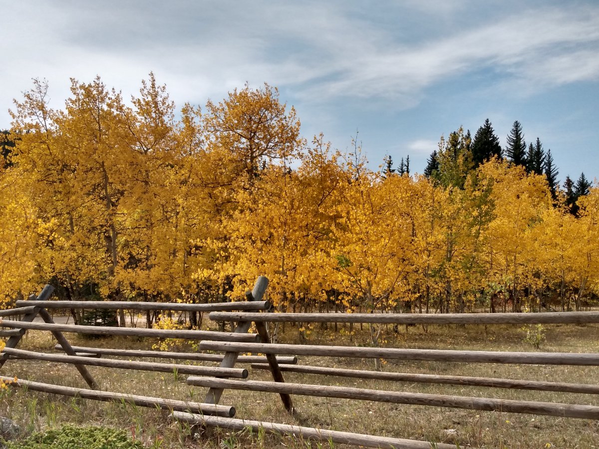
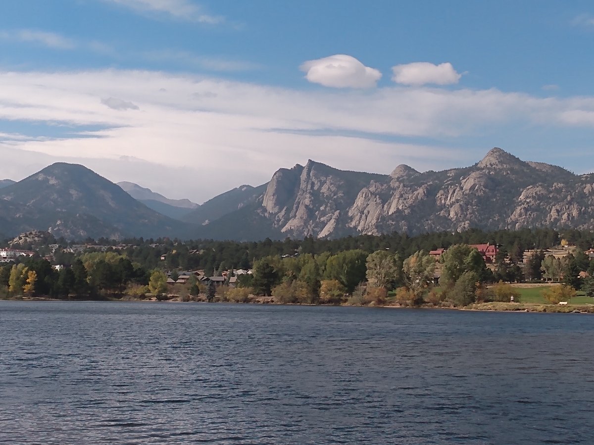
Went for a drive on the Peak to Peak highway between Boulder and Estes Park yesterday, scoping the falliage.

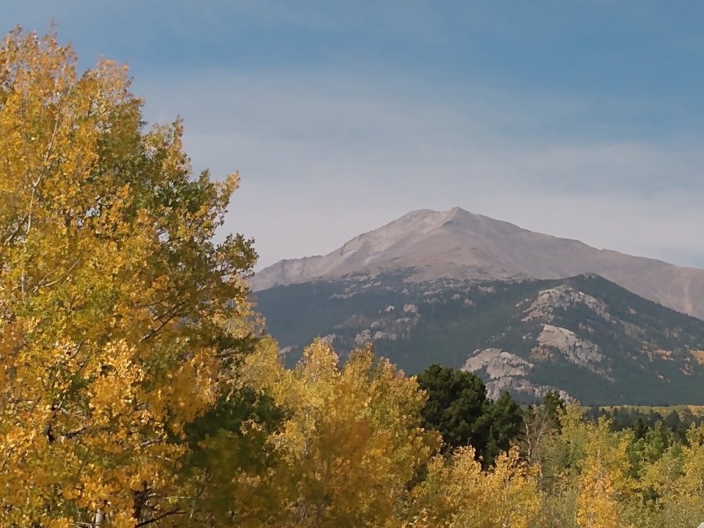
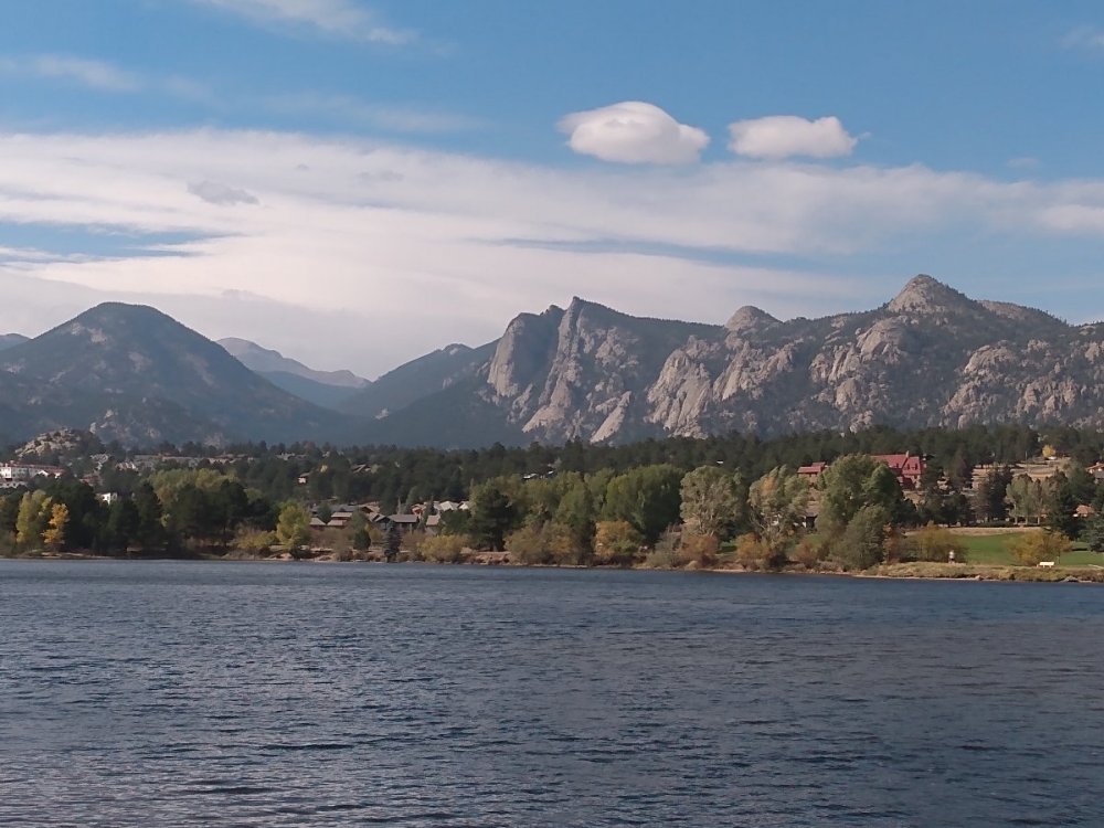 1 point
 -
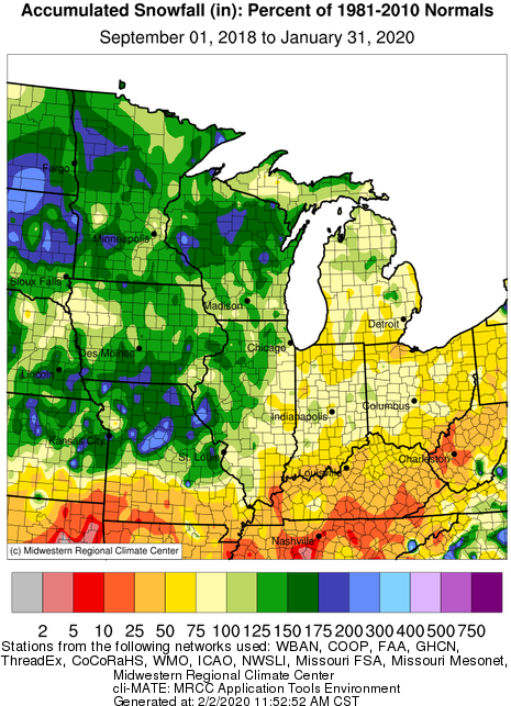
Some of those systems verbatim would indeed get far enough west to "hit the Mitt" (see hot zone map attached) Great stuff Tom - thx
 1 point
 -
Just sprinkles here but the low cloud deck and NW breeze are nice. Just 59°1 point
-
A tweet from NWS DVN... Click on image to view replies.1 point
-
2017 was horrid hot well into October. I think we've gotten this month to kinda balance that one out.1 point
-
Nice turn-about amigo. As I said about that GEFS animation, with a high confidence in SLP development and placement, this looked promising. I feel for our Plains Peeps and their drought situation. We've also gone back to at least a surface dryness as my south facing garden and lawn is going brown again. A solid 0.5 to 1" of rain followed by more cloudy-n-cool wx should alleviate the dryness concerns around here. Let's see if this can trend even wetter?1 point
-
Yesterdays official high of 81 tied 1901 with the 9th warmest high of any September 26th here at Grand Rapids. however it was well short of the record high of 92 set in 2017. The official overnight low of 65 so far would tie the record warmest minimum for any September 27th if it can stay that warm until midnight. (very low chance) That just shows you how fast it cools off here in Michigan in September.1 point
-
Northwest flow1 point
-
Some LR thoughts on this beautiful Sunday morning...I'm paying close attention to the wx pattern thousands of miles to our NW, near the Gulf of Alaska, where today a powerful and rare early season storm system is poised to thrash the SE coast of Alaska with Hurricane Force winds. My brother and his family have a cabin near the Kena coast where they had some great Salmon and Halibut fishing last month. Over the next week, this part of the North American continent is going to get lambasted by 4 storm systems in a week long barrage. Take a look at the 00z GEFS animation below... Why is this important??? Well, the track to which these storms are taking is critical to our wx pattern downstream as this pumps the ridge up along the western NAMER coastline in the near term. Last year, I remember these storms plowing east into western NAMER, thus pumping a huge EC ridge and very different compared to last year. Now, this is where I think the pattern may be heading towards Week 3-4 of October. The track to which these storm systems are taking suggest to me that we will see a lot of systems tracking up from the south (potential GOM systems) and ride up the App's or EC. Unfortunately, this means those members in our western Sub may not benefit from this pattern come Week 3. We'll see but if the PNA relaxes to more neutral by then it may allow a farther western storm track through the MW/GL's during this period. I'm thinking there will be a very active period by Week 3 and a persistent Long Term - Long Wave trough across eastern North America. This could be the chilly pattern both the Euro Weeklies and CFS model are seeing towards the later part of the month.
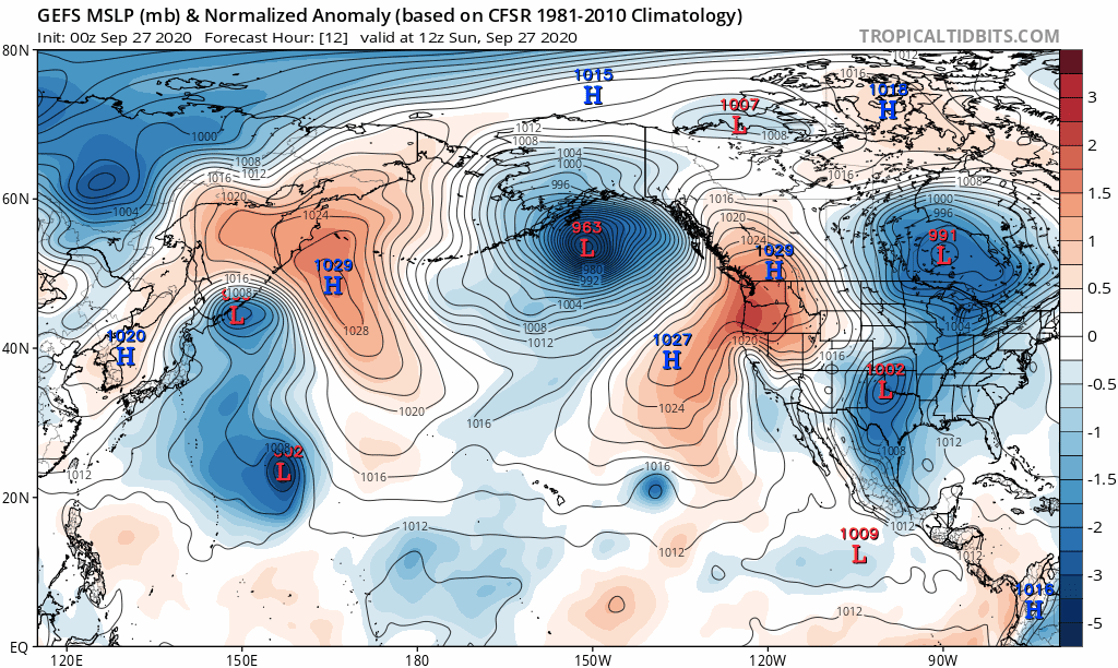 1 point
 -
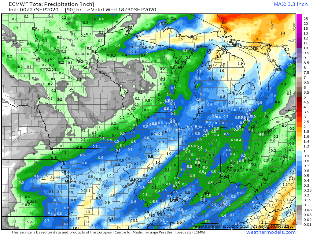
Just like many of you yesterday, we got stuck in a low stratus deck all day long, thus, temps only topped out in the upper 70's instead of mid 80's. I was hoping to get some vitamin D but nature had different plans. Gusty SW winds continue to blow before the CF makes its way here this afternoon. Is this the last mild morning of 2020??? It's a very warm 68F right now and with the windows open it does feel kinda nice. Took a look at the models and we may have a SLP to track after all??? Both NAM's show a SLP tracking up along the trailing CF and strengthening up into the Mitt on Monday. Perfect storm track for Jaster and crew. Other CAM's also agree to some extent. Last minute trend??? 00z Euro increased precip totals around the GL's region and down by Clinton...
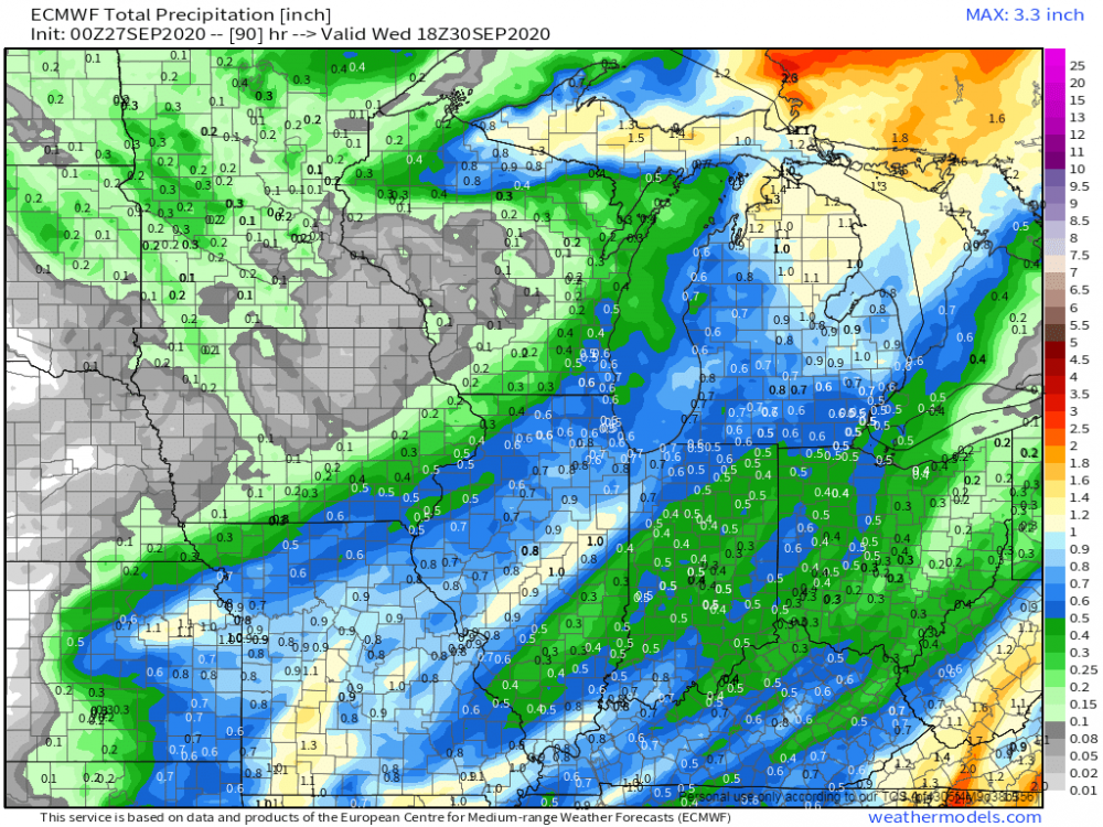 1 point
 -
Gusty south breezes here but also a noticeable amount of leafs blowing around for Sept.1 point
-
LOL @ GFS showing a snow swath across N. IL for 5-Oct. Anyone in a betting mood?1 point
-
Cold front just coming through. Temp is dropping and the wind is howling out of the north. Lots of blowing leaves also. Goodbye summer, hoping you are gone for good this time.1 point
-
We also fell well short of the expected high temp today due to plenty of clouds. I'm glad it remained pleasant. Southwest Iowa hit the mid 90s.1 point
-
You can control our weather Stop driving cars Kill off all cows Stop using electricity Never ever vote Republican again1 point
-
NWS Hastings says most locations aren’t reporting anything hitting the ground. Sprinkles at best. Rinse and repeat. It is very hard to break a drought.0 points


This leaderboard is set to Vancouver/GMT-07:00