


Beltrami Island
-
Posts
368 -
Joined
-
Last visited
Recent Profile Visitors


Beltrami Island's Achievements
")


-
March 2024 Observations and Discussion
Beltrami Island replied to Tom's topic in East of the Rockies
In this case that is the dry slot of this storm, no? Iowa still has the nw to se gradient on average. Minnesota's gradient is particularly contrasting between gulf moisture feeding into storms of upper Mississippi vs the arid plains of ND/MT, etc. -
March 2024 Observations and Discussion
Beltrami Island replied to Tom's topic in East of the Rockies
I am weird,but I find it interesting when a storm system demonstrates climo so closely.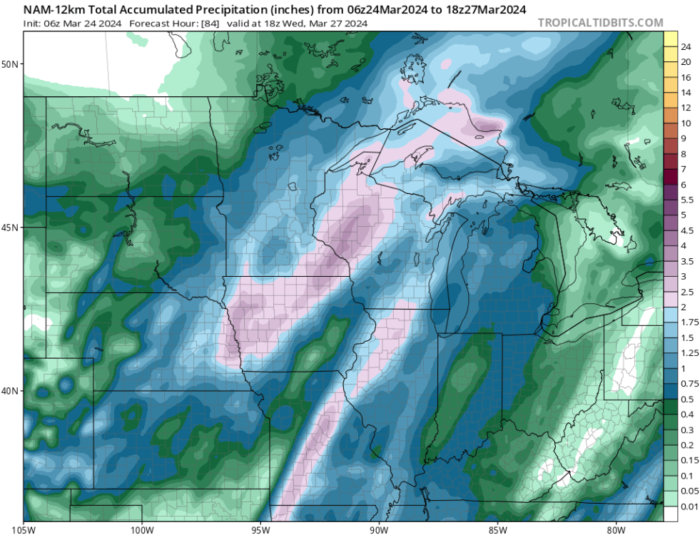
-
3/24-3/27 Midwest/Plains Colorado Low(s)
Beltrami Island replied to Minny_Weather's topic in East of the Rockies
Looking at last nights GFS I was starting to get interested and think maybe the north trend is going to get me into something worth watching. I wake up and see the northern trend smashed with a hard northerly cutoff line to my south reappear. Like living Jan-Feb 2023, watching central and NE Minnesota get crushed while I enjoy the bright clear skies of NW MN. -
ORD and Duluth battling it out 18.5" to 18.7" for the season so far. I can believe ORD has beaten Duluth at some point over an entire cold season. But, you'd have to be a fool to predict this little for Duluth to date.
-
2023 - 2024 Autumn & Winter Discussions
Beltrami Island replied to Tom's topic in East of the Rockies
Had to laugh at this... Accurate for the whole of this winter
-
March 2024 Observations and Discussion
Beltrami Island replied to Tom's topic in East of the Rockies
Just to tease, Teton pass atm... The entire west is getting hit with the current storm. What's funny out west is, while isolated weather patterns do happen to favor different areas at different times. When good storms hit the west they can cover vast areas from California to Colorado to Montana to Washington at the same time. Snowstorms in the Midwest have maybe a max 200-250 mile wide swath 95% of the time?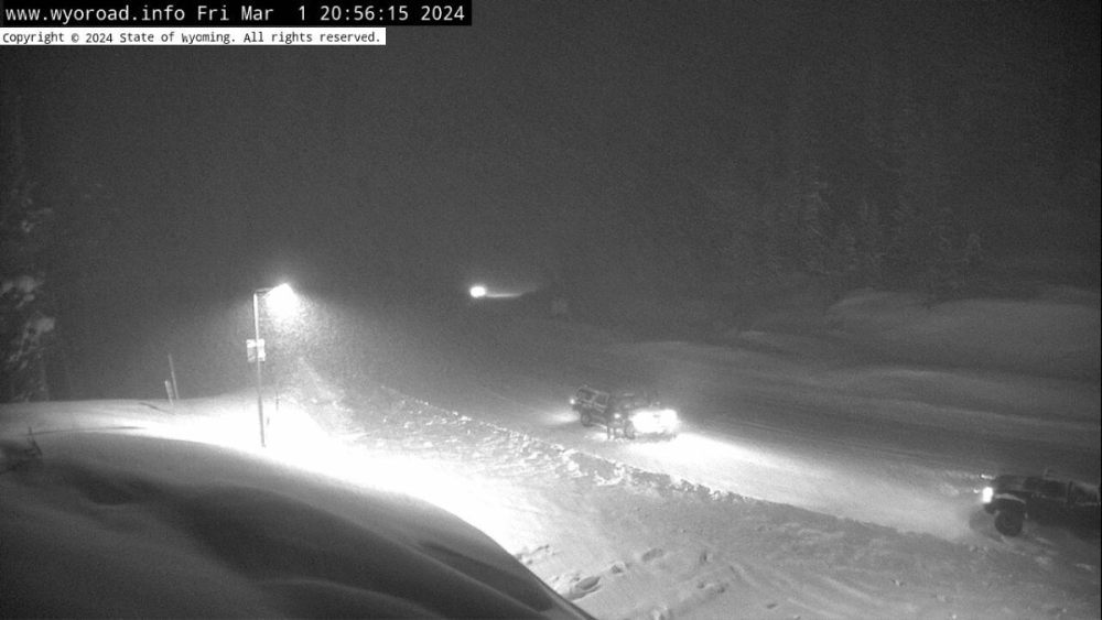
-
February 2024 Observations and Discussion
Beltrami Island replied to Tom's topic in East of the Rockies
Quite the unusual weather here the last 24 hours and next 12, just to stay in line with this wacky winter. Woke up to 2" fresh snow yesterday, then a high of 53 in the afternoon melted it all. Even my wife asked, did we move to Denver? Now its dumping snow with temps dropping below zero tonight. NWS says 5-9 inches accumulation today, but back to near 50 by Friday. I have this feeling, the rest of the cold season is going to be a yoyo bouncing between really warm and snowy days. With the rainstorm earlier this month and the Christmas rain it might turn out the cold season will statistically be categorized as wet and snowy imby. But, without looking at temps, the nature of this winter is totally lost. -
February 2024 Observations and Discussion
Beltrami Island replied to Tom's topic in East of the Rockies
The entire region needs to get some snow on the ground or this spring fire season is going to be awful. I know 2015-2016 the DNR here was ramping up by mid-late winter for all hands on deck in anticipation of high fire danger but a widespread wet 8-10" snowfall third week of March erased the danger. Now here is a fun fantasy model run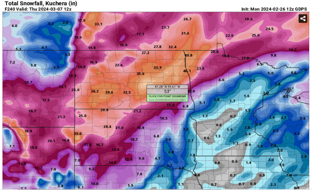
-
February 2024 Observations and Discussion
Beltrami Island replied to Tom's topic in East of the Rockies
https://www.weather.gov/wrh/climate?wfo=dlh -
February 2024 Observations and Discussion
Beltrami Island replied to Tom's topic in East of the Rockies
I've noticed going back to early fall, every time a "cold" front has come through the state that the actual wind never seems to have lived up to the speed or duration forecasted by models even 3-4 days out. Those forecasted periods of 36-48 hours of 20-25mph NW winds turned out to be about 12-18 hours of 10-15mph winds before the SE, S, or SW winds returned. I guess just more ways to describe this torch of a winter. As opposed to 2013-14 which felt like day after day of constant 15-20 mph NW winds interrupted by brief lulls due to arctic highs passing overhead. -
February 2024 Observations and Discussion
Beltrami Island replied to Tom's topic in East of the Rockies
I've been to togwotee numerous times so I follow the snotel station there for curiosity sake even if I have no immediate plans to go there. Its been near 0th percentile for snow depth on the date near the entire winter (records going back to 1980-81). Togwotee and west Yellowstone aren't to far from each other as the crow flys, so I would guess they are near the same vs each's avg. Record low snow out there still means 4'+ snow depths at 9-10k feet by this time in the winter. -
February 2024 Observations and Discussion
Beltrami Island replied to Tom's topic in East of the Rockies
For msp cwa 96-97 to 97-98 contrast is similar to this year and last. Enso states compare pretty well I think there as well. Just don't want to follow the trend through 98-99 and 99-00 because that was 3 clunkers in a row for Minnesota and only 00-01 from 97-98 through 02-03 was not below avg snow. -
February 2024 Observations and Discussion
Beltrami Island replied to Tom's topic in East of the Rockies
If you haven't read it yet, read State of Fear by Michael Chrichton... 20 years old now, I should reread it and see how it holds up but it has quite a few examples that look like the red line for us cities up until 2000. -
February 2024 Observations and Discussion
Beltrami Island replied to Tom's topic in East of the Rockies
Up north this is the late Jan/Feb version of March 2012 -
February 2024 Observations and Discussion
Beltrami Island replied to Tom's topic in East of the Rockies
This system keeps coming in with lower and lower SLP and less moisture with each model run it seems. Not very high hopes for this producing anything meaningful other than front end rain and wind and flurries on the backside.


