


Hawkeye
-
Posts
7152 -
Joined
-
Last visited
-
Days Won
17


Hawkeye's Achievements
")


-
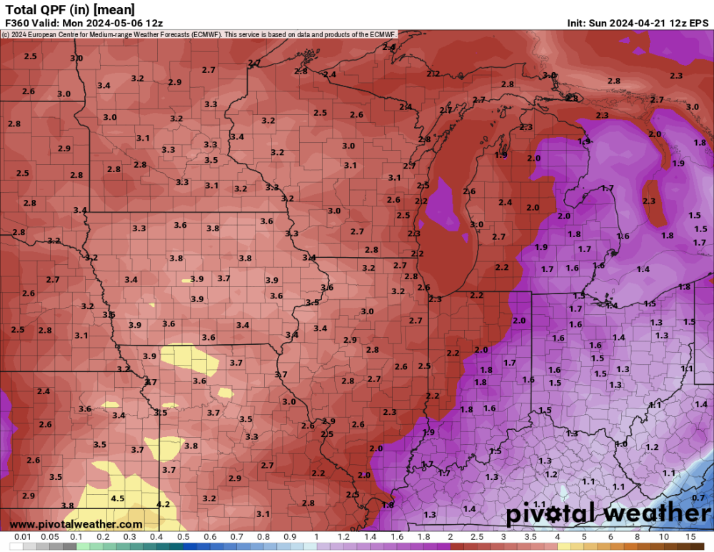
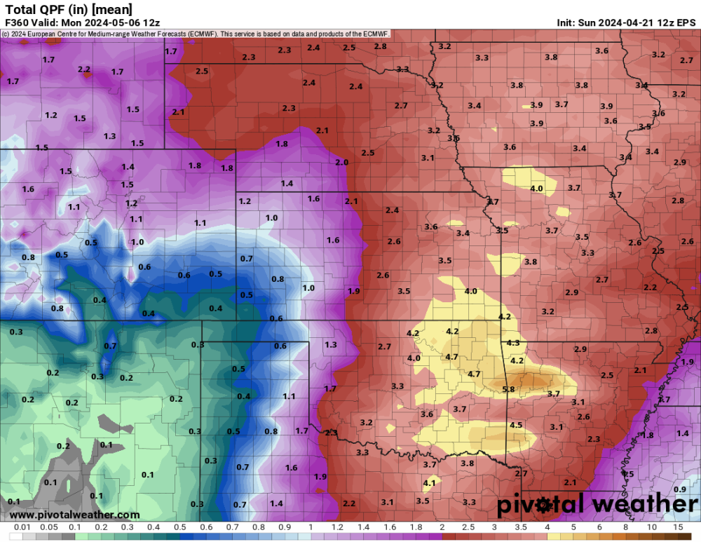
Euro ensemble avg next 15 days. That is what I want.... warm, stormy, wet.
-
I covered several budding plants with multiple layers of protection. The NWS lowered our low to 26º, but, fortunately, here in town we only dropped to about 30º, similar to the previous night. Yesterday sucked, barely making it over 40º. I'm ready for this stuff to be over.
-
I got 0.36" of rain today, pretty close to the middle of the model range. The grass is very lush and green. Cedar Rapids has been downgraded from "extreme" drought to "severe".
-
The second line looked promising for a while, but it was very thin and raced through in only a couple minutes. My event rain total is 0.67". I'll take it, but it's much less than what models were spitting out a few days ago.
-
I got lucky. A heavy cell passed just west of Cedar Rapids and another heavy cell moved up through the middle of Cedar Rapids. I just barely got caught inside the western edge of the eastern cell. There was barely any thunder, but it was gusty and the rain was very heavy. I finished with 0.57". Only one mile to my west only 0.12" fell. I wasn't expecting much from the secondary line, but it is actually really beefing up. There is a nasty cell near Ottumwa.
-
Radar shows a hole in the line moving into Cedar Rapids. It'll probably be June before we get a decent thunderstorm.
-
The dewpoint has risen nearly 30º since sunrise, but thick clouds have prevented any insolation across Iowa.
-
Radar sure doesn't look like a severe event. It's just a wide band of showers with embedded brief downpours.
-
As expected, overnight was a total bust. Strong east wind is pumping very dry air into eastern Iowa. On top of that, the entire area is covered in thick clouds. At this point I'm hoping we can get a half inch of rain.
-
I am becoming increasingly concerned about my rain total. A couple days ago, the GFS and Euro were suggesting up to four rounds of storms and a rain total possibly 2+". Tonight's storms are gone and the Tuesday night rain is mostly gone. Models are down to only one main round Tuesday afternoon, with maybe a thin second line. There may be spots around here that get missed by the stronger cells and end up with only a half inch of rain.
-
It's looking good for storms and heavy rain across Iowa Monday night/Tuesday. I'm very much looking forward to this because I really haven't had a thunderstorm yet this year.
-
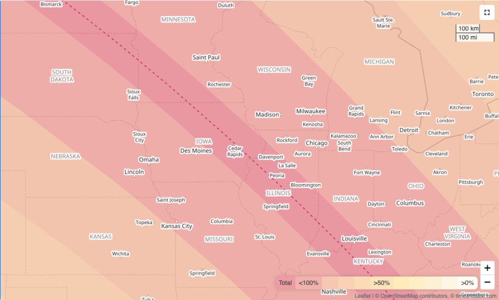
A significant portion of the totality path through the US got to see the eclipse. At this time of year there could easily have been thick clouds from Texas to New England.
-
Unfortunately, there have been no total solar eclipses near my area in my lifetime, and there won't be any through the rest of this century. I just found a set of maps for total solar eclipses next century. In October of 2153, downtown Cedar Rapids will be exactly in the center of totality.
-
It appears solid spring has arrived, with nothing but 60s, or even 70s, for the next week+. I only got 0.17" of rain yesterday.
-
It's too bad the totality path isn't farther nw, through Kansas and southeast Iowa. It's clear and sunny here today. It appears the Texas part of the eclipse is covered in clouds, so tough luck for them.


