All Activity
- Past hour
-
Dead calm here but already up to 54.

-
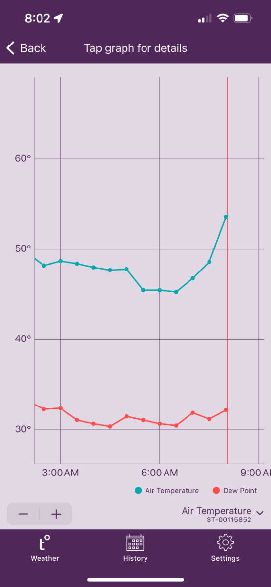
Winds are howling here currently! 53 degrees, DP 26, RH 35%! Pretty rare to have such a stretch of this dry warm air in April!
-

April 2024 Observations and Discussion
chescowxman replied to westMJim's topic in East of the Rockies
After some light rain overnight we are starting to see some sunshine across the area. It will be a few degrees below normal today with highs only in the low 60s. Sunshine the next few days with well below normal temps both tomorrow and Monday before we warm to near normal by Tuesday. Next shower chances arrive on Tuesday night. Chester County wide records for today: High 91 at West Grove (1941) / Low 23 in Coatesville (1926) / Rain 1.99" in Phoenixville (1940) / Snow 5.0" West Chester (1983) -
 Second lousy spring in a row here.
 -
Came back from 90 degree weather in Vegas to 6" of snow overnight.
- Today
-
Crazy day... a gusty east wind becoming a gusty SW wind by 5 p.m. And sunny for a good part of the day with a front early this evening but then the sun is back out by sunset.
-
I can’t believe how quiet the nights are out here. You can hear a pin drop. So different from back home where the distant sound of traffic on I-495 fills the air.
-
You bastard.
-
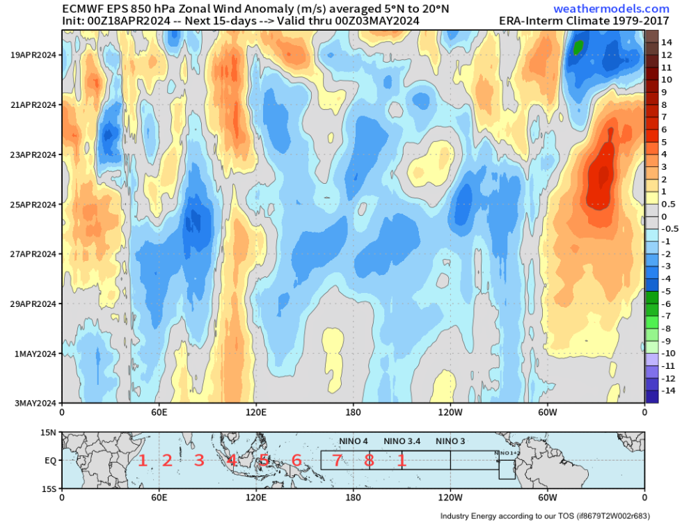
Yeah, major switch in winds coming up both in tropics and NH-extratropics. Will cool ENSO and NPAC waters.
-
Cool temperatures this weekend hopefully I can avoid any frost Sunday morning as temps may dip into the mid 30s. Later next week one of the stronger storms in this year's LRC will likely ignite a major sever weather outbreak across the middle of the country. Models are already showing significant amounts of rain in my area but it's gonna have to show me it can actually happen here in the show me state before I get to excited.
-
The official H/L yesterday at Grand Rapids was 51/42. As has been the case many times this spring it was a windy day with the average wind of 15.3 MPH and the highest wind of 39 MPH out of the W. That wind made it feel much colder than that 51. There was a reported 0.12" of rainfall and the sun was out 94% of the time. For today the average H/L is now up to 60/39 the record high of 83 was set n 1987 and the record low of 13 was set in 1897. (good 4 digit lottery numbers for today) The most rain fall of 2.45" fell in 2000 the most snow fall of 0.4" fell in 1943 the most snow on the ground was a trace in 2013. Last year the H/L was 73/41 and there was 0.16" of rainfall.
-
The flood of 2013. January 2013 was a rather wet month with 4.01” of total precipitation. February was snowy (33.1”) and wet (3.05”) while March was dryer with just 0.94” of precipitation. Then came April with 11.10” of rain and melted snow. That 11.10” is by far the wettest for any April. And is the 3rd wettest for any month at Grand Rapids. All that precipitation in January, February and April led to the big flood of April 2013. West Michigan saw weeks of heavy rainfall caused widespread flooding and led the Grand River to crest at record levels. Grand Rapids already had shattered its longstanding April rainfall record, but just crept into the top three wettest of any month of the year. The No. 1 spot goes to June 1892, when 13.22 inches of rain fell. Second place gs to September 1986, when 11.85 inches fell. On April 21, in Comstock Park, the Grand River crested at 17.8 feet, 5.8 feet above the 12-foot flood stage while in Grand Rapids, the river rose to 21.85 feet, or 3.85 feet above the 18-foot flood stage. A storm deemed "catastrophic" that had the potential to drop 3 to 4 inches of rain had also barely missed the Grand Rapids area on the day that the water crested in the Grand River, so we kind of lucked out on that. I work for the West Michigan Whitecaps and there were several home games during that flood. A large section on the north parking lot was flooded and the road along the river was closed. The only way in and out of the park was thru the secondary way under the overpass for US 131. On the east side of the ballpark there was water that was up to the top of the stop signs and during one game there were huge logs floating through the parking lot. here is some video about the flood of 2013 https://www.youtube.com/watch?v=Ee56qwN9wcs
-
I actually said one GFS run from days ago looked very wet down there because it showed rain all day on both Saturday and Sunday. It was an accurate statement on that specific run then and still is accurate when referring to that specific run. It was not a prediction. That specific run did not verify.
-
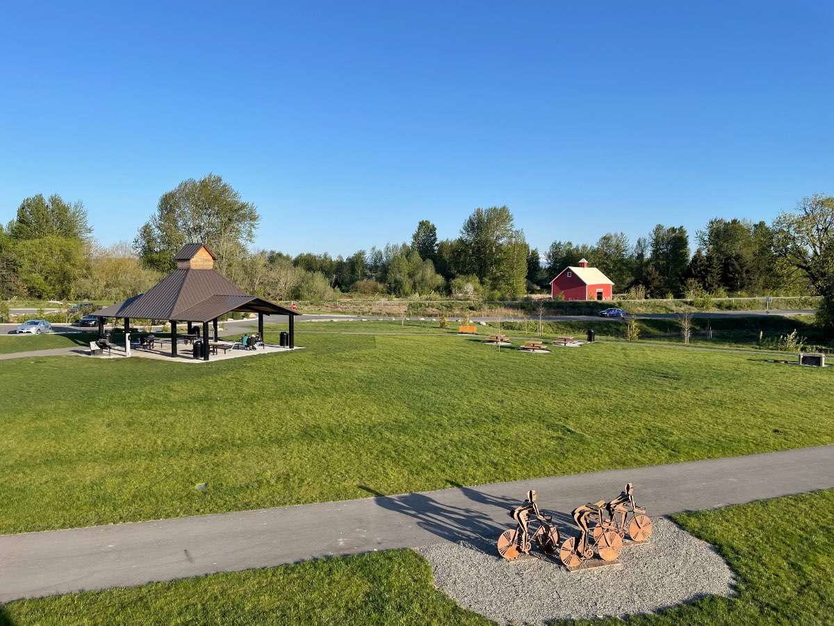
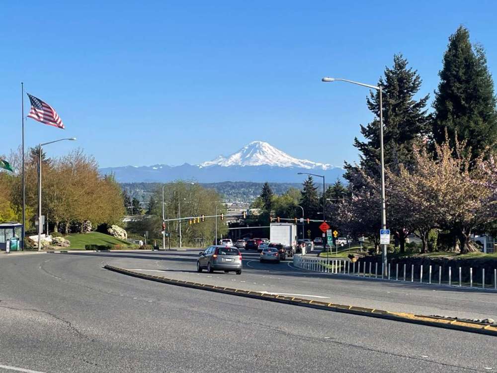
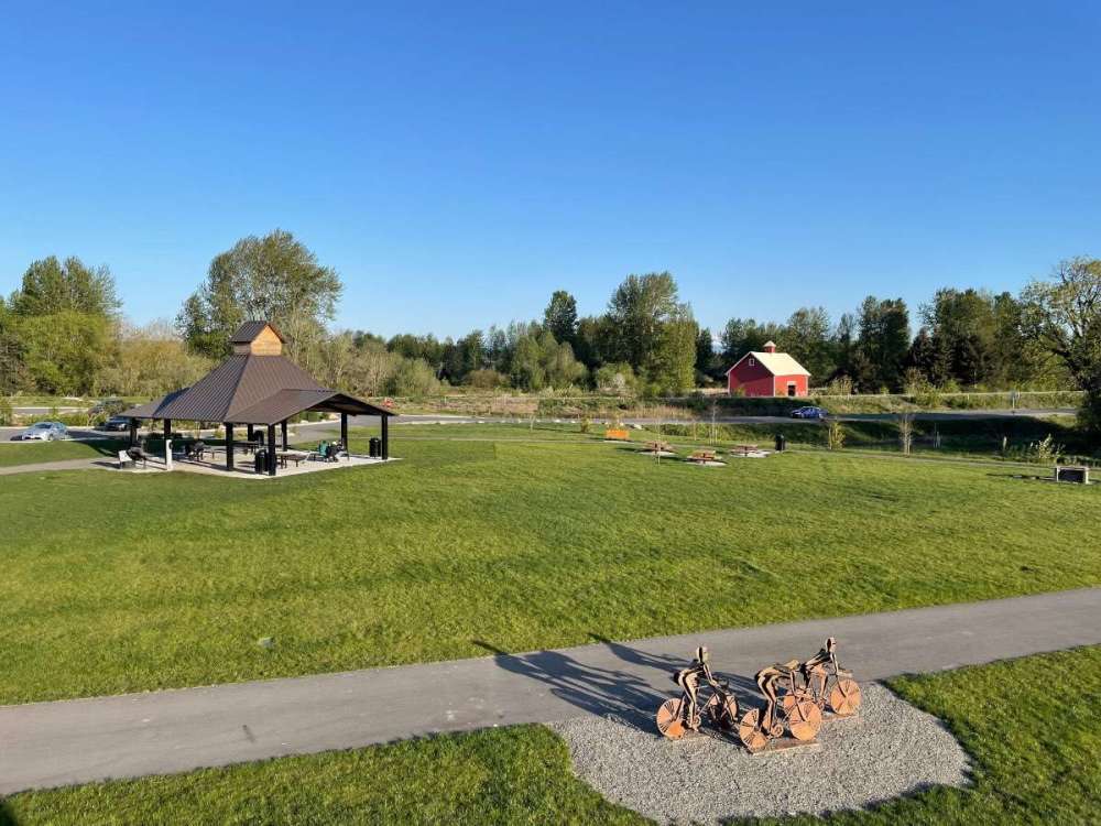
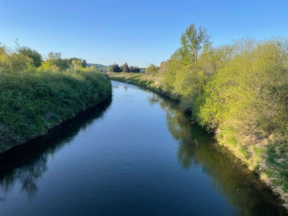
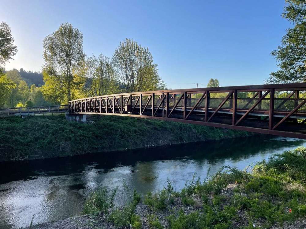
Gorgeous day. Was up in the Seattle area earlier. Giving my best friend and his wife a ride to Sea-Tac. They will be going to New York and DC this week. Great day to drive up I-5 with the mountains popping. Had enough time afterward to check out a nice park along the Green River near Kent before heading back south. Temps were in the mid-60s with breezy conditions and very dry air.

-

April 2024 Weather in the PNW
SilverFallsAndrew replied to Tyler Mode's topic in West of the Rockies
Tim predicted a “very wet” weekend, but aside from some light showers this weekend looks mostly dry. -
April 2024 Weather in the PNW
SilverFallsAndrew replied to Tyler Mode's topic in West of the Rockies
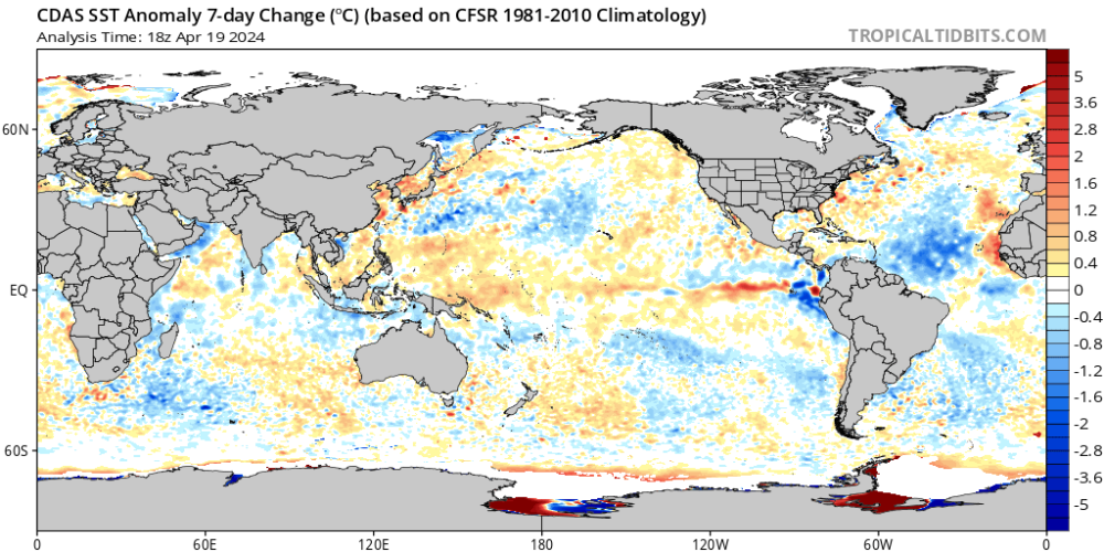
Probably looking at a moderate Nina according to most global models. -
Or are we gonna have a 2nd year niño split flow hell winter?
-
Nino not crashing really hard yet. I am sure its coming though.

-
Yeah... temps are going to crash hard.
-
April 2024 Weather in the PNW
SilverFallsAndrew replied to Tyler Mode's topic in West of the Rockies
My Dad is 72 and still hasn’t retired. He easily could have years ago, but just enjoys staying busy. -
I wish I could retire in my early 50s (two years from now) instead ill probably work another 15-20 years, oof!
-
April 2024 Weather in the PNW
Anti Marine Layer replied to Tyler Mode's topic in West of the Rockies
Where is the southerly surge that precedes the onshore push? -
The scum and refuse burnt off around 2 PM and it got warm for a few hours.
-
My kids friends B-Day party hangs in the balance, it’s all on you now!