
Leaderboard


Popular Content
Showing content with the highest reputation on 07/04/17 in all areas
-
Visible satellite shows a disturbance well off shore that could produce thundershowers north of Pt Conception tonight; hopefully more monsoonal chances during the rest of the week. 93/ 641 point
-
It seems to the weather (Gods) it's a national emergency if we can't have warmer then average summers. Send everyone to the bomb shelters we are going to have a -1.0 departure! (Air raid siren sounds and everyone rushes to the shelter and brings their radio with them so they can hear the all-clear signal)1 point
-
America and Jesus.1 point
-
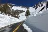
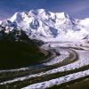
Winter surroundings above Lake Tahoe Squaw/ Alpine
 1 point
 -
That must feel fantastic. Are the higher elevations surrounding Orcutt warmer at night?1 point
-
Yeah that -35 on 2/24/03 seems to really stand out compared to other late winter cold snaps. Looks like the 2003 cold snap was preceded by a pretty decent snowstorm which led to a fresh, deep snowpack (~12") which of course always helps.1 point
-
Most states are scorching hot or humid in the summer. Even with much of the "hot" interior of WA, most locations' daytime averages don't top 85-86 and the nights cool down promptly with the extremely low humidity. I'd definitely still rate the summers of somewhere like Spokane or Wenatchee or Pullman as comfortable overall.1 point
-
It doesn't get any better than this...Happy 4th of July everyone! #MAGA #HappyBDay'Merica Took a morning jog along the coastal hwy breathing in the oceanic air under ample Cali sunshine. Thank you God! Have a splendid day. Time to pound some breakfast. Adios!1 point
-
Followed by Minnesota at 2nd place. No wonder Tim expects the pattern to pamper him 24/7.1 point
-
It was quite cool here in Orange last night, but was warmer than forecast today. Only low 80's were forecast, but it reached closer to 90 this afternoon.1 point
-
I don't think whitetail is the part of Montana that you are looking to move to. But, If it is I could give you his number when the time comes.1 point
-
10 degree difference between Santa Monica Airport (75 F) and Santa Monica Pier (65 F) today. Even sunny afternoons are cool right next to the water. It was hotter than expected today.1 point
-
Whitefish.1 point
-
12z ECMWF does indeed put us in the cooker later this week. Second half of this month looks a lot better on the weeklies though so fingers crossed! Where in MT you headed??1 point
-
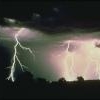
I like a little lightning and thunder with my fireworks! Lots of early fireworks going off. Sounds like war. Gives perspective I guess. I'm a grateful American today.1 point
-
I was surprised by how cool it was this morning but afternoons are too warm for my tastes. 93/ 621 point
-
They look pretty close to normal. It actually shows much warmer water in the Southern California Bight than other places along the coast. It just seems mornings have been a bit chilly for early July, but that might be because the last couple of summers, sea surface temperatures were well above normal.1 point
-
Model guidance has been poor recently; every day is hotter than forecast. Hopefully this will actually be cooler than predicted. NWS_LA Ventura County Interior Valleys-Ventura County Coastal Valleys- Santa Monica Mountains Recreational Area-Santa Clarita Valley- Los Angeles County San Fernando Valley- Los Angeles County San Gabriel Valley- Including the cities of Santa Paula, Fillmore, Ojai, Piru, Thousand Oaks, Simi Valley, Moorpark, Newbury Park, Santa Clarita, Newhall, Valencia, Woodland Hills, Northridge, Burbank, Universal City, Pasadena, San Gabriel, and Pomona 255 PM PDT Mon Jul 3 2017 ...EXCESSIVE HEAT WATCH IN EFFECT FROM THURSDAY MORNING THROUGH SATURDAY EVENING... The National Weather Service in Los Angeles/Oxnard has issued an Excessive Heat Watch, which is in effect from Thursday morning through Saturday evening. * TEMPERATURES...ranging from 100-107 degrees. Overnight low temperatures will remain in the 70s to lower 80s across warmest locations, especially in the foothills. * IMPACTS...Very high temperatures may create a dangerous situation in which heat illnesses are possible. Temperatures inside vehicles, even if the windows are partially open, can quickly rise to life-threatening levels. The extended period of hot temperatures will bring elevated fire weather concerns.1 point
-
But aren't these readings close to normal? TANNER BANKS 60 63 320/ 4/ 4 1017.0F 5/180/14 S CLEMENTE BASIN 66 270/ 6/ 6 1016.8F 5/200/15 SAN NICOLAS IS. 62 N/A 3/160/14 SO. S. ROSA ISLA 59 63 270/ 8/ 8 1017.0F 5/160/15 W. S. BARBARA CH 60 61 260/ 6/ 8 1017.3F 5/170/15 M. S. BARBARA CH 64 64 250/ 6/ 8 1017.6F 3/270/ 9 S. MONICA BASIN 65 65 250/ 4/ 6 1016.5F 3/180/12 S PEDRO CHANNEL 68 N/A 3/160/14 CMP PENDLETON NS 68 N/A 3/210/15 OCEANSIDE OFFSHR 69 N/A 2/180/13 TORREY PINES OTR 69 N/A 2/200/15 SAN DIEGO BAY 73 1016.3F POINT LOMA SOUTH 69 N/A 3/180/131 point
-
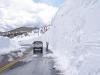
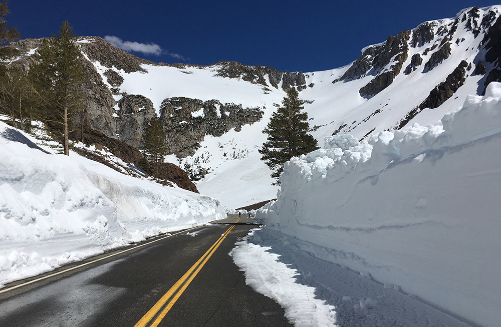
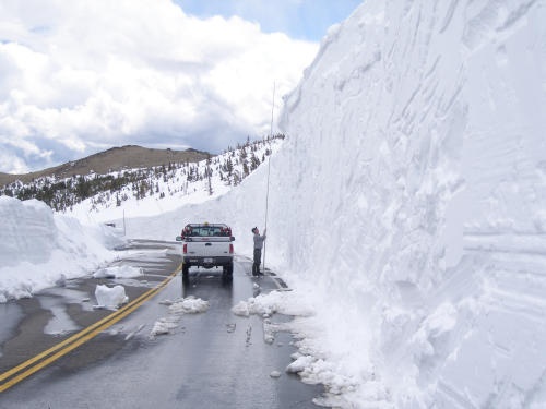
Thanks wx_statman for the reminder of a great winter. There's sort of a contest going on a California site over when the Tioga Pass will be cleared. Here are photos of recent conditions in Yosemite.
 1 point
 -
And finally, January 16th - 6 days after.
 1 point


This leaderboard is set to Vancouver/GMT-07:00