
Leaderboard

.thumb.jpeg.e3014abf99ef08a9f9ac2c0cd31b485b.jpeg)


Popular Content
Showing content with the highest reputation on 12/12/18 in all areas
-
Me walking in here like: ...... ......


 11 points
 -
What's interesting is that should the much anticipated pattern change not occur or deliver around these parts, our historic December to remember could actually make another run at the least snowiest December. Not sure if Tom or anyone knows where Chicago is officially at or that the record is, but something to keep an eye on. In other new, leaves finally starting to drop off my stubborn tree.7 points
-
Got some beautiful bucks on one of my game cams.
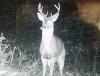
 6 points
 -
After I read your comment, it brought me back memories to the terrible winter of '16/'17 where it seemed like the pattern changes never came and were always delayed. With that in mind, and knowing the type of LRC pattern that set up the record setting season for the PAC NW, I learned my mistakes from that season. Not to mention, the fact that the Long Term Long Wave Trough was NOT favorable for the majority of our sub that season and the pesky ridge kept on showing up relentlessly. On the flip side, this year's cyclical pattern is remarkably different and places the Long Term Long Wave Trough right across the MW/GL's region, just east of the central Plains of NE. I think Gary Lezak also agrees with this idea. Anyhow, I firmly believe the pattern change is coming and it will likely begin around the Winter Solstice period as I'm still expecting a northern tier runner coming off of the N Rockies into the Upper MW/GL's region. There is still some question if a southern piece tries to run up from the southern Plains and phase with the northern piece. Lots to digest over the coming 7-10 days as the models try to iron out this big shift in the overall N.A. pattern.5 points
-
I’m getting deja vu of my deja vu all over again. This same convo literally replays itself over and over again on here. Like a skipping record.3 points
-
Tim is MORE powerful, he made adjustments to the storm.3 points
-
When you stop looking at your phone app and start reading the models, only then will your rain stop3 points
-
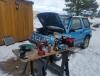
Got about 4 inches yesterday. And more coming tonight looks like. Had fun plowing the road. Then after that had to replace water pump and timing belt on my geo tracker. Did it in 2 hrs not bad for the conditions lol.
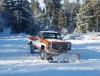
 3 points
 -
Much better looking EPS tonight3 points
-
What concerns myself (as a snow/cold lover) about this current pattern and the one forecasted to change it back to the one we had just a few weeks ago is twofold. #1- These types of patterns ALWAYAS last longer then models show and what people like JB and some others think. Bias with JB and others, but the models simply struggle at long range with regime changes and these patterns are always buggers to break. #2- Once the pattern is broken, my fear is NW flow with little moisture as previously mentioned by another poster. But at this point in the game with .7" snow for DEC at my location; a Clipper producing 1-3" will seem like a pan handle hook. I value Tom's and others' thoughts on here but I don't see serious change until after the New Year - not before. With the current forecast through 10 days - and I think most would agree there are slim/none chances of accumulating snowfall - DSM will had 2.7" for the year and have to go back 12 years to 06-07' to find a lower amount through DEC 22 at 1.4" But there is good in the bad - just like anything else. It has allowed those who heat with wood the extra time to gather kindling and extra wood in the rather dry woods which is much more difficult with a deep snow cover. I just hope the snow eventually shows up.3 points
-
Getting a good old fashion Victoria rainstorm this evening.2 points
-
In other news, I lost power just now for 5 seconds2 points
-
Tim lives in an eternal, extremely localized downpour.
 2 points
 -
The problem is that we aren't getting that, either. These types of Nino winter patterns here are just the absolute worst. We just stay stuck in weather purgatory with warm temps, splitting fronts, and nothing remotely dynamic. It's what we saw a good chunk of in February 2016, January 2015, January 2003, 1991-92 and so on. Getting this pattern in December this year. January will be hard pressed to be worse.2 points
-
Nothing is more perfect than when "Let it Snow" is playing while it's snowing. It's also pretty depressing when it's not. It was playing while I was at Kohl's this evening and made me want to punch an elf.2 points
-
There would have been some massive teeth-gnashing by early January that winter.2 points
-
How did you know what I was about to post. Also shows a chance of a dusting above 1500' at hour 210...2 points
-
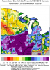
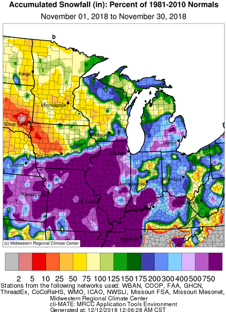
Yep, Tom's call for a wild early start to winter verified. Act 2 was not scripted very well tho. Departure maps for November look insane and follow my seasonal outlook line of winners vs losers quite well.
 2 points
 -
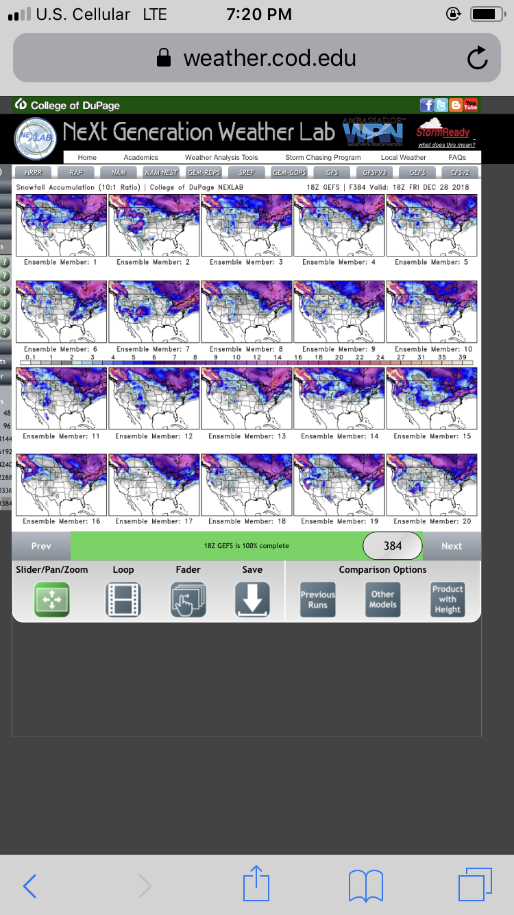
When widespread freezing fog is the highlight of the next 384 hours, you know you’re pretty close to wx hell.2 points
-
iFred, if you're looking for someone to make an example out of with a nice little mod preview, I think we have a good candidate!2 points
-
Weird looking pattern. I wonder how much of that is a product of ensemble spread? Then again, weird looking patterns are commonplace during SSW events, and models often fail to capture them correctly outside 5 days. I have no faith whatsoever in the clown range modeling right now. None.2 points
-
You're trying too hard2 points
-
Sad that i feel the need to report such meager snowfall but.... well here we are.2 points
-
WWA issued for up to an inch of snow and2 points
-
Really impressive to see such a strong retrogression signal on both the EPS and GEFS. The mean trough moves from the Eastern US to Western US in 2 days with an exploding GOA ridge..2 points
-
Must be referring to post 240 hours2 points
-
Indeed! I'm really excited about what the GFS is showing for tropics during week two. Basically a very low pressure strongly positive SOI. That combo can be dynamite for us.2 points
-
Did the men in black retract it or something? I can't find anything close to that on either GFS the past 2.5 days. Fake news..2 points
-
Which run showed that mega-bomb? Or were you joking? This could go bigly2 points
-
At least the EURO and GEM give us decent shots of chilly air that we could parlay into a solid inversion pattern.1 point
-
Knock me over with a feather. When the pendulum inevitably swings the other way, he’s gonna nope the f**k outta there like a bolt of lightning.1 point
-
We really need rain. If it isn’t going to be cold and snowy bring on a raging jetstream and frequent storms. I’ve had enough stagnant, dry ridging to last me a lifetime this year.1 point
-
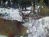
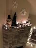
I’m doing my part to get some snow around here! “Let it snow” was also playing on the radio when I took this picture.
 1 point
 -
Wow, they've upped the winds in my area to 50mph and West Tx. 50-70 mph. That's hurricane strength winds. This should slam into us after noon. Some flurries in DFW but West Texas could see 3-4" of snow.1 point
-
Good thing this is a moderate La Niña like 1995-96. Don’t understand why anyone would be nervous this early. We are good to go1 point
-
The problem is that HIO is a different station than the COOP station in Hillsboro from 1929 to 2003. So no continuous period of record to compare the current numbers. Driest year at the old Hillsboro station was 1930 with 23.70". Good analog for this year too with the Nino shitfest.1 point
-
Good amount of rain? Lol not even that. We're running way under normal for rain and will probably continue to do so for a long time.1 point
-
Very nice pics. If we can manage sub 1500 foot snow levels in the near future I want to take a trip up the hills behind the house to find me some snow1 point
-
Give yourself a pat on the back.1 point
-
Wow the models are quiet. Not showing anything around here for 10-15 days. Sure hope that changes. Relatives coming next week from KC were hoping to play in the snow, but that will be a thing of the past here in a few days. Hopefully not singing "I'm dreaming of a brown Christmas" but going to need that pattern change after the 21st.1 point
-
Yeah, maybe we'll have a wet spring, that can occur sometimes coming out of an El Nino, so if anything perhaps that could be our saving grace. Once nice thing is that if we can avoid a back to back Nino we should be set up pretty nicely. Some of our best winters have followed some of our all-time duds. 92-93 was an epic winter in the valley, 03-04 was pretty good, 16-17 followed back to back +ENSO duds.1 point
-
PNA is trying really hard to trend down by Christmas time...ish.
 1 point
 -
Keep an eye on the low pressure at Darwin!!! Remember our research of the sub 1000 readings???1 point
-
Dang been so quiet lately lol. Kinda nice to get some work done. But looking forward to storminess soon!1 point
-
00z GEFS Spokane. This shows the definite potential for backdoor cold or arctic air. How you like them tabs? You know you're a weather geek when you have tabs like those.1 point


This leaderboard is set to Vancouver/GMT-07:00