
Leaderboard


Popular Content
Showing content with the highest reputation on 03/07/20 in Posts
-
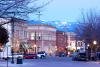
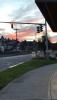
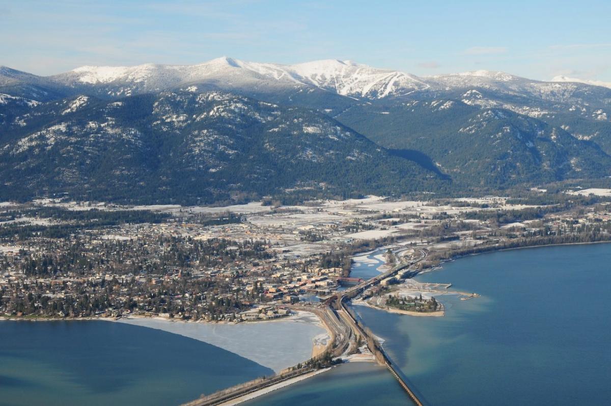
Finally, it is official! We will be moving to Post Falls, ID in June into an apartment, then we should have our custom home completed late next spring in the Sandpoint area (shown below) - Sandpoint will be our final home. So excited to get into a climate with truly 4 beautiful and distinct seasons! I am soooo excited!!!! If everything works out like we have planned, we will have our house built close to the golf community shown in this video:
 10 points
 -
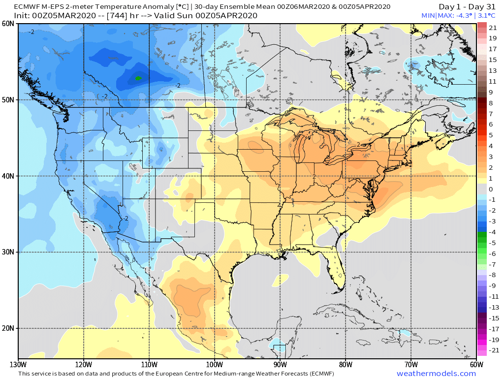
It's almost as if you're looking at different models than everybody else. You're setting yourself up to be massively dissapointed. Verbatim the Euro operational looks solidly chilly but not remotely close to historic, and that's the coldest solution any model is showing right now. It's also been getting pushed back and watered down the last few days which has been the theme all winter.4 points
-
Already up to 66 here. I would think we have a very good chance of crossing 70. Forecast high was 68. Only downside is 35 mph winds and the Red Flag warning again.3 points
-
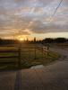
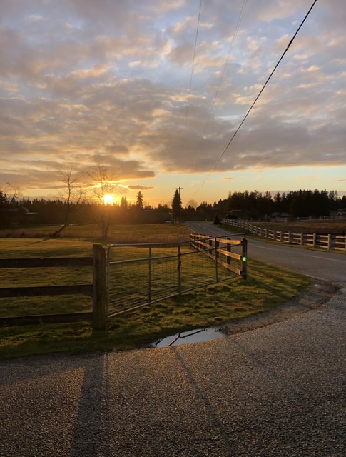
No snow here. I walked up to my neighbors highest point which is 700’, no snow there, either. Currently 38 degrees and cloudy. .06” on the day so far, 2.49” for the month, 20.69” for the year. Caught a lovely sunset on my 3 minute drive home last evening.
 3 points
 -
I'm ready for thunderstorms!3 points
-
Very cool. I would hate having to go through apartment phase, but it sound like that will be short lived. My wife is finally beyond convinced we have to get out of here too. Just going to make the best of it until that happens.2 points
-
Man, I don’t know what you are on but let me have some. This has been such a boring winter for everyone in the lowlands south of Seattle, and the models are gradually watering down the potential for anything interesting mid month. Really no way to sugar coat things right now.2 points
-
I’m sure you could lend him some eye drops otherwise.2 points
-
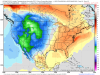
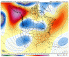
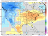
This graphic pretty much sums up the difference compared to this years open vs March '19....my goodness, that was a frigid open last year and I think we did not have much snow OTG iirc. Edit: Yup, we had bare ground back then...
 2 points
 -
As always "Beware of the Ides of March"2 points
-
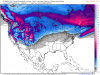
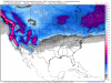
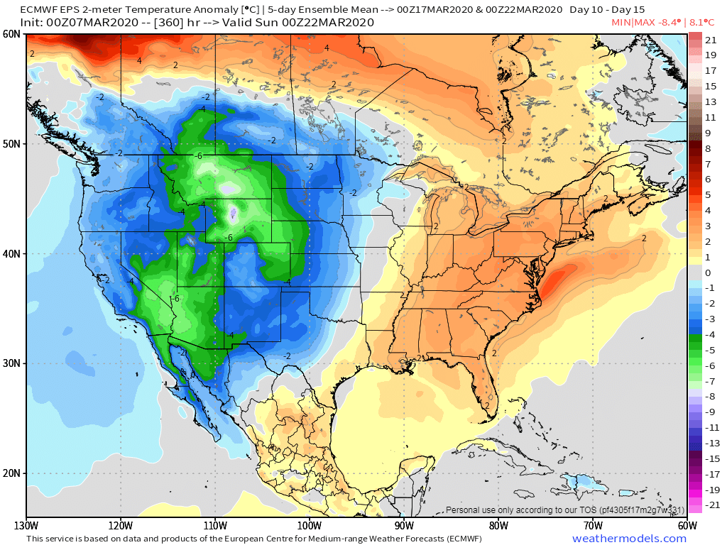
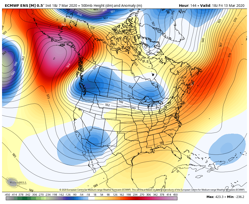
The volatility of March can produce some wild weather and temp swings, none moreso, than those who live in the Great Plains. Spring "Shoulder" season is fully underway and parts of our Sub are going to get "teased" by some Spring time warmth this weekend. Does it last? Quite an active pattern is setting up from the desert SW into the central CONUS this week into the following weekend. Is there a late season winter storm on the horizon??? I haven't had much time to analyze the pattern and left my notebook back home, but I will say, there is growing model consensus that the EPO is to tank later this week which will allow the pattern to amplify and seed some late season arctic air into the Upper MW/Plains states where the potential for Spring Snows lies ahead. Last nights 00z EPS turned significantly colder for the Plains and the GEFS/GEPS are not far behind on that idea. 00z GEFS...
 2 points
 -
March is typically our second snowiest month here in MSP, on average. Anyone up this way that thinks winter is completely done is in denial. Hell, we got 30” two April’s ago.2 points
-
This x 100. Even the 0.50-0.75" of general rain Monday will be a nice start. We haven't had a rain event heavier than 0.20" since late December.2 points
-
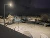
Up here in Canada we woke up to a temperature just below the freezing point and 4" of super fluffy snow sprinkled straight down.
 2 points
 -
Polar vortex. It’s mid-March. In January the models were showing something rivaling 1950 or 1969 which was murdered by the aforementioned PV. Certainly killed the optimism for many here. After that, an inch or two of wet slop just isn’t that exciting. GFS and ensembles have little to no cold air with the ECMWF very inconsistent. 12z run was not as cold as this run.1 point
-
2002 never really got impressive with the low temps. Down here the whole thing was fairly cold, but it never delivered the cold temps this situation might. Looking at past cold snaps after March 10 it's remarkable how rare it is to get cold / clear with a legit cold continental air mass. In 1906 Clearbrook dropped to 10 on March 15 so it can certainly happen. At this point I think the blocking being shown on the recent model runs is pretty extraordinary. Certainly a chance to see some impressive cold before this is over.1 point
-
Spring/summer/early fall rainfall = convective activity and thunderstorms. Winter rainfall = drizzle. Yeah winter rainfall is what we need for mountain snow and skiing, but there’s no denying that the former is simply much funner in the lowlands.1 point
-
Hyperbole aside, I’ll give you kudos for mentioning the possibility of a 1953-like flip being possible this winter after the exceedingly dry late-Oct to mid-Dec period. I didn’t see it coming, as that attempted midwinter pattern transition towards more sustained blocking fell flat on its face.1 point
-
Bye bye 7:30 roll out of the 00z... 00Z ALERT!!!1 point
-
Nice night...
 1 point
 -
Heavy! Nothing now, temp down to 35.1 point
-
One thing for sure....the neighborhood is absolutely dead today. Nobody outside because it's so chilly.1 point
-
Te 18z EPS is certainly looking chilly for late next week. Looking like a legit cold shot. This run only goes to day 6 so that' why it isn't quite across the border yet.
 1 point
 -
Going to service the mower next weekend and get it ready for the season.1 point
-
Yeah just looked and after scanning the forum I was excited to see the 18z. Not really anything to look at.1 point
-
Congrats!!1 point
-
I hope you are correct regarding the 2013-2018 regime! Not only was a good portion of that a terrible drought period for California and even parts of the PNW at times, but it was downright warm to hot at times out of season. 2016-17 was a good year, though, despite being within that time period.1 point
-
Light snow mostly right now, not much rain mixed in. Cool to see!1 point
-
Personally I’m hoping for neutral ENSO next winter given the evolution of the QBO (will likely have easterlies dominating the lower stratosphere with descending westerlies at/above 30mb). Statistically speaking at this range, reducing the prominence of the low pass component in the wave state increases the odds those conduits to extreme blocking under said QBO would be utilized. Too much La Niña under -QBO is more of a destructive interference in terms of how they’re communicated via the NPAC High and the end result is often dirty Aleutian Ridge/+EPO, though it’s not always the case nor is it unshakable. Especially in solar minimum/weaker solar cycles in general, there are clusters of exceptions. But generally, the heavy La Niñas perform for the PNW more consistently under +QBO, and that’s true irrespective of solar, where-as in -QBO it’s more fickle and more dependent on solar and also the IPWP structure. As for El Niño, those conduits to blocking are generally more open with weak canonical/modoki type events but once into strong territory it becomes problematic even if it’s a solid wave-1 without IPWP/IOD interference. If it’s an EP based event or under high solar, game over. Not that we’ll have to worry about this next winter, but raging solar and/or aerosol feedbacks (thermal wind amplification/etc) alone can render all of this inert. See 1989/90, 1991/92, 1992/93, 1993/94, 1999/00, etc.1 point
-
The EPS looks a lot colder with the trough late next week than the 0z. More continental as well. Interesting all of the operational models and the EPS control show a crazy amplified GOA / AK block at day 10 with the potential for a major unloading of very cold air as that evolves. Looking at the post March 10 period there were very few examples of cold continental air making into the Western Lowlands after that date during the 20th century and so far this century. Being the cold anomaly lover that I am I think it would be super cool if we can pull that off this time! Maybe a trip back to the 19th century?1 point
-
We’ll know a lot more by mid/late April. I could envision a powerful 4CH that roasts the Intermountain West and Southwest but spares the PNW similar to 1988 (or a muted version of the dust bowl years). An outcome like 1998, 2007 or 2016 is also possible. On the fringes of the spectrum are 2009 (warm) and 2010 (less so).1 point
-
it’s 39 here with moderate rain maybe we will see some flakes mixed in today.1 point
-
Got snow/ice pellets/rain mix currently. 38 degrees.1 point
-
I understand maybe 10% of this but yeah probably going to be another hot and dry warm season for the west.1 point
-
Holy crap the models are tantalizing. The players are there and SOOOOO close to really delivering. I still like our chances with the crazy high heights most runs are showing for much of AK during week 2. Realistically speaking we are still in line for a bunch of solidly cold nights coming up and some well below high temps mixed in. As it stands now some interesting possibilities are in play in the temperature department. 1. Lowest March average low in decades 2. Coldest post March 10 low temps in decades could be possible If the details actually go our way an historic outcome for the middle third of the month is still possible.1 point
-
Every run just comes out drier and drier.1 point
-
Always 10-14 days away.....1 point
-
My wife teaches at La Salle College Prep HS. All the kids are required to have iPads. Snow days are a thing of the past for them now as kids and teachers are required to work on line. If this does become a problem, it will be business as usual.1 point
-
Fantasyland GFS drops 33" on Fargo in that one storm1 point
-
1 point
-
Should be a bumpy ride mid & late month for your area and a lot of the central CONUS. The weather out here in AZ will turn cooler later next week and the following. I’ve been enjoying the amazing weather over the past few days. Yesterday, we topped out at 84F and today it will be in the low 80’s before we “cool” down around 70F with rain chances Tue- Thu. I’m expecting a BN pattern for the reminder of this month over here. Average temps will be in the upper 70’s later next week and approaching 80F by months end so BN temps won’t be too terrible. We need the rain so that will be a bonus.1 point
-
The 16th-18th needs to be watched closely, if there is going to be a big dog in my area that would be the most likely time.1 point
-
No winter isn't over, the EC has a snowy look, esp for Nebraska and Iowa. Lezak is expecting 1 or 2 more accumulating snows in KC, we shall see.1 point
-
We need some kind of weather action. Hopefully we see some small hail or a few claps of thunder before 4 PM. By the way, if anyone here is also in my PDX WX Analysis facebook group if you could pass along this message I would greatly appreciate it. I was flagged for spam for posting too many messages too quickly(Radar images) when I was tracking the tornadic supercell in Nashville the other night. This isn’t the first time Facebook has done this to me. The other time was back in 2015 during a severe weather outbreak in my Texas group. Due to this they banned me for 30 days (27 days remaining). Very annoying and frustrating. I did contest this asking for a request for Facebook to review this, so hopefully they will do so and I’ll be able to access my account and groups sooner. If you do so please also mention my Texas group TheSTORMCenter/DFW as we do have a few members also in my PDX group and they can then hopefully pass this along there too. Alrighty. Thanks1 point
-
March is already off to a much warmer start compared to the last couple March opens. You guys just need it to continue but I suspect a lot of back and forth due to storm enduced warmth followed by CF’s.1 point
-
I'm hoping we get to finally see widespread heavy rain and thunderstorms early next week.1 point
-
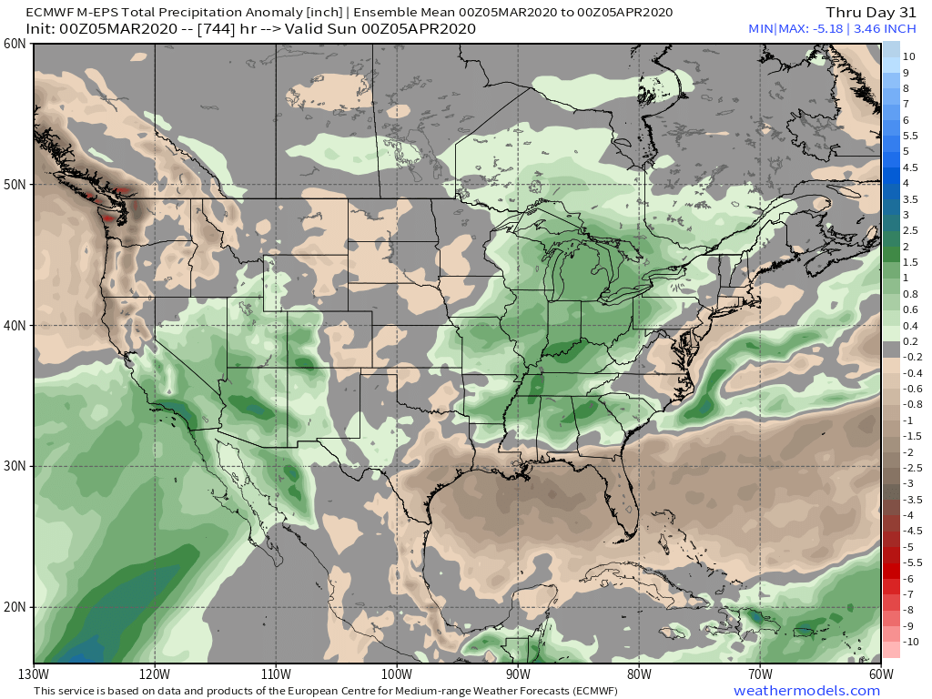
Overall, a wet and warm start to Spring across the eastern Heartland and throughout the OHV...quite the battle zone shaping up over the Plains/Upper MW causing concern for late season snows up north.
 1 point


.thumb.jpeg.e3014abf99ef08a9f9ac2c0cd31b485b.jpeg)


This leaderboard is set to Vancouver/GMT-07:00