Leaderboard
Popular Content
Showing content with the highest reputation on 07/06/20 in all areas
-
Something I find interesting, my mean temperature (61.6) for June has been the same the last 3 years, however, they were all achieved different ways. You can't just look at temperature to judge how the month was overall. 2018: Average high 75, well above normal, but the average low was 48, well below normal. Typical during a drier than normal month, and it was the driest June I've recorded. 2019: Similar to 2018, the average high was 74, 1 degree above normal, but the low was 1 degree below normal. This yielded the same mean temp. 2020: Opposite of 2018 and 2019, June was very wet. This means cloudier than normal skies which keeps the overnight low temps warmer, but the daytime high temps cooler.4 points
-
I have an old box fan in my garage that I can loan you. Probably won't need it here.3 points
-
2 points
-
64 and partly cloudy here. Don’t think we will hit 70 again today but should be upper 60s atleast. Looking at this mornings model runs...the next 10 days don’t have any noteable heat to speak of. First half of meteorological summer has been pretty pleasant and much closer to normal so far than some summers in the 2010s.2 points
-
2 points
-
My coolest average high temp for the first 5 days of July since 2012. 72 degrees. Then there was 2015 which started with 5 days in the 90s and an average of 94 degrees.2 points
-
Muskegon reached 90 between hourly readings today so they did indeed tied the record set in 1947 of 8 days in a row of 90 or better. Here is the break down. 91 on June 29, 92 on June 30, 91 July 1, 92 July 2, 90 July 3, 92 July 4, 91 July 5 and 90 today July 6.1 point
-
I accidentally deleted my last post when I tried to edit. High of 61 down to 58.1 point
-
1 point
-
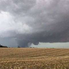
storms all over the place had some decent winds at the onset it really came down for a bit there.did not get the direct lighting as we did yesterday but still legit storms.tornado warning for the cell on the eastern shore.1 point
-
That was a good storm. Plenty of lightning, just under an inch of rain, heavy winds. Was almost a complete whiteout at times.1 point
-
1 point
-
Still completely cloudy here in Salem. Oh the humanity. A cloudy day with pleasant temperatures.1 point
-
Yeah, there were a couple tiny cells that popped up. One was a couple miles west of me, the other a few miles north. I did not see a sprinkle.1 point
-
1 point
-
1 point
-
Comparing the 00z vs yesterday does seem to kill off any chance that the 4ch builds nw. Instead it looks like it just bypasses and retrogrades entirely out into the pacific.1 point
-
I just did a quick check. While it has been very warm to hot start to this July and there is a good chance that Muskegon could tie the record for the most 90 days in a row. But in fact this has been the 3 year in a row that July has started off on a warm to hot note. And here in Grand Rapids due to the somewhat cooler nights this year has the coolest mean for the first 5 days of the last 3 years. This year the 5 day mean is 79.2. Last year it was 80.0 and in 2018 it was 81.2. Today I will keep a eye on Muskegon to see if they do indeed tie that record set in 1947.1 point
-
I mowed the lawn on Saturday again but some have a hint of brown. Haven’t had much rain the last few weeks where I live. A nice band of outflow clouds from earlier storms to the north is moving south across central and western Iowa.1 point
-
I know I was up all night. Couldn’t sleep because of it1 point
-
Hasn't grown much over the last several days. Later this week looks to be a shot at some storms.1 point
-
1 point
-
1 point
-
Locust are loud this evening! First time I've heard em this summer.1 point
-
I just had to check in considering this very unusual (especially by 21st century standards) regime we have entered. A few days ago the models appeared to be hinting at a more normal July pattern setting in, but recent runs show a continuation of unusually cool conditions persisting. Today's 12z GFS has thicknesses below 552 on the 10th of July. Pretty insane by recent standards. Jesse has to be breathing a sigh of relief! You certainly have to say we were more than due for a cool July. On the ENSO front....even the ECMWF has cool ENSO for this fall and winter as the deepest solar min in about 200 years continues. On the political front...I am in wholehearted agreement not a word should be spoken in the weather threads and probably not in any thread. I am 100% worn out on it.1 point
-
Locked into a daily thunderstorm pattern here with measurable rainfall on 7 consecutive days and counting now with temps in the 60's and 70's. I think it's very pleasant and would love a pattern like this to stick around all summer!1 point
-
1 point
-
Santa Ana Winds have just surfaced here, despite it being June, but everything is out of whack in 2020 so far.1 point
This leaderboard is set to Vancouver/GMT-07:00

