
Leaderboard


Popular Content
Showing content with the highest reputation on 07/15/20 in all areas
-
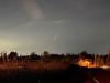
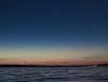
I managed to get an iphone shot tonight, I was looking too far west, and it was really hard to see at first with all of the light pollution.
 6 points
 -
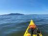
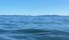
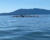
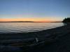
Got out on the water off Larrabee State Park today, lots of momma seals with their babies. It was about 68-70 on the water and got up to 80 at my house (about 4 miles inland as the crow flies).
 3 points
 -
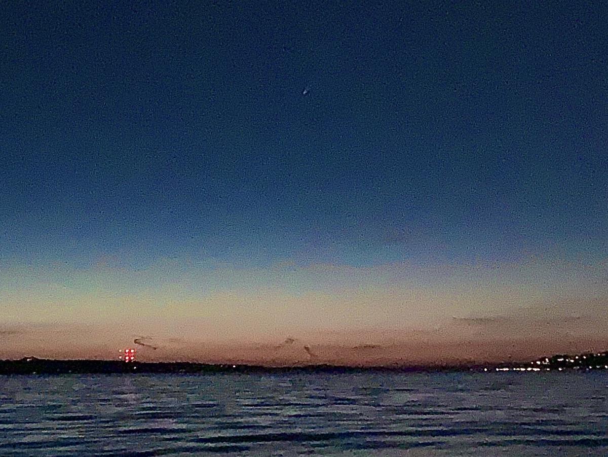
It’s there but so Tiny ! sunset was more spectacular then the comet. Found out I can see it from the bathroom window at my house too now that I know where to look. iPhone so once the light went so did it’s focusing ability
 3 points
 -
Saw the comet! Even with the city lights it’s definitely visible.3 points
-
NWS Hastings with a very detailed disco this afternoon. Kind of echoed what I have been saying about getting missed by many rains. They mentioned the haves and have nots of rain this summer in the area. Counties along I80 to Highway 6 in Central Nebraska are the have nots this summer. Of course this includes my county. Yards look terrible. Irrigated crops look great, but are using a lot of water. And right on cue, some of the hottest days of the summer are forecasted for Friday and Saturday. Going to make a bad situation worse.2 points
-
We have only picked up about 0.60" so far this month in Omaha, so not much better at all... however Eastern Iowa fared much better in June with rainfall than here. Omaha will be over 7 inches short of its normal annual rainfall total by this weekend... so we will have a LONG way to go to make up that deficit. Thankfully the weather pattern starts looking a little better for us later this weekend with decent and fairly widespread convective events showing up for Sunday and Monday nights after the brief heatwave coming later this week. That is if you can believe the longer-term models (which I don't right now).2 points
-
Picked up 0.42" today. Wasn't expecting that. 0.74" event total2 points
-
Warm and dry July up there still means 53 degree rain for the most part.2 points
-
Summer is the worst. Can’t wait for fall.2 points
-
The WRF- ARW models and others did a good job yesterday. Was hoping they'd be wrong. But I like the latest HRRR for se.Ia. for today. Most of the other CAMS aren't great at all. I'm afraid it will weaken as it moves eastward or stay south. I had very light rain most of the night but not even 0.20"!2 points
-
The HRRR has trended much wetter for southeast Iowa today as the northeast Kansas MCV heads northeastward. The latest run even has 0.75" up to Cedar Rapids. I'm skeptical of that, but we should get something. As Tom said, some very dry areas to the southwest received a much-needed soaker overnight. In addition to KS, parts of IA/MO did as well.2 points
-
Nature gave almost the entire state of KS a nice drink of water last night and continues today... http://mesonet.agron.iastate.edu/current/mcview.phtml?prod=ictrad&java=script&mode=realtime&frames=100&interval=5&year=2020&month=7&day=14&hour=20&minute=552 points
-
Thanks Niko! I was debating on when to fire up this thread but I'm glad you did. While we are at the mid point of Summer, it's not to early to start thinking about Autumn and cooler thoughts. Based on what I'm seeing at this range, things are indeed looking much more interesting this season. Last year, I busted badly and I hope that my intuition for this season is right. We need that blocking to rock this year!2 points
-
39 here this morning. Your "truck" would've needed a block heater to start up I'm sure.2 points
-
Hope it is acceptable w the mods by starting this topic in July. I have been hearing lately about a lot of "Polar Vortex" visiting our nation next Winter and a lot more snow for many. Last year it never unleashed its fury, until late Winter and into Spring, where snows were falling in April and in May. This upcoming Winter will be different. Lake Effect snows also will be amazing as well, since there is a lot of warm water available. Upper Midwest will freeze as P.V visits are much more frequent and stronger. Michigan likely to see major snowstorms. Again, it is very early to predict what will happen, but it is looking very good for many. Lets discuss...........1 point
-
1 point
-
85 in Portland is not like 85 on the East Coast. Dewpoints matter.1 point
-
83/54 currently 72* Felt like summer today1 point
-
Could be worse, it could be 20 consecutive days with lows > 90F:1 point
-
1 point
-
Only 0.41” here since last evening. Still have dry spots beneath the plants. A lot more rain one county to my se. At least it’s that much1 point
-
1 point
-
Looks like they are finally having an extended period of warmer weather there.1 point
-
Faaaaaaacccccccceeeeeeebbbboooooooooooooooooooooooooooooooooooooooooooooooooookkkkkkkkkkkkkkkkkkk1 point
-
I had 18 degree heavy snow one morning during that event while it was in the 40’s south of Seattle...Good times!1 point
-
There were legit Arctic temperatures in many places north of the King/Snohomish line IIRC. The pictures in Bellingham and Lynden with the Fraser outflow looked like North Dakota. January 12 there was a great storm in the Cascades that I got to ski in. Nor’easter type weather with insane snow rates and 65 MPH wind gusts. They had to close the lifts down early. Can’t say I have many good things to say about the rest of that January down in my location though.1 point
-
Yeah we managed to reach freezing on 3 occasions so there was that.1 point
-
Up to 90F. Third one of the year. Going to be another above normal day. Unlikely we finish July with below normal temps.1 point
-
Clinton probably hibernates in the summer haha1 point
-
Same here although you're probably drier than I have been. Barely 0.40" here so far this month.1 point
-
It’s not a seasonal realignment. It’s an intraseasonal cycle driven by a CCKW crossing the pacific w/ an in-situ tropical/subtropical -AAM moat presently a holding pattern. I’d mentioned July 15-25th a little while back. Could run a little shorter or longer on the backside, I suppose, but the theme(s) aren’t changing, in my opinion.1 point
-
You bet! B4 ya know it, August will be here and the countdown to "Meteorological" Autumn will be upon us. Funny how time flies by. We all have to bust in our lifetime to learn from our mistakes, so don't let that concern you. In the meantime, looking forward in reading your thoughts on this upcoming, excited "Winter Season."1 point
-
Looks like we got down to 55F. Another day of PNW summer perfection on the way.1 point
-
And yet we cannot even buy a decent rain shower or storm at this point in East Central Nebraska. EDIT: Finally seeing at least some light rain here, enough the wet the pavement at least. Hoping some of the heavier showers to the south can make it north this morning... please Mother Nature haha!1 point
-
I'm not to enthusiastic about getting much, if any, storm action today as the good ol' "Chicago Split" may be in the cards. I actually don't mind getting missed to the south because our farmers down in MO/IL need the rain badly. Over the last 30 days, notice how dry it has been in MO and C IL. From the Ozarks of MO to St. Louie, storms should be firing up later today...1 point
-
What a difference a day makes. I woke up with a sweaty face this morning and didn't expect such a warm night. The DP wasn't that bad yesterday but noticeably on the rise today ahead of the approaching storms. It's a much warmer start to the day at 73F with a DP of 65F, however, there is a nice southerly breeze which is nice.1 point
-
Coastal weather can be weird, you probably have some summer microclimates over there that are similar to Victoria. Today had a modest sea breeze with temperatures steady in the low 70s, then there was a drop to 66F around 6:30 followed by a spike to 77F at 8pm.1 point
-
84/52 here today. Nw breezes, low humidity and a deep blue sky. The kind of summer day the PNW is famous for.1 point
-
Today was perfection.1 point
-
The hottest day of the year will likely be on my birthday (Saturday). There was also a bad heat wave around this time last year. Sorry guys, it my fault, lolz.1 point
-
I haven’t noticed. We are still a few months away from that intoxicating mix of mouldering leaves and wood fires. It smells like berries and green, growing plants out in the forest lately.1 point
-
Low of 32 at Meacham this morning.1 point
-
500mb heights are close to normal D11-15. Which is a good thing if you enjoy the typical 75°F weather, right?1 point
-
I am going up to Baker this weekend with A buddy of mine who is an amazing astrophotographer to get some shots with it. Sounds like we should be able to get the MIlky Way as well. This is something I've never done before but have always wanted to do, so I'm pretty excited (even bought a new lens for the occasion) get to go up with a "pro". At this point looks like the weather should cooperate for us.1 point
-
Bring it on !!!1 point


This leaderboard is set to Vancouver/GMT-07:00