
Leaderboard


Popular Content
Showing content with the highest reputation on 10/11/20 in Posts
-
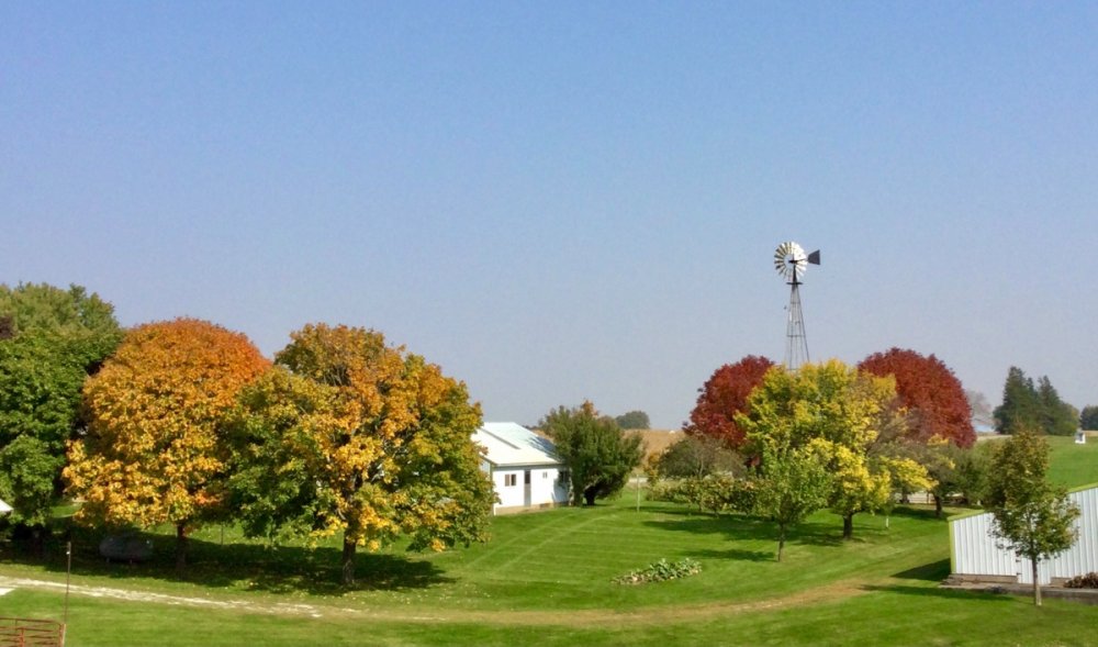
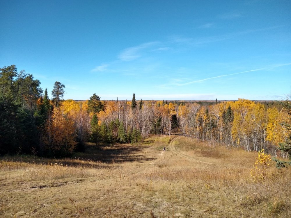
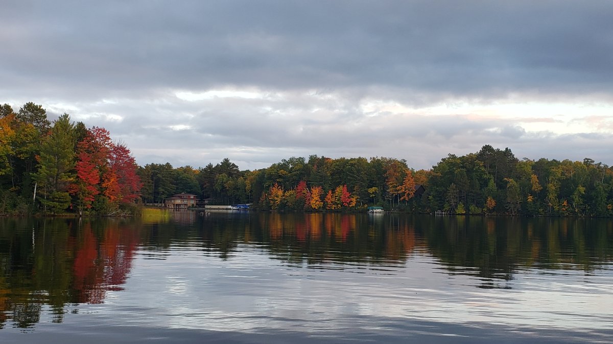
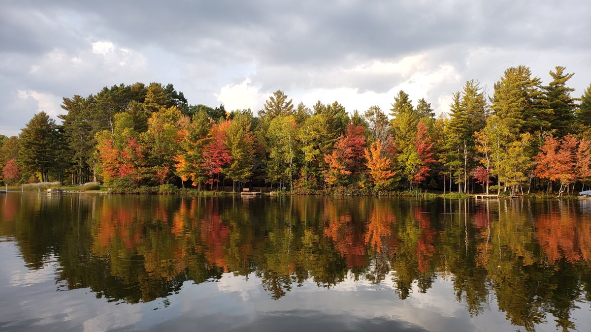
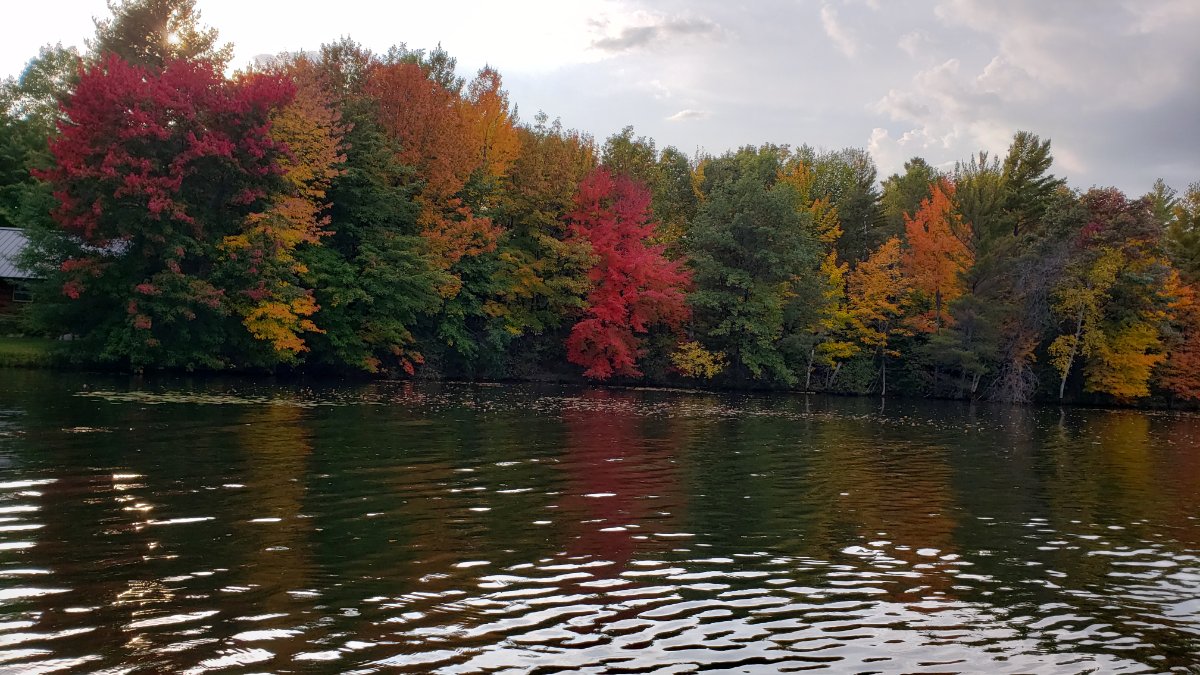
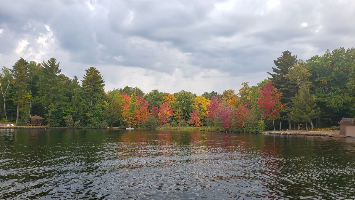
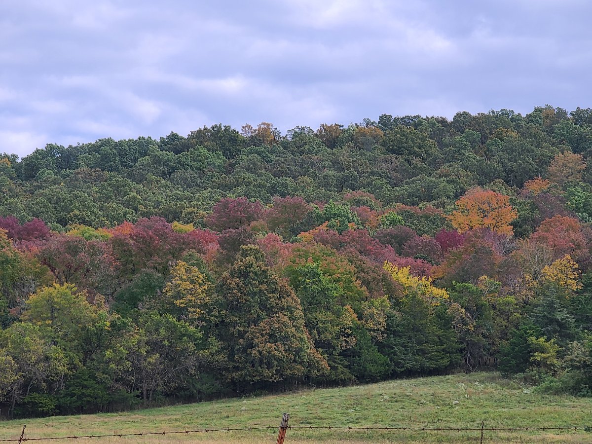
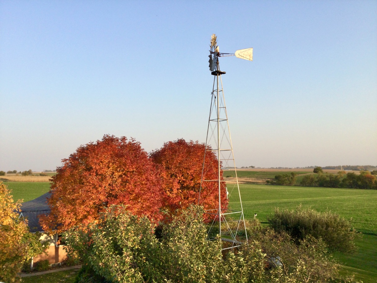
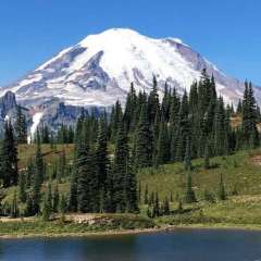
Fall in the northwoods!
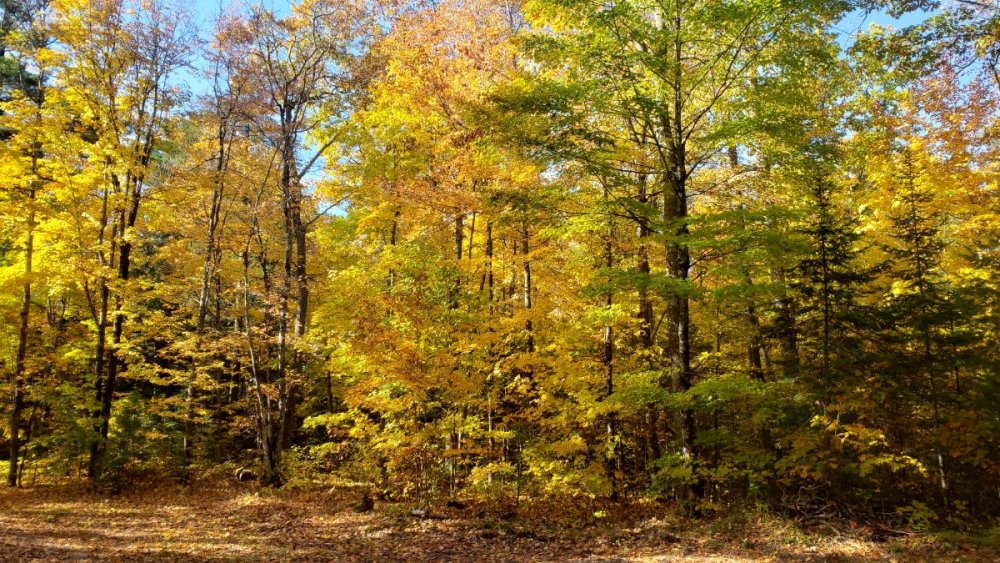
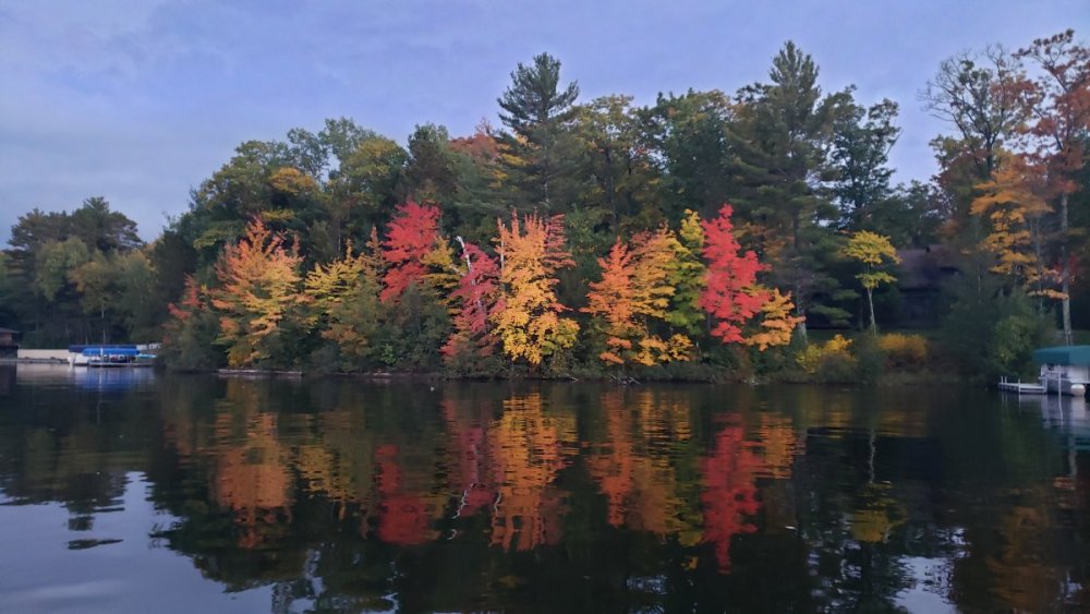


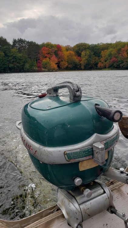 8 points
 -
Feels like late spring outside right now, with temps soaring into the mid and upper 70's with dewpoints in the 60's. High temps look to get back in the mid and upper 80's before the cold front surges in this evening. Looks like our best chance for severe weather here in Eastern Nebraska since August, as we are in a slight risk. Kind of fitting that one of our most decent chances of severe weather in all of 2020 comes in mid-October... this year has proven that it can be hard to break weather patterns though, so I really wouldn't be surprised if we get missed again somehow. On a positive note, my COVID-19 symptoms are going away quickly and according to CDC guidelines I will be able to return to working in the field by Tuesday or Wednesday.7 points
-
Good morning trend continue to move towards a wetter and more active period as we move into the second half of Oct. Good to see all that snow cover in Canada and down the Rockies.6 points
-
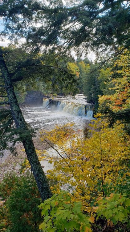
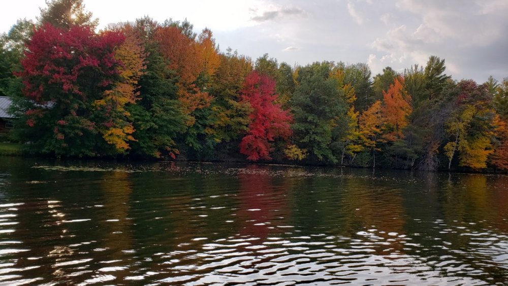
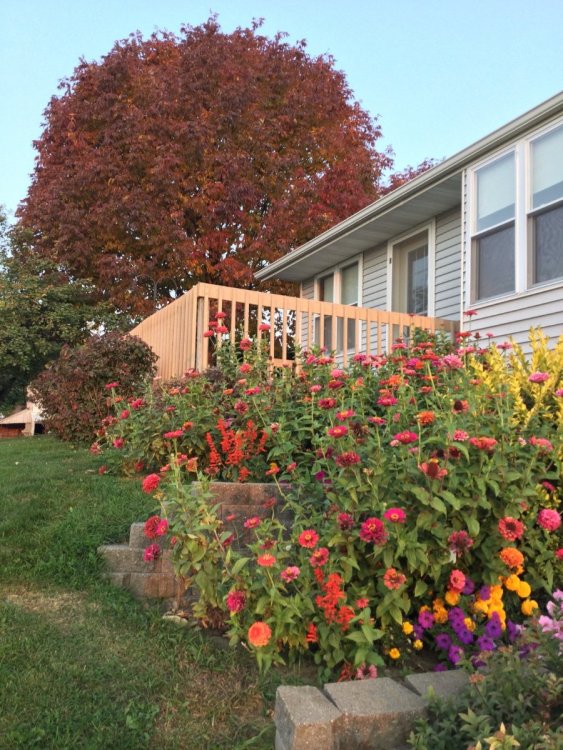
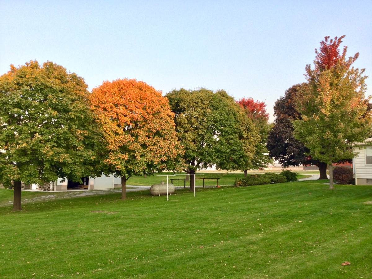
A few of the contrast and color. Will try some more over the next week.

 6 points
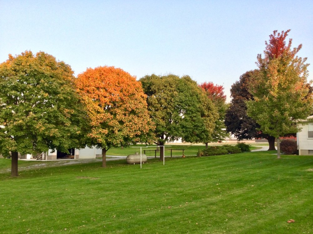
 -
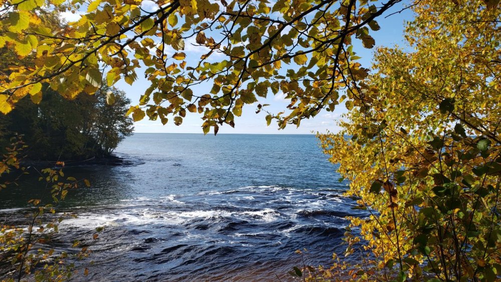
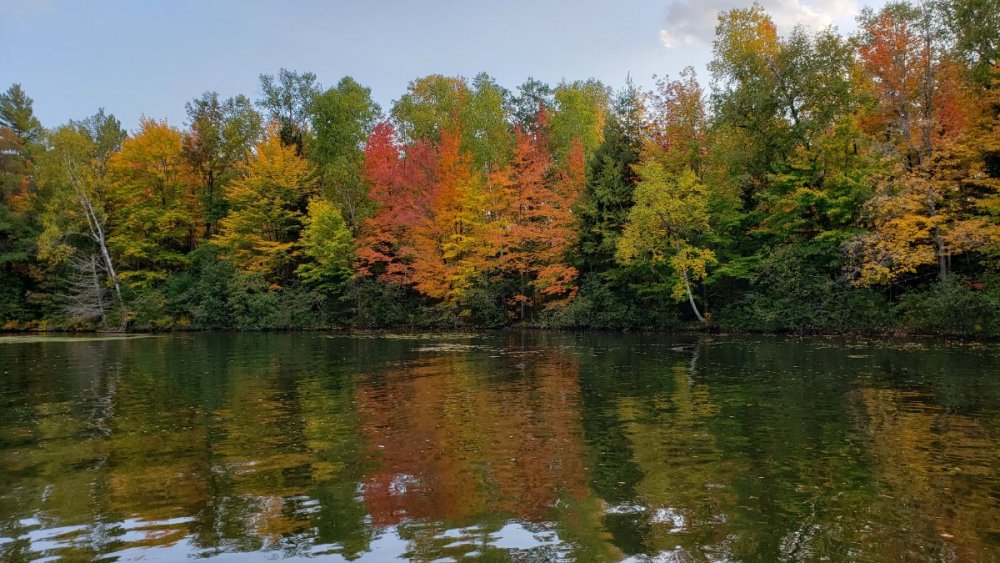
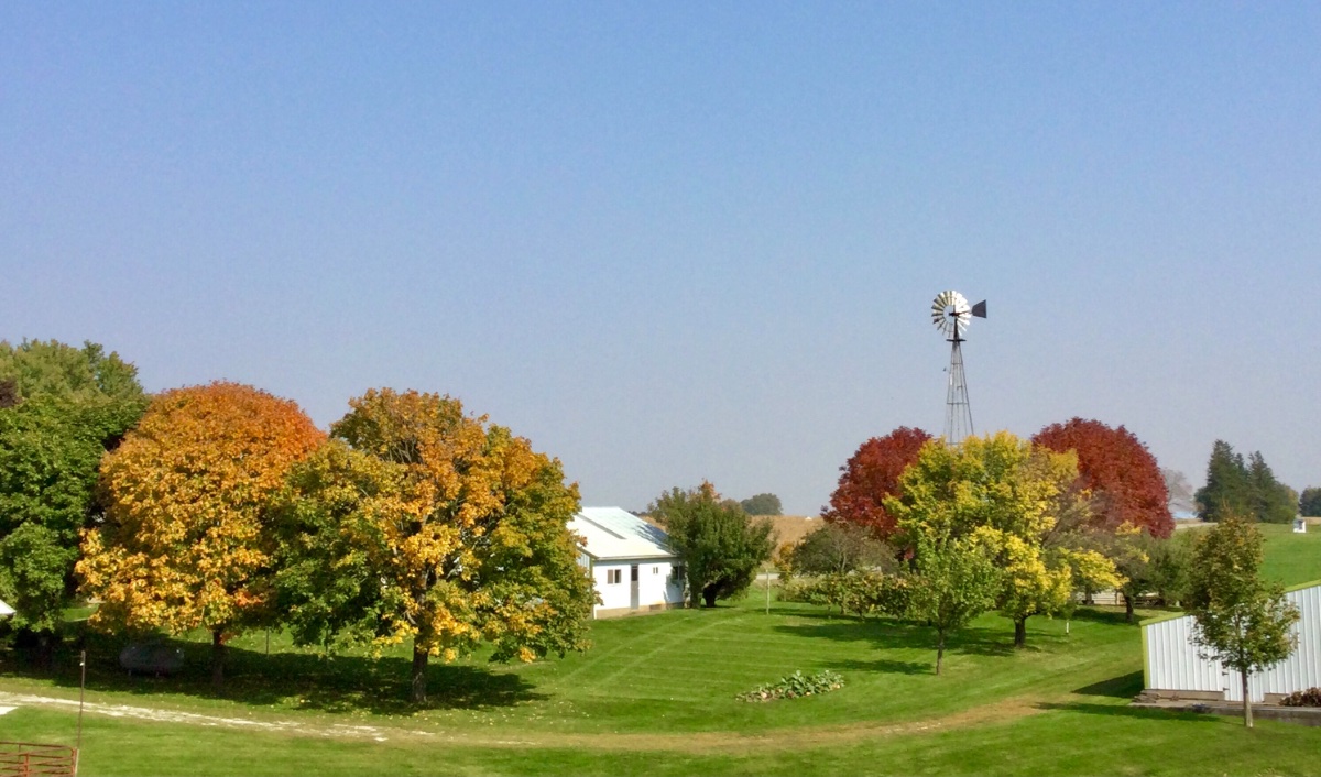
Fall colors on the farm. The purple ash are probably as nice as they have ever been. Hopefully the emerald ash borers don’t kill them. I had to cut down another type of our ash tree earlier this summer as it was infested with that borer and it was dying. Just perfect weather for pretty colors this fall and it should last longer too. I like to take photos earlier and later in the day when the softer reddish sunshine enhances the colors.
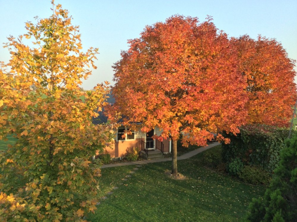

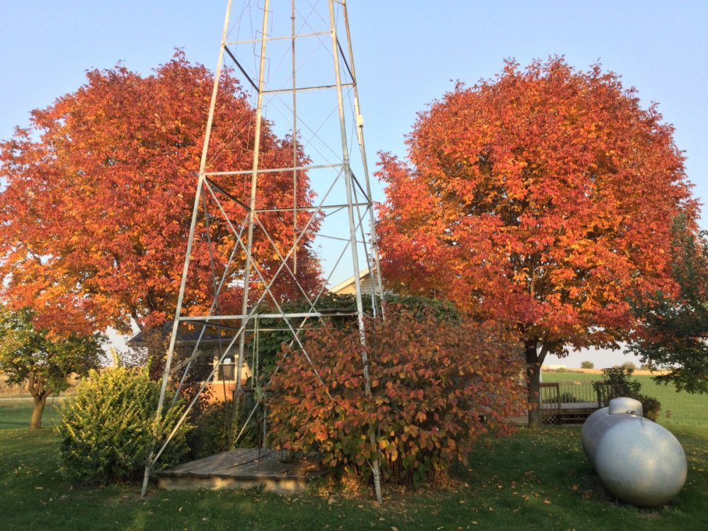
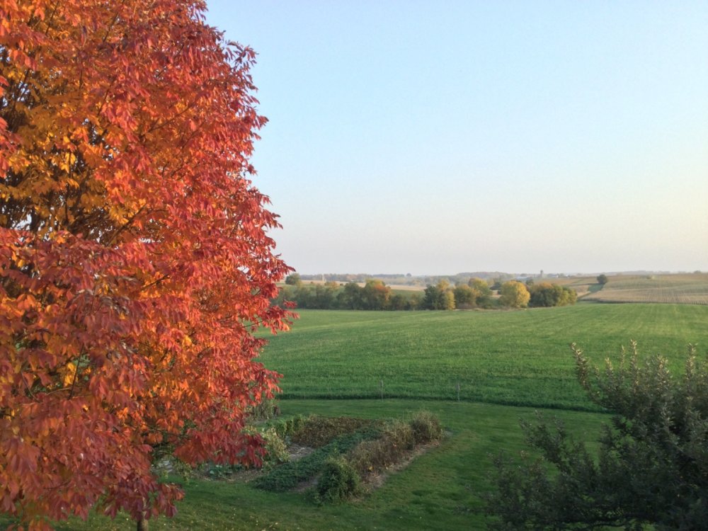 6 points
 -
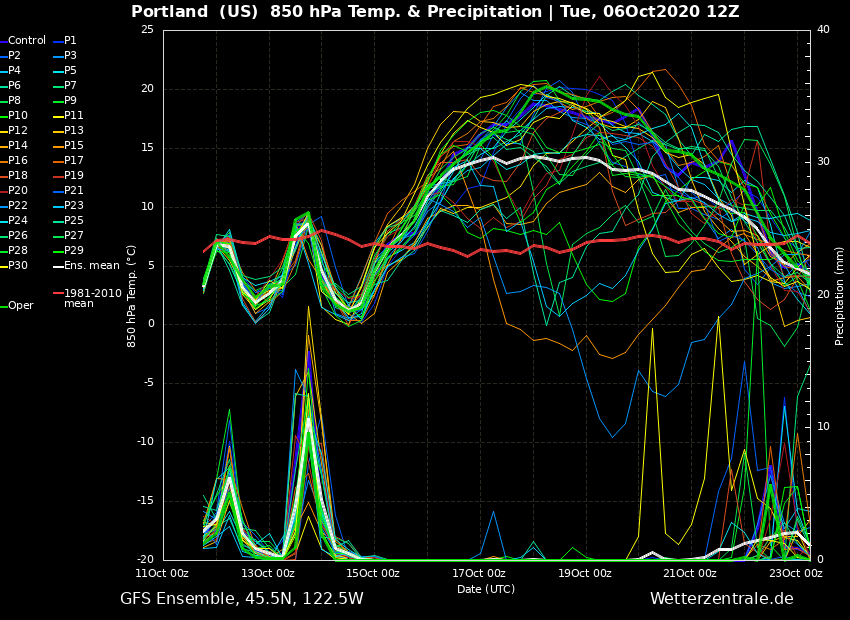
I'm surprised nobody has mentioned the GFS ensemble yet. I just looked and was shocked to see how many cold members there were. We'll see if that was just a hiccup or not pretty shortly I would think. 15 members show the 850s dropping to 3C or lower next weekend. Way better than any recent run.5 points
-
Jesus Christ. Cedar Rapids, IA is still a mess after the Derecho back in early August. Hard to fathom how destructive this must have been. Thread.4 points
-
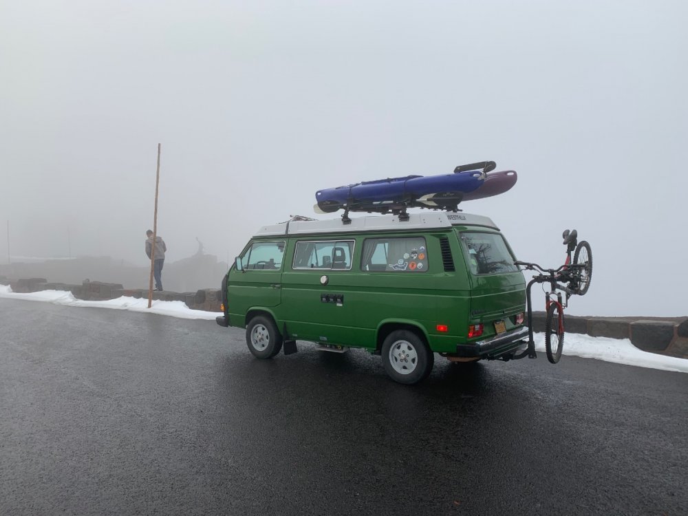
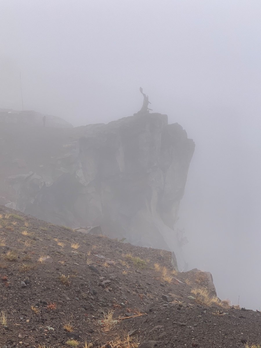
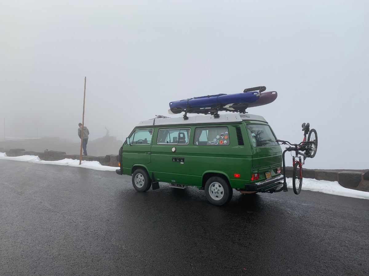
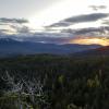
Down in Timmy Supercell country tonight! Here’s a shot of Crater lake earlier today. Brisk winds and drizzle. I’m sure the lake was down there somewhere in the white mist! Didn’t matter as I just loved being in the rowdy wind blowing drizzle...easily entertained Back down on 97 it was a different world of partly sunny skies. Stars are out in Klamath Tonight

 4 points
 -
Southerly gradients increasing. As of 3 PM PDX-EUG: -4.2mb PDX-MFR: -6.2mb OLM-PDX: -6.5mb OLM-EUG: -10.7mb Wind Advisory is in effect Greater Portland Metro Area-Central Willamette Valley- Greater Vancouver Area- Including the cities of Hillsboro, Portland, Wilsonville, Oregon City, Gresham, Troutdale, Salem, McMinnville, Woodburn, Stayton, Dallas, Vancouver, Battle Ground, Ridgefield, Washougal, Yacolt, and Amboy 1037 AM PDT Sun Oct 11 2020 ...WIND ADVISORY IN EFFECT FROM 4 PM THIS AFTERNOON TO 10 PM PDT THIS EVENING... * WHAT...South winds 20 to 30 mph with gusts up to 40-45 mph expected. * WHERE...In Washington, Greater Vancouver Area. In Oregon, Greater Portland Metro Area and Central Willamette Valley. * WHEN...From 4 PM this afternoon to 10 PM PDT this evening. * IMPACTS...Gusty winds could blow around unsecured objects. Tree limbs could be blown down and a few power outages may result. PRECAUTIONARY/PREPAREDNESS ACTIONS... Use extra caution when driving, especially if operating a high profile vehicle. Secure outdoor objects.4 points
-
This isn’t really accurate, though. 2010/11, 1988/89, 1955/56, 1949/50, etc, were all strong niñas, with lots of lowland cold/snow. Some are also zonal..1974/75, 2007/08, etc. The reason why some strong niñas are zonal and others are meridional/blocky is due to a variety of factors..many of which are external or peripheral to the ENSO system.4 points
-
Well, its a happy October here. Sold the house as week and moving to the Northwoods of WI for good. Can't wait. Staying at the cottagebfor the next 5 mo. Here's to living in a snow belt! With 2 new 900 Ace's! BRING ON WINTER!!!4 points
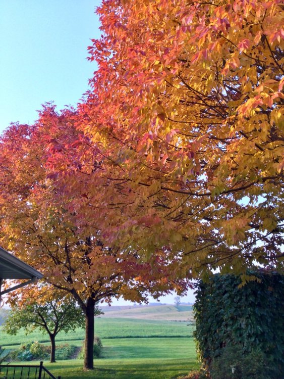
-
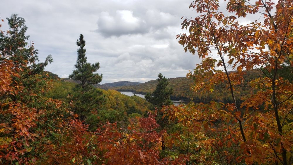
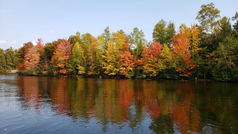
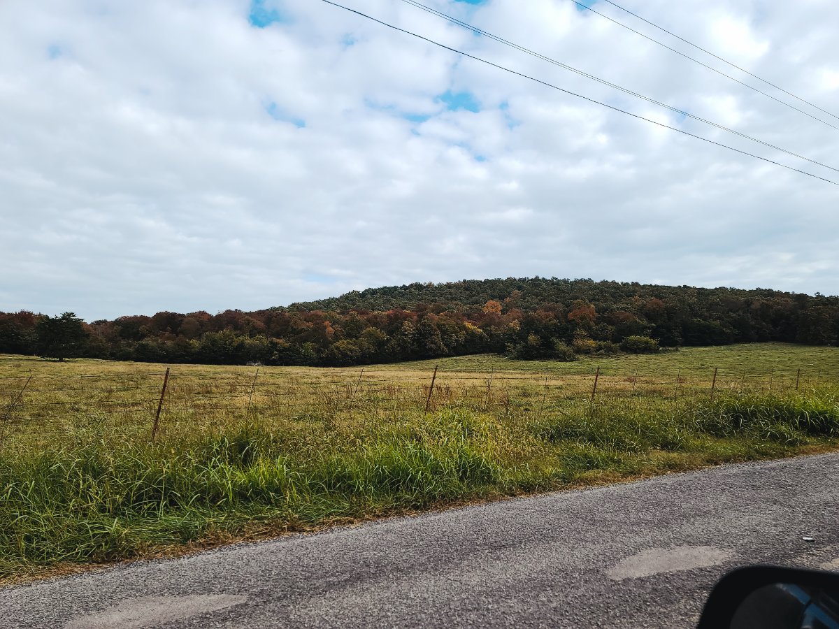
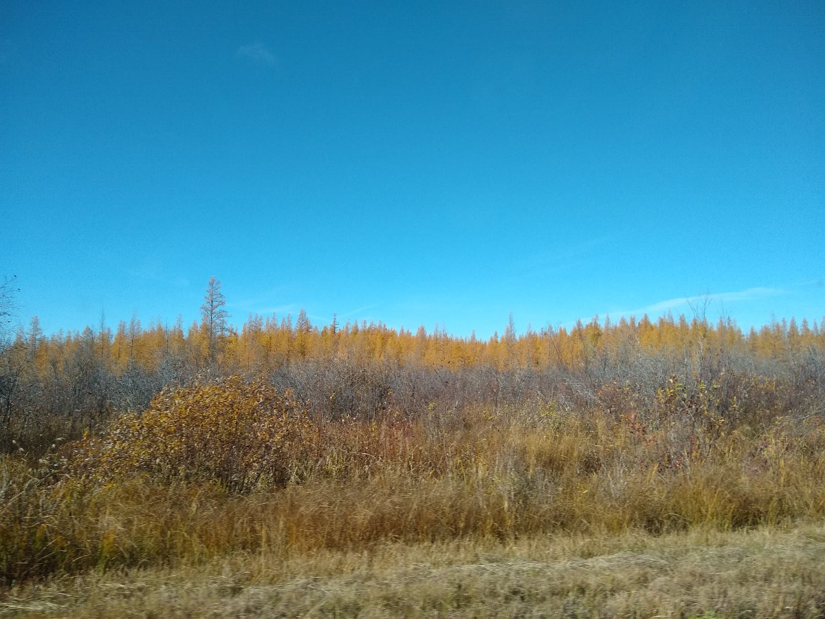
Took advantage of what may be the last couple days of nice fall weather. The sun came out and the tamracks seemed to glow.
 4 points
 -
00z ECMWF Day 63 points
-
My spread exactly here in McMinnville. These are my favorite fall days!3 points
-
For now it’s kind of on its own. Canadian and Euro look better. If the Euro was the more progressive solution, that might be more significant. But per the usual, it’s the GFS.3 points
-
Really gotta hope the GFS is wrong in the mid range with putting another big fat ridge directly over us. I much prefer what the Euro and EPS have been showing with most of the height rises staying offshore and brushes with cool air to our east. Would be a much more seasonable pattern with some cooler nights finally. This will probably be the one time everything trends toward the OP GFS though, given how this fall has gone so far.3 points
-
Up to .59” on the day. temp up to 54.3 points
-
Saw there was a 76 MPH wind gust in Lincoln. The line has hit us pretty good here with strong winds and brief heavy rains, enough to warrant a Severe Thunderstorm Warning. Only have picked up about .30 of rain so far though with a little bit more to go. However this was expected to be a quick hitter and we will take any moisture we can get. This has been an interesting and much needed Fall severe storm event for us around here to watch. Mother Nature finally delivered us a nice storm.3 points
-
For whatever reason, Vancouver WA seems to be the PNW's tornado alley.3 points
-
Lancaster under a SVR warning and the line has really thickened in the past hour.3 points
-
We have had some real tornados here. The most infamous was the one in Vancouver in April 1972 which killed 6 people and destroyed a shopping center. The Central Puget Sound has had a few of note also. The one pictured is from Auburn in the 1960s. Supposedly it was F2.
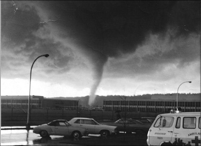 3 points
 -
Having been to both Western WA and coastal Maine, I can safely say they’re actually quite similar topographically, and have similar summer climates. Evergreen trees everywhere, hills/ridges, marine air in the summer with thick AM fog, etc. Obviously, come winter, the climates diverge significantly. Maine is literally hoth for 5 months of the year. A bit too much for my blood.3 points
-
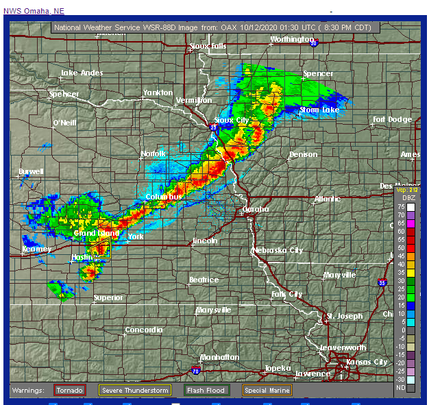
This is the best the radar has looked around here for a couple of months it seems like. A nice line of strong storms from South Central Nebraska up towards Minnesota. Only one severe warned cell currently west of York along Interstate 80, however it looks like we should get a decent shot of rain and thunder in the next couple of hours in Omaha. You can do it Mother Nature!
 3 points
 -
I've dropped a few subtle and not so subtle hints to my wife about Maine/New Hampshire area and she's not biting....I would love it there, but I think it's a bit too much cold and snow for her....3 points
-
Wind advisory for PDX metro for 40-45 gusts tonight.3 points
-
There will be plenty of GOA blocking this winter. The end of this month is going to be down right frigid with frost on my pumpkins. November is going to be super duper wet. The rest of the winter is going to be drier and cooler than normal. Two big wind storms are in bound. Two good snow makers - one for Oregon, one for Washington. Lots of fog. There's also going to be lots of fog. Oh, and one major flooding event that FOLLOWS a major lowland snow dump. Somewhere during the frigid cold snow dump Tim will be pointing out how it will be in the mid 40's and raining in no time at all. It's a lock.3 points
-
Given the context a cold October wasn't necessary this year, but I would have liked it. This has really been a dud of an autumn so far. At least today is solidly cool. I remember hating the autumn of 1988 also, so there is that.3 points
-
Euro still looks a lot closer to something good next weekend than the GFS or the previous Euro run, but still a huge step back from yesterday’s epic 12z.3 points
-
What are you seeing for me??? Please include dates, dew point spread and (approximate) flake size. Thanks in advance!3 points
-
If you do not know this about me, you will learn. I am cold onshore flow's #1 fan.3 points
-
Definitely been true lately.3 points
-
This incessant return to death ridges is getting a bit old. On a positive note I think there could be quite a flip side to this later.3 points
-
Fair enough.3 points
-
yeah what happened to the models?3 points
-
I recorded a solid 1/2" as my first snow of the season on 10-23-13 here in Marshall. This map would hint at a similar outcome. Looks like almost everyone except our most southern members have a shot verbatim. Like Niko said, we get nervous about too much snow before Turkey Day around here, but coatings and dustings aren't bad. I like the way the snowcover is advancing by latitude southward. Huge gaps in Canada and N Plains are a red flag from past experience. Like Nov of 2011 when I had scored more snow than Gaylord. Major red flag and we know how that ended.3 points
-
MAJOR Southeast wind this morning. Like the debris flying type of wind, gusting to 45mph. 59.4*F. Today will be the last day in the 70s for the season.3 points
-
^ LOVE that EPS snow mean. More members are showing a storm the week after next.3 points
-
La Niña looks really legit now.3 points
-
Just a complete soaking rain out there. Up to 0.74" for the day, 2.74" for the month.2 points
-
Close enough.2 points
-
The 1972 one was pretty severe for these parts. Supposedly an EF3. It's interesting to note there are many places in the West where tornados are more rare than they are in parts Western OR and Western WA.2 points
-
The Central Puget Sound is one of the better places for them in Western WA. There was another one that sounds like it was easily an EF2 in north King County in 1969. They happen every so often2 points
-
2018 Port Orchard tornado was an EF2.2 points
-
I can live with what the EPS and EPS control are showing. The EPS control is very much like the ECMWF operational is showing a chilly trough a couple of days later than the period we have been focusing on. The mean still shows us getting brushed with Canadian air next weekend. Maybe we will at least get our first lows in the 30s.2 points
-
Nice weekend.2 points
-
2 points
-
Nothing to talk about. Give it 5 weeks or so....2 points


This leaderboard is set to Vancouver/GMT-07:00