
Leaderboard


Popular Content
Showing content with the highest reputation on 11/09/20 in all areas
-
Foggy right in Battle Ground, but just 3 miles east it was beautiful ground fog with frozen spider webs
 13 points
 -
Almost all snow now. 34.7 points
-
Fwiw, I like what I’m seeing in the evolution of the momentum budget going forward. More analogous to the blockier subset of -ENSO years rolled forward.7 points
-
We bought our first house two months ago. It's literally right next door to the house we had been renting for the past 6+ years because we liked the neighborhood so much. I just realized I can't see the street lamp from here. I may need to chop a tree down.6 points
-
Temp down to 41 here from a high of 42 earlier. Earliest <45F maximum here since 2003.6 points
-
Rain/snow mix here @+2.5C6 points
-
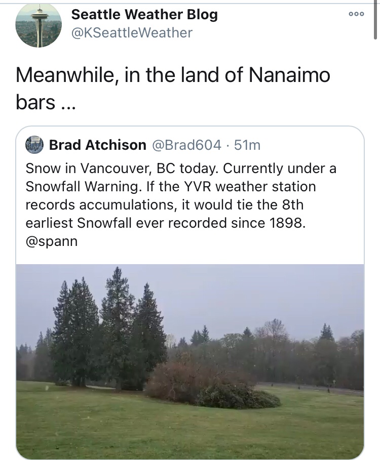
Amazing to see this! Northern Oregon Cascades-Cascades in Lane County- South Washington Cascades- Including the cities of Government Camp, Detroit, Santiam Pass, McKenzie Pass, McKenzie Bridge, Oakridge, Willamette Pass, Coldwater Ridge Visitors Center, Mount St. Helens, and Wind River Valley 238 PM PST Mon Nov 9 2020 ...WINTER WEATHER ADVISORY IN EFFECT FROM 10 PM THIS EVENING TO 10 AM PST WEDNESDAY... * WHAT...Snow expected. Total snow accumulations 6 to 12 inches for elevations above 3000 feet. * WHERE...In Washington, South Washington Cascades. In Oregon, Northern Oregon Cascades and Cascades in Lane County. * WHEN...From 10 PM this evening to 10 AM PST Wednesday. * IMPACTS...Travel could be very difficult. * ADDITIONAL DETAILS...The heaviest snow is expected to occur early Tuesday morning through Tuesday afternoon.6 points
-
Just pulled into the garage from the road trip to Omaha and KC, and a Winter Storm Watch gets posted for the TC metro. 4-7” possible. This after getting a nice late season sunburn in NE.6 points
-
BOOM Salem sets a record low, Eugene ties theirs!6 points
-
This is so satisfying
 6 points
 -
Some of the CAM's are suggesting a tightly wrapped up storm system traversing the plains/mw and potential Defo band wrapping up near OMA then up towards MSP. 12z GFS...looks like some of you will see the flakes flying after record warmth!6 points
-
My daily average of 34 today was a whopping 27 degrees lower than Wednesday of last week. That is a pretty crazy crash for this climate. Furthermore the average temp here for the first 20 days of October was 55.2, while the average for the 20 days since Oct 20 is 44.6. Quite an astonishing turnaround!5 points
-
Temp down to 36 with some lumps mixed in.5 points
-
Smells like snow...5 points
-
Wow what a storm train we get going on the GFS!5 points
-
Turning white in Winthrop!
 5 points
 -
This would be a whole lotta rain for the entire west coast.
 5 points
 -
WOW that is a weenie band. Temp still dropping here.
 5 points
 -
Pretty remarkable start to November; I have a feeling things have to flip sooner or later.
 5 points
 -
Wet snow in Lake Steven's. Rain/snow mix in Mill Creek. If it was 2 degrees colder we would be getting dumped on right now.4 points
-
Drove to 800' in southeast Bellingham and got snowed on. I wonder if anything will stick up there. Just cold rain here at home.4 points
-
Wow I’m surprised it’s 38 with some flakes mixing in. I figured the temp would be going up with breezy SW winds not down.4 points
-
Druncle showing a northern Washington special.4 points
-
4 points
-
42/22 today in Olympia. Pretty d*mn impressive.4 points
-
Jay Albrecet, AKA JAYA in our forums, has some good tweets about the possibility of coastal flooding in WA. 4. Importantly, let's look at tides. Tides at Westport on Saturday morning are as high as they are all November! #wawx #orwx #flooding Jay Albrecht Retweeted NWWashingtonWX @wx_washington · 3h 5. What causes salt water flooding on the coast? Combination of 1) Low atmospheric pressure, 2) tides, 3) Ekman transport and 4) wave setup. When they align, watch out! It is still too early to call, but be watching closely! #wawx #orwx #flooding 3 54 points
-
If it keeps trending south perhaps a windstorm could be replaced by a snowstorm! (If there was enough cold air to draw down)4 points
-
I miss the "Siberian Express" cold blasts that we got in the 80's. Straight from Siberia, right through Alaska, and down to the PNW. Those were memorable. Cold in Alaska can be good for us as well.4 points
-
Hell of a windstorm Friday night on the 12z GFS and WRF.
 4 points
 -
12 GFS is pretty legit.4 points
-
It will definitely go lower, as the 3.4 region is already in major Nina territory. And, in comparison to the other years, the SSTs were pretty much neutral in the summer and early fall, where some of the other years the SST's were already in nina territory by then. In 2010, for example, the July-September ONI was at -1.4, where this year it was at -0.6. The next months numbers will replace August, where the Nina was very weak, with November, where it is at -1.5 or lower.4 points
-
Looks very possible the ski resorts could be open by the weekend before Thanksgiving. At least some of them. Great news for everyone!4 points
-
Finished with exactly an inch of fluff on my balcony. 29.3*F.4 points
-
What an overnight here. I was woken up at 4:30 AM by a torrential downpour along with pea sized hail. Only lasted about 10 minutes. Then a few more storms came through after 5 AM. Right now it is 60 degrees with low clouds, calm wind, and a dew point of 56. Cold front is just to my northwest. Temps are supposed to drop below freezing by the time school is out this afternoon. Went to school in short sleeves this morning, but I brought a coat for after school. Just another typical Nebraska day.4 points
-
December 2008 was amazing. I am about 6 miles southeast of the Airport, so it's always colder here. The arctic front blew threw on the 13th. We had round after round of snow showers and then the back to back blizzard/snow storms on the 18th and 21st. We had a bit more on Christmas Day too. Christmas Eve I had 30" on the ground. I don't remember January or February 2009 being all that noteworthy. After the December snowpocalypse Winter weather ended for the lowlands. Here is a pic of me December 2008 digging a path to remove the snow from the basement window wells. I would love to see another mega snow storm like that one!
 4 points
 -
Looks like Cliff needs to join Andrews Zoom call. https://cliffmass.blogspot.com/2020/11/potential-for-major-storm-on-friday.html?m=13 points
-
Looks windy for Seattle.3 points
-
Happy for y'all seeing your first flakes...the first of many.3 points
-
35 now and more lumps. Most likely a good rain/snow mix going on at my neighbors.3 points
-
43 / 25 here today. Currently light rain and 38. It would easily be snowing tonight if this were Dec, Jan, or early Feb.3 points
-
Ekman transport. Sounds like something Phil would make up.3 points
-
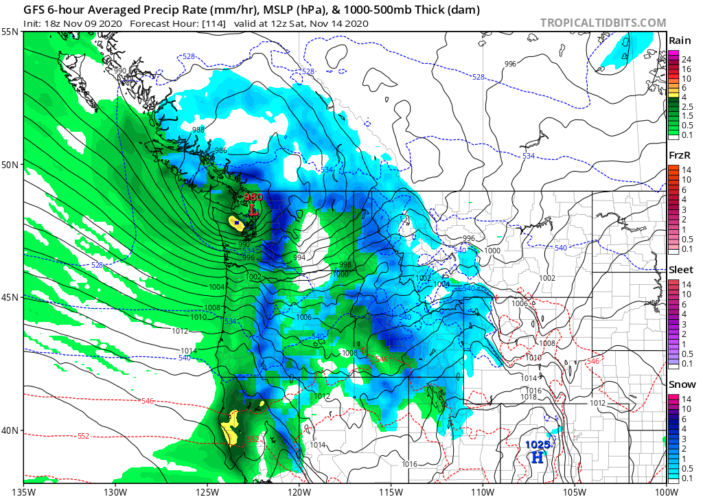
18z GFS is further South with Friday night's windstorm and brings the low across the tip of the Olympic Peninsula and through about Skagit County. Would be a big windstorm for the Seattle area.
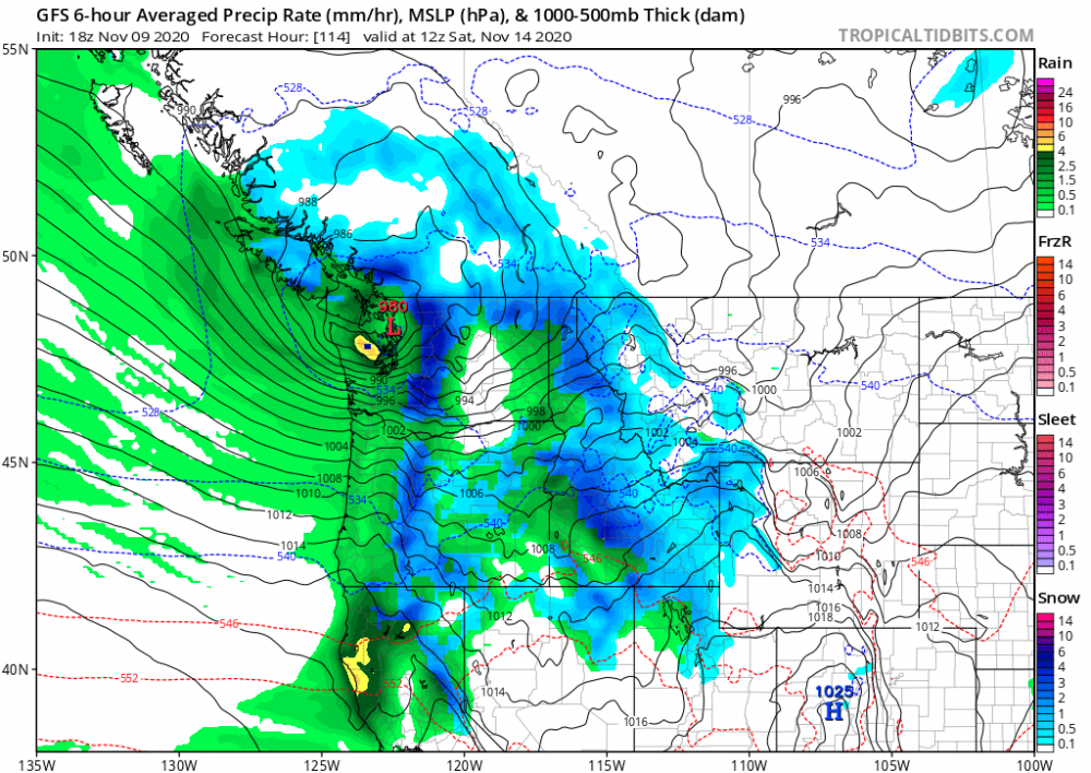 3 points
 -
Winter Weather Advisory just issued for 2-6" of snow and possibly some ice. Well this turned in our favor quickly. Really nothing mentioned just a couple of days ago. WINTER WEATHER ADVISORY IN EFFECT FROM 9 PM THIS EVENING TO 3 PM CST TUESDAY... * WHAT...A wintry mix of precipitation is expected this evening, eventually switching over to all snow after midnight. Total snow accumulations of 2 to 6 inches are forecast, with the highest amounts favoring locations northwest of a line from Cambridge to St. Paul. Ice accumulations of a light glaze will also be possible. * WHERE...Portions of central and south central Nebraska. * WHEN...From 9 PM this evening to 3 PM CST Tuesday. * IMPACTS...Plan on slippery road conditions. Periods of heavier snow, combined with at times gusty northwesterly winds, may result in lowered visibility. The hazardous conditions could impact the Tuesday morning commute.3 points
-
Some of the short term models want to paint a stripe of heavier snow somewhere over Central Nebraska tomorrow. This might be a nice little November surprise. Temp now 30 degrees with north winds gusting over 20 MPH.3 points
-
That wraparound may give me a little snow. It was actually a tad bit humid this morning. That is gone. Down to 34 and falling right now.3 points
-
Finally got our first freeze this morning...low of 30. Currently 32.3 points
-
PDX and the valley north of Albany got buried. Had a handful of inches down here in the initial Arctic airmass with a couple of sub-freezing highs, then we moderated and had cold rain for the weekend. Left a lot to be desired here but then there was 2-25-19 that set the standard for our most significant event since Jan, 1969.3 points
-
I think this is a pretty typical Nina November, really. A wet and active November with a consistent jet aimed right at us is a pretty easy call with a 1st year strong Nina. 1998, 1988, 1973, 1942... all pretty similar. Those years all featured some significant midwinter blocking and arctic air at some point, so it's the general trend you'd want to see to continue towards that path.3 points


This leaderboard is set to Vancouver/GMT-07:00