
Leaderboard


Popular Content
Showing content with the highest reputation on 11/10/20 in all areas
-
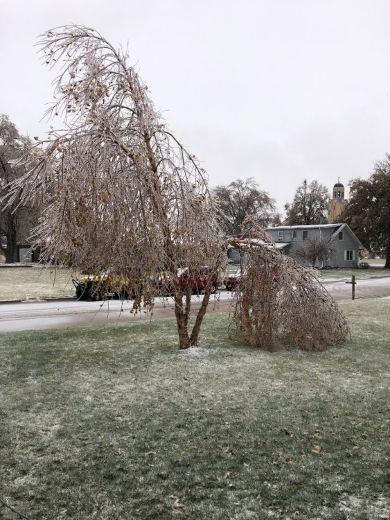
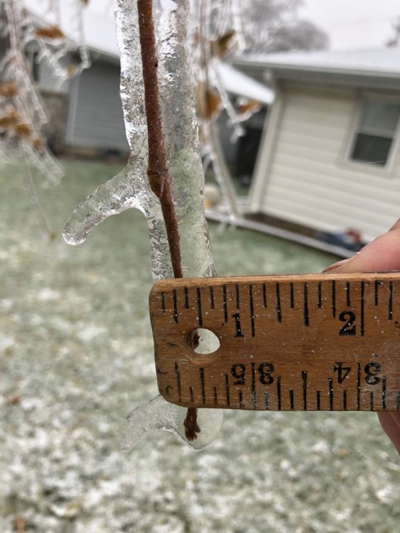
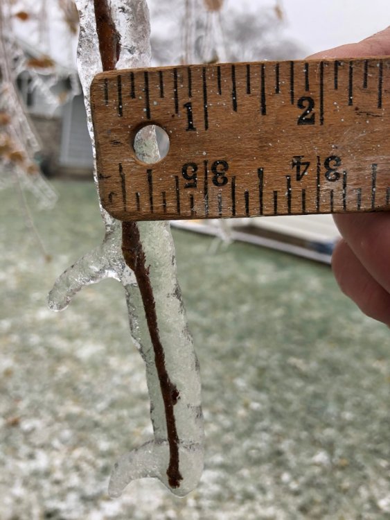
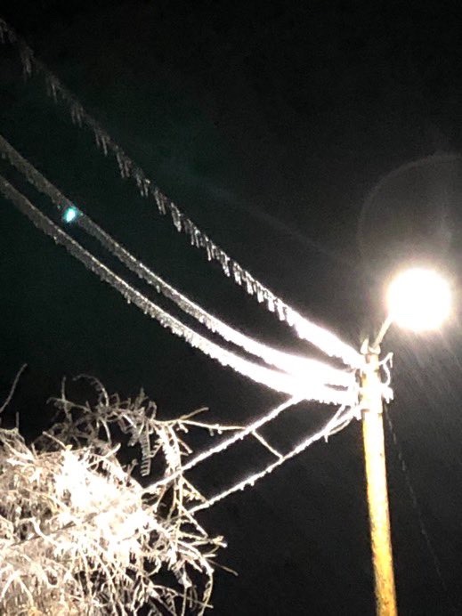
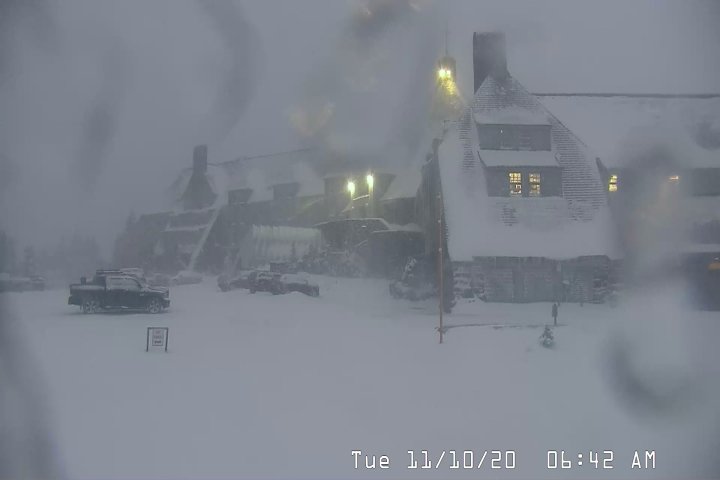
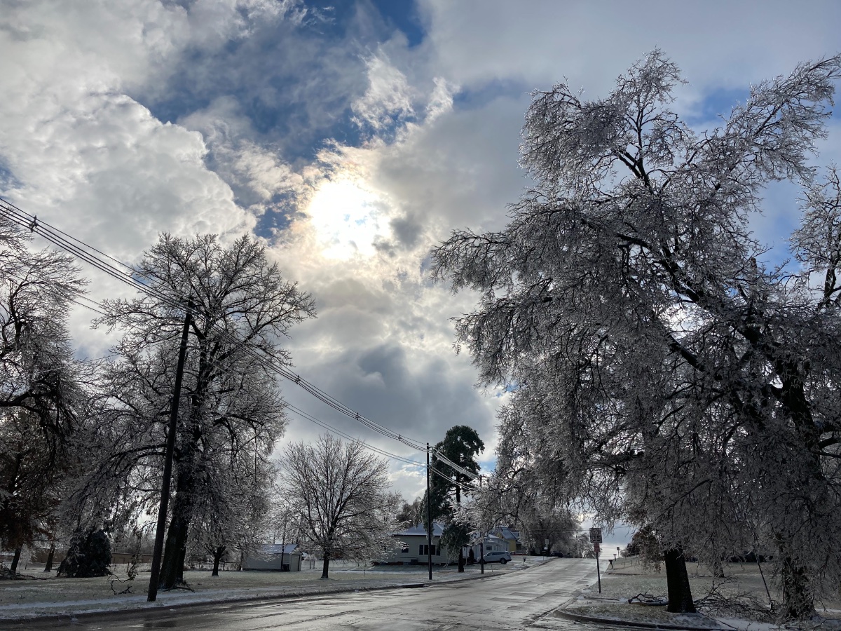
Crazy to think that just a week ago we were in the 70's all week! This turned out to be quite the ice storm to say the least. Ice accretion is around .5-.75" and trees are breaking like match sticks. Hoping to keep power today as school was called off. Correction: After doing the actual way, came out to .375" of ice.
 12 points
 -
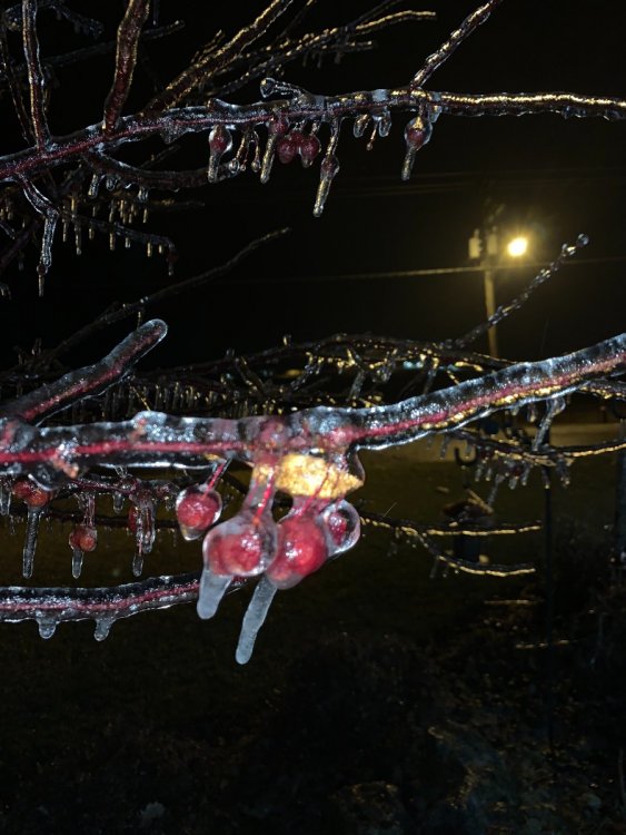
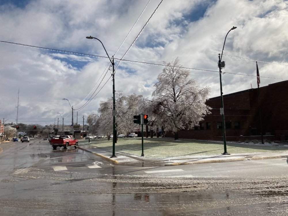
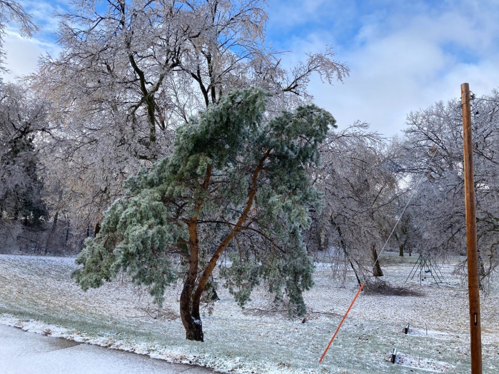
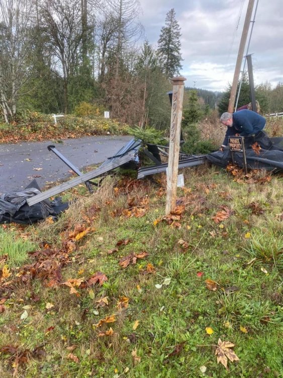
1.41” of rain/freezing rain here so far. Crazy how much of a difference one or maybe two degrees make. looking at my weather station, the temperature was between 31.6-32.2 all night long while we’ve had .93” of the total rain since midnight. Bc it was so close to freezing we only got minimal accumulation on the trees and elevated surfaces. You go west from here about 20-30 miles and further and that’s where the major ice accumulations occurred. The first pic is from my house, the rest off of Twitter from areas west of here.

 9 points
 -
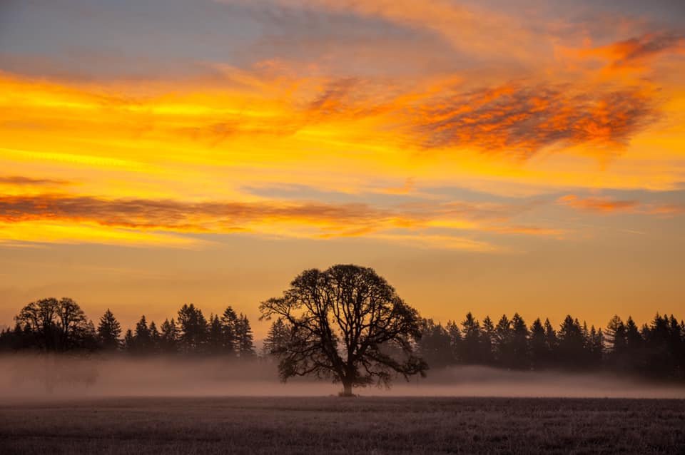
Since it'll be raining the next 7-10 days, here's another look at yesterday's sunrise.
 9 points
 -
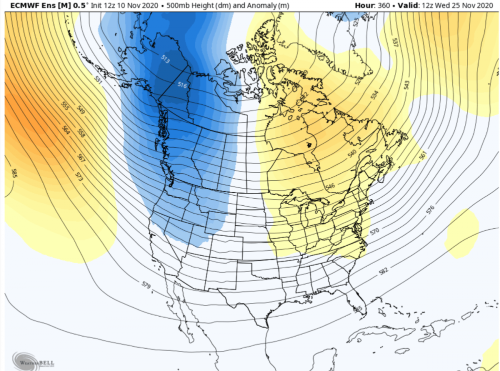
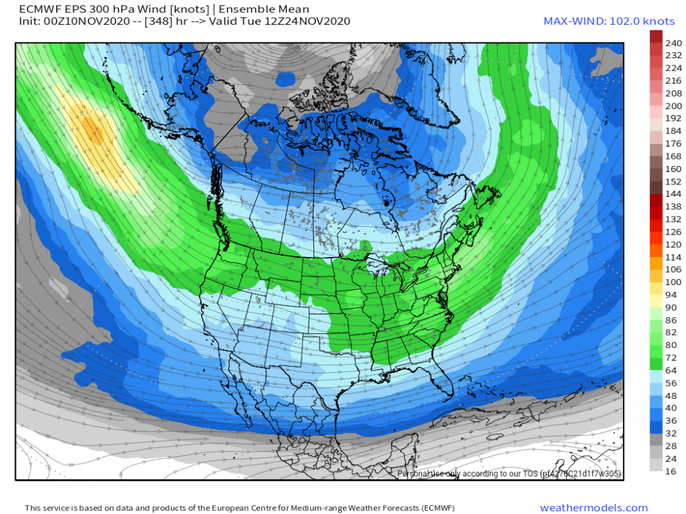
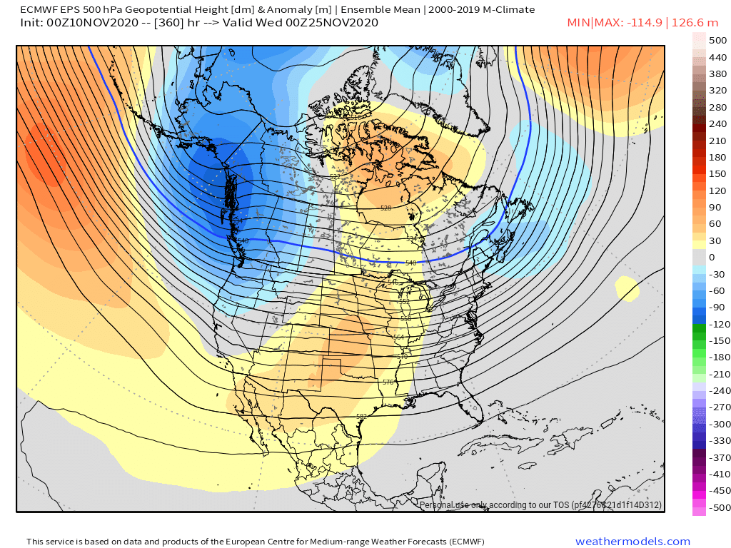
Very strong signal for high latitude blocking at the end of run on the 12z EPS. Something is a brewing for late this month.
 8 points
 -
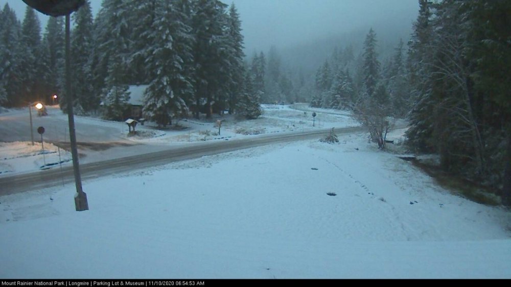
Nice to see some good snow coming down in the mountains. First decent snow at Longmire on Rainier too.
 7 points
 -
I was able to make my work trip out to Kearney, NE this morning... lots of ice just west of Lincoln. Stopped in York to check in with a client, and was amazed at how much ice they accumulated out there overnight and this morning. The pictures turned out nicely as the sun came out as I was leaving town to jump back on I-80, which really wasn’t bad at all this morning.

 6 points
 -
I'll struggle to get above freezing today with the sun in full force. 13.6*F.6 points
-
Enjoy your smoke after this one, Sounders.6 points
-
Nice round of thunderstorms this morning, I would think around New Years day we might have a nice Winter storm on our hands. Congrats to those scoring some wintery precip!5 points
-
Once there is snow, I would love to get some snowshoes and do a proper hike in the snow up in the mtns. Or once we get a foot here at some point.5 points
-
These types of storms always remind me of bowling. Will the ball hit in the pocket for a strike or gutter ball? Always a mystery until the hour is upon us. 41*5 points
-
Upgraded to a Winter Storm Warning. Still looking like 4-7” with snow starting by early afternoon and heavy snow starting by the evening commute.5 points
-
Yes. Possibly a lot of it.4 points
-
Maybe I'm totally wrong here but I do like how models are starting to intensify the low as it hits land rather than gradually weakening it after a stronger peak...4 points
-
The 2006 storm wasn't nearly as strong down here, but I definitely remember leaving my dad's work Christmas party driving down Mill Plain (a major road through Vancouver) and seeing a huge power flash and everything went out. Even the stop lights weren't blinking. It was a fun drive home through that mess.4 points
-
That is a massive AR on the long range GFS.4 points
-
Not sure of picture credit, obviously not major damage, but I'm interested to see if that weather station was recording at the time.
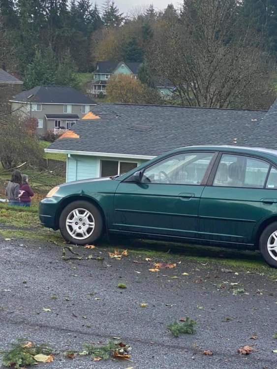
 4 points
 -
Awesome clip of the electricity this storm is producing...4 points
-
Alert! Tornado in St Helens today.4 points
-
MPX going 1-2" per hour rates this evening after a rapid transition from freezing rain to snow. Niiiice!4 points
-
The mean temperature yesterday was 34.1 degrees, the coldest since 32 back on February 4th. In fact, it was the 2nd coldest day of the year behind that day.4 points
-
Probably 1.5-2.0" as of now with a heavier band coming through right now. We might get to 2.5" as it winds down. Forecast was 2-6". I always assumed we'd be at the lower end as we had freezing rain first. Thankfully here the roads weren't too bad. Many schools in our immediate area are starting at 10 AM. Our Supt. doesn't call school off very often, and we rarely have late starts. If we are off, it must be bad.4 points
-
Just another day in paradise! From record warmth to a Winter Storm...what volatile wx pattern that has set up. I think this will be a common theme going forward. Many ups and downs in a La Nina pattern with a lot of potential for heavy snows the farther north you are. Sorta reminds me of the pattern during the '17-'18 season I believe it was that buried the Upper MW/GL's. I think @Madtownplanned a perfectly timed move up farther north!4 points
-
EPS doesn't have split flow. And looks interesting toward the end.
 4 points
 -
Rather impressively the ECMWF only depicts above normal 850s two out of the next ten days. We are certainly on a pretty chilly roll right now. I'm going to be very interested to see how that low tracks on Friday. It's probably no secret I am rooting for the chillier southern track. I just don't have a lot of interest in wind anymore. I've had plenty where I'm living now to suit me. 44 / 38 for the temperature range today, and currently 38 with totally clear skies. I'm quite surprised the northerly flow proved strong enough to clear it out so quickly.3 points
-
Coastal windstorms, on the other hand, are pretty sweet since damage usually isn't severe. I'm thinking about heading over to Yachats Saturday morning if the conditions are right. There's a chance of 30' - 40' swells. We'll see.3 points
-
A sloppy wet mix of Cascade concrete makes a nice base to hold it all together.3 points
-
The only thing we’re sure of is the fact we’re not sure!3 points
-
Just caught up with this thread. IMO the mood swings after each model run warrant the issuance of weenie tags.3 points
-
Pure rippage out there. I’d say about 4-5” down. Might pick up another inch by the time it ends. Quick hitter, but man is it hitting hard. Good stuff.3 points
-
Anyone remember the 1981 wind storm, also about this time of year? https://climate.washington.edu/stormking/November1981.html#:~:text=The November 13-14%2C 1981 windstorm followed just such a,80.5 mph average peak gust. That was less than 3 years from the 1979 storm that sank part of the hood canal bridge. And there was also the Thanksgiving 1983 storm too.3 points
-
I don’t want that one again. it destroyed my Christmas decoration display and power was out for a week. Countless trees down everywhere.3 points
-
The most recent major damaging windstorm. We’ve had several big windstorms since...but none of them have matched the power of this one.

 3 points
 -
Moderate freezing rain now. Up to 0.25" of ice expected, then 3-5" of snow tonight. Temp 30F. Bright radar returns moving in. Gonna get messy just before the evening rush.3 points
-
I picked up a solid 1.12" of rain overnight through midday.3 points
-
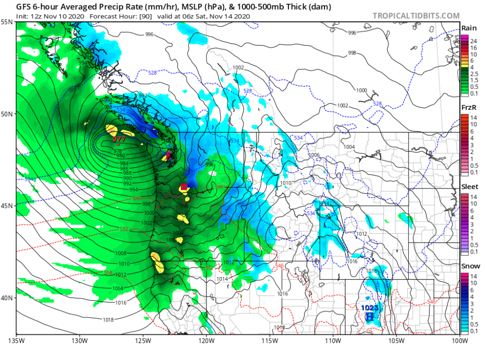
977 low coming in from the west near southern vancouver islnd seems like the Euro and the GFS are at odds as usual.3 points
-
I'm beginning to see signs of HOPE once we turn the calendar into December, but I want to see some more data come in by later this weekend. The northern half of our Sub into the eastern part should keep an eye on the blocking pattern that is showing some early signs of development right around Thanksgiving week into December across Hudson Bay/Greenland. I'll dive into this signal a few days.3 points
-
43 with rain this morning. The mountains should do really well the next 4-5 days. It's a good start even if we get a period of higher snow levels later this week, which really is to be expected so early in the season. Ended up with a 44/26 yesterday thanks to the burst of SW winds in the late evening. Still pretty solid for 11/9.3 points
-
I think you should go back to requesting downvotes when you post. It got you more attention, which seems to be what you seek.3 points
-
Should be fun tracking these storms in the next couple of days. Currently 42 degrees with rain showers.3 points
-
Of course I'm just barely getting missed. Thats ok its early in the season and I wasn't expecting anything from this anyway. I see there are Ice Storm Warnings out!3 points
-
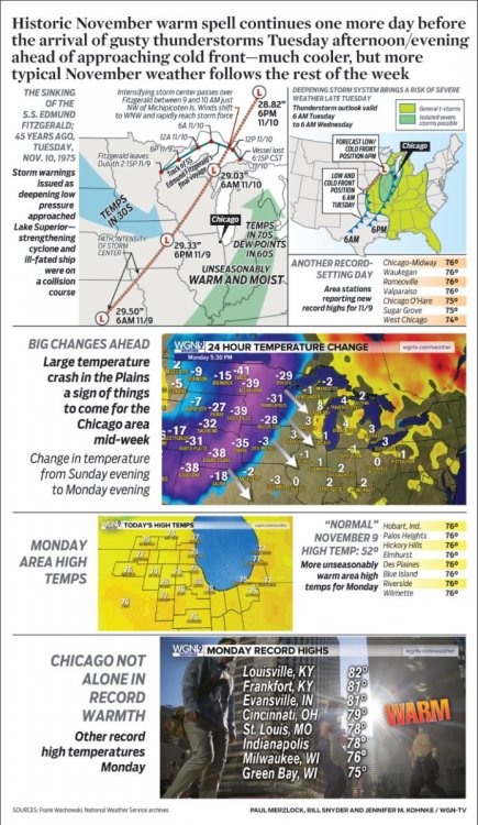
Grizz, I was just going to comment on this storms anniversary and the eerie coincidence that today's storm system forming across the Plains is taking a very similar track back in 1975. Here's a graphic that shows the full storm track from KS up into the U.P. The winter of 1975-76 featured a strong La Nina. I find it fascinating how nature shows us similarities in weather patterns even though not all seasons are the same.
 3 points
 -
Lost power about 10-15 minutes ago. Going to try to save phone battery now. Hopefully it isn't out very long3 points
-
Remember that one too !!! I was only 7 years old, but still have vivid memories of how hard the wind was blowing. No power... in the dark, but the thing I remember most from that night is the noise ! My moms sister called us on the phone in hysterics saying Shelton was blowing away !!! Very scary night !!2 points
-
When I was 7 I lived on the 3rd floor of a condo right above the narrows about 2 miles north of the bridge. We could actually feel the building shaking when the winds were hitting. I have no idea how strong the winds were but the narrows is like a wind funnel so probably 80mph. I can remember seeing all the substations flashing looking outside as the storm rolled through. That was pretty crazy and scary as well.2 points
-
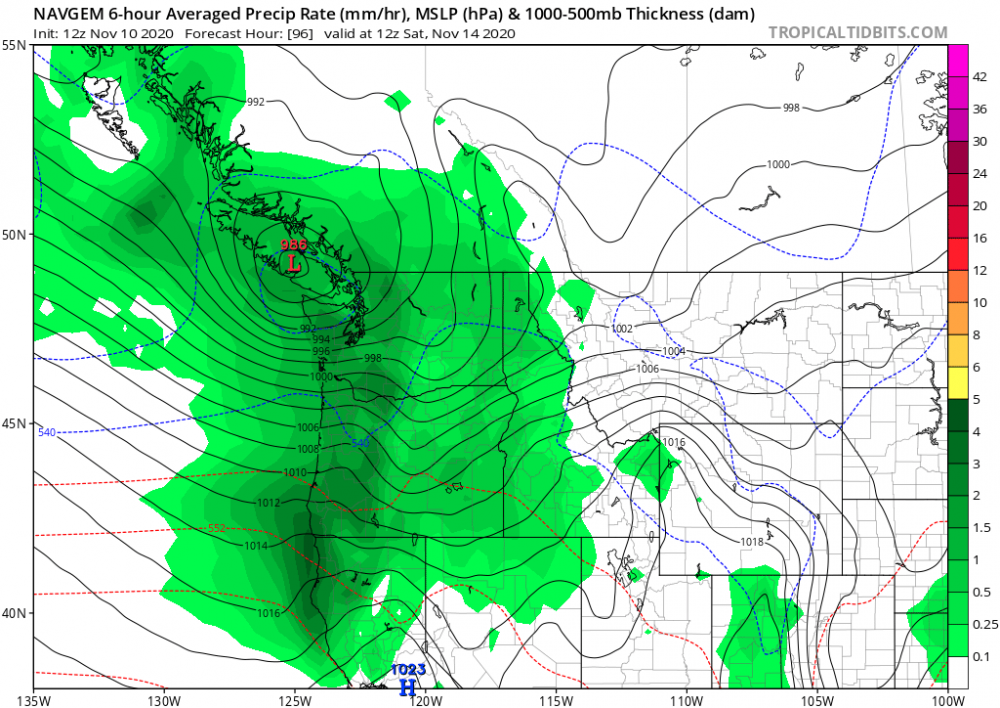
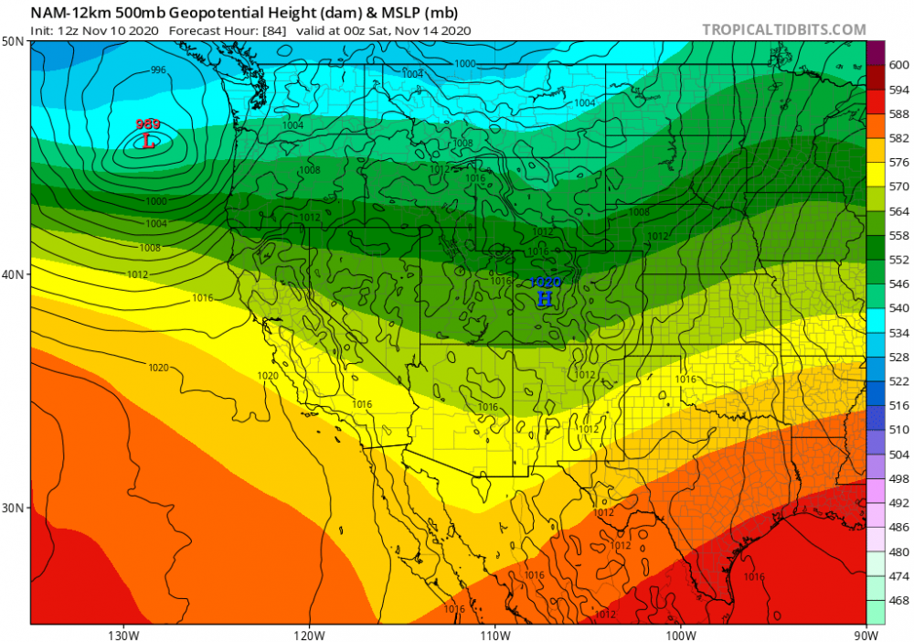
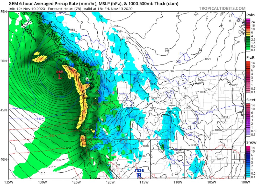
Quick rundown of the 12z suit of models today. All show a strong storm but significant differences in track and strength remain. The NAM is the furthest South with the Euro next and the GFS, ICON, and GEM further North.
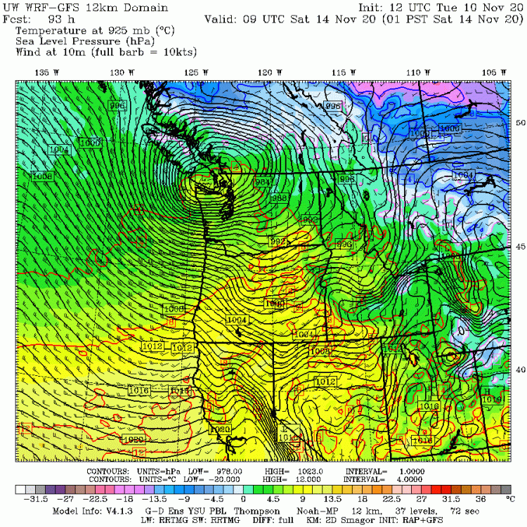

 2 points
 -
Low of 41 this morning...went up to Crystal mountain last night they had about 3” of fresh snow at 4400’ last night. Went sledding and did a few snowboard tricks for the first time this winter.2 points


This leaderboard is set to Vancouver/GMT-07:00