
Leaderboard


Popular Content
Showing content with the highest reputation on 11/16/20 in all areas
-
From Mark Nelsen!
 8 points
 -
Anyone want to take a minute or two and help a n00b out by annotating/drawing/identifying exactly what and where you guys are looking on the loops to make this determination? Like, how would you present this to a 101 class of "whats going on here"7 points
-
It can happen and it can be spectacular when it does. February 1989 is the modern classic example. But also December 1964 and November 1955, which is celebrating its 65th anniversary right now.6 points
-
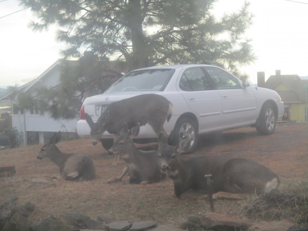
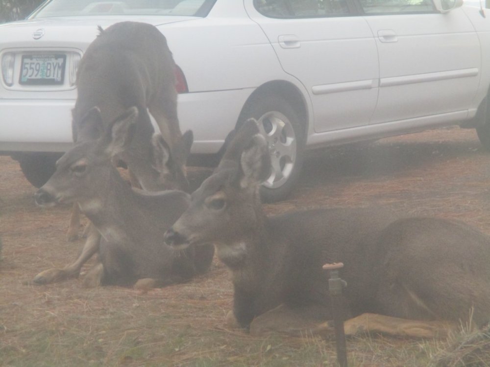
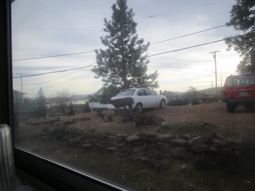
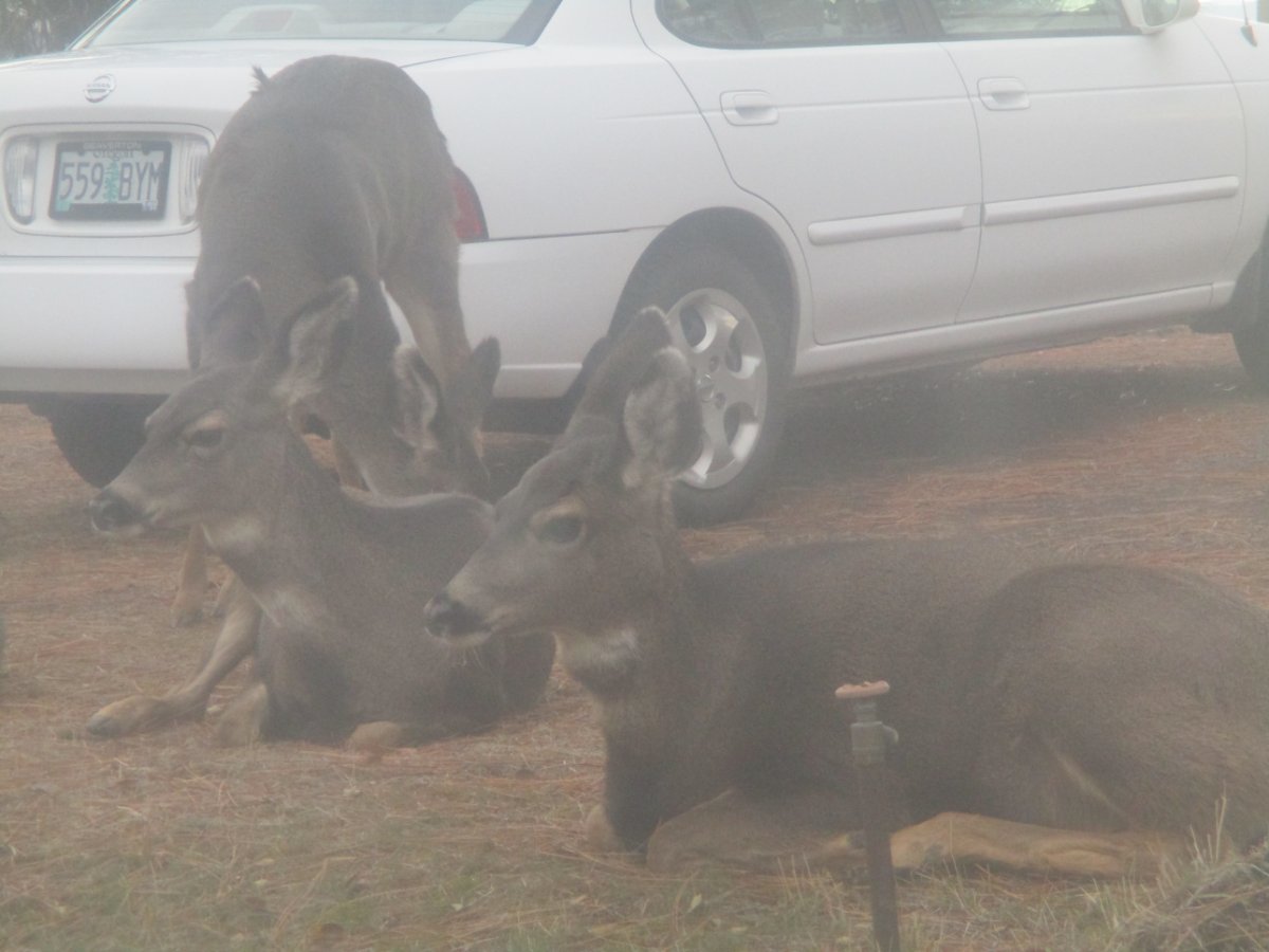
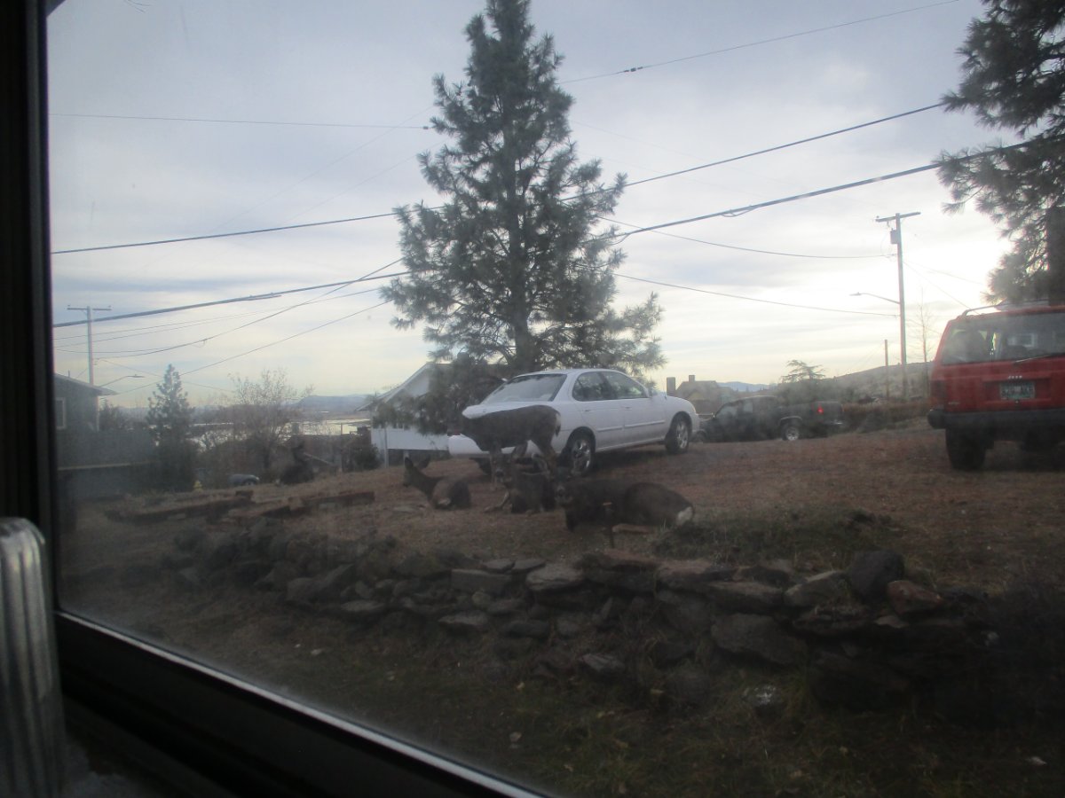
Just chillin' right next to the Nissan. I know, window shots are very foggy, unless you want me to scare them
 6 points
 -
Iota is a monster! On the verge of being a CAT5.6 points
-
Looks a little snowy north of Parksville this evening. Quite snowy up around Comox:5 points
-
I always knew you were a "move the goalposts to win the game" kinda guy. Now do it for snow would ya?5 points
-
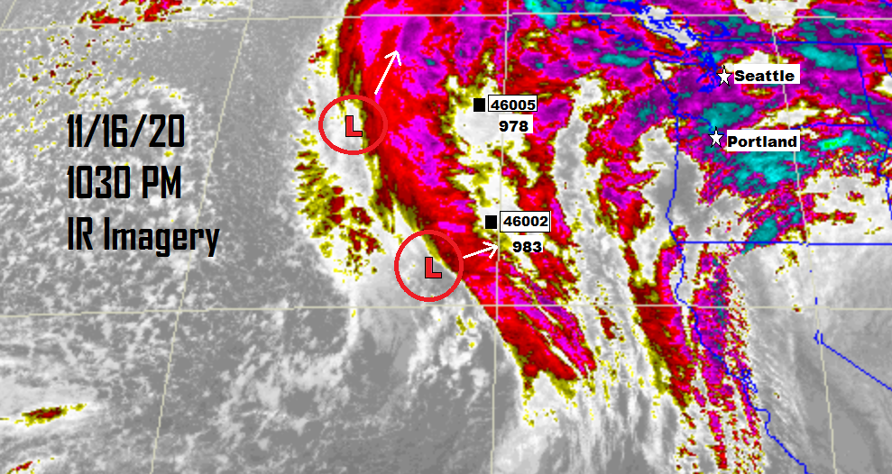
IR Update Time for an update. The northern stronger low has finally revealed itself. As of 10:30 PM Buoy 46005 300NM West of Aberdeen, WA is reporting a barometric pressure of 978mb. Buoy 46002 275NM West of Coos Bay, OR is reporting a barometric pressure of 983mb. Both lows continue to deepen. I estimate the northern low is now around 973mb and its track is off to the north-northeast. The southern low is estimated at 980mb which is dramatically stronger than anything modeled and is moving east-northeast. We must keep an eye on the southern low, its depth, and exactly where it tracks. In a few hours that low will have reached or pass by Buoy 46002 to which we then will rely on the Buoys off Newport, Tillamook, and the Central Washington Coast.
 4 points
 -
When moving to Whatcom County, I will confess that Glacier tempted me, not only for the snowier winters but for being so close to National Forest land. Ultimately, I decided to opt for the practical convenience of living closer to existing friends in Bellingham. But I still fantasize about the extra snowy days I'd get in Glacier.4 points
-
Snow up around Campbell River now:4 points
-
Forget Monday Night Football, it's time for Monday Night Model Riding! 00z GFS Day 14 points
-
That would frustrate me so badly! All of my jobs until my current one was working outside in the elements, and with my current job I am not tied to my office chair and have the flexibility to go outside anytime...Also my office window is big and can glance up from the monitor and look right out...I am truly spoiled haha!4 points
-
It takes a storm like Jan 3-4 2017 to keep me wide awake the whole night. I remember being up until 4am sipping cabernet during that, got 3 hours of sleep but I paid for it the next afternoon We get so many snows, in Feb 2019 I counted as many as 20 days I observed sticking snow. Gotta get SOME sleep!4 points
-
I hated that when I worked for Costco! Into box while wild weather happened outside. So many times I had to escape my department for a fake bathroom break to look out the entrance doors for a weather check.4 points
-
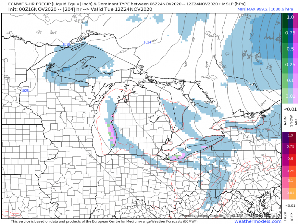
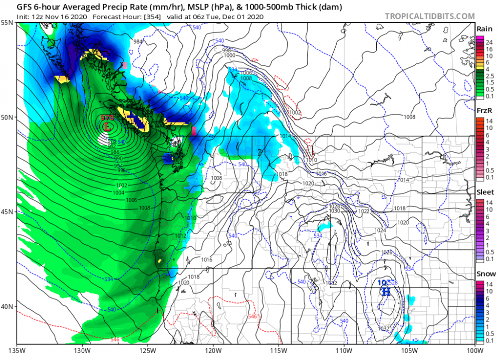
12z ECMWF 10 Day Rainfall, Snowfall totals4 points
-
No the 'Big One" is holding off until we have a regional blizzard and it'll happen during a flash-freeze and multi-day driving snowstorm.4 points
-
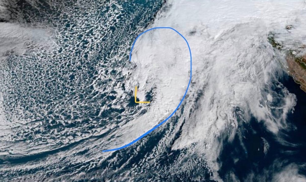
I’m waiting as well for the what’s going on here!! lightning still taking place in the area the low is developing and my eyes could be playing tricks on me as I look at the animation but it certainly looks like circulation is happening down there. Wait and watch situation like always....story of our life on the West coast. Hope others chime in with their knowledge. Wundermap only shows the parent low. Discloser: I’m just an OBS
 4 points
 -
Up to 6.39" on the month. Going to likely end up solidly above average in the rainfall department.4 points
-
Maybe a little something early next week for snow belt areas in Michigan?
 4 points
 -
In the Atlantic, Iota just became the latest category 5 storm ever. Pretty amazing that the strongest storm of the year is going to landfall after mid November. Winds currently at 160 mph.4 points
-
50mph may not look impressive on paper but that will cause plenty of damage. All eyes on the trailing front swinging up from the parent low. After looking at the sat loop I'm getting that feeling we're getting a good blow. After this year I'd say we're due!4 points
-
Yep, it is a pretty impressive late-season burst of action in the Caribbean. The water down there is always plenty warm for tropical cyclones, but this year's shear-reducing la nina and a favorable pattern has led to what we're seeing.4 points
-
Generators, back to standby! Hrrr
 4 points
 -
What a year for the Tropics...2020 continues to deliver an anomalous year in the wx dept....4 points
-
00z EPS suggesting a ribbon of heavy precip a bit farther S than the GEFS for the weekend system...at least there will be more moisture coming to those who need it...
 4 points
 -
Barometer is dropping.3 points
-
I'm in the middle of one of the exciting brown areas!3 points
-
That's at about 270ft asl.3 points
-
I’d love to live somewhere up north at that elevation roughly. If it wasn’t so isolated I’d live on orcas island. They have some pretty cool terrain with some decent foothills.3 points
-
I think about how awesome it would be if western Washington had more live-able highlands quite a bit. Winter would be a whole different animal. Even the people living at 800-1000' around Bham see much whiter winters.3 points
-
Snow will develop tanite, w temps dropping into the upper 20s. Per radar, its coming......minor accumulations, if any, (mainly grassy surfaces). Its a quick mover also. Jaster....this outta put you in the mood for decorating your Christmas lights outside your property....3 points
-
That's a stark development. Will need close watching. 925mb jet is about as good as it gets around here, just need to mix that to the surface3 points
-
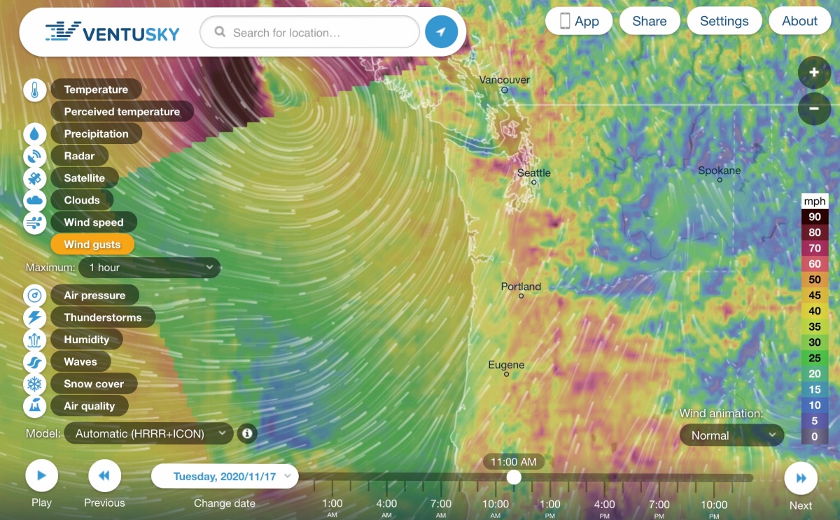
Just got a wind advisory alert on my phone. Gusts to 50mph.3 points
-
It is precipitating felines and canines at the moment.3 points
-
Bit nervous for the homes and businesses along the waterfront near Birch Bay. With some models showing Whatcom County and the San Juans catching some of the stronger winds, and King Tides starting tomorrow through Thursday, it could get bad. Don't know if anyone rembers this video from a couple years ago, but I believe the restaurant reopened again not too long ago. And I'm sure this year hasn't been too kind with COVID restrictions and access to their primary customer base (Canadians) cut off.3 points
-
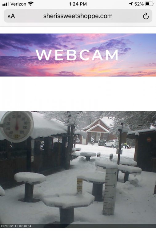
Looks like pretty wet snow but I would sure love to be in Winthrop right now!!
 3 points
 -
Wind warning up here up to 55 mph3 points
-
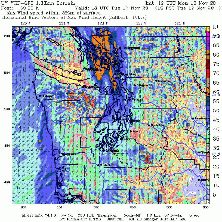
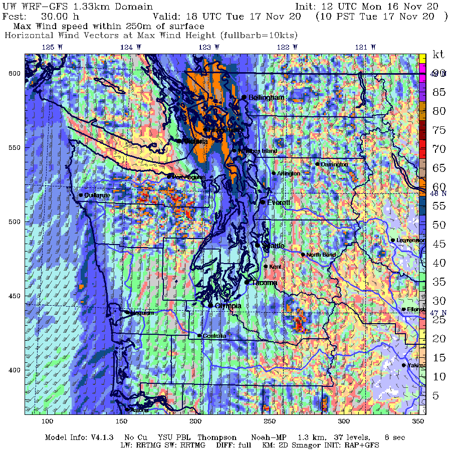
This is a map of maximum wind speeds within 250m of the surface from the WRF. I hadn't looked at this before (I think it's a relatively new product), but I assume that this above-ground layer is where we get our strongest gusts from? Anyone know?
 3 points
 -
Now, this would be ideal right before Christmas.............3 points
-
Ways off, but one of these windstorms should work out at some point.
 3 points
 -
There are few things better than a decent blow.3 points
-
C'mon man, only 50mph, I hope you aren't like this when the ECMWF shows you getting 40" in 24 hours on XMAS DAY GODDAMIT! Do you get my "drift"?3 points
-
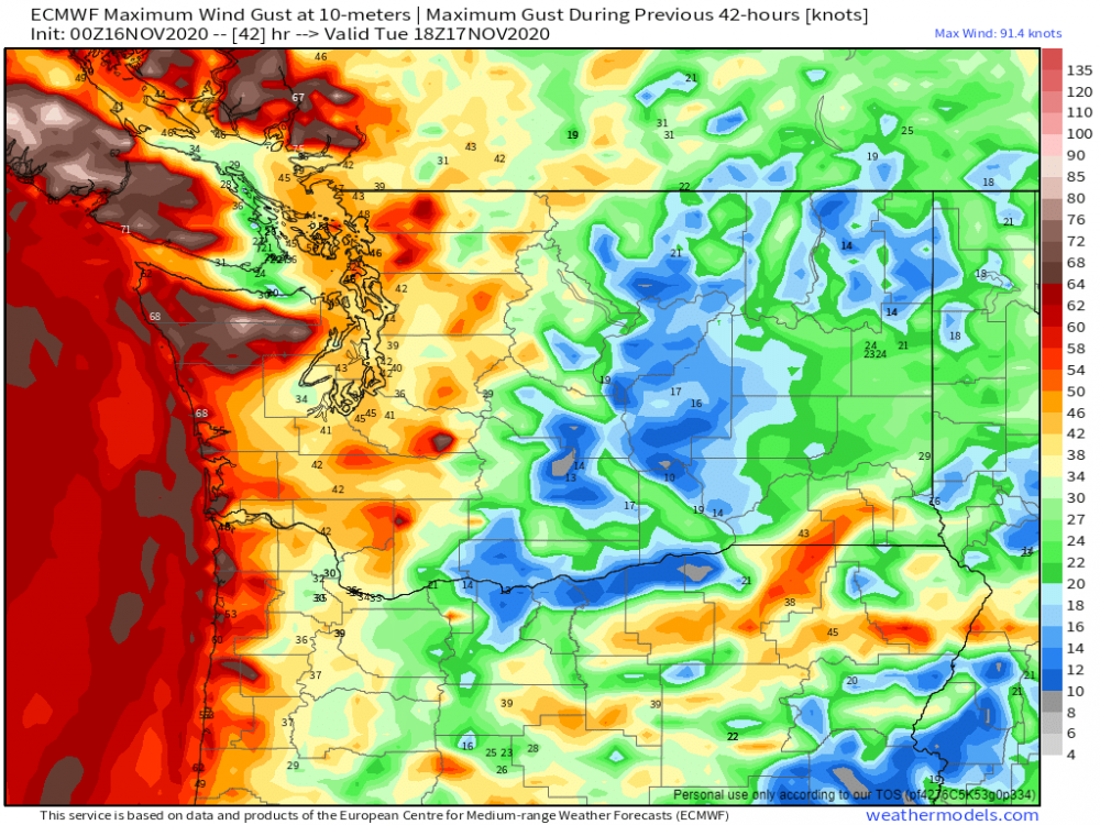
This is what I got for the Euro. And this is in knots, not MPH
 3 points
 -
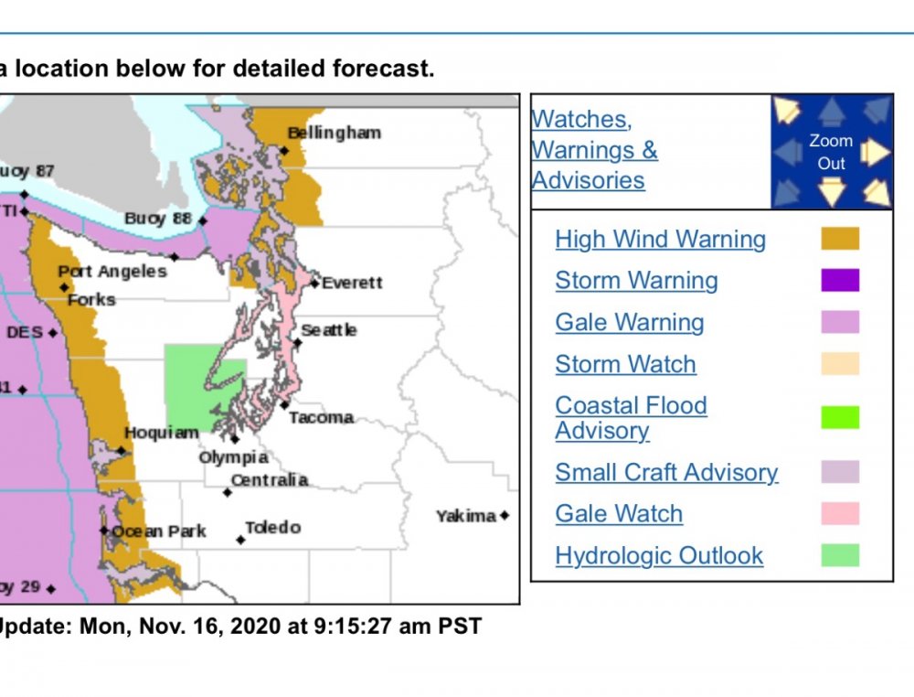
I am going to include myself in this High Wind Warning since I’m less than a mile from the Skagit border. Bring on the winds!!
 3 points
 -
Attm, 42F w mostly cloudy skies and still a little breezy out there, but nowhere near yesterdays ferocious wind gusts. Btw: Detroit yesterday had a wind gust of 61mph and 65 in nearby locales. Lots of power outrages and trees down.3 points
-
Southern low is clearly the dominant one.3 points
-
This one has everything going for it. Strong jet, a ton of cold air pouring into it, and deep southerly trajectory. It could perhaps cross or be in proximity of the critical ~40 N, ~130 W position threshold for all major PNW wind storms. 12z GFS in 38 minutes3 points
-
The pattern has turned much wetter the last couple of weeks in my area. I am much more optimistic about winter going forward than I was in Oct.3 points
-
@Tom Nice catch amigo! Sure would be nice if what they have going on translates downstream to our region! Notice the correlation is also there wrt last winter being the complete opposite there (warm).

 3 points


.thumb.jpeg.e3014abf99ef08a9f9ac2c0cd31b485b.jpeg)


This leaderboard is set to Vancouver/GMT-07:00