
Leaderboard


Popular Content
Showing content with the highest reputation on 11/26/20 in all areas
-
Happy Thanksgiving everybody!9 points
-
Happy Thanksgiving you goddamn savages.9 points
-
Happy Thanksgiving! And happy Thursday to all of the Canadians on here
 8 points
 -
Happy Thanksgiving everyone! This year has been an unusual one, but as we celebrate the holiday today, I am ever so grateful to be alive, healthy and have such amazing family and friends....of course, I'm also grateful for all of you on here that contribute each and every day.8 points
-
End of the GFS starting to go places. And the end of last nights EPS is starting to maybe go somewhere.
 7 points
 -
Happy Thanksgiving all! Looks like a drizzly morning out there. .05" in the rain bucket so far.7 points
-
Happy thanksgiving to all! 42 degrees here this morning. Should be a decent fall day.7 points
-
From my house to yours, in this unusual year of 2020, may your Thanksgiving be filled with family, food, forgiveness, much love and many blessings! Happy Thanksgiving to you all!6 points
-
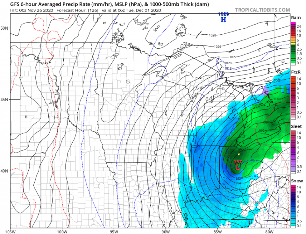
I think it's a matter of exactly when/where/who scores the most snow from this impending storm. As I understand it, the UL wave came onshore in Cali last night and that ingest may have been the reason more models are converging. Time for a thread me thinks as we are within the magical h120 range. Right now, eastern Michigan looks like ground zero as well as parts of Indiana and Ohio. Happy Thanksgiving to everyone, and good luck to those hoping to score!
 5 points
 -
That’s..putting it lightly. If I were you guys, I’d take advantage of these next few weeks to rest up. Bound to be some all nighters before long (cough..Rob..cough).5 points
-
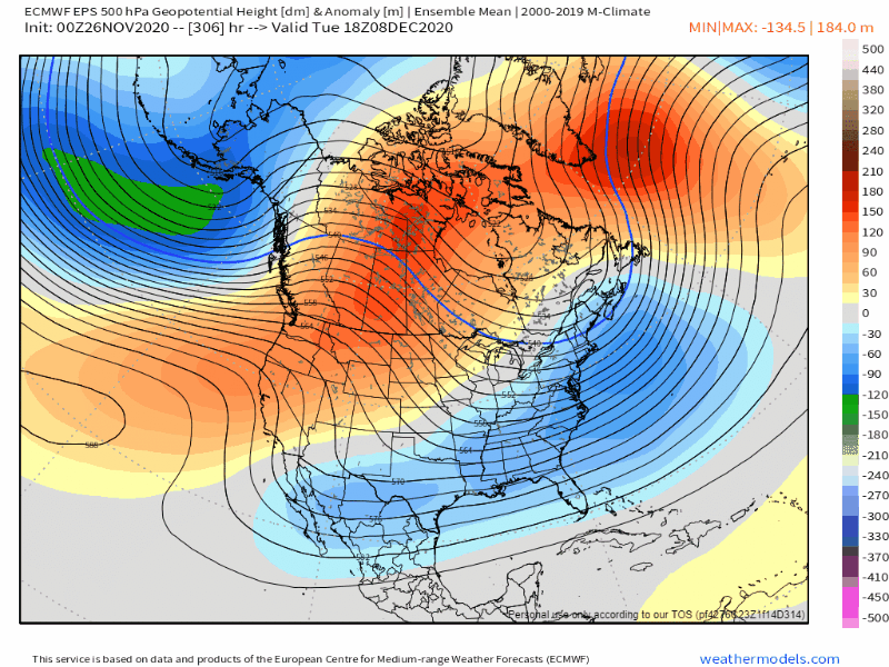
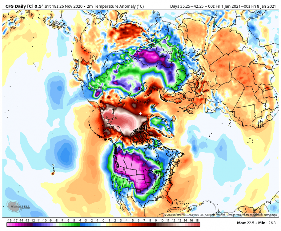
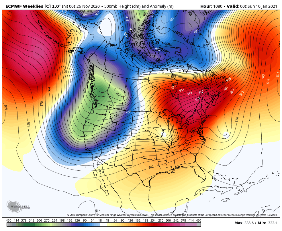
The ECMWF weeklies look great for late December. The last couple of CFS runs look similar. People are probably ready to see some eye candy. The control gets pretty crazy as we get into January.
 5 points
 -
’78/’79 is one of the best winters I have experienced. Two winters prior, I had moved to the southern Rockies, and got to hear the stories from the kids in town of how much snow could fall if conditions were right. For the first two winters, conditions generally were not right, though there were a couple of “interesting” early and late-season events* that pointed to how “interesting” midwinter could be. Then comes ’78/’79, with three significant upslope snowstorms. I remember the first one. The snow started absolutely dumping in the early morning, like it does at the very peak of a vigorous snow shower, but simply kept on dumping for the rest of the day. It was magic watching the landscape get transformed. Then after the snow is done the cold air comes in and drops the temperatures into the -20’s. And that happened three times that winter. * The year that in the week before Thanksgiving, a vigorous early-season cold front sweeps in, dumps a quick 9" of snow, and drops temperatures into the -20s in November. Then the year with a total dud of a winter, no snowfall over 3"… until May 2nd, when 8-10" of wet glop causes utter chaos. To make that better, one of the newcomer kids that liked to tease me called me nuts when I said it looked like snow that day: “You idiot, everyone knows it can’t snow in May.”5 points
-
Happy Thanksgiving Mostly cloudy and a low of 44 here. Should get into the 30s tonight with some clearing.5 points
-
Nice and cloudy.5 points
-
Happy thanksgiving to all y'all5 points
-
I just let my parents know about the snow in the third week of December. I can’t wait.4 points
-
I'm pretty excited about a realistic shot at decent January this winter. Historically speaking that is our magical month. It blows any other month out of the water as far as potential for long lasting cold and snowfall. Still a long way to go, but the signs are there.4 points
-
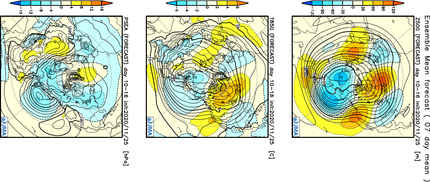
As interesting as the EPS Control run looks, it’s actually one of the less blocky outcomes amongst the array of solutions in the NPAC. At least 20 members are dislodging the TPV into BC/Alberta with blocking over AK/Aleutians and Greenland, bottling significant cold into SW Canada. Much higher potential in a setup like that, versus the ones with a tight vortex remaining at the pole.4 points
-
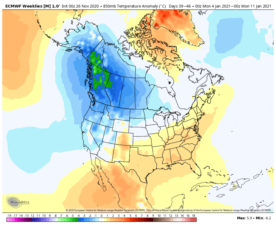
The EPS weeklies are actually quite impressive. Strong signal for cold loading in western Canada (and warmth across Greenland + NPAC). Have to double check the baseline climatology, but cold anomalies are actually deeper than the warm anomalies by the middle of January. Usually it’s the opposite signal at that range, with warm anomalies everywhere except Greenland and the Aleutians. Interesting to see this instead.
 4 points
 -
What goes up...Must come down! Im dreaming of a White Christmas, just like the ones like 1990, 1998, 2008, 2016, 2017!
 4 points
 -
You too man, although I am gonna feel obese in about 3 hours!!4 points
-
This +WPO/+PNA pattern may suck regionally, but it has longer term benefits too re: wave driving/PV weakening. Get that vortex weak ahead of the return to favorable tropical forcing for PNW, and that cold will spill right in, unshackled.4 points
-
I have to watch this every year... Mind you this episode aired for the first time in late, great 1978. A chilly and occasionally SNOWY winter followed!4 points
-
We have pretty remarkable model agreement that heights will quickly rise over the North Central Pacific around Dec 10 thus putting us into a -PNA situation. In the meantime the potential for a very significant inversion next week is alive and well. We start out with a legit cold air mass just before the ridge moves in right on top of us. Initially offshore flow looks to get pretty strong before a rapid moderation. The initial strong offshore flow will dry the lower levels of the atmosphere which will create potential for impressive radiational cooling once things settle down. We could easily see a highs in the 30s lows in the 20s inversion for some places.4 points
-
Happy Thanksgiving everyone! Also, I see there is an 'lol' emoji now. Thats awesome!4 points
-
I hinted at bad winters chasing you around the country in the Nov thread. Like in deer hunting, two styles. You move about seeking deer, or you wait it out for them to come to you, lol4 points
-
Hmmm. Seems like my snowy Thanksgiving prediction hasn’t happened yet, but we will see how the day unfolds.4 points
-
Happy thanksgiving folks!4 points
-
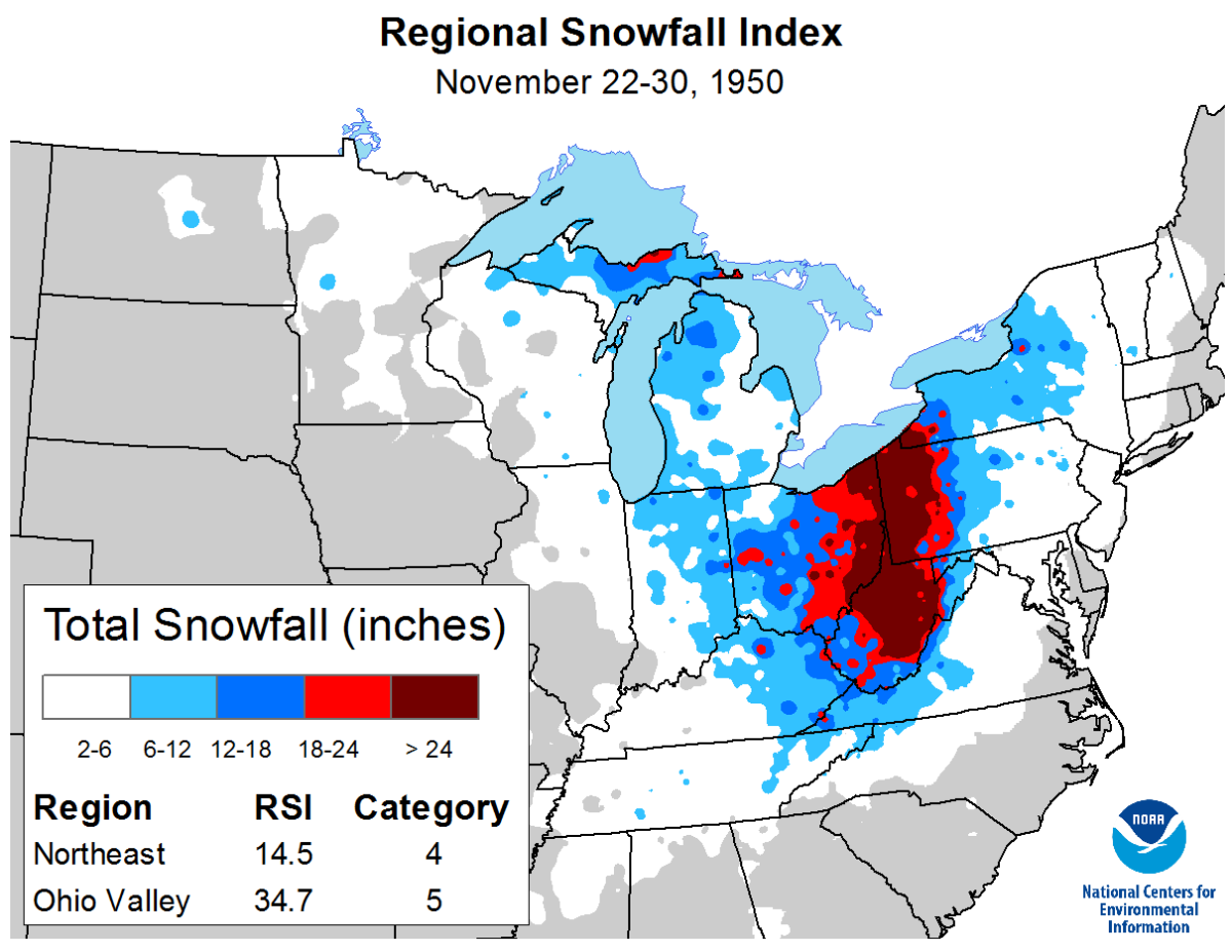
It's tough to say at this point if the Euro is legit. Phase-bombs are a serious rarity around the OHV/Lakes region so that would argue against it. Over the years a model or two will flash a run showing such in the fantasy long range, but then immediately drop it. Iirc, there was a better looking chance leading up to Christmas of 2014 but the cold air failed to get pulled south out of Canada so it ended up a dud. Dec 2014 was a warm month similar to what we've got going on right now fwiw. I referenced the Nov 1950 storm which gave this area about 7" but that was during an extremely cold autumn regime. There is Nov 2-3. 1966 which phased and delivered the goods (12" KBTL) and the only other time I've seen a mild regime go bomb cyclone for Michigan was 11/16/89 and that one had zero degree airmass just north of Superior to work with. Maps in order of events.

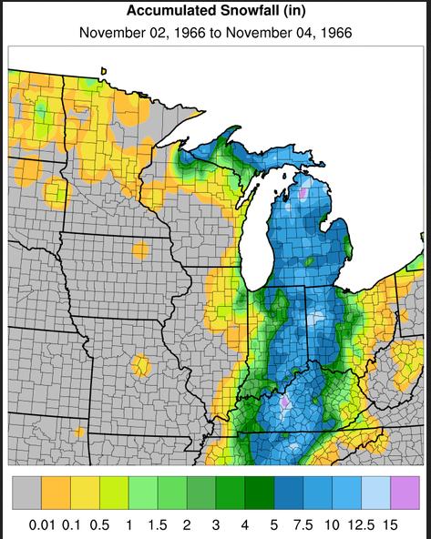
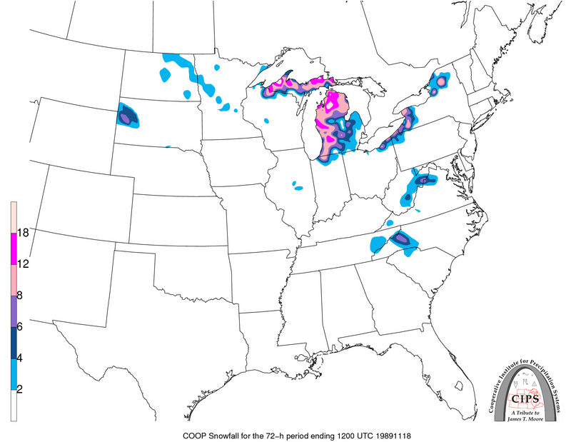 4 points
 -
It's not taking the Rockies in to account, they would block most of that cold air.3 points
-
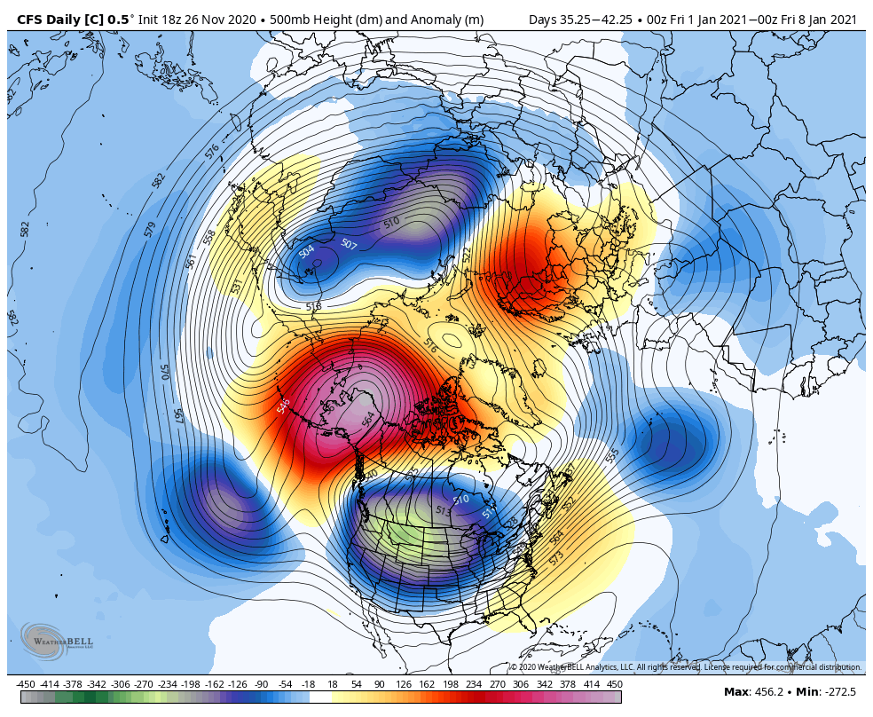
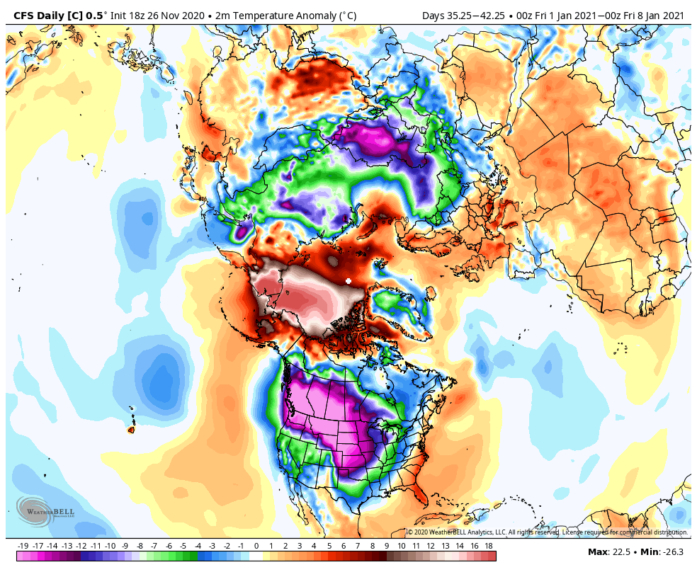
Fantasy shown on the CFS control run. Highly unlikely to verify but would be epic if by some miracle it did.
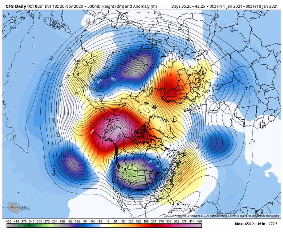
 3 points
 -
Great euro weeklies. Twl May get a white Christmas!3 points
-
Saw a snowplow driving around Federal Way! We’re ready! 43*3 points
-
The BIG December 2008 Snowpocalypse kicked off with the arctic front on the 13-14th if I recall. That's 17-18 days away. The timeline with the potential pattern flip coming up with the Gulf of Alaska/Alaskan block is eerily similar. Just sayin'. C'MON!!!!3 points
-
Here's the final result.
 3 points
 -
12z WRF-GFS For those east wind fans, freaks, and fanatics, you're going to love this! Tuesday afternoon east wind develops. By Tuesday night it becomes strong and overnight into early Wednesday morning it is absolutely raging. Check out those tightly packed isobars! The PDX/TTD-DLS gradient looks to be around -10mb to -12mb. That's impressive. This is probably the beginning of a long duration east wind event. The 12km Sounding observed over PDX shows an impressive 50-55kts aloft. That's pretty decent. This will be the first east wind event of the Fall season and worthy of a Crown Point visit. C'MON!!!3 points
-
Happy Thanksgiving. Just got off work, a lot more to-go orders than people actually dining in. I took a peek at the 12z GFS...not surprised to zero precip for the entire run.3 points
-
I have been summoned. But.... BUT.... There's so much to track! Inversions, 925mb temps, PDX-DLS/TTD-DLS gradients! I don't know how to NOT post the 00z runs every night. 00z GFS in 5 hours 33 minutes 00z GEM in 6 hours 3 minutes 00z ECMWF in 7 hours 48 minutes3 points
-
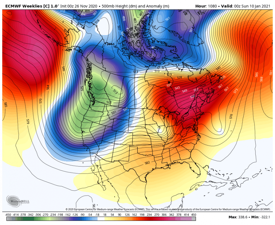
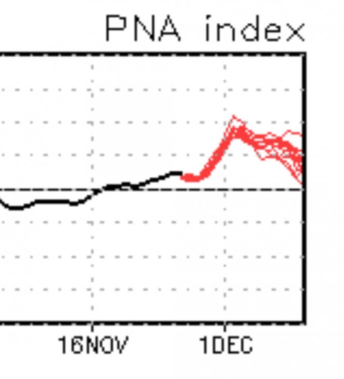
It's remarkable how consistent the ECMWF weeklies have been in showing the PNA going minus at mid month in December. A good 4 or 5 consecutive runs now.
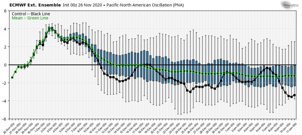 3 points
 -
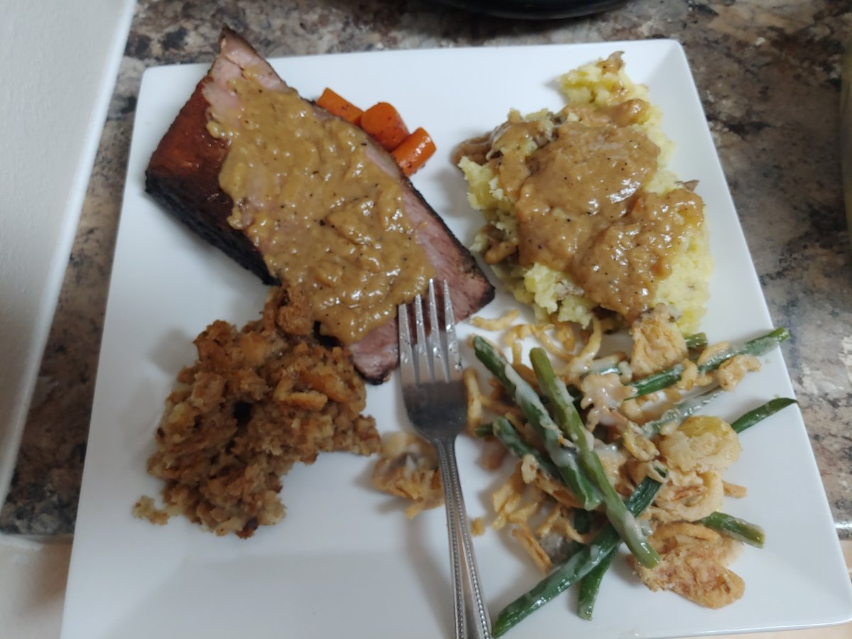
Sounds yummy. 46 degrees, but a north wind has a bite to it. My mother in law made turkey and ham with mashed potatoes and gravy. My wife made her famous green bean casserole and my daughter made the stuffing. Pumpkin pie filled in the spaces as my late mother used to say.3 points
-
Yes, happy Thanksgiving everyone! It is a bright day here today with a temp of 41*F. Have a roast going in the crock pot and I'm just about to start on the sides.3 points
-
Lol! Gotta love LESS NESSMAN !3 points
-
Probably around less than .50" here in mby yesterday. Rainfall was very light and persistent.3 points
-
00z 25th LR GEFS....looking more and more wintry...
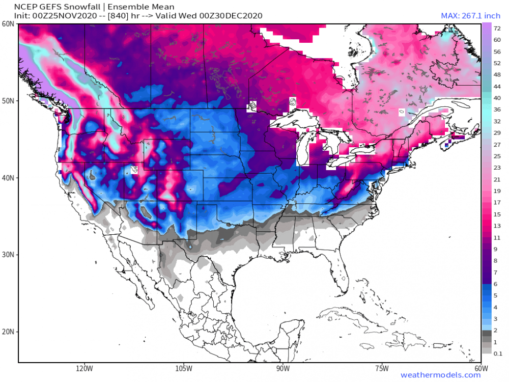 3 points
 -
He may have several chances for winter storms this month from all indications. The blocking is really going to justify if the southern stream converge with the N stream later this month.3 points
-
While sitting here and sippin' on my coffee, flipping through multiple windows open on my comp and analyzing a ton of data...I'm encouraged to see continued support that an interesting month lies ahead for the start of met Winter (esp the eastern/southern Sub). For weeks and months, the majority of the climate models were advertising a blow torch December for most of our Sub. The caveat?? They all seemed to miss the blocking signal near Greenland and now what is looking like a western NAMER ridge that will grow heading into Week 2 of the month. The latest JMA weeklies came in this morning and do favor the eastern CONUS trough for most of the 1st half of December, but then I see a more traditional signal for a La Nina pattern setting up with the N stream coming back into play for the second half of the month. Depending on the exact length of the LRC, I will say, I'm expecting to see more of a SW Flow develop by the middle and end of the month. Those of you out farther west and north will then begin to share in the wealth and see more chances of storminess. Week 2... Temp... Week 3-4...that Greenland Block is gonna rock this month... Temp/Precip patter...I think the model is too warm in the Plains/Upper MW...should trend colder and wetter...the wet signal near the GL's/N Rockies/Upper MW should expand South IMO... Notice the upward motion across the Indian Ocean and the sinking air across the central PAC. These are favorable colder MJO phases for Week 3-4 and that would lead us up towards the Winter Solstice/Christmas Holiday. Things are really looking promising!
 3 points
 -
Much better signal for troughiness/blockiness in the very long range on the GEFS than Tuesday 00z. It's a solid first step.3 points
-
Happy Thanksgiving everybody!!!3 points


This leaderboard is set to Vancouver/GMT-07:00