
Leaderboard


Popular Content
Showing content with the highest reputation on 11/27/20 in all areas
-
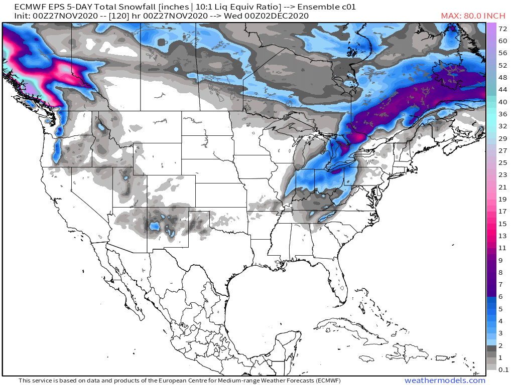
Wow the 0z Euro was pure gold. Love those maps you posted this morning. Glad the storm on the 4th is showing up, hope I can get a little white gold on the 4th, not sure it will look quite like this but until then I can dream. @OKwx2k4you need to watch this one.6 points
-
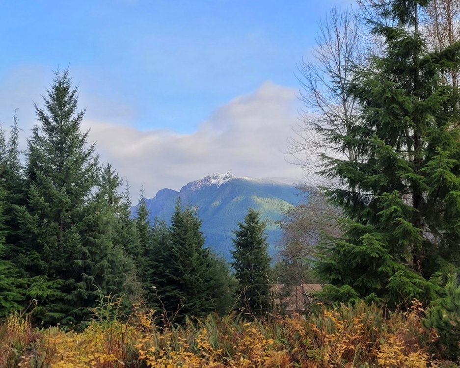
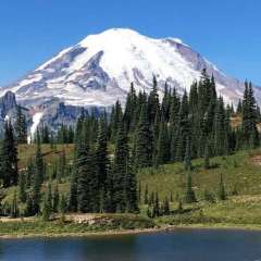
A little snow on the peak of Mt. Si this morning...
 5 points
 -
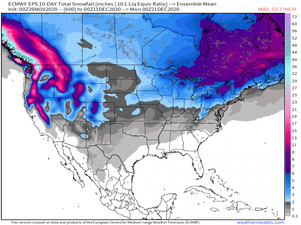
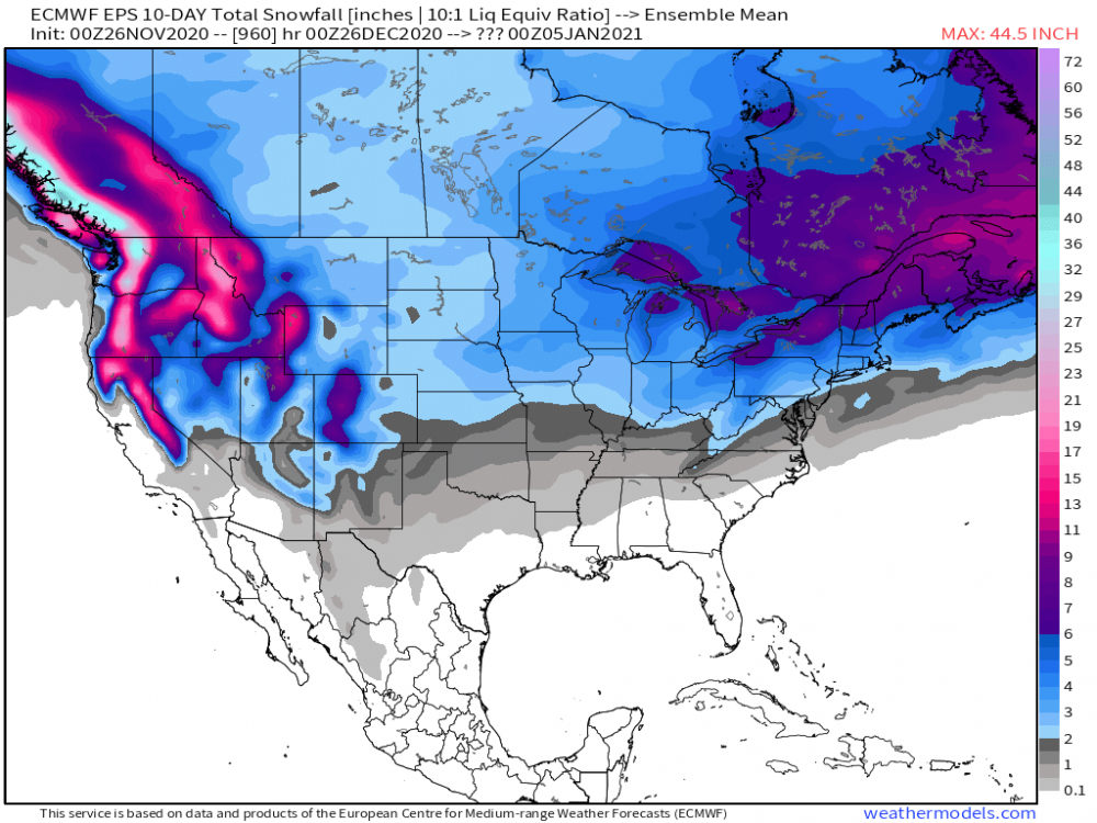
Love, Love, Love the way last night's Euro Weeklies have gone and fit the ideas that Winter will spread across our Sub by the middle of the month. I'm diggin' the pattern that is setting up and the models seemingly are veering away from a blow torch December. Blocking is setting up shop in all the right places in the modeling. While the eastern and southern Sub will be the primary focus of action over the next 2 weeks, by the time we enter the Week of the 13th, Winter will settle in quite vigorously I believe and the Flow aloft will allow Arctic air to penetrate down across the central U.S. along with a nice southern stream jet. Check out the models thinking and provides us a potential glimpse of an action packed rally towards the Solstice and Holiday stretch....Dreaming of a White Christmas??? The LR clues continue to support the idea that Winter is coming and may be coming hard by the start of the 12th/13th....all eyes point towards eastern Siberia and the alignment of the PV will undoubtedly funnel arctic air into the pattern. Something I did notice from the Euro Weeklies is the displacement of the Polar Vortex into our side of the Pole towards the end of the month and into January. This may be an important piece to the puzzle as we flip the calendar into 2021. BTW, hope you all had a relaxing and enjoyable Thanksgiving with family and friends. Let the holiday season begin!
 5 points
 -
We've had some pretty epic winters in the 168hr-240hr window around these parts over the years!4 points
-
I cut the grass and raked more leaves today. If it does snow, it has a clean slate to stick to. I'd prefer three or four weeks of weather just like today though. D**n it's beautiful. Gonna drink a beer or three and smoke one down. Ahhhhhhhh!3 points
-
If Michigan were my back yard (more on back yard later) I'd be concerned about the NAM daubing out, (usually amped at this range) per my back yard for any impending storm shown on guidance out in the long range- expect it E and weaker with cold air (lacking) as previously mentioned by several posters. Without true Arctic air - and little snowpack- expect systems to shift E and get wetter (more rain). It sucks getting drawn into these models. One thing I've learned over years in this field that is outside 48-60 hours - anything can happen with winter weather, infact- much closer. Posting of snow maps +96 (ive done in the past) I will not do again. Just too many variables for it to really make any sense between snow and rain or even nothing. Look at this Michigan "system" and thread title. #1 rule as a forecaster is to down play events until you can't anymore as the rule of (most climates) dictates agst it. 12-24" snow events don't happen for 99.5% of us reading this 2-3 days out. 6-12" events on the order of 90%- 36-48 hours out. Remember folks- model (guidance) has a MAX set into to POP- can it excede it is not up to the model but for a human to see the likely effect it WILL not over that forecast range per SQ MI. I give NWS a hard time- but they are more right and give credence to "status quo" and are more right per "SQ MI" than we could ever be. Again - DOWNPLAY all events - unless you really follow the weather- if models- expect to get what you deserve.3 points
-
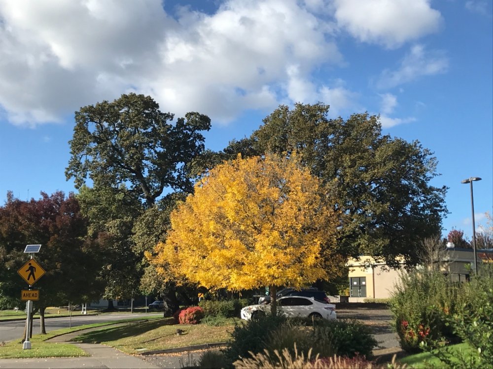
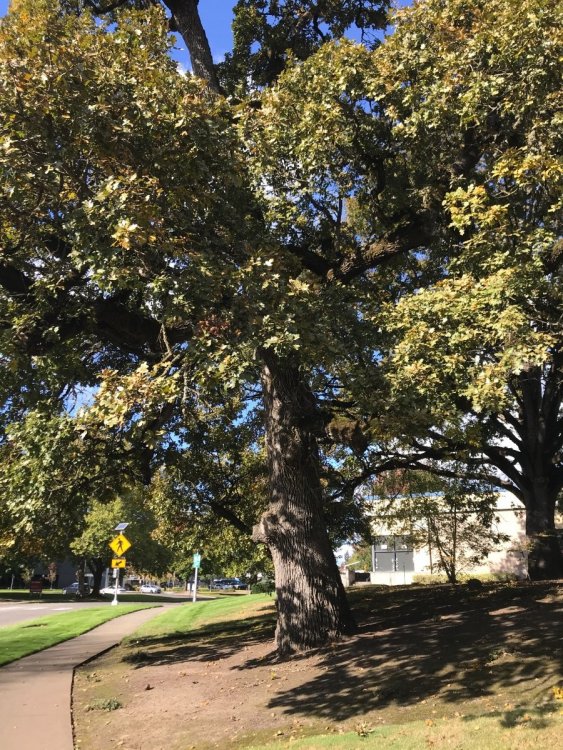
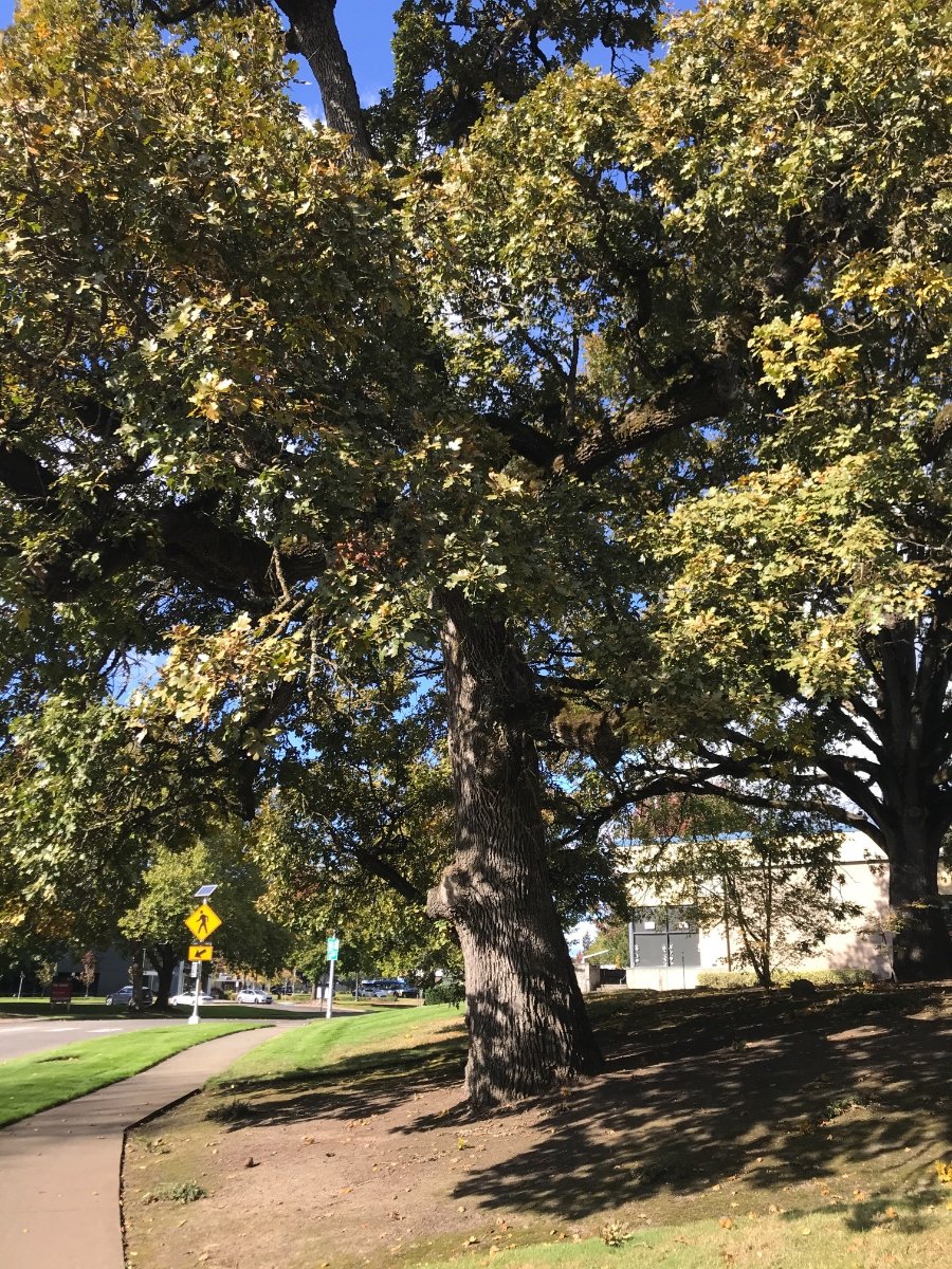
About vegetation - funny enough, I actually know of two California valley oaks growing in Beaverton. They’re not native up here but they are very nice trees nontheless. Most massive oak species in the West and possibly even North America.
 3 points
 -
Depends on which model you believe....GEFS, yes...but EURO says not... GEFS also trending less amped into the warmer Phases...Euro has been steadfast in the "null" phase...3 points
-
Can we just not do winter in April for the 49th time in a row? Can spring start on time just once?3 points
-
This would be interesting.3 points
-
Yes. A stalled out blocked-up storm that sat and dumped huge fatties. I was growing up in Genesee Cnty then, which per the records got 8" yet it doesn't stick out in my memory. I do remember my aunt calling from Detroit saying the flakes were half dollar size there in Grosse Pointe.3 points
-
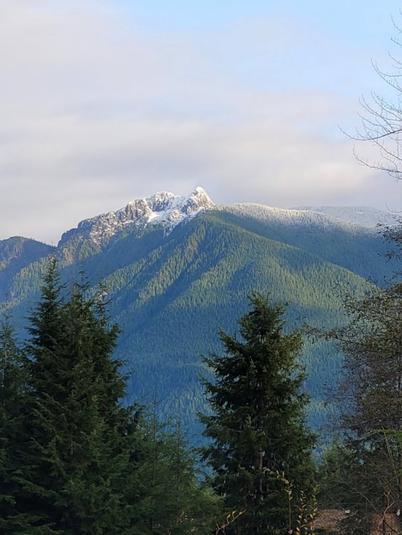
Here's the final result.
 3 points
 -
2 points
-
Early February 85 was pretty nice.2 points
-
2 points
-
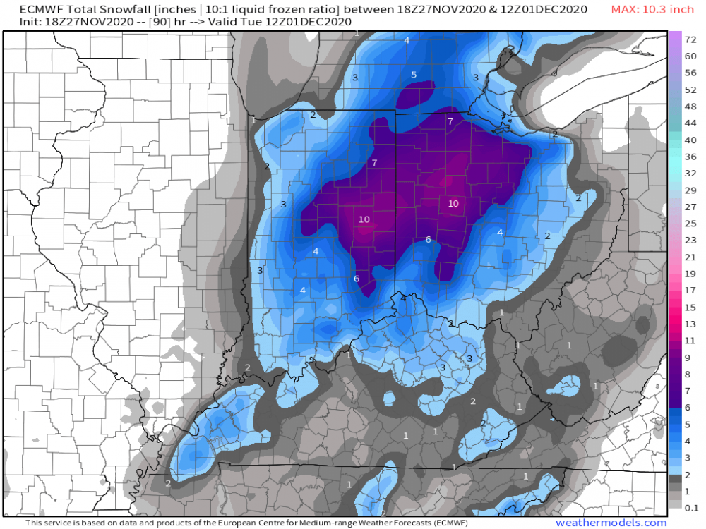
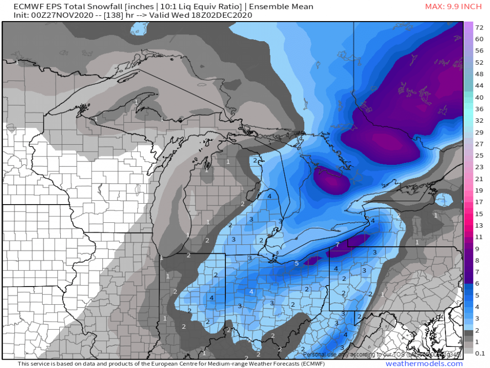
No measurable precip in the region Dec. 1-14. Seems legit.2 points
-
I agree hope you can pull a nice one out of this.2 points
-
GEM looks good as well, if not better. Tbh, I suspect that there will be better sampling by tomorrow as the event nears.2 points
-
0z CMC back west also. Real nice snow for Niko.2 points
-
2 points
-
Happy holidays!
 2 points
 -
I hope it happens for you. You put a lot of time into posting some cool maps.2 points
-
Speaking of which, it has fogged in here now. I’ve always thought it looks pretty with the Christmas lights, which are starting to pop up around the neighborhood pretty quickly the last few days. Down to 36 degrees.2 points
-
18z euro more west..
 2 points
 -
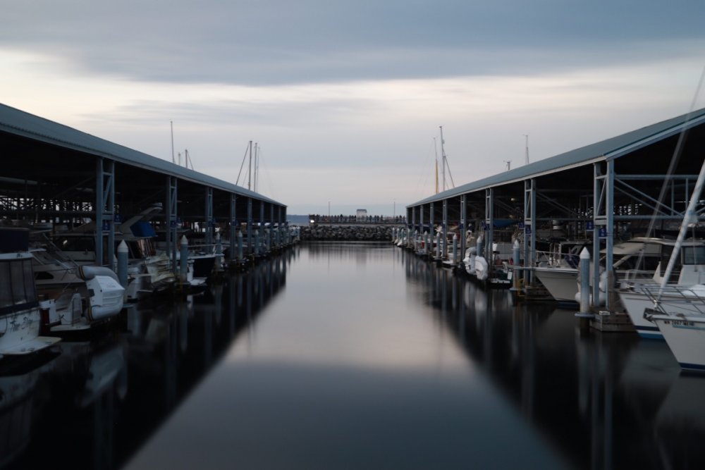
Nice evening. Tons of people out fishing on the pier here in Edmonds. Thought maybe there were some Orcas out there, but all those people have fishing poles. No social distancing!!
 2 points
 -
I think the last 20-25 GFS runs have ended up like this:2 points
-
Okay I just washed my truck just like I did Thanksgiving weekend 2008...I also won’t get my Christmas lights up until the first weekend of December...Like 2008...Things are lining up nicely now!!2 points
-
Drooping members. Oh my.2 points
-
We will see.....I hope so too. This will not be a blockbuster, but a few inches could accumulate.2 points
-
Looking like a pretty classic early December inversion scenario coming up, with a shot of some cool air followed by some persistent ridging. Nice to see some members dipping back below average toward the end of the run too.
 2 points
 -
There’s areas of oak savanna as far north as the rain-shadowed parts of Vancouver Island. Here in Whatcom County, you can find native oaks on south-facing rocky areas in the Chuckanut Mountains.2 points
-
I know that, but these didn’t look like any Oregon white oak I’ve seen. The bark looked a bit different and the tree was a lot wider at the crown. Looked on sequoiatrees.com, a good source for getting to know many common Western tree species, and the valley oak (lobata) looked like a very good match. I could very easily be wrong though, could just be a very old garry oak. The pondies are interesting. I did a bit of research on them not too long ago. Genetically they are much more similar to southern Oregon and California ponderosas (ssp benthamiana) than eastside ponderosas (ssp ponderosa) but a lot of sources say they’re still somewhat different from the southern OR ponderosas. Some have proposed creating a new subspecies but some botanists say they are too similar. It was actually quite rare to find these Willamette Valley ponderosas at one point but restoration efforts have caused a comeback, you can now see a lot of young ones growing in the west valley.2 points
-
Why even reply? Everyone knows Jesse is annoying by this point. He has even surpassed you in that regard with his latest campaign of weather righteousness.2 points
-
Same here...I'm actually kinda glad I'll be missing the storm early next week for this reason...LOL, but not for the next one lining up around the 4th/5th!2 points
-
Oh, good. Let's hope it follows through. Gives me a little more time to finish outdoor decorations.2 points
-
Negative, the action will be widespread and NOT like October that supported a stout SER and hard cutters. It'll be the same pattern but different. There will also be sufficient cold infiltrated into our Sub. The cold comes down south the Week of the 13th which I've been saying for a little bit now.2 points
-
The model trend to this point with the next system is clear. The storm weakens dramatically shortly after forming.2 points
-
As I have seen it, any substantial cold will come after the 11th which should brew up a large winter storm. That's when real Winter will arrive. For the time being, its going to marginal and a tease for some peeps on here. It's like nature is getting things geared up after a torch of a November.2 points
-
Hopefully Niko can still pull a rabbit out of a hat with this over his way. I'm now marginalized on the accum's and tbh, with highs Monday and Tuesday well above freezing this would be more white rain or dust-up. Without high enough rates to overcome the still warm surfaces, that's all I'm expecting at this point. Such potential wasted without the arctic connection. We REALLY need a stretch of cold to cool off the ground first before snow can come and stick. Lwr Lakes (as in between Michigan and Huron, not west like Chicago) has to have the cold temps or it's a no-go for snow.2 points
-
I accidentally posted this in November. But to reiterate the above the Euro is hinting at another storm system. Not good on this run for Eastern Iowa, but that obviously can change in a hurry. Hopefully something materializes.2 points
-
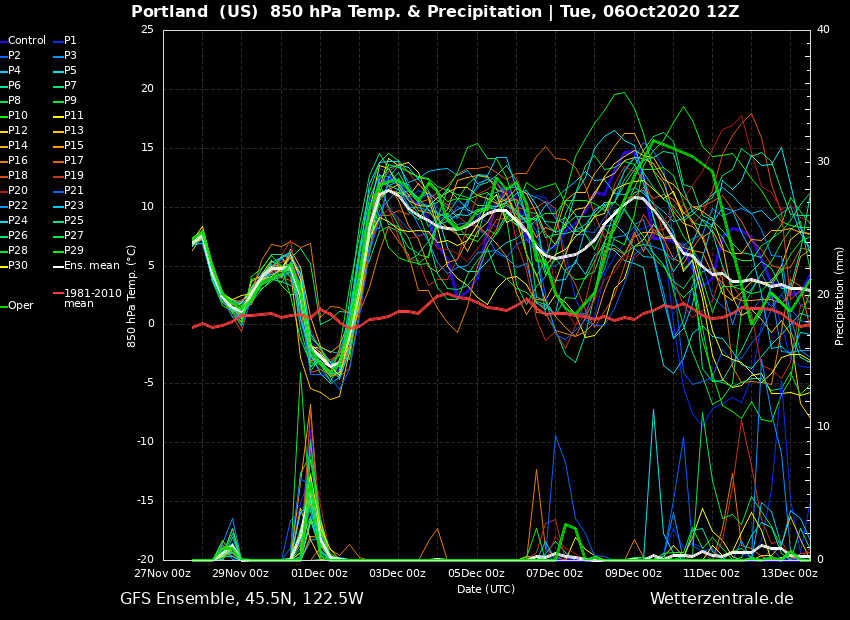
6z GFS Wow. The block retrogrades pivoting around and is somewhat close to nailing us. Day 8-16 500mb Height Anomaly GIF Day 8-16 Extracted Data for Portland and Moses Lake. This is REALLY impressive. MEGA fake cold. In fact, it turns into real, legit cold. Portland Moses Lake
.thumb.gif.c18c538a5b18be6be52ed4c12bcaef05.gif) 2 points
2 points -
2 points
-
The main ULL is currently spinning directly overhead across the state of AZ. Some snow is falling up in the mountains right now, esp up near Flagstaff where the ski resort opened up earlier this week. Not expecting much snow but enough to lighten up the holiday spirits. They are having their annual Christmas lighting tonight up in Flagstaff so the snow is well-timed.2 points
-
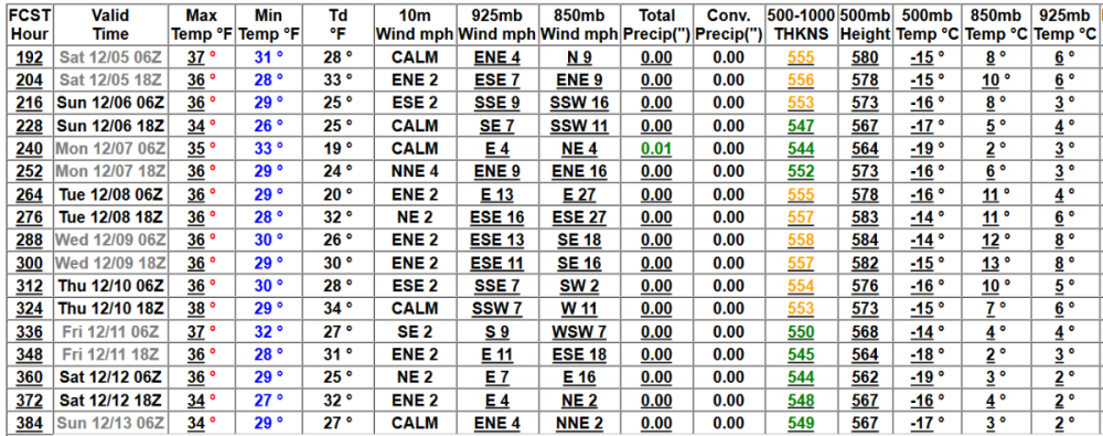
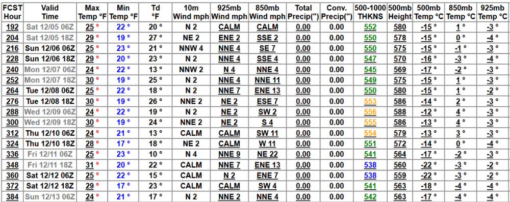
00z EPS trending away from a large scale winter storm and more or less an OHV early season snowstorm. @Niko looks to be the magnet with this one... 00z Euro Control...
 2 points
 -
LOL a few members showing Brookings getting something. I feel like that doesn't happen very often.2 points
-
That is the big piece missing .2 points
-
EPS getting more interesting.
 2 points
 -
We could. I've seen many times where we go into these persistent big ridge, fake cold, east wind patterns and then the block retrogrades evolving into a cold pattern/arctic blast. That is exactly how I think this will play out, but as Tiger has said 417 times(I counted ), we need to be patient. He's right. This feels so much like 2008 all over again. C'MON!!!!2 points
-
Unexpectedly strong wind kicking up now. Everett just gusted to 38 mph and it was enough to rattle the window a bit and blow stuff around the yard here.1 point


.gif.60b59429b2e4bc348ba23e3b450a8514.gif)


This leaderboard is set to Vancouver/GMT-07:00