
Leaderboard


Popular Content
Showing content with the highest reputation on 12/05/20 in all areas
-
It was awesome watching this approach and have "sunset" happen well above the horizon.


 7 points
 -
Today's cold front has a pretty incredibly sharp leading edge. You can even see the shadow extending like 30 miles East of the East side.
 7 points
 -
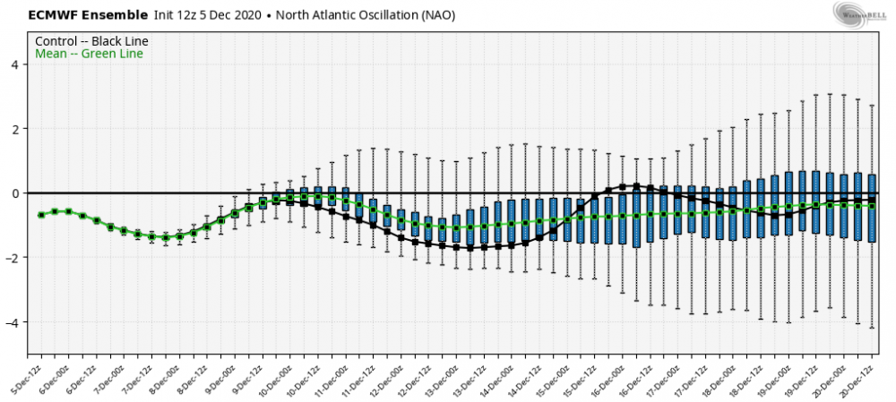
I have been impressed with the consistency of the long term models, (Euro weeklies and the 35 day GEFS). And also the mid term ensembles that go out to 16 days. Devil is in the details, but they all show pretty much the same thing.6 points
-
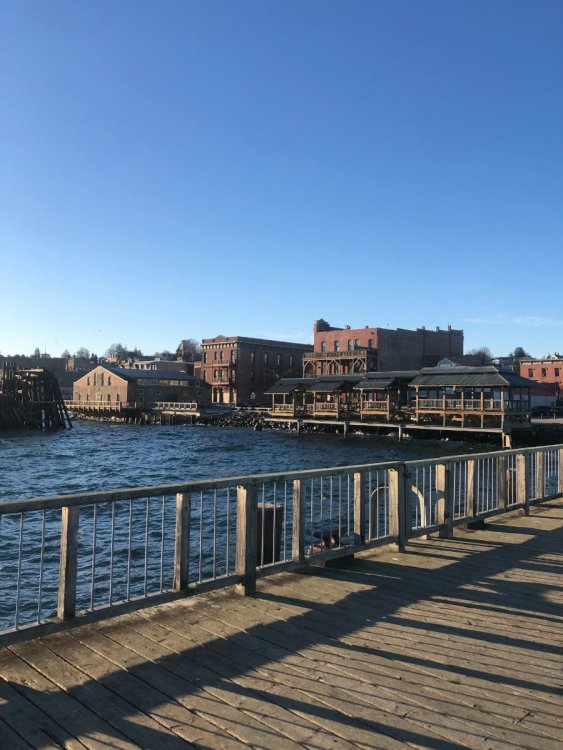
Took a drive with the gf out to Port Townsend. First time being out here
 6 points
 -
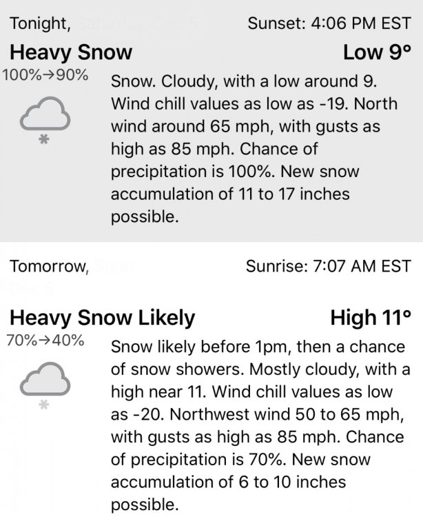
I just time traveled back from Jan 22, 2021. This was the forecast for downtown Seattle. No joke.
 5 points
 -
Last frame of the druncle5 points
-
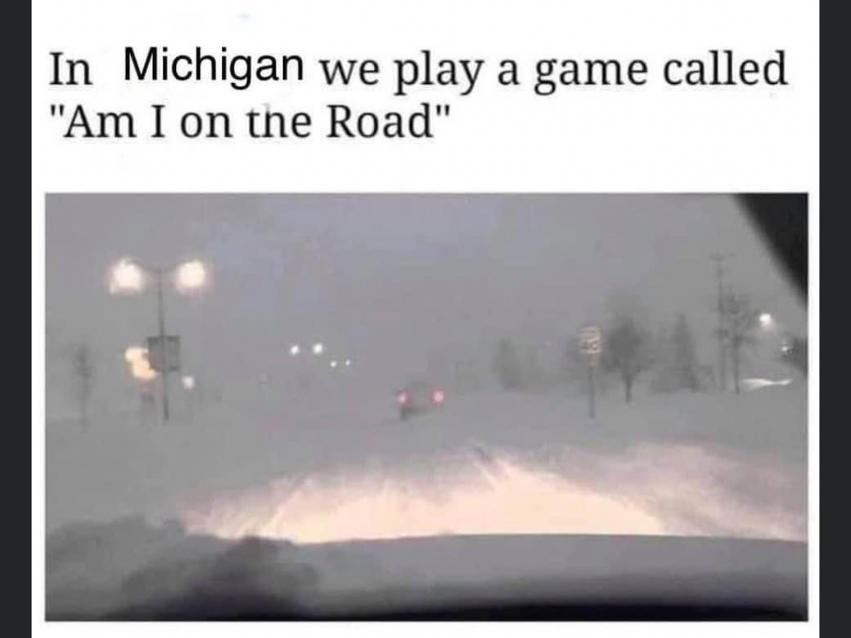
The abandoned cars on the road here in 1-2" of snow are hilarious.5 points
-
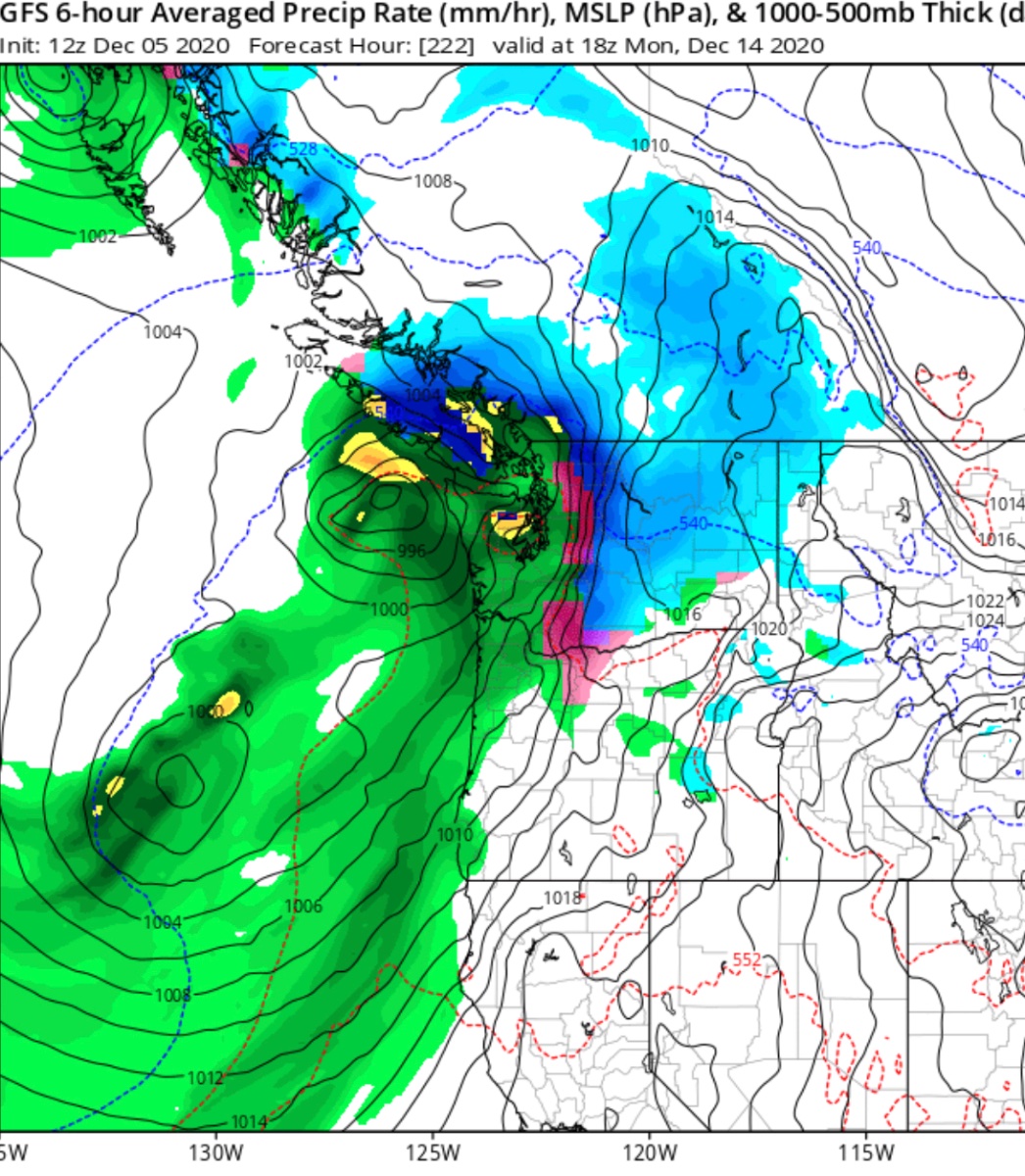
0z GFS-Para has two pieces of energy and it holds the 2nd and stronger piece back over the Rockies. Holding the 2nd piece of energy back west allows the first wave to push colder air southeastward ahead of the 2nd low. The 2nd low then phases with a weak wave of vorticity sliding down the front range of the Rockies then ejects and heads east across the southern plains before bending NE through the Ohio Valley. Very similar to what transpired in late Oct, one big difference is the low doesn't cutoff on this run. Whether it cuts off or not likely won't be resolved for awhile. I'm not saying it will play out exactly like this but the similarities to late Oct caught my attention. Hope everyone has a great day!5 points
-
This is going to make any snow that falls this winter look really pleasing. Bring it on, winter.
 4 points
 -
The GFS sucks, but is always 100% accurate when it shows a west coast death ridge.4 points
-
The line of clouds looked cool coming in.
 4 points
 -
Yowza! Just noticed this in the NWS forecast for my area. Could get exciting here.4 points
-
That’s solid. Okhotsk Sea/E-Asia low and Scandi-Icelandic High is a really good combo for wave driving.4 points
-
By far, the most annoying drivers are the ones that move here from a flat as a pancake midwestern town. Herr Derr we never close schools where I come from unless it's 12" deep. Meanwhile, their town has dry snow that almost always has much better grip than the 3 or 4 inches of wet slop that we typically get here and often freezes overnight into a sheet of ice. Plus their town uses 3 cubic miles of salt per year to melt the snow and rust out their vehicles. Not to mention that they have about 3 snow plows for every 5 residents.4 points
-
GFS consistently showing an AR developing in the long range.4 points
-
Would help load cold in W-Canada for sure. No coincidence 1968/69 was the most -NAO winter in recorded history.4 points
-
Seeing a lot of the longer range models looking decent for late December and January now. Still waiting on the updated ECMWF seasonal outlook. Lots of reason for optimism. The models look solid on a much more active falling PNA pattern as we get into mid month.4 points
-
Can we play this here in the lowlands ?!?
 4 points
 -
Last frame on WB4 points
-
I think Tim is like 1000’ and andrew is 1700. I used to be 1500’ (nw of pdx) until last year. tim has a better location for snow than both of us though. He also has greener grass and foliage as well.4 points
-
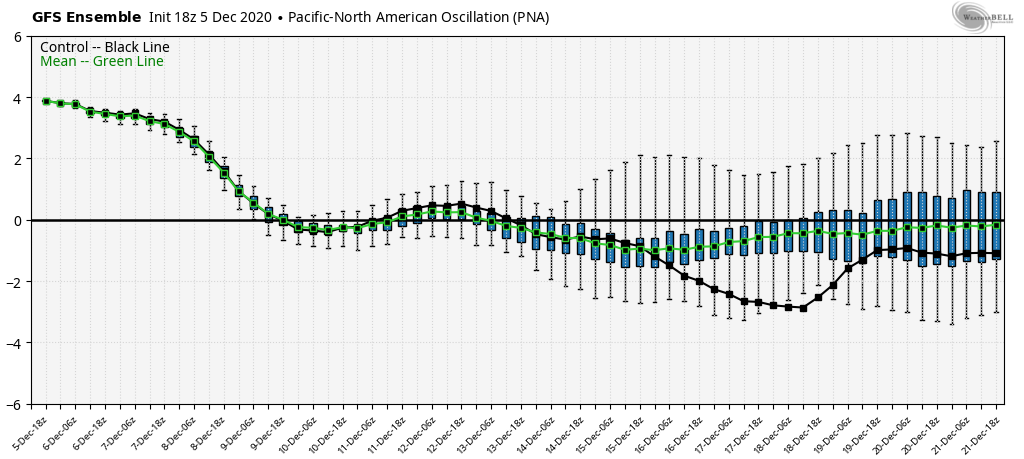
I think so. PNA should be negative by 3rd week of December at the latest, if I’m seeing it correctly.4 points
-
3 points
-
I can't decide if I miss it or if the constant letdowns outweighed the fun of it. They've definitely made major strides in eliminating the biases in the long range the last few years. Makes it much more meaningful when things consistently pop up even outside day 10 than it used to be.3 points
-
things are looking interesting at day 10 on the GFS. Lots of blocking trying to set up.3 points
-
I would take wet or white as this point of our drought.3 points
-
Well... thank God we did not have just a boring, soupy, dank inversion then. Dodged that miserable bullet and set ourselves up nicely for a white Christmas!3 points
-
I wore shorts and mowed in early December 2008. I also sat on my deck in shorts in mid January 2019... I’m chaining up my mower plow tomorrow.3 points
-
We all need to chip in and buy you a gorge for Christmas.3 points
-
For what little it’s worth, I still think models are underestimating potential out there during the 2nd half of the month.3 points
-
It was pretty cool. You could watch the shadow vividly crawl up the west slopes of Hood about an hour ago.3 points
-
What are your thoughts on this Phil? Looks like the GEM is trying to build a strong GOA ridge.
 3 points
 -
Blocking just explodes over the north Pacific at the end of the run. A theme that has been showing up consistently on the GFS extended on recent runs.3 points
-
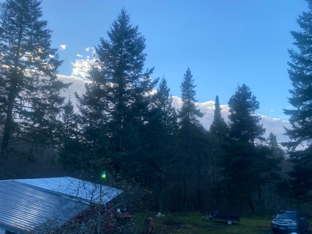
Rather sweaty trip to the tree farm today.3 points
-
Only the GEM shows this. The other 2 trend back up to neutral. Let's try not to wishcast too much or we will burn ourselves out.

 3 points
 -
12Z EPS... the week of Christmas coming into view now and there is some potential.
 3 points
 -
Not that warm, especially by Sunday, as it shows even the lowlands of Eastern Washington getting snow. Not particularly cold though either.3 points
-
A lot of cold air in the Yukon and Alaska at the end of the run.3 points
-
Not a bad looking GFS run by any stretch.3 points
-
I like the dark.3 points
-
Geez, I apologize, now Tim has to completely ruin the forum for everyone else for the next 48 hours. Why don't you go watch Jake Tapper.3 points
-
This isn’t bad, with some potential.
 3 points
 -
I remember when he did that early December 2008. Of course we had torched most of November and had little to no mt snow then.3 points
-
12z gfs shows nearly lowland snow next weekend.3 points
-
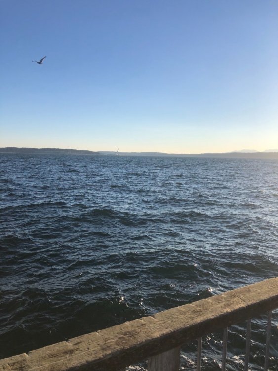
About an hour ago:
 3 points
 -
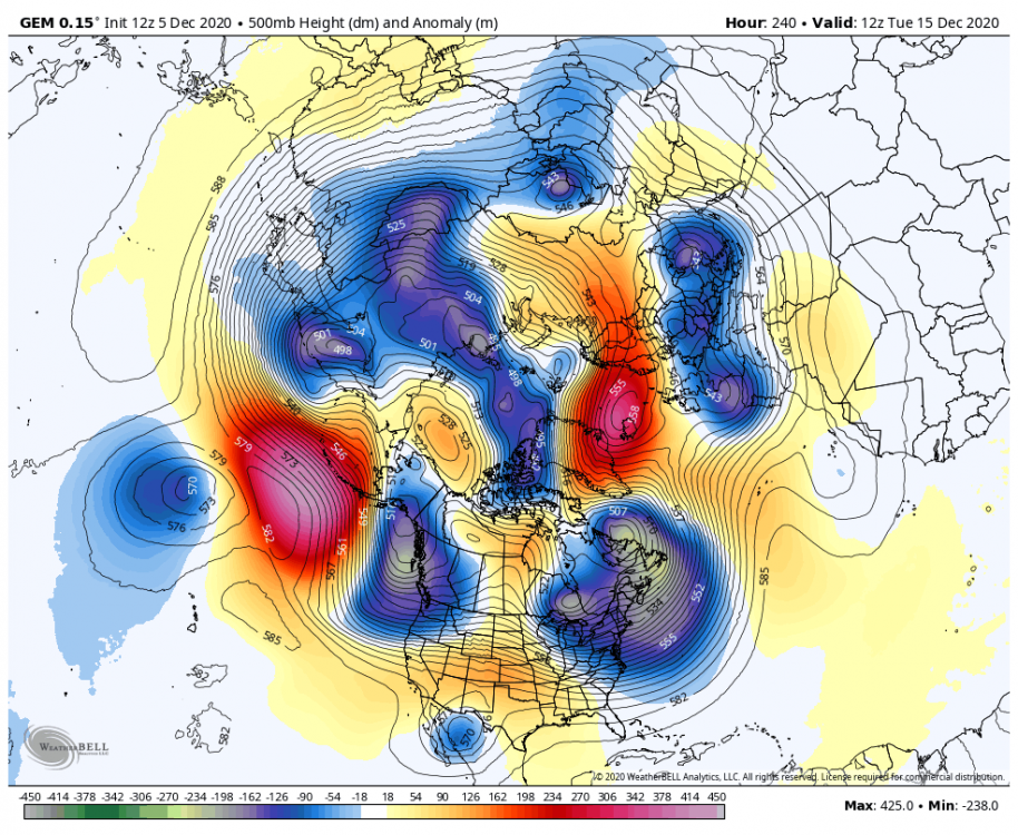
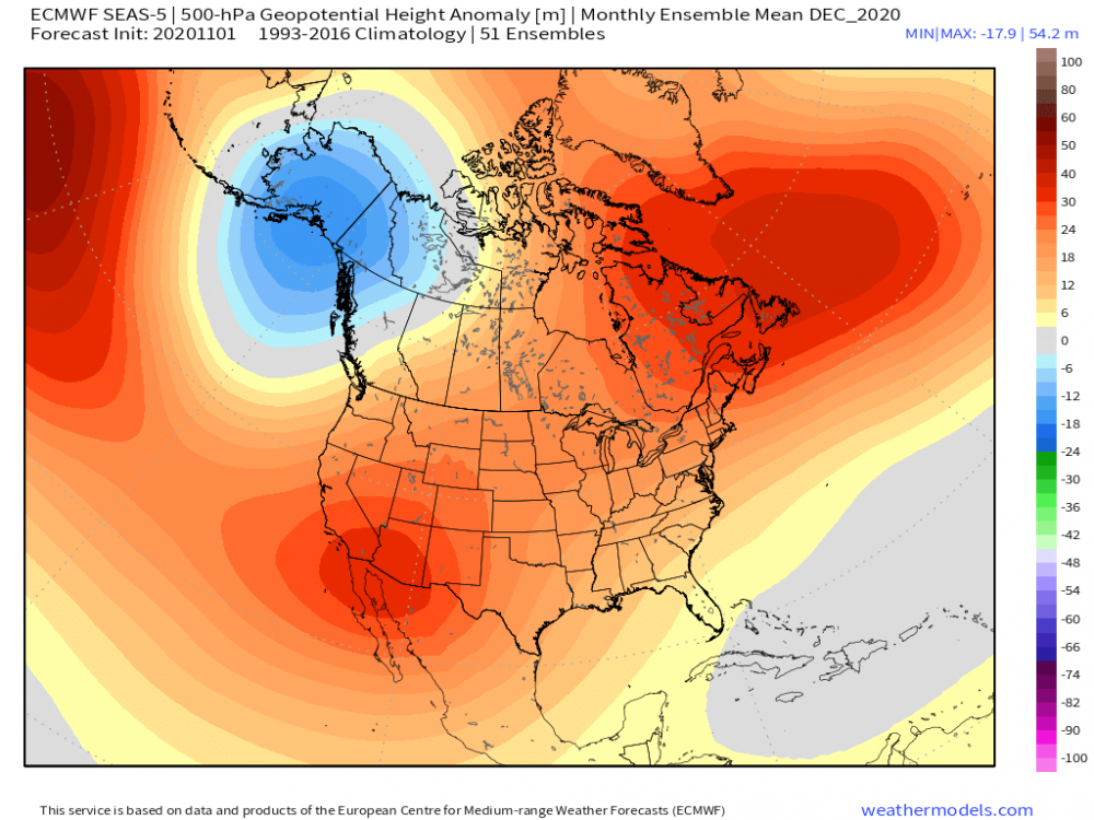
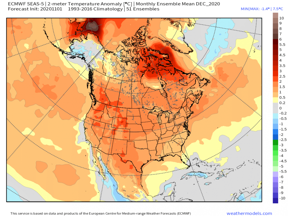
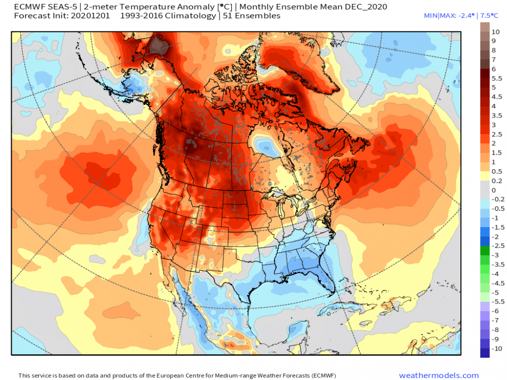
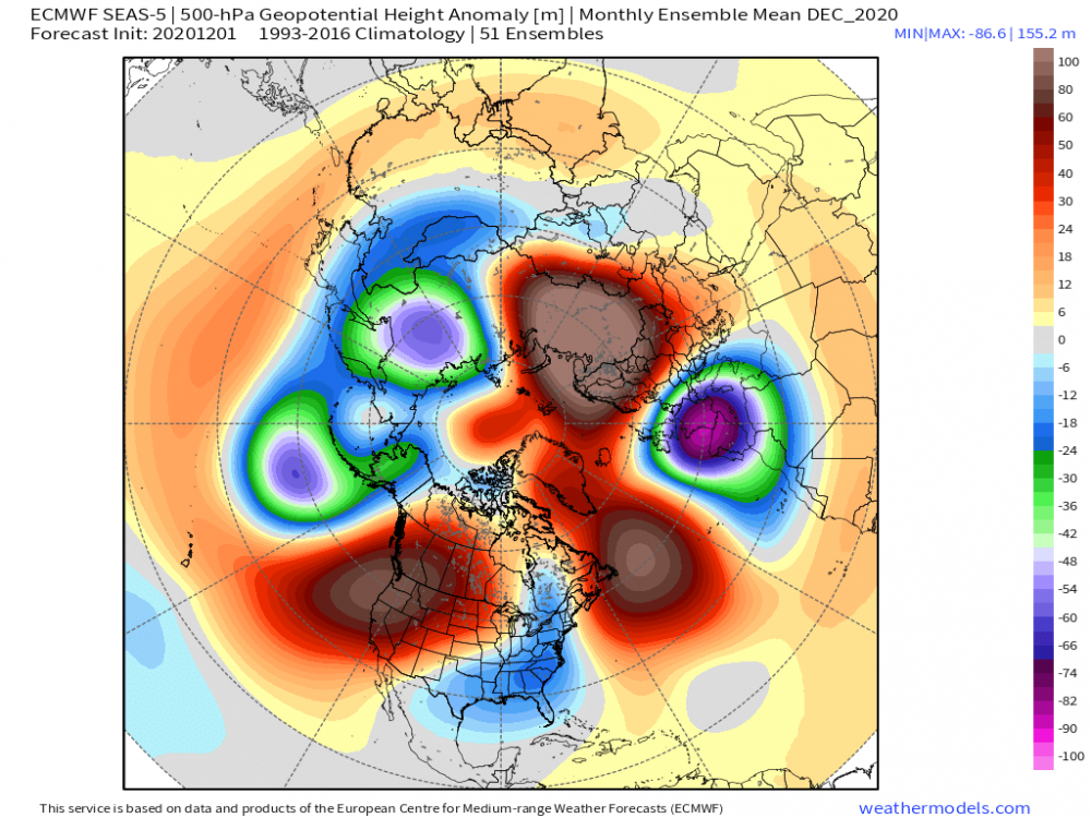
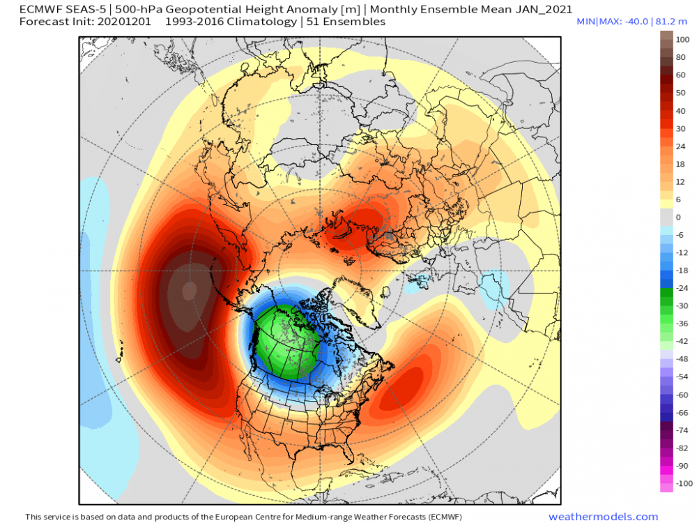
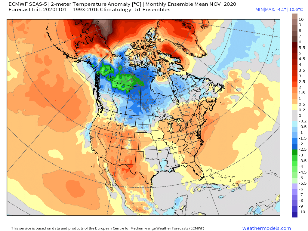
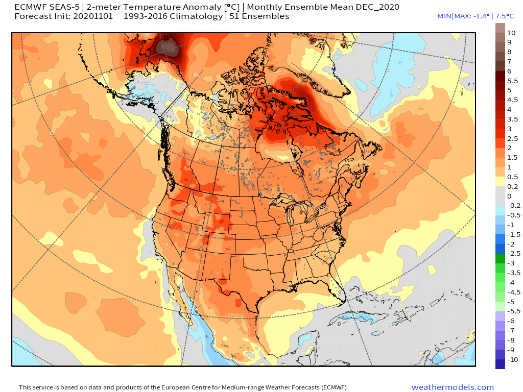
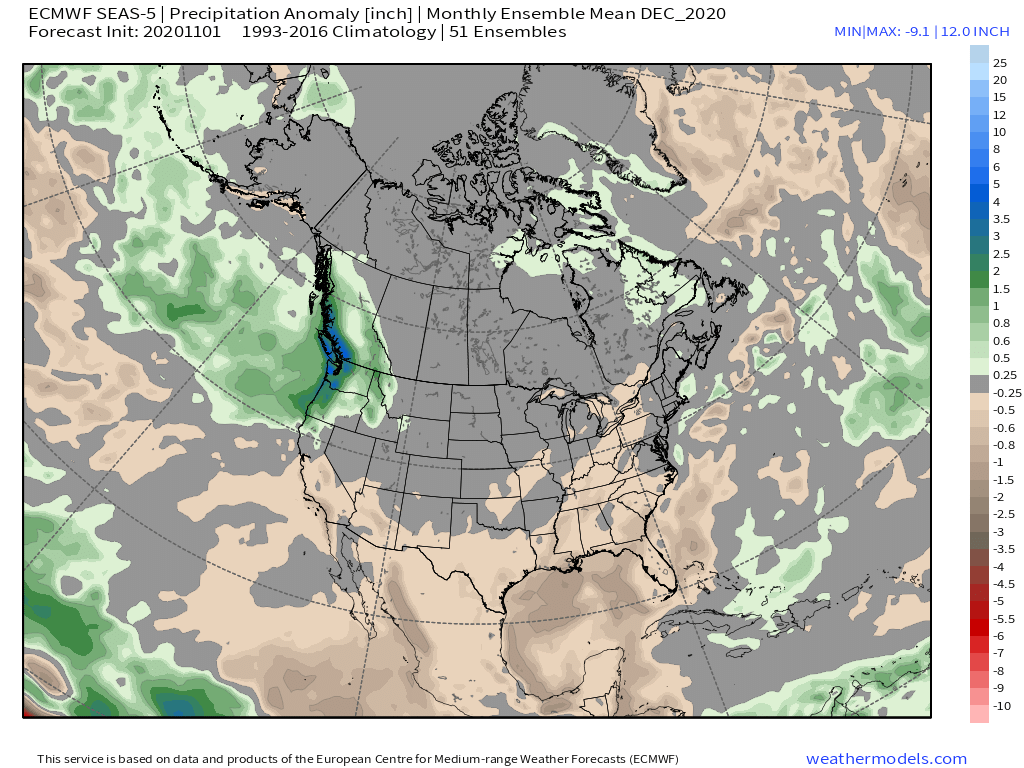
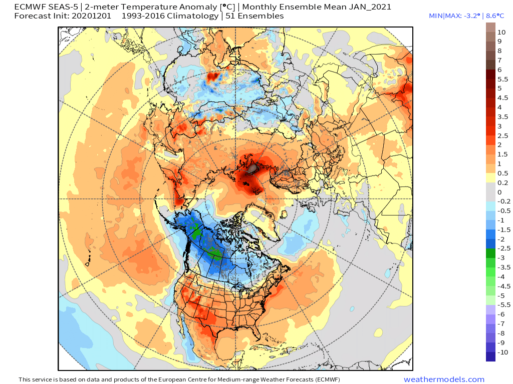
So, the anticipated changes in the Euro Seasonal are showing up on this run. Instead of a large AK/Yukon/NW Territories trough, it has shifted west this run along with a deeper Aleutian Low allowing for more ridging across W NAMER. The N ATL Block and Greenland Block have both grown resulting in a EC trough. Is this believable? Assuming the teleconnections that the models are now spitting out and this forecasted 500mb pattern, it certainly is plausible. With the understanding of the warm bias this model has, seeing the model cool off so much this run gives me some idea that its seeing a colder month ahead for the eastern CONUS. Will we start seeing the rest of the LR models picking up on the Blocking, thus resulting in deeper troughs across the eastern CONUS?? This is what I'll be looking for over the next week. Here is the Dec 500mb N HEM map... Now, comparing to last months run, January is trending in the same direction...stronger Scandinavian Block and I anticipate the model seeing more blocking near AK/Greenland next run which will shift the Polar Vortex farther south and more into central Canada. That's my vision for Jan '21.


 3 points
 -
12 AM PDX-DLS -11.0mb which is notably already stronger than modeled by 3-4mb.3 points
-
EPS mean has -11C anoms over the Yukon Territory @ hr300. Legit for that far out.3 points
-
It would need to scoot alot a bit east3 points


.thumb.jpeg.e3014abf99ef08a9f9ac2c0cd31b485b.jpeg)


This leaderboard is set to Vancouver/GMT-07:00