
Leaderboard


Popular Content
Showing content with the highest reputation on 12/13/20 in all areas
-
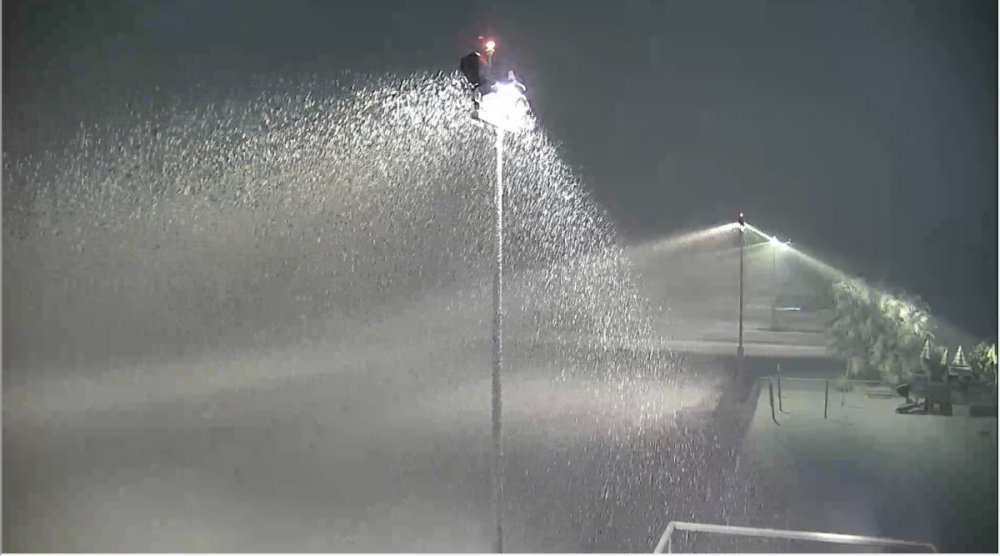
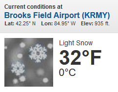
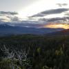
Just to get ya in the mood! https://truckeetahoeairport.com/webcam heavy snow right now with plenty of lights to gaze at it ILS rules with chains
 11 points
 -
In my apartment we've reached a fair compromise where my girlfriend gets to keep the living room how she likes it with sand poured all over the floor and an above ground pool with the temperature at 92.3 but in my office I'm allowed to use an artificial snow machine and several garage style meat freezers where I leave the doors open along with a series of high powered oscillating fans. Tim can tell me this is bad for my health all he wants but I haven't been sick in days.10 points
-
Thank you buddy. It's pretty great to see the flakes again. Just wrapped it up a few minutes ago actually. Couldn't be more happy. I'm silly when it snows. I love it.7 points
-
20201213_144243.mp4 20201213_144243.mp4
 7 points
 -
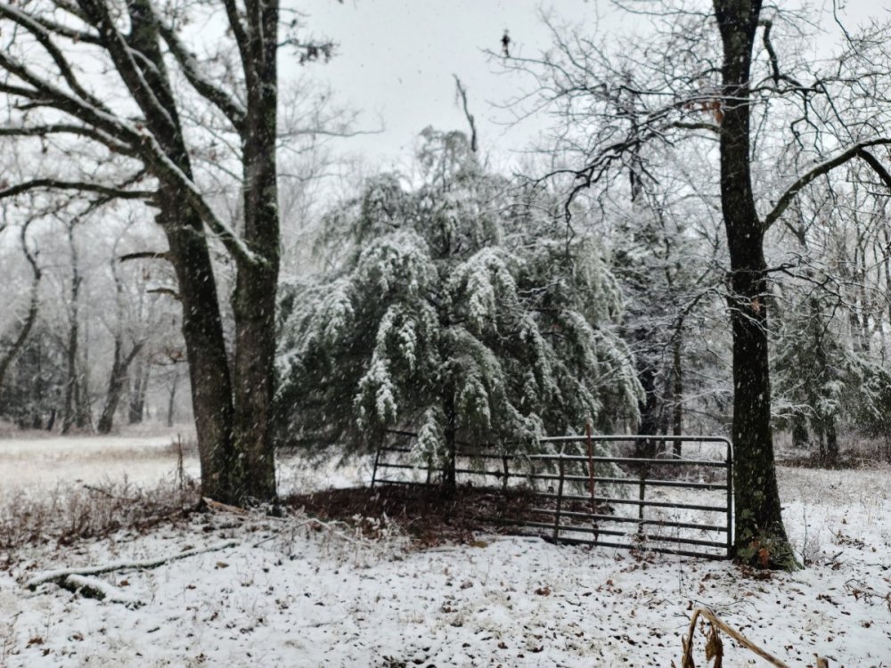
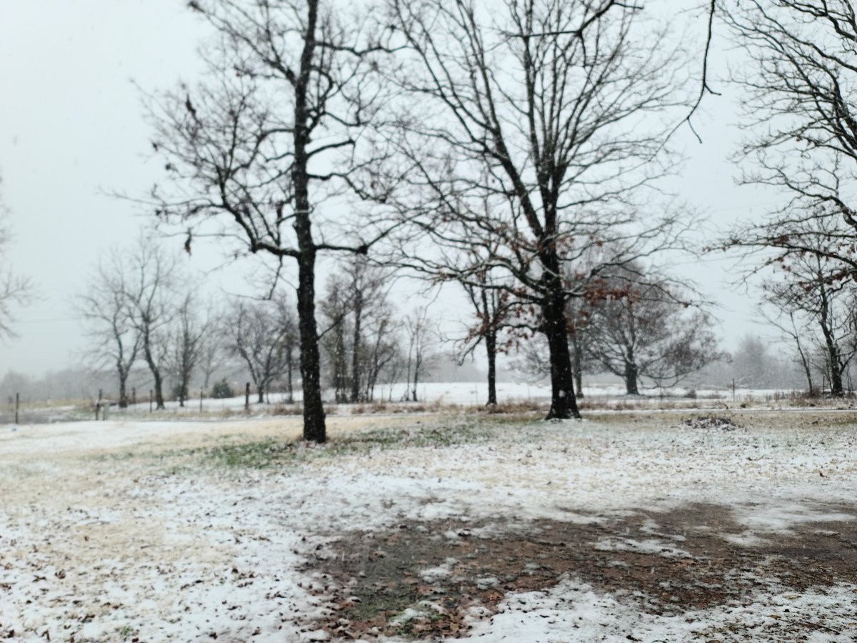
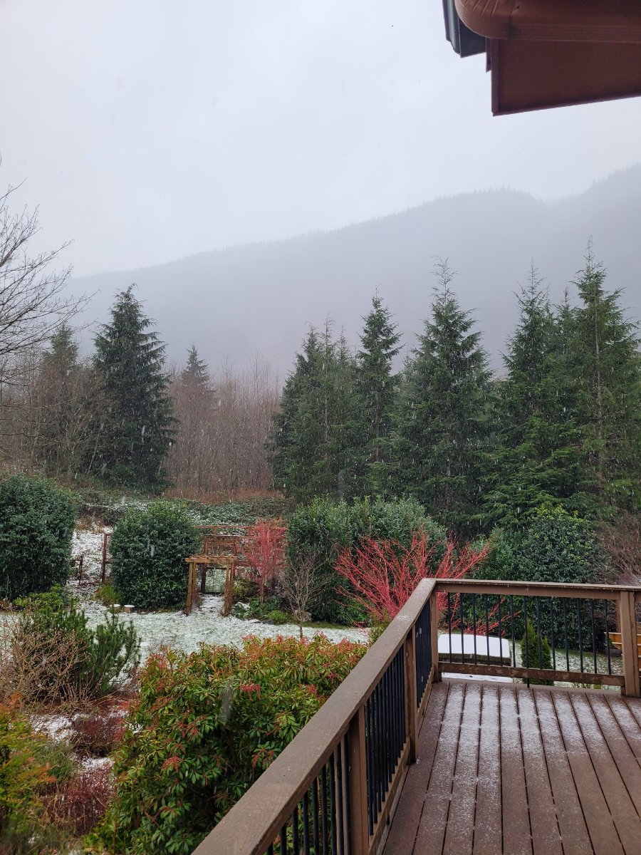
35F. With some intermittent light wet snow falling. Our first slushy trace of accumulation for the season7 points
-
Its a snow globe out there. It really CAN snow here. Lol Its still ugly out there so gotta cool and snow harder.
 7 points
 -
Snowing in Weed, California right now.6 points
-
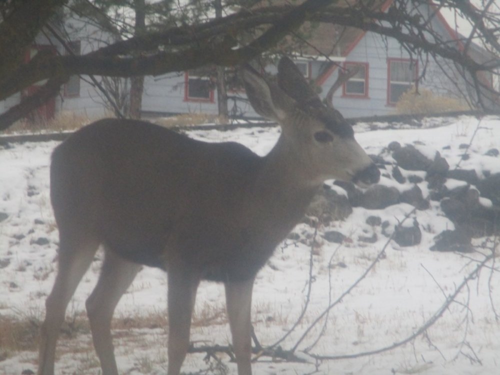
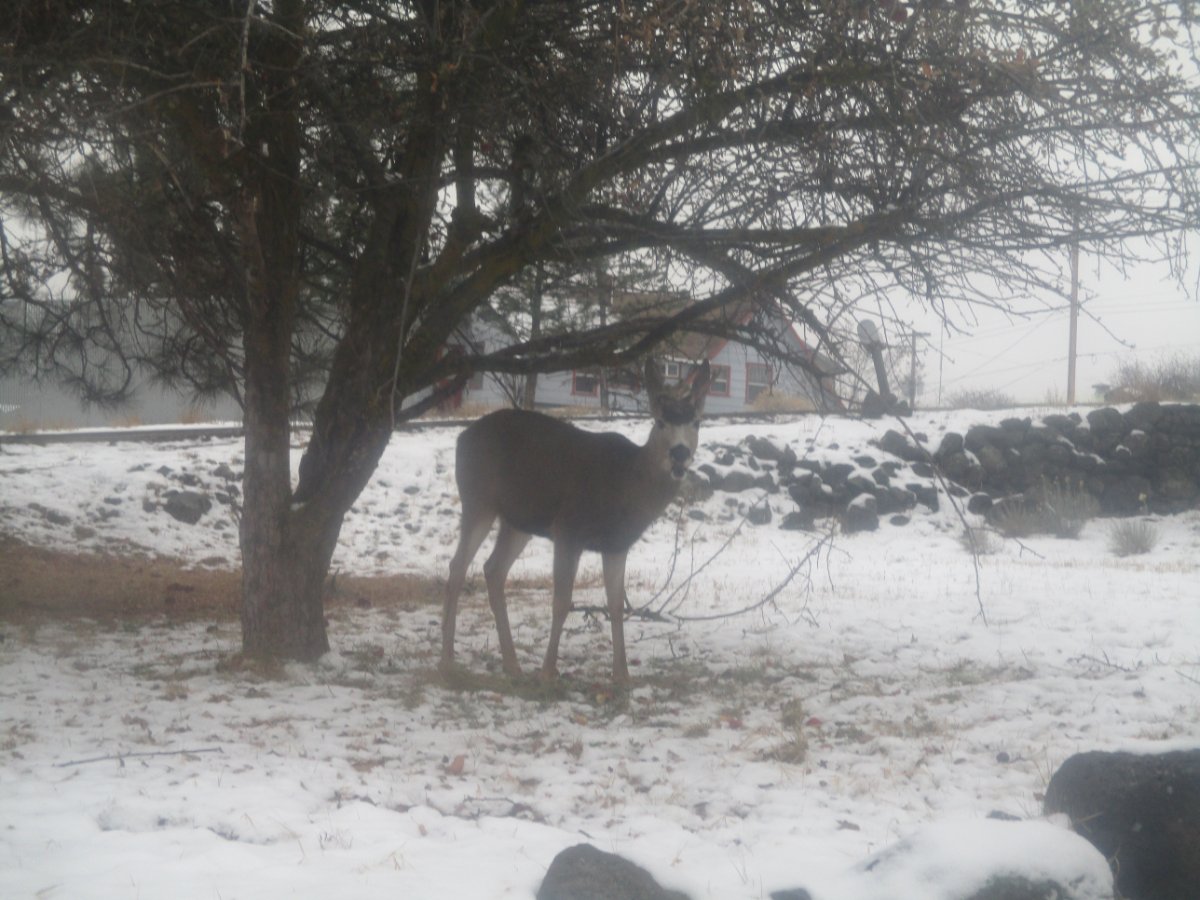
Somebody is saying hi to us.

 6 points
 -
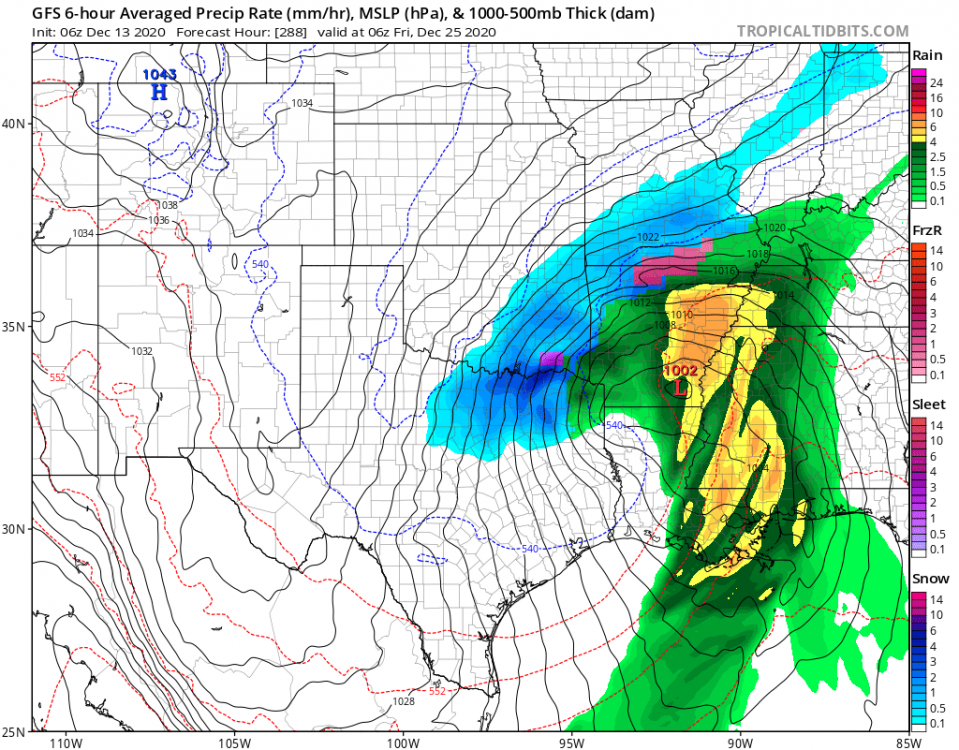
This comment may be off topic but I thought I'd throw it out there. I'm not a conspiracy type of guy but I'm also not naive and I can read between the "fine lines" and see the "signs" so to speak. Anyhow, you hear Dr. Fauci and all these top officials saying to prepare for "Dark Winter". Did it ever cross your mind maybe they are referring to ACTUAL Winter and not the virus??? Or Both??? I've been thinking about this a lot lately and when I analyze what I've been seeing in the climate models, esp the robust trends in the CFSv2 of a brutal looking January...you have to wonder if these scientists or gov't officials have known that this Winter could be an epic one for the CONUS. Something to ponder about as we move along... Meantime, I think this is what @OKwx2k4was talking about that winter's fury is about to begin late month into Jan... Jan 18th '21...Ice Box nation...6 points
-
Yeah, there's no doubt that we will enter a period of high latitude blocking, with average heights rising dramatically over the northern Pacific, consequentially lowering the PNA. The real questions are, 1. How favorable will the block positions be? 2. How much cold air will be available to us from the north? (A.K.A. Will ridging beforehand usher in mild Pacific air into inland BC and the Yukon?) Statistically speaking, a pattern with an increased bias towards blocking, along with La Niña and +QBO, for an extended period of time, increases the odds of a PNW cold snap drastically, perhaps by as much as 80-90%. But it is far from a guarantee at this point, especially given the solutions we've seen from the OP runs. It is hard to snow down to sea level here. There is much room for things to go wrong, and not very much room for things to go right. Even under an extreme cold pattern, moisture can be an issue (ex. north of Portland during 2016-17.) I'd reserve excitement and calls for guaranteed snow down here until a few days out, at most. But there are many reasons to be hopeful. Odds are the highest in the country at this latitude that we'll be colder than normal in January. Stay hopeful y'all, and be patient. 06z in around an hour and a half (d*** this evening is going by slowly...)6 points
-
How sweet is this: NOAA: NYC area Given the supply of low level cold air and unlikelihood of warmer air intruding aloft, this event looks to be all snow for just about the entire region, except maybe the south shore of eastern Long Island for a time. Too early to get into the mesoscale details here, but confidence in significant snowfall amounts continues to increase, with potential for over a foot of snow in areas that experience the best mesoscale lift and snow growth NW of the low track. NE winds should also be quite strong along the coast due to the pressure gradient between the strong high to the north and the developing low, as high as 25-35 mph with gusts up to to 45 mph, causing considerable blowing and drifting of snow and at least near blizzard conditions. Wednesday Night Heavy Snow and Windy Low: 27 °F Thursday Windy. Heavy Snow then Chance Snow Showers High: 30 °F Would not be surprised if Blizzard Warnings go out.5 points
-
I'm just glad the pattern is more active this year overall. Last November we didn't even see 3 inches of rain, more than tripled that this year. September and October both featured convection here at least once. That September thunderstorm was the strongest/strangest I've ever experienced here. It was still really smoky from the labor day fires then suddenly the flood gates were opened and we picked up over an inch of rain in 20-30 minutes. Huge Florida type raindrops as well.5 points
-
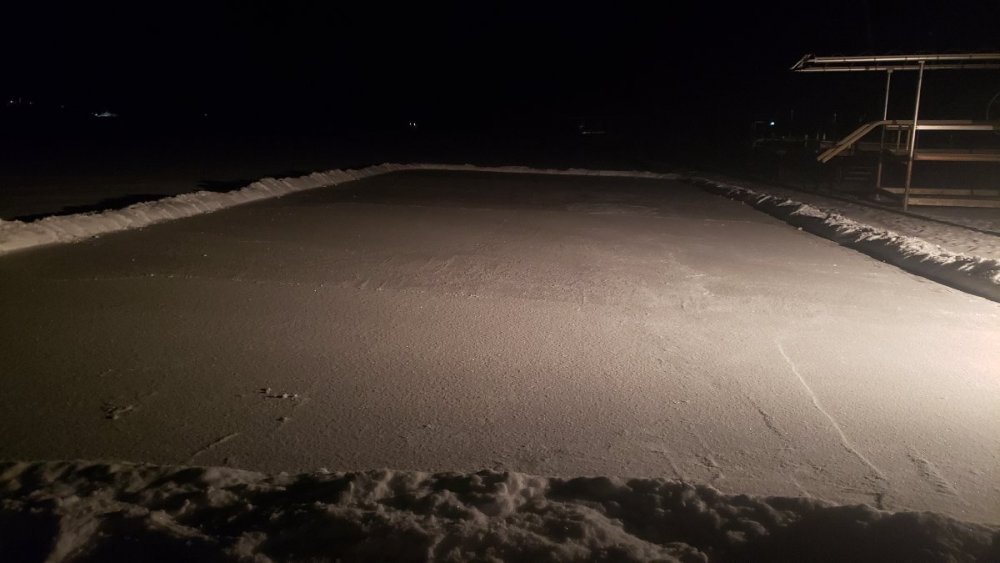
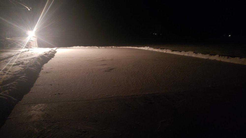
Just measured in my yard, and have a solid 4-5” base after some compaction yesterday.5 points
-
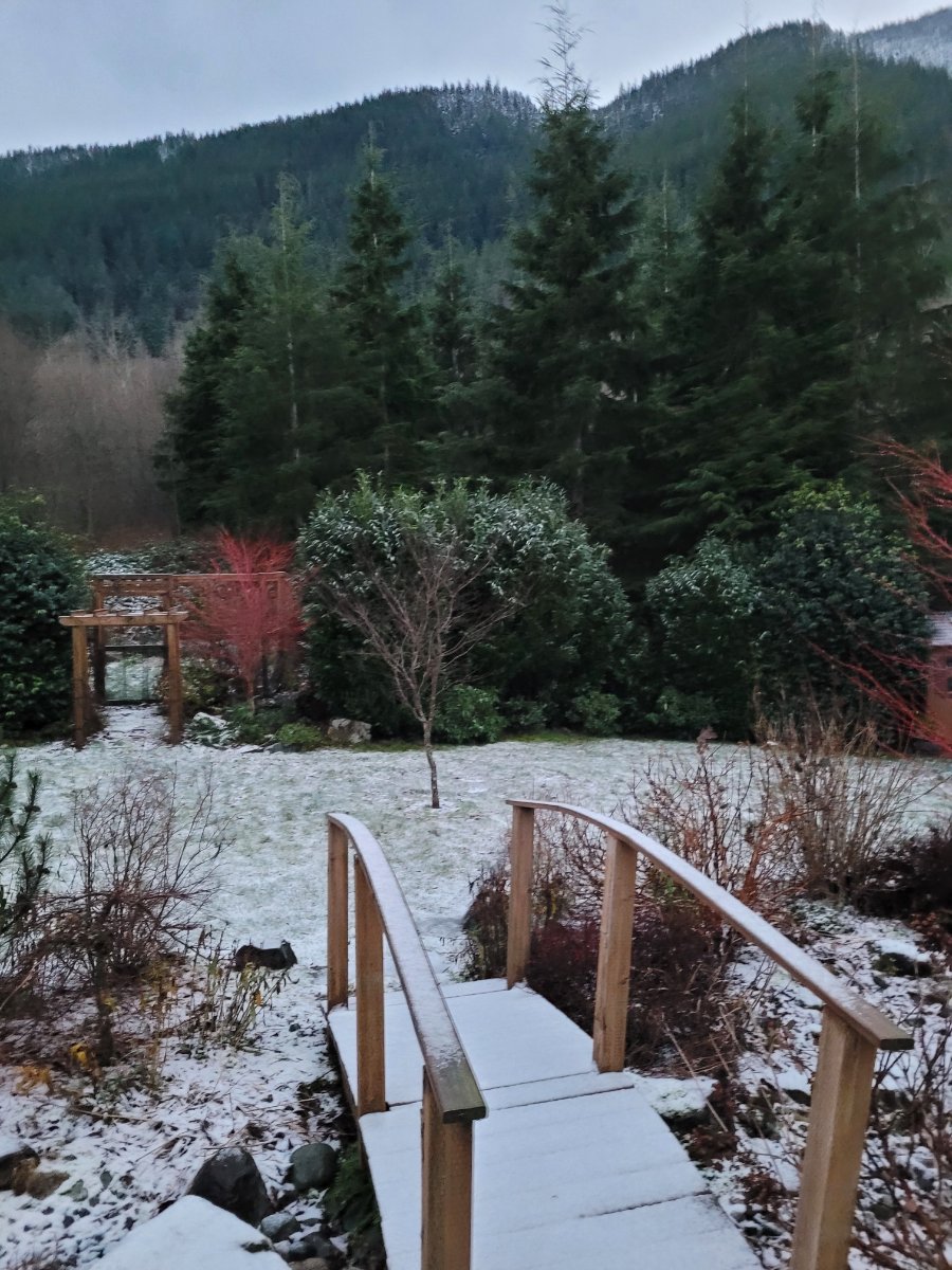
There is a crispness in the air this morning that you only get after freshly fallen snow. How I’ve missed it. Temperature currently at 21.6°5 points
-
Well that’s my name!4 points
-
High of 26 today after a forecast of 34. Skies are just now clearing, several hours later than expected which kept temps down. LNK should have first single digits of the season tonight. Combo of light winds, clear skies, and snow cover should tank temps. OAX is forecasting 9.4 points
-
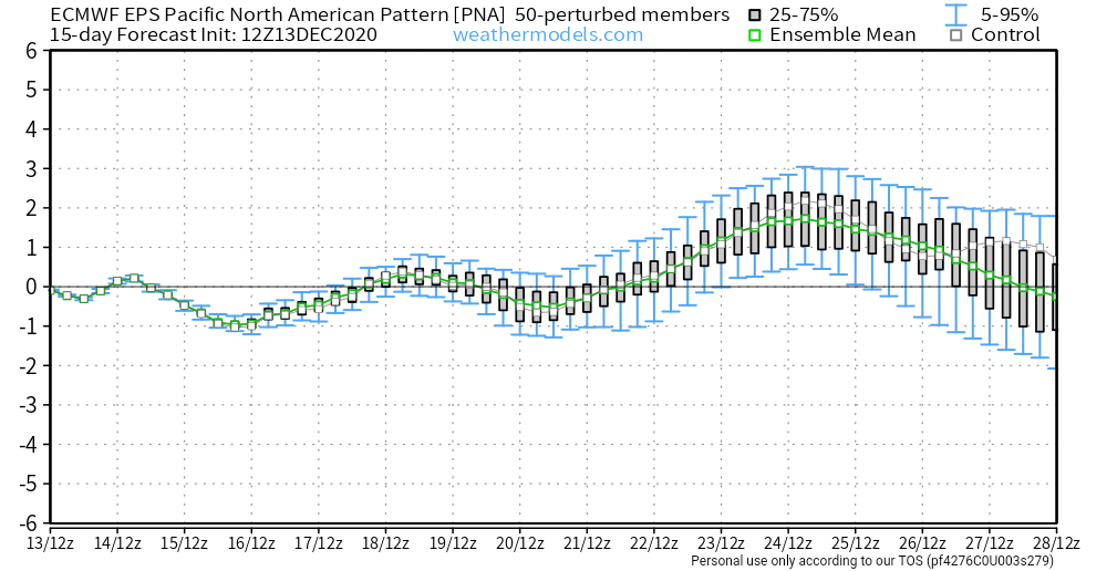
The 12Z EPS PNA forecast continues to be consistent run to run and with the weeklies last week. Bit higher +PNA this run around Christmas, though you do see it dropping at the end of the run.


 4 points
 -
Had some rain/snow mixed earlier. Now just rain and 39. Oh and this should turn the models around...
 4 points
 -
Actually snowing again here now... the east wind is still going.
 4 points
 -
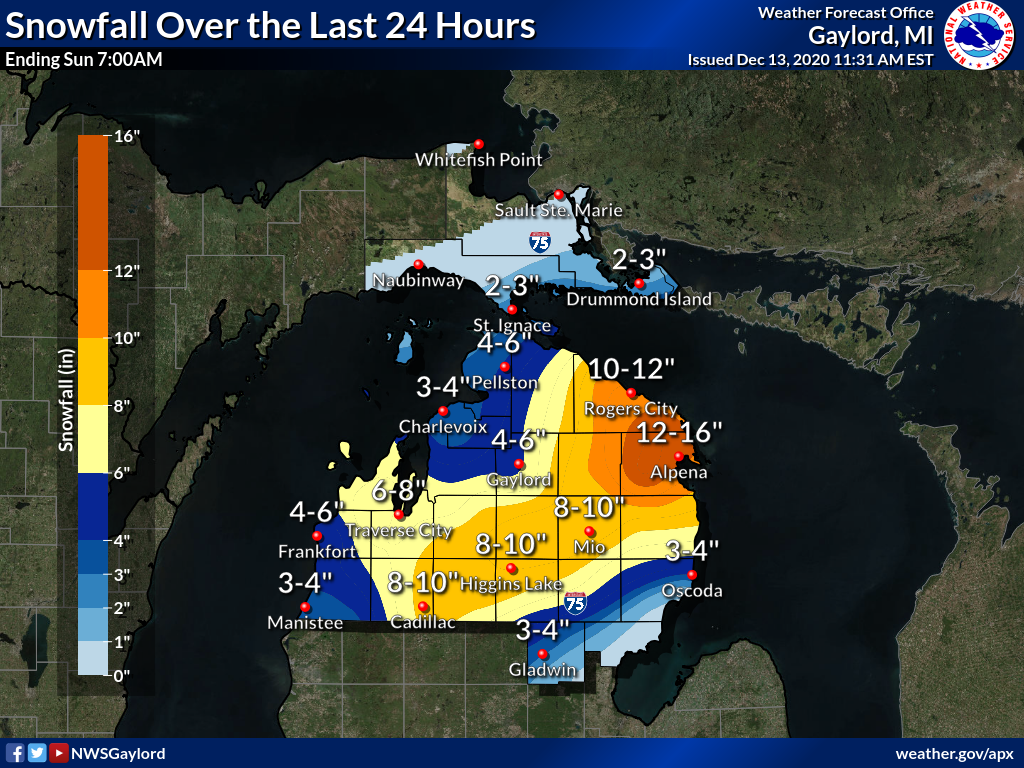
What this storm did in NMI
 4 points
 -
You aren't really supposed to look at it that way. You are supposed to look at the maps and dream about the possibilities.4 points
-
Next system looks to give my area and west and southwest of me a nice several inches Monday night into Tuesday. NWS Hastings saying over 3” from the Highway 183 area and west of there. That is one of the two major highways that come through my town, the other being Highway 6.4 points
-
Dry and 37 here now... and there is a little snow on the ground I woke up at 3:45 and saw it was snowing pretty hard but radar showed it was about to end. Guessing maybe an inch fell.4 points
-
I just got back from a rather cold and scenic walk with a temp of 26F. Even though there is no real snow OTG, we had a light dusting last night and a heavy Frost that covered the landscape which makes it look sorta festive out there. The twinkle of the grass tips from the suns rays shows one side of natures beauty.4 points
-
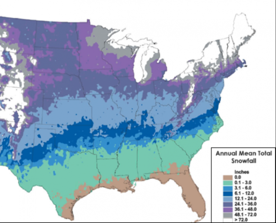
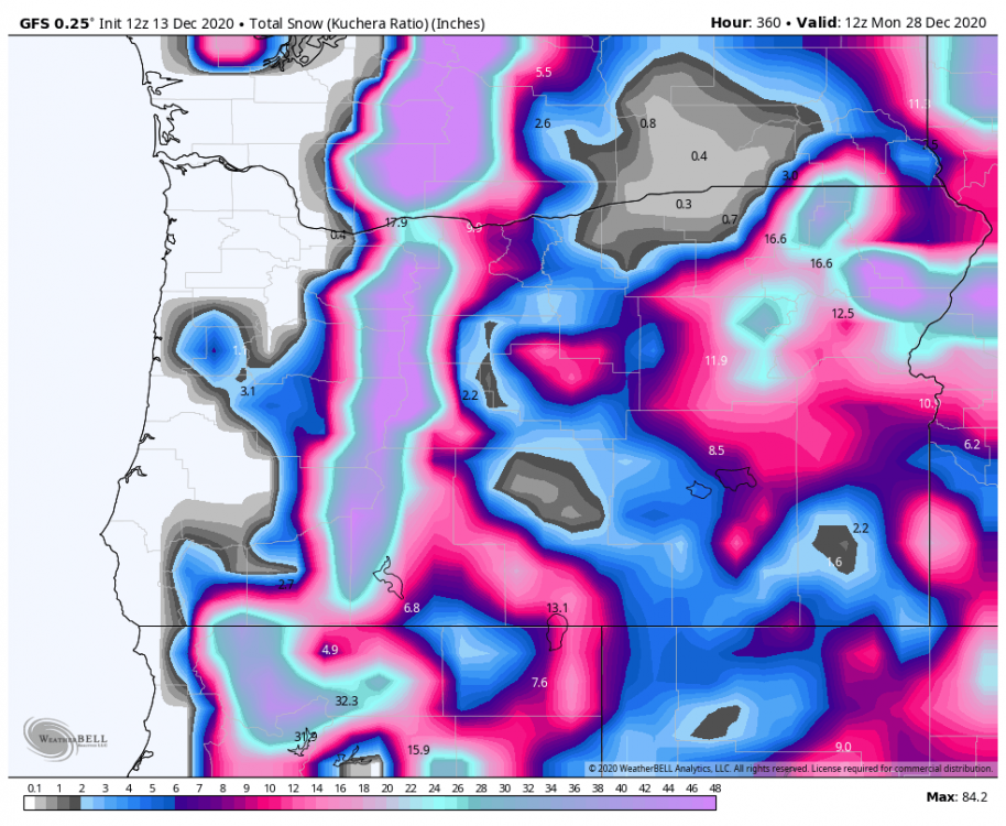
Someone commented on my annual snowfall here and I found this map for the US. There was probably a time in the 60s-80s span there when the higher amounts over Arkansas terrain extended back west over the Oklahoma lower Ozarks. Interesting times we are in.....
 4 points
 -
Well.... Ask for a 2000 winter since late summer and *poof*....
 4 points
 -
We are a clever bunch, aren't we?3 points
-
Finally enough to get everything covered. About 1" maybe and inch of lake effect overnight....Game on!
 3 points
 -
Down to -8*F on the wind chill. Forecasted high tomorrow is 15, even with full sun.3 points
-
Wind chill is down to -4*F.3 points
-
NWS Hastings mentions in their afternoon disco that amounts are trending up for the snow event Monday night into Tuesday. Has my area in at least 2-4” and may need to issue a Winter Weather Advisory. Nice.3 points
-
Update, I turned on the heat so now it’s 57 in house instead of 51. Might be a little bit more bearable for some u fellas now3 points
-
Snowing hard here in Vadnais Heights (St Paul)! Ground is getting white3 points
-
Wind chill is down to 4*F here.3 points
-
Mood flakes in St Paul currently! Just 25°3 points
-
Still just 39 with rain here. Nice to see the easterly flow really hold on today. It was 36 with heavy rain and gusty East winds at one point overnight. The passes are currently getting hammered. This weekend was looking mild with rain in the mountains not too many days ago.3 points
-
Received 0.2" on my patio from the frontal passage. Should have started a thread. 24*F.3 points
-
Yeah not sure why people are upset nothings happened yet. Still pretty early. If there’s nothing still showing up 6 weeks from now I’d be concerned. Overall it’s more likely we see snow than not in any given year. In the last 15 years we’ve only had 3 years with no snow accumulations whatsoever...04/05, 09/10 and 15/16. It’ll snow at some point. Odds are even more in our favor this winter than average. La Niñas are typically better in the second half too.3 points
-
It hasn’t snowed a single flurry, but Santa dear we’re in a hurry!!!!!!! #patients3 points
-
lol a sneaky field goal for Eugene before Xmas
 3 points
 -
Here is the latest on the Nor'Easter:3 points
-
We have a winner brother. All the way.... Thats not 2000, that's 1911, 1917-18, or like 1978-79 stuff there. I'll be buried by then. Lol. I have 6 weeks of this stuff in my pattern dead in the jackpot heart of winter. I was scared to death to say it back then for the number of times I had been so wrong.3 points
-
I saw a Muppets Christmas Carol twice in theaters. 92-93 was easily the best winter of my life. SLE had 32” of snow that season.3 points
-
Just looking at trying to compare the EPS to the last ECMWF weeklies, using PNA as a comparison. The 0Z is not out yet, but probably similar. A few observations. Both have the PNA going up and down between the 14th and 25th, then down. Up a bit around the 14th, down a bit around the 16th, up around the 18th, down about the 21st. Then up heading toward Christmas, and then down after that. Current models go to just about the 26th or so, and of course the Weeklies go way past that. But my point is that, what we are seeing with the EPS is pretty consistent with what we saw out of the weeklies a few days ago. I think that is a good thing.3 points
-
Consolation flakes made my night. Even dusting up the grass and cars near BC. Great for my first night lighting up the holiday decorations outside. Rolled into town and it was so much more festive with the flakes flying. Jingle bells..jingle bells..
 3 points
 -
Shout Out to OKIEWX (sorry it's not your real username, but we all know we he is) -- For a place that avg's about 10" of snow (if that) congrats!!! Been pretty bleak down there the past few winters. Enjoy--
 3 points


This leaderboard is set to Vancouver/GMT-07:00