
Leaderboard


Popular Content
Showing content with the highest reputation on 12/23/20 in all areas
-
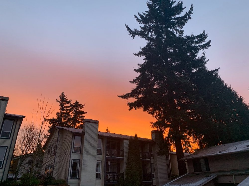
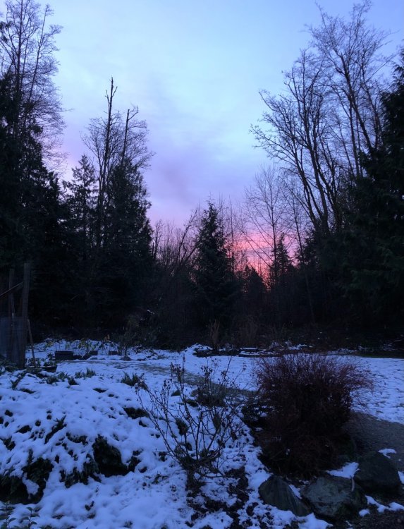
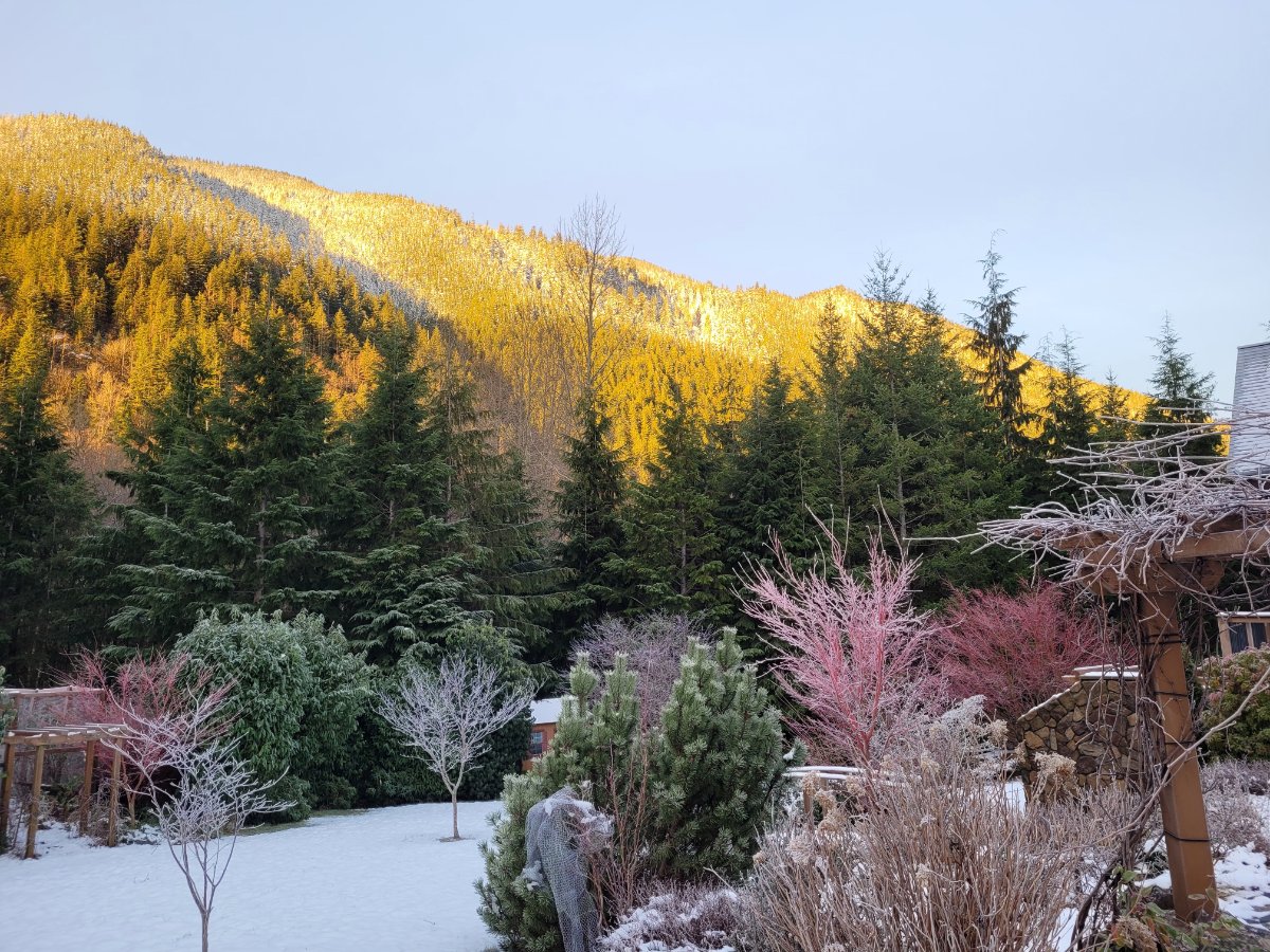
The view of the neighboring condo's isn't as nice as some of you have it, but that color (as captured by a crappy iPhone Xr camera) is incredible!
 11 points
 -
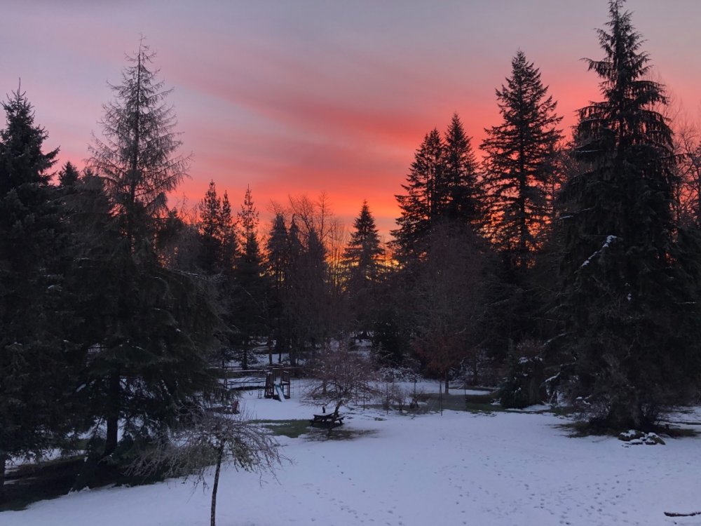
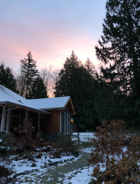
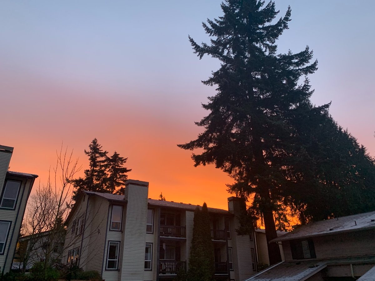
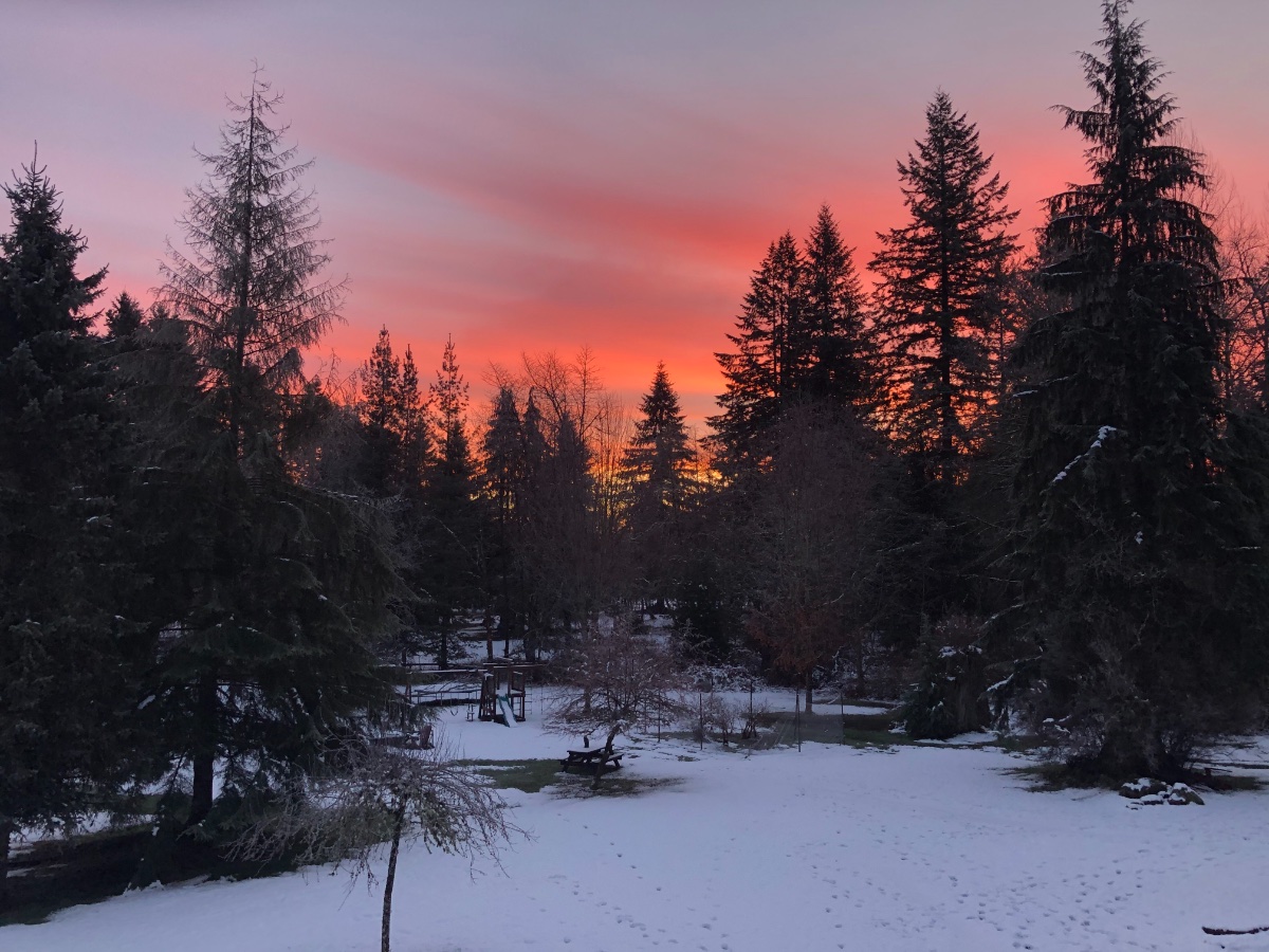
I guess I’ll add my sunrise shot as well. 27 here and very crunchy.
 11 points
 -
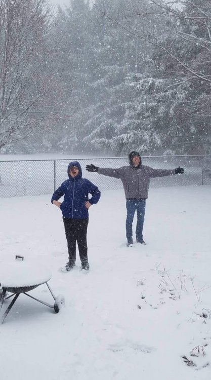
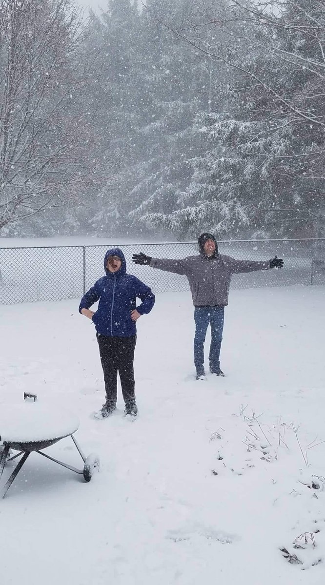
Myself on the right. GF's son on left. And this is only 2 hours in. Can't imagine how this will be later!
 10 points
 -
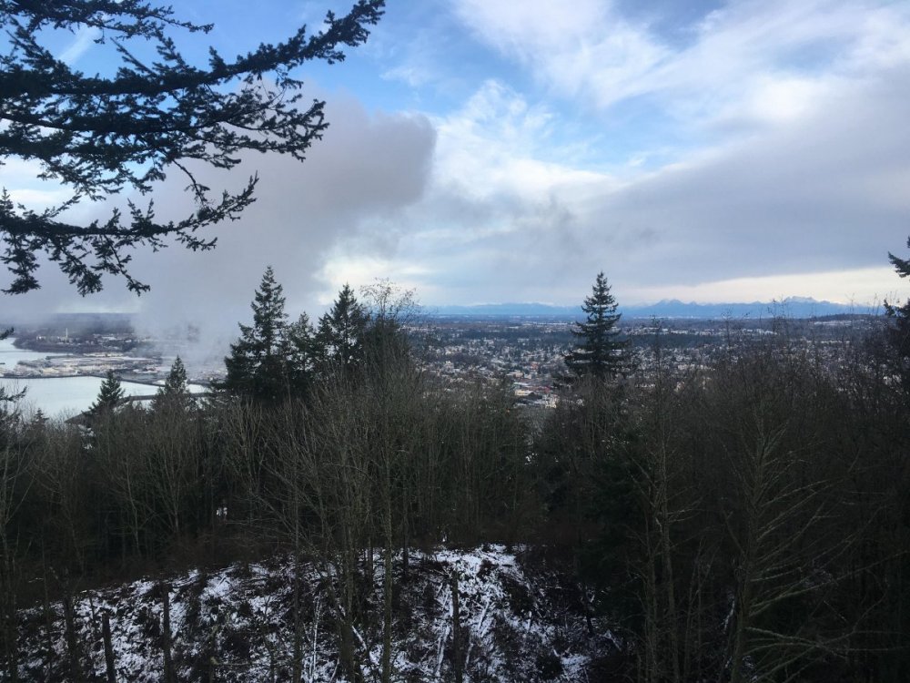
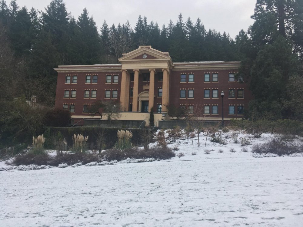
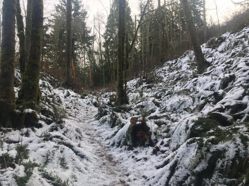
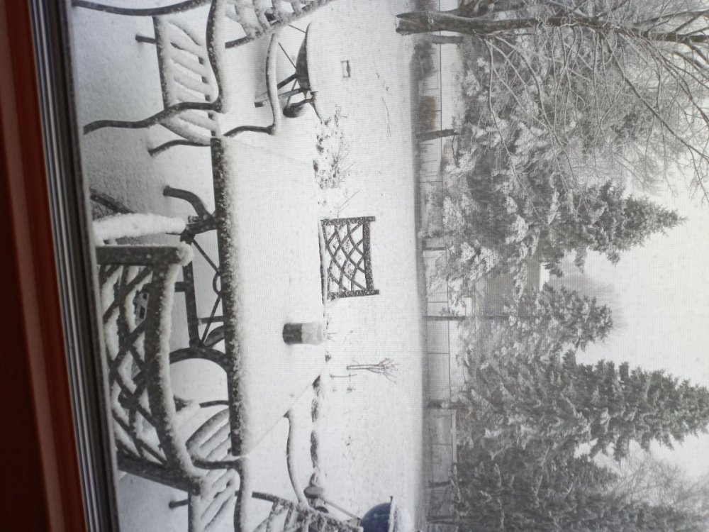
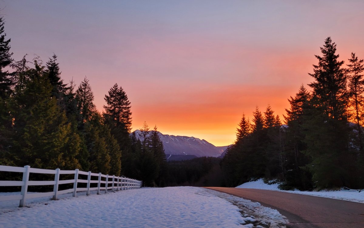
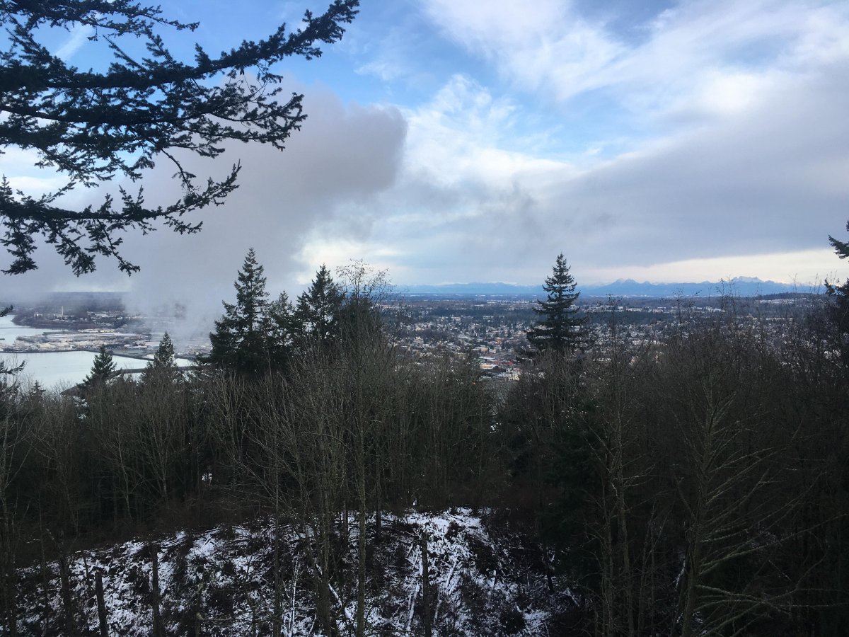
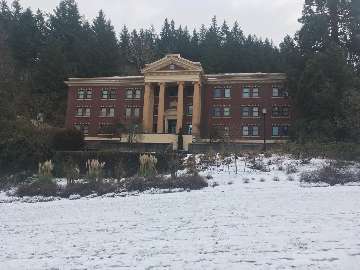
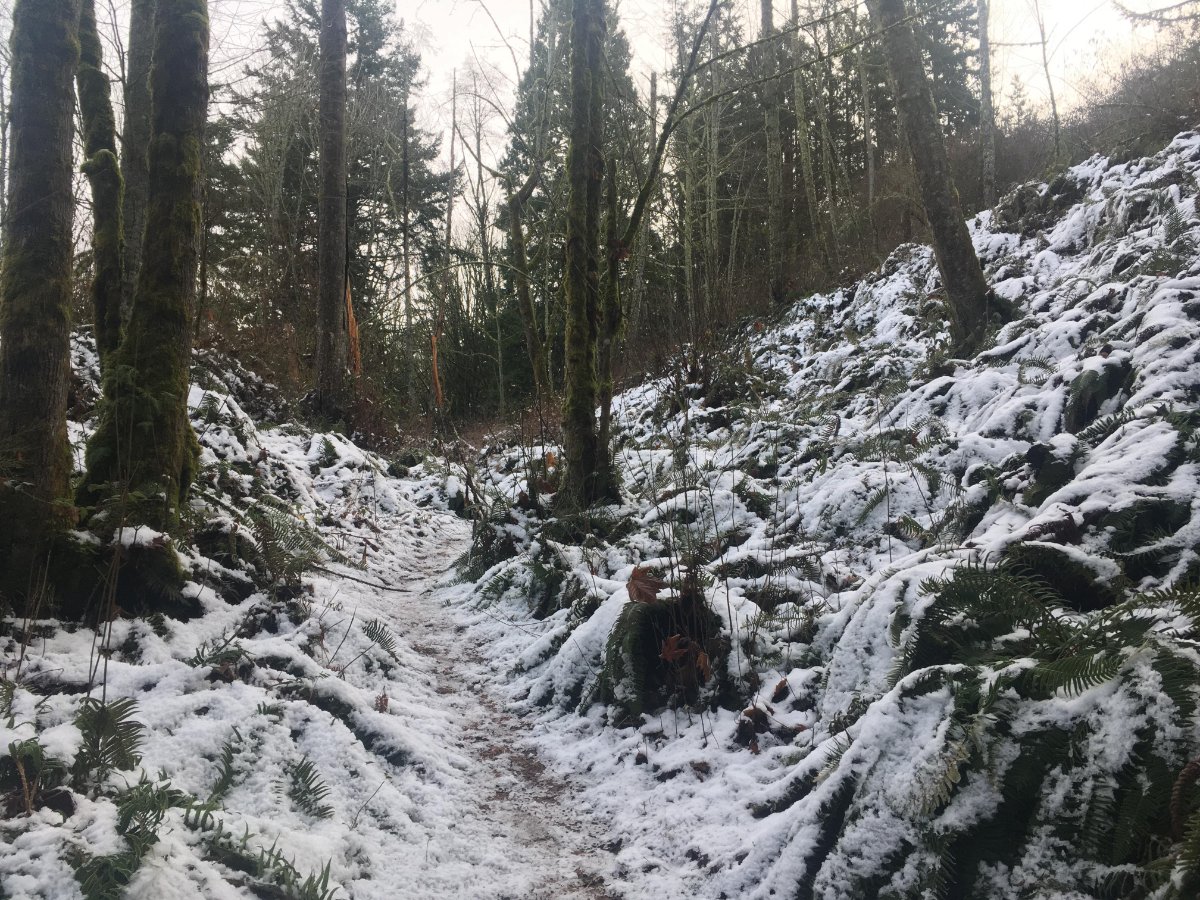
Gorgeous morning up here, with a nice coating of snow still hanging on. I took a walk through WWU's campus and Sehome Hill--there's a bit more on top (630 feet up or so). The first picture is the view from the top of the watchtower. I've never seen the mountains so clear. In fact, I think I just barely made out a few skyscrapers in Vancouver, which I've never seen before!
 10 points
 -
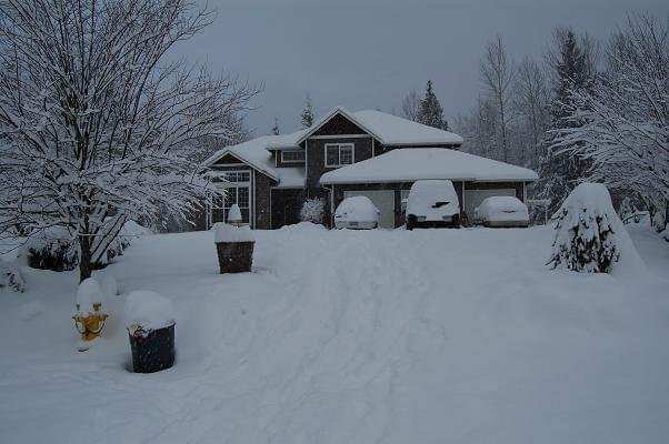
I had my mom send me some of her photos from Dec. 2008. We lived out in the Monroe foothills north of Sultan. 550' feet or so, PCSZ, inland...we were prone to some epic snow. The igloo in the backyard lasted until early February I believe. The picture with my dad clearing off the car was the morning of the 26th. I was heading to the airport to fly down to California to see a friend. If my memory serves, it snowed basically non-stop from Christmas Eve around 5pm until Christmas day around 2pm. The car only halfway in that frame had been cleared off on the 23rd as my dad took it in to work that day, so all that snow on it is fresh. The Armada hadn't moved in who knows how long, but it took some work to clean it off. The rest of the pictures, I am unsure of the actual dates they were taken.


 9 points
 -
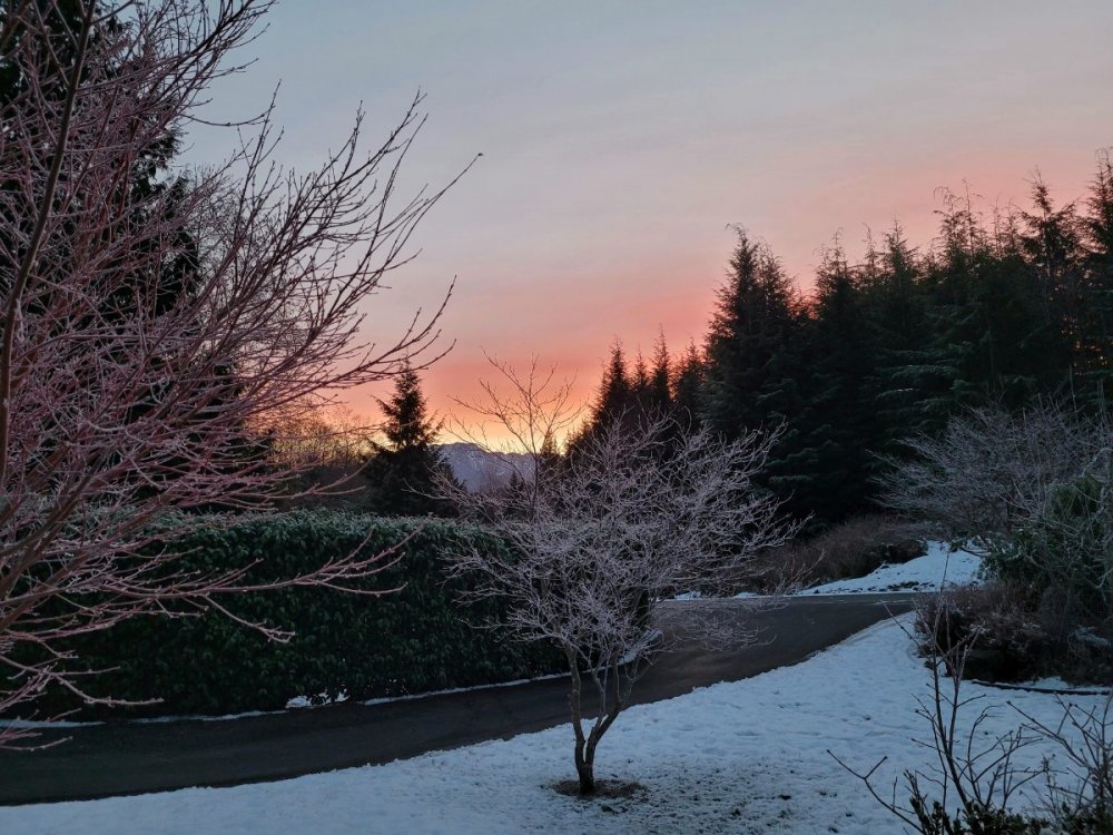
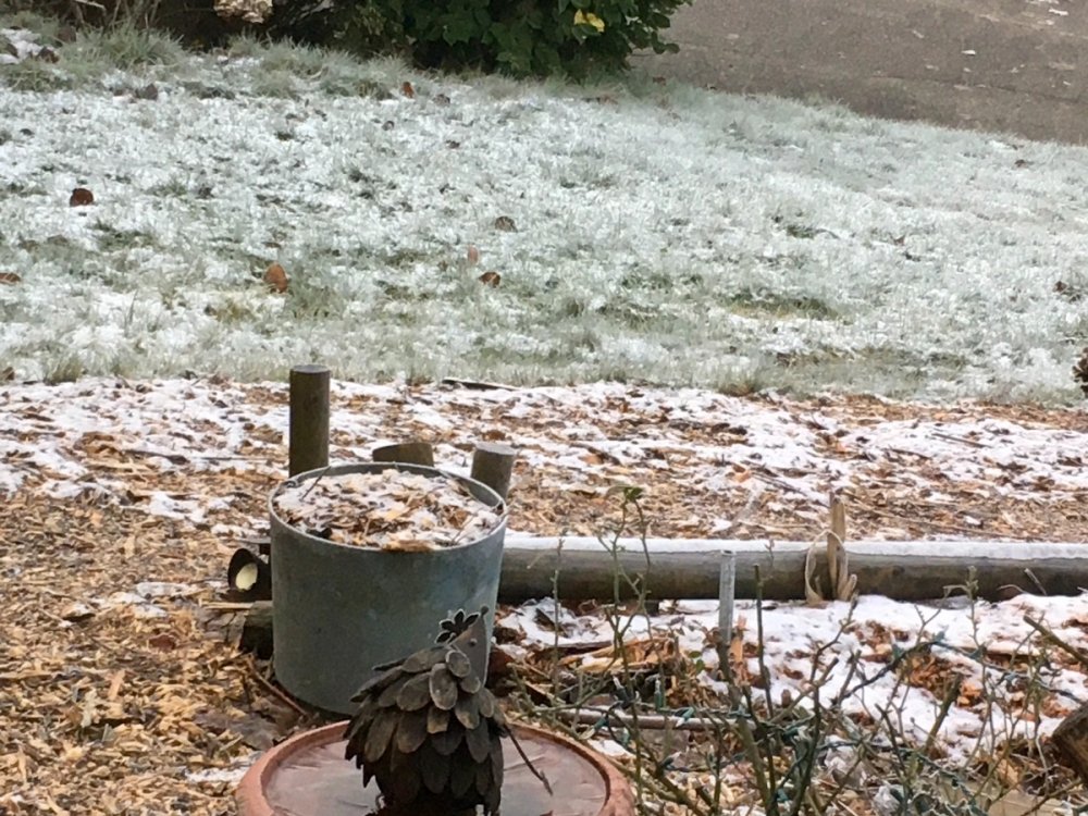
Trees have a coating of ice... and a nice sunrise. Looks like winter!
 9 points
 -
Learned a few neat things here so far this winter: 1. Models are never accurate in the LR unless they show warmth. Then it's time to plant the Tulips! 2. It's okay to cancel winter when it's a few weeks old. In a -ENSO/+QBO regime. With an impending SSW. It's not even Christmas y'all. Seeing a lot of doomposting from the "patience" and "wasn't even expecting anything until late January" crowd.8 points
-
Just upgraded to a blizzard warning! Welcome to the blizz! Now up to 12” in the point. Yowza!8 points
-
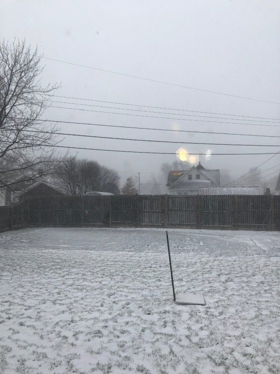
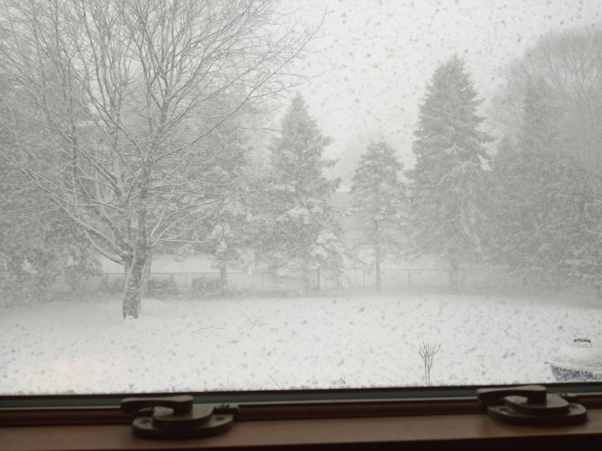
Photographer playground out there this morning! You guys got some good shots as well! 28* and still patchy snow on the ground. Feels and looks like winter
 8 points
 -
One more pic from this beautiful morning...
 8 points
 -
Pretty much sums up this place.7 points
-
After the first hour
 7 points
 -
7 points
-
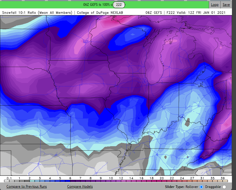
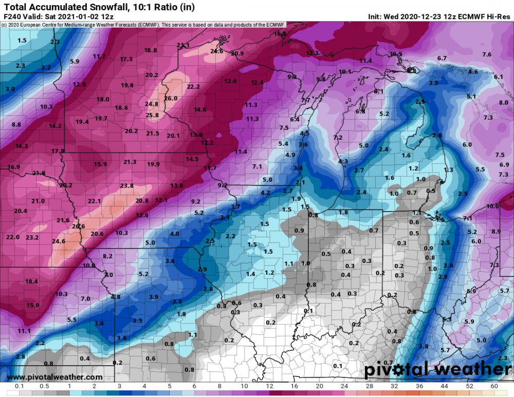
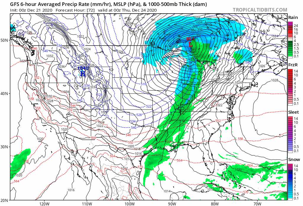
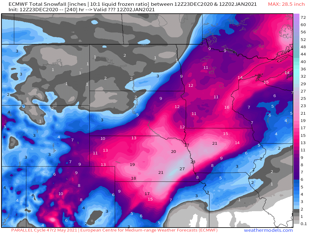
Worth noting that the Euro will be upgraded in May 2021, and this upgraded version is running parallel to the operational. Parallel ECMWF attached, more or less in line with the operational one Edit: note 10:1 ratios on this chart
 6 points
 -
If I had to guess, I’d say we ended up with 2-2.5”. Definitely a nice surprise and will make it a white Christmas. Now to the watching every goddamn model run for the next 6 days6 points
-
Blizzard in town here in Omaha. I missed the best part too. Right before this the houses were completely gone! FullSizeRender.mov6 points
-
Just measured a solid 2" in 2 hours. Zero visibility down the street. Literally just ran around the yard like a kid.6 points
-
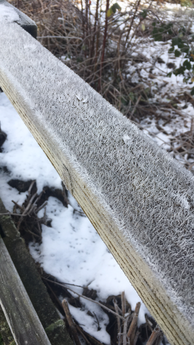
There's also some cool frost crystals from the freezing fog last night.
 6 points
 -
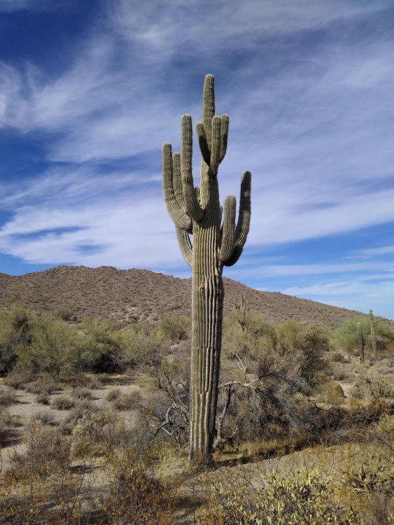
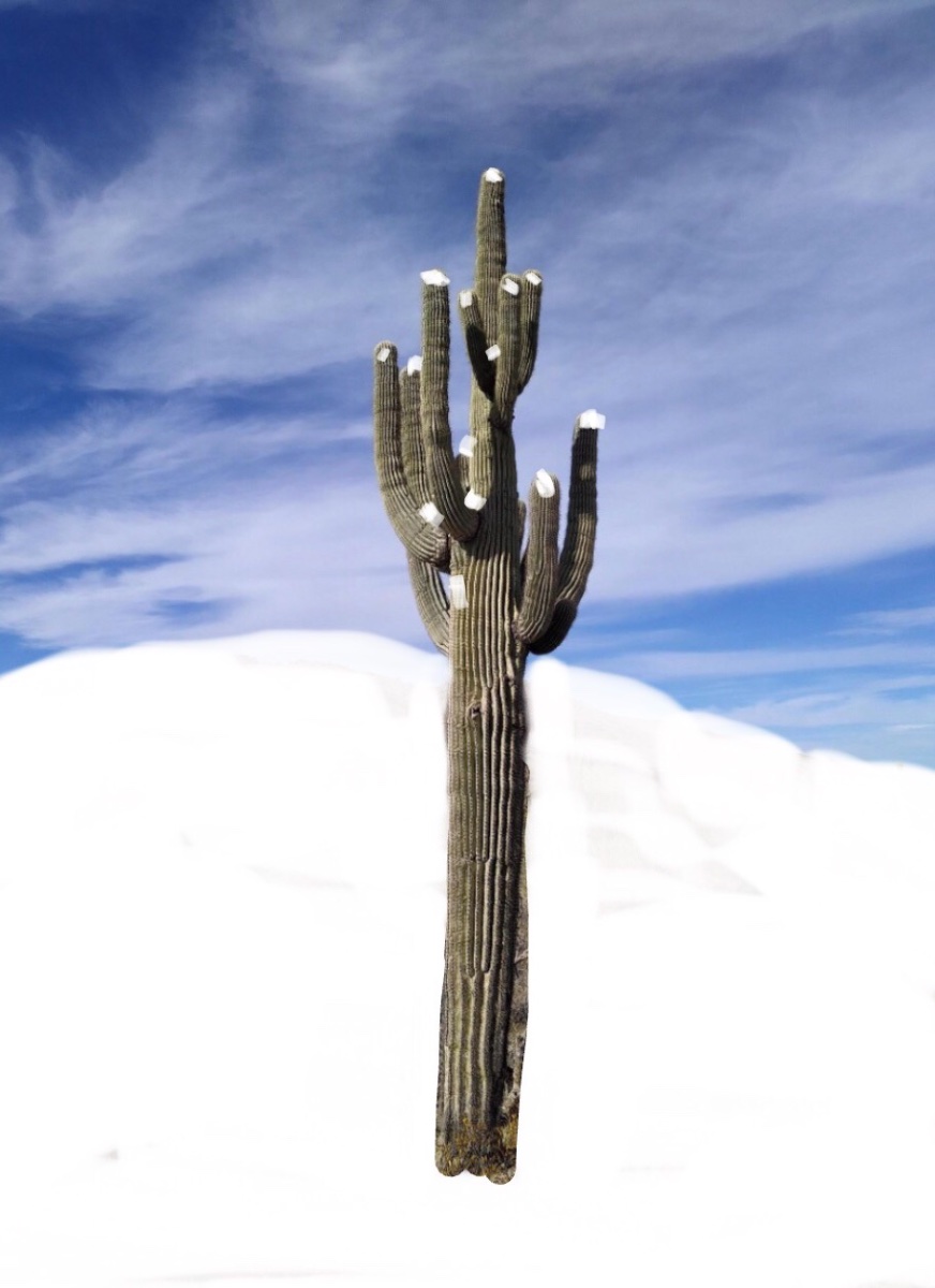
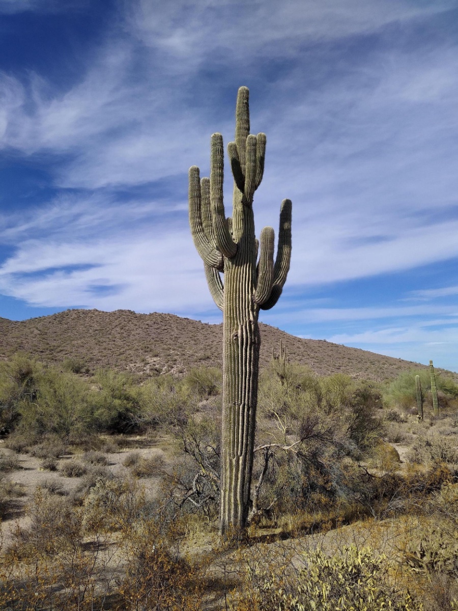
Allow me to post a picture of a Saguaro Cactus...
 6 points
 -
Here is my shot! Not much snow left, will be interesting to see if any of it makes it until Christmas. Currently 29 degrees.
 6 points
 -
06z GEFS ensemble mean is impressive.
 6 points
 -
Wow 0z Euro control with almost historic amounts for mby. This is at 10:16 points
-
Total guess, but looks like about 7”. Still pounding.5 points
-
18z GFS splits the vortex D10-11 now. Timing moved way up.5 points
-
Holy smokes some big hits on there! That's crazy to see a mean that high this far out.5 points
-
12z GEFS mean5 points
-
I'd be ok with the Canadian.5 points
-
38/29 the past 2 days. Looks like we have 6-7” of snow left. The official measurement for Shawnigan was 11” for the storm. Either they got a little more just to the south of here or they have a generous measurer.4 points
-
12z GFS mean. Still a lot of spread among members.4 points
-
It certainly could be sooner. The -NAO all of the models are showing in early Jan is insane. Coupled with a -PNA that rapidly forces a deep trough over the NW.4 points
-
This was just west of Palmyra I believe. So that was a little scary lol.
 4 points
 -
It is pounding!! I'd say 5-6" by now.....4 points
-
Me looking at the models but also reading Phil's comments
.gif.e1e7d8b8dce12456b3d82647ecc8baed.gif) 4 points
4 points -
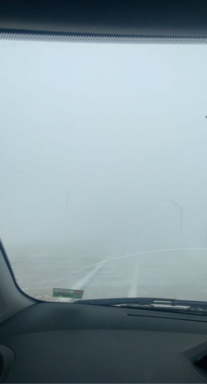
I just tried driving to the store for some beer. I got onto the main road and for the first time ever I thought to myself ‘I should not be on the road right now.’ I can’t believe how intense it is out there.4 points
-
WE GOT TIM!!! CALL THE MEDIA4 points
-
Euro with a record breaker for us if this came to fruition.
 4 points
 -
This is absolutely absurd! Glad to hear this thing is working its magic down in NE! Looks like we are about to get this party started in not too long up here in the Twin Cities. Very curious to see how the HRRR and RAP perform with this because both are showing a TON of snow. Merry Christmas!4 points
-
Hitting a couple stores right now before the show gets goin. Down to 41 now with light rain. Very dark out. All the vehicles have their lights on. Some street lights are on too. Virtually no wind yet. A bit eerie4 points
-
My wife is making Greek Butter Cookies, which are phenomenal. Also, I am expecting lots of packages from NYC, so looking forward to that. Here is an i.e. of a batch of Greek Christmas Cookies: "Kourabiedes" The ones on the right are called Melomakarona:4 points
-
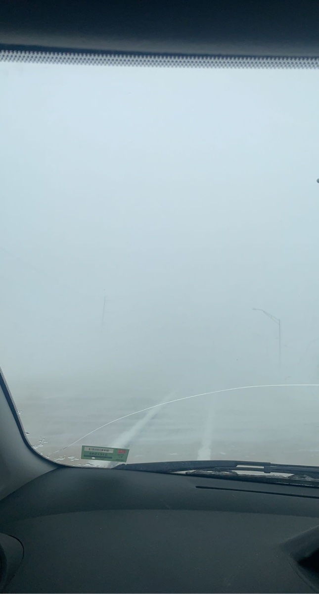
My area got upgraded to a blizzard warning and we have them. Crazy how fast conditions changed; I went and picked up groceries and snow was just blowing. Then 10 minutes later snow moved in and visibility went down to 1/4 mile or less! The flash freeze turned the roads into a sheet of ice and the wind pushes your vehicle off the road. I can always tell how bad visibility is by looking out my back yard; the town elevator is 3 blocks away!
 4 points
 -
Yes sorry here is the end of year storm, here is a break down.4 points
-
12z NAM with a 14” swath right through the metro. 3km with a ridiculous 20” total over Ramsey and Hennepin counties for St Paul and Mpls. Probably a tad bit overdone, but fun to look at. If we get +12” and 50mph gusts I’ll never ask for anything else for Christmas.4 points
-
Major highway in Central Nebraska closed.4 points
-
Surprise here. Had 1” of snow around 3 AM. Now in a WWA for 1-3” more with winds potentially gusting to 65 mph. As I’m typing, snow has moved back in. Was supposed to go to Lincoln this morning to pick up a car for my daughter. I’ll go another day as we’re having flash freeze conditions. Also, if you’ve driven I 80 across Nebraska, it is very flat and winds this high with snow, is a recipe for disaster on one of the busiest travel days of the year.4 points
-
WOW- (date is wrong) but obviously this storm- A major winter storm to impact the area today. Snow, high winds, and blowing snow are likely to begin this afternoon and will cause disruptions to travel and the evening commute. Heavy snow and high winds may cause blizzard conditions and blowing snow across the entire forecast area. Winds may gust up to 60 mph.4 points
-
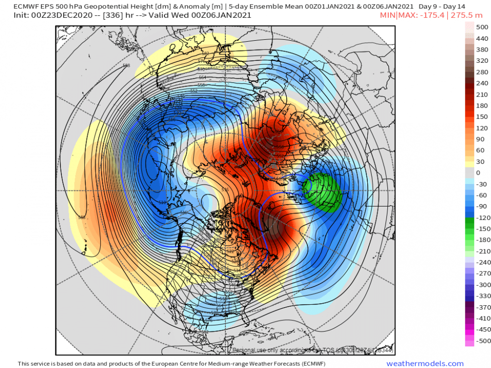
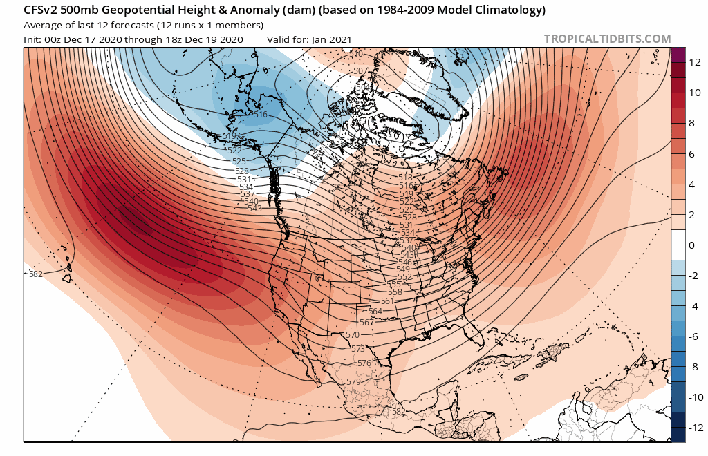
It is starting to become very clear that a MMW SSW event is going to take place as we open up January. Will it be a Polar Vortex Split or Displacement is the question??? If your a winter wx enthusiast, this month will feature things that I have not seen in years. It would be truly amazing to witness some of the things that are being forecasted by the models. In any event, the opening week of January is showcasing the long awaited return of the "Greenland Block" and it is likely to Rock! Last night's 00z EPS 5-day mean illustrating an eye opener way to open up the 1st week of 2021... If the CFSv2 is right, is a Jan '14 redux in the works??? There are some impressive indications that the "Nanook From the North" may indeed Freeze the nation next month for millions east of the Rockies. No joke, but I'm convinced that the climate models have ZERO clue of what to do with the high lat blocking this season. It almost feels like if they forecast blocking in the Long Range, it disappears in the short range. This year, the climate models forecasted no blocking and now there is immense blocking! I guess its better to see them flash a non-winter scenario than a good one. Needless to say, next month at face value looks deliver some interesting wx phenomenon's.
 4 points
 -
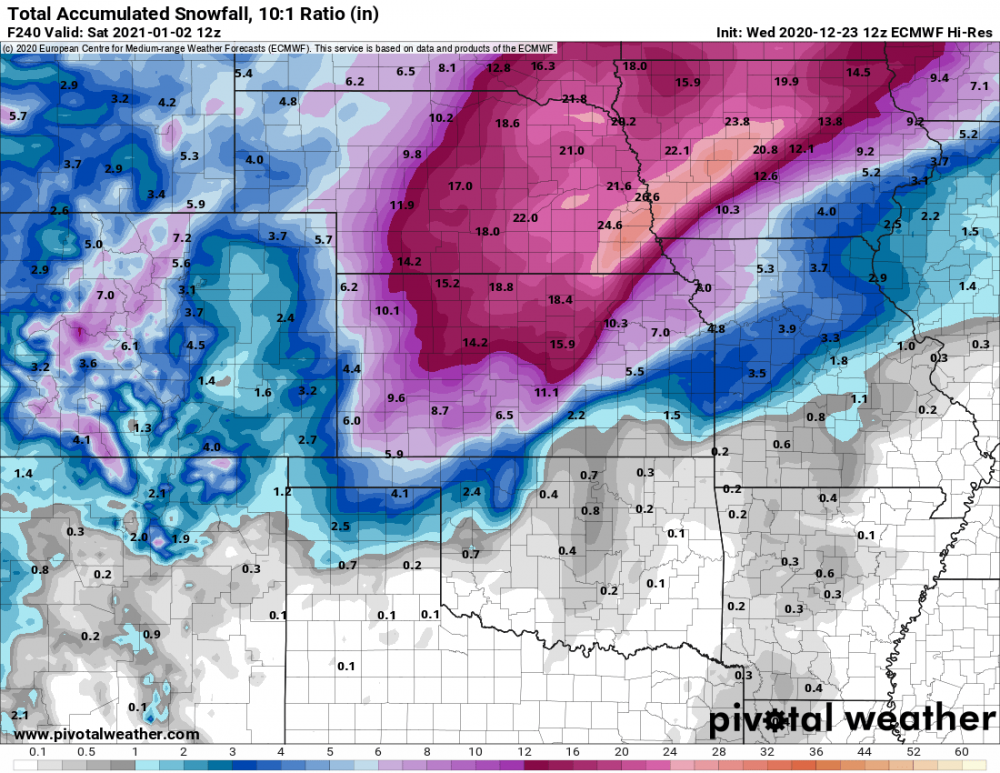
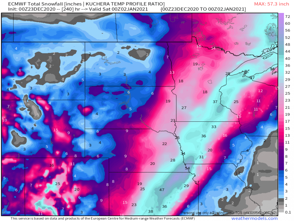
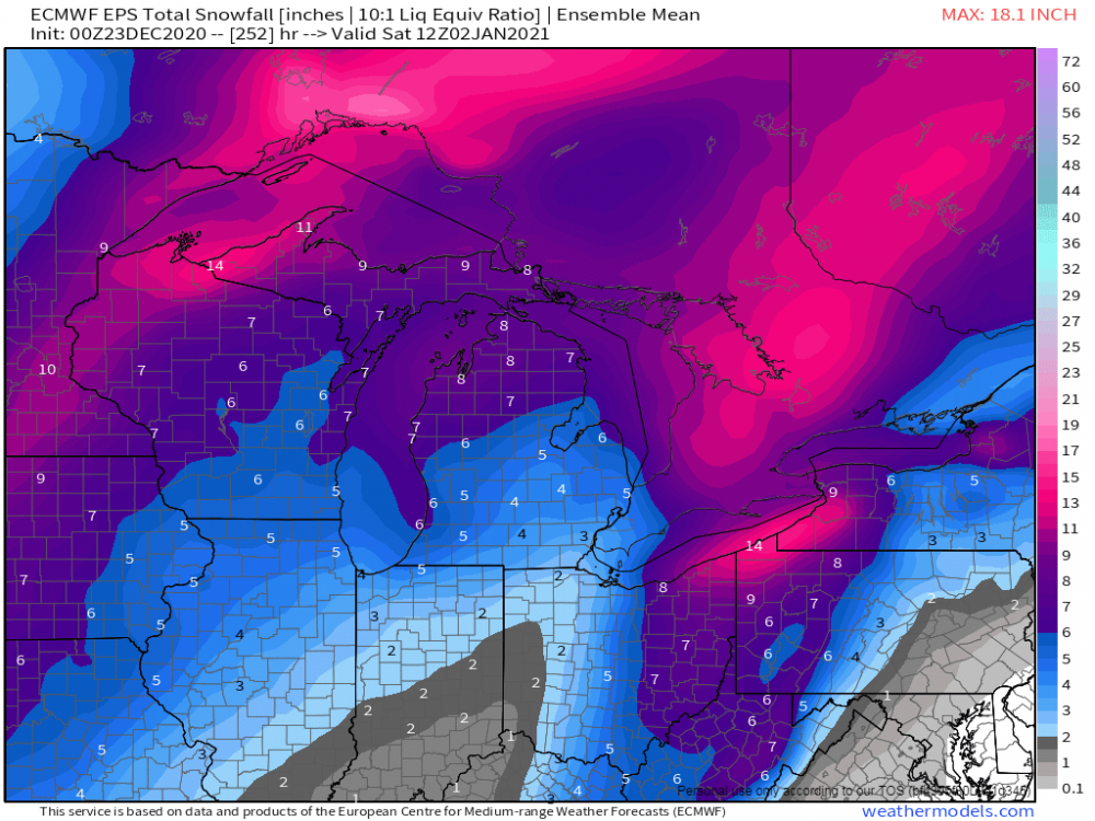
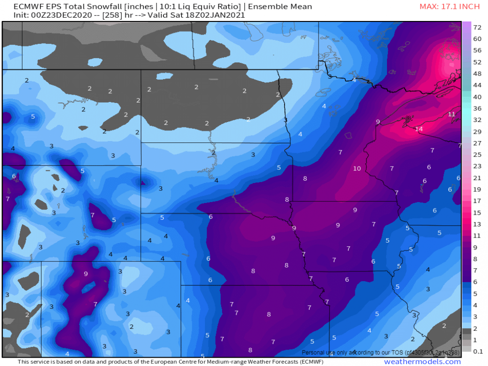
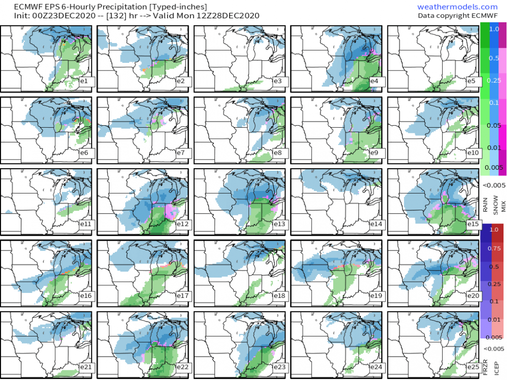
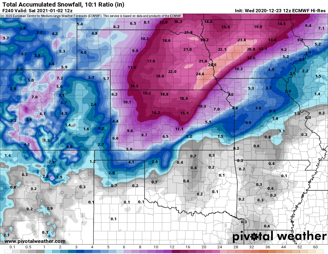
This is probably one of the wildest runs I've ever seen off the Euro showing a max of 54" near LNK...these are runs you typically see from Nor' Easters...enjoy this weenie run! Like @CentralNebWeather said yesterday, how many more times will we see shifts in track and intensity??? The amount of blocking showing up in the models during this period will make tracking this Big Dog quite interesting and fun. Giddy up! Anyone else excited about storm tracking??? This pattern is about as exciting as I've seen it in a very long long time for nearly all of our Sub. Just about every model is dialing in on a major New Year's Holiday storm. I just love it when nature can dial up a wx system to track during a holiday period. Just hope one can be on the benefiting side of a snowstorm! Speaking of storms, the next system on deck is for later this weekend for parts of the MW/GL's...it doesn't look like a very large system, more or less, a teaser before the knock out punch to 2020...grand finale??? 00z EPS members for the 27th/28th system... 00z EPS...big time signal this far out for a potential massive storm...
 4 points
 -
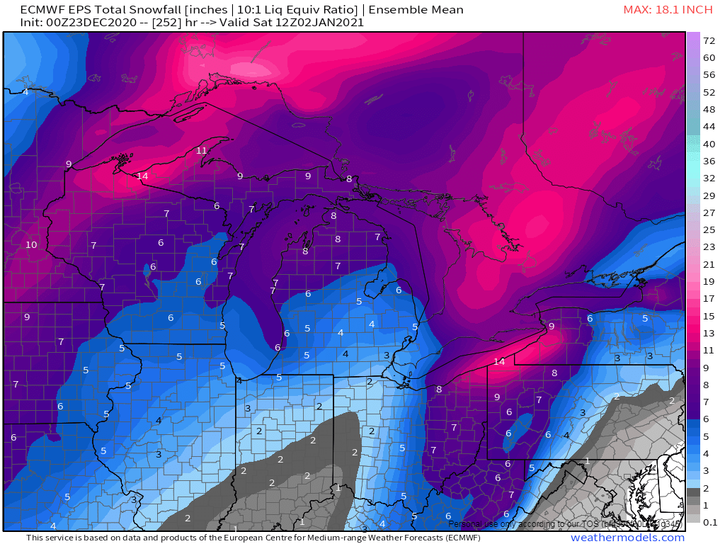
The last 10 runs of the GFS showing the clear indication of the "MSP Defo Band Magnet"...
 4 points


This leaderboard is set to Vancouver/GMT-07:00