
Leaderboard


Popular Content
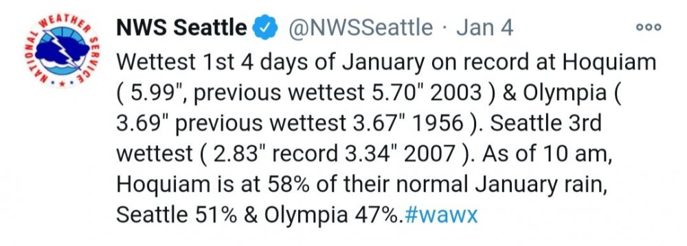
Showing content with the highest reputation on 01/05/21 in all areas
-
12 points
-
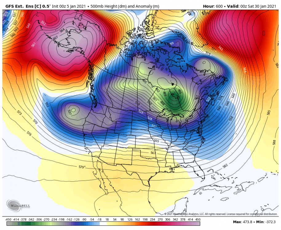
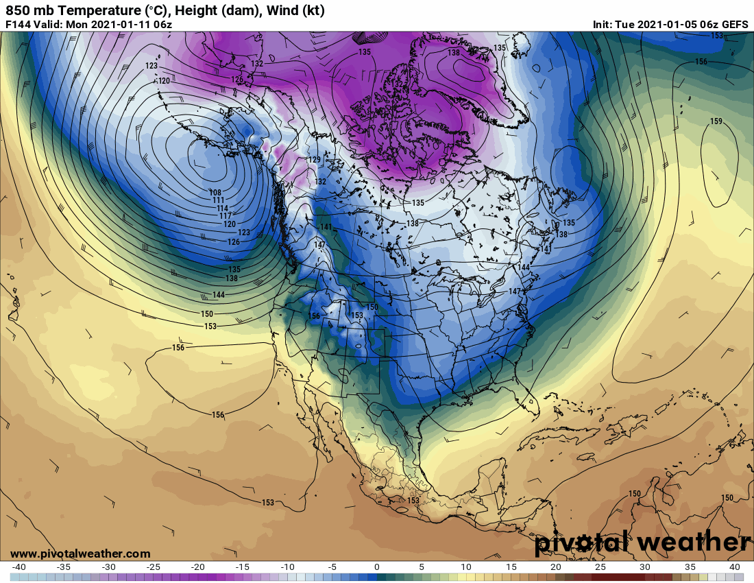
18z GEFS Day 8-16. Hard to not like this. The improvements continue. Best yet. Let's keep the good run-to-run consistency going and also move timing ahead. C'MON!!!!
.thumb.gif.2f47039b4a83dc19455a6c9d6f6ed332.gif) 9 points
9 points -
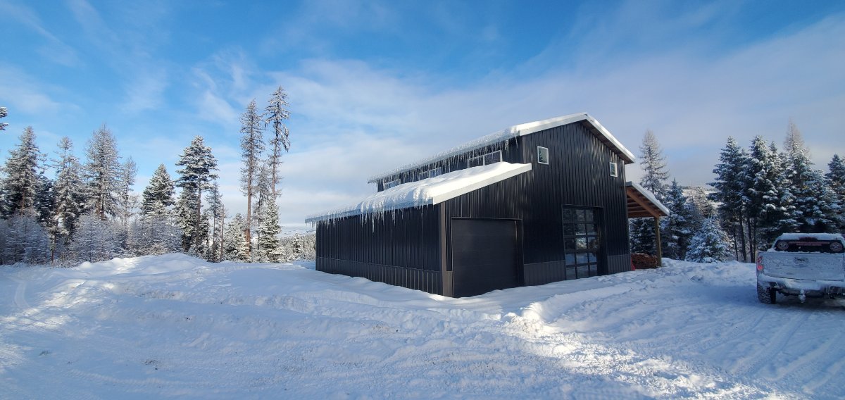
Here is my brother's place we built. Still needs finished inside but they have been going up on weekends and relaxing. The garage door is a triple pane door that opens the living room for some fresh air.
 9 points
 -
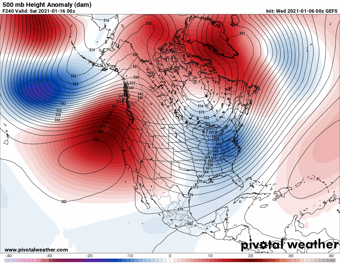
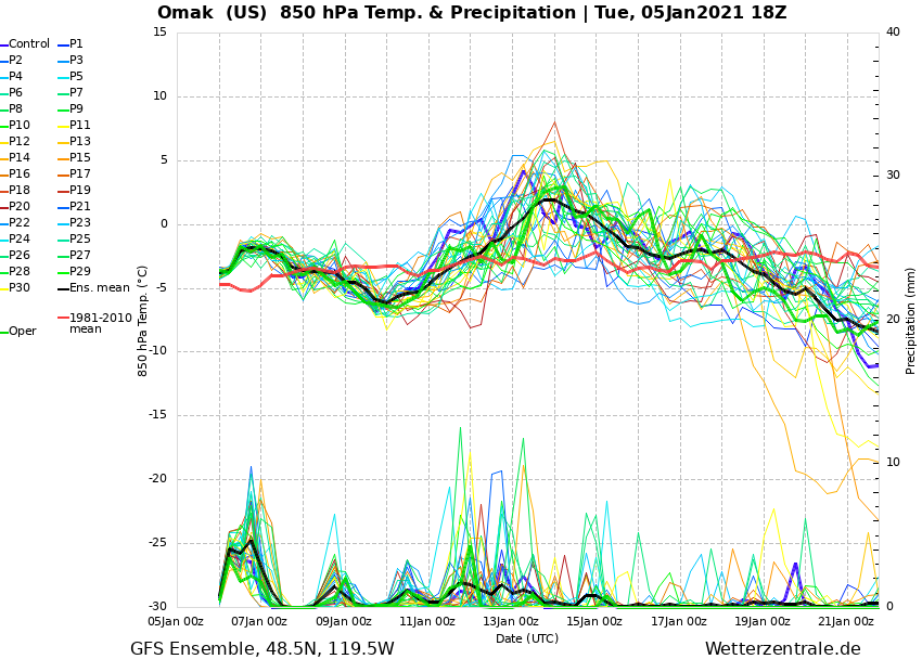
Looking at 850mb temps at that range is not a good idea. Not that looking at the long wave pattern at that range is a considerably better idea, but there is at least some skill there. It’s not the same as chasing weeklies or phantom “blocks” as was happening throughout December. There is at least bit of a signal for a significant pattern change (ridging followed by some manner of retrogression) in the long range. Don’t get wound up about the details and let it ride.8 points
-
GFS V16 has a much more robust block8 points
-
GEFS day 16. I’m sure someone will still say this is terrible and winter is cancelled.
 7 points
 -
It is flat out amazing how much snow this d6 cat will push!. It will just idle it's way through 3 feet of snow and not even breath hard. My daughter is 5 feet tall for reference.
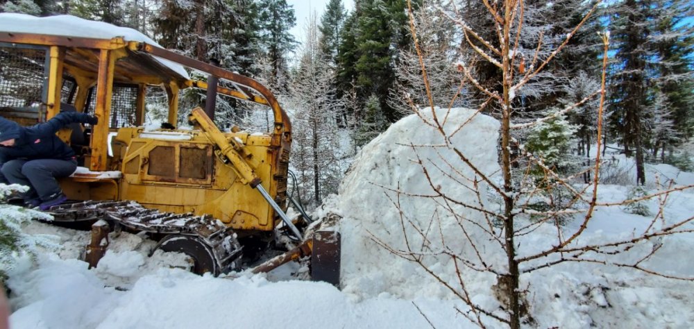 7 points
 -
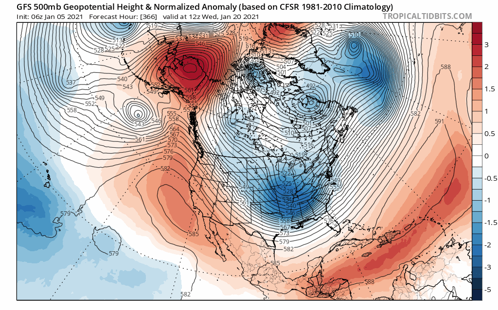
6z GEFS Day 8-16. More improvements. Ridge/evolving block retrogrades slowly but surely to the 'sweet spot' with favorable tilt and quite a strong signal that far out. Also noted after Day 6 a huge chunk of bitter air in the high Arctic slides south into central Canada. Nice to see the Vodka on our side of the pole. Once that trough kicks out of the eastern US heights will rise/ridge build over the southeast US and we'll be set. It is remarkable how the GEFS progression is in near lock-step mirror both the GFS Ext. ENS and Euro Weeklies. Depending on how soon the Aleutian low weakens and NPAC jet retracts it is possible sharper retrogression occurs even sooner. Cautiously optimistic. C'MON!!!!
.thumb.gif.2f7fd58dee6a9c53a184f0e324e84ab2.gif) 7 points
7 points -
6 points
-
You think ensemble means will adequately capture a discontinuous retrogression that is still ~ 2 weeks away? The fact we’ve seen the LR signal transition from raging Pacific jet to legitimate NPAC blocking in 3 days (let alone for retrogression of said blocking) speaks for something, IMO. Nothing is ever guaranteed, but this is more than your typical extended range vacillation.6 points
-
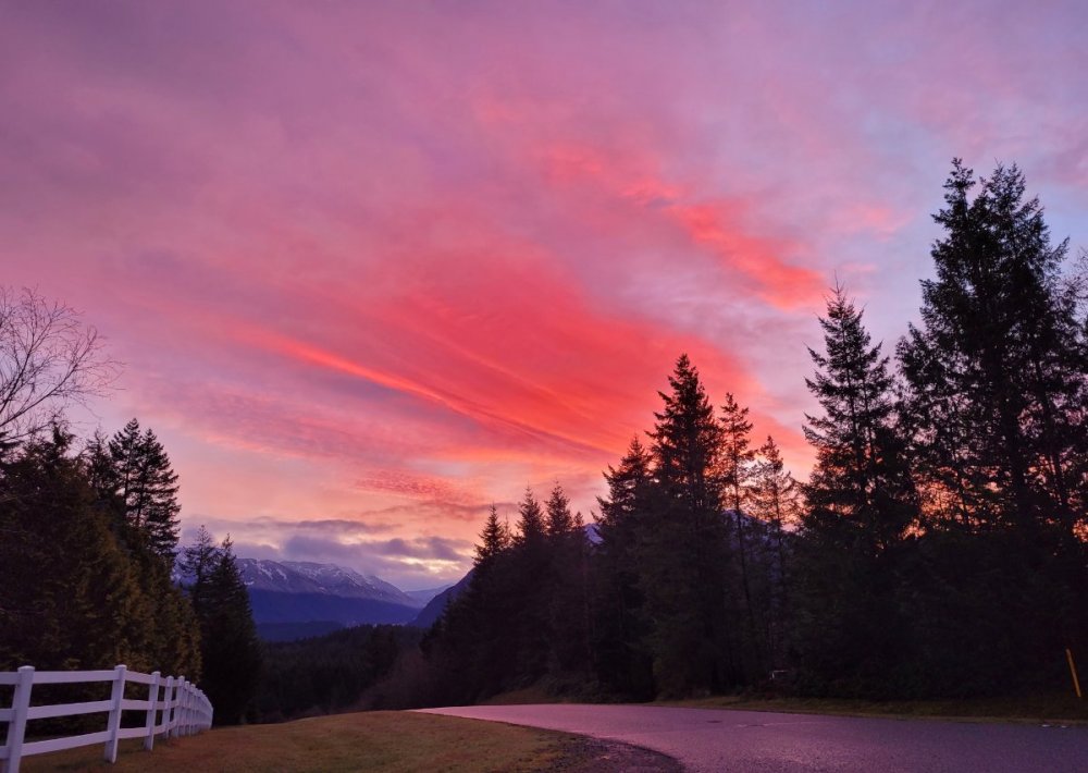
Same here Hawkeye, the stagnant blocking pattern is creating a uniform forecast through the next 7 days. If its not going to snow in a "warm" pattern, I'd rather have it cloudier along with seasonal high temps. The overnight lows are really driving the AN temp regime. My local grid showing temps continue to trend lower with daytime highs AOB normal, I guess its the silver lining in this pattern. Colder temps will certain allow the snow to stick around and the clouds will aid in that dept as well. The foggy pattern has created some gorgeous photos out in the western burbs...#HoarFrost6 points
-
BTW, I'm actually feeling rather optimistic about our chances for some chilliness. The jinx is on!5 points
-
By design... the reverse psychology tactic is an attempt create some type of win-win situation for the person. Even though its pretty hollow in reality. If the person is right then at least they can say they were right. And if they are wrong then they really win big. Its a form of self protection from disappointment. I deploy it all the time during Seahawks games!5 points
-
I've never mentioned this before, but I'm rather amazed how many members here can recollect so quickly what events have happened, when they happened, and you have pictures of those events. I think that alone adds a lot to the Forum. 00z ECMWF in 3 hours 50 minutes5 points
-
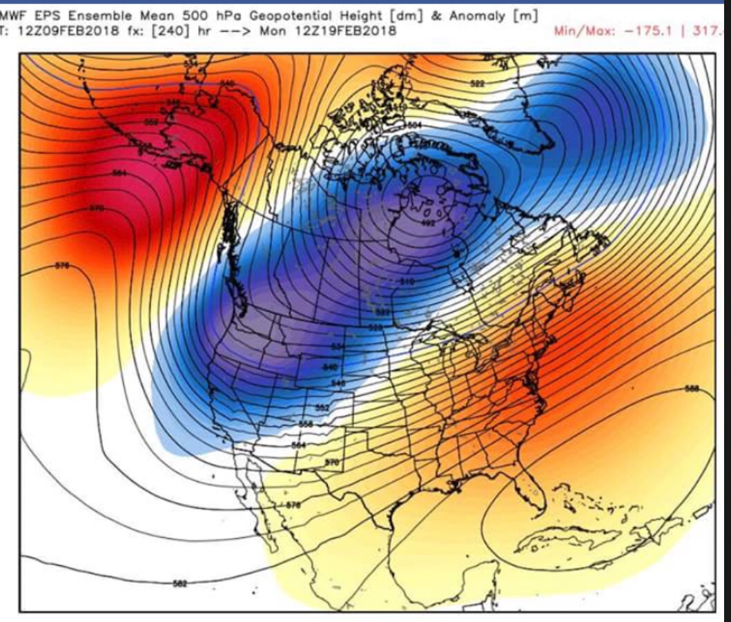
At 576 hours it looks like things fall into place. Nice looking block but 576 hours...lol
 5 points
 -
I’m still struggling with whether this is better. I never really have a need to know what the weather is going to do more than a week or so in advance and I like surprises. Hell, now with the SSW craze we’re going out of our way to predict surprises weeks in advance. Makes me nostalgic for the old days where you had to wing it with an ensemble blend of local network meteorologists and NOAA weather radio’s five (5) day forecasts.5 points
-
Another look at the GFS-para 18z. Pretty.5 points
-
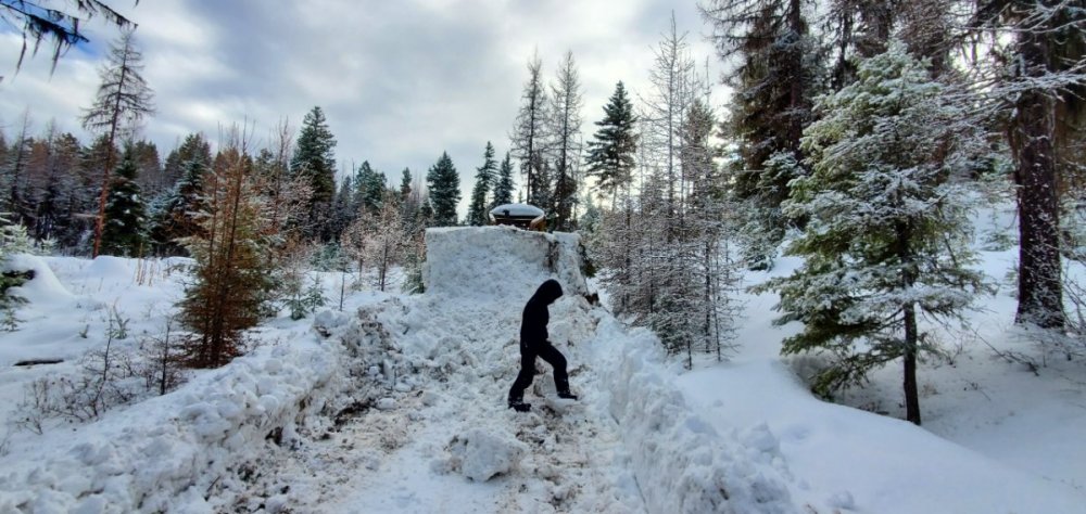
See those bent tree's to the right? That is from 2 years ago when a freak wind storm rolled through.
 5 points
 -
One year ago today the GFS was just a tad snowy . . .
 5 points
 -
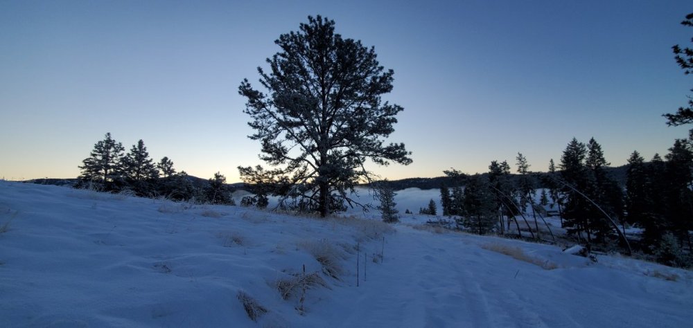
A brief break this morning in this very gloomy period...
 5 points
 -
For the first time, we have a cluster of legitimately tricked-out EPS solutions popping up in the D13-15 range (with regards to blocking + retrogression into GOA/NPAC). Sis is taking 1st shift driving so I’ve literally had nothing to do but peruse model data and strat/tropical obs from JMA. Really digging into stuff for the first time in several days, haha. ..and for what little it’s worth, I’m as “on board” as I’ve ever been. If I lived out there I’d be feeling pretty optimistic right now. Not just for the second half of winter, but also for the prospects of a cool (if not downright cold) spring.5 points
-
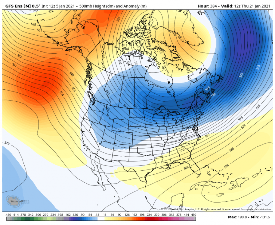
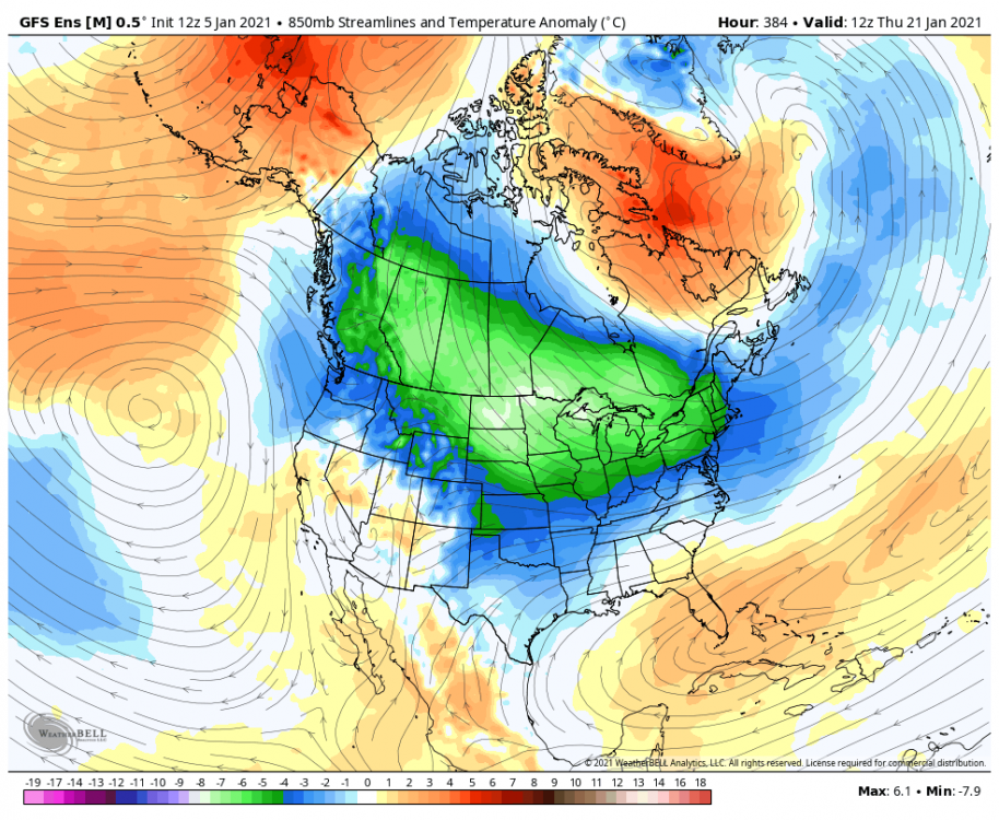
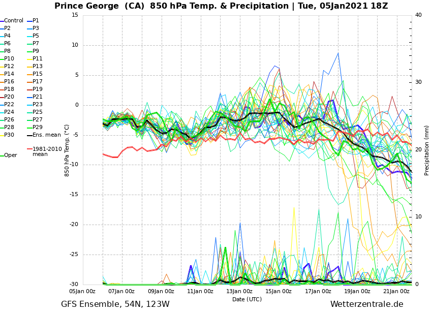
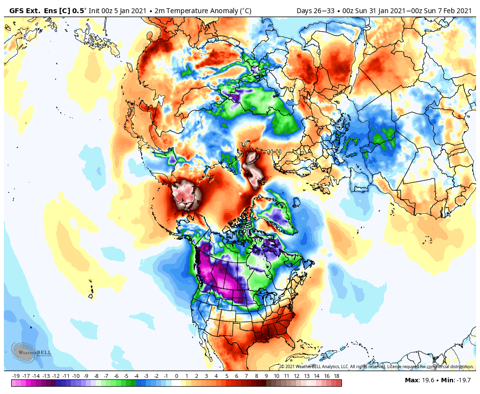
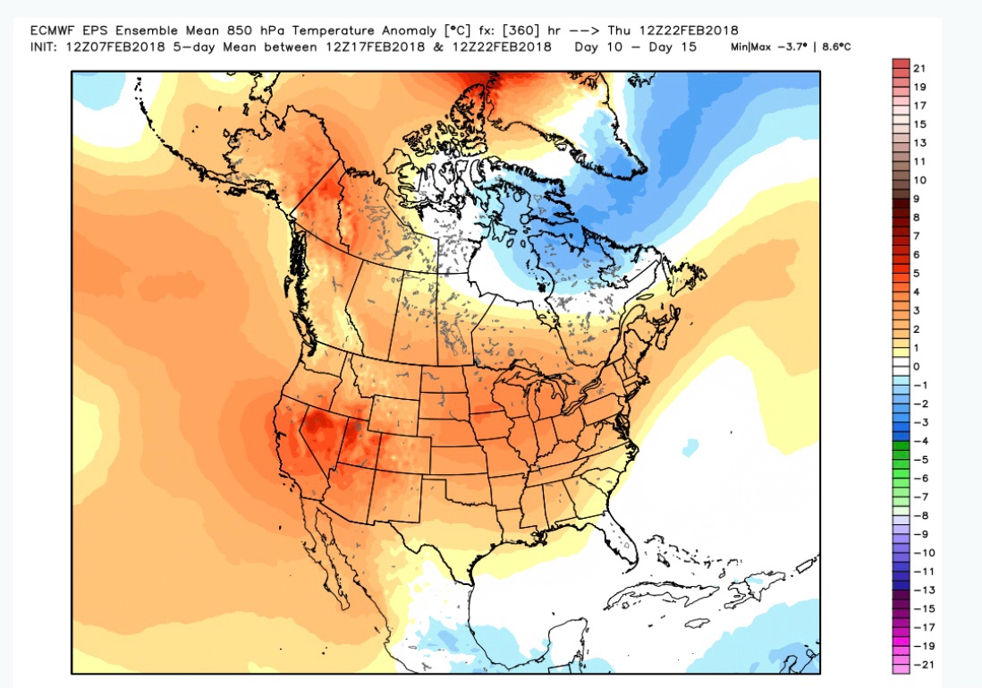
Day 6-16 850s. Nice to see some cold on our side for once. This is just the beginning.
 5 points
 -
Was just going through the first few days of February 2018...Phil was warning us about the SSW and to not trust the models that looked terrible, I was NOT on board and was whining about the non-stop rain, drizzle, Tim had enough and went wine tasting in Eastern Wa, and it seemed the GEM was the first model to start seeing some changes...5 points
-
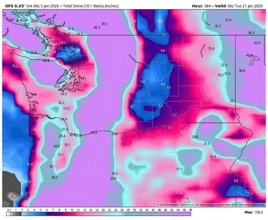
00z GEFS Day 10-16 Not too shabby.
 4 points
 -
We best move this discussion to the political thread. We have enough to monitor here with the 00Z runs.4 points
-
From yesterday...
 4 points
 -
Just a thing of beauty!4 points
-
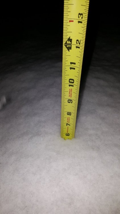
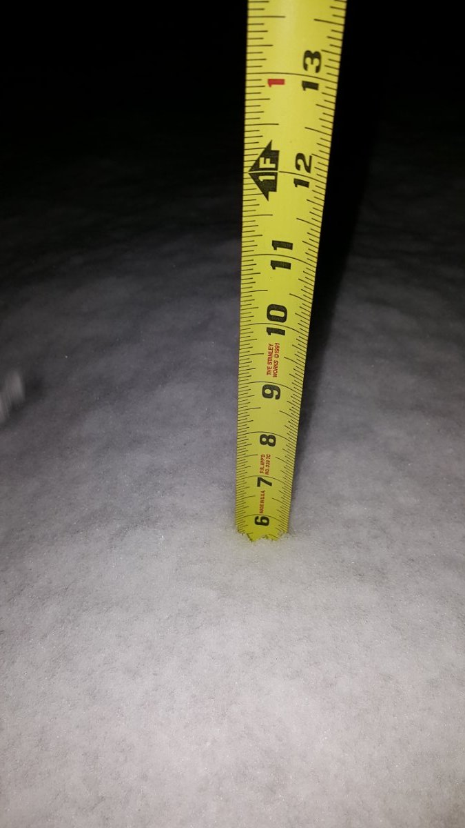
Alright alright let me try this again. I was off by a year earlier lol. This was taken the day of the Super Bowl 2017. The measurement made the front page of a KOMO news story. There's nothing like heavy snow at night. I hope it happens again soon! ❄
 4 points
 -
Okay boomer...4 points
-
The Pacific definitely shuts down.4 points
-
Looks like our March graupel shower is ON!!!4 points
-
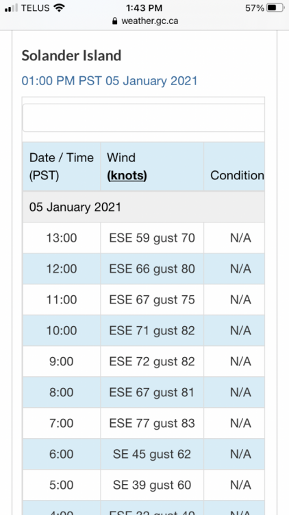
A bit of wind on the coast today. 89 gusting to 96mph.
 4 points
 -
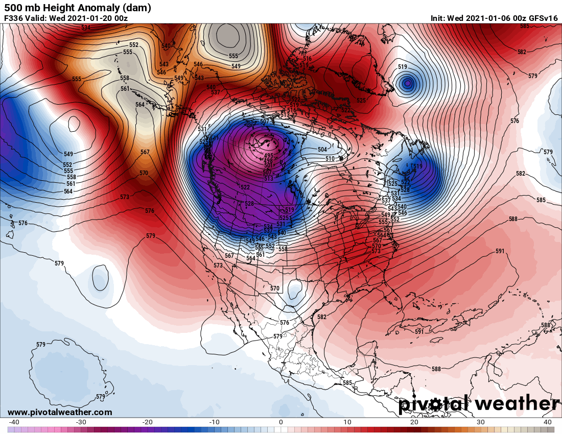
I’m still on this fascinating February 2018 kick, but it is so fascinating to see how dramatic of a shift the EPS took in just one day. Not saying we will see a repeat...But... *DISCLAIMER THIS IS NOT CURRENT JANUARY 2021 MAPS!*
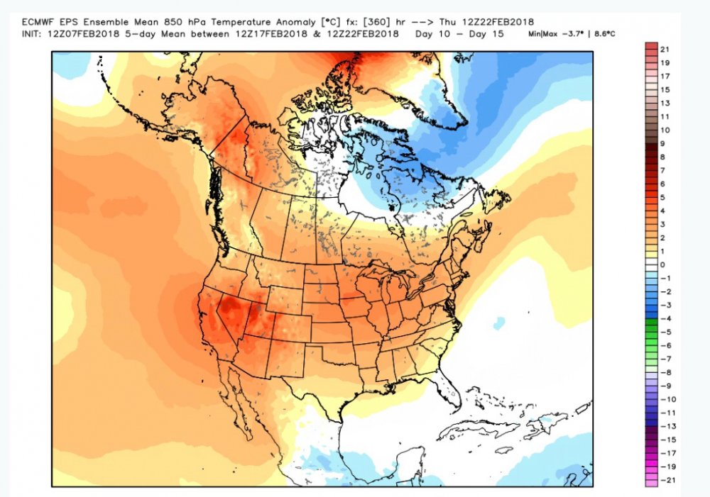
 4 points
 -
This is literally the worst start to winter in the history of W Michigan. We have the right to complain. Above freezing temps on top our first little snow fall is cool and all, but this isn't winter. Not sure what the rest of you arecomplaining about. Some of you have had plenty of snow. 2014-2015 isn't happening though. As much as some hope to look for it. It will get cold and we will get some snow. It has happened every winter. But in reality, this isn't a "winter" in W Michigan.4 points
-
Yeah the fact it’s an ensemble mean probably dampens signal for amplification. But it’s a notable shift westward + more amplified from 12z.4 points
-
LoL. Passed thru your region today and there's a solid 4-6" OTG. You've got solid winter. Come down here if you want to see #jokewinter conditions. This latest "snow-banza" 1-2-3 punch brought a total of 3.5" but included 2 rains & above freezing temps leaving a patchy 1". This is one of the lamest excuses for snow cover I've seen in my 18 years around here. I'm sure many on here would gladly trade places with what you've seen this past week. I'd post maps but it seems GRR didn't do any event summary maps. Last one I snagged was on 12-26 for the LES.4 points
-
Yeah, whatever one shows us want we want to see gets the crown.3 points
-
People are right than the Ensembles are the main show, but the 00z Op is definitely a significant improvement in the 12-14 day period. Last 4 runs at day 14:
 3 points
 -
I agree. Politics should not invade the weather thread.3 points
-
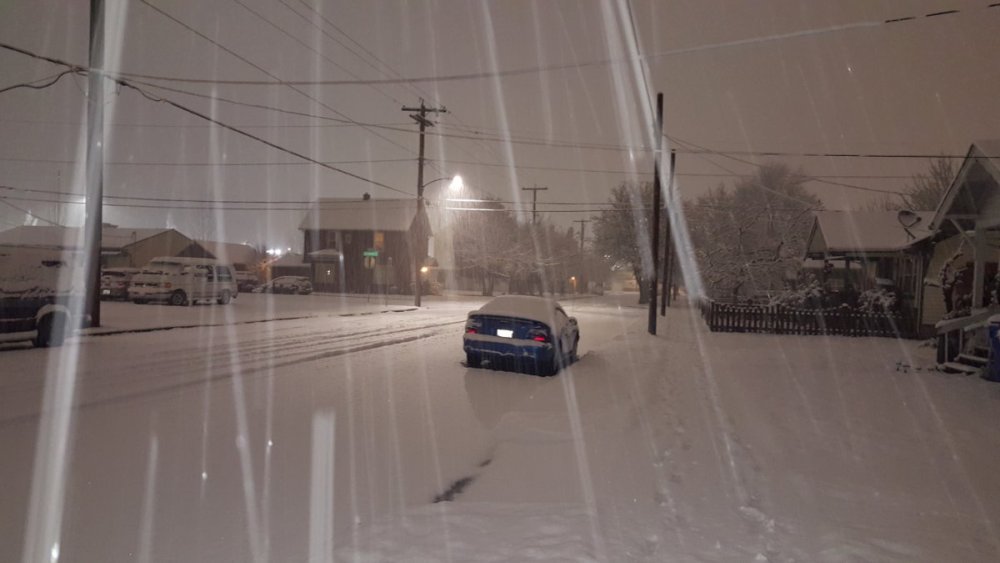
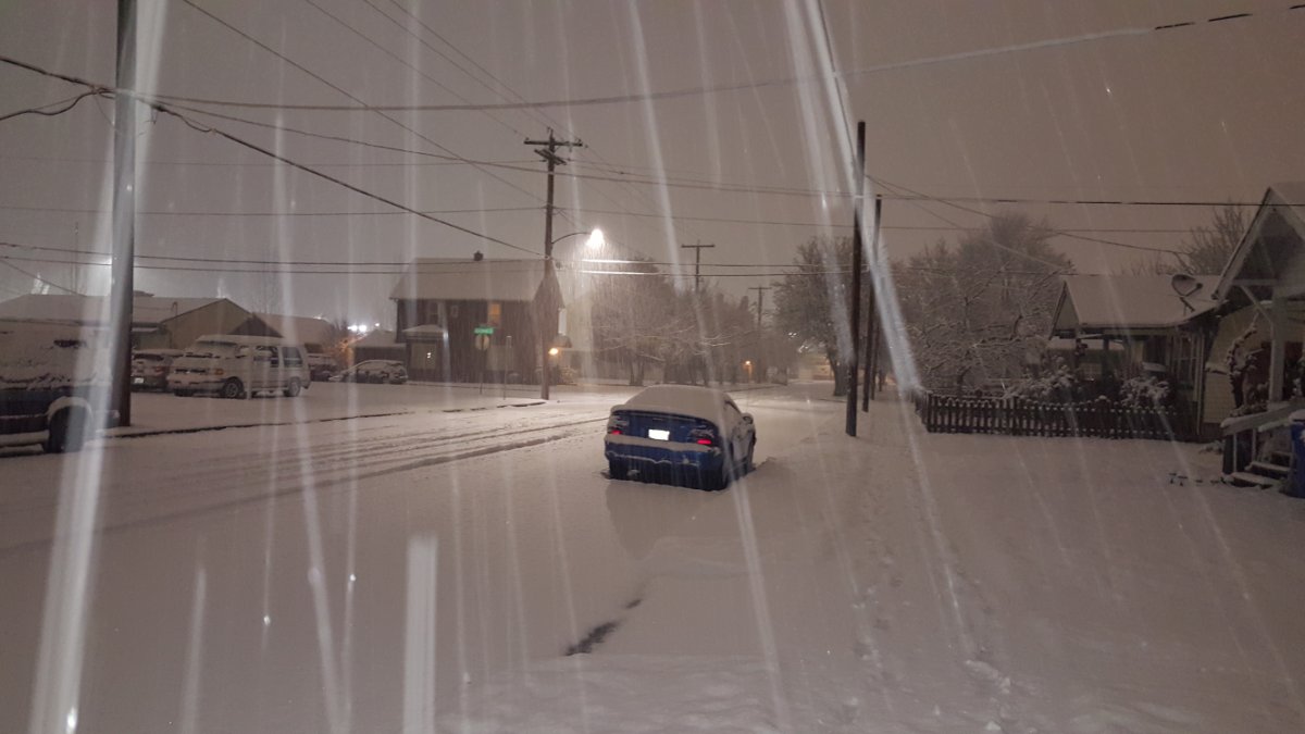
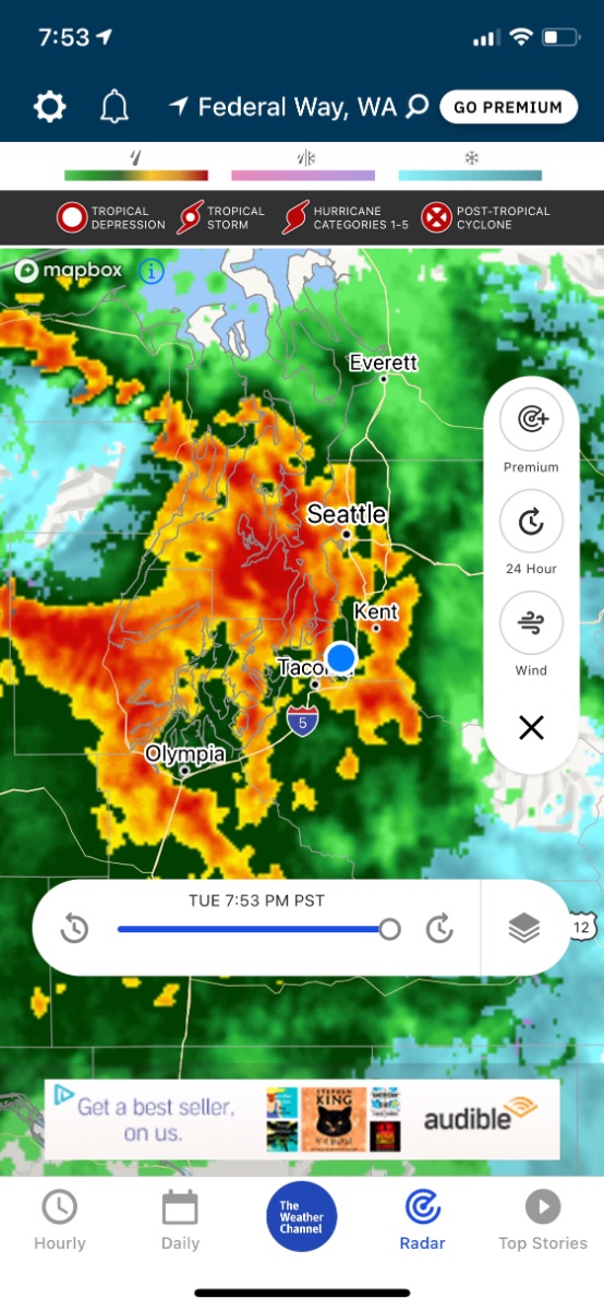
Current events It’s really coming down around the Sound....again!
 3 points
 -
He's putting together a true greatest hits collection.3 points
-
Here's a look at what's upstream
 3 points
 -
Still looks to me second half of January will be colder than normal , question remains if it will be cold enough to offset the mild first half. There’s too much stretching of the imagination going on....just seeing some light orange colors over Alaska and light blue over Montana ain’t going to cut it. need white hot/red hot blob right over Anchorage, not over some forsaken container ship at 48N 150W to get real cold vs this fake cold frosty krap3 points
-
Sick of hearing about the February 2018 recap yet? Well sorry you get more anyway! Wow the further I get into the pre February 2018 madness the more I see the models struggled HARD! The EURO on the 10th said NO to any cold air source even though the 500mb setup was favorable. It showed a high of 49 degrees at my house on the 20th so 10 days out...In reality the transmission linkage on my truck was in cased in frozen rock hard ice that day that was slush when driving in a foot of wet snow on the 18th. I did not get above freezing that day.
 3 points
 -
I wouldn’t quite say it popped up out of nowhere. The ensembles have been hinting at it the possibility for a few days, but yeah... The “warmer” versions would certainly break the positive anomaly monotony. Down side to a prolific western ridge is that history tells us the retrogression path, which seems likely, is often quite a bit slower and less prolific compared to big pattern breakers. Still should be a much more interesting second half of the month either way.3 points
-
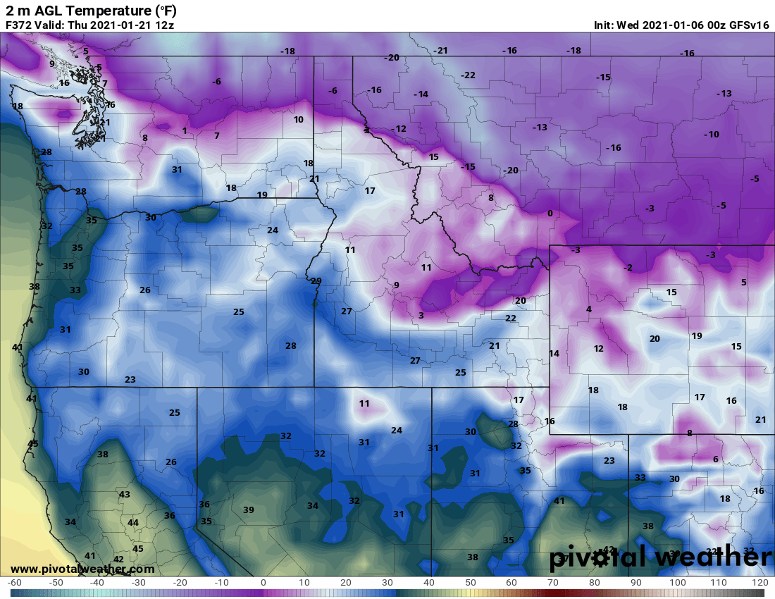
12z NAM still trying to make something out of tomorrows system. Temps look marginal for KC area.3 points
-
What’s interesting about this SSW is the prolonged nature of the wave-1 (displacement) at the projected amplitude. The vortex itself actually remains intact while displaced well off the pole. There’s a LR signal for a follow-up wave attack w/ a more favorable structure for a wave-2 response @ 10mb. If that’s the progression, then it’d be one of the most dynamically interesting events in the satellite era. But even with the displacement, u-wind at/below the tropopause is very weak, so we’re not waiting for the wind reversal to downwell into the troposphere..the blocking has developed concurrently with the stratwarm. If we had a +NAO right now, then we would probably have issues.3 points
.gif.54a94ddcf9626a6f51fe4c5607e0f381.gif)
.thumb.jpeg.e3014abf99ef08a9f9ac2c0cd31b485b.jpeg)


.gif.44bded294b74c3d71e265b0808032f90.gif)


This leaderboard is set to Vancouver/GMT-07:00