
Leaderboard


Popular Content
Showing content with the highest reputation on 01/06/21 in Posts
-
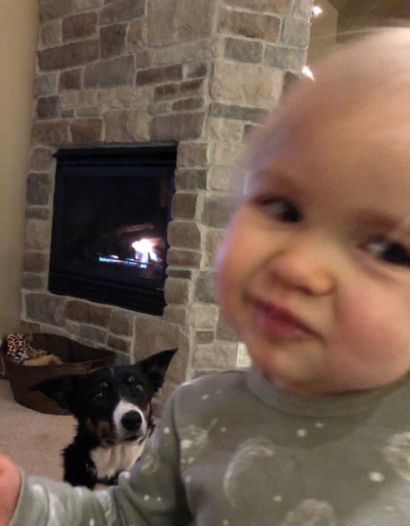
37 degrees. My 2yr old is skeptical of the skeptics on the forum. Let’s go full Arctic!!
 7 points
 -
Can’t complain about the trend7 points
-
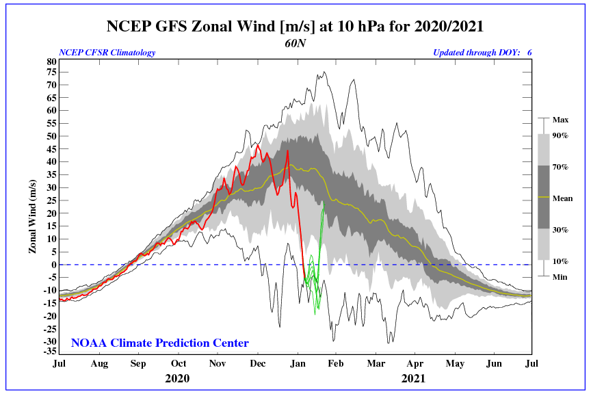
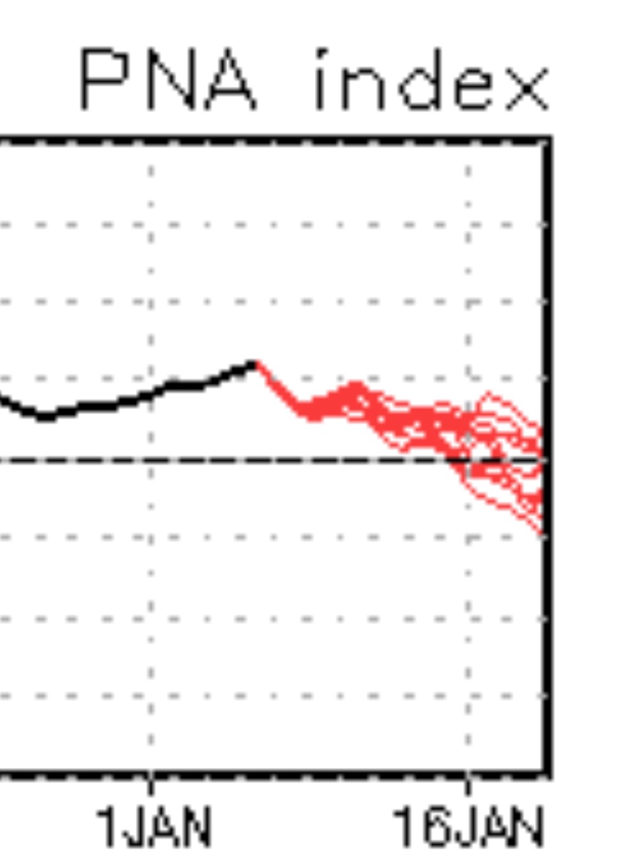
Zonal wind reversal has occurred.
 6 points
 -
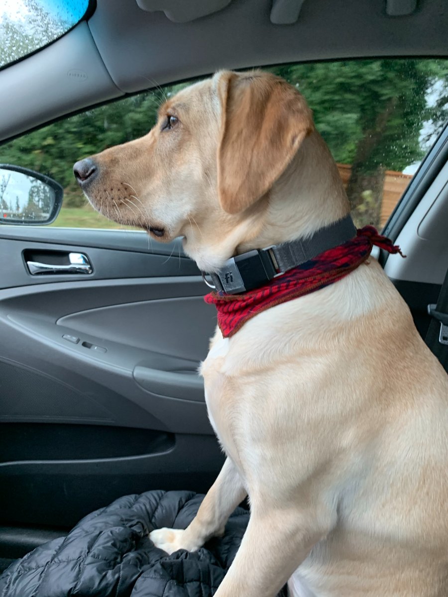
Who needs their dose of puppy?
 6 points
 -
every frame you think he's gone???
 5 points
 -
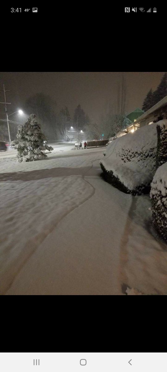
Been getting heavy snow here in fremont for at least an hour so far5 points
-
Currently 42 degrees and drizzle. .11” so far on the day, 3.12” for the month.
 5 points
 -
I didn't see this posted, but I may have missed it. Japan was recently hit with a tremendous ocean effect snow event. Up to 7 feet fell in spots. Below is an article. In addition the all time highest pressure is believed to have been recorded in Mongolia at 32.31" or 1094mb! And if that wasn't crazy enough just to the east of that incredibly strong high was an incredibly strong low pressure of 27.2" or 921mb. Absolutely fascinating. https://www.washingtonpost.com/weather/2021/01/04/japan-ocean-effect-snow/
 5 points
 -
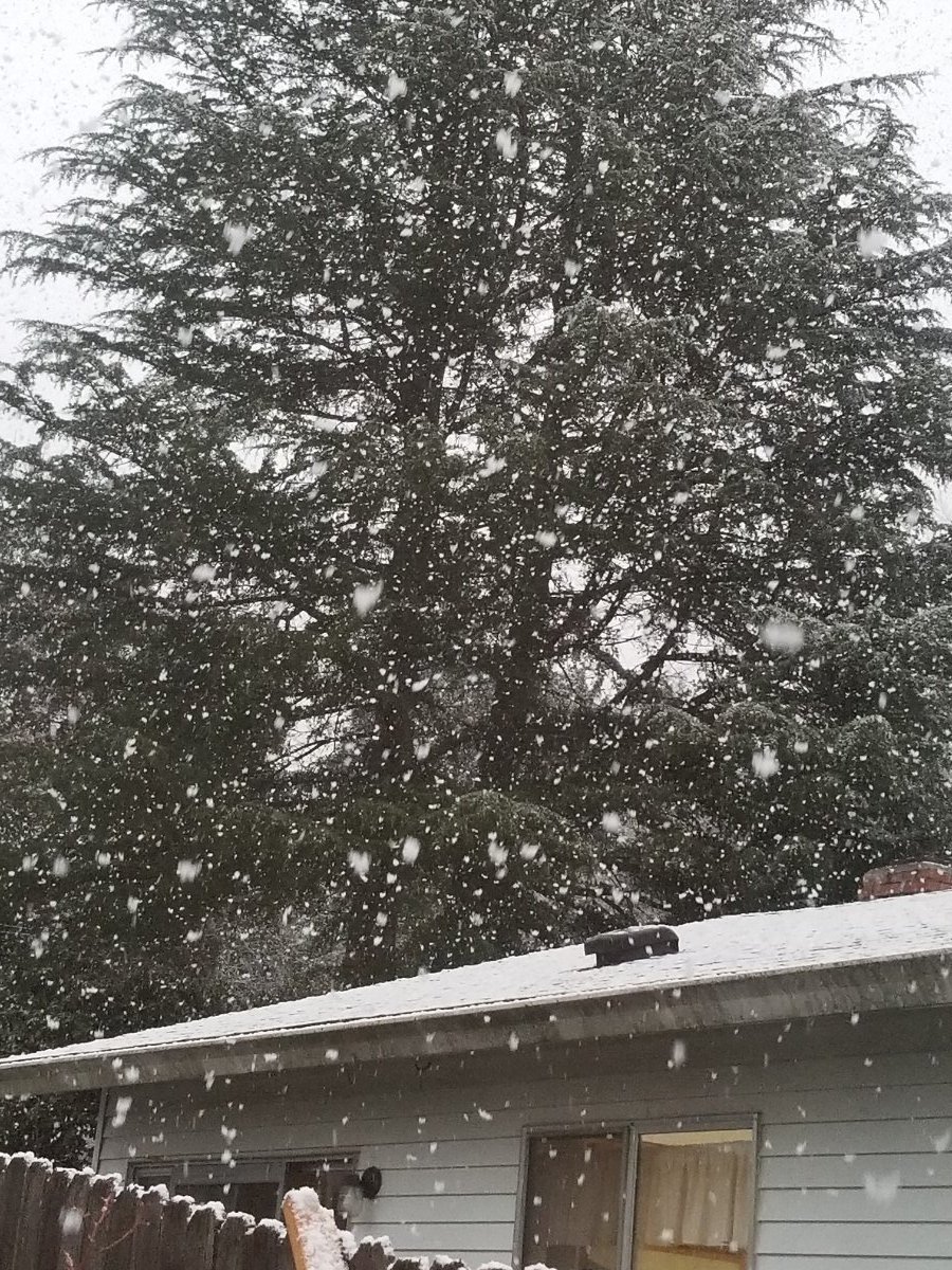
Snowing nicely up in twisp right now. Been waiting for some bands to make it over here after watching my cameras at home in Renton just show constant dumpage all day. IMG_3395.MP45 points
-
A meridonal pattern like this will still greatly benefit your area as it suppresses things south. And California's biggest winter precip events often evolve from the southern branch of the jet strengthening enough to eventually undercut an offshore block... while remaining suppressed south over your area. This is a win-win pattern for the West Coast. More of the Aleutian Low dominated, zonal pattern that we've seen will only mean a continuation of the northern storm track.4 points
-
You guys should rock and roll a bit in February and March.
 4 points
 -
We have a politics thread.4 points
-
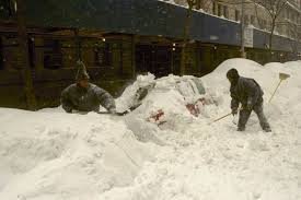
Today marks the anniversary of one of my favorite blizzards of all time in NYC...."Blizzard of 96." It was a blizzard for 2 days straight, non-stop. Travel was impossible!!!! At that time I was living in Northern Queens, about 15min away from the city and I was inundated w nearly 30" and the city had 2 feet. Everything was buried. No transportation for a day or 2, which really slowed everything down. Truly, only on the EC will you see snows like this. Take a look...... It’s one of the defining winter storms of the 20th century and is still a record-holder to this date for several cities. A true blockbuster storm, this nor’easter walloped the Eastern Seaboard in a manner that few snowstorms in the past have been able to do. Over the course of Jan. 6-8, 1996, it blanketed areas from central North Carolina to southern Maine, while immobilizing the Northeast corridor for days. To this day, the Blizzard of '96 remains Philadelphia’s single biggest snowstorm on record with a total of 30.7 inches. Elsewhere, nearly 2 feet fell in New York City, and 18 inches were measured in Boston. Those totals were substantial but still fell short of the largest accumulations in western Virginia and the mountains of West Virginia where amounts between 40 and 48 inches fell, according to the National Weather Service.
 4 points
 -
Not the worst!4 points
-
Lol, hold my beer.....
 4 points
 -
Up to 5.45" of rain on the month. 1.16" today. Still coming down out there.3 points
-
Another 18-19 day beauty. Although this one ain't looking bad at 16, either.3 points
-
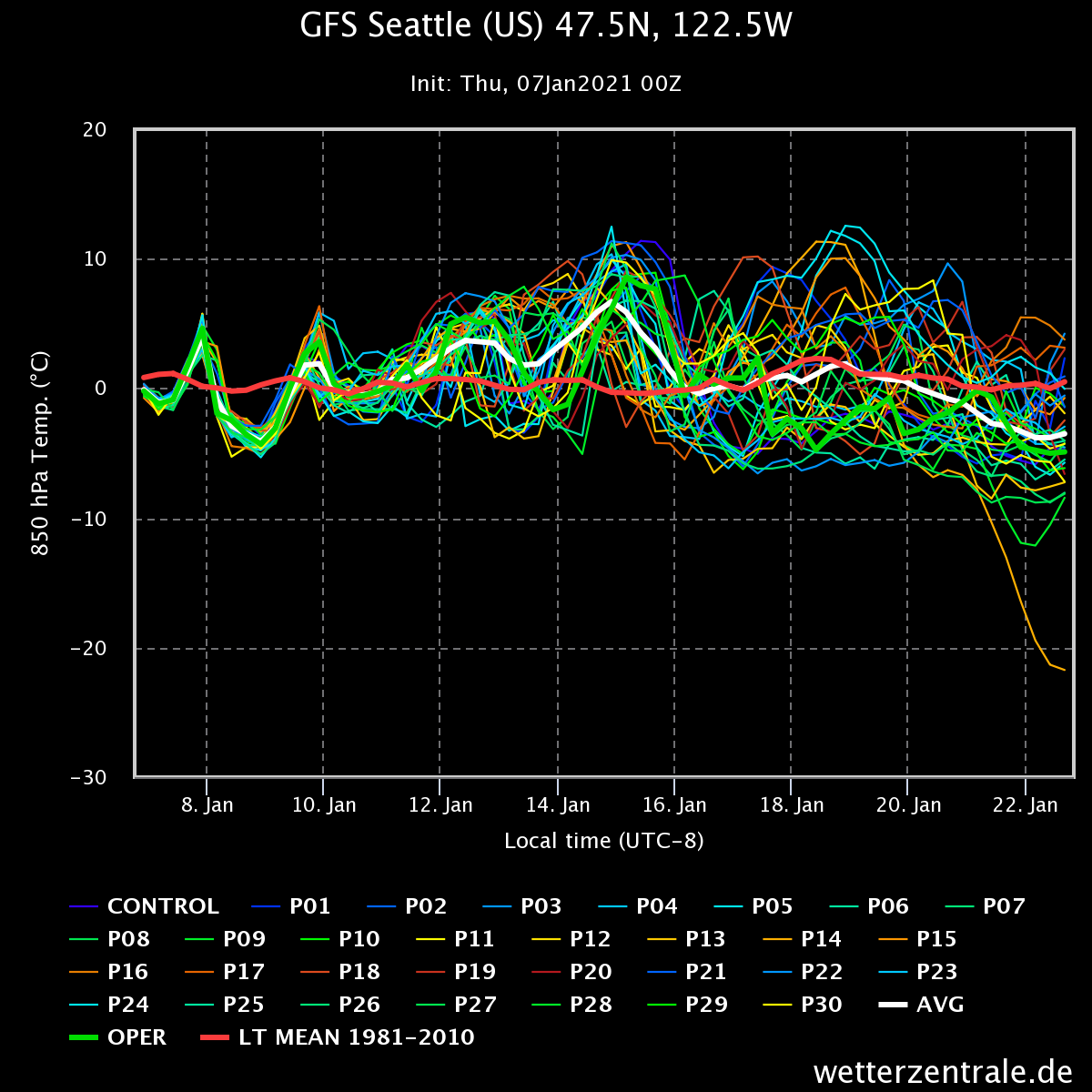
Last nights GEFS extended control run fumbles around with the ridge for about 10 days before setting up this beauty3 points
-
That's a strong signal for offshore ridging on an ensemble mean.3 points
-
18 GEFS remains consistent with past runs. However reliable it is or isnt, it is probably more reliable at that range than the operational.
 3 points
 -
Speaking of February 2018...
 3 points
 -
I’m on team “the 12z GEFS looked a little better”.3 points
-
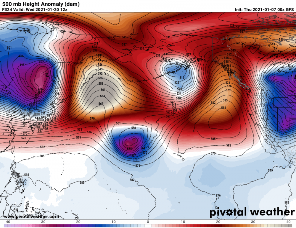
From GRR - Colder and snowy after the 15th? However, a significant change in the pattern is forecast by both the ECMWF, the GFS, GFS16, GEFS, CFSv2, and the ECMWF weekly model forecasts. There are 3 things happening to support this. First is a very week MJO, so that will not be strong enough to force the pattern over the next 3 week. There is a stratospheric warming event over Canada now that spills into the CONUS. Beyond that we have one of those 200 knot East Asian Jet streaks heading this way for early next week. That by itself will be strong enough to break through the blocking we currently have. The GFS has been forecasting this for at least 3 days now, so there is consistency to this idea.3 points
-
Oz Euro Control has 2 large snow storms in the middle of the country in the extended . Definitely has my attention.3 points
-
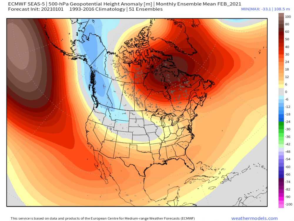
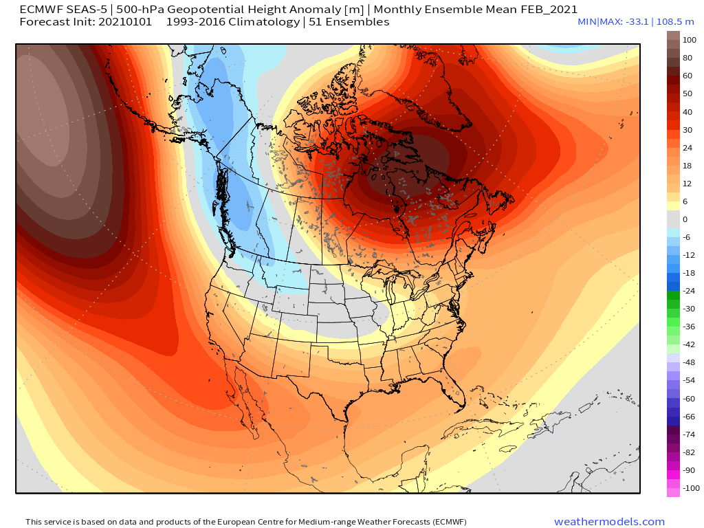
Massive changes hemispheric changes in the latest Euro Seasonal for January as the model has flipped in dramatic fashion away from the stout trough over western NAMER/AK compared to the last several runs. Did I mention the models have no clue of the blocking across Greenland??? Not only that, but the Scandinavian Block which hooks over the top allowing for cold to spill south into the lower 48. This 500mb pattern is ripe for action across the majority of our Sub. Nice wet signal showing up over the Plains/MW...cutters??? February is also trending in the right direction...big signal for the -NAO block to continue...
 3 points
 -
Yeah, that's one large positive of this constant westerly flow. Highs in the 40's and lows in the 30's have resulted in wet climo for the majority of the winter, and consequently a bountiful snowpack. Solid chance that this Spring will be nutty up in the Cascades. As much as people have complained about the largely mundane weather, it has certainly not been a bad winter. Even 1988-89 was largely a split flow-ish winter, with extended dry periods and below average precip/mountain snowfall. This winter at least hasn't been harmful to our ecology.3 points
-
Tonight's EPS run.
 3 points
 -
This is starting to feel earily similar to 2019 IF the long range GFS is onto something. The cold did get to NW Ontario, Manitoba, and northern Minnesota by mid month it just didn't penetrate to far into the CONUS til the end of the month. Similar thing happened with The polar vortex in Jan 2014. Here is my monthly temps for Jan 2019
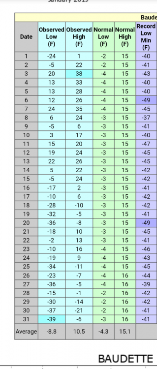 3 points
 -
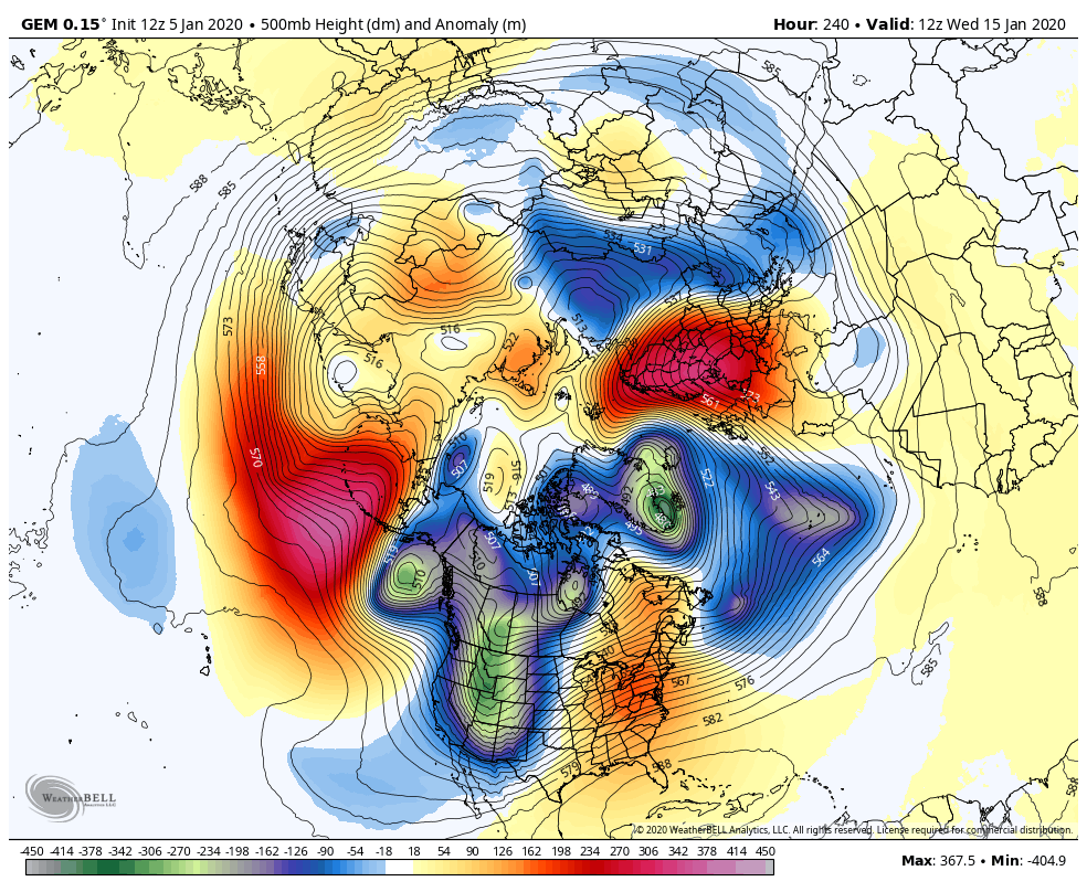
00z GEM Day 102 points
-
Ignoring placement, this is some great high latitude blocking, some of the best in quite a while. If anything close to this occurs, someone in the midlatitudes is going to get some major cold. Who knows, it could even be us...
 2 points
 -
It's coming. It will be a question of exactly how cold do we get? Not if the cold happens.2 points
-
They do. Here is the last 22 days.
 2 points
 -
I'm sure stoked.2 points
-
Like the cross polar flow. And now if we could introduce 30 degrees of retrogression
 2 points
 -
Dang it man. I'm so sorry. Bless your heart. Don't matter how tough you are, it sucks.2 points
-
Sometimes the EPS pulses like that... Dewey has called it a pulsating egg.2 points
-
I’m thinking of all the times that left-wing protesters have been allowed to rush police barricades without massive amounts of tear gas and rubber bullets being unleashed on them. Oh, wait, there basically aren’t any.2 points
-
I suspect that a week from now things will look even more interesting. Climatologically speaking, with a +QBO/-ENSO regime, a prototypical -ENSO regime would have some staying power. I'm still worried about that Pacific jet, though. That sh*tter has been a resilient beast, and the persistent AL presence we've seen since early December is no coincidence. Time will tell. At least we're looking within *300 hours* now.2 points
-
Jim should be back shortly if the trend continues.2 points
-
Clearly better on the 12z there, big guy.2 points
-
2 points
-
Good thing they are not having a parade anyway. Otherwise Biden could end up like Zachary Taylor.2 points
-
That’s a ton of cold air in North America.
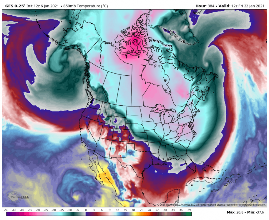 2 points
 -
Flurries the day before send us home on our first day at school since Christmas break. Then I woke up that next morning with 5” of snow on the ground. I think it snowed close to 15” the next day or two. Then came a bunch of zr on top but we stayed below freezing for awhile. Despite the news saying every day it was gonna warm up. And watching a reporter being blown around in Troutdale with blowing snow and sub 25 degree weather2 points
-
Saving our democracy!2 points
-
Cold rain at the moment. It’s January but can’t forget we’re still drought, any moisture is welcome I suppose.2 points
-
I work international hours so I'm pretty much 24/7 and get as much sleep as I need to in order to be productive. The saying goes, "Money Doesn't Sleep"...hope your doing alright down there...seems like the past couple weeks the storms have been tracking down by your area but no real deep cold, however, I see the models all starting to see the pattern shift by the 15th. Let's hope we can track a few big S streamers that can share in the wealth before winter is out.2 points


This leaderboard is set to Vancouver/GMT-07:00