
Leaderboard


Popular Content
Showing content with the highest reputation on 03/01/21 in all areas
-
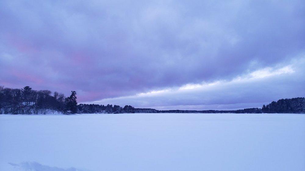
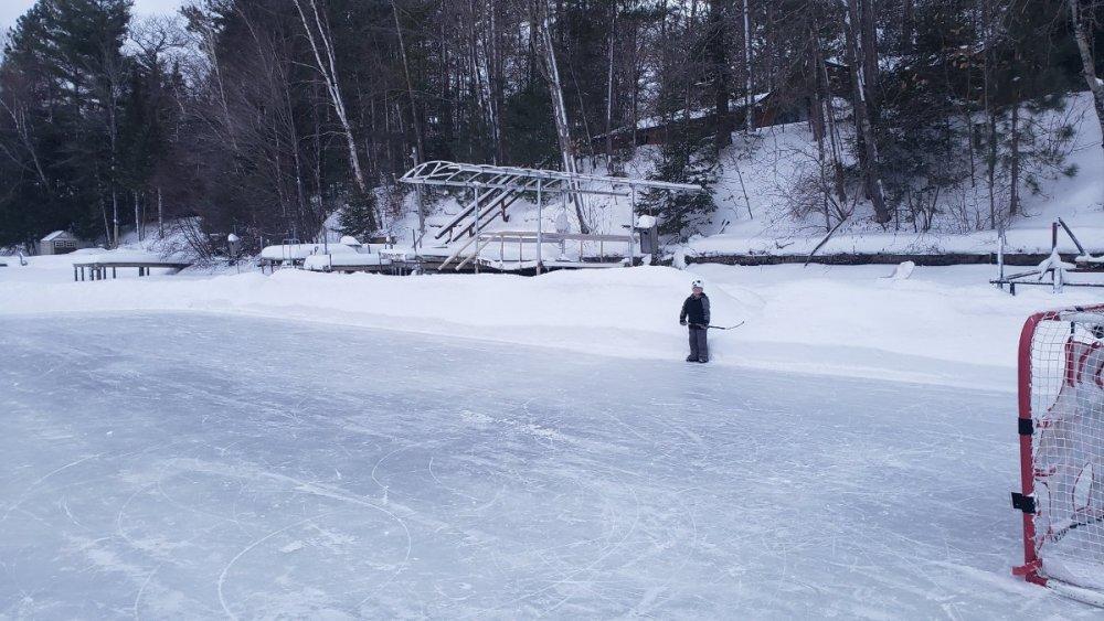
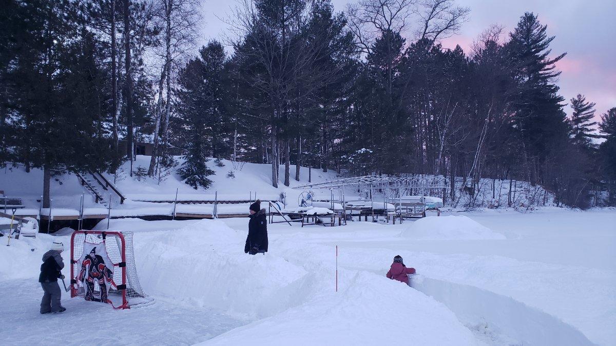
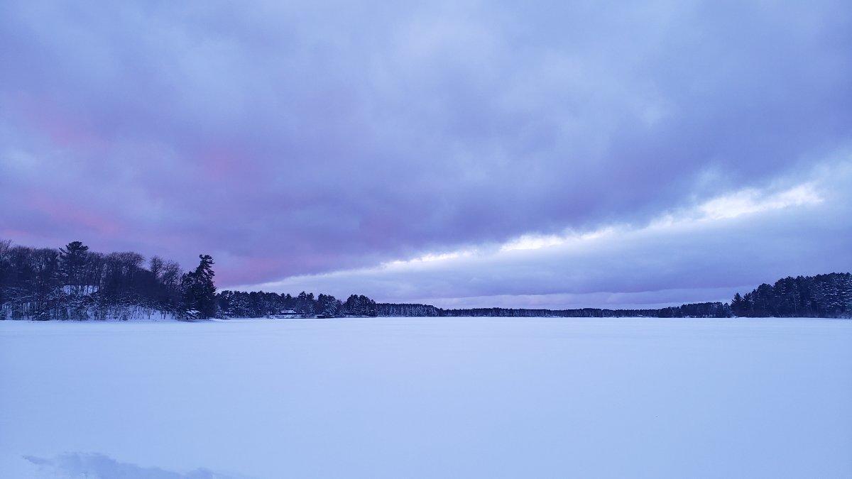
Finally some picture worthy snowbanks!
 7 points
 -
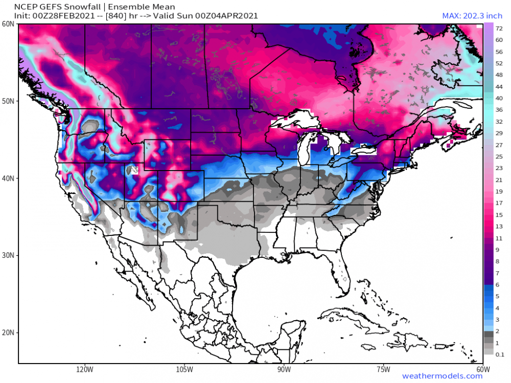
GFS has some really nice weather in store for early March. Starting on Saturday running through Wednesday, widespread highs well into the 50s for many and 60s for parts of NE early in the period before widespread 60s hit further east by mid-week. Fingers crossed.5 points
-
5th coldest February in Lincoln and 6th in Omaha. Pretty impressive when the only years ahead are 1899, 1936, 1978, and 1979. LNK may be 6th as well if 1875 was included, which was up there for OMA, but LNK didn't record temperatures then. It could be decades before we see a month as extreme as this again, I'm glad I lived it. Other stats for Lincoln: 5th snowiest February (16.6") -31 is the coldest Feb temp recorded -First sub zero high (-4) since 1996 -17 days of 10"+ snow depth this month beats previous record of 11, though I can only find snow depth stats back to 19484 points
-
Coldest Feb since 89 in KC NWS Kansas City · 58m As we close the book on February and immortalize it by freezing it shut, we finished the month 10.3 degrees below normal at 23.2 degrees . That makes it the 7th coldest Feb on the 133-year record for KC and coldest in 32 years (1989)!4 points
-
The period between the 10th-16th is one to watch for back-to-back Spring storms coming out of the SW/Rockies as the LRC's signature storms rolls on through the Sub. The seasons 1st Severe Wx threat could develop for the S plains/MW depending on how strong the blocking sets up. The north will likely score some late season snows and make up in that dept. "Beware of The Ides of March" will be the theme heading into the middle part of the month.
 3 points
 -
Still an outside chance that DSM loses another tenth - but as of 8:35pm the avg temp for FEB for KDSM is 15.3F. That puts FEB 2021 as the 7th coldest FEB on record. Here are the top 10. FEB 2021 was also the 34th coldest month ever recorded including Jan and Dec going back to 1878. TOP 10 Coldest FEB for KDSM 1936- 8.0F (one of DSM top 5 weather/climate stats of all time imo) 1978 - 13.3F 1979 - 13.8F 1885 - 14.4F 1905 - 14.8F 1929 - 15.2F 2021- 15.3F 1989- 15.4F 1899- 15.6F 1904- 16.7F3 points
-
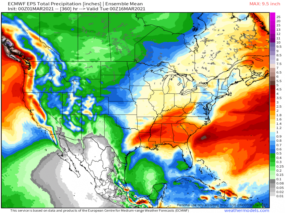
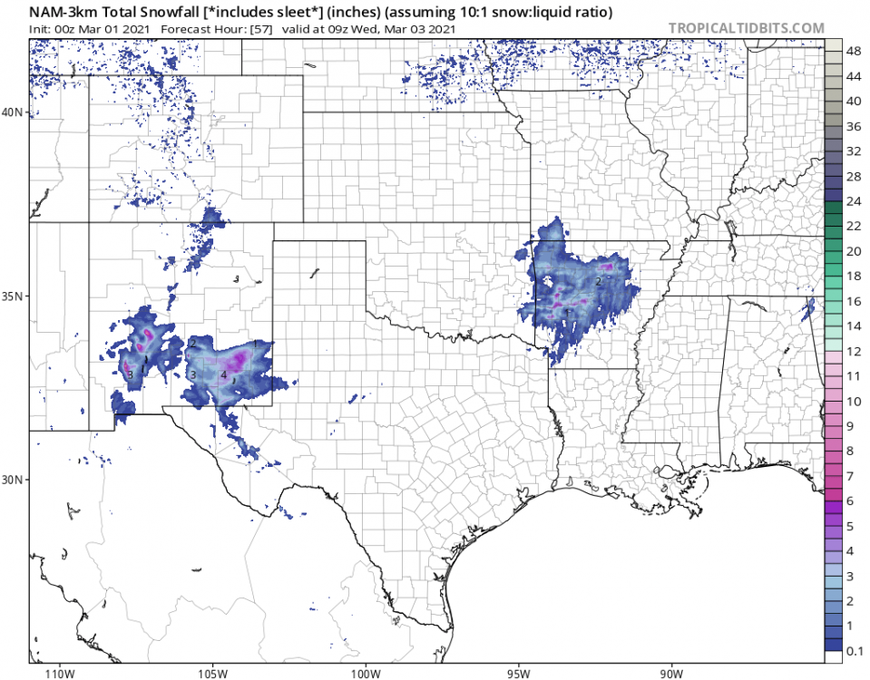
12z Euro 10-day forecast for Cedar Rapids 29 42 41 47 52 50 52 57 60 622 points
-
As Tom said, it's a cold start to March here. -2°F. Got around 2" of powder overnight.2 points
-
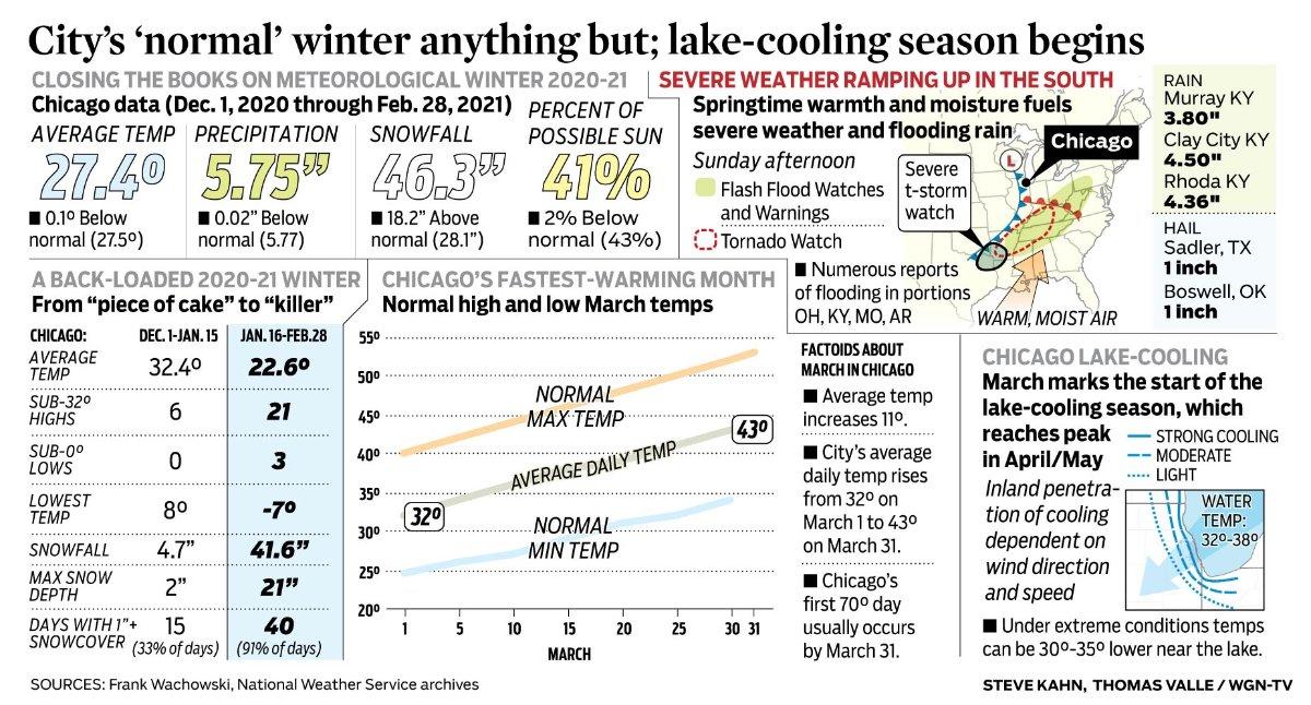
That's a wrap! This was the epitome of a "back-loaded" winter for Chicago and the most memorable comeback of Winter I've ever experienced. The numbers below say speak for itself. I was surprised to see that the avg temp ended up 0.1F BN after such a warm Dec and Jan. Interestingly, precip was BN while in the snow dept it ended up much AN! The brutal cold wasn't that much of a player over here as subzero readings at ORD were shy of the avg (12) days a typical winter season sees. Now, I'll be honest, as a winter wx fan I'm already paying attn to next winter and some similar ideas are already coming to mind with high late blocking (esp Greenland) next cold season. Low solar and cyclical patterns will be in the cards so there is hope for a good to great one next year without having to see so much warmth as the oceans cool this summer/autumn.
 2 points
 -
My guess is most of the cooler / wetter weather in the summer would have been in the form of stratiform precip, although some cold troughs could have happened I suppose. I think most of the thunder in the summer would have come from any cold troughs, because the 4 Corners high would have been pretty much irrelevant here under the circumstances of the time. To answer one of your other questions...we probably still had a lot of typical marine low cloud type of days in the summer, in fact probably more due to the Pacific High being more dominant. On the other hand June might have actually been a little bit less gloomy due to things being bit more active in that month than present. Much of this is conjecture of course. There would have undoubtedly been more "eye candy" during the winter. We know that the last half of the 1800s were far snowier here than present, and it is generally believed the 1600s were colder. I'm with you...I would pay a handsome price to have some actual records from back then. The farthest back that I know of is from the winter 1833-34 where an official from the Hudson's Bay Company kept a diary of conditions somewhere in the Nisqually Delta area and he noted that winter was tremendously snowy.2 points
-
NAM wants to leave me with one last memory of the winter past in a couple days. If it does, it will be a beautiful upper country snow day here. Just one more.
 2 points
 -
Data I have puts Tulsa's February temps at 31.4 as an average. Good enough for 4th coldest of all-time and one of only 6 February listing all-time that have been below freezing. <5% likelihood. Incredible.1 point
-
DVN stated the frost depth was just 2" here due to the snow blanket.1 point
-
I saw a post somewhere that our frost depth only got down to 5-6" I believe bc of that same reason. Wasn't cold and then it snowed, got really cold, and that insulated the ground. Should be a quick green up. We're mostly snowless here now1 point
-
It's pretty cold today with a temp in the low 30s and a good breeze. Thankfully, it's the last cold day for a while. My snow depth is down to 7-8".1 point
-
Grass is beginning to show here in spots.... pavement edge, open areas, the path I dug through my backyard. The grass is still a bit green because we had no real cold before the snow began to pile up. When we finally got some harsh cold, deep snow protected the grass.1 point
-
Looking at the remaining few inches of crusty snow I have left, and a week full of highs in the 40s upcoming. I would rather tell nature to bank any potential snow for the rest of this season until next December. However, if it does have to snow, it better be significant. Nothing worse in my mind than 6" March snows on bare ground that melts in a few days only for another 6" that melts quickly followed by another 6" that melts quickly, etc.1 point
-
Looks like a more favorable pattern for some precip for you guys coming up. Too soon to call it a March miracle but we’ll see.1 point
-
Beautiful weather this week! Today Mostly sunny, with a high near 42. Northwest wind 6 to 13 mph becoming northeast in the afternoon. Winds could gust as high as 18 mph. Tonight Mostly clear, with a low around 26. Northeast wind 6 to 9 mph becoming south after midnight. Tuesday Sunny, with a high near 56. Southwest wind 10 to 17 mph, with gusts as high as 26 mph. Tuesday Night Mostly clear, with a low around 27. Southwest wind 5 to 8 mph becoming light and variable after midnight. Wednesday Sunny, with a high near 56. Light and variable wind. Wednesday Night Mostly clear, with a low around 34. Thursday Sunny, with a high near 60. Thursday Night Mostly cloudy, with a low around 36. Friday Mostly sunny, with a high near 58. Friday Night Partly cloudy, with a low around 35. Saturday Sunny, with a high near 59. Saturday Night Partly cloudy, with a low around 40. Sunday Mostly sunny, with a high near 60.1 point
-
@FAR_Weather @Beltrami Island....LR GEFS suggesting a good possibility for late season Spring snows heading your way this month as the signal for a parade of storms coming off the PAC could very well eat away at your snowfall departures.
 1 point
 -
Welcome to meteorological spring! This past February the mean temperature was 20.8 and that is a departure of -6.0 the high for the month was 48 on the 28th and the low was -12 on the 17th there was a total of 30.6” of snow for the month and that is good for the 6th snowiest February at Grand Rapids. For meteorological winter the total is 45.4” and so far for the season it is 45.8” At this time it is cloudy here and 30.1 point
-
Welcome to met Spring! March is roaring in like a Lion for some and for others its limping in on its tippy toes compared to what a lot of us endured last month. @FAR_Weather@Beltrami Island are experiencing some brutal cold right now in subzero temps. Ouch! Once the sun comes up it'll feel a lot better I assume. Geeze, that's gotta feel a bit nippy after a brief spring teeze last week. Meantime, it's a nippy 38F over here as I'm experiencing the back end of the trough that swung through over the weekend. Warming trend the next few days before the next storm comes in mid week.1 point
-
Fairly certain the low of 25F at midnight pushed FEB 2021 into a tie of 6th coldest FEB all time for KDSM. Reason for my post above. Will see how CPC rules this in the future but in the last 6 hours KDSM lost .2F in avg temp for the month based on a low of 34F going to 25F for the 28th. It all matters...1 point
-
Looking at radar, I think I have a good chance of overachieving on tonight's clipper.1 point
-
Probably a more suppressed jet in the winter. Want to see some of that next winter.1 point
-
In PNW/BC, it was cooler, with wetter summers and drier winters. Though there was interdecadal variability back then just as there is now. The larger difference was in the SW US, which was significantly cooler/wetter.1 point
-
9" down from 9:30 to 2:30! Sun is out now! 20210228_122553_1.mp41 point
-
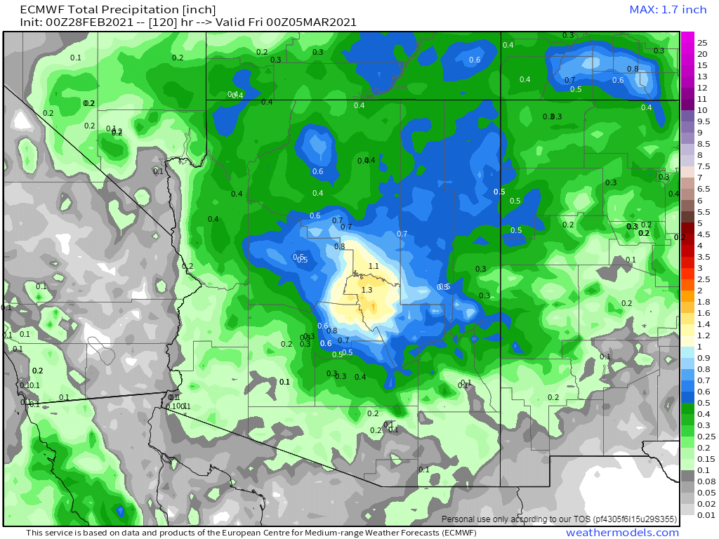
I'm digging what the 00z Euro is showing for the system this Wed/Thu...this would be a major blessing for the valley to score a widespread soaker in excess of 0.50" of rainfall...
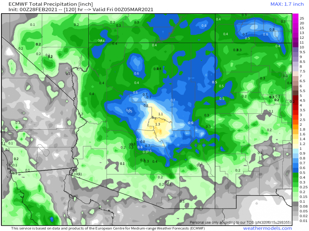 1 point
 -
Trading historic cold for rainy warm mush and mud season is always a delight..1 point
-
Very interesting this temperature and hygrometric distribution in Pittsburgh area, clearly affected by the presence of the 3 rivers. The analysis performed on the MeteoTracker web platform some days ago. (By the way MeteoTracker is a low cost but accurate mini weather station for measurements on the go).1 point
-
Happy new years!1 point
-
Meteorological spring starts tomorrow.0 points
-
Happy new year!!! Onto 2021!!0 points


This leaderboard is set to Vancouver/GMT-07:00