
Leaderboard


Popular Content
Showing content with the highest reputation on 04/05/21 in Posts
-
Omaha was under a severe tstorm warning last night 2 different times, once until 1 am and then again until 2 am. The warnings were for collapsing showers that were producing wind gusts up to 60 mph. Didn't have any kind of wind that strong here, but my weather station did show 2 different small heat bursts where the temp jumped up about 5 degrees and the humidity dropped a decent amount for a few minutes.3 points
-
Another beautiful spring day. A tad windy if I'm being picky, but that's a small price to pay for upper 70s.2 points
-
We often see a stationary line of low precipitation during a storm. Eventually it moves away. What could cause this? Thanks, Duane
 1 point
 -
The SCOTUS has handed Georgia a win in the ongoing battle for Chattahoochee/Appalachia river water. The court couldn't find how Florida was damaged; how much is too much water usage? The real problem is not insufficient water flow down to the oyster estuary of Appalachia Bay; the problem is polluted water. In addition from the huge urban runoff from Atlanta, the farmers in the Georgia cotton and peanut along the rivers banks continue to use Roundup and other posions for weed control. These weed killers are biodegradable by UV light and soil microbes, but once the posions get into the water column they float down to the Bay where it kills the tiny green phytoplankton (plants) that oysters feed on to grow. The issue won't be resolved until this is prevented by subsidizing the additional costs of conventional mechanical tilling for those farmers right on the river drainage. The entire Southeast oyster industry has been destroyed by Roundup like chemicals.1 point
-
"Wx Geek Alert"...taking a look at last night's 00z EPS, look way up north towards the N Pole and you can see the Vortex send a lobe down the western shores of Canada, down into the Upper MW/GL's by Day 7-10 where it stalls out. Golly, that blocking is doing some weird stuff this Spring. As the jet stream this week pretty much comes to a crawl, some interesting model runs are showing up for later in the week/weekend. Late season Spring snows are showing up for the North land...
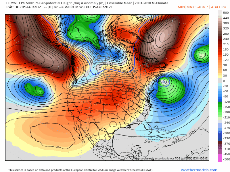
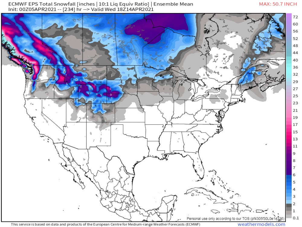 1 point
 -
I had a wonderful time yesterday with my sisters family in town. My duties were in the kitchen and I cooked up some delicious food. Lot's of leftovers. Spent time at the pool earlier in the day before it go to hot as PHX tied another record high for the second day in a row (98F). Well, the cool down the models were indicating last week for this week are no longer. The streak of 90's shall continue into the weekend. Full blown summer mode over here. We skipped right from late winter into summer it seems as it was snowing in the mountains just about a week ago.1 point
-
Looking to get some much-needed QPF here on Wednesday. The brush fires here recently have been ridiculous.1 point
-
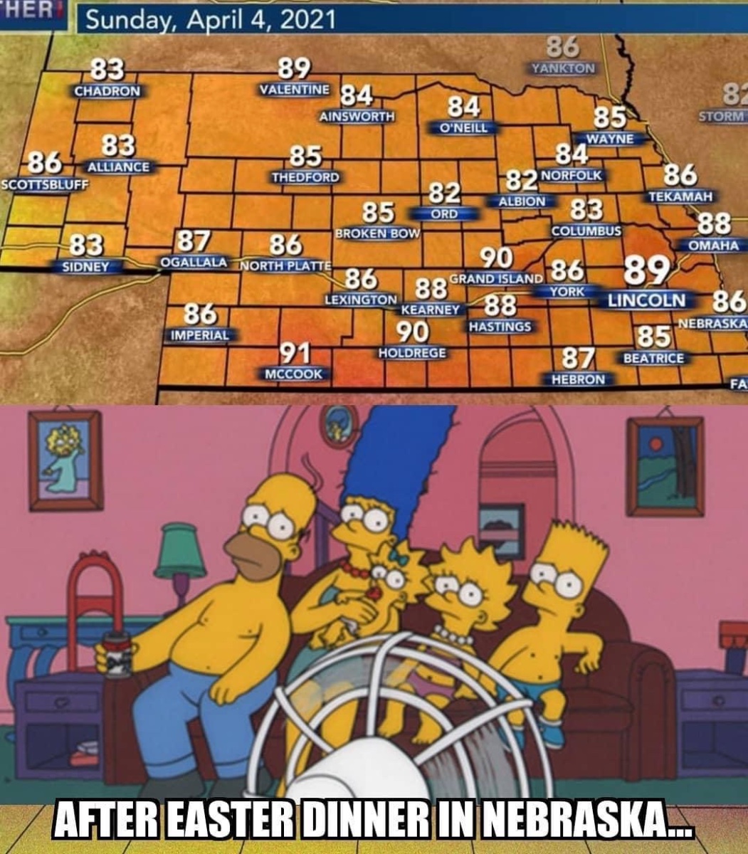
91 and 90 in McCook and Grand Island today. Lincoln got 89’d1 point
-
Made it to 80.4 yesterday with a dewpoint in the mid 20s. What little wind there was during the day yesterday died off at sunset and the temps tanked pretty fast falling all the way down to 53 degrees by 1030. Pretty rare to see a drop that quickly without a cold frontal passage. Severe weather looks pretty marginal with this system. Capping concerns on Tuesday and then too much clouds and precip on Wednesday. I actually am not a big fan of closed cut off lows and severe weather opportunities. A lot of times you have one hell of an ugly looking atmospheric column for winds with horrible veer back and the system moves so slow you have big issues with convective overturning.1 point
-
We just hit 70º, so today will easily be the warmest of the year so far.1 point
-
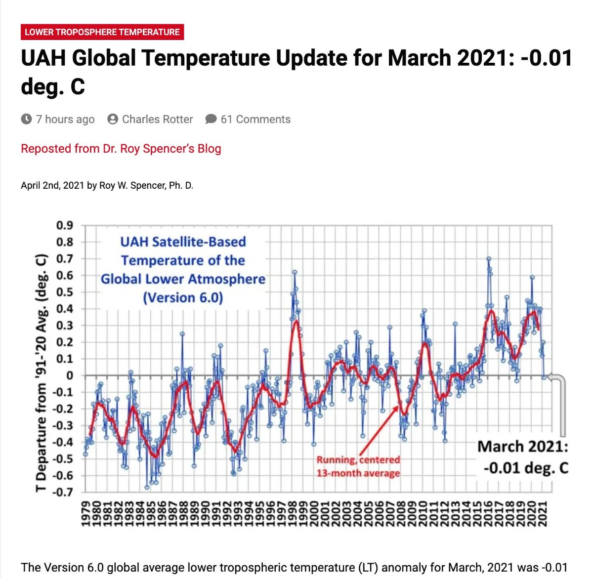
It's rather interesting to see how much the Global temps have tanked since the double peak. I'm really curious to see where we go over the next few years. Oceans at play??
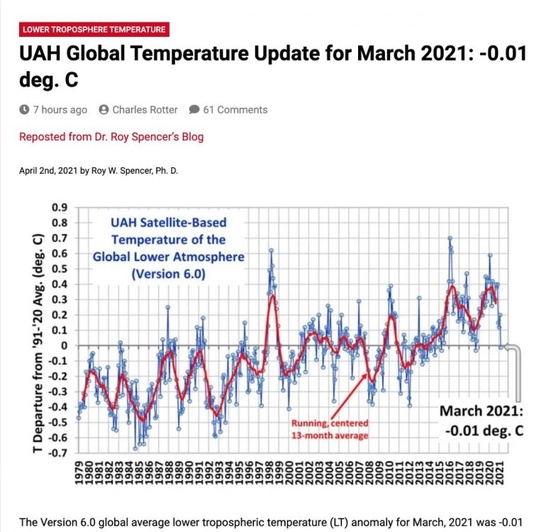 1 point
 -
The big rain event for much of Iowa is vanishing. Much of the forcing goes north and the instability remains south. Basically, the only chance for decent rain is down to only late Wednesday or Wednesday night as a line moves through. The Euro gets drier every run.0 points


This leaderboard is set to Vancouver/GMT-07:00