
Leaderboard


Popular Content
Showing content with the highest reputation on 05/07/21 in all areas
-
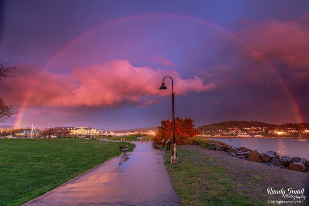
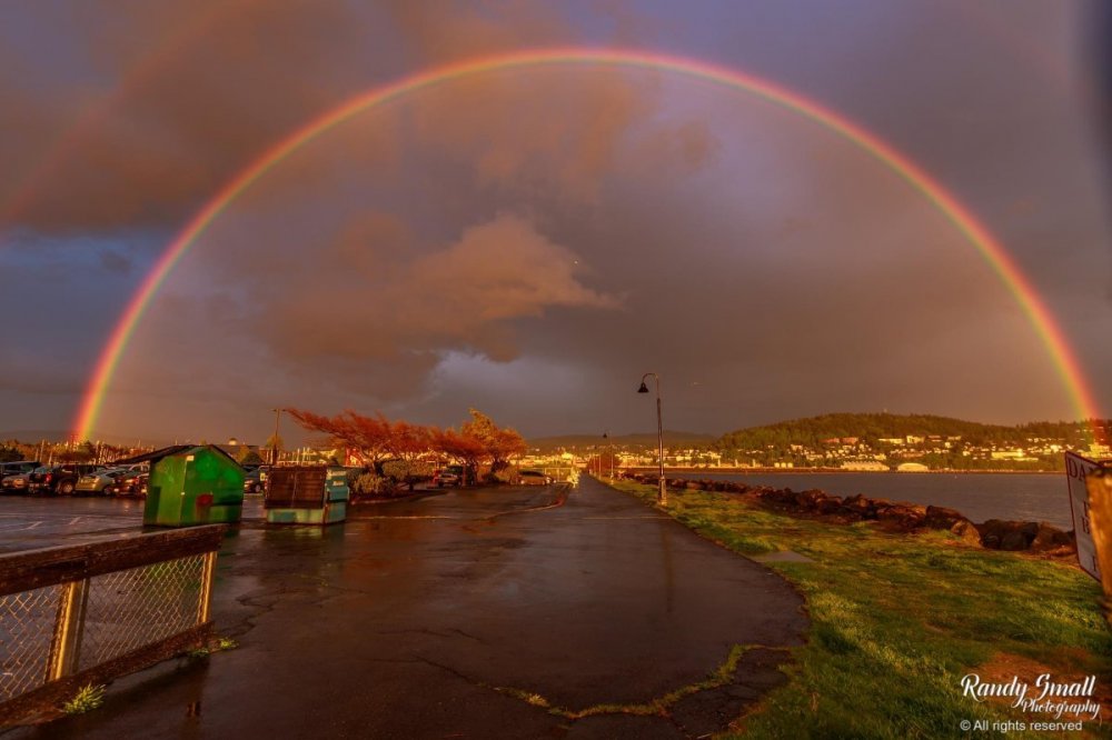
Here are a couple of pictures of the rainbow last night, credit to Randy Small photography/Whatcom County Weather FB page I am bummed I missed out on it and the sunset, got the second round of the Covid vaccine Wednesday and felt like hell yesterday.
 11 points
 -
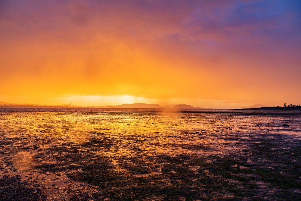
It was pretty spectacular here although I got dumped on while taking this shot (as you can see by all the raindrops on the lens). Yesterday was a fun day in general. Warmest day of the month so far at 67F (way warmer than the 61F from Wednesday) and strongest May wind gust in more than a decade at 33 mph. Then the storm moved through and provided this sunset. I wish I'd gotten out to the water just a few minutes earlier because when the sun was still up in the sky the light was incredible.
 7 points
 -
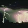
There was a couple rumbles of thunder and saw some lightning about 45 minutes ago down by Ruston. Didn’t get the lightning on camera but still a cool picture.
 6 points
 -
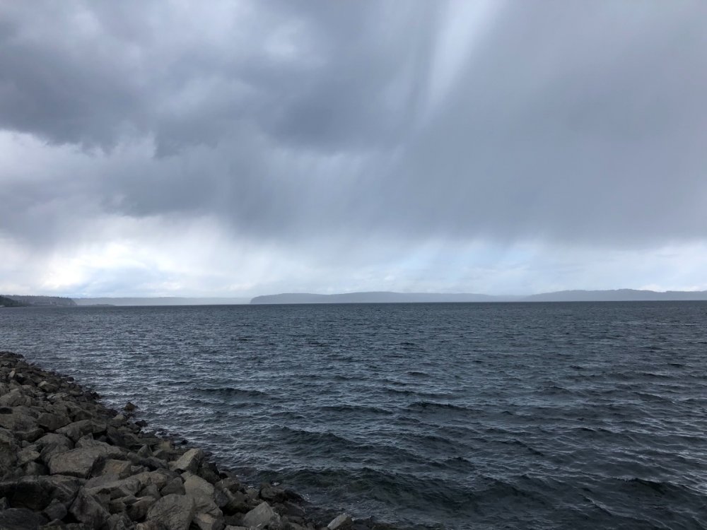
Everything sliding by to my north but makes for some cool looking skies.
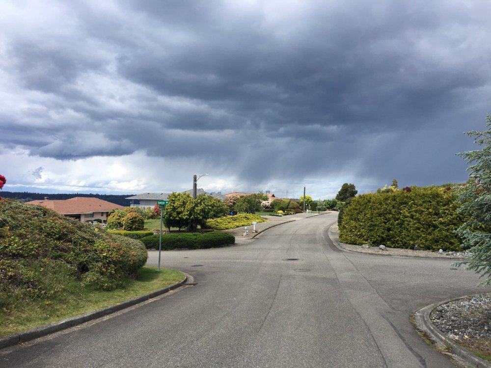
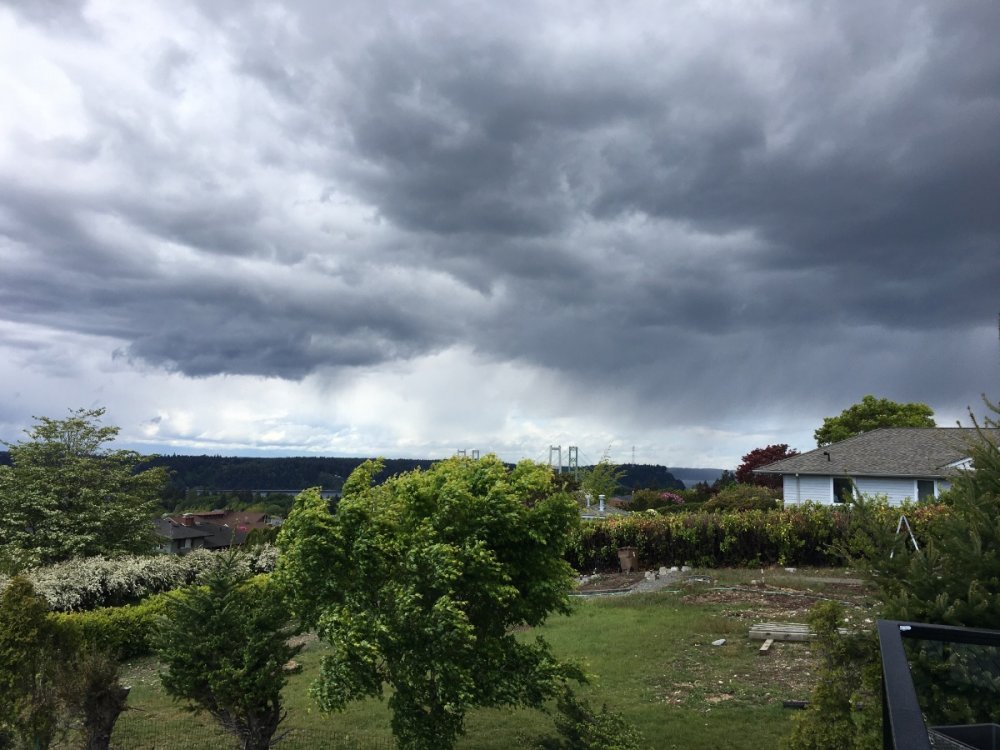 6 points
 -
56/43 0.24” of rain today. Had a couple rumbles of thunder and some hail today so a somewhat interesting weather day.5 points
-
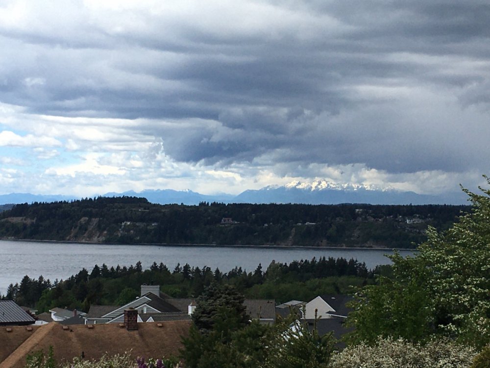
Sun break on a stormy day...
 4 points
 -
A little spring Chinook fishing under the unsettled skies
 4 points
 -
Pretty impressive for May 7th.
.jpg.89edbb8792b1ba74ef019970b9e55442.jpg)
.jpg.9fd7415e8b79c871c9fde73b1c18ddf7.jpg)
 4 points
 -
And his cohort.3 points
-
C-zone reforming... raining hard once again here.3 points
-
59/47 here with very widely scattered showers and a whopping .02" of rainfall.3 points
-
Up to 1.67” this month. Better than I feared. Looking at the models we have a real shot at 3”, still below average, but some cool showers on and off this month. Could be worse. In 2018 and 19 we torched big time in May.3 points
-
No nothing!
 3 points
 -
Yeah I saw some lightning and heard a rumble of thunder. Looks like we took the pics around the same time.3 points
-
3 points
-
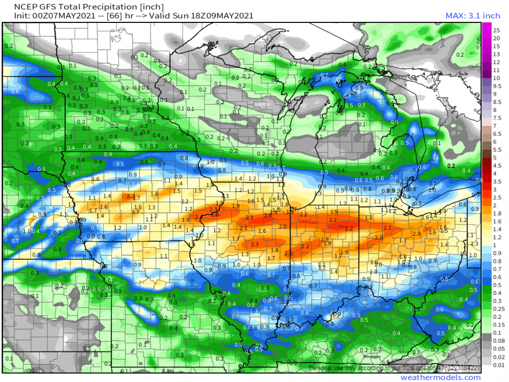
SPC has us under a Marginal chance for severe storms here this afternoon turning to heavy snow tonight. Classic Bozeman spring weather. Likely 1-1.5" of precip coming over the next 24-36 hours which is very welcome.
 3 points
 -
Heavy shower moving through. Up to 1.36" on the month. May is already wetter than April was. We will still likely end up below average, but at least we are not headed for a May 2018 like disaster.3 points
-
00z Euro/EPS maintain a southerly track while the GFS/GEFS are farther north.... This would be a nail biter situation if I was tracking this storm during the cold season...nonetheless, some heft precip is going to be delivered by this system. 06z RGEM...

 3 points
 -
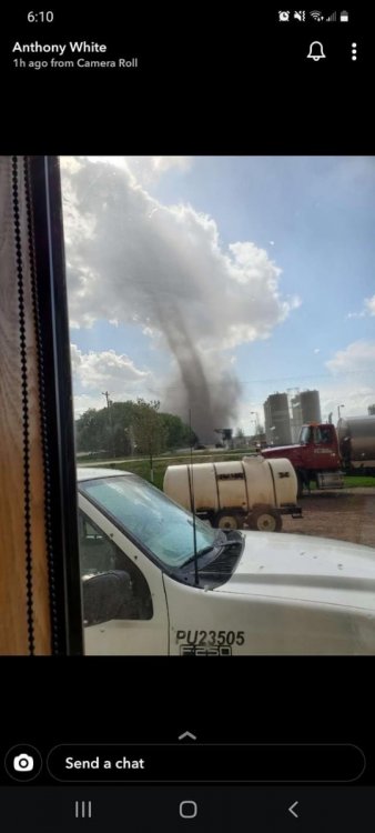
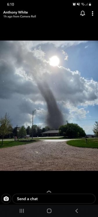
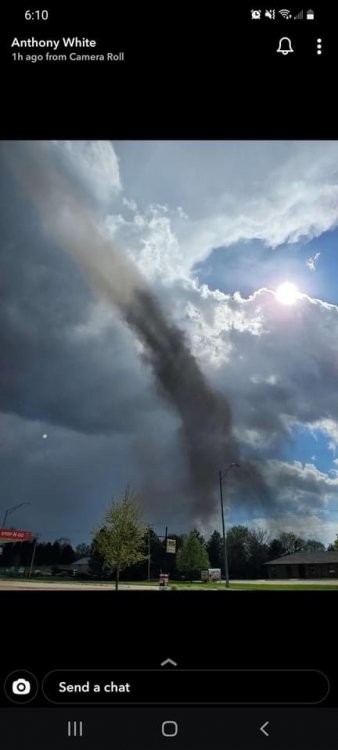
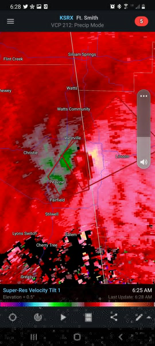
Crazy landspout tornado in Hartington Nebraska yesterday!!
 3 points
 -
Apparently Jesse just reacted to 20 of my posts with puke emojis. That's a good night.2 points
-
Up to 0.55” of rain for the month...not much if any rain the next week on the euro but next weekend could be rainy.2 points
-
Torrential rain!2 points
-
The RDPS has inched north, now has a soaking rain up to Cedar Rapids. The Euro still barely drops anything here.2 points
-
Ah ha, the CFSv2 has now have flipped to a warm spell for Week 2... Wet pattern should shift farther north as well...2 points
-
Around 1” of rain is increasingly likely in my area. The GFS hasn’t shifted south at all, but instead shifted north while the Euro keeps inching north.2 points
-
Good f*cking lord that was some of the heaviest rain/hail we’ve had here in awhile. Was too loud to sleep through.2 points
-
Calling for all input!! What the hell is up with all of these land spout tornadoes?! We had a couple in my county the other day too. I’m thinking it’s a sign of something big coming soon.....2 points
-
You awoke the sleeping (puking?) giant.1 point
-
.55” on the day. Currently sunny and 53.1 point
-
No hail, no rain, no thunder and no fish .... quite windy though. Nest cam back home showed lots of activity though. Some pretty awesome photos being posted....gotta love Spring !!1 point
-
And a new round of activity is firing to the north and west of Seattle and moving to the south and east... going to be a stormy afternoon.1 point
-
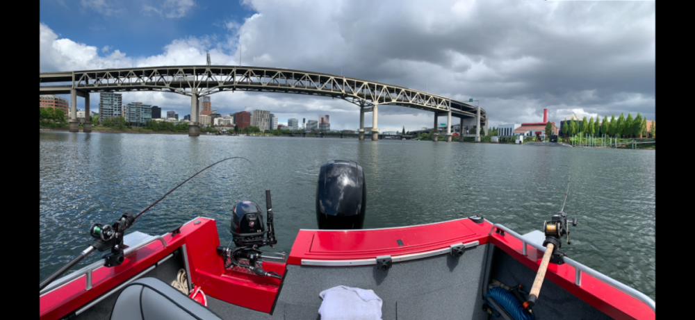
We usually fish Sellwood bridge but giving this a shot as it’s slow everywhere1 point
-
Looks like the convergence zone is sagging down here. Suns out for now but I’m expecting some more heavy showers like we had early this morning soon. Hopefully some lightning too!1 point
-
Only 0.56" here so far. And not much in the pipe for the next 10 days. I'm really starting to become worried.1 point
-
Rain has now stopped in north Everett! Light to the west, dark to the east.
 1 point
 -
The official overnight low of 32 makes today the 7th coldest low for any May 7th in recorded history at Grand Rapids and the coldest May 7th low since 1947. Will let you know later how todays high plays out but it will be in the top 15 or less. And with lows forecasted in the low 30’s for the next several nights that will continue to be the case. At this time just had a brief shower and the temperature is now at 48 here. The 30 year average reading for 12noon at Grand Rapids is 61.2.1 point
-
@Clinton, your looking good for some severe Wx action Sunday. That goes for the KC crew as well. Best setup of the season so far.1 point
-
Yep! Up to .52” so far on the day, .70” for the month, 23.45” since Jan. 1. 40.8 degrees...Brrrr!1 point
-
Just another 50 inches to go before you hit your average!1 point
-
12z HRRR showing some strong storm clusters...
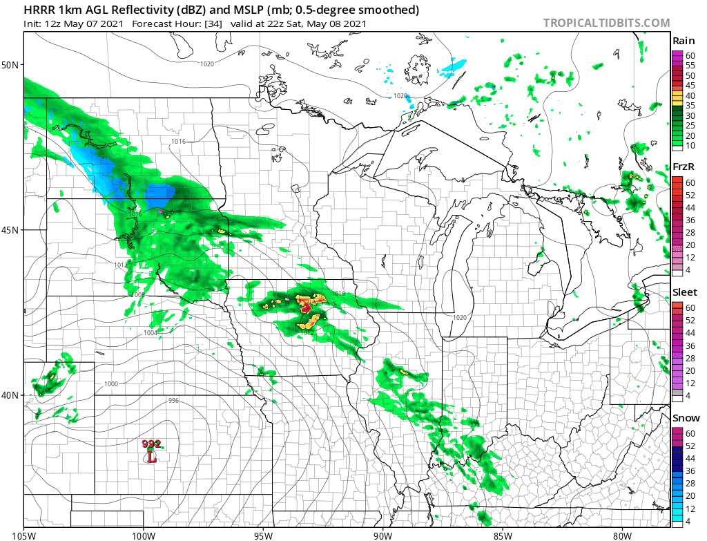 1 point
 -
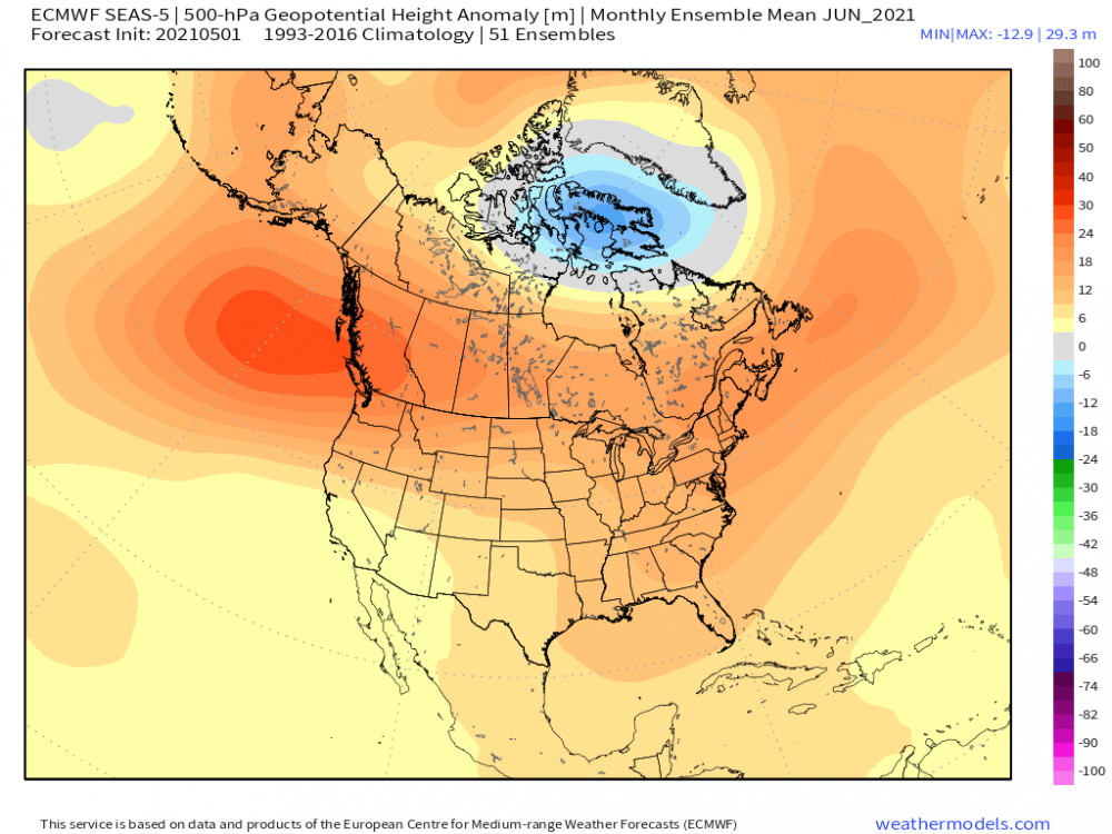
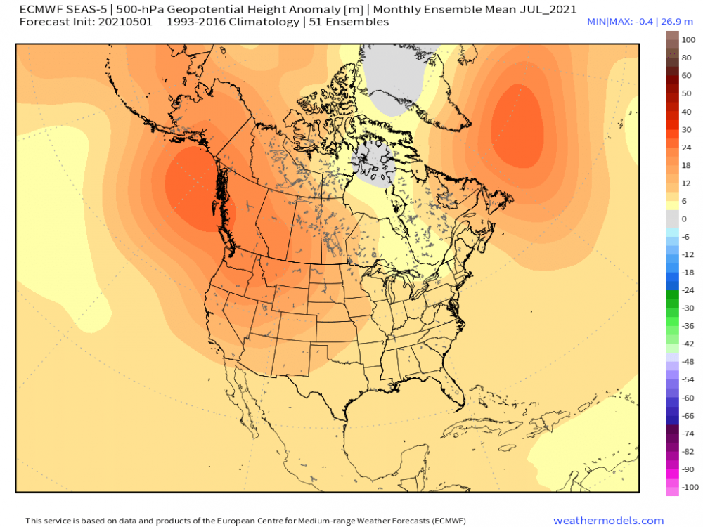
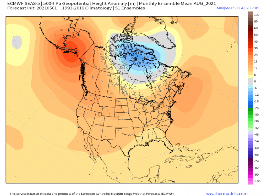
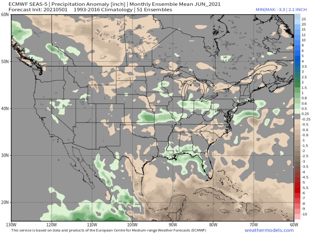
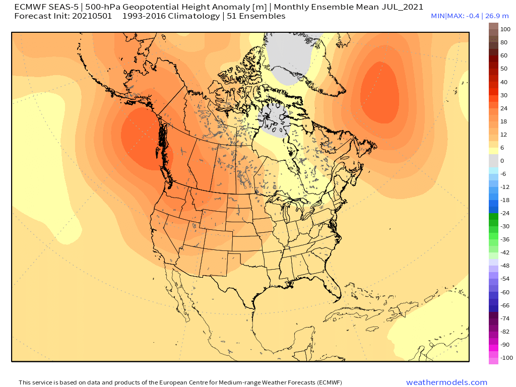
The Euro seasonal came out the other day and it is beginning to show signs of trending more towards the CFSv2 climate model which is suggesting the domination of a west coast ridge pattern. See maps below... What was once a dry June, it has trended a lot wetter for the heartland...on a side note, if you look at the maps above and what I find strikingly fascinating is the suggestion of a displaced vortex over the northern parts of Canada. Year without a Summer up there? Sheesh. Imagine living up that way and possibly seeing it snow in the summer. My personal opinion, this is a Big time clue for what is the evolution of a climatic shift. Moreover, how will this effect our winter next year?? My mind is always pondering on these ideas. Let's get through Summer first...who will have an enjoyable summer pattern and who will not??? That is the question that remains to be seen.
 1 point
 -
.80 here now since yesterday afternoon and raining hard. SEA has had nothing though in the rain shadow.1 point
-
If we are to believe the 00z EPS, a sustained warm up is on deck from next weekend into the following week...not only that, but an active pattern is shaping up for the 2nd half of May esp for those who have been quite dry of late. I took a glance at the Euro weeklies from yesterday and they, to, suggest this warm signal to have some legs. It may get interrupted by Memorial Day weekend, however, but then another warm signal shows up as we enter June. Summer heat by late month for parts of the Plains/Upper MW?? It's been on my calendar for some time now. Yesterday, PHX made it to 101F and that makes it 2 days in a row hitting the century mark and it appears that next week there may very well be a string of 100's.
.gif.15256daa6d1650f8c4c0da7c45d772eb.gif) 1 point
1 point -
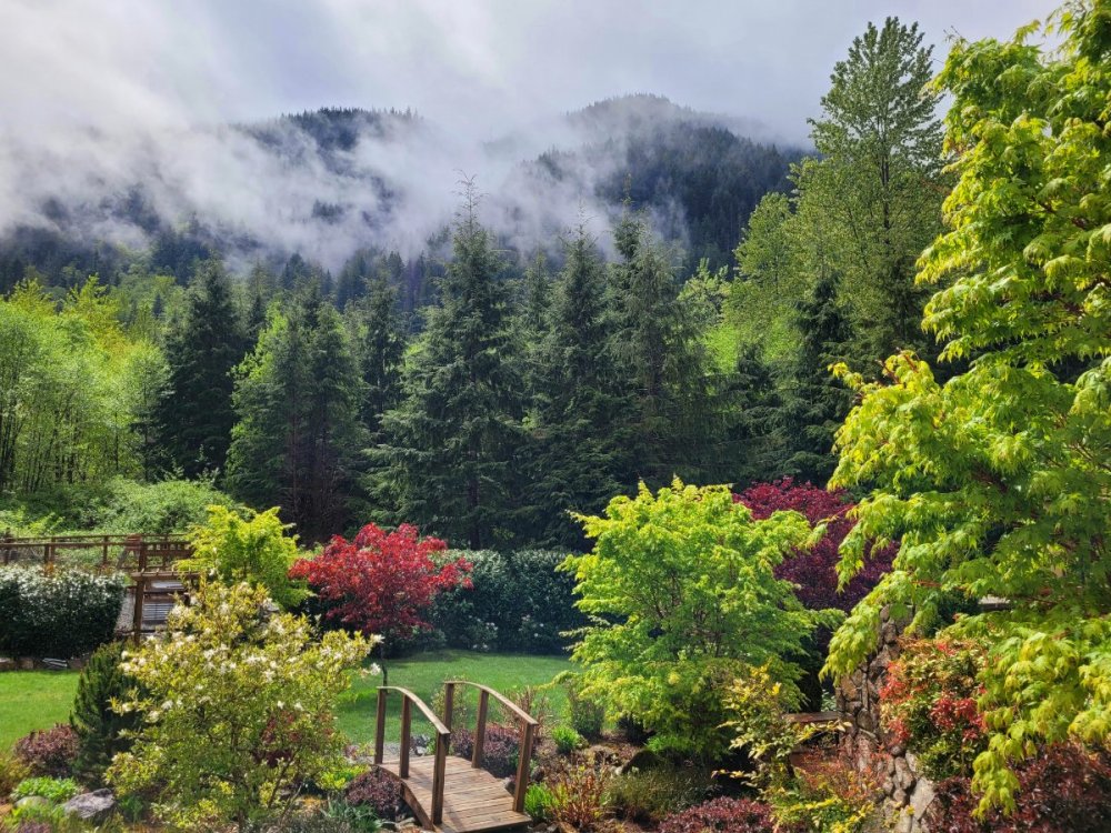
Very early return of the low clouds this evening.1 point
-
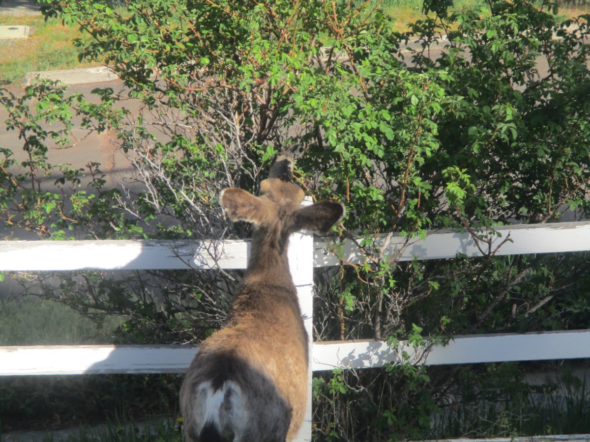
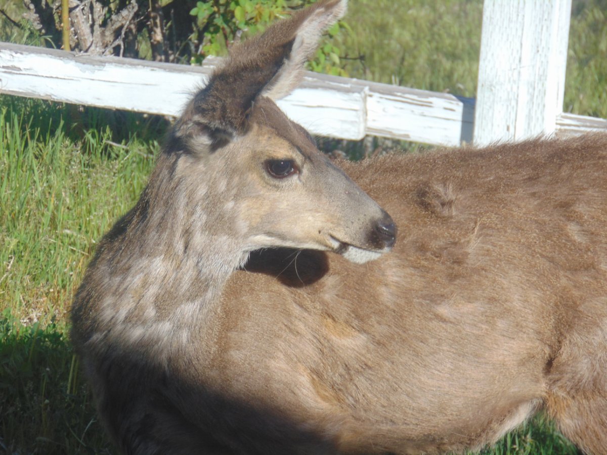
They are lucky I am not an avid gardener. Rose bushes getting massacred.

 1 point
 -
Do you and others at NWS Phoenix see signs that we may have a more active monsoon this summer? I have been reading some hints on this possibility recently, but I wanted to see what your take is on it.1 point
-
The UK has joined the GFS in showing more rain farther north this weekend. That would be great.1 point
-
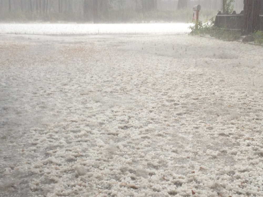
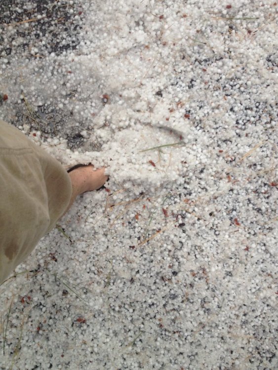
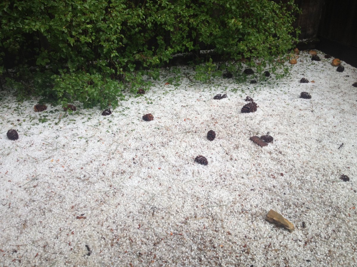
Here's some pics I found on my phone from a good storm back in Auf 2013. Had about 3-6" of hail on the level. It stuck around for almost 48 hours. The last picture was the hail the following day in my backyard still.
 1 point
 -
This is pretty cool... it would be interesting look up the AFDs from our big events over the last 30 years and big events in other parts of the country.1 point


This leaderboard is set to Vancouver/GMT-07:00