
Leaderboard


Popular Content
Showing content with the highest reputation on 05/08/21 in all areas
-
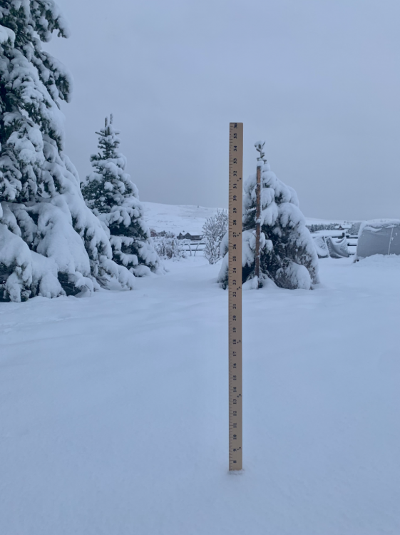
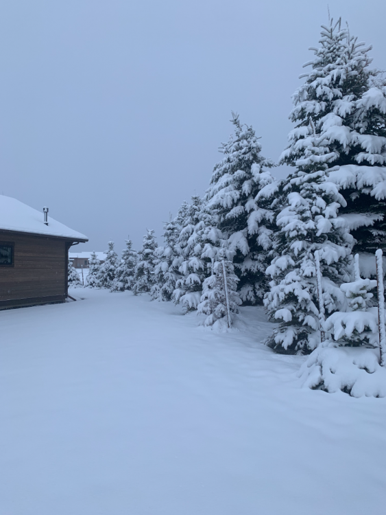
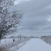
1.05" of rainfall/hail yesterday afternoon/evening with the strong storms that moved through here before changing to heavy snowfall around midnight. Measured 7" this morning! Pretty incredible for May 8th. Currently 28F.
 13 points
 -
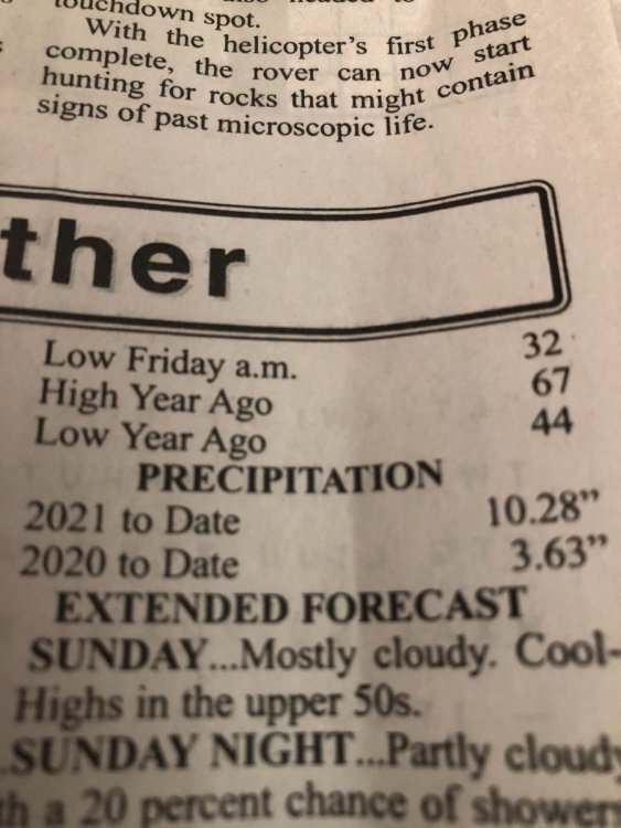
I sure didn’t realize we are 7” ahead of last year’s precipitation as of May 7th. Got this from the local newspaper.
 5 points
 -
Lol yea this spring has been pretty kold.5 points
-
Severe thunderstorm watch issued until 5am. Going to be a stormy late night.4 points
-
My son got the auto repair bug and we ended up finding a decommissioned police package 2014 Ford Explorer for him. The thing was in ruff shape and he’s turned our 3rd bay into a mini repair shop complete with a broken snow shovel. The Haynes manual has become his bible.4 points
-
The SD black hills are awesome, I gotta come in the winter some time! The drive here was interesting as well since I had never been west of Kearney. The sand hills is probably the most desolate region of the country east of the Rockies. It was quite the peaceful drive (except at one point I was about to pee my pants and had to go on the side of the road )
 4 points
 -
I finally finished the partial engine rebuild I did on my 1997 Expedition, and it runs fantastic! Yay! From that standpoint all of the dry weather has been a blessing since I was doing it outside.3 points
-
41 with ice pellets and thunder. Crazy3 points
-
Yeah every year since we moved here in 2017 but usually it's just an inch or two here and there sprinkled throughout the month. Don't think I've seen more than 3-4" in a single storm for the month of May. Record single day snowfall is 15" (1938) in Bozeman so obviously not even close to a record.3 points
-
Mowing a very wet and soggy lawn... but the weather is not too bad right now.
 3 points
 -
Final Euro is very close to the UK3 points
-
The UK has been one of the drier models for the northern edge. Today's 12z run changed that.3 points
-
What the....??? May snow in the grid back home...no bueno...dynamic cooling may do the trick...in the warm sector of the storm, KC and MO peeps have a nasty squall line signal showing up...
 3 points
 -
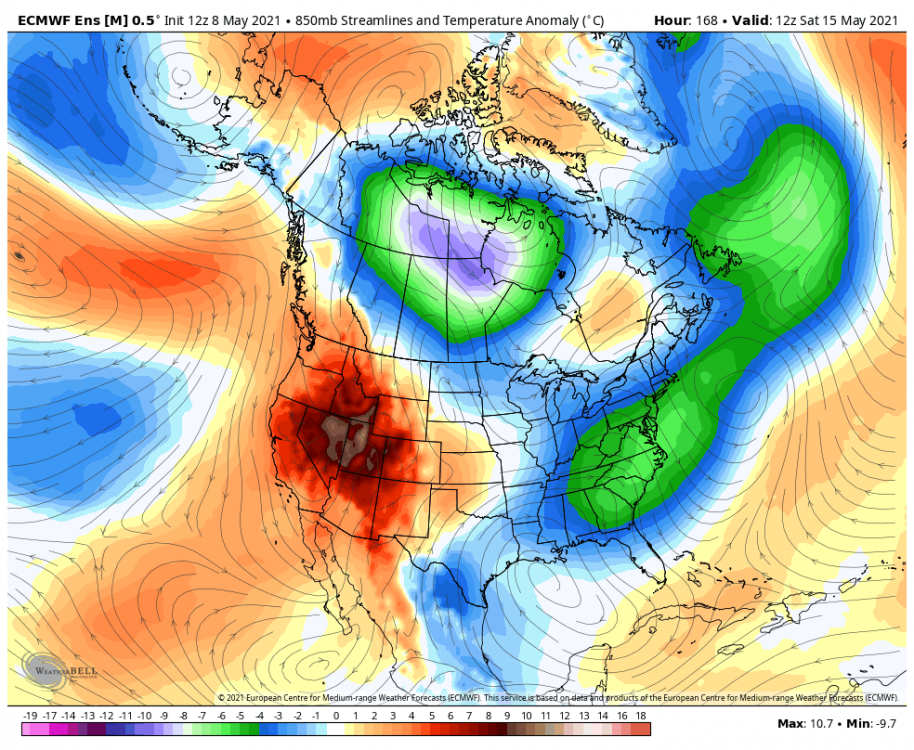
Nice to see the Euro/EPS follow suit and trend North...below is the 00z EPS... I don't have my notebook handy to be able to look back at previous LRC cycles, but what I'm seeing in the modeling for late next weekend into the following week starkly reminds me of the LRC pattern which parks a trough in the SW creating a SW Flow aloft. This is a bonafide major warm signal for our Sub Forum. Is this the summer pattern we have been waiting for? Sure looks like it. Could summer temps be coming in earlier??? Boy, the 00z EPS is certainly looking mighty nice in terms of temps and precip chances. Is the traditional Tornado Alley going to come alive??? I think so. Severe Wx looks ideal in this set up and I think we may be heading into a very active pattern with multiple days of severe wx potential starting late next weekend.
 3 points
 -
Euro finally came north. And many models are showing snow mixing in and changing over on the north end of this system.3 points
-
I agree, pretty balanced Spring weather for us2 points
-
Tweet from KDVN.
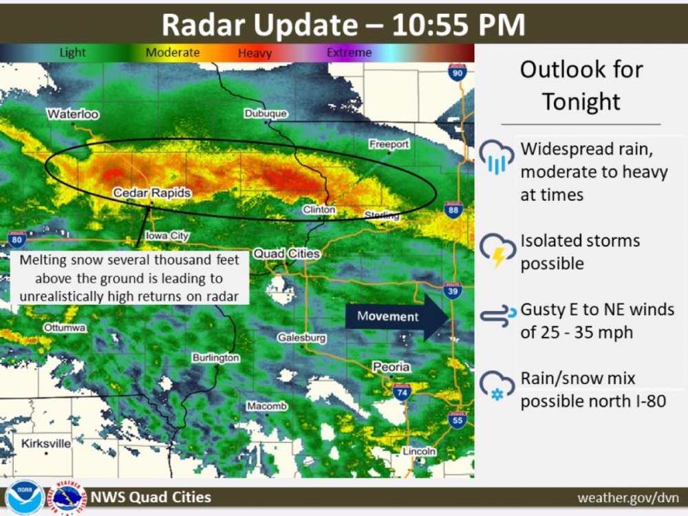 2 points
 -
I'm more of a "very light downpour" person myself.2 points
-
2 points
-
2 points
-
I’ve found this spring to be pretty enjoyable. Could have been a little wetter here to better prepare my lawn for the summer dryness, but overall a pretty good mix of clouds and sun with just enough deck weather along the way.2 points
-
Had a light frost this morning.2 points
-
No doubt... I hope this is right bc that'll put a dent into the drought conditions for the lower lakes...1-2" of rain would be welcomed...2 points
-
Ended up with an impressively chilly 55 / 42 for Friday. Really nice temperature variability this spring.2 points
-
I'd rather have that over torrential melanoma.1 point
-
Sounds like a snowy climate there. My latest 3+ inchers are in March. I had a 2" day in April 2012 but that was a cooler and wetter La Nina than this one by a long shot.1 point
-
Northern Iowa is getting hit hard.1 point
-
Its been thundering on and off all evening. Been a while since that has happened.1 point
-
Snow is being reported just west of Mason City.1 point
-
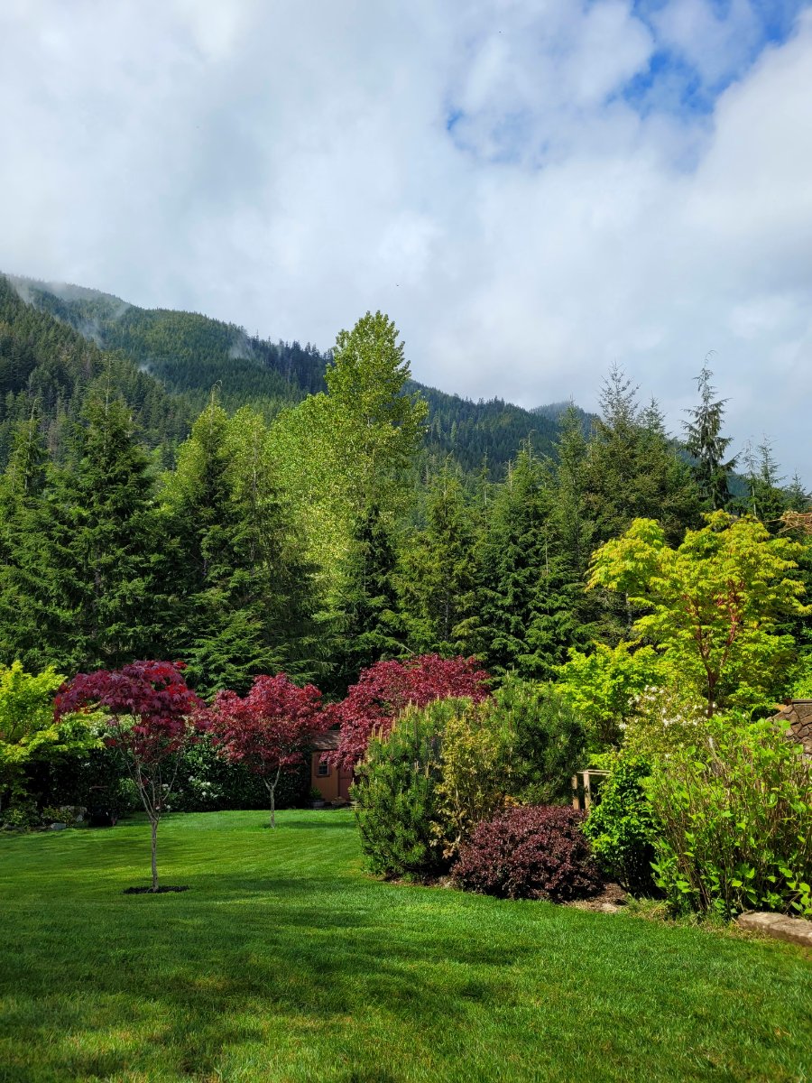
Nice day! Perfect conditions to start phase 2A of landscape projectapalooza 2021.1 point
-
Spring 2019 was just really dry. We got lucky and had a good amount of rain in July and august...but we may not get as lucky this time. Going into our driest time of year with most of the region well below normal in rainfall isn’t a good thing.1 point
-
Man the IO is a fireball right now. SSTs approaching 90°F.1 point
-
I’m in the first shade of red!1 point
-
Eastern Washington when or if I ever retire!1 point
-
I think you belong somewhere with a large seasonal cycle. That seems to be your thing.1 point
-
It’s 48 right now and I just waded half a mile up a creek in flip flops. According to you I should be dead right now.
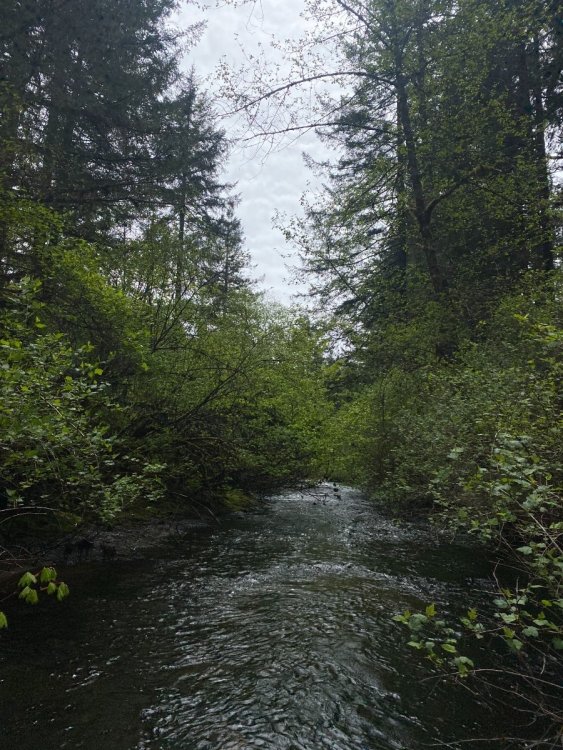 1 point
 -
12Z EPS is starting to look like the ECMWF next weekend. Side note... this entire upcoming week is looking much nicer than it did a few days ago.
 1 point
 -
52 and mostly cloudy here. Might eke out a few sprinkles this evening.1 point
-
It is morning out1 point
-
Looking forward to a good soaker. My yard needs it!1 point
-
0.02” of rain today. 0.13” for the month here1 point
-
You often get burned by these proclamations. Time will tell. If I had to bet... I would go with a watered down trough that brings very little rain except for the usual spots.1 point
-
It’s a bogus run.1 point
-
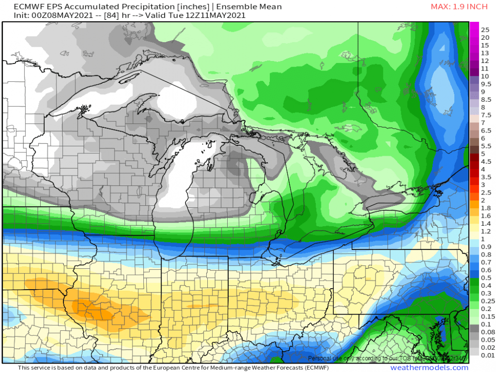
00Z ECMWF looks less troughy later next week. 00Z run last night on top and new 00Z run on the bottom...
.thumb.png.74de86ecefa4e90c8c8bcf0dac5ed9d4.png)
.thumb.png.4293e769dd92338b9bad63e1fbda924b.png) 1 point
1 point -
@Clinton, your looking good for some severe Wx action Sunday. That goes for the KC crew as well. Best setup of the season so far.1 point
-
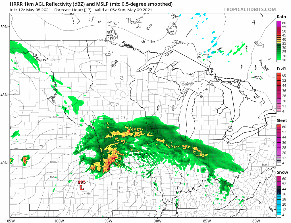
12z HRRR showing some strong storm clusters...
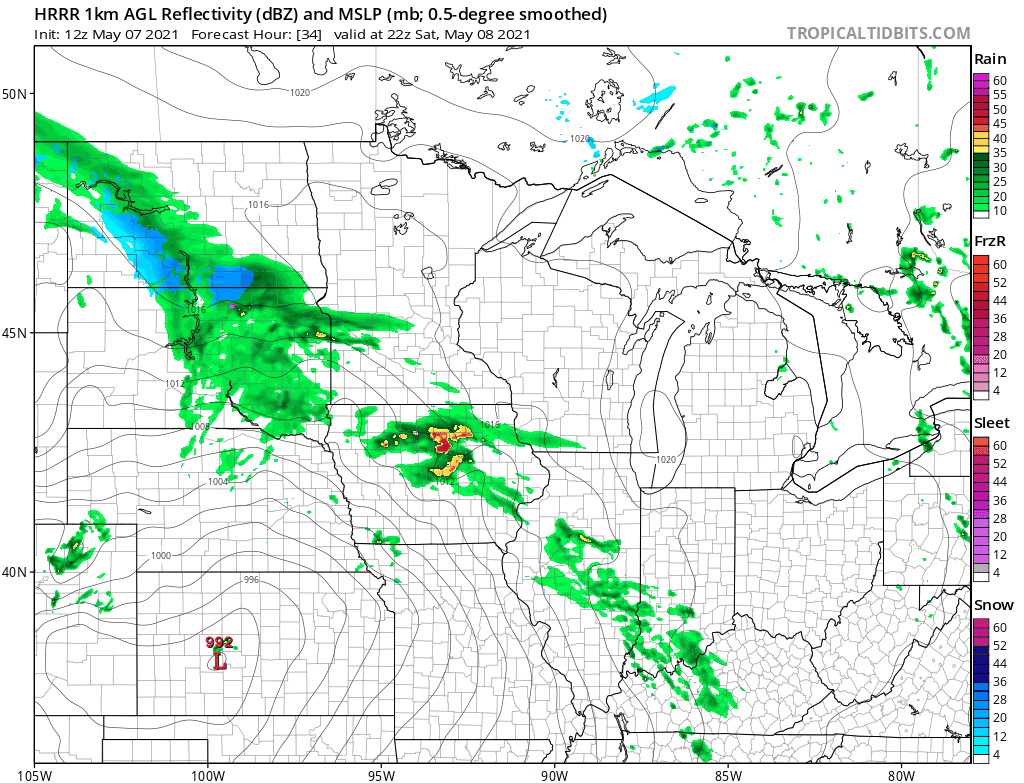 1 point
 -
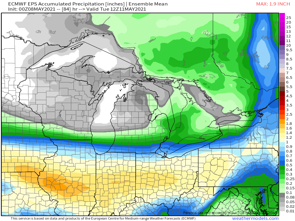
Ah ha, the CFSv2 has now have flipped to a warm spell for Week 2... Wet pattern should shift farther north as well...1 point
-
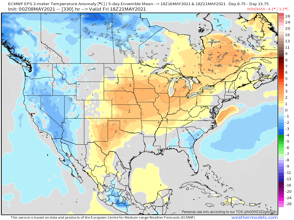
If we are to believe the 00z EPS, a sustained warm up is on deck from next weekend into the following week...not only that, but an active pattern is shaping up for the 2nd half of May esp for those who have been quite dry of late. I took a glance at the Euro weeklies from yesterday and they, to, suggest this warm signal to have some legs. It may get interrupted by Memorial Day weekend, however, but then another warm signal shows up as we enter June. Summer heat by late month for parts of the Plains/Upper MW?? It's been on my calendar for some time now. Yesterday, PHX made it to 101F and that makes it 2 days in a row hitting the century mark and it appears that next week there may very well be a string of 100's.
.gif.15256daa6d1650f8c4c0da7c45d772eb.gif) 1 point
1 point -
I remember feeling the energy in the air that day. NWS Kansas City 18 years ago our region saw a pretty devastating tornado outbreak. Here are a few photos and radar images from that day: https://weather.gov/eax/may0420031 point


.png.3329b132871ac8b9ae05217be57a49ea.png)
.png.f23d4b5caf848490152026f477748163.png)

This leaderboard is set to Vancouver/GMT-07:00