
Leaderboard


Popular Content
Showing content with the highest reputation on 05/19/21 in all areas
-
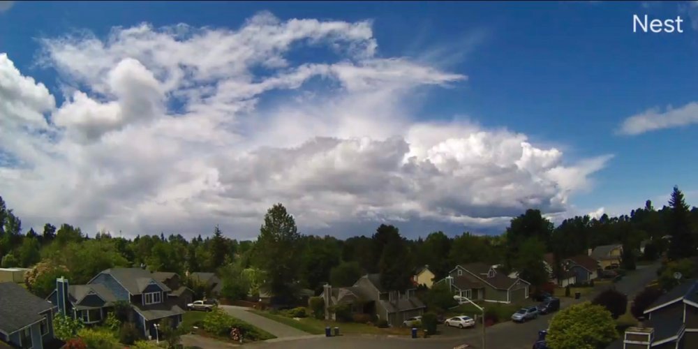
Clip of the storm from beginning to end.....very cool! https://video.nest.com/clip/1fd9d2f06b77452cbc676458b5263e1e.mp48 points
-
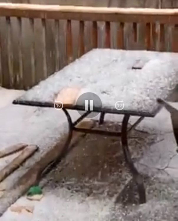
FullSizeRender.mov8 points
-
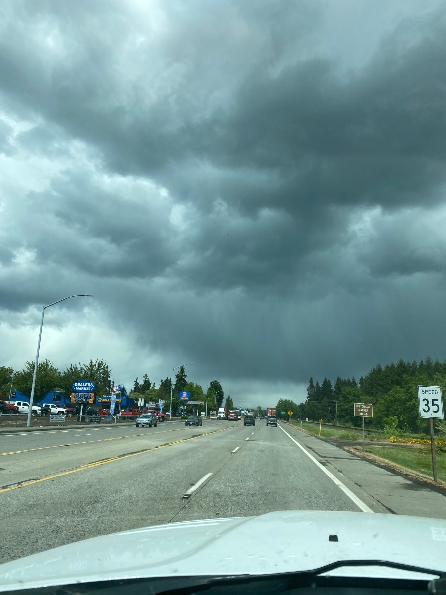
Getting some awesome hail right now. Biggest I’ve seen in a couple years for this area.6 points
-
Rainbow!!
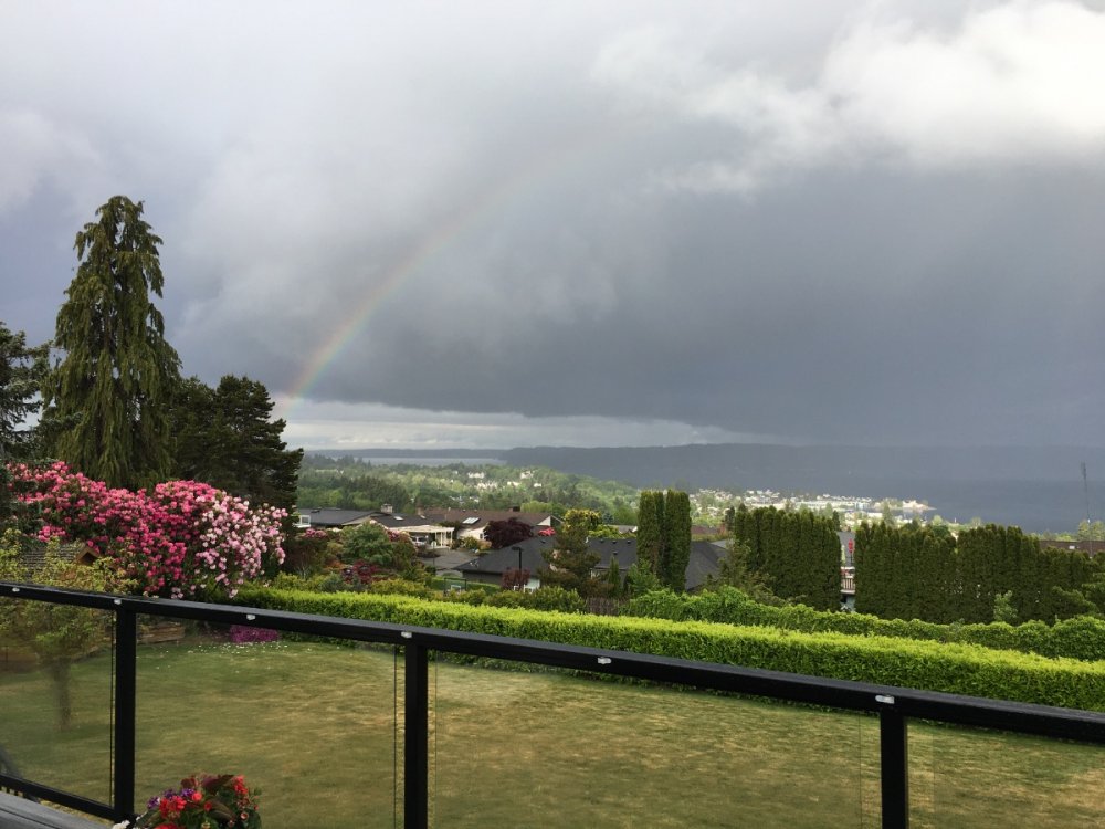
 6 points
 -
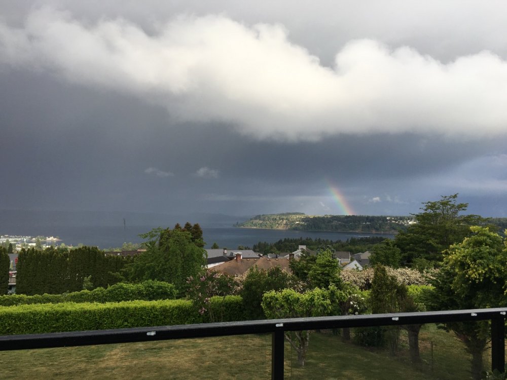
Faded by the time it got here but made a cool pic.
 5 points
 -
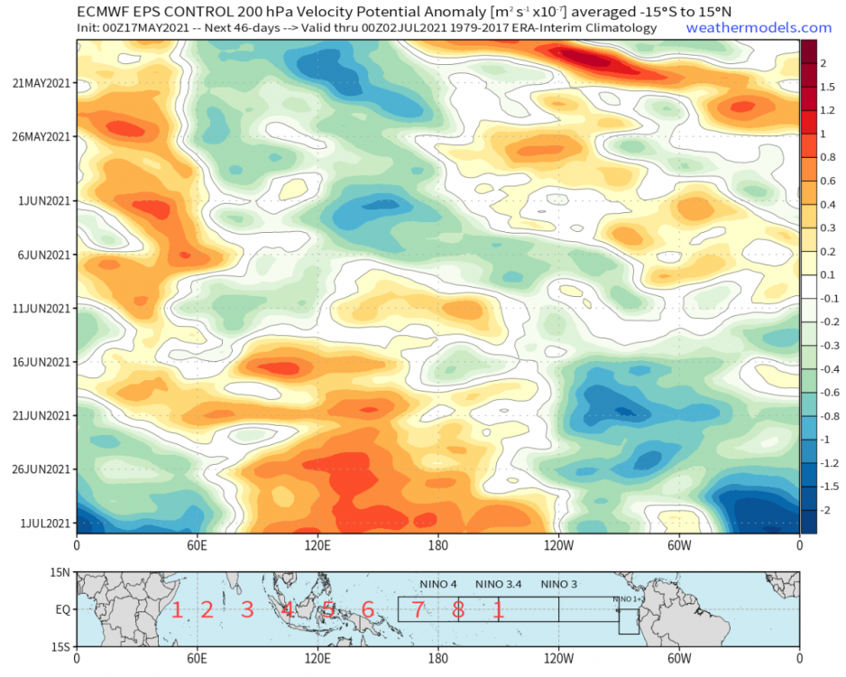
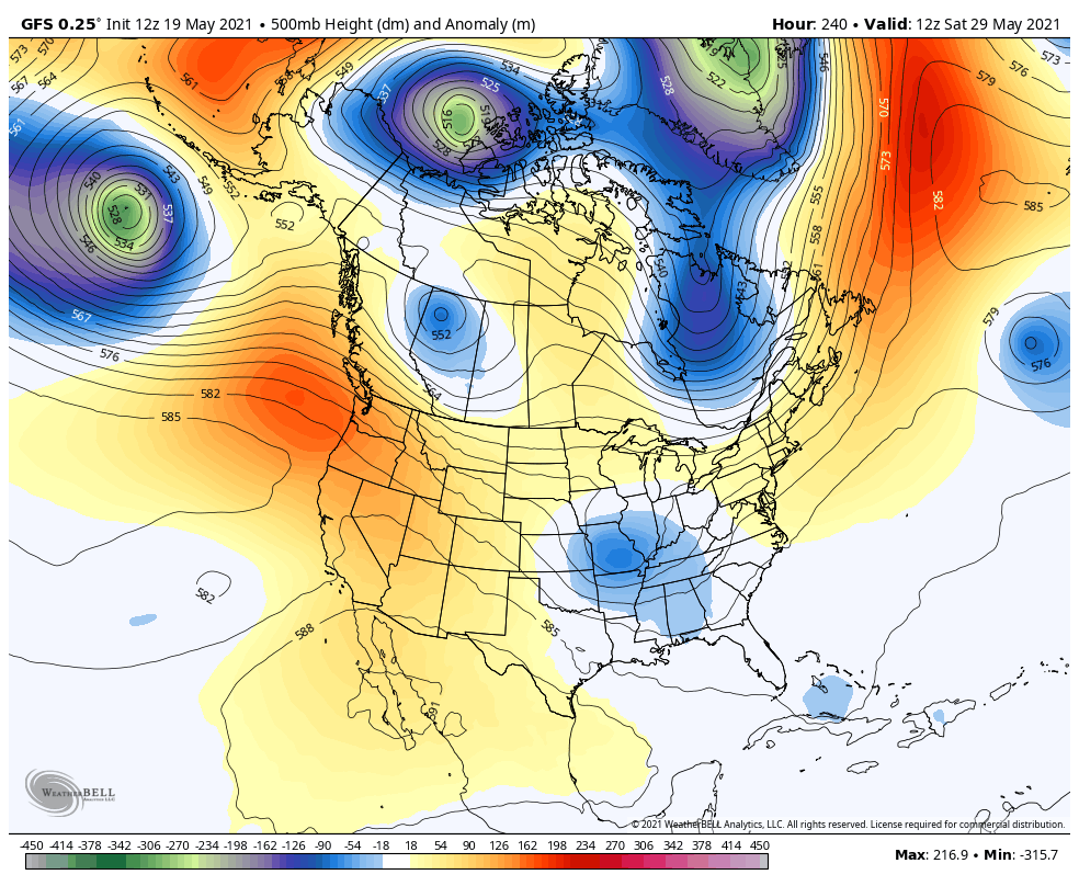
Models are showing a couple of ULL stalling out over Montana over the next 10 days. Kind of crazy that we have drought concerns yet flooding could become a real issue if the models are to be trusted.
 5 points
 -
Schools out for summer. I'm as excited as the kids. Cloudy, humid morning, but no one is complaining. Have a great summer all.5 points
-
I can't remember a stretch like this in Mid / late May of low stratus / drizzle and -RA. Haven't seen the sun since Saturday and probably won't again till Friday or Saturday. It's almost like Nov with % of possible sunshine.5 points
-
Sitting outside watching this one. Will post the nest action shot later! So cool, I’m the only one in the neighborhood looking up
 4 points
 -
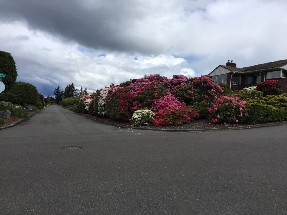
Neighborhood rhododendron garden is in full bloom. It seems like rhododendrons and azaleas are staying in bloom longer this year, maybe due to the cool and dry weather. Or maybe it’s my imagination...
 4 points
 -
Went out to Leavenworth and Chelan and was surprised at how green everything was and no fire risk. Went from almost 70 deg to 34 and heavy snow in about 15-20 min going from Peshastin to blewett around noon today. Really cool to experience.4 points
-
I remember this one time, at band camp, it was sunny and then it was rainy and then it was sunny again.4 points
-
Only 32 days until daylight starts to wane once again!!!! I can’t wait for Fall.3 points
-
Heavy rain in Tacoma! We finally got nailed.3 points
-
Got about 10 minutes of very light sprinkles here in Culver. Hoping things get a little more dynamic tomorrow as the low placement creeps south.3 points
-
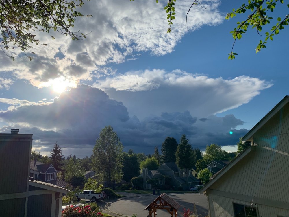
I can see the anvil of those things to the SW from my place. Pretty mean showers.3 points
-
Ran over to Ellensburg and back this morning and the summit of Snoqualmie had some snow on the trees about another 100’ up in elevation. Chilly, partly cloudy, and windy in Ellensburg and the same back here at home.3 points
-
55 here under mostly sunny skies fairly chilly for this time of year under almost full sunshine. Might get fairly chilly tonight too.3 points
-
My current view ! 55* with 12 mph nnw winds
 3 points
 -
And now this...
 3 points
 -
Yup its starting to get muggy. Cloudy and 68 currently. DMX feels confident with some decent rain tonight and possibly isolated severe storms Friday. Id love to see some storms!3 points
-
Dew points sure have been creeping up. 68 here in page county, Iowa (my internship location). Lincoln is sitting at an arid 63!3 points
-
First summery morning here. 65°F and muggy.3 points
-
Interesting pattern, if a hurricane was to move into the Gulf later this summer that moisture would be pulled up north for many of us. However SE Texas would be in big trouble.3 points
-
Brrrr...33.6 right now. Good enough for my coldest temp so late into spring. Will it hit freezing???3 points
-
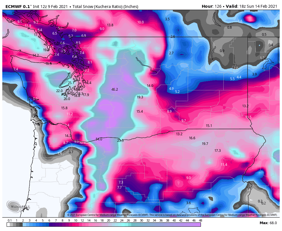
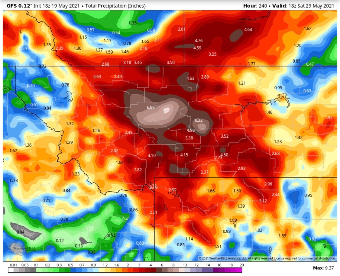
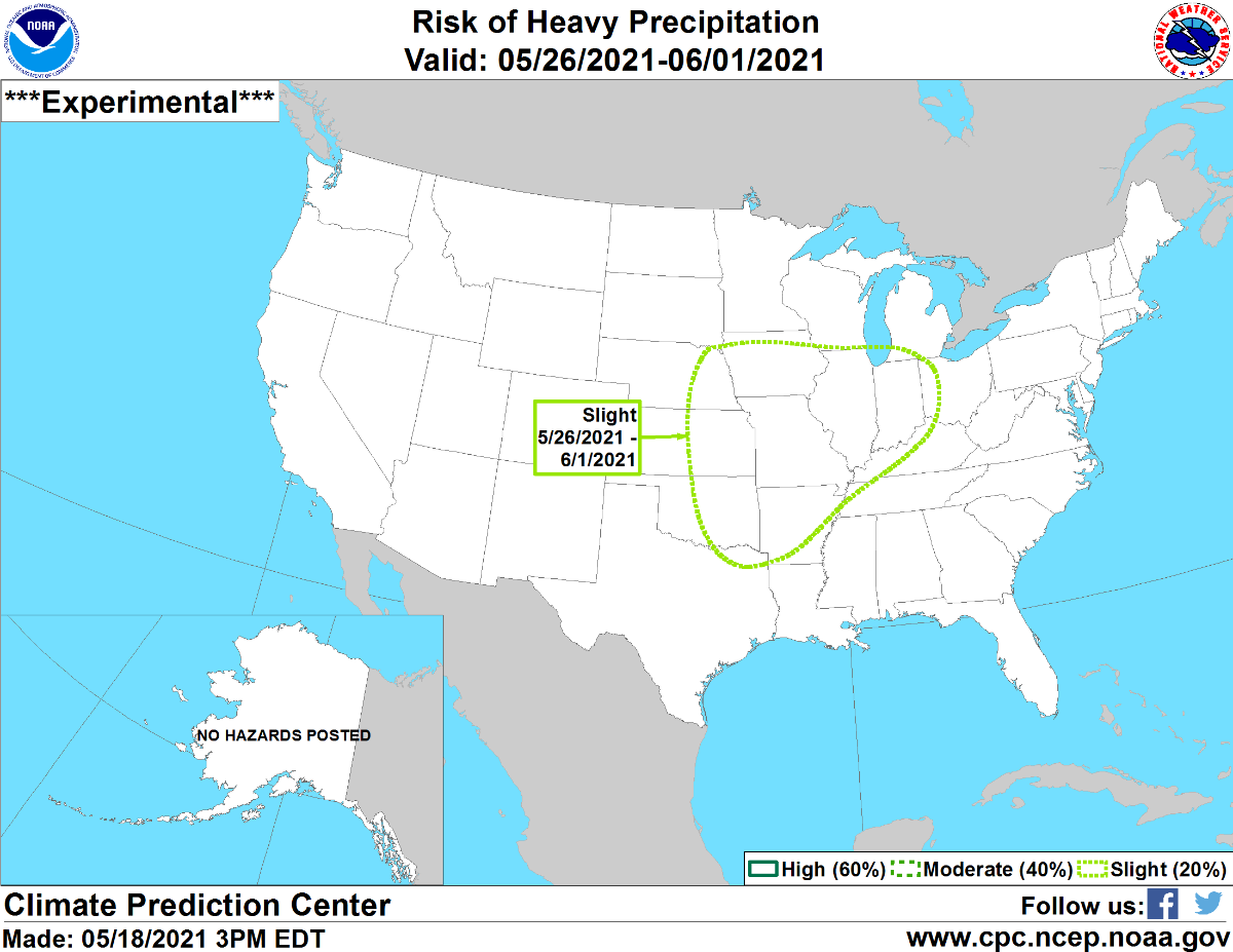
The NWS DVN had also mentioned the wet outlook for next week, referring to the map below as well and the atmospheric river from a wide open Gulf.
 3 points
 -
Meanwhile- in and around Glacier National Park- r forecast by "City, St" or zip code Winter Storm Warning URGENT - WINTER WEATHER MESSAGE National Weather Service Great Falls MT 230 AM MDT Wed May 19 2021 MTZ009-048-192200- /O.CON.KTFX.WS.W.0003.210520T0300Z-210521T1500Z/ Northern Rocky Mountain Front-Southern Rocky Mountain Front- Including the cities of Marias Pass, Bynum, Choteau, Browning, Heart Butte, Logan Pass, and Augusta 230 AM MDT Wed May 19 2021 ...WINTER STORM WARNING REMAINS IN EFFECT FROM 9 PM THIS EVENING TO 9 AM MDT FRIDAY... * WHAT...Heavy snow expected. Total snow accumulations of 4 to 9 inches at lower elevations. In the mountains, 10 to 20 inches of snow are expected, with isolated higher amounts. * WHERE...Northern Rocky Mountain Front and Southern Rocky Mountain Front. * WHEN...From 9 PM this evening to 9 AM MDT Friday. * IMPACTS...The wet and heavy nature of the snow could cause isolated power outages and damage trees or vegetation that have fully leaved out. Agricultural interest, especially those with newborn or young livestock, could be extremely impacted due to the duration of wet conditions and cold temperatures. Roads, especially bridges and overpasses, will likely become slick and hazardous. The wet and raw conditions could lead to hypothermia in the backcountry if not adequately prepared. * ADDITIONAL DETAILS...Visibility will be reduced below one half mile at times. PRECAUTIONARY/PREPAREDNESS ACTIONS... Do not touch downed lines and report any power outages to your electric company. Travel is highly discouraged due to slick roadways and the possibility of downed trees and power lines.3 points
-
Managed to avoid any rain showers today. Everything seemed to be focussed over the mountains SW of here.2 points
-
You really got that much? What was it like when it came down? We just got a few sprinkles of this strange water stuff several hours ago. Too bad we don't have a rain barrel to collect any of it.2 points
-
Only 0.08" on the bucket, however some pretty heavy rain just started. Let's see what this shower can do. Chilly highs up and down the I-5 corridor today. Looks like quite a bit of snow on the highlands of S. Central Oregon tonight.2 points
-
You can have my 'comfortable' air mass, 38° at 4pm with mixed rain/snow showers...2 points
-
Wow! Last night was very chilly, definitely felt like as if it's winter. I had window slightly opened and had to wake up in the middle of the night to fully shut it and turned on the heat.2 points
-
The sun just poked out for the first time this week. The temperature has responded by jumping into the 70s.2 points
-
Through yesterday Cedar Rapids had hit 70º only twice in May, the least number of 70º days through May 18th since 1945.2 points
-
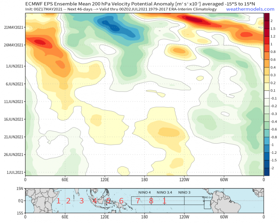
Evidence on the EPS weeklies for a period if large scale WPAC subsidence as we head towards the summer solstice. Excellent news if that verifies. A Jesse pattern.
 2 points
 -
Clear with a somewhat impressive low of 37 this morning. Even had a touch of light frost on the roof. Weird spring. 58/44 yesterday with widely scattered showers and .05” of rain. Hoping we can score a little more in the way of activity today.2 points
-
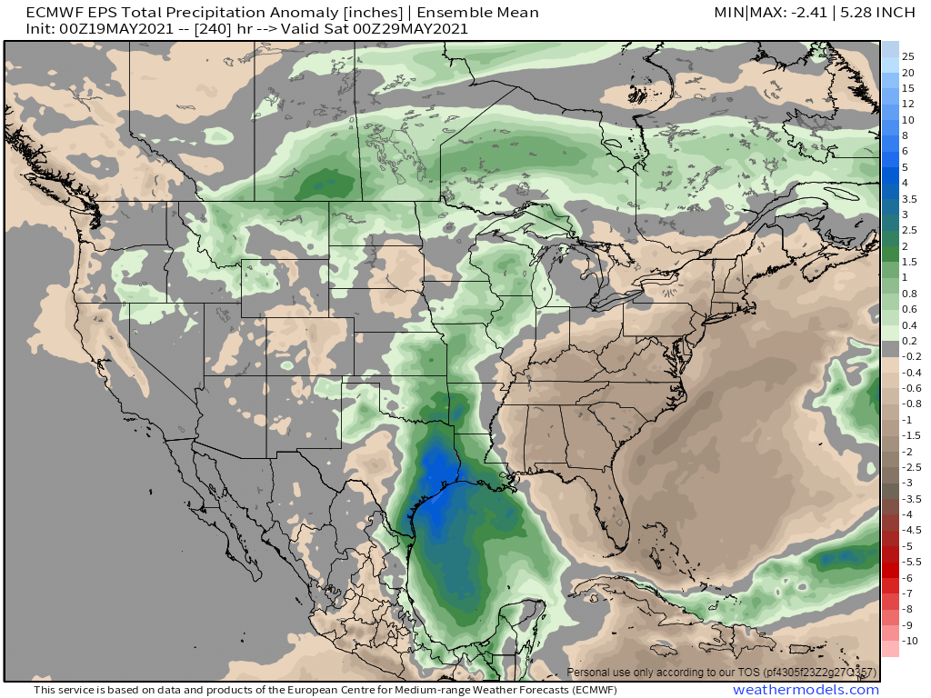
00z EPS and the GEFS are starting to look very wet next week across most of the MW ag belt region. Signs of hope for the drought stricken GL's region??
 2 points
 -
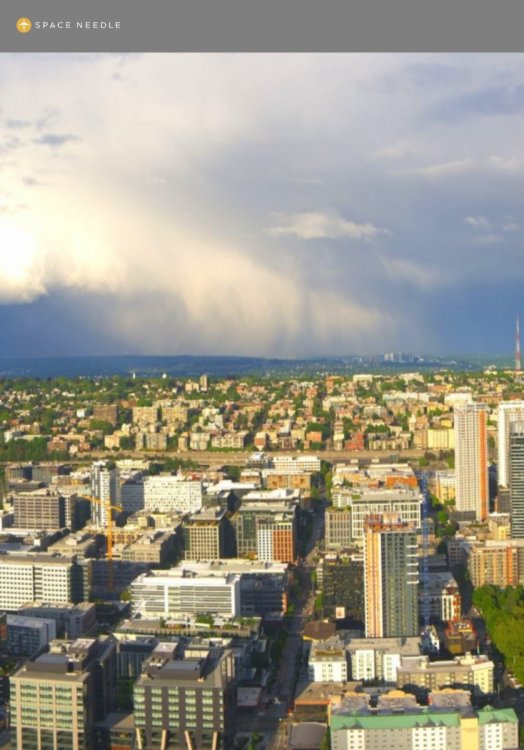
Zoomed in view of storm now just north of downtown Bellevue.
 2 points
 -
I ended up with 0.28" today.2 points
-
00z Canadian looks..less bad out there.1 point
-
Don't worry the long range GFS will always throw us a few bones and take it away to a ridgier solution. Ridges bring ridges and troughs bring more ridges.1 point
-
Thanks for sharing that! Cool video.1 point
-
58/45 today 0.02” of rain.1 point
-
Wow! that is awesome. I'll be heading back west over that route tonight...guess i have to keep an eye on it.1 point
-
What a brutal pattern this is. I’d say there’s a 50/50 chance we don’t see a sub-80 high until September now. The MJO transit to WPAC means the West probably joins the blowtorch soon. Hopefully not too long lasting out that way but..just bad bad bad signs all around. Been digging for anything positive re: drought situation out there, and I can’t find anything. At least we have the tropics to help us.1 point
-
Good thing it’s like 300 hours out lol. Too d*mn early for it to be hitting 90 already.1 point
-
12Z GFS is fairly dry over the next 10 days... and looks much nicer leading into Memorial Day weekend than the last couple of runs.
 1 point
 -
I just saw one of my friends on FB posted a video of it just now in the Snohomish area!
 1 point


This leaderboard is set to Vancouver/GMT-07:00