
Leaderboard


Popular Content
Showing content with the highest reputation on 05/25/21 in all areas
-
A good bit of rain in the last 24 hours for SW Washington and a lot of the Willamette Valley. I'm the 0.91" in Clark County.
.png.db9f4af628a1c1c16e5a600f39cd059e.png)
.png.f639c94396a70a8df8140e46093a85fd.png)

.png.8e9392060a7273f351273d46b5c6b249.png)
.png.5f368324ba0703cde038978003f10f81.png) 7 points
7 points -
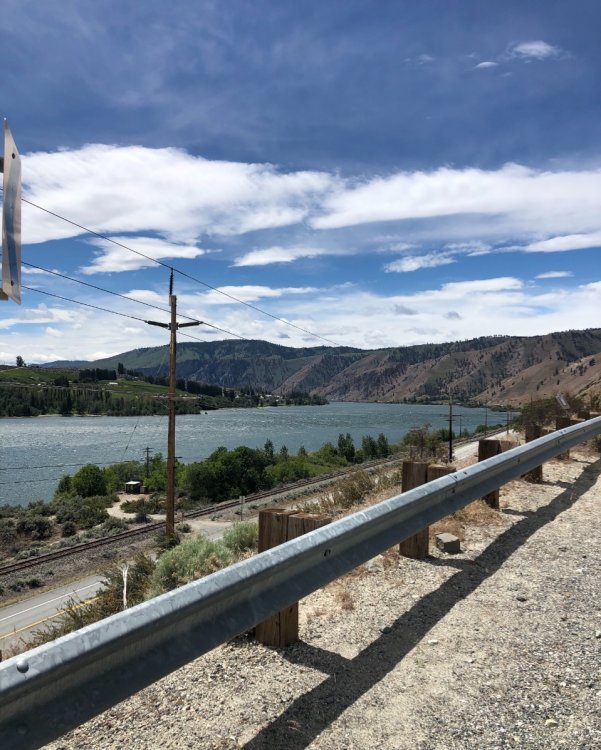
A nice drive back on HWY 20 today. Back home and it appears we have had some rain! My driveway had a small washout that happens when it rains very hard so I must have missed that...Darn. According to my weather station we have had .90” so far on the week, 1.90” for the month, and 24.65” ytd. Currently cloudy and 53.
 5 points
 -
Pretty incredible downpour yesterday in Salmon Creek, looks like about 1.47" fell in under an hour from 6pm-7pm https://www.wunderground.com/dashboard/pws/KWAVANCO486/table/2021-05-24/2021-05-24/daily5 points
-
I’ve been in a pretty good spot for downpours in the last 48 hours. About .65 of rain so far from them.4 points
-
The last 18 hours have been nice and rainy. About 0.4" so far in total so not bad at all. We need all we can get before the coming warm spell and the beginning of AC weather (for this part of the region).4 points
-
Another 0.30” from rain that has moved through the last several hours. No need to visit the Amazon Rainforest, just come to Central Nebraska. Many large rain chances in the next week. They are talking about several inches tomorrow night. I keep saying it, I don’t remember a time when things have looked this lush.4 points
-
10pm news last night showed Cedar Rapids getting measurable rainfall for the past 11 days but only adding up to 0.88"4 points
-
We probably have an outside shot at hitting 5" of rain on the month. What a blessing.3 points
-
Everyone knows the PNW ends at the Enchanted Forest.3 points
-
You could make a legitimate argument that the "PNW" ends as far north as the 44th parallel, just south of Eugene and Bend. The coast range starts to transition into the Siskiyous, increasing in elevation and preventing marine layers from reaching inland (summer in southern OR is nearly constant sunshine without marine layers). The number of rain days per year starts to fall going southwards from 44N and really declines rapidly south of 43N. As such, the California floristic province begins to take hold and species like canyon live oak, black oak, and sugar pine become much more common south of 44N - these are both drought-resistant and grow in higher elevations. The northern edge of the Great Basin also runs pretty close to 44N in central to eastern Oregon.3 points
-
Euro/EPS and the 06z GFS are hinting at a +EPO/jet pattern as westerly momentum increases. Also trending weaker with the WPAC MJO transit. Maybe the hot pattern will be short lived and followed by a crash.3 points
-
59/49 spread here yesterday with .35" rainfall. .10" so far today, good to see but we could use a lot more.3 points
-
My potential for severe weather Thursday looks dependent on how strong the morning MCS is and how quickly skys can clear out. If Iowa is the target of the Wednesday night MCS than my chances for a rough afternoon go way up.3 points
-
Tomorrow night has people’s attention.3 points
-
Ugly looking forecast for Friday around the GL's region...October wx in late May...0z Euro showing highs barely reaching 50F for NE IL as a raw, wet, windy day will be on tap. I can almost guarantee I'll be putting the furnace on later this week. Meantime, it's a beautiful July-like morning with a temp of 73F and a slight SW breeze. A touch of humidity is in the air that hopefully will help fuel some storms later tonight. Gonna enjoy these warmer days before the big cool down.
 3 points
 -
SPC forecast for mid week is kinda exciting. Thursday could get wild in MO.
 3 points
 -
I can just look at a picture of scotch broom and my eyes start watering.2 points
-
Justin’s on board!2 points
-
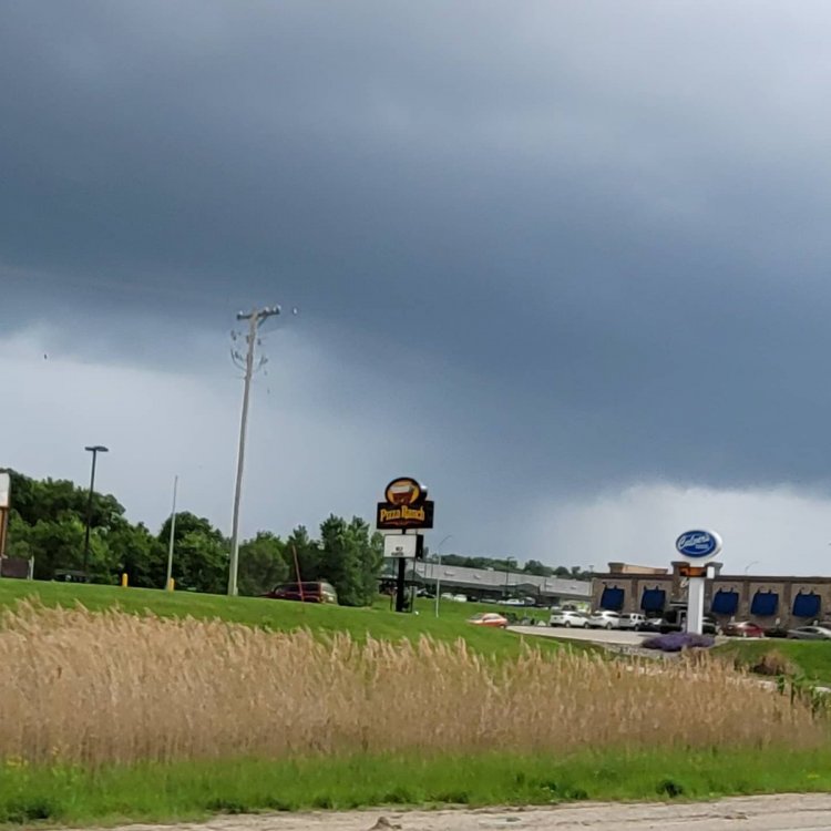
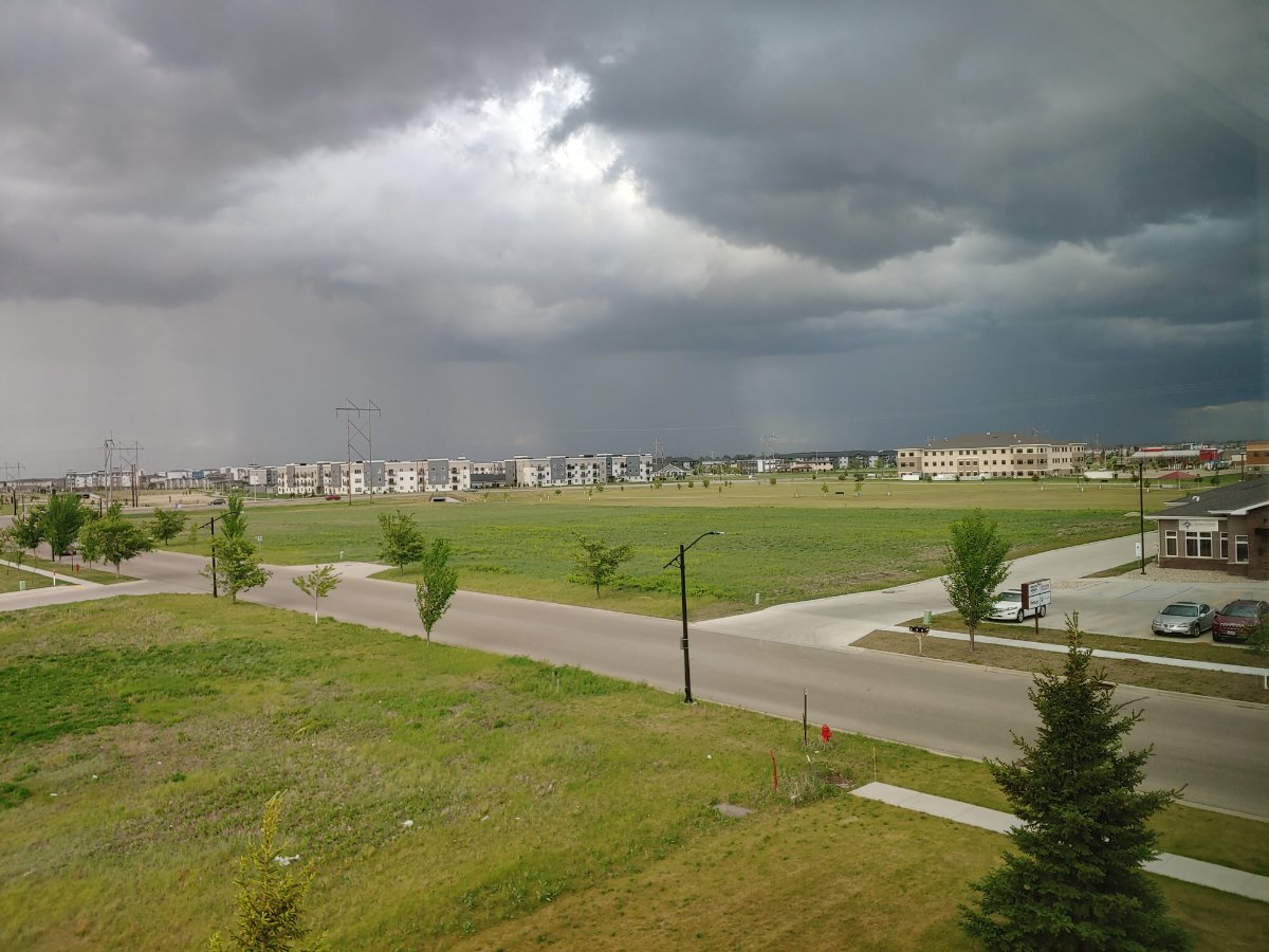
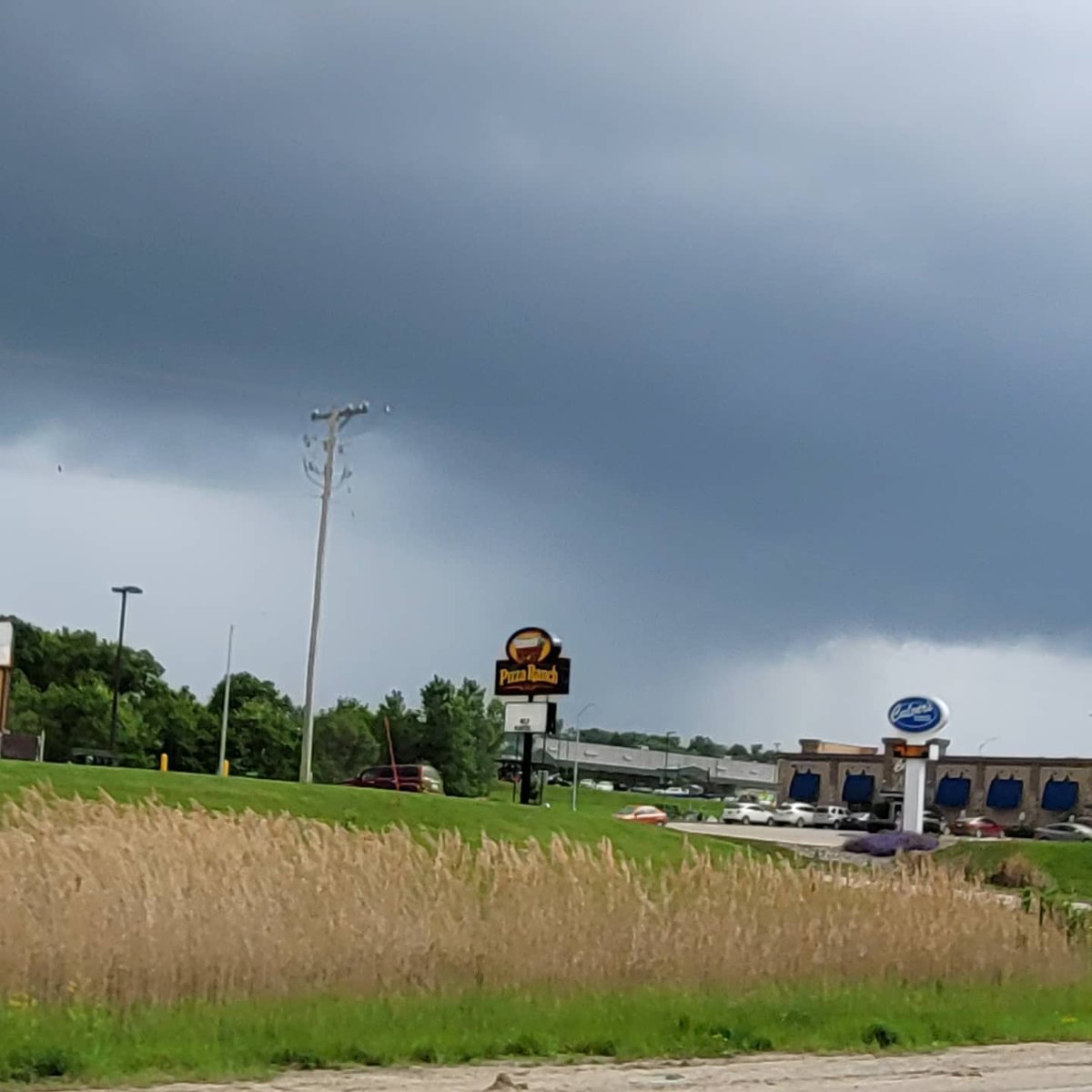
Dark sky to the North. I won't be getting any rain from this but the airport should.
 2 points
 -
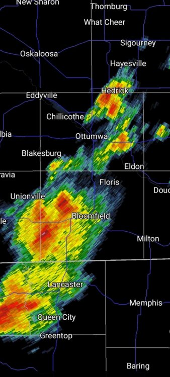
12th straight day of some rain in the Ottumwa, Iowa area. Just .03 at my home, but much more in spots. When will this end? Possibly Wednesday? I wouldnt bet on it
 2 points
 -
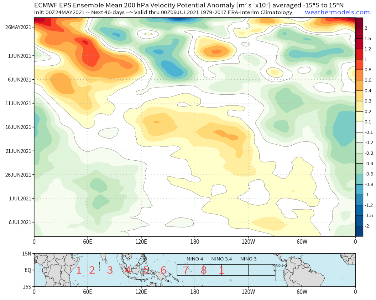
New EPS weeklies suggest a nice bout of IO/E-Hem forcing begins around the summer solstice. Would fit the idea of a more sustained cool period later in June and into July.
 2 points
 -
Yikes!!
 2 points
 -
Today 9 years ago I woke up to 1/2" of snow. That was my latest measurable snowfall I've observed, and it occurred after our first 80+ degree weather of the year.2 points
-
Some heavy showers out there this morning. Might double our monthly rainfall!2 points
-
Sorry for OT ramblings but man, this is an incredible display by Mother Nature. Today we can hear the cicada chorus even in the basement. Ear splitting. Gets disorientating if you’re outside for too long. Craziest thing is, every now and then all of the cicadas on one tree will fly up like a thick cloud then dart over to a neighboring tree. Can’t go 10 seconds without one landing on your head or torso. Estimating a 50% increase in numbers (locally) compared to 2004. Probably (in part) related to the fact conditions in 2004 were extremely favorable for cicadas to reproduce. Also the fact we’re surrounded by protected forestland that hasn’t been touched in over a century.2 points
-
While we wait for the expected rain fall over the next few days it is still dry in many parts of west Michigan. That was not the case to the NE of GR on Sunday where just to the north and north east a lot of rain fell. And there were some very cold afternoon temperatures as well. Yesterday was a very nice warm day and I would expect the same for today. The official high for Grand Rapids was 85. Here at my house the high was 87. The overnight low both here at my house and officially at the airport was 66. If that 66 holds until midnight it would make the minimum for today the 2nd warmest in recorded history at GR. There has been a trend this month of some very cold weather and then some very warm weather there have been many days/nights with highs and lows in the top 10 for warm and cold. Making for a up and down month at this point there have been 5 days with departures of -10 or better and 5 days with departures of +10 or better and we have a chance of a few more on both sides of that coming up this week. At this time it is now sunny and 76 here.2 points
-
snowshowers in the grid for Thursday night2 points
-
The strongest cell moved over me, but it was still just a low-end thunderstorm. There was lightning and thunder, but not a lot of it, and the thunder was not loud at all. I picked up 0.39" of rain. It's nice to get a thunderstorm in such a quiet year.1 point
-
Washington State Department of Transportation had an extensive scotch broom planting campaign in that era. It was the shrub of choice for stabilizing road banks. One reason it’s so widespread in Washington highway corridors today.1 point
-
00z GFS convinced me. Just bought a cardigan.1 point
-
Yeah, I've been following it all night. It didn't look good for us, but the storms to the north have gradually sunk southward and built up at the south end. Now the strongest cell is about to move into Cedar Rapids.1 point
-
Yes... we normally flip to sub-60 degree highs as we go into July and August. They always say that summer ends here on July 5th. Or is it start? Can't remember.1 point
-
I can't tell you one thing from that so I'm glad other people are able to tell me On another note, the 12-3 am time frame is pretty annoying. That was around the window basically every severe storm rolled through Lincoln last summer.1 point
-
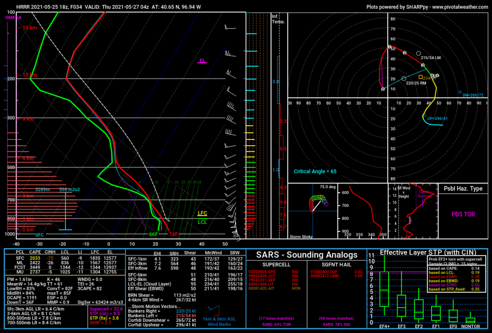
18Z HRRR is pretty scary looking for Nebraska tomorrow. Develops what would probably be tornadic supercells out ahead of the main line tomorrow evening in east central Nebraska and then has a big squall line go across the state. Shows 3-6" of rain for east central Nebraska as well. Very impressive soundings as well even well into the overnight when surface based CAPE normally disappears. Most models are showing 2-3k of surface based CAPE and 40-60 knots of shear all through the night. Could be a pretty bad night Wednesday night.1 point
-
You’ve had a string of disappointing winters, but that doesn’t mean you are not part of the PNW. Vancouver, BC (the City of Vancouver proper, outlying areas have fared significantly better) has had a string of such winters as well (and there was plenty of whining about it in the Canadian forum last winter). Granted, it’s not been the snow shut-out Eugene has had, but the annual snow totals tend to be higher up this way, so the end result is still anomalously low. And it’s not been that long since Eugene had some truly epic winter storms (of the sort points north missed out of). Your turn will happen again.1 point
-
Nice to see lots of spots down in Oregon got some nice rain totals. Not enough to reverse the past couple dry months but much better than nothing.1 point
-
1 point
-
I mean, Eugene and south basically isn't anymore. This past winter hammered that home.1 point
-
Ended up with 0.64" yesterday and another 0.27" so far today. Now the grass is back to growing quickly. Perfect timing for a good soaking before the holiday weekend.1 point
-
Still raining here...love living here. Maybe next year I'll track my yearly precip. Kinda late in the game to start now1 point
-
Sounds like the extremes that I experience around here.1 point
-
Very nice 0.63" of rain so far today! Assuming it continues for a bit, this will be the wettest day since February 22nd.1 point
-
No measurable rainfall here today for a change.1 point
-
ORD officially made it to 90F today…this marks the 1st 90F+ of the season. It’s a remarkable recovery from the mid 50’s this morning. Thankfully, DP’s held in the 50’s which made it tolerable and also one of the reasons why the temps were able to rise so quickly.1 point
-
Much nicer now and 76! Windy however!
 1 point
 -
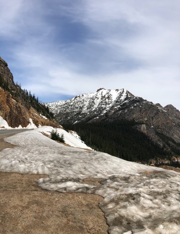
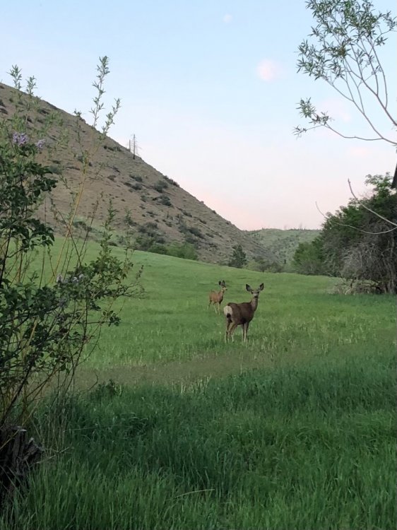
Been staying at a remote cabin up in the hills of Entiat, no cell or internet service but the deer have been keeping me company.
 1 point
 -
Only YOU can prevent rest fires.1 point
-
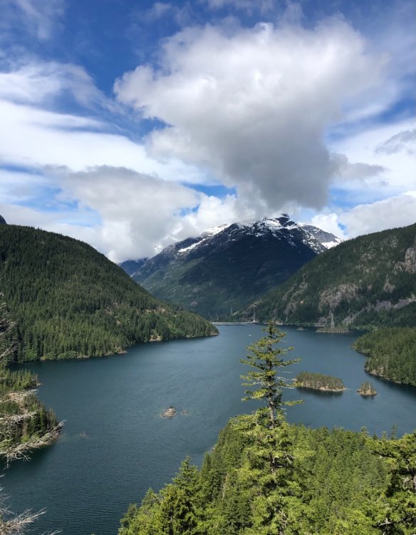
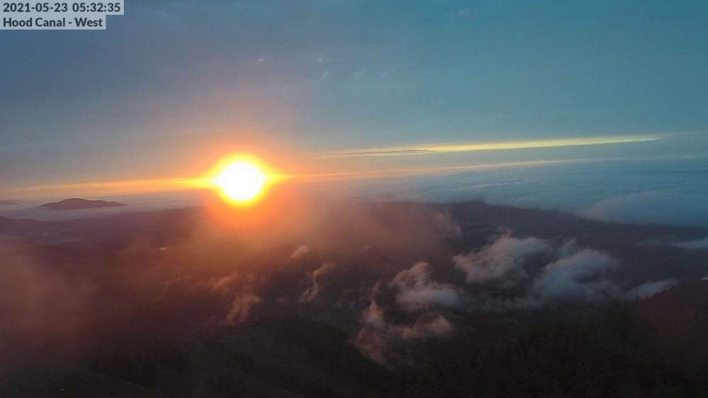
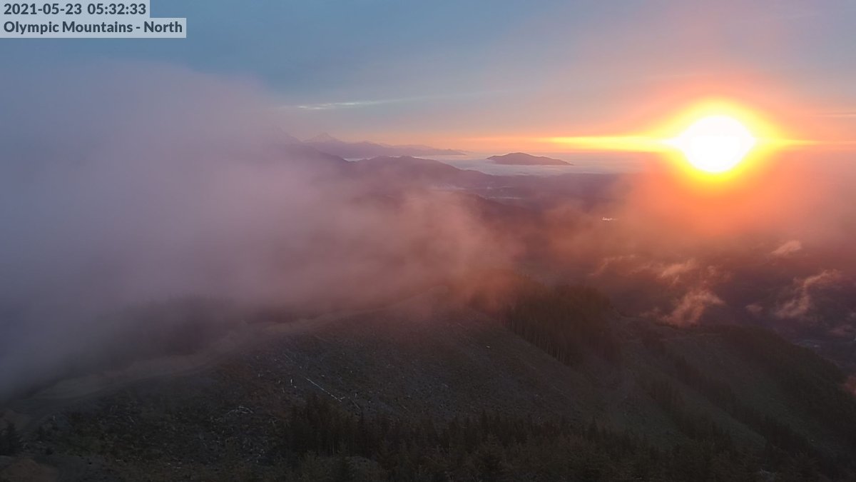
Socked in right now, but caught this at the right moment on these cams!
 1 point
 -
Pretty fun to go back and scroll through the late January/early February 1989 discos and see how clueless we were back then. Jesse might hate you, but this was a good find!1 point


This leaderboard is set to Vancouver/GMT-07:00