
Leaderboard


Popular Content
Showing content with the highest reputation on 07/20/21 in all areas
-
It was rain and showers all morning until about noon in Lynnwood and Everett. It was wonderful. I got soaked! I don't know when it started, but it was raining at 8:00am. The rain felt so good!!! It did not hit 70F here today. We were in the mid to upper 60s as out high.5 points
-
Hmmm… In that case, sunny or cloudy North Bend sucks.5 points
-
Warm and cloudy/humid here. No drizzle on the day in my area. My yard continues to explode with growth. My grass however is starting to slow down, I can now go to a every two week mowing rotation!

 4 points
 -
Happy for Giannis and the Bucks.3 points
-
Our fires? There are no fires around here. You can keep all that garbage over there. Thankful for the jet stream right now.3 points
-
I really don’t think Tim was actually trying to criticize you at all here…it can be hard to tell on the internet what people mean. Sometimes he is criticizing things people post but not everything he’s saying has a double jaded meaning to it. As for you not having much to add to the forum you actually do add to the place we’re glad to have you. Just talking about your weather conditions and statistics adds a lot to the place. Just stick around and you learn a lot. I’m still not an expert by any means but I’m still learning a lot. You learn a lot about how to read and interpret forecast models here which I had no idea how to do until I stuck around for awhile.3 points
-
The convergence zone being the most famous Puget Sound generated weather phenomenon.3 points
-
Quite a pleasant surprise with the drizzle this morning. Good enough to wet the roadways.3 points
-
A warm 78* this AM with humidity at 58%. Chance of rain this morning then here comes the heat. 91* for the high. It’s still summer. Update: As feared, rain was a no show!3 points
-
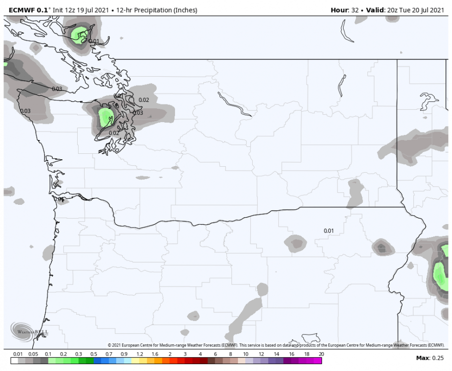
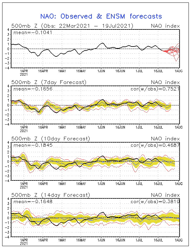
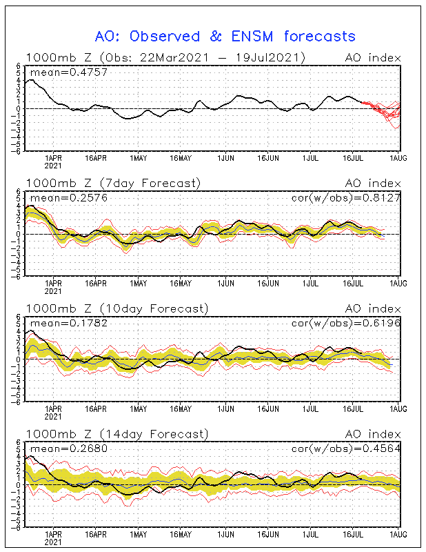
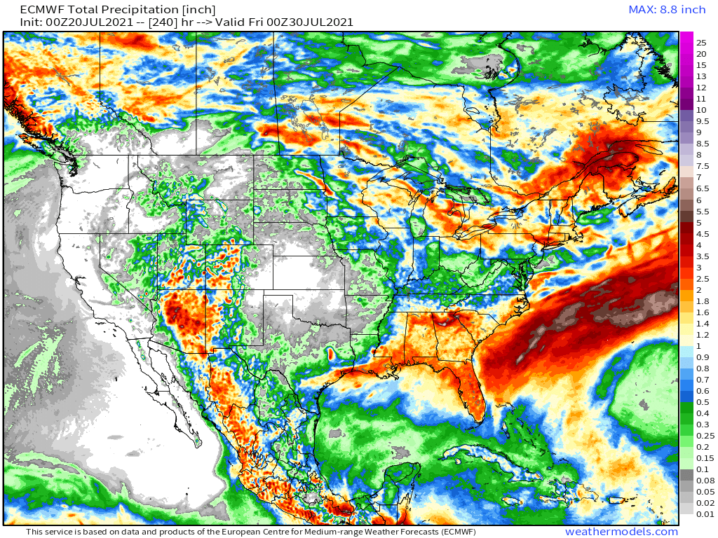
@Clinton, your post the other day about the early June heat wave that is cycling through over the next 1-2 weeks for the Upper MW/Plains states is right on. This time, however, instead of a +NAO/+AO the teleconnections are going to flip and are forecast to hover near neutral to (-). This allows the storm track across Canada to be adjusted farther south instead of farther N as it was back in June allowing the massive and expansive GL's ridge to blossom like it did back then. I'm still thinking our area will benefit from "ridge riders" and the most intense heat remains out W & N. 0z Euro precip map over the next 10 days....can you spot where the summer anticyclone is located??? On a side note, a welcomed bullseye of abundant moisture for the state of AZ. Boy, does that look pretty for the SW.
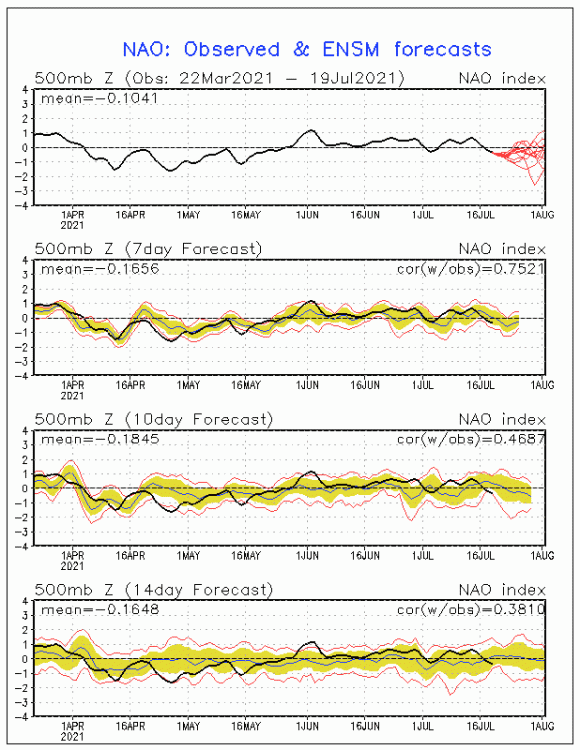
 3 points
 -
0.3" is the official total at KFAR. Can't help but feel like we got more, but I was in Moorhead at the time so maybe I just got lucky with more heavy rain than just across the border.3 points
-
In a league where star players constantly pick up and build a super-team to chase titles, Giannis did it the right way. He had the chance to leave Milwaukee but stuck around. Good for him... still only 26.2 points
-
Had some beautiful soothing stratiform rainfall this afternoon thanks to monsoonal moisture. Smoke is gone (for now) and the vegetation was very thankful for the slight reprieve from this forgettable summer.
 2 points
 -
There are many parts of the PNW. Western WA claims no responsibility!2 points
-
This is some cool stuff. The Puget Sound is very capable of creating its own weather. Just amazing.2 points
-
A lot more than what the model was advertising though it seems. Still waiting for numbers for SEA but WFO picked up 0.06”. Base on what was fallen this morning, I think the dry streak is over at SEA.2 points
-
2 points
-
Actually... just looked back at the 12Z ECMWF run from yesterday and it did show precip around Seattle this morning. It also showed it being drier out here. It did quite well... just did not notice it.
 2 points
 -
Got down to 56F. Now 69F and beautiful.2 points
-
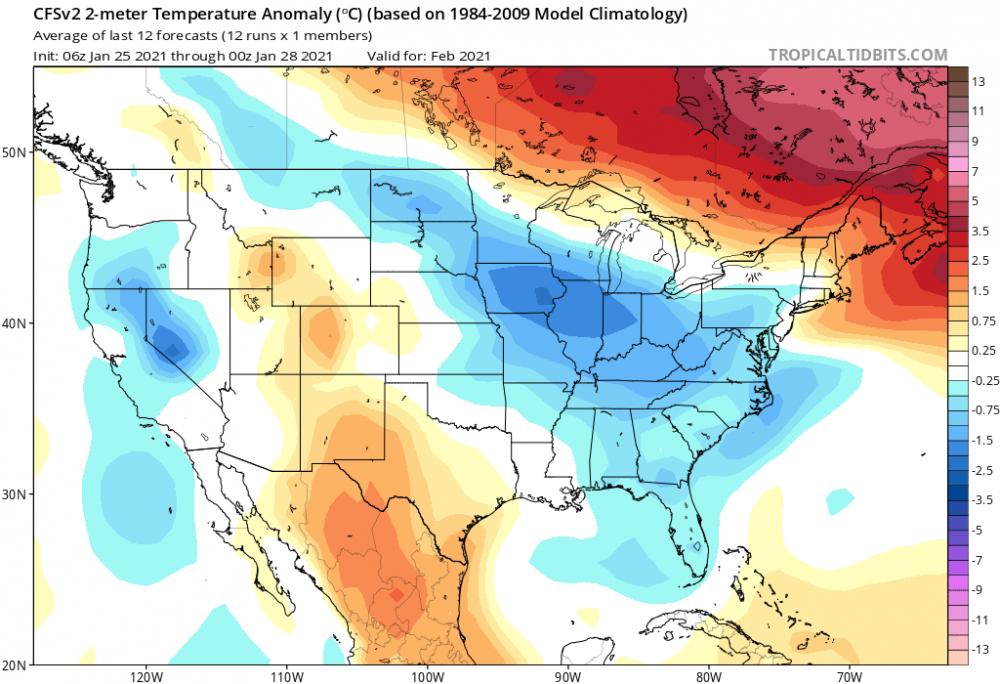
KC office posted this over the weekend and my summer has been below average temps and above average on precip. Even with the hot weather coming I believe summer will finish the same. Halfway through the summer (Jun-Aug) we are 2.3 degrees below normal for the season. KC, on average has 15 days of 90 degrees or more at this point...this year we've had 14. We have not had a 100 degree day this summer with the warmest temp being 98 on 6/17 and 6/18. The 90s will return later this week. #Summer2021InKC2 points
-
Today will be two minutes and seven seconds SHORTER than yesterday!2 points
-
Nice West-Pacific cooling. Lets keep this going.
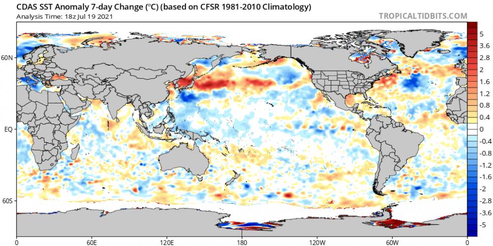 2 points
 -
The radiational cooling at OLM is a very unique thing... its real and based on geography and soil composition but it's not representative of the region.2 points
-
Here is a pic from roughly the same spot on Google street view from August 2015...
 1 point
 -
Beautiful sunset. And a beautiful NBA finals game 6!1 point
-
Because I am fascinated with old photos and it pertains to the Mountain West... this photo was taken 88 years ago this week in Glacier National Park on 7/15/1933 at Logan Pass and the opening of the Going-to-the-Sun Road.
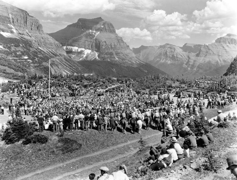 1 point
 -
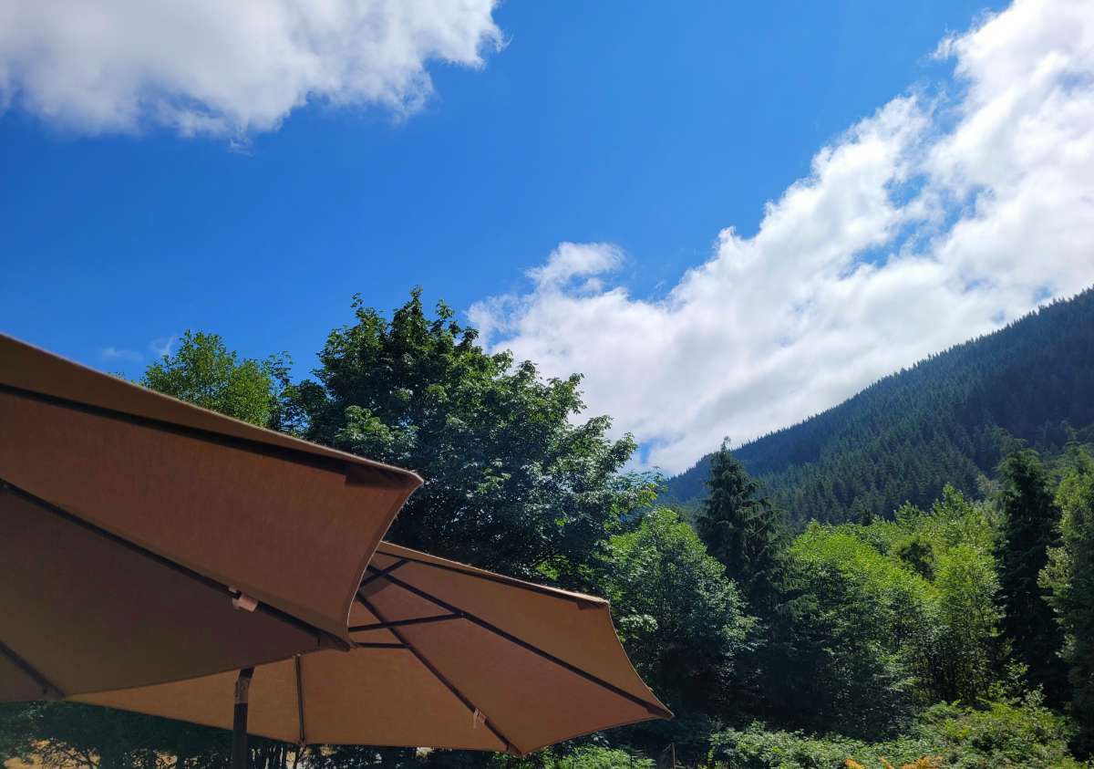
Pollution? Could not be more pretty here... a deep blue sky and a refreshing breeze and the smell of fir trees.1 point
-
18Z ECMWF shows tomorrow being pretty much the same as today with clouds hanging tough over the central Sound area...
.thumb.png.336f88437c17cd4e57b52ff84eed7bdf.png) 1 point
1 point -
WSDOT cam at MP 33 shows mostly sunny skies.1 point
-
I am not obsessed with making anything seem warm. People say I post too much about all of our rain and make it sound like it's wet and cold everywhere. But the fact is that this has been a very warm and sunny summer out here... and our area has been running warmer than Seattle almost every single day which is unusual. So I do report when its anomalously warm and dry here too. And it definitely has been. Current view here:
 1 point
 -
Just a trace at SEA so their dry month remains intact.1 point
-
You timing is always off... its your specialty.1 point
-
The strait of JdeF is a pretty big gap and is aligned WNW. But you don’t see the low clouds swirling up into the Strait of JdeF nearly as often as Puget Sound.1 point
-
Sun is trying to come out here and its 67 in North Bend now. But I see it looks quite wet in Bellevue...
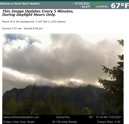
 1 point
 -
It’s been drizzling all morning but not enough to wet the ground still. It’s nice to see atleast we’ve only had a little bit of drizzle on 2 or 3 mornings since mid June.1 point
-
Literally no one has said that. But comparing this year to 2015 is absurd. Pattern is massively different, if not inverted in some respects going forward into late July and early August.1 point
-
Surprisingly cloudy this morning. Sub-80 high?!1 point
-
Looks like the seizures caused me to mix up the 6 and 5...can't win 'em all. Took me like 10 mins to type it.1 point
-
Light rain 59*1 point
-
I'd be happy with Euro's QPF, especially with the rain across Western Ontario.1 point
-
Mostly cloudy with a low of 59 here. No drizzle yet.1 point
-
Got down to 59 this morning and drizzling here too but not enough to wet anything down.1 point
-
Getting some drizzle this morning! This is the first time in over a month that I'm getting some precip from the sky. It actually feels nice with the mist! A bit of a warm night with a low of 59 and currently 61.1 point
-
ENSO has been catching up as well. Getting closer everyday.1 point
-
Meanwhile Hurricane Felicia recently reached a whopping cat4, but is headed west and already on its way out as it passes over the Central Pacific cold blob.1 point
-
New update, 0Z GFS ***all time record high in Omaha is 110*** Similar numbers forecast for South and North Dakota!! Average high temp over 13 days: 107.5 degrees 7/23- 101 7/24- 105 7/25- 105 7/26- 98 7/27- 110 7/28- 106 7/29- 110 7/30- 109 7/31- 103 8/1- 109 8/2- 113 8/3- 115 8/4- 1131 point
-
Just got the new IPhone 12 Pro Max! Can’t wait to take fancy pics and videos of our record breaking snow and cold the last week of November!! 76/49 on the day.1 point
-
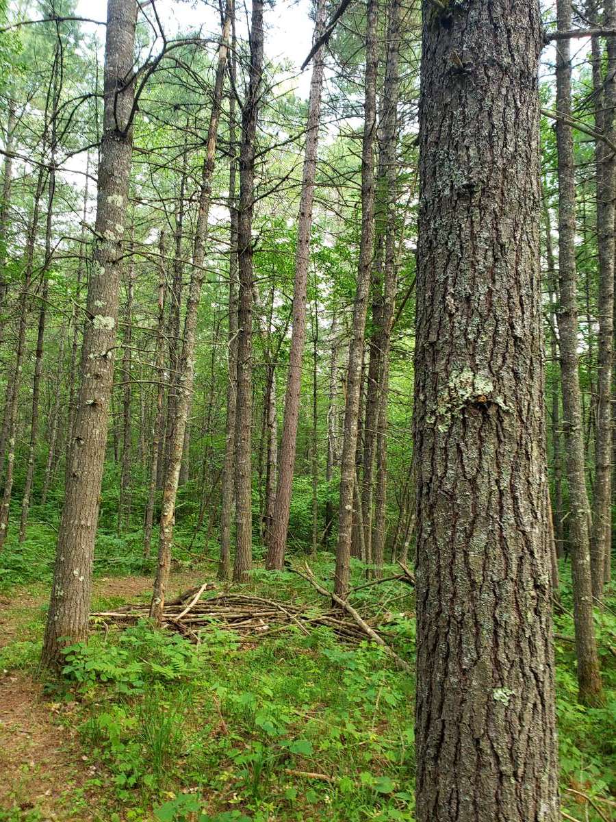
Avoid closing the windows at all costs...fresh pine scent all day everyday. Its literally one of the best parts of moving up here!
 1 point
 -
DEN hit 102 today, one short of the record. 98 at my house. As often happens with hot summer days, most of the metro area was 2-5 degrees cooler than the airport.1 point
-
Looks like continued hot for my area (central Idaho @ 4,800 ft.) and the entire west really... 90° today... Looks like more mid and upper 90's coming...1 point


.png.6a3b7ca3c233d22517f895cf5604d806.png)


This leaderboard is set to Vancouver/GMT-07:00