
Leaderboard


Popular Content
Showing content with the highest reputation on 07/23/21 in all areas
-
Well if you only care about the small part of the region surrounding your house, don’t chime in on a debate regarding regional anomalies with incorrect statements like you did earlier. Sorry that it’s warmer everywhere else this year and wherever you live is largely unrepresentative of the region.5 points
-
Wow, I just took a rain fall measurement and I recorded 1.78" of rain fall here overnight. GRR reported a thunderstorm at 5AM. While that may be true I did not see any lightning or heard and thunder but I do sleep good. There are some thunderstorms to the south west of GR down west of Kalamazoo at this time. most of the night was in the lower 70's but during the rain it fell to 67 at GRR and it fell to 68 here. At this time it is 68 with light rain falling.5 points
-
Heh..there’s actually a substantial QBO relationship to PNW summers since the 1990s. Not sure if it’s statistically significant but it’s there. There are exceptions, but I think there is a substantial difference between these two groups. Some of the exceptions are clearly ENSO driven. * denotes deviations from expected long wave pattern. +QBO within/descending below 40hpa: 1993, 1995, 1997, 1999, 2000, 2002, 2004* 2006* 2008, 2010, 2011, 2013*, 2016, 2019, 2020. -QBO within/descending below 40hpa: 1992, 1994, 1996, 1998, 2001*, 2003, 2005, 2007*, 2009, 2012*, 2014, 2015, 2017, 2018, 2021.4 points
-
The official rain fall from this mornings rain event at Grand Rapids was 2.39" Here at my house I had a total of 1.86" It looks like the most rain fell is SE Grand Rapids were there were several reports of over 2" and one even up to 3.42. At this time it is cloudy here and very humid. The current temperature here at my house is 79 with a DP of 774 points
-
Is this good enough? https://climate.cod.edu/data/surface/US_zoom/contour/current/USZOOM.fronts.gif I’ve noticed several se. Iowa stations always have higher dews and I’m thinking they’re not accurate because they often also show 100% relative humidity when that also seems to high. I’ve noticed that the last Vantage Pro2 wx station I got never shows 100% humidity even if it’s foggy or raining for awhile. My other station occasionally hit 100% and had more range. Then the new one also doesn’t seem to show low enough humidity in the afternoons and maybe that’s why my dew point often seems to high. Either way, some numbers on the maps probably aren’t totally accurate either.4 points
-
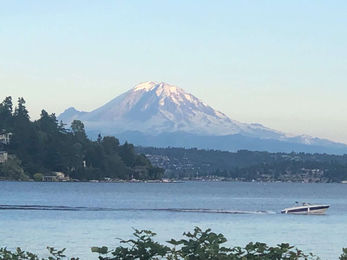
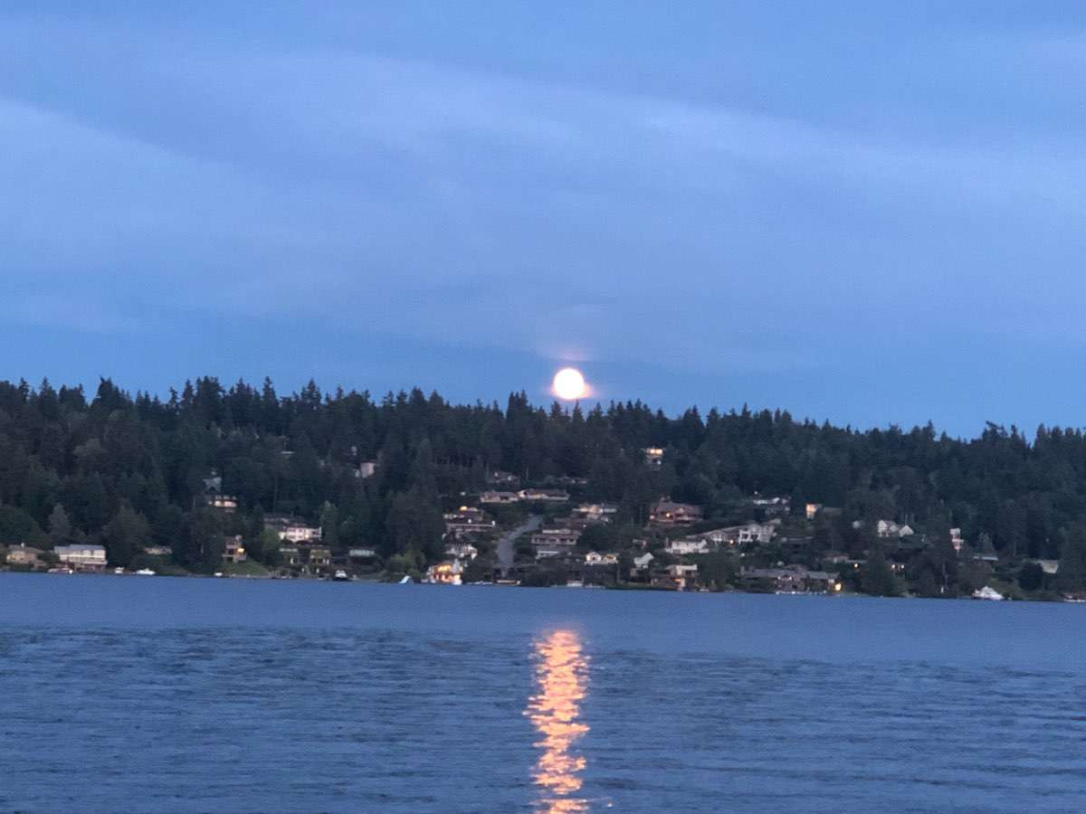
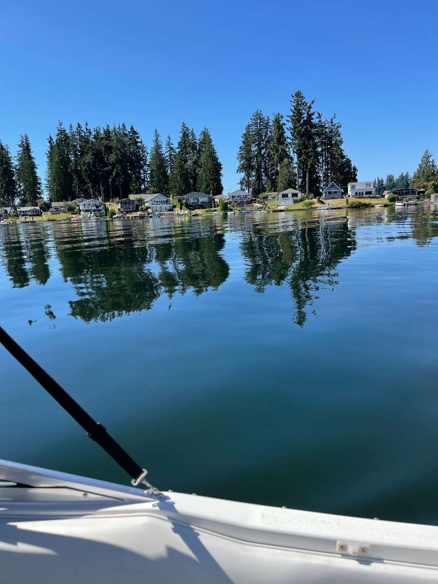
The not-so-snowy Mt. Rainier and moon rise from Lake Wa. Wish I have a better camera for the moon rise. The phone cam was not doing it justice but still a wonderful reflection off of the water’s surface.
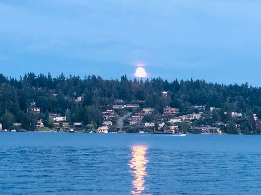

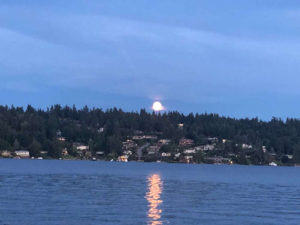 4 points
 -
Yeah……. I’m very sorry that you’re gonna end up warmer but I don’t live in said parts so I can’t relate. Facts are facts and W.Wa been running a 0 to +2 anomalies for July. And that’s about the only thing I care about. 2015 was a different set up with a different pattern. Sorry that it’s warmer this year.3 points
-
Absolute perfection!
 3 points
 -
Yeah, no. It’s far from a stretch to say this summer is on track end up close to as hot as or even hotter than 2015 for many parts of the region, fog belt locations within five miles of Puget sound notwithstanding.3 points
-
1977 might be the ultimate example of this. The first 17 days of the month was perhaps the hottest 17 day stretch on record, then we crashed into fall and never looked back. The last 10 days of the month had 3.59" of rain at SEA, 4.17" at OLM, and 3.26" at PDX. Even a pale imitation of that would be a godsend for our ecosystem.3 points
-
The second half of August is our best case scenario for some decent rain to return, although the last two decades have taught me not to put any faith into August. If balance was still even remotely a thing in the climate universe then one would historically anticipate some significant rain and summer coming to a screeching halt around August 20 given how crooked things have been. My suspicion is that it'll wait a few more weeks this year just for some extra torture.3 points
-
Don’t even know why I try reasoning with the king of shifting goalposts. Lol keep trying to show everyone how and educated and right you are good job!3 points
-
Interesting patterns in the smoke this morning in Glacier NP.
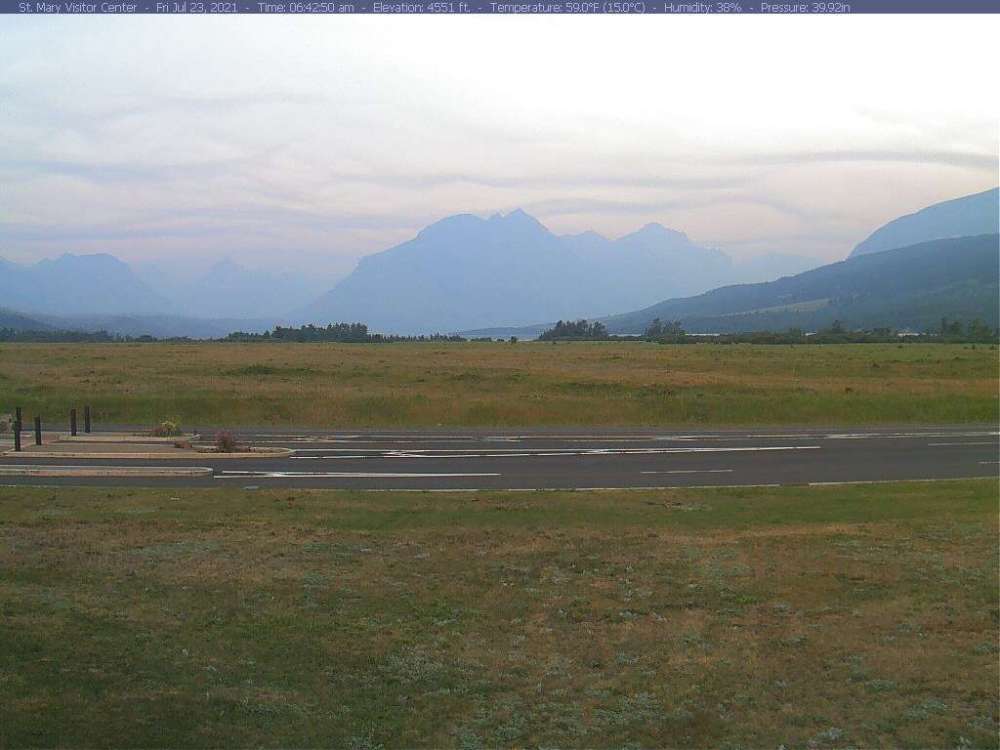
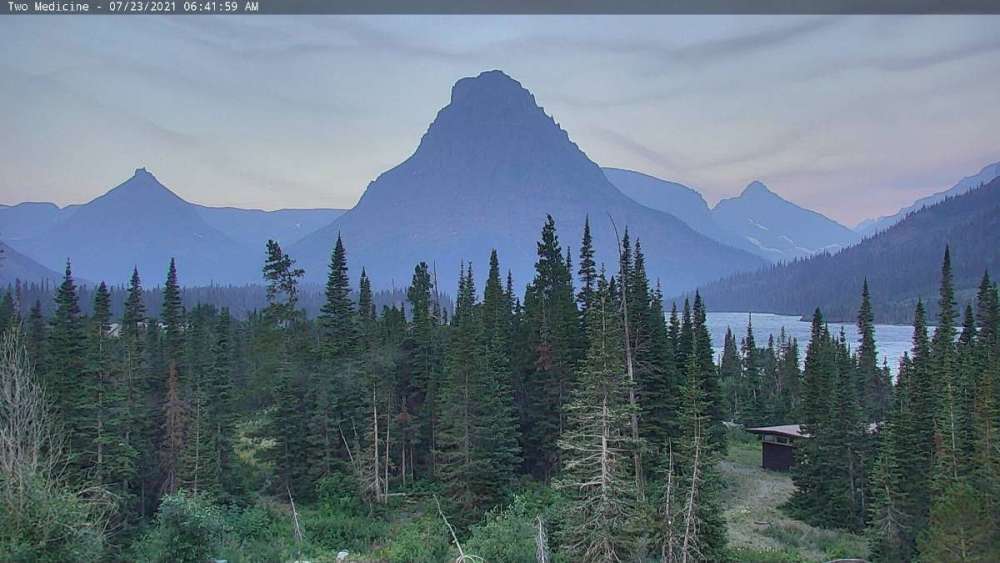 3 points
 -
What a difference in air mass this morning. Currently 76F/72F as the humidity is here to stay. Starting today, DP's will remain in the 70's (except for Sun), approaching Amazon levels in the upper 70's on Sat and Wed. This will undoubtedly be the muggiest stretch of the summer, but not so much the hottest as the highest temps thus far this summer have hit 94F when DP's were lower. Plus, I think the hazy skies will obscure the suns rays a bit as well.3 points
-
Heads up guys, expect some whining from Winter (wiener?) dog soon2 points
-
Up to 88F beautiful day. Been following NCAA conference realignment very closely as it directly affects my charity and I have the kiddos over so not a lot of time to post.2 points
-
Nobody’s actually even arguing it’s been like 2015 in Seattle though somethings that’s been recognized for a couple weeks now. It is close to comparable or comparable to 2015 in some places though. People seem to think I’m saying that it’s been like 2015 in Seattle…but it’s not. I’m just anti having a certain someone tell everyone everyday for a month straight in a condescending smug way.2 points
-
3...2...1...2 points
-
We’re going to catch our first M’s game since the pandemic Monday night against the Astros! Definitely bringing a jacket though since daylight is waning2 points
-
Seattle Times is imploring people to get out and enjoy our bright summer while it lasts because we will all be mole people living in the dark very soon.
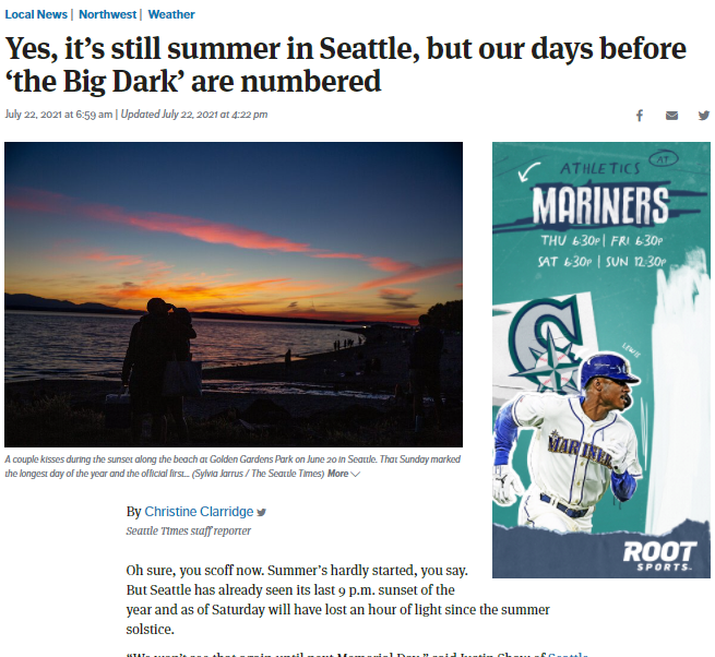 2 points
 -
I’m looking for something to argue about? You know exactly what you were doing when you posted that don’t act dumb. You’re looking for an argument that’s all you’ve done the past month.2 points
-
What? I didn't say anything about 2015. I pointed to the actual anomalies for this month, because someone said it's been "+2 to +4 with onshore flow". Seems like you're just looking for something to argue about now.2 points
-
My dewpoint currently is 77f!!! Ive compared dewpoints around se Iowa to rest of usa for years. Most summer days mine is as high or higher than entire usa, even Florida. This summer has had few days with breaks in the humidity. Unlike the drought areas just to my north. Does anyone have a detailed map of dewpoints around the country? Not just a couple reporting stations each state? Ohio st twister had nice one, cant find them now.2 points
-
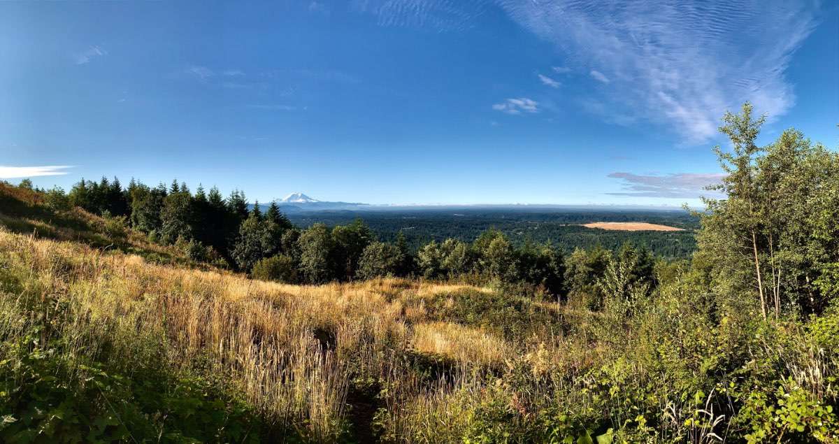
Took advantage of this sunny morning and hiked Poo Poo Point Some distant clouds but nothing heavy. Paraglider's must be sleeping in Currently 77* and sunny
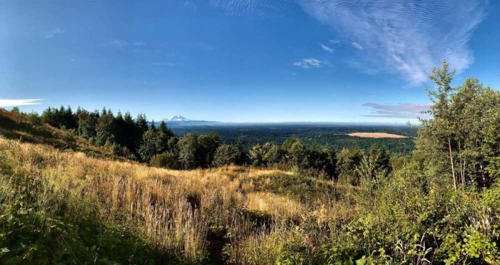
 2 points
 -
Haha, no whining from me, I'm just impressed that you were able to unearth 42 of my posts that you hadn't already downvoted. I probably haven't made 42 posts in the past year. For something as innocuous as downvotes you sure put a lot of effort into it.1 point
-
North wind over the Sound will battle to keep us a bit cooler then the rest (according to HRRR). I think we will still string a few 80*+ this weekend into next week though.
 1 point
 -
1 point
-
Come on man, that's enough of this 2015 rhetoric j/k!!!1 point
-
This actually extends back into the 1980s as well. Data less reliable before the satellite era but I think there’s something here. What stands out the most is there are no hot summer niñas in the W-QBO group.1 point
-
Nina MAGIC!1 point
-
It could be worse!!! https://weather.com/news/climate/news/2021-07-22-americas-hottest-summer-20211 point
-
Only 2017 was a Niña. 2018 was a developing Niño, albeit borderline. But still not really analogous in that respect.1 point
-
2004 was a bit of a poor man's version of that. Septembers in both years were also quite pleasant and troughy. Unfortunately our current warm season climate is no longer anything like the 1970s, and even the 2000s are noticeably cooler. Winters have certainly changed here but summers have changed much faster and much more decisively.1 point
-
Looks really windy!1 point
-
I found this one for Nebraska, I’d assume they have maps for every state. I took this screenshot at 2 pm.
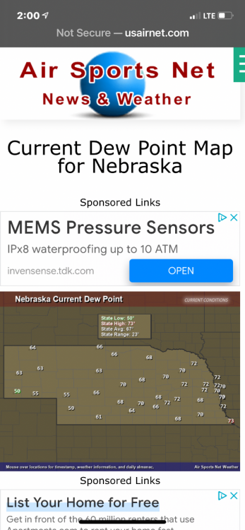 1 point
 -
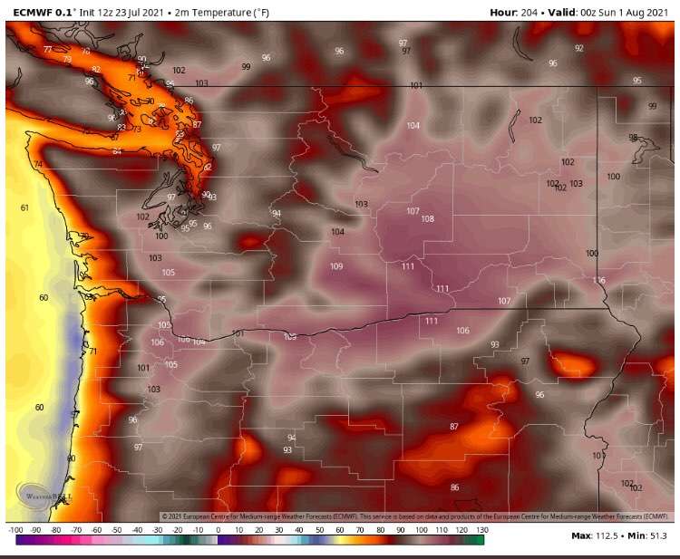
12Z ECMWF not really backing down... it shows 107 in Portland one week from today.1 point
-
I was at Ocean Shores this past week which is why I haven't posted. It was certainly interesting how the nicest days were the ones that were cloudy in Seattle. At any rate this has been a purely enjoyable summer outside of the one week from hell. In fact if you take that week out SEA would be a tad below normal for the summer to date. Looking ahead the center of the high over the CONUS remains displaced unusually far east so things aren't going to get all that hot any time soon. Probably a few solidly warm days, but nothing too out of the ordinary.1 point
-
Model trends can change over the course of several days. Does it count as 4CH if it covers most the U.S.?1 point
-
I was pointing out facts. You should stick to those instead of this pettiness.1 point
-
Summer is easily the longest season here now.1 point
-
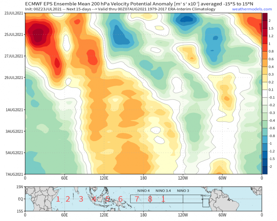
Looks like convection propagates out of the West-Pacific by the start of week-2. There’s lag time/reverberations globally, but overall the system seems to want to correct back to the La Niña type circulation faster than last month.
 1 point
 -
lol here you go banging your 2015 drum again that nobody even cares about at this point. We all know it’s been modestly warm north of Portland in western WA compared to the region like has been discussed many times recently thanks again for the heads up. Here’s the issue though…a few people said right after the heatwave this summer could go on to be like 2015 and backed off…and here you are a month later still letting everyone know about it because you need to let everyone know how smart you are. People aren’t even arguing about 2015 at this point it’s all you. Funny thing is it’s about to get warmer and bump this months averages up and august could still even push us to record territory for the summer as a whole.1 point
-
I stay out of the drought map for another week. May not be so lucky next Thursday when the new map comes out.1 point
-
The crazy thing is how insanely hot this month has already been in the western US, especially east of the Cascades and south of the Willamette Valley. The last week looks to really push things over the edge.1 point
-
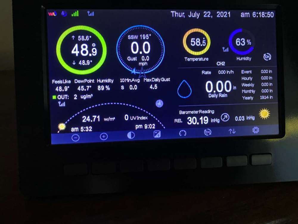
Been a while since I've seen the green ring on my weather station. Topped out at 75 with the temp in the picture being the low.
 1 point
 -
The GFS hasn’t backed down AND it was the model that first predicted the record shattering crazy heat for the northwest that no one believed either, so I’m not so sure yet.1 point
-
Starting tomorrow, we look to be 90 or above for about 10 days. Not anything we haven’t seen before. Besides a couple of days in June, this hasn’t been a hot summer at all. With all the rainfall, it’s actually been fairly pleasant.1 point
-
Arrived in Amarillo! Sunny and breezy with 31% humidity and 88°1 point
-
Some July 2013 mean temps on the eastside: GEG- 73.94 YKM- 77.48 RDM- 69.58 PDT- 75.34 Some July 2021 mean temps so far, with a hot last week of the month still to come. GEG- 77.55 YKM- 79.60 RDM- 72.38 PDT- 77.501 point
-
You know I truly didn’t understand what everyone was talking about when the term “flatironing” was brought up when I started here. I fully understand now.1 point


This leaderboard is set to Vancouver/GMT-07:00