
Leaderboard


Popular Content
Showing content with the highest reputation on 07/25/21 in all areas
-
You are splitting hairs. Shawnigan, MUCH further north, has an even bigger departure. Eugene is on pace for their 2nd warmest July of all time, PDX 5th, not much of an outlier. And if we look at the east side, this month is blowing away pretty much every July one record over a wide area. As my previous post which you ignored, stated, it really comes down to how prone an area is to marine influence with weak onshore flow and amazingly consistently warm upper level airmasses.7 points
-
I've missed some days due to work scheduling, but it needs to be said: Today will be two minutes and twenty two seconds SHORTER than yesterday... Which was two minutes and nineteen seconds SHORTER than the day before... Which was two minutes and sixteen seconds SHORTER than the day before... Which was, finally, two minutes and thirteen seconds SHORTER than my last check-in! If my arithmetic serves me, that ought to be around the order of nine minutes and ten seconds in total...in just four days...7 points
-
Tucson having its wettest monsoon to date! Hopefully we can get some of that moisture advected up this way for a juicy thunderstorm outbreak come August.5 points
-
Water time...
 4 points
 -
My gauge is showing 1.10” as of 10 am and rain continues to re form. Talked to a farmer at church who lives just south of I 80, about 15 miles north of town. He had only received sprinkles. Another farmer had 3.90” just 5 miles north of town.4 points
-
Yesterday ended up several degrees cooler than expected due to clouds. Now we’re getting some rain this morning which wasn’t forecasted. Gotta appreciate the little things during summer.4 points
-
Its not often you see such high DP's in PHX at this time of year. It must feel tropical out there and I'm sure things are looking very lush where there is vegetation growing. In fact, my mother told me there is an abundant amount of wild mushrooms up in the mountains from all the rainfall. Scottsdale has received a little over 4" of rain the past 3 days alone! Wild stuff. Current conditions at Phoenix, Phoenix Sky Harbor International Airport (KPHX) Lat: 33.427799°NLon: 112.003465°WElev: 1115ft. Partly Cloudy 75°F 24°C Humidity 88% Wind Speed E 4 MPH Barometer 29.99 in (1015.58 mb) Dewpoint 72F°(22°C) Visibility 10.00 mi Last update 25 Jul 07:05 AM MST4 points
-
NWS Hastings with a very detailed disco this morning on how models and Mets missed this ongoing thunderstorm activity that wasn’t seen 12-18 hours ago. I appreciate his honesty and apology for not seeing this. 3-5” in places have forced flash flood warnings to be issued for the first time since Mid May. I’m approaching 0.75” as heavy storms continue to develop. Farmers just north and east of me had 2-3” earlier and will only add to that this morning. Can you imagine what the dews will be when the real heat hits mid week? I’ll sweat standing in place.4 points
-
I know it's not PNW-related, but the monsoon is properly showing its teeth this year. Tucson is having its 12th wettest monsoon season (to date) of all time. The past few days in Phoenix have been crazy cool for this time of year, and tomorrow is likely to follow suit, with another potential sub-85 (very likely sub-90) day there. Three sub-85 days in a row have never happened before. And oh yeah, Phoenix is much wetter than average, too. It's nice to see nature+regional climatology working properly for once.4 points
-
Beautiful day on Hyalite today. Picked up about 0.5" of rainfall over the last few days and today blue skies. Heat and likely smoke return tomorrow unfortunately.
 4 points
 -
Back to mowing every 3 days. This is just crazy. There is standing water everywhere. Only made it to 76 with clouds and rain much of the morning. Was supposed to be 95 for a high. Extended forecast is really backing off the intensity and duration of the heat.3 points
-
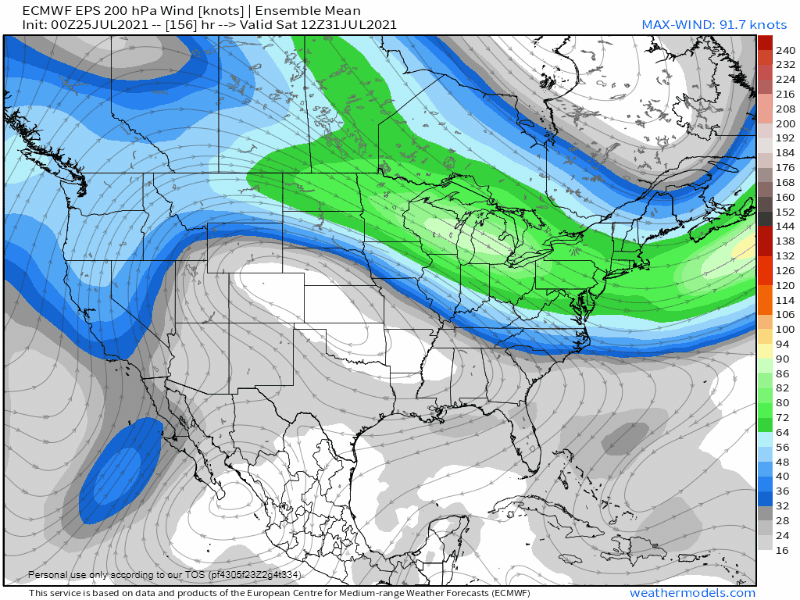
Looks like a pretty traditional mid summer heatwave. Haven’t seen any prog, including today’s vile Euro run, that depicts any real offshore flow component as the ridge axis remains solidly to the east.3 points
-
It is apparently rocket science though since we keep having the same discussion on here. It’s honestly not even worth trying to explain has been stated many many times already. People can believe what they want…I’m not going to spend time trying to change minds that don’t want to be changed.3 points
-
Semantics? I think it’s more about intellectual honesty if you actually apply the definition of the term outlier. Neither station is throwing off the mean at all and fit quite well within what would be expected based on the prevailing patterns this month. Not rocket science…3 points
-
I've come to the conclusion that engaging Flatiron is almost as pointless as engaging Tim.3 points
-
Hit our first 90 of the month yesterday at 90 degrees even. Today should be close again. Then should pick up at least another 3-4 later this week into the weekend. Absolutely cannot wait for this summer to end, or really any summer these days. Will probably be waiting for awhile, though.3 points
-
It is going to be great. Can't wait for people who live 2,000 miles away to tell me how normal it is.3 points
-
At least that big High moves off of us. Let NMx have it. We don’t mind sharing!3 points
-
Had a rumble of thunder early this morning but only .12 fell. One of the more miserable weeks of weather I ve had in awhile coming this week. #readyforfall
 3 points
 -
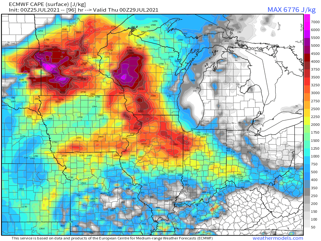
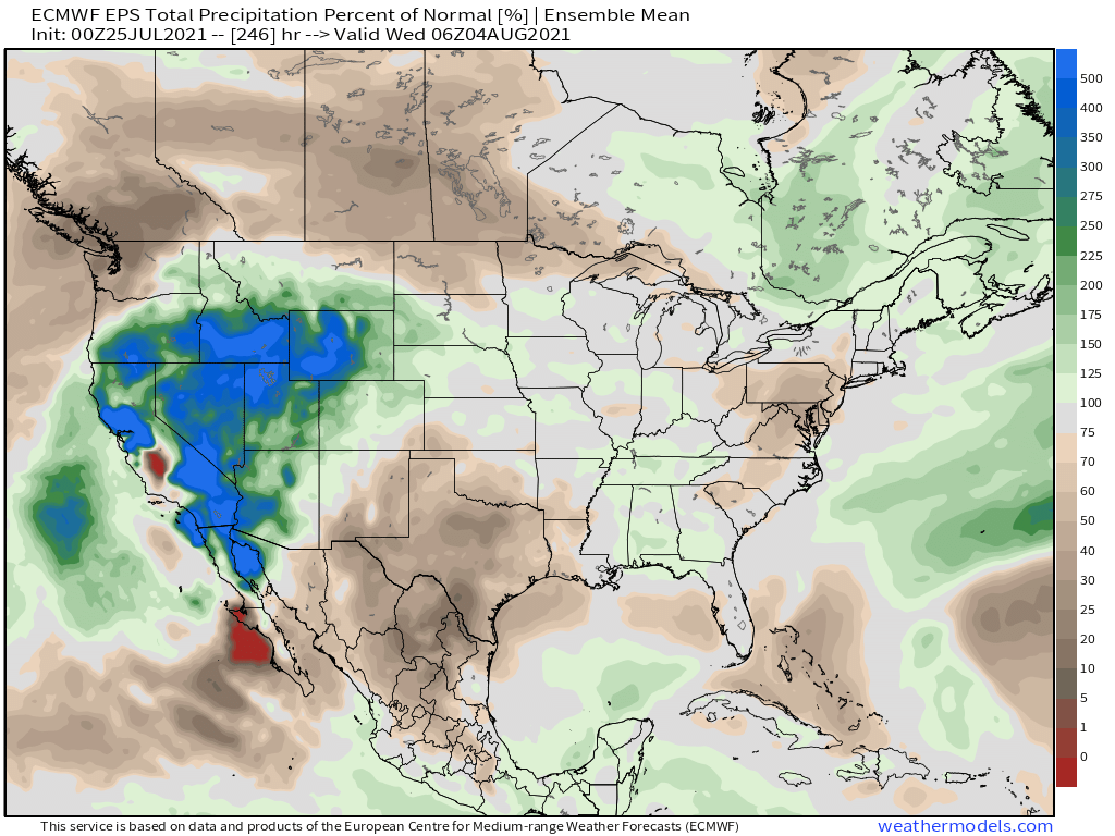
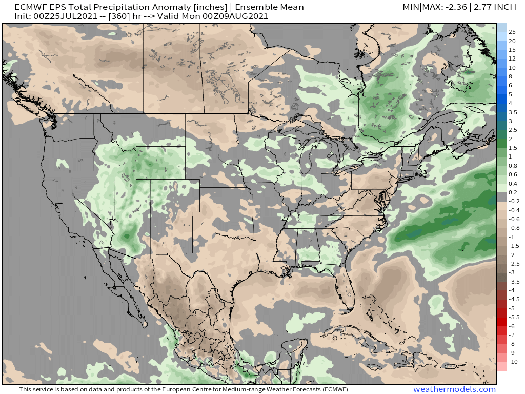
The GL's regions next round of severe wx potential is dialing up during the Wed/Thu period as a rather decent CF will usher in a pattern change for us across the eastern Sub. The 0z Euro is suggesting some intense CAPE values for parts of MN/WI and esp near @Madtown...somebody is going to finish off the month with a bang from nature. Save the best for last? Some of the models are showing another final severe wx set up for the month next Sat across parts of NE into IA. Long ways out, but this could just be the beginning of an active period of wx across the main ag belt region of the central CONUS once we flip the calendar into August. In fact, the 0z EPS is steadily starting to see this wetter pattern during the opening week of August leading to pockets of AN precip anomalies. This suggests to me we will see numerous storm clusters. NW Flow aloft and a rather strong jet stream for this time of year I imagine will produce some atmospheric fireworks. The placement of the Heat Dome appears to shift a bit SW from its current position later in Week 2 that'll allow for NM to dry out but increase moisture across the inter-mountain west.

 3 points
 -
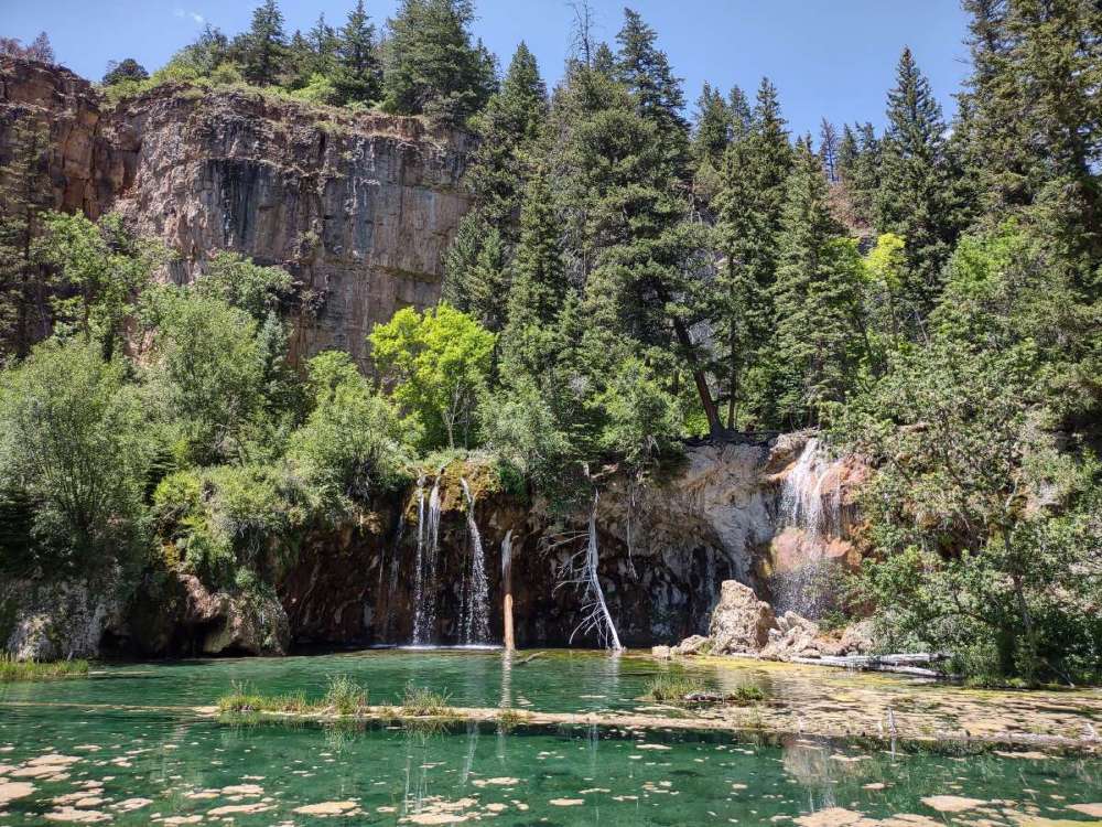
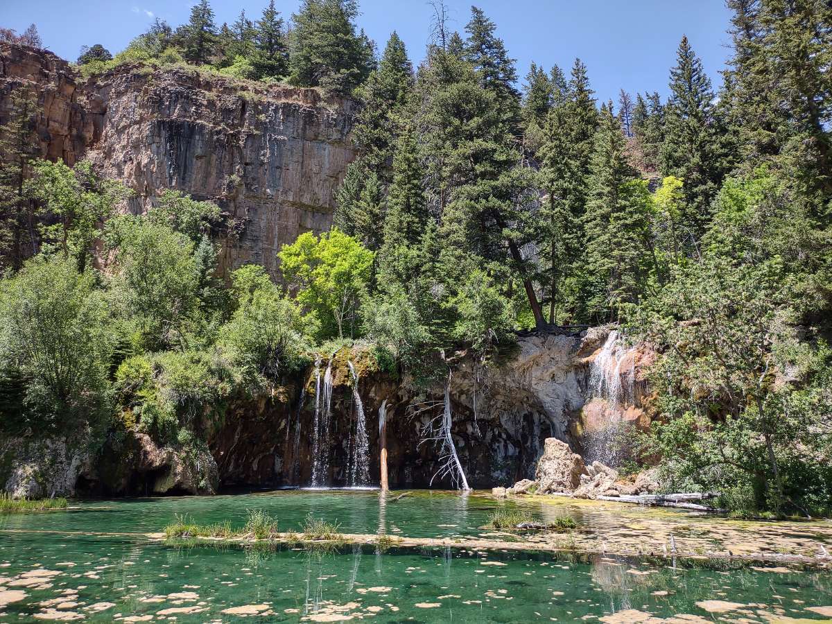
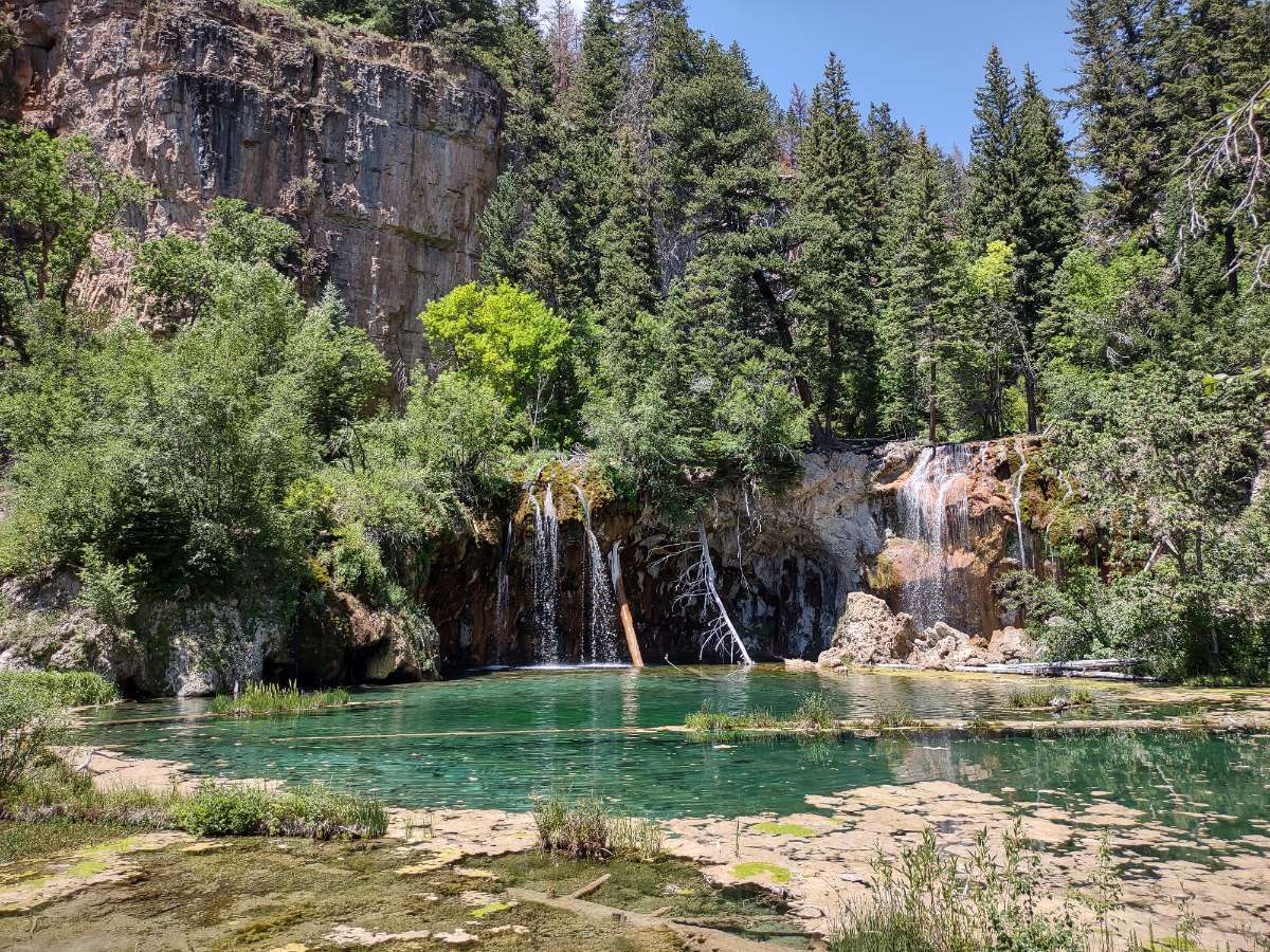
Hiked up to Hanging Lake near Glenwood Springs.
 3 points
 -
My county is being rocked by heavy rain. My house has not seen a drop, but just 3 miles north has received 3” so far. Areal flood advisory in place. Relatives east of town have had 1.50”. What a strange summer. Again heavy rain when none is forecasted.3 points
-
Phoenix barely escaped the 70s today w/ a high of 81F under an unusually strong monsoonal upper-level low and associated stratoform precipitation. The mean of 77F today is 18.5F below average. Their high of 81F ties 7/25/1915 for coldest daily high, as well as the third coldest July high temperature on record. Meanwhile, KSEA reached 85F today with plentiful sunshine. KEUG soared to 94F, KSLE to 93F, and KPDX to 91F.2 points
-
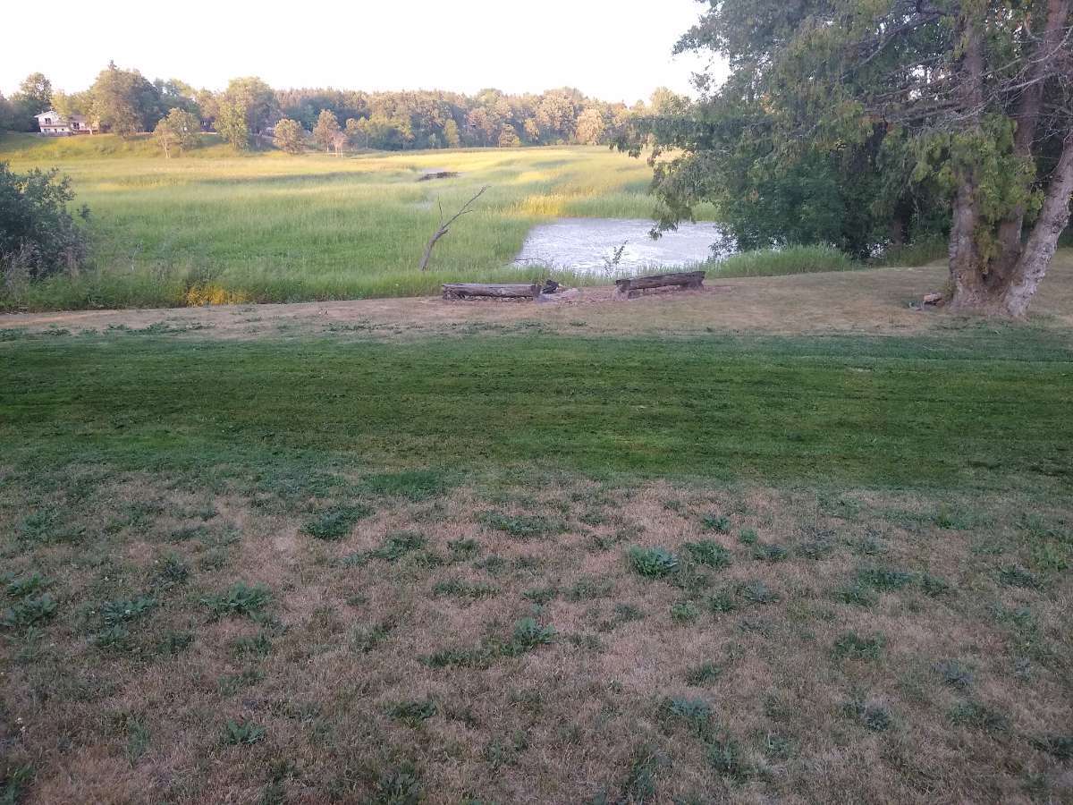
Can you make out my drain field? Everything is brown otherwise...haven't mowed the rest of the yard in two weeks and only contemplating it to knock down the weeds. Locally the drought here is comparable to 2012 and 1988.
 2 points
 -
80 degrees here #17 this year. We only had 17 days 80+ in 2020 and 2019…and will rattle off a few more by the end of the month.2 points
-
Did we do it again?? You goddam right we did!!! 91F
 2 points
 -
I’ll have to check the forum hyperbole matrix I drew on the back of a Dominos pizza box, if I can find it. And yeah, getting in on the monsoonal fun would be nice at some point. A couple runs tried to tweak the dry westerly component but it looks less likely at the moment. Should help keep the smoke mitigated for now, though.2 points
-
Neither look like an outlier at all. Just the opposite ends of a generally warm spectrum overall.2 points
-
I am grateful temps have stayed mostly in the low 90s this month, better than 117! On the other hand, no real crash, just insane warm airmass moderated slightly by onshore flow. Places whose climates are influenced more by onshore flow (i.e. near the water or gaps), have seen their temps moderated more this month. Not a tough concept.2 points
-
We will hear how reasonable this summers been over and over still even if august ends up super hot.2 points
-
Cloud cover and scattered storms including a severe storm to my SW are keeping temps down today. Getting work done in the garden today.2 points
-
Rain continues in my area. Going to be some impressive totals in some places. Radar just has storms reforming in the same areas.2 points
-
The storm from last night produced some rather strong winds to knock down large trees in my city as well as nearby locations, esp just E of ORD. Overall, the best model that handled this event 2 days out had to be the high rez NAM which never lost the idea of storms blossoming just after 4:00pm local time. So glad to have been on the receiving end of a strong storm this season...check that off the summer list!2 points
-
I’m here now. I came down for this weekend specifically but am so disappointed! I’m in Avondale though, and most of the rain and crazy weather has been further east. Hoping for something tomorrow.2 points
-
Scottsdale saw over 2" of rain yesterday, and is over 3" for the month. Looks like that area averages less than 1" of rain in July...could easily end up being one of the wettest Julys on record for parts of the Southwest.2 points
-
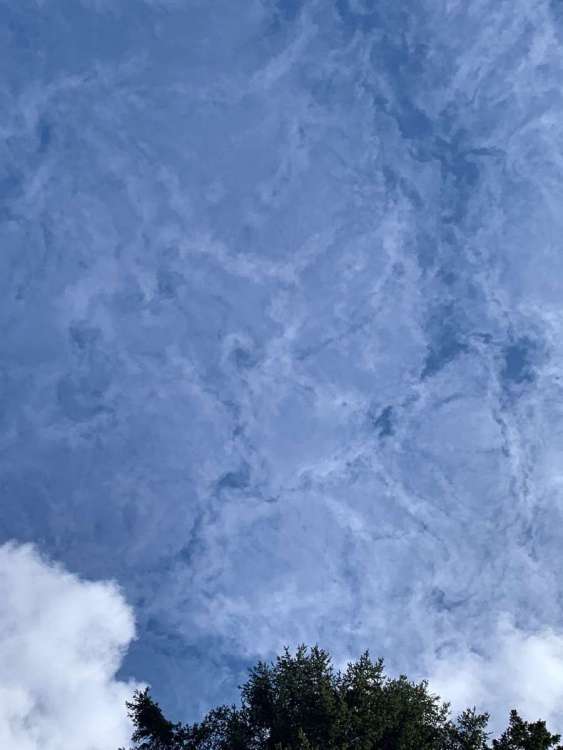
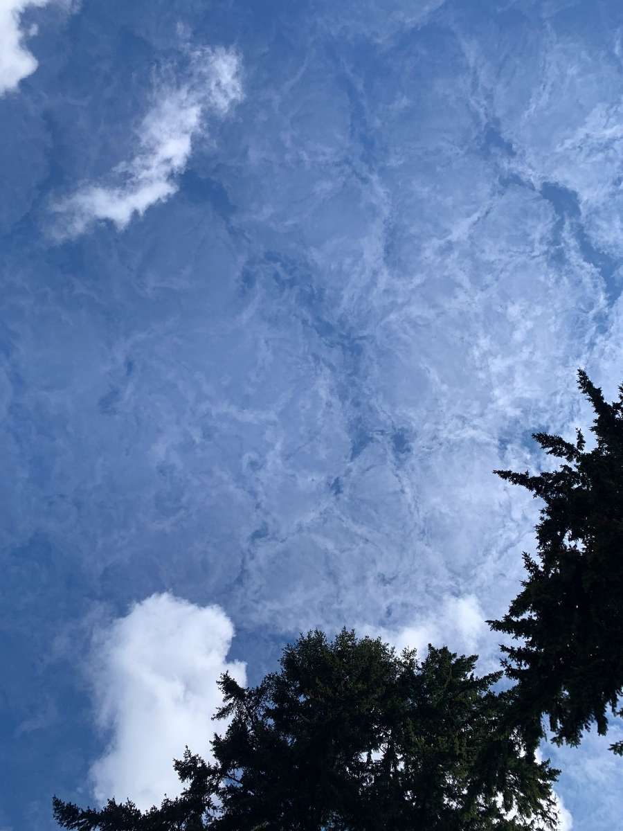
Saw these in Bellevue WA about 1010 HRS Pacific 7/17/21. A minute later a cloud which was shielding the direct sun from my position moved. When the light came up the clouds either became impossible to see or went away.

 1 point
 -
1 point
-
Beautiful 49F and raining in Nome, Alaska today. 65F here by the water in Everett. The station about a mile from me says 68F. Everett. I do believe we did hit 70F today though as a high. Not sure what the official reading will be yet.1 point
-
85 at SEA. Spectacular blue sky day with a nice breeze. Best summer weather in the country.1 point
-
We did it Tiger!1 point
-
78 here now... heading out on the water. I remember earlier this week the models were actually showing some rain for today. I would trade a sunny, warm Sunday for some rain at this point. I still want summer to continue but some rain would be awesome. It was pouring rain here on this day in 2015... and North Bend ended up with 1.3 inches of rain on 7/25 and 26.1 point
-
Similar dryness is what I was dealing with 1 year ago, and especially 2 years ago. I’ve had 2.77” so far this July (nothing spectacular) while my brother around 6 miles to the se. had around 4”.1 point
-
The area burned in BC this year is at 975,000 acres1 point
-
Should also be quite cold and amazing in Covington.1 point
-
Wow, what a blow torch.1 point
-
Yesterday afternoon there was a heavy but brief rain shower here. That shower dropped 0.32" of rain in about 20 minutes. But once again there was no thunder here in my area. (so for me no thunderstorm) As of July 24 the mean at Grand Rapids for July is at 72.0 That is a departure of -0.8 from the new 30 year average. There have been only 8 days when the mean was above average 15 days with the mean below average and one day that the mean was average. The warmest so far this month has been 89 and the coolest has been 54. At the airport there has been 4.36" of rain fall. At this time it is sunny here and 78.1 point
-
Anniversary dinner on Lake Washington waterfront in Kirkland was lovely on an 80-degree evening.1 point
-
Medford NWS has confirmed the pyrocumulus column spawned a significant tornado last weekend on the Bootleg Fire. Asphalt scouring also occurred.1 point
-
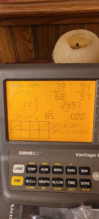
Just incredible humidity here today. The weak front dropping in squeezed out more moisture! A nice shower went over city of Ottumwa missing me, but it added moisture! Incredible 85f dewpoint highest since purchasing my davis pro 6 years ago. Possibly high dewpoint of my life. High temp was 94.
 1 point
 -
Best storm of the season that I’ve experienced with torrential rains, wind, vivid light and very loud thunder. Over 1” of rain in about 20-30min. Local reporting station shows 1.27”. Very pleased.1 point


This leaderboard is set to Vancouver/GMT-07:00