
Leaderboard


Popular Content
Showing content with the highest reputation on 10/08/21 in Posts
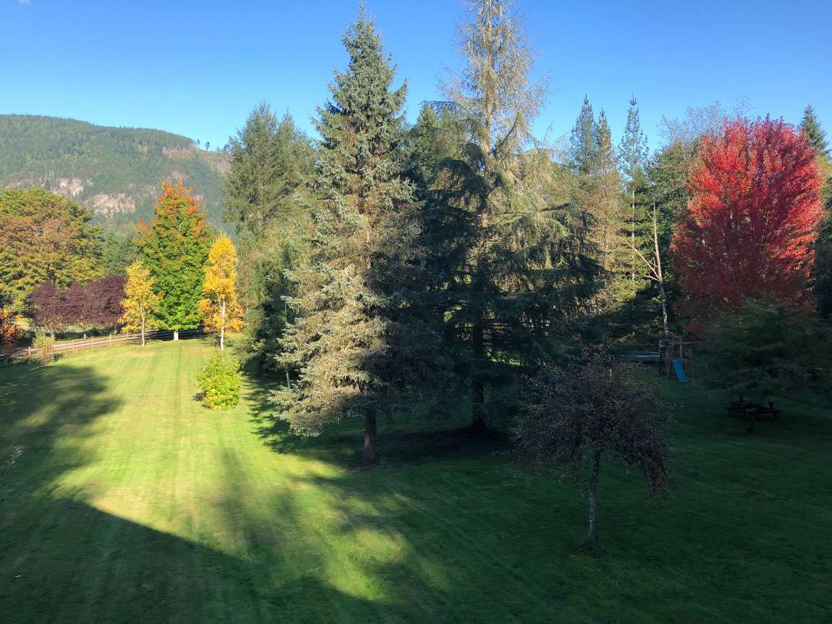
-
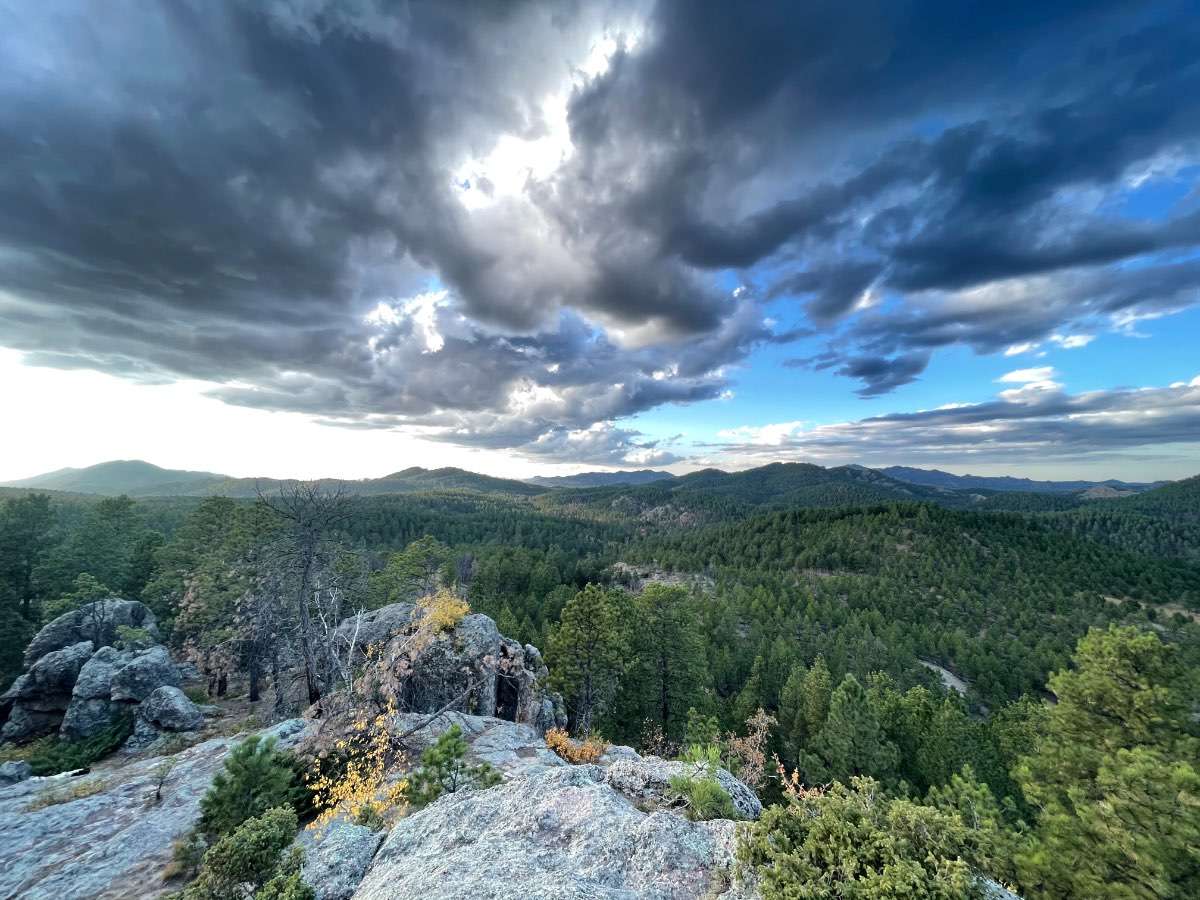
Took this last night in the Black Hills.
 18 points
 -
Good news everybody, I just accepted a promotion at work11 points
-
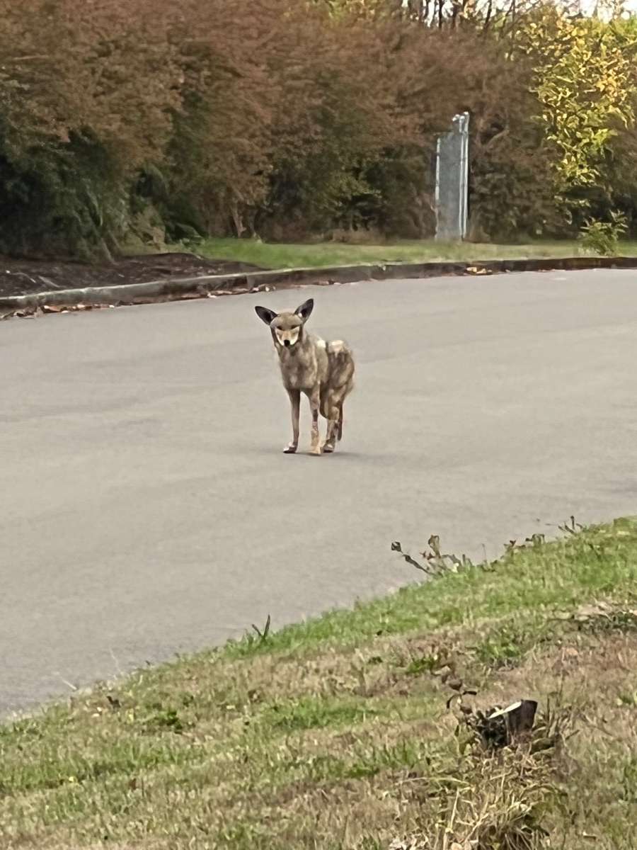
The ones I’ve seen around here are pretty ragged looking…out on Anderson island they’re big and healthy looking. This coyote is a lot bigger than it looks. I guess they tend to do better in rural areas?
 7 points
 -
Been away for a bit due to moving. Relocated from Shoreline to Mercer Island. Got a nice spot close to the highest point of the island with a view of Lake Washington. Was definitely chilly last night. Got down to 40*. I'm betting most of us in the area will see frost within the next 7 days. Trees sure started turning quickly!6 points
-
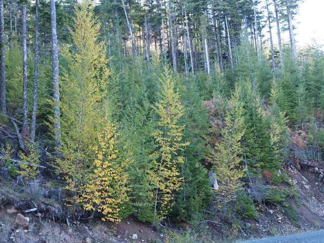
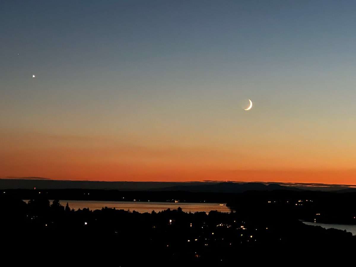
Colors coming in nicely now.
 5 points
 -
Dropped to 35 here last night with some frost on the rooftops. The clouds stayed thinner than the models had anticipated. We are really putting up some nice minus departures now. Monday night continues to look downright chilly!5 points
-
I'm rooting so much for you to score big this winter. As everyone knows, a tiger without frost or flakes is a sad one.5 points
-
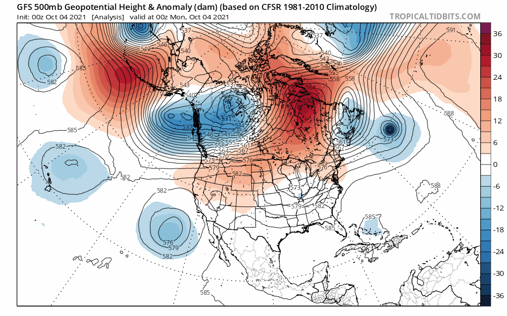
Classic -PDO signature developing in response to the persistent Aleutian High.5 points
-
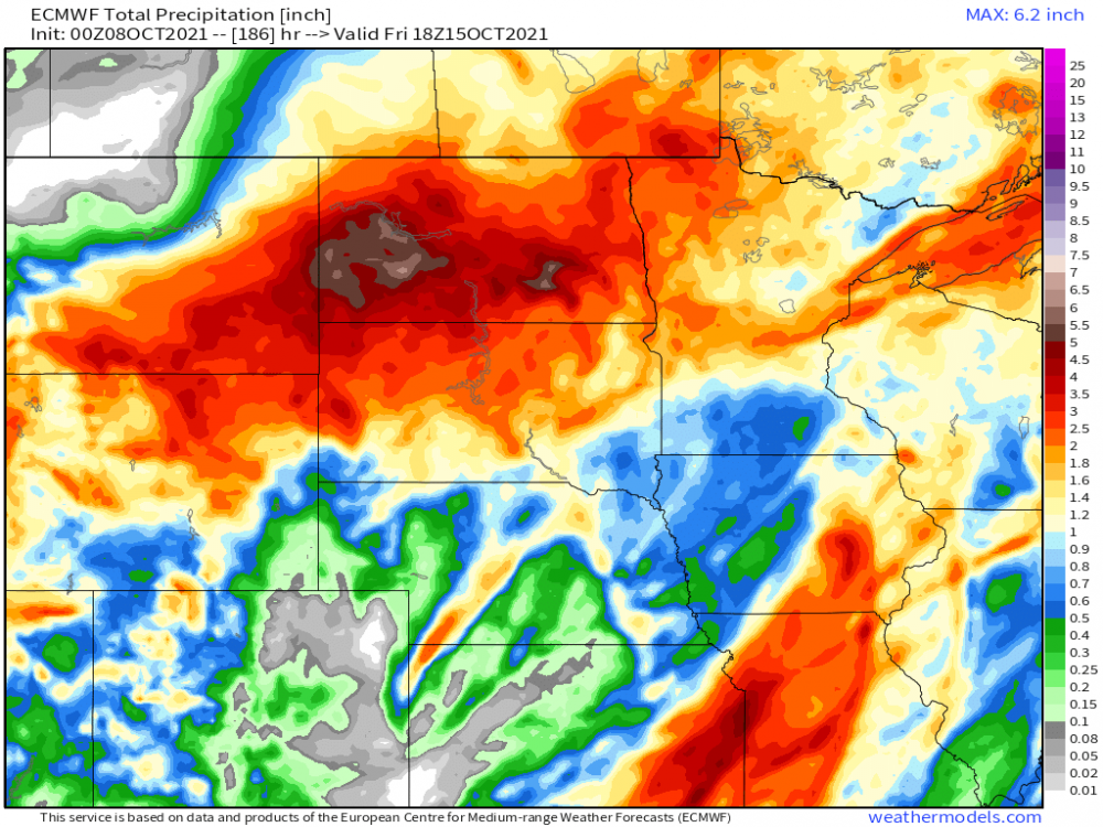
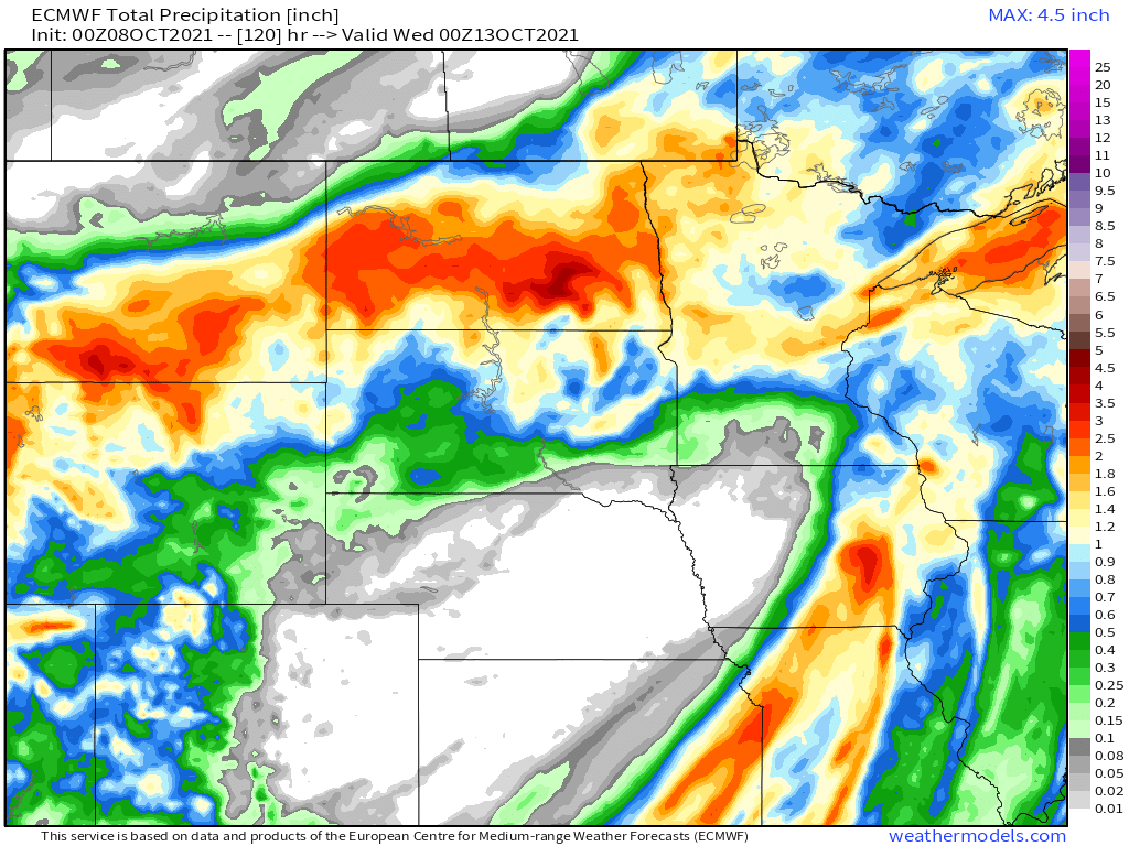
I picked up a healthy .76" of rain yesterday from on and off showers (some heavy) throughout the day. Perfect rains since I cut the lawn the day before and laid down some fertilizer. Might get some more pop up showers/storms today with the ULL nearby and if the sun pokes out it could aid in development. Alright, the next few systems on deck are inspiring to me. For one, it's freakin' nice to finally see a change in what was a warm and dry Sept. Second, instead of having to wait weeks for an active pattern to start, this year's LRC is beginning with several systems to track. Over the past few days, the models finally latched onto to the early week system next week. Kudos to the GFS which has been rock steady with this one while the Euro finally latched onto this system. Last night's track has shifted S/SE. First severe wx threat down south near @OKCWX for the start of 2nd severe wx season. The Sat system is going to drop a lot of good stratiform rains up by @FAR_Weather @Beltrami Island and the UP posters... Then, we will focus in on the 1st major trough of the season....more drought alleviating rains coming your way! Since Aug 31st, there has been a good dent in the drought. These maps will look better by months end. Aug 31st... Oct 5th... 0z Euro thru the 15th...again, smack dab where the worst drought conditions are currently being experienced... Now, here comes the fun part...who's ready for the seasons coldest chill??? The Plains get it first...
 5 points
 -
Both matter. Trees higher in the Appalachians are already turning noticeably while down here it’s a sea of green. Sunlight matters, but if that was the end all be all, there’d be little to no variation in peak color dates from year to year. Not to mention moisture balance/drought, etc.4 points
-
I’m ready for some big fall storms!
 4 points
 -
Tacoma coyotes are urban coyotes. Gotta maintain a rough exterior to maintain their street cred.4 points
-
Neighborhood coyote.
 4 points
 -
Terry Swails posted his winter '21/22 discussion overnight. https://www.tswails.com/single-post/terry-s-take-on-winter-2021-224 points
-
Promoted to Community Regular this morning. On top of it being Friday and payday, today’s recognition for being regular is a great way to start the weekend.4 points
-
This system way overperformed here. I picked up 1.01". Some spots in the CR area received 1.50+".4 points
-
I found Joe D'Aleo piece interesting this morning. The Pacific is in the second year of a La Nina. The SSTAs at this point of the transition season bears some resemblance to 2013. The warm pool in early October that year was south of the Aleutians and moved east perhaps aided by undersea volcanism on the 'ring of fire'. By mid winter it settled south of Alaska. We noticed that was similar to other years than ended up very cold like 1917/18. That was a very cold winter central and east. The statistical and analog models we use showed the cold, and they verified over North America. The Pacific is in the second year of a La Nina. The SSTAs at this point of the transition season bears some resemblance to 2013. The warm pool in early October that year was south of the Aleutians and moved east perhaps aided by undersea volcanism on the 'ring of fire'. By mid winter it settled south of Alaska. We noticed that was similar to other years than ended up very cold like 1917/18. That was a very cold winter central and east. The statistical and analog models we use showed the cold, and they verified over North America.4 points
-
Monday forecast high is 39F here with a low of 17F. That is late Nov cold for us!4 points
-
I've got top tier cold here in the swamp at 38 this morning. Shiver me timbers.4 points
-
Steady light rain all night. I picked up half an inch. DMX talking potential significant rainfall sun-mon with system #1 and then the big dog midweek could produce severe weather in Iowa and very strong winds. Gotta love the active start to this new pattern. Another thing of note is the past several discussions they have mentioned a cirrus shield likely for Saturday with the strong SW flow pulling in moisture from the Baja area at the 300-500mb level which could keep temps in the 70s instead of mid 80s. I'm interested to see how this pans out tomorrow.4 points
-
Yet another warm (for October) overnight low the official overnight low at Grand Rapids was just 65 if it don't fall below that before midnight this will be the 2nd warmest low for any October 8 at Grand Rapids. That is after yesterdays official low of 62 was the 3rd warmest low for any October 7th If Grand Rapids reaches 80 on Sunday that would be the 5th warmest high for that date. At this time it is cloudy and 65 here at my house.4 points
-
Ok boomer3 points
-
Yeah...I'm kind of done with wind. Some of that has to do with the trees around my house, but it causes real problems with the type of trees we have here. I get plenty of east wind here to give me my annual fix.3 points
-
I can only imagine the sound of large branches breaking and trees crashing to the ground or on the top of the house, car or an outbuilding. All of this without electricity or phones. Wind sucks.3 points
-
Birches are just starting to turn on Sumas Mountain.
 3 points
 -
Just like this past summer... its very likely that nothing goes according to any plan this winter. These analog lists never seem to mean anything for the future,3 points
-
A lot of old time analogs today. Most are pre 1980. Pretty impressive to see both 1955 and 1985 up there. They ended up the two coldest Novembers of the 20th century.3 points
-
Maybe in a flat Midwest state where temp distribution is much more evenly meridional. Temps and soil moisture are what are important and in the PNW elevation is a bigger driver. Springfield to Seattle isn't generally going to be some huge difference and it's the same plant and hardiness zone anyways.3 points
-
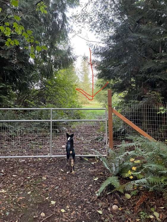
Looks a little rough around the edges! At my place the Coyotes look amazingly healthy right now, can’t really see this one in the pic very well but it was just sitting there looking at my dogs freaking out at it at the back of our 5 acres…Probably sizing up if it’s worth trying to jump the fence to munch on one of them. Took me yelling at it to run off, they have been quite active at night with their yipping.
 3 points
 -
That’s a low bar for happiness, but also achievable. Which is nice.3 points
-
The rain has now ended and the rain gauge reads 0.67" the sun came out for a few minutes. The current temperature here is 67 with cloudy skies.3 points
-
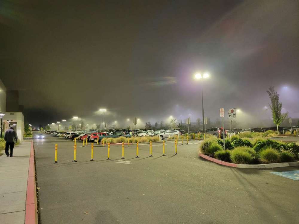
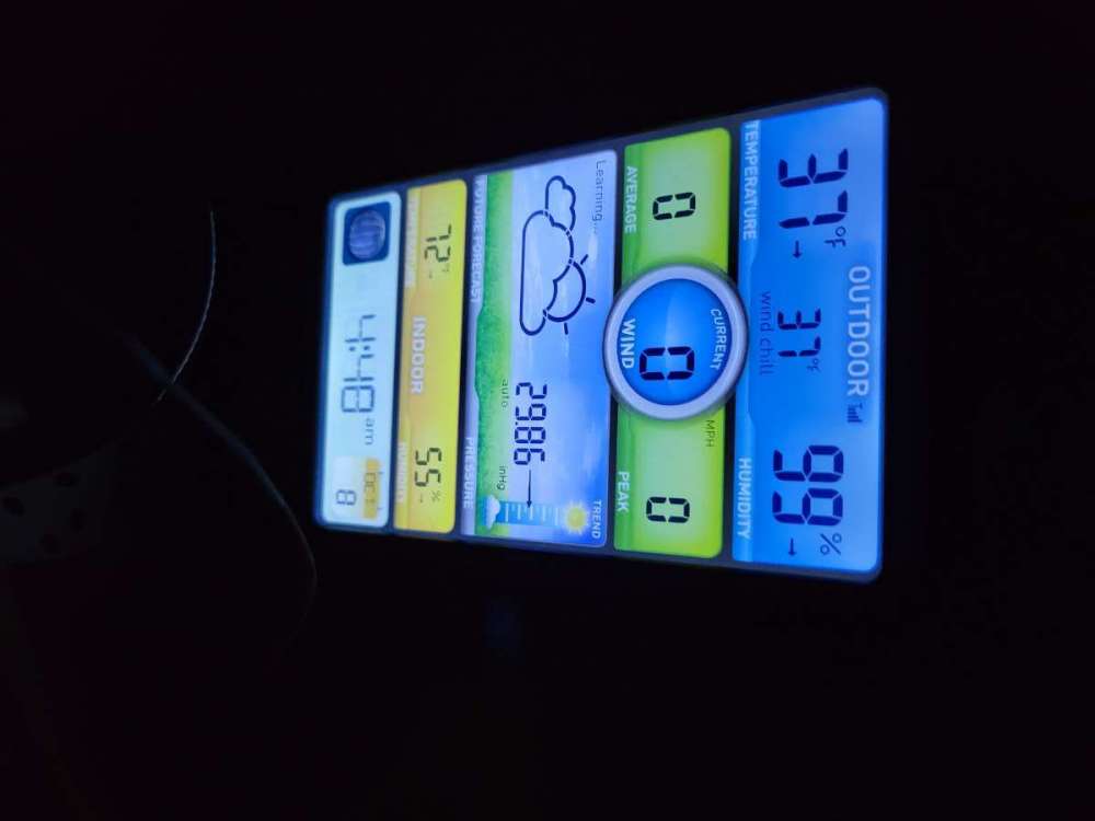
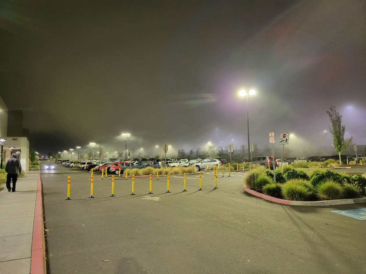
Crazy fog at work and 37 IMBY!
 3 points
 -
This post will be my interpretation of the new LRC pattern setting up and it has some really fascinating patterns transpiring across the N.H. First off, we had major Hurricane Sam that developed in the ATL and then tracked towards Greenland right when a trough came off the shores of eastern Canada, resulting in a Fujiwhara Effect. IMO, this is a sign the new LRC pattern Snapped into motion. The placement of the trough S of Greenland is a classic -NAO signal. Then, we see another trough slide E into the same region S of Greenland...Long Term Long Wave Trough setting up??? Yes, this is a Bigly signal to suggest that it will be an exhibit to the LRC and pump the Greenland Ridge. We have already been speaking about the storm train and where they are tracking, digging, energizing, etc...I'd like to focus now across the region from the 30th parallel from near Hawaii and points East towards So Cal/Baja. The consistent troughiness setting up here is eye candy. Why? This will be, IMO, what sets the stage for a -EPO signal later in Winter. The current SST anomaly below shows the ribbon of cold waters, from Hawaii to Cali, right where the troughs keep showing up near the 30th parallel...the warm waters hugging Baja and Mexico will be the "fuel for the fire" for the pattern heading into winter. Also, not to mention, but look at the E PAC tropical storm that slams into W Mexico later in the animation above. Active Sub Tropical Jet??? Sign me up! In summary, this is all coming together in my view as one hellova pattern when you take into consideration all the variables setting up as the pieces of the puzzle are beginning to show itself. Furthermore, as I look out well into the LR, I see the modeling coming into agreement that the MJO looks to be moving into Phases 8/1/2 by months end. The Euro Weeklies shown below are suggesting THE best scenario if you take into consideration the MJO cycles every 30-60 days (just like the LRC) those are the coldest phases you experience during late Autumn/Winter and early Spring. I mean, can you ask nature to "tee" it up any better? Am I dreaming? Are we about to be "living the dream"??? One can only Dream I guess....that's all I have for now...ciao!
 3 points
 -
Does it come with snow days?2 points
-
18z GFS takes 850s down to -3.5 on Sunday. Very respectable for this early.2 points
-
The trough late next week has gone even colder on the 18z GFS. What began appearing on the models as a trough that would dig well offshore is now shown to come right down on us.2 points
-
You masochist, you.2 points
-
Coyotes are a big problem here. I finally put up some powerful LED floodlights that light up a large area around the house that I can flip on from my cell phone. That gets them running. They were waking us up two or three times a night yipping and yelping within 50 feet of our bedroom windows. Up to 50F out there now.2 points
-
Elevation is a bigger factor. I'm in New Hampshire right now and it's very noticeably different above 1000' throughout the state. Still a lot of green leaves in the valleys but the hills are a brilliant red and orange. A couple hundred miles of latitude isn't going to make as big of a difference.2 points
-
Did I just hit a record low this morning? Info I'm getting says 22 on 10/8/2013, this morning hit 21 on Mesowest! First hard freeze of the season.2 points
-
Every day is payday when you are just happy to be alive.2 points
-
Possible record high tomorrow here
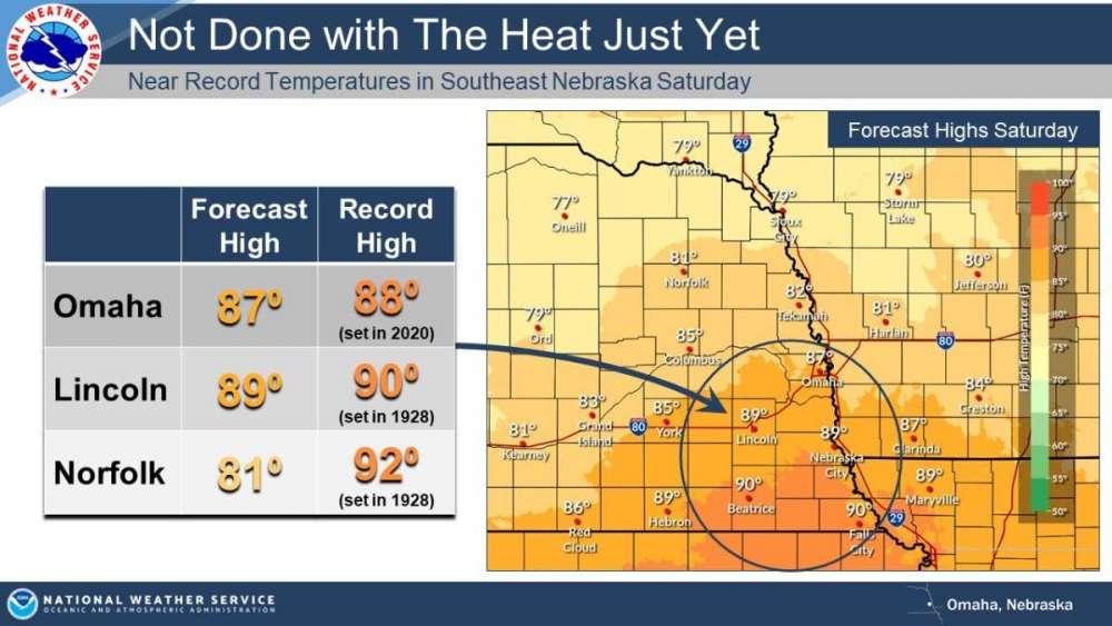 2 points
 -
Like I said though in terms of tangible weather it’s not really that exciting. It’s early yes but unless you’re like a weather stat geek like many of us on here you wouldn’t really notice this weather. it’s not unusual to have highs in the low 50s and and overnight lows in the low to mid 30s a lot of the year in western WA. That’s why many don’t find it too interesting.2 points
-
06z GFS dumps snow in the North Cascades pretty consistently up to day 10. Well below average temps for most of the run until lala land drops a high pressure system that pumps up the temps around hour 270.2 points
-
35 in Gold Bar. Apparently tied the record low here? Weird. Edit: disregard about the record low...it still pulls up KSEA records here. Having such a hard time getting weather records for this town.2 points
-
35.6, coolest morning of the season so far.2 points
-
So does the rain. Looking very dry. Nobody took my bet.2 points
-
Down to 40F in downtown Springfield. Coldest night of the regular season for this location to this point.2 points
-
Just dropped below 40 here as well. By far the coldest night so far.2 points


This leaderboard is set to Vancouver/GMT-07:00