
Leaderboard


Popular Content
Showing content with the highest reputation on 10/18/21 in all areas
-
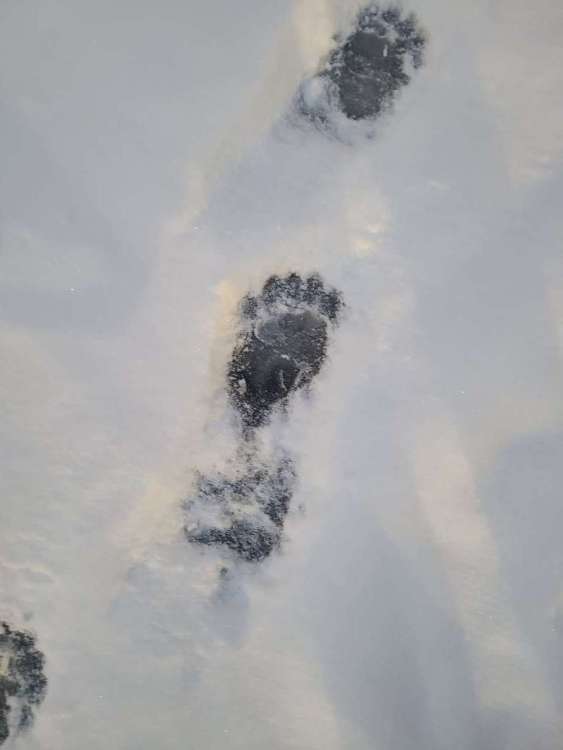
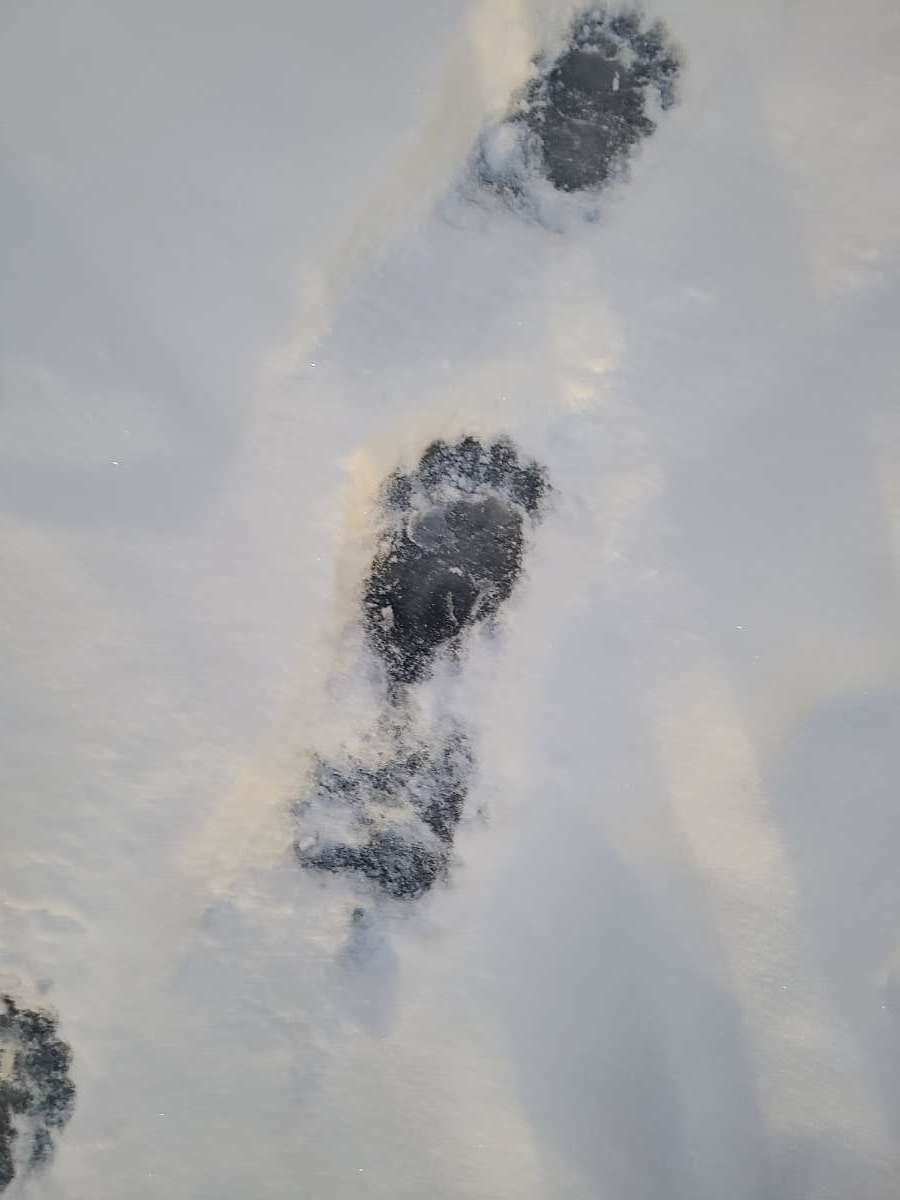
Picked up 3" of snow this morning and a bear apparently beat me to the office front door!
 19 points
 -
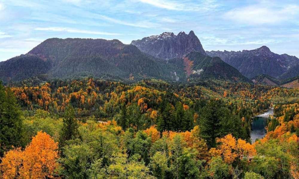
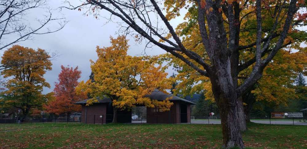
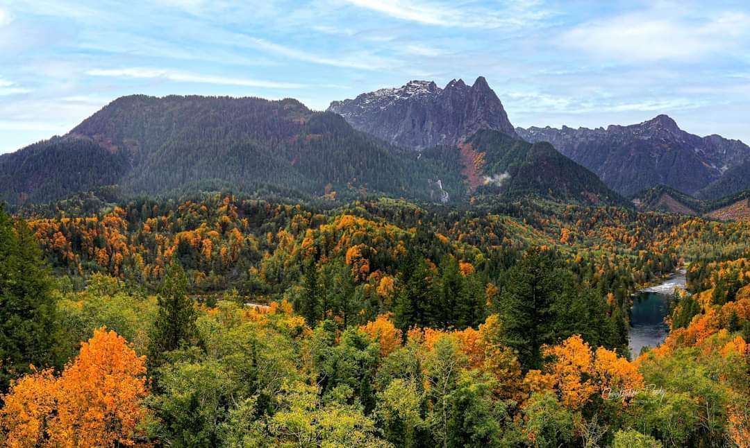
Oh heck. I'll contribute a bit of fall splendor. Let's get in a good mood people!
 16 points
 -
Rapid City, So Dakota. Woah!
 9 points
 -
The hills a bit above my location are covered in snow.8 points
-
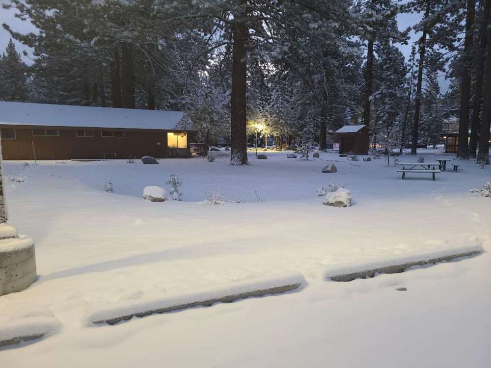
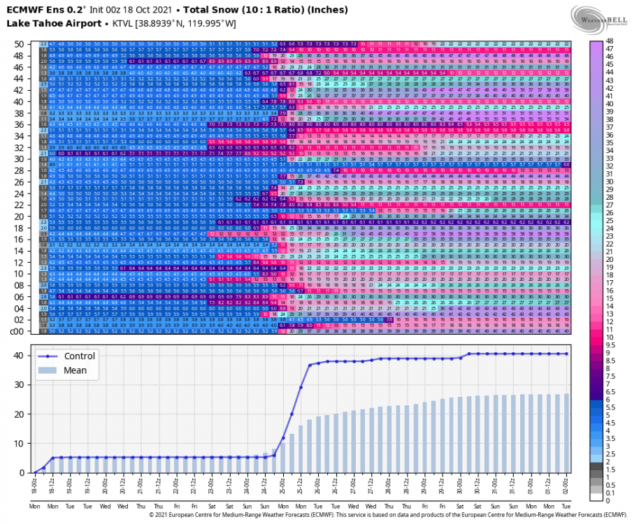
I am at South Lake Tahoe, probably 800 feet or more above the town, and we got several inches of snow overnight
 7 points
 -
Ummmm... That's a nice hurricane off the coast...6 points
-
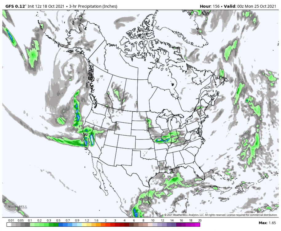
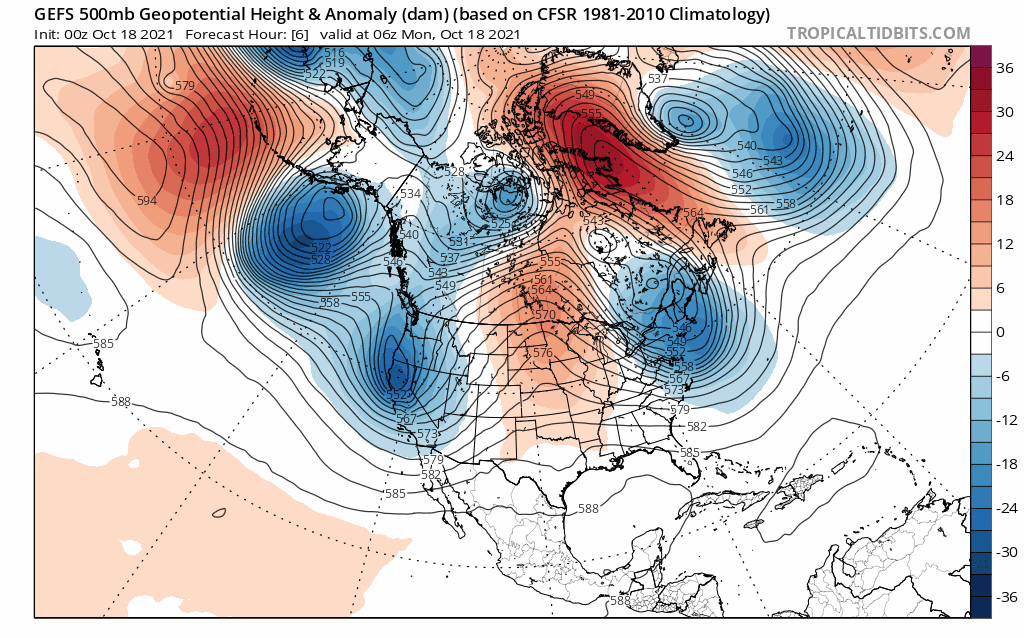
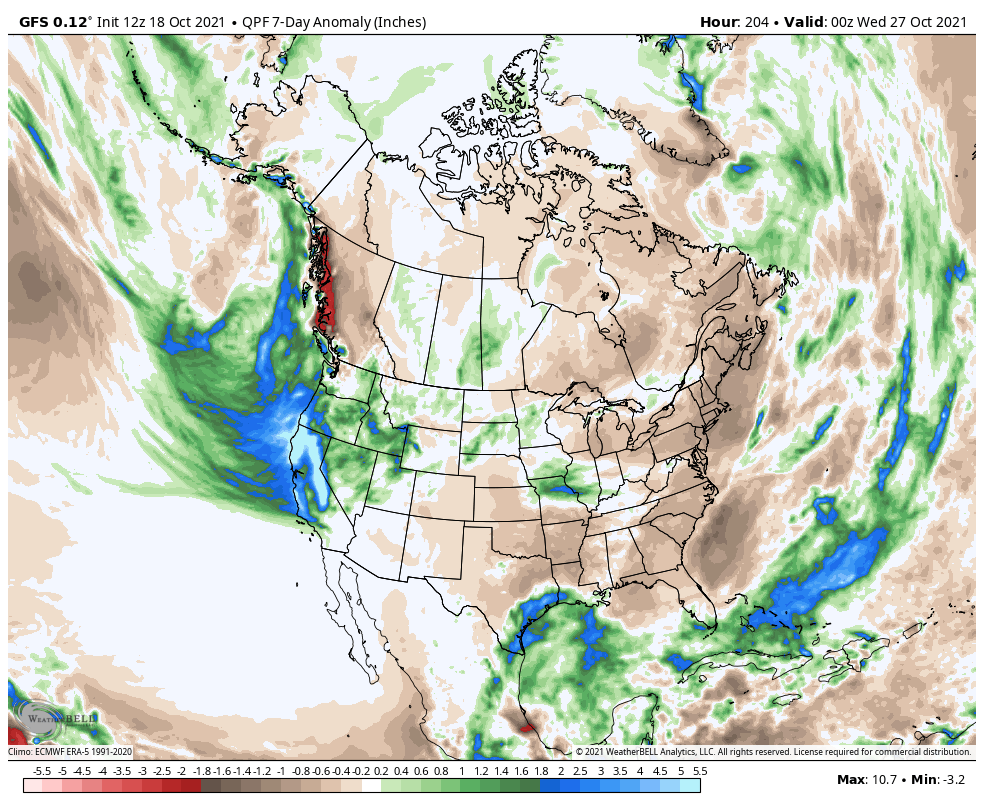
GEFS and EPS seem to agree on precip amounts and location to close out October.6 points
-
What a stormy way to close out October, the GFS has 5 storms in the final two weeks of the month. We have been missing cold air in the pattern and that looks to change on Halloween. Is this a trick or a treat that the models are showing in the long range? The Euro Control shows this for temps to open up November. While the GFS brings Iowa and Minnesota their first snowfall of the season. At the very least the blocked up pattern looks to provide some very interesting weather.6 points
-
GEFS has deep troughing through the end of the month, and then, as if on cue, flips on a dime to ridging as the calendar transitions to the 11th month. It feels so scripted; the cold Niña October, the weakened SPV, the warm November... Something's brewing...
 6 points
 -
50/42 Today. Chilly.5 points
-
"The European Centre for Medium-Range Weather Forecasts is an independent intergovernmental organisation supported by most of the nations of Europe and is based at Shinfield Park, Reading, United Kingdom, and Bologna, Italy, and Bonn, Germany."5 points
-
That’s a godsend for CA. They need as much STJ as they can get in case we move to +ENSO/+QBO in 2022..which would be an unmitigated disaster for the West.5 points
-
I am sure it will change again... but I really like the 12Z GFS for the weekend with the rain focused where its needed the most.
 5 points
 -
Here's the UKMET solution for that potential system:
 4 points
 -
Btw, I was wrong it’s 1.23”, not 1.26”. In other words, an approximately 74”/hr rainfall rate. Yikes. That’d be 740”/hr if it were snow. https://www.wunderground.com/blog/weatherhistorian/what-is-the-most-rain-to-ever-fall-in-one-minute-or-one-hour.html4 points
-
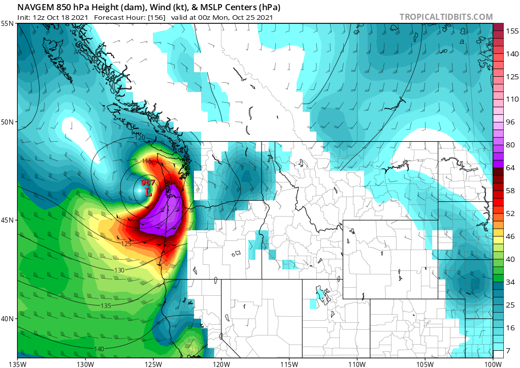
Interesting from the NAVGEM, which doesn't typically show very strong centers of pressure.
 4 points
 -
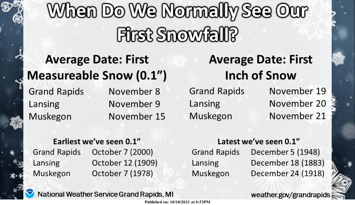
fwiw, Marshall hit 38F this morning. Last year, we had the earliest 32F low in many years which helped give us a brilliant color season. This year we are at least a month behind. So far behind, that the NWS office isn't even talking up the lack of frost(s) or freezes. Maybe they've punted frosts and just fast-forwarded since they put this out today..
 4 points
 -
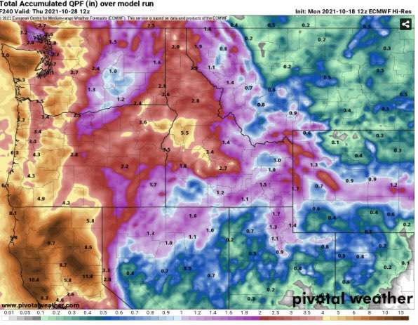
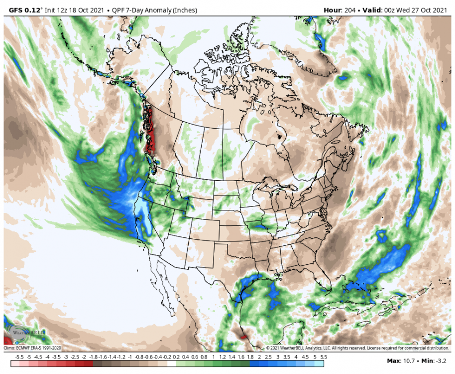
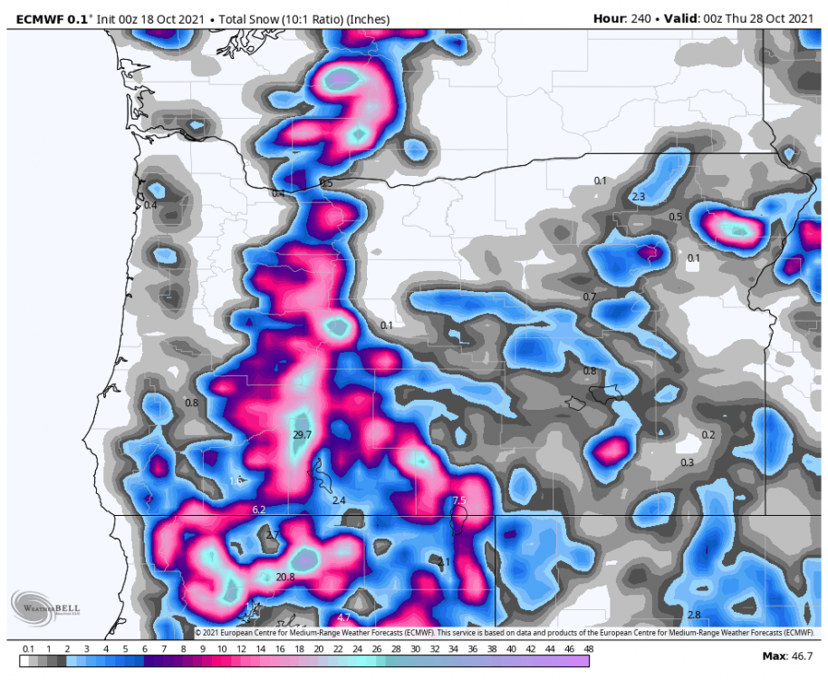
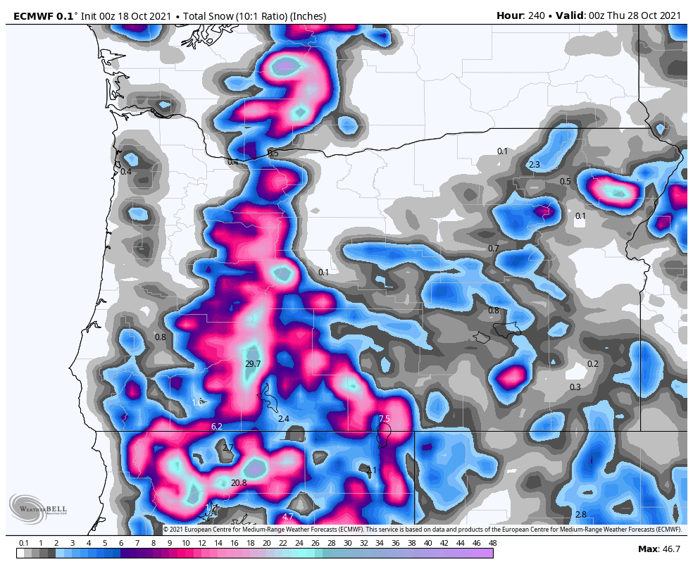
Some of those rain totals on the euro in Northern California are pretty incredible.
 4 points
 -
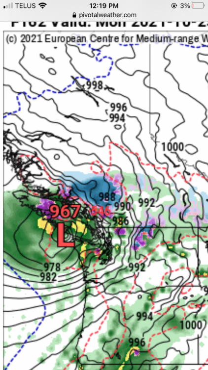
967mb low into central Vancouver island on Sunday night. Impactful, possibly devastating windstorm for Washington and SW BC
 4 points
 -
Even an average January would be a major win at this point.4 points
-
That winter was great for Cascade snowpack and here in the foothills we had near record breaking snow fall. Had a few things broken differently it could have been good in the lowlands, still was a pretty chilly January in the Willamette Valley at least.4 points
-
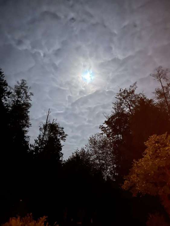
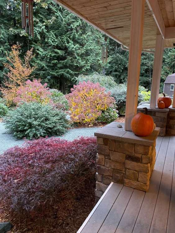
Mid October moonlight. And fall color outside my front door. 55/43 on the day.
 3 points
 -
Though what the UKMET spits out for actual wind gusts inland isn't that impressive, it certainly is interesting that there's such a disparity between the weak GFS and the more powerful (and consequently more offshore) storm solutions painted by nearly every other model. Will be interesting to see this active pattern evolve as time goes on. All eyes on the EURO!3 points
-
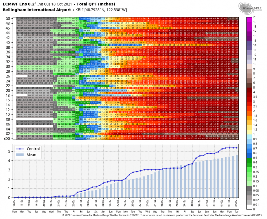
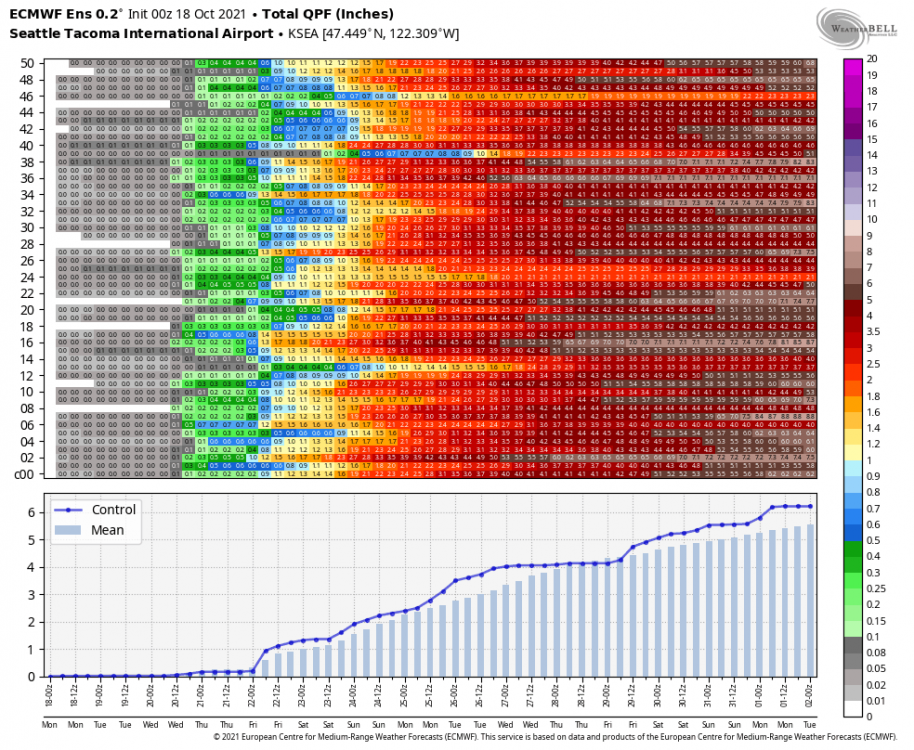
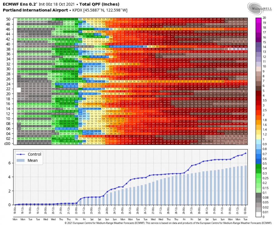
0z is crazy wet for the next 10 days. 4-5” for the Puget sound and 6” for PDX. 🌧3 points
-
We should all meetup somewhere like the north Oregon Coast and have a bonfire with an extravagant feast.3 points
-
51/37. First 5000 ft snow of the season! Euro still shows an inch at my place Wednesday morning.3 points
-
I grew up experiencing 83 degree rain every summer... usually accompanied by thunder and pretty fun.3 points
-
They're due and this is mostly the reason why. And we think our dry streak was bad. edit: hadn't realized you already mentioned the Sacramento dry streak in the later post.3 points
-
I especially like 63 degree rain. During the Dec 2007 coastal gale there was a day like that in Hillsboro. Tropical! I stood outside in the rain without a jacket on and was wonderful. lol3 points
-
Imagine this with January/February mean 850s. We'd be looking at feet of high ratio powder at ski resort elevation.3 points
-
Worth noting that models have had a massive warm bias recently. It's been above average here, but not what models have shown.3 points
-
Nice. Upper Kingsbury.3 points
-
Upper 30s this morning. Already upper 60s before noon. Crazy Make that 70 at 11:45AM3 points
-
45 this morning, a very soggy weekend here with 1.63" since Friday, with most of that falling Friday and yesterday. The winds were pretty impressive on Saturday, I saw there was a SCA out on the water, but I am kinda surprised we didn't get a wind advisory. Headed out to Kayla's neck of the woods this weekend to catch one last band performance for my son, and the weather looks pretty spectacular. Part of me wishes we could get a nice winter storm like they had last week, but the part of me that will be sitting on aluminum bleachers for several hours is very glad that it will be dry and in the upper 50's to low 60's, although the Bobcats are looking really good this year so there may not be a lot of sitting!3 points
-
NWS Reno's got an *actual* night shift going!3 points
-
WB pepto version for good measure.
 3 points
 -
I think in any given winter the deck is always stacked against us for something historic.2 points
-
Definitely and I have no desire for it to happen as well. But why does it feel like the deck is stack for something historic to happen this fall/winter? Seems like we are due for a historic windstorm sometimes this fall.2 points
-
00z GFS - 10 Day GIF: 500mb Height Anomaly. 10 Day Rainfall Totals. 6" for PDX!2 points
-
Yes, not actual airmasses like that. But the most concentrated rains can come from our most short lived events especially east of the cascades. It takes a really solid AR in December for rain in the winter to be legit 'heavy' in Klamath Falls.2 points
-
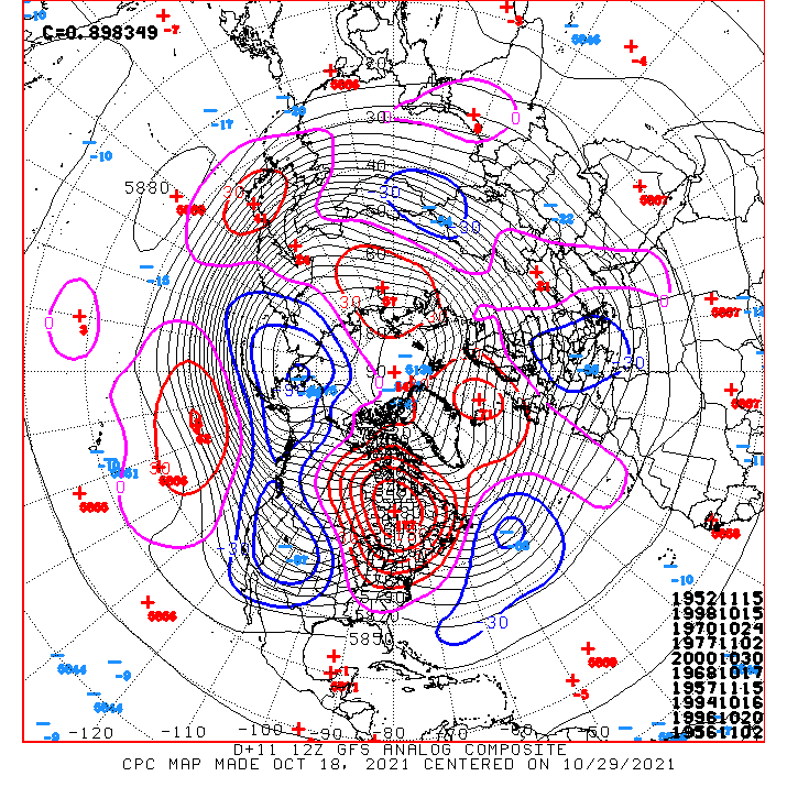
These are all -QBO minus 1957/58. Not a single Niña/+QBO to be found.
 2 points
 -
EURO has a very very fast moving and powerful system rake the coast next week-- much more of a windstorm track than what the GFS shows. Models are obviously waffling around but its nice to see some agreement in some sort of strong jet/low pressure combo.2 points
-
This would be really nice... much wetter anomalies in Oregon and CA. I am sure people in drenched SW BC would agree.
 2 points
 -
Go Bobcats! It does indeed look pretty nice all week into at least early in the weekend. We could really use the moisture though and it looks like we'll only see 0.5-1.0" of precip over the next two weeks while the west coast gets drenched. We're still experiencing exceptional drought conditions even after the big storm last week so I would love to see the mean trough position shift slightly further inland but that doesn't look to be the case. Happy to see what looks to be a pretty big drought buster for NorCal though.2 points
-
Precip totals using 00z EPS. One of these is not like the others

 2 points
 -
That's Index in the center, looking from Heybrook Lookout. This is down the street.
 2 points
 -
Could be a very interesting pattern if it happens in Dec or Jan. We would undoubtedly be talking lower heights, lower 850s, and even more suppression.2 points
-
EC. Looks like the jet suppression gives us some low snow levels.
 2 points
 -
ANALogs Gone Wild 2021: Bombs Away!2 points
-
The upcoming pattern is great for the drought-stricken west. Models show a firehose aimed at the central/nw coast.2 points


This leaderboard is set to Vancouver/GMT-07:00