
Leaderboard


Popular Content
Showing content with the highest reputation on 10/19/21 in all areas
-
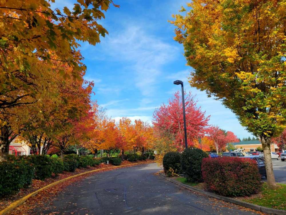
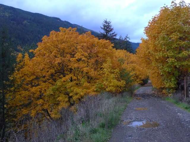
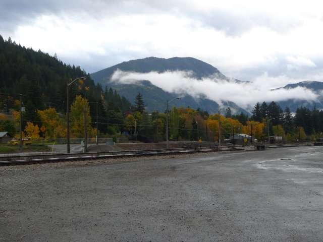
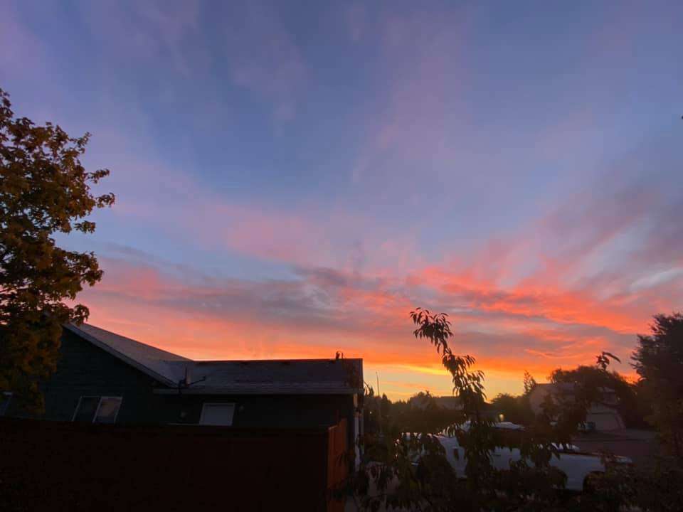
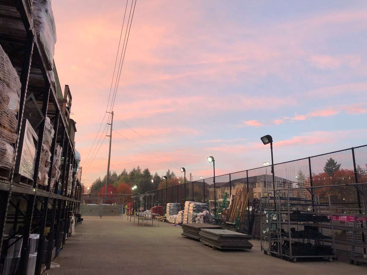
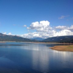
Lots of colors popping now in North Bend... had to get some pics on my trip to Safeway.

 16 points
 -
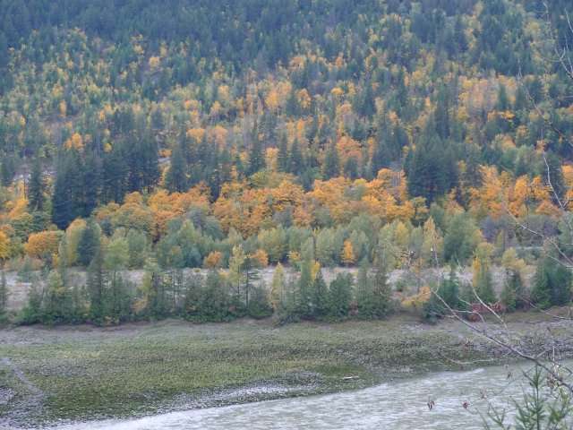
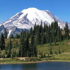
Fraser Canyon colors.
 10 points
 -
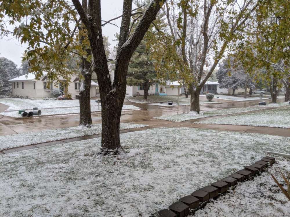
57/43 today. Some trees in my neighborhood looking decent.
 7 points
 -
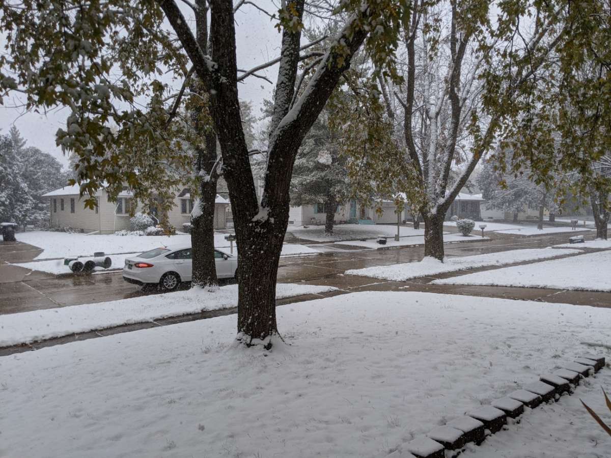
39 this morning.
 7 points
 -
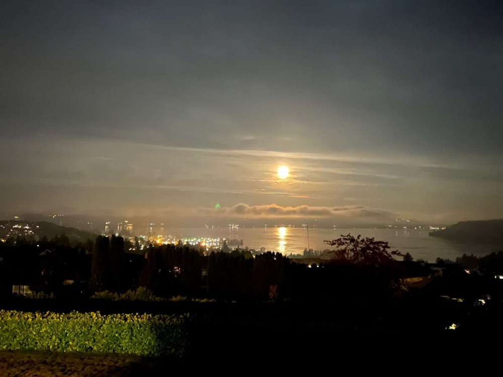
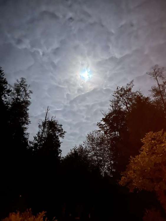
Got a shot of the setting moon this morning. The fancy new iPhone camera has its limits because the photo doesn’t do it justice.
 7 points
 -
One year ago today--- can't wait!!!

 6 points
 -
Okay all. Here comes the forecast you have all been waiting for. The man who essentially NAILED the past two winters, is back to make it rain (OR SNOW) again. Buckle up. It is going to be a fun ride. November: It's hard not to read the tea leaves and go mild and dryish with this month. I don't think it s a lock, but I think we have an above average chance at warmer than normal temps and we will likely see at least a 7-10 period where ridging dominates. The beginning and end of the month will probably be the wettest. We get into inversion season in November, so temps can be tricky, but I feel at least some of the ridging will be the kind of dirty ridging that brings mild southerly flow in November. Temps: Regionally likely above average, warmer further south. Could see some WV inversions towards Thanksgiving. Warmest part of the month will probably be 10-20th. Could be a very warm month south of Eugene. Best chance for cold anomalies later in the month. MAYBE early, though not a big chance. Precip: Generally below average, though not necessarily a dry month. First week could be fairly wet, last week could trend wetter too. Extreme northern parts of the PNW could be fairly wet overall. Snow: Very low chances for lowland snow. Small chance north of Seattle late in the month, very unlikely south of Portland. Cascade snowfall likely below average. December: I expect things to pick up and we will likely see our coolest December since 2017. Temps: Regionally average to slightly below average. Best chance for below average temperatures in NE Washington. Best chance of above normal temps across southern Oregon (SW and SE Oregon). Better than average chance of a cold, but fairly short (2-3) Willamette Valley inversion mid-month. Something like this... https://climate.usu.edu/mapServer/reports/e15daily.php?stn=USW00024232&year=2006&month=12&unit=EN&network=direct:ghcn&sidebar=0... Precip: Overall a fairly wet and active month. Above average precip for most of the region. Quite a bit of onshore flow and full latitude troughing. Likely less of a N/S precip gradient than November. Snow: About average lowland snow chances for the month of December. Likely 1-2 minor lowland snow events. Not getting a December 08' feel, but a significant regional event is possible, though not likely. Would be surprised if no sticking snow north of Seattle, or if the Willamette Valley was entirely shut out. Should be a good month for the Cascades. I bet Spokane does well. January: Overall I am most bullish on January. I think the long term models are most bullish on December/March, but my sense is January is our best bet. Temps: Generally below average. We could have a torching period which skews things a little, but overall I would say it will easily be the coldest January regionally since 2017, and some places could see their coldest January since 1993. Best chances for arctic air around the New Year and then later in the month. Better than 50% of a regional arctic outbreak. At some point I think we see an AR which will bring a thaw and several day torch to parts of Central and Eastern Oregon. Precip: Generally above average, though closer to average than December. At some point we could see some jet suppression, best chance for below normal precip is probably north of Seattle. Snow: At least one significant snow event West of the Cascades that is fairly widespread. Most areas will see accumulating snow. Cascade snow near normal. I expect NE Washington (Spokane) to do well once again. February: February has been red hot over the past five years, does lightning strike again? Salem has been colder in February than January the past 4 years, that will not happen again, but it will be a decent month. Temps: Average to slightly below. If we get a cold snap in late January it could linger into early February. Otherwise a cool, but not cold month, maybe turning colder again late in the month. Precip: Above average. Snow: Generally low snow levels, probably something similar to February 2017 or 2009. A lot of places could see accumulating snow at some point, but any big snows will likely be further north, elevation dependent, or narrowly focused. Cascade snowfall should be above average. March: Could be a very chilly month. Temps: Below average, especially the first half of the month. Precip: Near average, drier further north, likely above average in Oregon. Snow: Widespread lowland snow unlikely. Possibly significant foothill and Cascade snow. Best lowland snow chances north interior of Washington, and C-zone. Recap: Overall I expect a cooler and wetter than normal winter after a fairly mundane November. It has the potential to be one of the most active winters in recent memory. December could be very stormy. We will flirt with lowland snow every month December-March with January holding big potential. Most of us will see snow in the air before Christmas. November has the best chance for above normal temps. January and March have the best potential to be cold/cool. Overall coolest winter since 2016-17, wettest winter since at least 16-17, potentially 11-12'. Cascade snow pack will be above normal. Snow predictions: Seattle: 14" PDX: 9" SLE: 12" EUG: 8" "My Location:" 60-70" TWL will see sub-freezing high.5 points
-
GEFS didnt change too much.
 5 points
 -
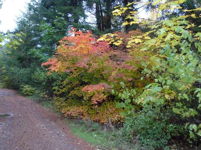
A frosty 35 here this morning. Not nearly significant since we dropped to 30 already this season. Great sunrise and it looks like our colors are peaking the next 7-10 days.
 5 points
 -
This is where I think Gary does a poor job of explaining the LRC to folks and I remember back on his blog some would challenge him on things like this and he didn't like it. I look where blocking sets up and longwave troughs and mean ridges. So far I don't see many negatives as far as they are concerned. We have currently had a -PNA as we go on through the fall that will likely not be the case very often as LaNina has more of an influence. The MJO has spent most of the month in the warm phase but is currently tracking towards the colder phase 8. The blocking that we've had would suggest that most of the Winter will have a -AO and NAO which tends to strengthen the jet stream and allow artic air to filter down. These teleconnections are all wild cards and I do not believe the LRC has any influence on them. I do however believe that they influence the LRC. The LRC is great at letting us now when storms are likely to occure and where they may track and strengthen but not so much on what the conditions will be when they do. That is why its so hard to make a prediction more than 30 days out. Hope this helps and the Chiefs better buck up and stop King Henry!5 points
-
KC has had snow and cold in 3 straight Octobers leading up to this year and it has translated into a whole lot of not much for those Winters. Very little cold in fact with the exception of last February. I think what's important going forward are the amount and strength of storms, the blocking setting up, and the fact storms are strengthening in our area. Look at the big picture (esp the 500mb maps) and keep an eye on those teleconnections going forward. So far (and it's very early) I think KC could have a much better Winter than what we've had recently. Good luck buddy and go CHIEFS!5 points
-
Glad your back! And I agree we have a fun pattern ahead. That Hudson Bay block is a beautiful thing. The last few days I've been watching a storm around Halloween and the EC has been real close to pulling in enough cold air for snow, last night it did it. I hope this is a start to a colder trend but we will have to wait and see. But we have another 4 or 5 storms to track to close out the month which is great! 6z GFS is joining in5 points
-
Poor Lake Oswego Joshua, he's gonna have a really hard time with this. That's some nasty drought weather heading his way.5 points
-
5 points
-
@MossManRandy only in the yellow sorry bro
 4 points
 -
I think the drought is over.4 points
-
I don't think I saw a cloud today. Absolutely gorgeous days. Sunny skies w no humidity, cool breezes, chilly nites and etc. I mean who can ask for anything more than this. Enjoy it now folks. Wont last!4 points
-
In all seriousness I feel like there's an elevated chance of a lot of goodies being spread across the region at some point during the coming months.4 points
-
Looks like we might make a run at the wettest Oct ever which was Oct 2016. Also if the cold air gets here in time we could break the record for snowiest Oct as well which was 19564 points
-
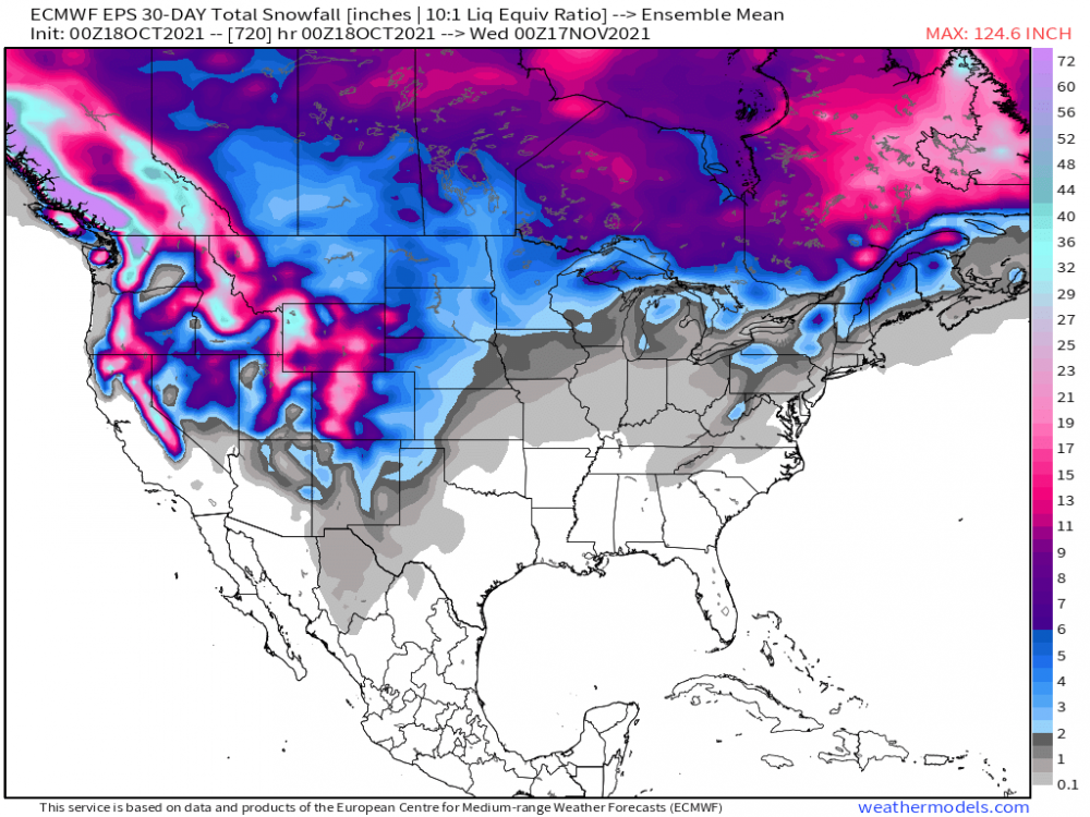
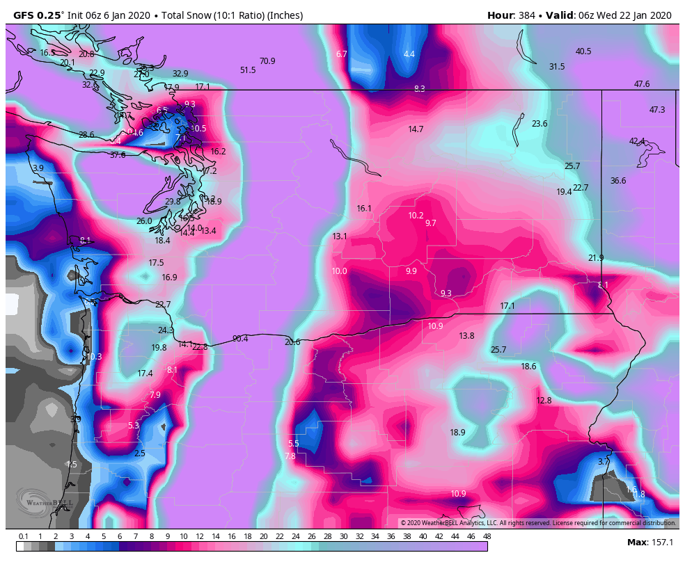
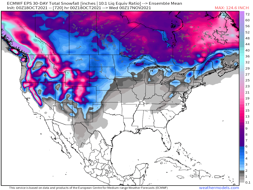
I've found it generally overstates snow amounts for our area. Probably because its basing it on a 10:1 snow:water ratio when it is usually more like 7:1.4 points
-
It is sunny and 71 here at my house right now. That last official reading for GRR was 70. It was just last year that the record high of 80 was set for Grand Rapids. It has been a record setting warm October so far and much of the area is still on course for one of the warmest Octobers on record. Here is where we stand as of this morning. Grand Rapids the mean so far is 63.3 and that is a departure of +9.3. At Holland the mean is 65.0 for a departure of +10.9. At Muskegon the mean is 64.3 for a departure of +10.0. At Lansing the mean is 64.1 for a departure of +10.6. To the east at Flint the mean is 64.1 for a departure of +11.9 at Saginaw the mean of 63.5 is good for a departure of +10.2 UP north at Alpena their mean of 60.0 is good for a departure of +10.2. At the Sault their mean of 61.2 is a departure of +12.2 and at Marquette their mean of 57.4 is a departure of +11.2. The only location that has gotten down to 32 so far is Marquette where the low so far this month is 32.4 points
-
It is objectively true. Big south windstorms were far more common around Portland in the 1940s-1970s period than they have been since. Your graph isn't taking wind direction into account and 40+mph easterlies are fairly routine at PDX during the cold season and of course are very different events dynamically. The last significant south windstorm around the Portland area was probably 4/7/2017. The Tacoma to Vancouver, BC corridor has seen several since then. The last top tier south wind event for the Portland area was probably 12/12/1995 or perhaps 12/11/2014 if we're being generous.4 points
-
43 here for a low this morning. Sunrise was decent again. Moon looked pretty cool this morning too but not worth a photo with this camera I got.

 4 points
 -
Back in biz! After years of using Windows, I made the switch to a Macbook Pro and I'm extremely pleased. The only caveat will be getting used to using the OS which will take some time. Anyway, what a glorious day it was yesterday. It reminded me of a nice autumn day in AZ in the month of Nov with blue skies and a high of 72F. Another stunner shaping up for today before big changes later in the week. I'm sure the furnace will be on for a few days this week. It's time. Ready to track? A series of storm systems are poised to track across the Sub underneath an expansive Hudson Bay Block. I gotta say, this is a beauty of a 500mb pattern when we fast forward to the Winter season. #seedthecold So, the long awaited trough is poised to roll on through this weekend before a brief ridge builds in early next week, but then is a potentially big Halloween storm brewing?? Wintry implications as we close out Oct and open Nov??? It may be so for those across the north and possible high Plains. Looking out farther, the Euro weeklies are continuing to suggest a pattern change as the EPO heads negative/neutral as the PNA relaxes. High lat blocking locks in for a while as a -AO/-NAO sets up. I'll post these maps here instead of the Autumn discussions. Is Winter lurking for the lower 48???
 4 points
 -
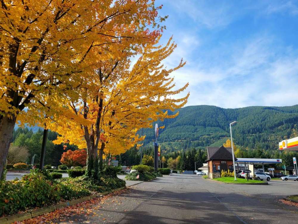
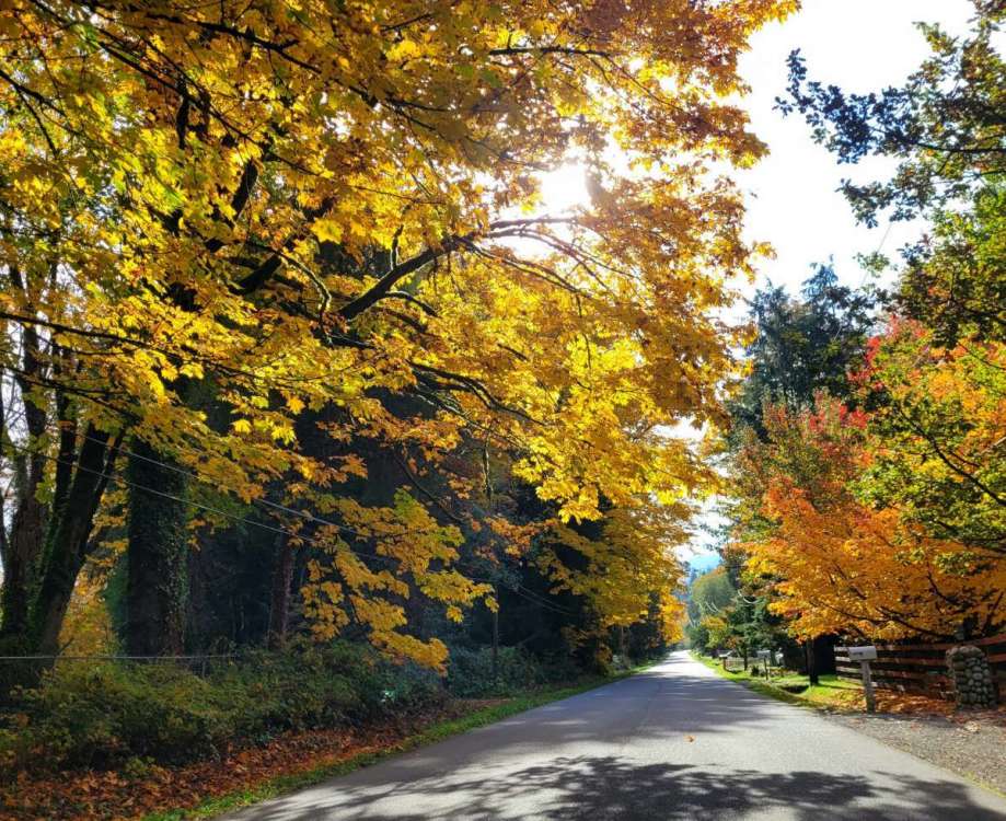
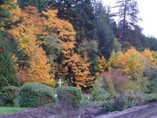
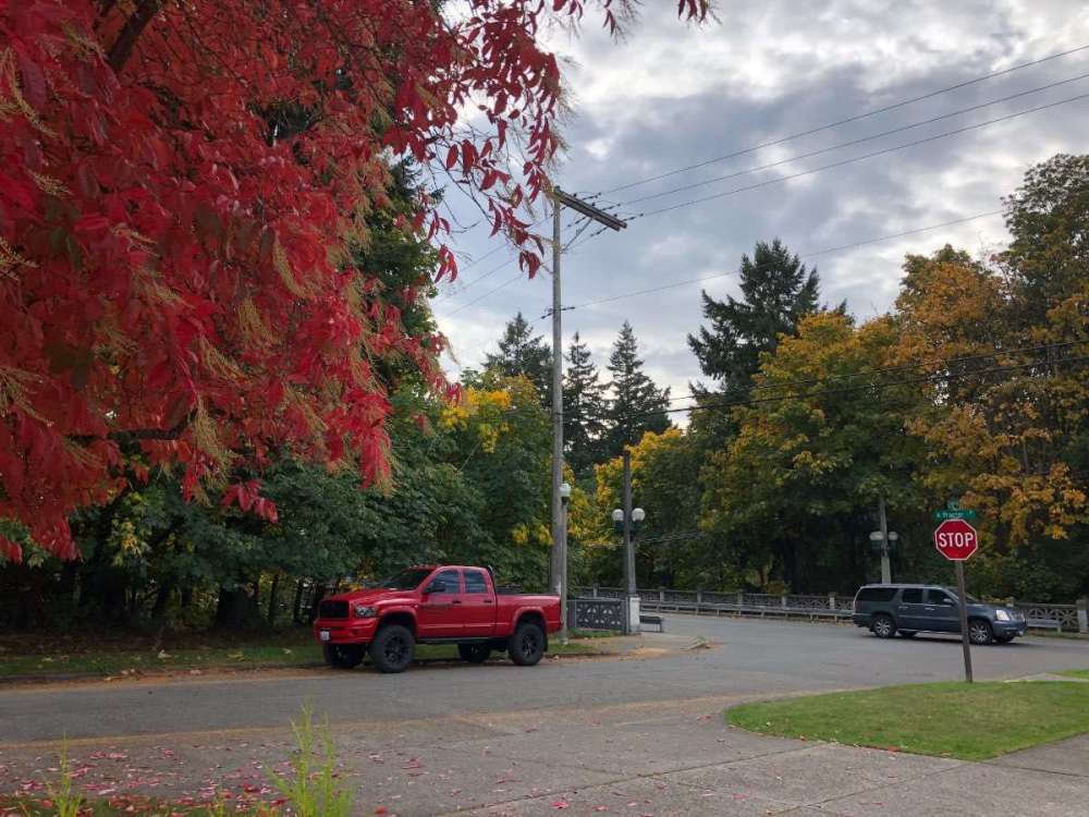
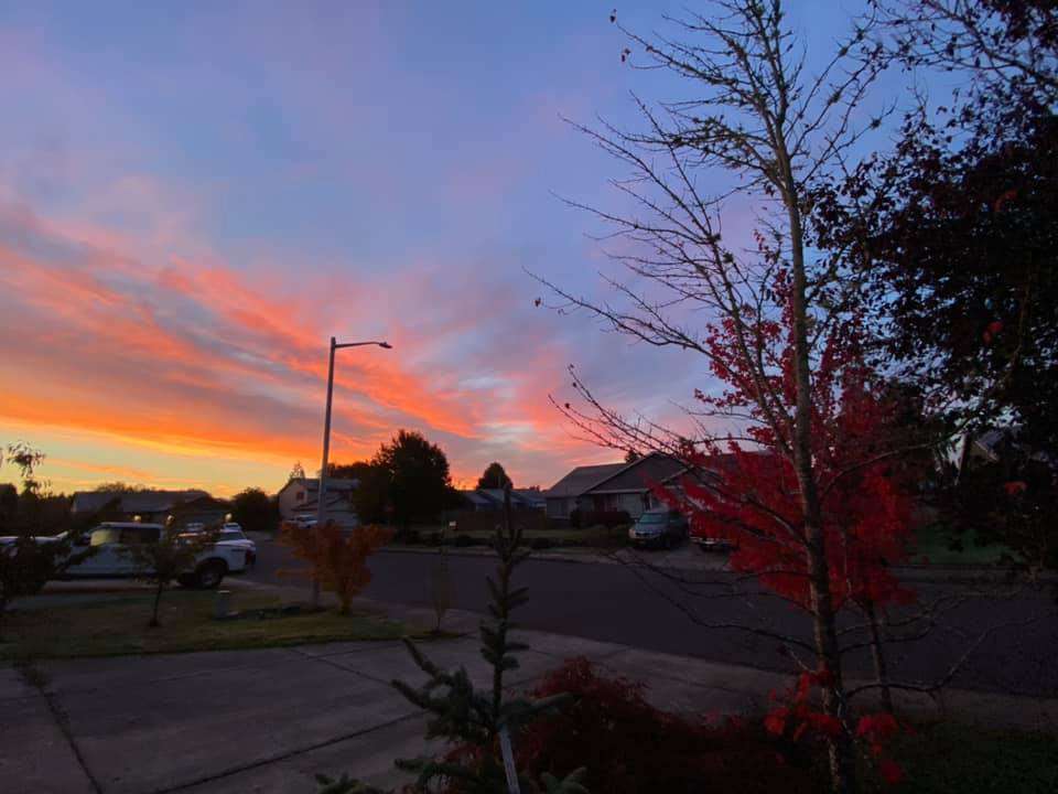
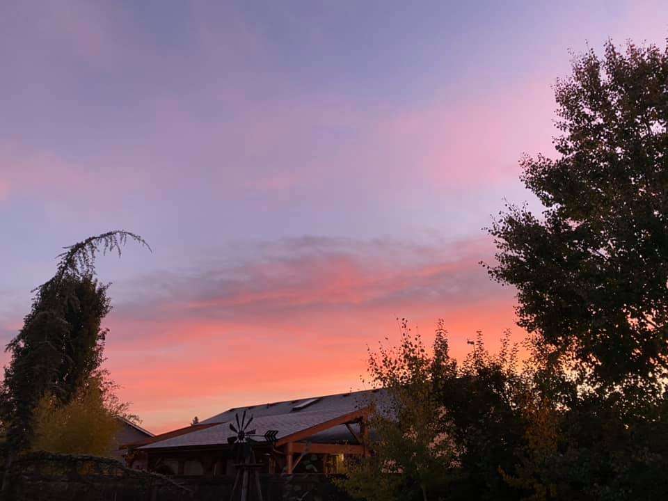
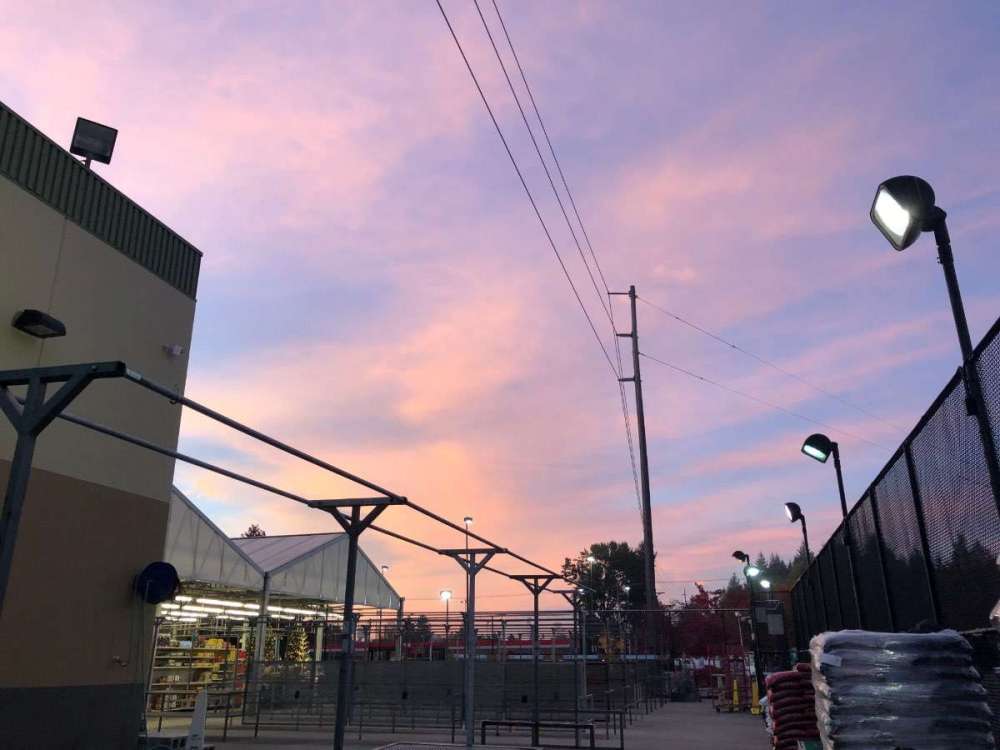
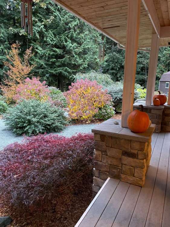
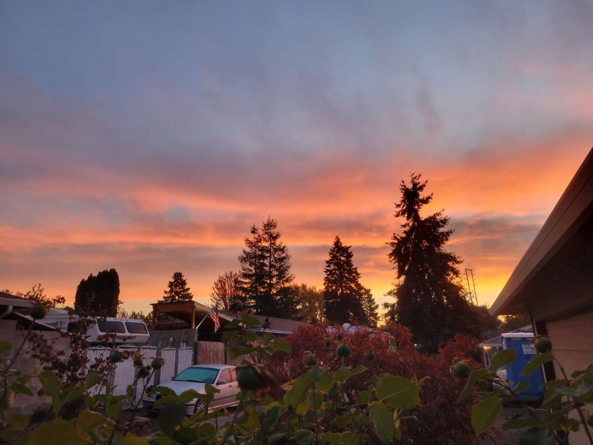
Mid October moonlight. And fall color outside my front door. 55/43 on the day.
 4 points
 -
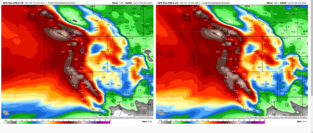
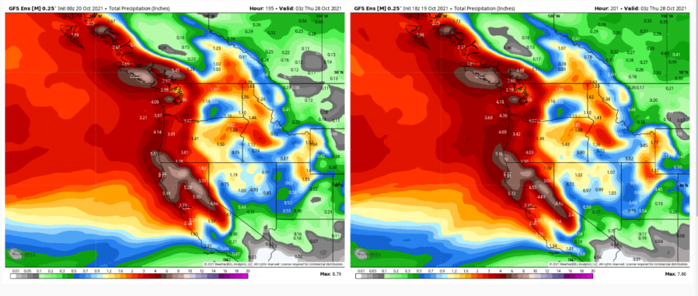
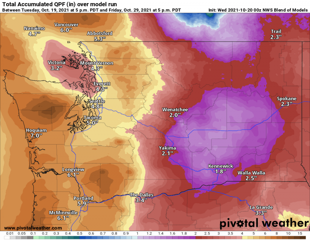
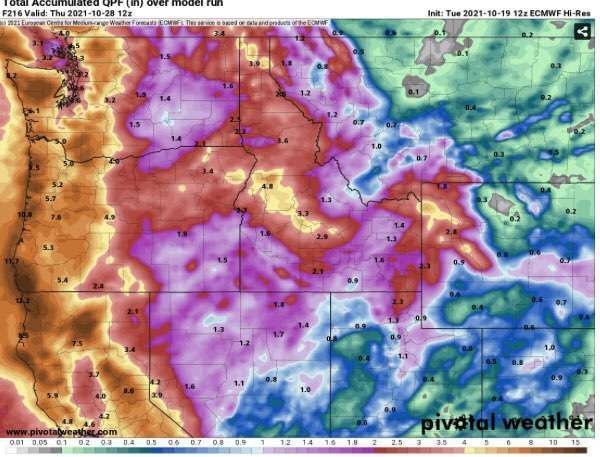
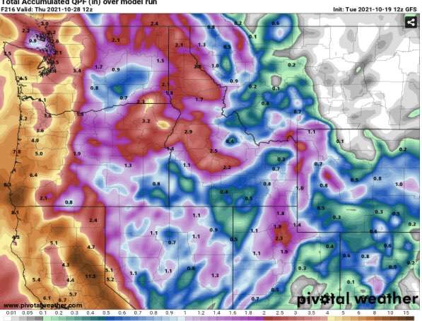
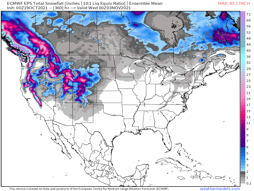
I feel like there would be more activity with the active weather ahead. 00z NWS Blend of Models total precip
 3 points
 -
@Joshua Lake Oswego EPS has PDX rain totals at 6+ for 15 days. I will do $20 at 5:1 for you that they hit 50% of that total (lets say 3 inches). by day 10. Thoughts?
 3 points
 -
@Requiemhere you go got back everything you lost on the 18z and more
 3 points
 -
Talk about windy! Hopefully it start to rain soon.
 3 points
 -
Go to sleep old man the future is now3 points
-
East wind has become quite breezy east of I-205 in the Portland area with modest gradients currently. I just had the first "gust" of the Fall season hit my east facing front room window. This is in response to the approaching strong front. We're now moving closer to east wind season! 'Tis the Season! C'MON!!!!3 points
-
Picking up!
.gif.fedbd037a5b01dc6fe8d2e9605e29630.gif) 3 points
3 points -
Ended up with a 61/40 day today. Pretty much spot on normal for the daily average. One of the more interesting things in the model world today is the EPS PNA forecast dropped considerably on the 12z run centered around the 25th. Certainly lends more support to another round of well below normal temps before the month is done.3 points
-
Will be interesting to see if we can manage 3 consecutive wetter than normal months this fall. Getting 2 in a row is pretty nice. Will probably end up with 10” of rain from mid September to the beginning of November at my location. Getting significant rain like this down into California during a nina is a good thing too considering nina usually isn’t the best for them.3 points
-
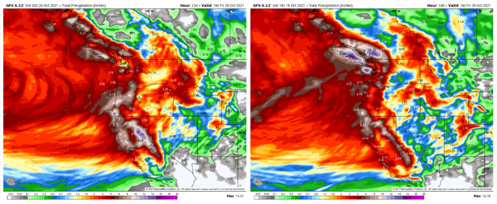
It's looking like it's going to be extremely wet. More than I would expect for a La Nina. The flip side will probably be three weeks of cold inversion fog. Should eventually end up drier than normal but wowies! Dats some serious rain on the way for the next week to 10 days.3 points
-
So far this month, temps have been AN for mby each and everyday. It has been awesome! Cold air can come in November.3 points
-
About .15 - .25 in your area. I have seen it do that before on marine layer days... maybe its not different. We will be able gauge it better over the next week.3 points
-
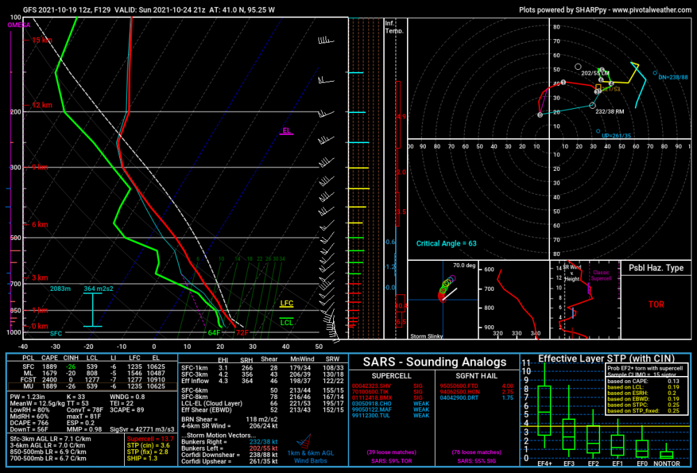
Both 12Z model runs of the GFS and Euro show eastern Nebraska well into the 80s next Tuesday. Meanwhile that's a pretty looking sounding for severe weather chances this coming Sunday in southwest Iowa. Might have to go chasing!
 3 points
 -
Gonna end up a wet month it looks like. Probably close to 6” of rain here which would be the wetter than the last 3 Octobers.
 3 points
 -
Very nice.
 3 points
 -
I've convinced the husband to let me spend some money on a better weather station. I like the one I have, but I want to save the data since my schedule is all over the place. I'm just lost as to what is a great one and what are duds.3 points
-
Glad you're back to the norm @Tom Been a quiet few days but we get active again tomorrow. A low should track close to the IA/MN border with some convection possible. Gets much colder behind this system. 50s to finish out the week with frost/freeze looking more like Saturday AM. Halloween storm would be awesome! Too bad its 11-12 days out. Interesting how long range models are in some agreement on it though.3 points
-
Very quiet stretch of weather around here. Regular season of HS football is ending this week, and the weather looks amazing for those games. Our school has Parent Teacher Conferences today and tomorrow with our Fall Break Thursday and Friday. Great time later this week to mulch some leaves. Farmers have had one of the best autumns to pick that they can remember. Sounds like a bumper crop is being harvested according to friends and relatives.3 points
-
Dr. Roundy’s experimental analog pool goes bonkers with NPAC/Alaska ridging towards Thanksgiving. Verbatim that’d be a prelude to some serious cold loading in Canada. http://www.atmos.albany.edu/facstaff/roundy/waves/analogs/analogs.html3 points
-
It's not. One week in October will not end a long term drought. If this winter ends up like 2017-18, it will be back worse than ever next summer.2 points
-
Davis pro2 and vantage pro2 line is nice. Very convenient to be able to separate sensors for proper positioning. Anemometer up high with temperature sensors closer to ground. They can get spendy if you go for all the options and the rain gauge accuracy can be a bit hit and miss. You could get a basic one to start and add sensors as you want. I’ve had mine for 9 years (wireless) and only replaced the battery once.2 points
-
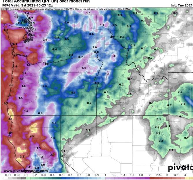
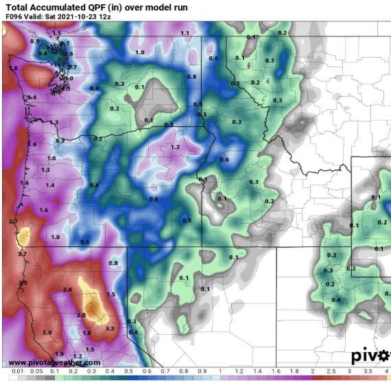
0z is crazy wet for the next 10 days. 4-5” for the Puget sound and 6” for PDX. 🌧2 points


This leaderboard is set to Vancouver/GMT-07:00