
Leaderboard


Popular Content
Showing content with the highest reputation on 11/04/21 in all areas
-
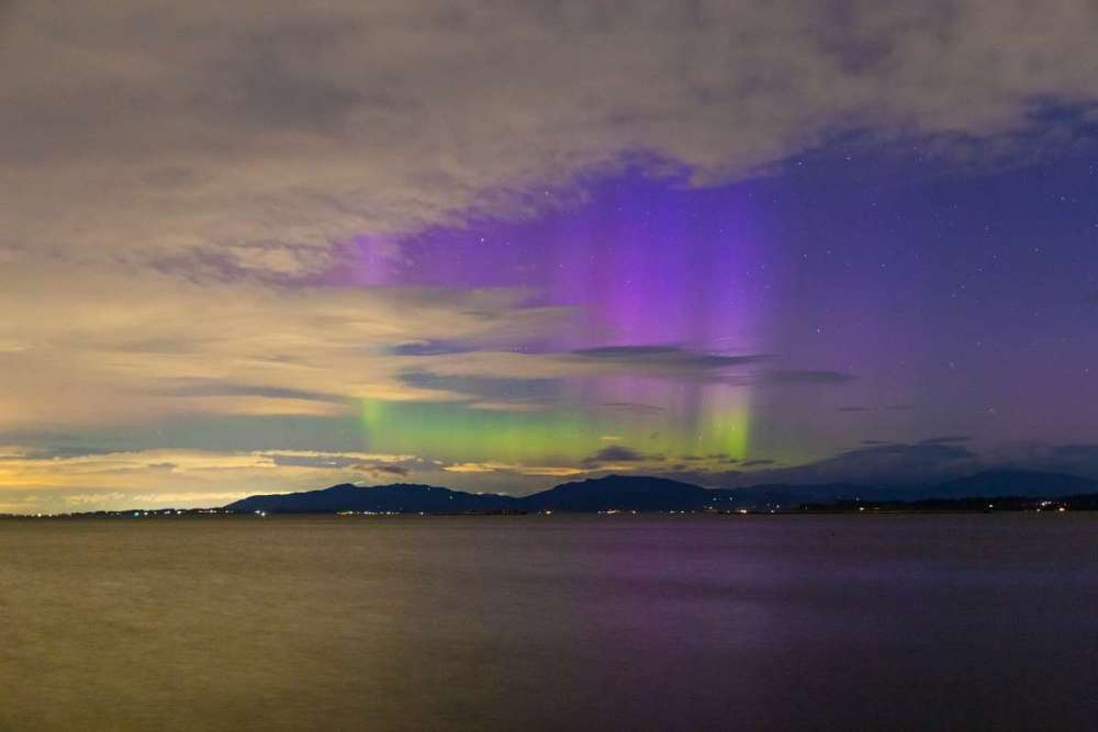
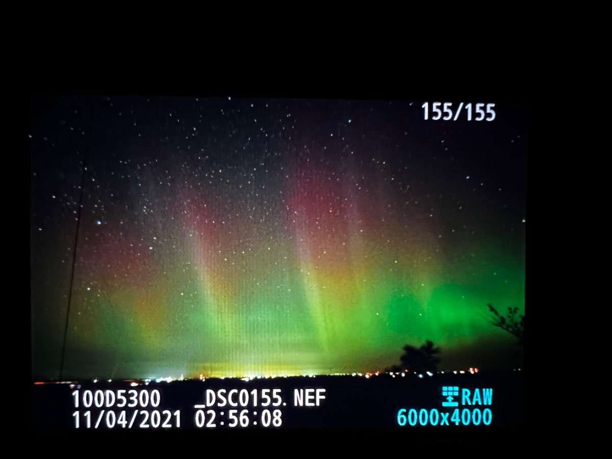
Woke up randomly at about 5:30 a.m. to clear skies and the aurora borealis visible to the north. Managed to get a few pictures before the clouds came back in and sunrise spoiled the show.

 20 points
 -
Too much cloud cover overhead here last night but woke up to clear skies and the lights were still going on! Just taken with my iPhone.
 19 points
 -
10 points
-
Was pouring all the way from Stanwood to about 1 mile west of Skykomish. Was just a few sprinkles happening there.
 7 points
 -
Just got the iPhone 13! Excited to get some better quality photos now. Big upgrade from my old iPhone 8.7 points
-
At least I’ll have someone to talk to in my thread instead of myself.7 points
-
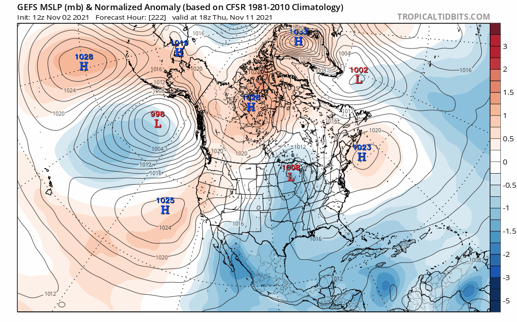
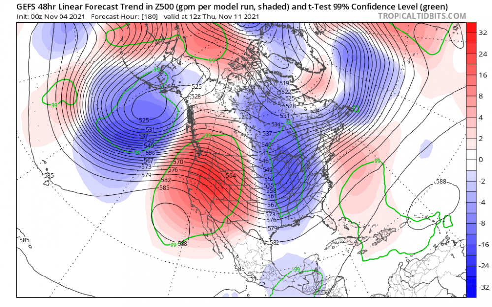
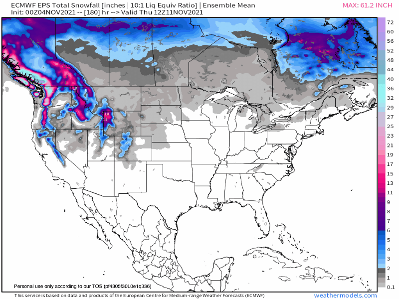
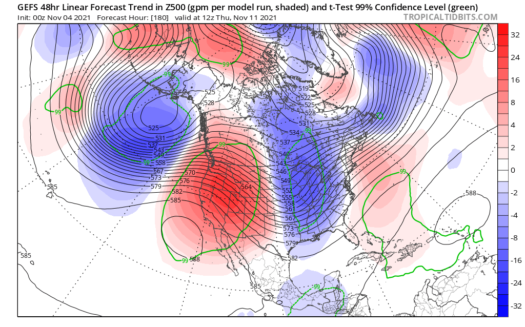
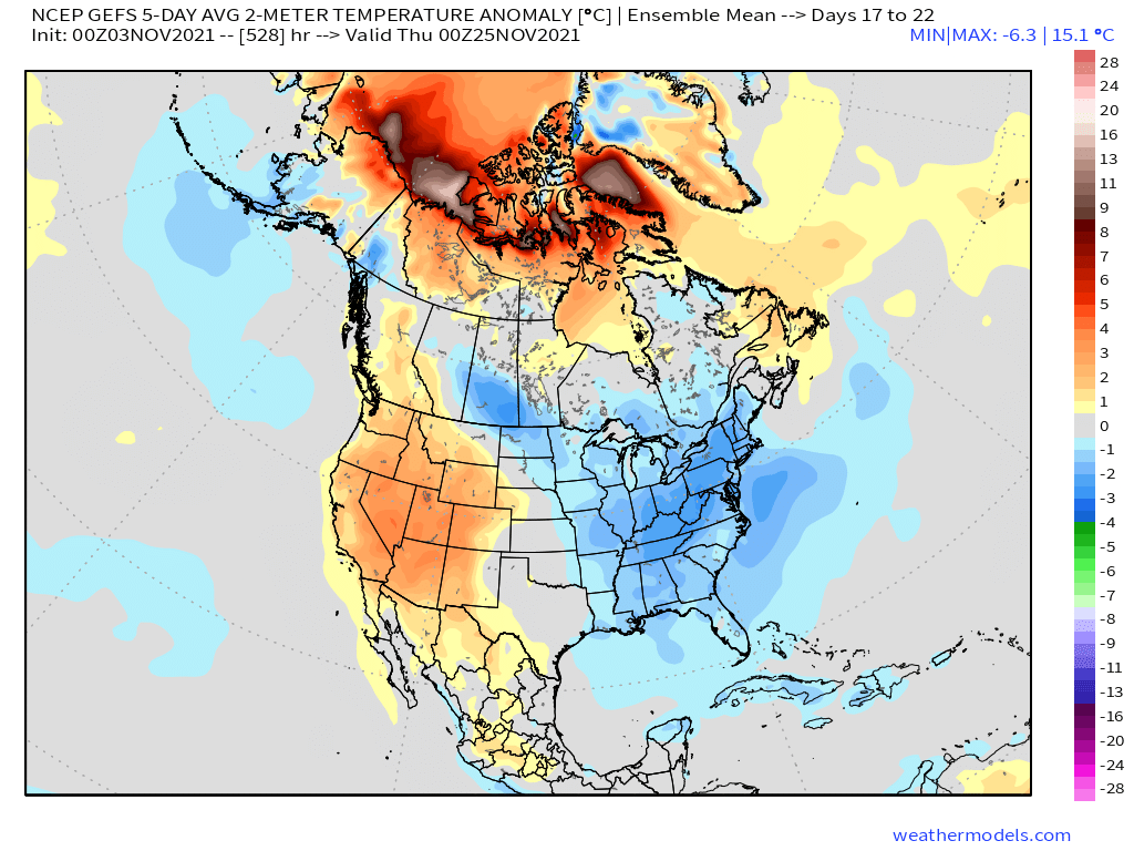
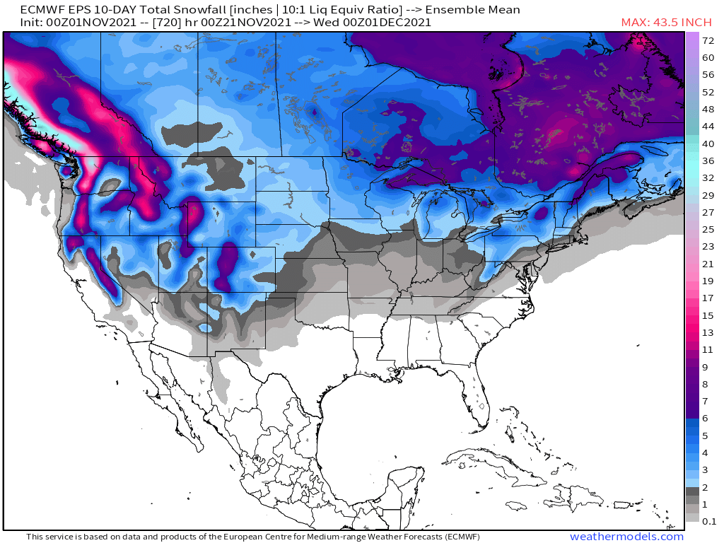
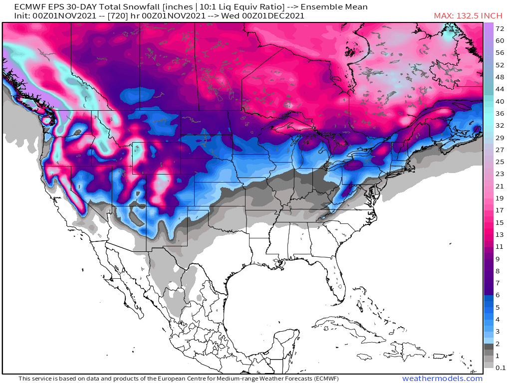
Boy, are the models flip flopping run-to-run and the blocking is certainly adding another layer of confusion for them. For instance, you can see the trend in the 0z GEFS over the past 7 runs. The culprit...a stronger Archipelago HP and stronger western U.S. ridge. The year of high lat blocking is playing a role...I'm also seeing more ensemble members shifting SE. The year of the "SE trend"? Hmmmm...could be something to watch in the models as the season of storm tracking has begun. This is going to be my first legit system of the season that officially kicks off "storm tracking"...check that off the bucket list....I'll probably start a storm thread in the next day or two. 0z EPS...I'm really diggin' the expansive coverage of snow over Canada...nature laying down the foundation... Looking down the road, towards the start of the Holiday season...is that foundation going to support a colder pattern??? LR GEFS....Warm Arctic = Cold CONUS....Bonus = Snowy times??? The signals are certainly pointing towards a wintry pattern, unlike we have seen in recent years. I think the last time we had a cold Thanksgiving holiday week was back in '13 or '14. I do remember one of those years putting up my Christmas Lights and it was pretty darn cold outside. How about the Euro Weeklies from Monday? Trending even colder/snowier as we get closer to the aforementioned period above... 30-day snow mean...

 7 points
 -
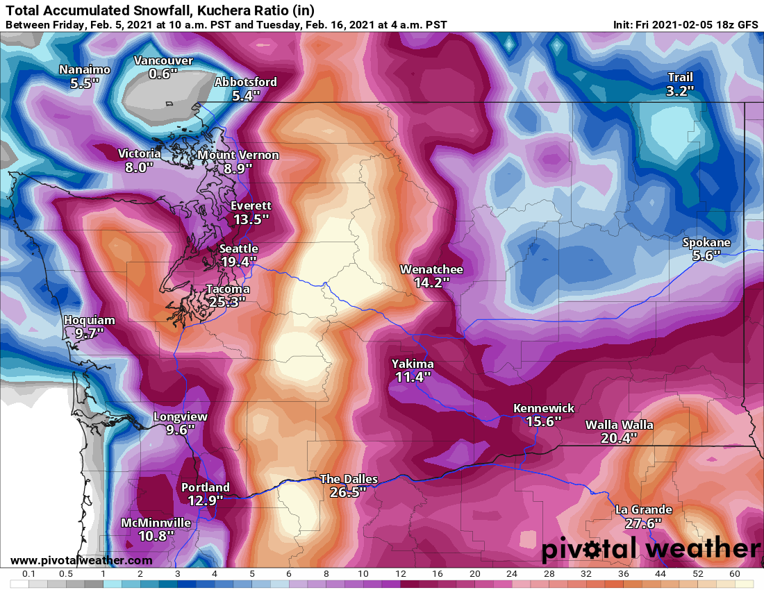
In more earth related news, I don't know how frequently this happens in the Coastal Ranges of BC and Alaska, but it looks like the Chugach got slammed by that atmospheric river up in AK. https://snowbrains.com/did-alaskas-chugach-range-just-get-over-28-feet-of-snow-in-3-days/ Saw the article and thought I would share. I wish they had more remote snow measuring stations in mountain ranges around the world to see actually what crazy snowfall records there would be. Look at this NWS point forecast!
 6 points
 -
Ownership of this house was officially exchanged yesterday, but noticed the original for sale by owner listing just popped back up, that needs to get taken off (lol). That'd be funny if we get new calls from locals asking if the deal didn't go through. We're leaving tomorrow I think.6 points
-
New JMA weeklies hint at a retrograde and ridge bridge from Alaska to Greenland.


 5 points
 -
The GFS trying to forecast this pattern
 5 points
 -
GFS to upcoming "windstorm" that Euro and NAM are showing5 points
-
He's not entirely wrong.5 points
-
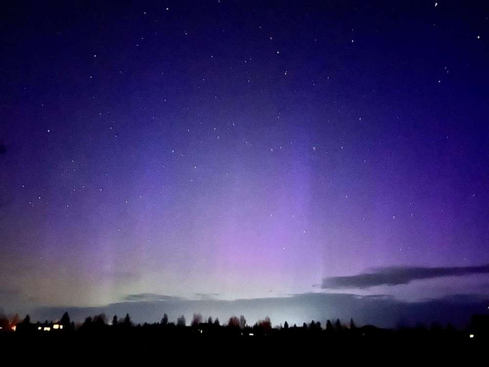
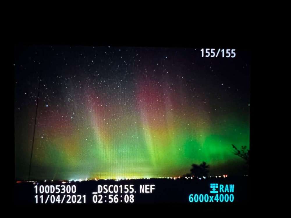
The Northern Lights were AMAZING last night even all the way down to just north of Omaha. Took this pic just before 3am!
 5 points
 -
So much drought... I get it, it won't really be this wet. But better to have the models showing this than bone dry conditions.5 points
-
The Euro shows that Everett snow falling tomorrow night. Definitely not a pattern that would support that.5 points
-
Literally no one said anything about that much rain. Models look good but as expected the posts are the same from you lol.5 points
-
That's Tim when he looks out his window and noticed he had to clear snow off the driveway.5 points
-
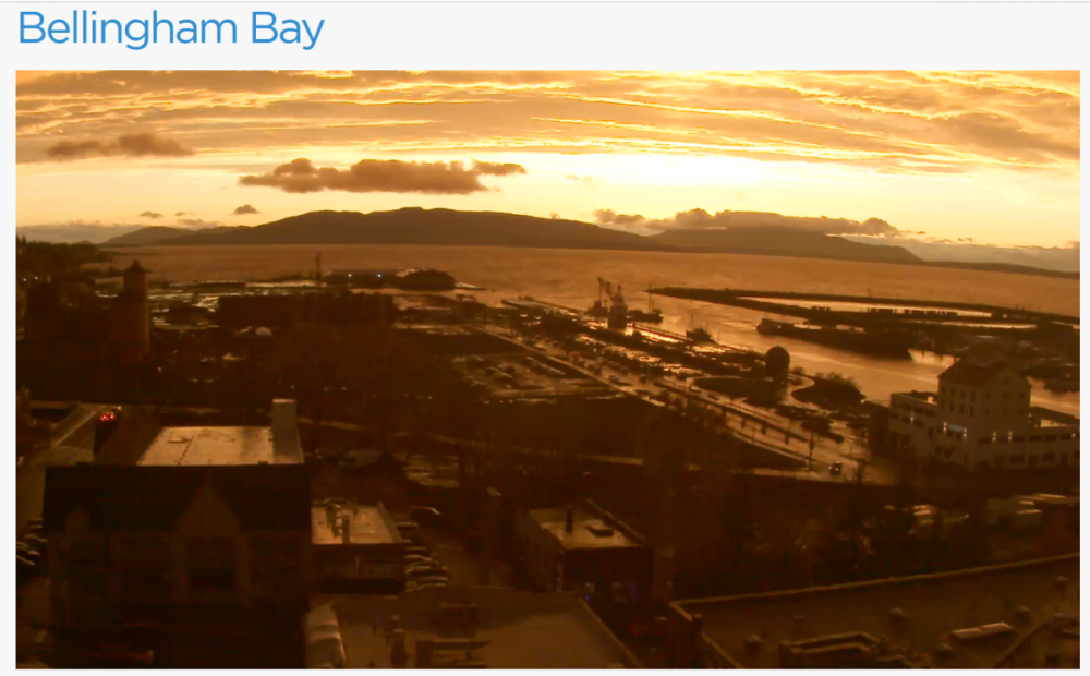
Quite the scene on Bellingham Bay right now https://faithlife.com/webcam
 4 points
 -
18z actually ends up wetter than the 12z.4 points
-
It is absolutely roaring out there... looks like a hurricane with branches and leaves flying by the window. I suspect this is the cold air mass moving inland.4 points
-
One month from now we could actually have the inverse of current NPAC pattern. Dead NPAC jet, GOA high.4 points
-
Jesse would have really enjoyed this phun banter.4 points
-
Chris’ 11/21 is starting to come into view. Go big or bust.4 points
-
Tim is going to be so busy posting from Hawaii, he is going to see about as much of the state as someone with a Hawaiian beach background in a Zoom meeting.4 points
-
Models took a pretty significant change this morning for late next week...Ridge looks to breakdown a lot quicker.4 points
-
12z Euro has a large storm next Friday. Now we wait for the SE trend.4 points
-
Great video near Hansville (Skunk Bay Weather) of the short period of clearing.4 points
-
Drought situation is improved even more now.
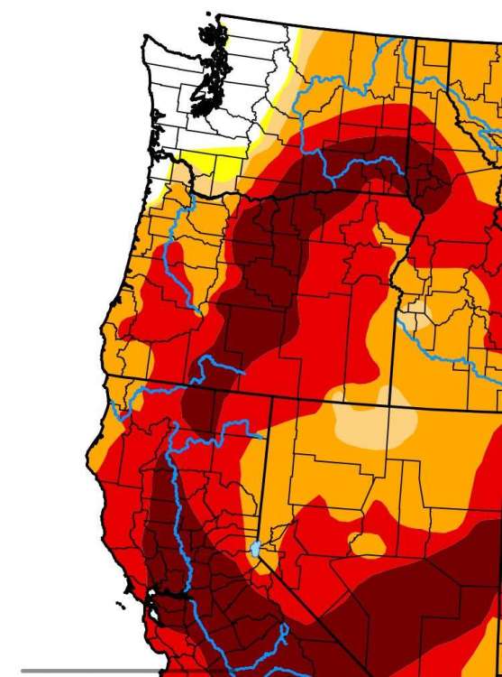 4 points
 -
Tuesday storm is back4 points
-
Detroit already has seen its first flakes of the season. Snowflakes were falling on Nov 2nd, 2021 and first freeze of 29F occurred on Nov 3rd, 2021. Also, the color here is spectacular.4 points
-
Individual Op runs will not have a good handle on the pattern bc of the new blocking patterns that are poised to set up next week. Follow the ensembles as guidance rather than any individual op run.4 points
-
Models don't seem to have much of a clue beyond the weekend/early-week warmth. There is no consistency later next week and beyond.4 points
-
42mph winds here!4 points
-
Wait snow in the believable range?
.thumb.png.88b30714e5a85f333ca08c5990235995.png) 4 points
4 points -
It’s coming…3 points
-
Digging the model trends today.3 points
-
1.60” on the day, 3.39” for the month. 48 degrees.3 points
-
Major dumpage! I feel like we are approaching 2” on the day but will take a look at my gauge when I get home.3 points
-
Yes! I will PM you the key box code.3 points
-
The airmass Sunday morning gets very close to supporting snow here, but probably not... Wouldn't be surprised to see a few flakes though.3 points
-
That's 16-17 feet in 24 hours. Holy sh*t.3 points
-
Early November 2006 redux?!3 points
-
3 points
-
Feel free to push the jet down this way. The computer models have fallen back into the default mode of the last 2 years. Which is to show big storms and take them away as we get closer. 2 days ago the Sierra was forecast for 5" of rain and 36" of snow. Then each run has gotten drier. Now it shows almost nothing for next week. Vanishing storms on the GFS and Euro are getting old. I thought we had turned a corner with the big AR event.3 points
-
W O W !!! No coffee needed after that giphy3 points
-
There goes any and every single snow chance. *rolls eyes*3 points
-
There was once again trace amounts of snow fall here. Yesterday during my walk there was some light snow falling and it looks like overnight there was some snow as there is some on the car. Yesterday here the high was 44 and the overnight low here was 33. At this time it is cloudy and 35.3 points
-
Beautiful sky up in Alaska currently even if we're missing out on it. Looks like Kp might be around 8 currently so it would probably really be putting on a show with clear skies. https://allsky.gi.alaska.edu/ Here it's quite wet although I might be entering the rain shadow soon. After rain most of the day I'm at 0.44" at 1.2" on the month. GFS continues to do poorly up here on rainfall amounts after we got significantly more than forecast both yesterday and today.3 points
-
Winds are a little less for tomorrow, but have increased for Saturday
.thumb.png.59688e2c86221b5c7007cf5e13f4f5de.png)
.thumb.png.03c0a3225e4a98ea1751e592cd20e4e1.png) 3 points
3 points


.thumb.jpeg.e3014abf99ef08a9f9ac2c0cd31b485b.jpeg)


.png.90f2d8271c20ecbc166597520749fba1.png)


.png.79af2ee6714b85d3c46edffd7624076e.png)
.png.1e5ee1499b72116b7bac74b8913a14e9.png)
This leaderboard is set to Vancouver/GMT-07:00