
Leaderboard


Popular Content
Showing content with the highest reputation on 01/14/22 in all areas
-
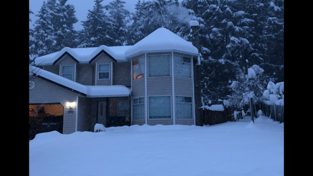
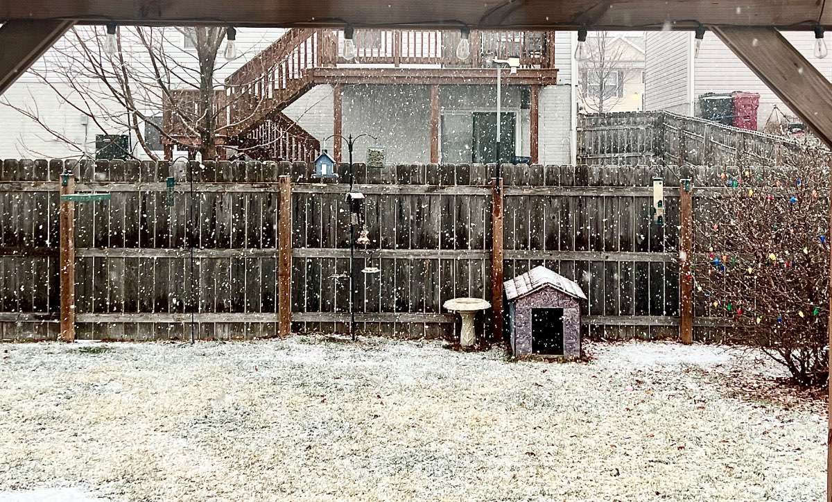
Pouring snow! 4.8" as of 4:45pm
 11 points
 -
There was some crazy frontogenesis snow this night 2 years ago across SW BC. We had 12” of snow in a little more than 4 hrs.
 10 points
 -
This is trolling right? You use this argument ALL the time and now it’s “close”!?!?
 9 points
 -
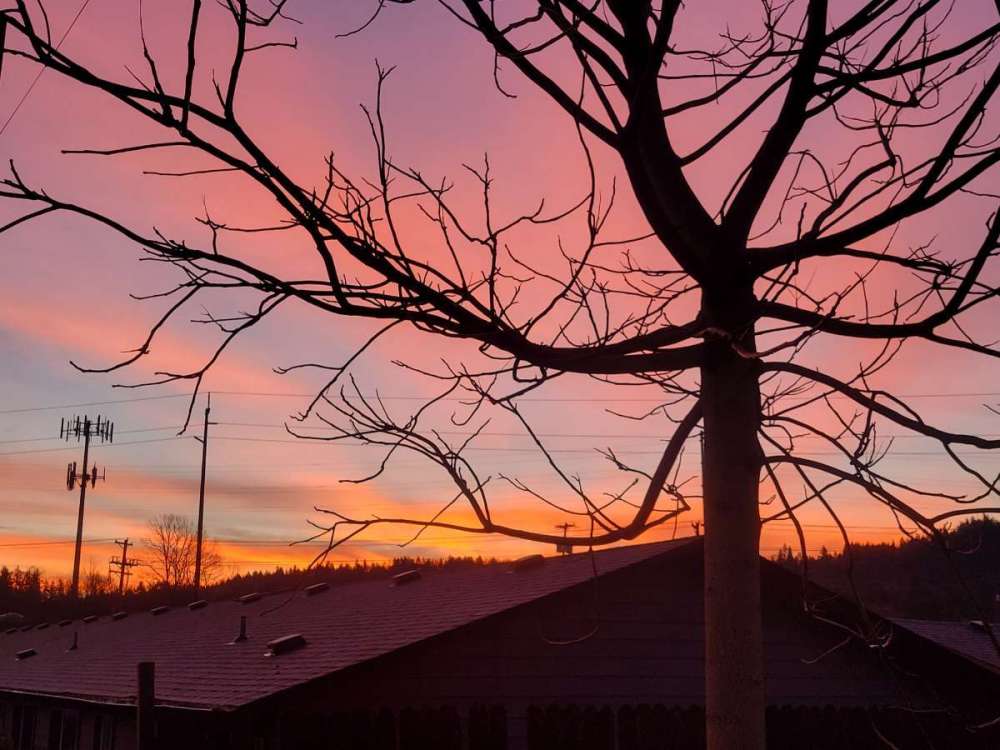
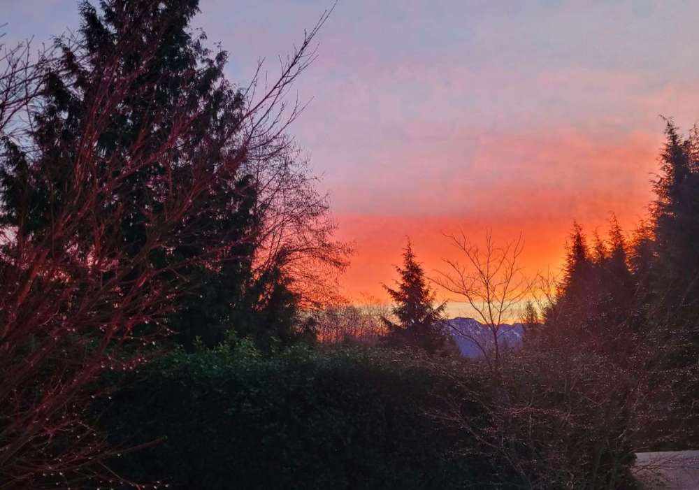
Sunrise was awesome this morning but what I woke up to two years ago today was better:
 9 points
 -
Beautiful sunrise
 9 points
 -
Same here...
 8 points
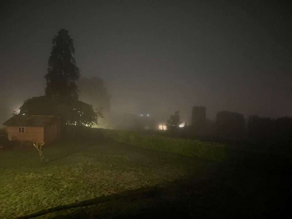
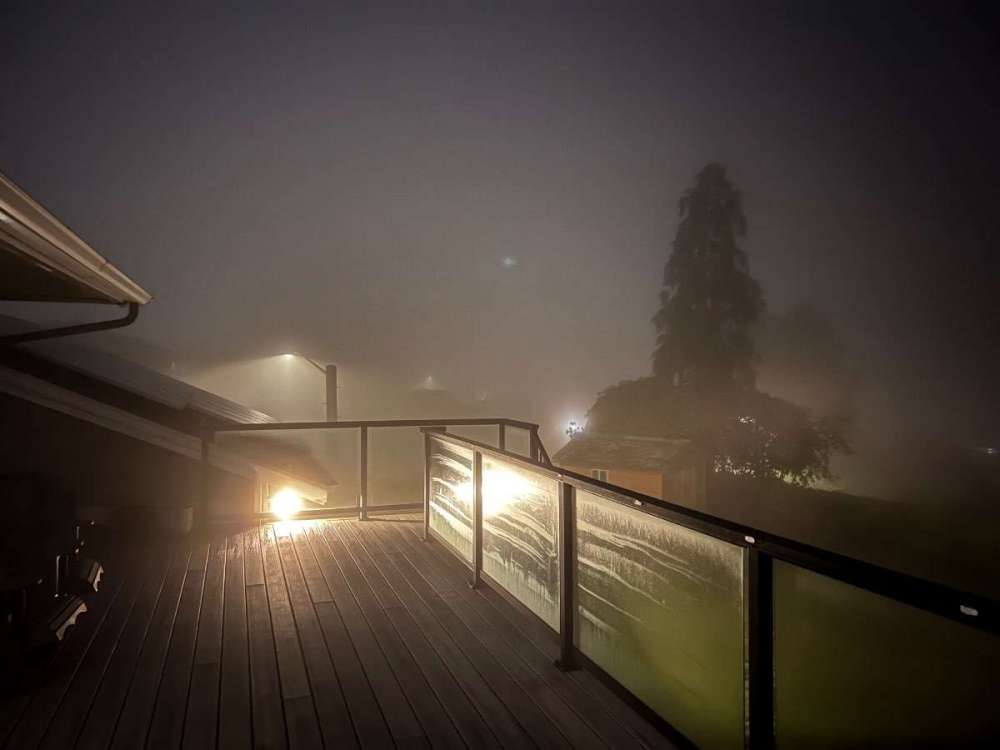
 -
The fog has rolled in here.
 7 points
 -
tomorrow will be 2 minutes longer than today.7 points
-
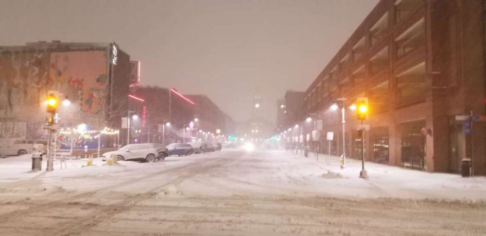
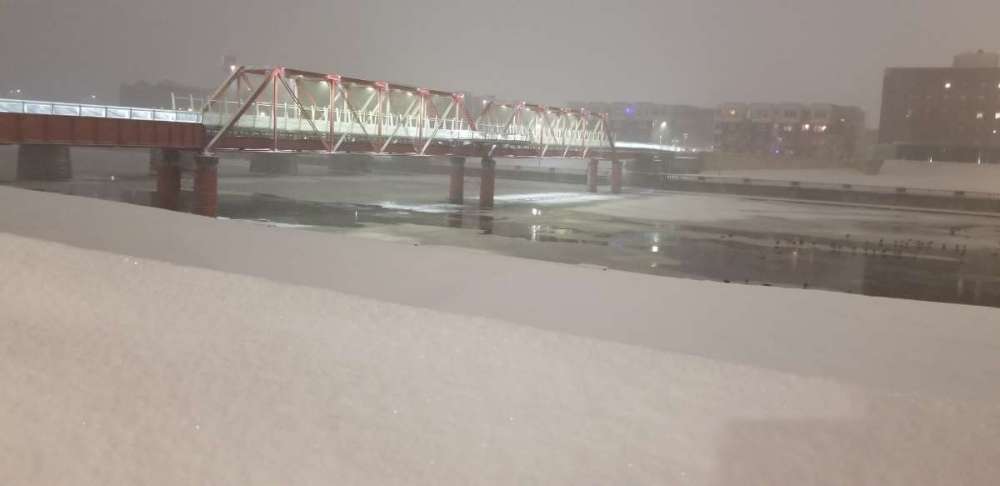
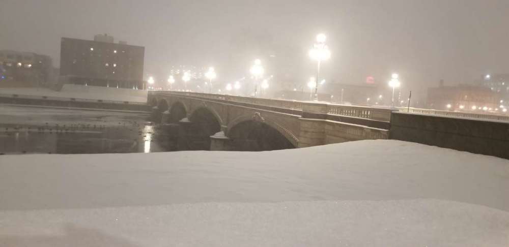
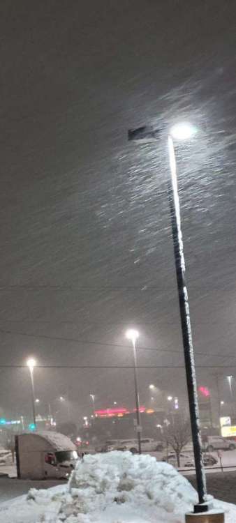
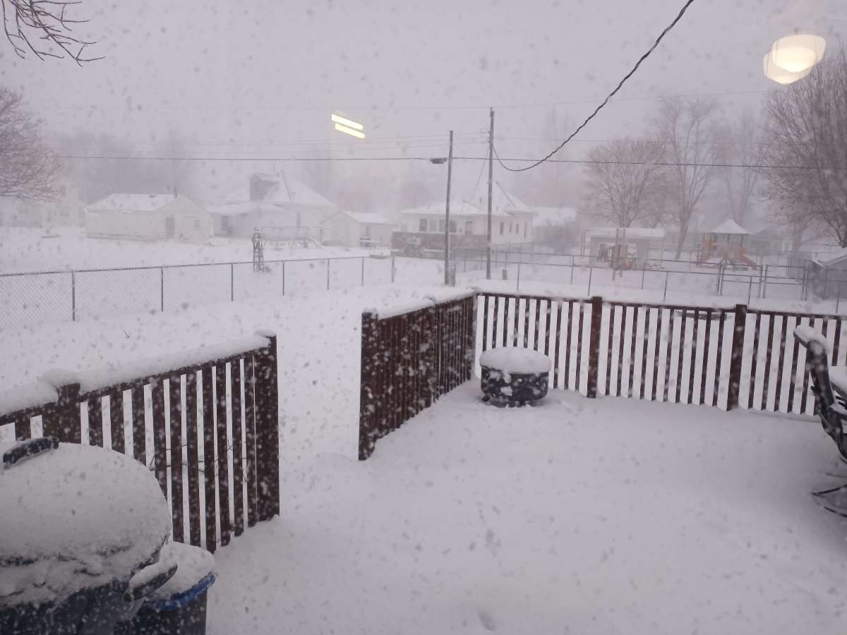
Took a stroll through downtown Des Moines. Coming down well. I'd say about 4.5 to 5.5 so far. Here are a few pics.

 6 points
 -
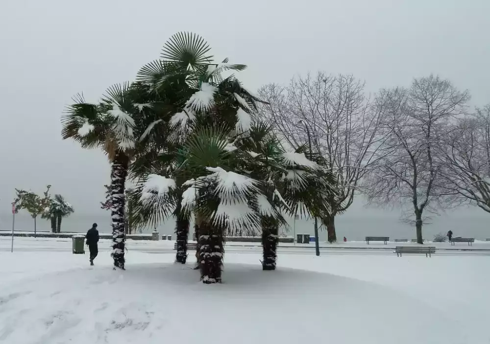
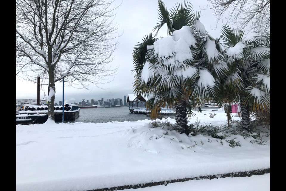
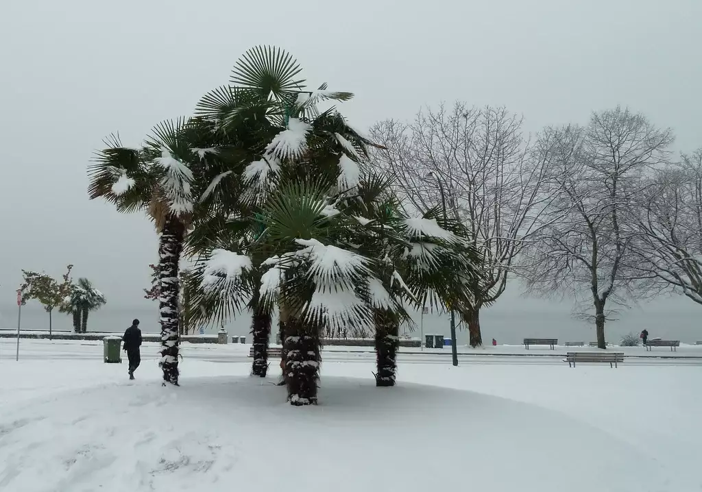
Look how pretty the palm trees in Vancouver look when it snows
 6 points
 -
My trip to Des Moines got canceled later so I'll get to have a few cold ones and watch it snow from home. Couldn't have had a better timing on this thing. Snow started right when sun was coming up and will go all day into tonight. Can't beat it6 points
-
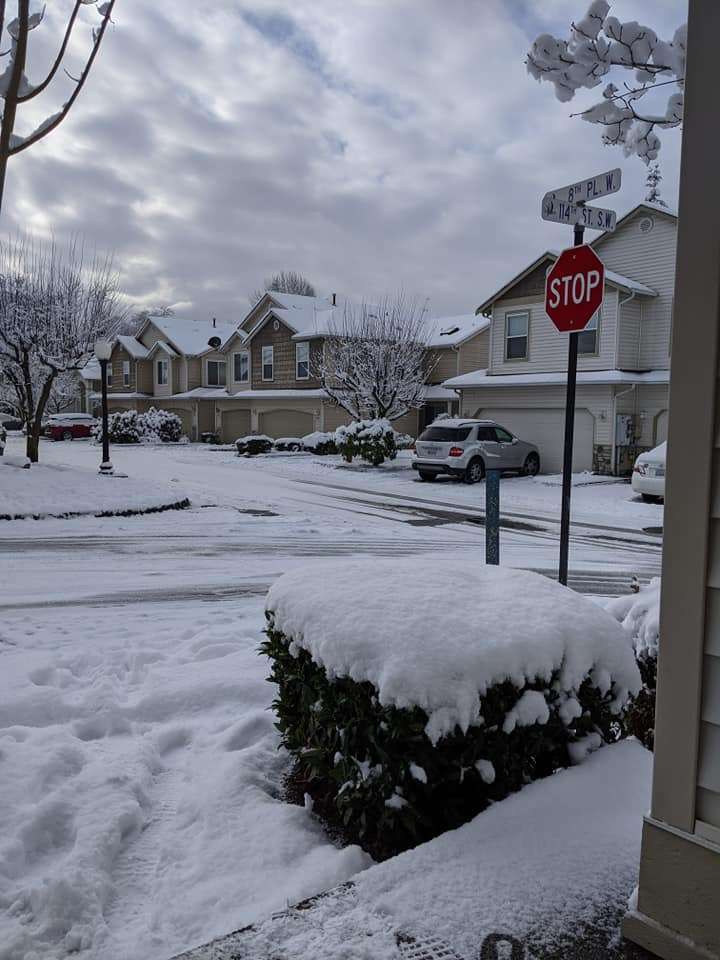
For a winter lover and transplant from Minny- it's a great day in C.IA. See below- so serene and beautiful out, it's hard to describe - but those here understand the beauty of mother nature other than just the "draw backs".6 points
-
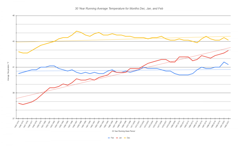
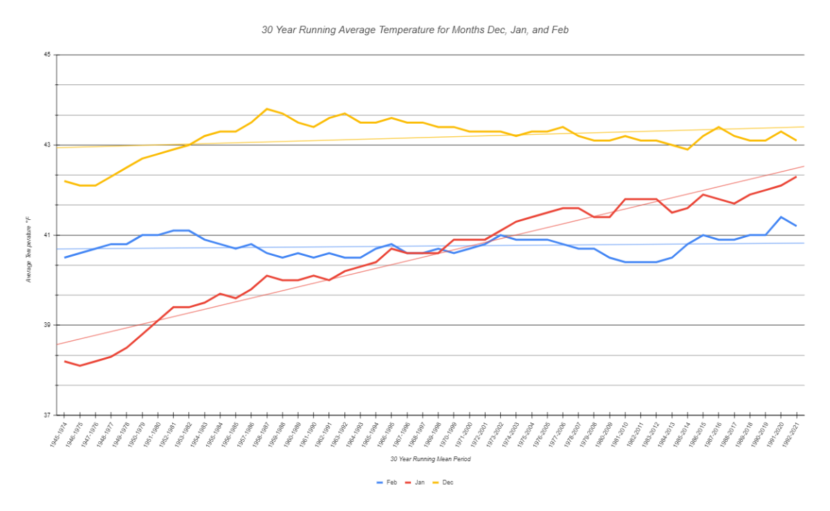
Shifting the 30yr running mean ahead by a year (1992-2021), and we see that August and January warmed by an additional 0.2°F. This is despite both months being colder than their 2020 predecessors. This makes sense since both months have been notorious for excessive torching over the last 10-15 years, this last year being no exception (as it stands 2022 is following the Jan transcript too, unfortunately.) Unsurprisingly, 2021 dropped Dec by 0.2°F. 2021 was 0.9°F cooler overall than 2020, yet still 0.5°F above the 30 year mean. The statistical oddities start showing up however during that magical, offputtingly excellent second month of the year. February, given the mid month cold snap and -2.7°F departure, actually cooled the running mean by an additional 0.2°F. This means that as it currently stands, the newest February 30 year running average is cooler than the one 31 years ago by 0.1°F. Amazingly, given the current -ENSO and improving guidance for an impending cooler than average February, this anomaly could drop further. To add to this insanity, if March ends up cooler than usual (likely given -ENSO), March could drop its 30 year running average down to the 1981-2010 mean or even colder. For the record, while the running average for March didn't budge, Mar 2021 was 0.8°F cooler than normal, so this is just an artifact of rounding.6 points
-
5 points
-
5 points
-
About 3.0 here. Moderate snow now still 32F. Hasnt mixed with rain at all in Ottumwa. But really has never been more than light to occasionally Moderate
 5 points
 -
It’s snowing fatties here right now. Ground is already turning white. 32.7 degrees atm. Forecast discussion said transition to snow would be closer to 6-7 here so hopefully that’s a good sign
 5 points
 -
Perhaps a bit less than they estimated... looks to be 4 inches or so on the ground with 2 or 3 left to go. Nice view. Being it's 18 degrees here it's all sticking.
 5 points
 -
Frogs will start chorusing almost any day now. Absolutely love the biorhythms of life esp those driven by photoperiods but I'd pass it up for a good February. Chorusing and La Nina seem like a contradiction although they're not connected to anything but increased daylight. Maybe we can get the frogs to chorus in some serious cold and snow despite longer days.5 points
-
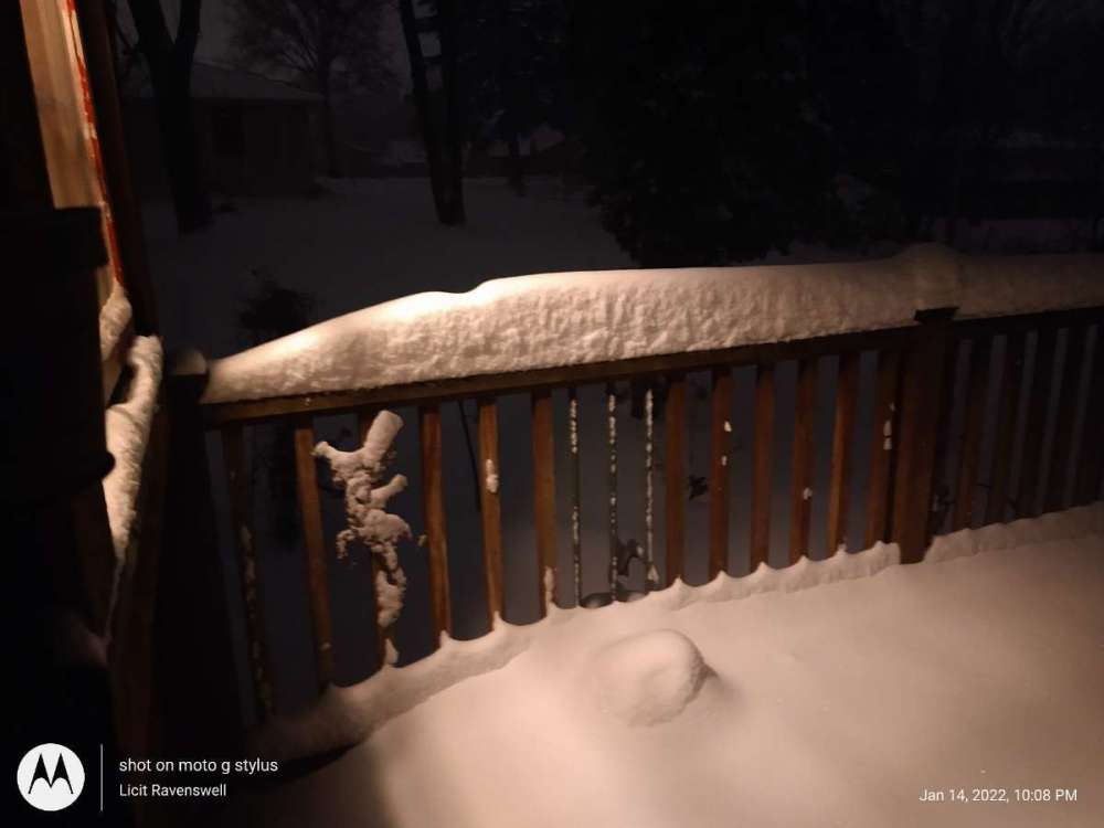
Just measured 2.5" on the patio table5 points
-
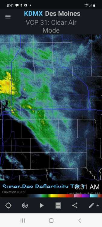
Some heavy rates in Fargo right now.5 points
-
Tsunami advisory for NZ. I can only imagine what other places could see this tsunami...4 points
-
Yep people now hearing it in New Zealand. Insane.4 points
-
NZ is like 1.8k miles away, Australia 2k. Wonder if they'll be able to hear it.4 points
-
GeologyHub (awesome channel, just a volcano nerd dishing out no-BS science) made a video today regarding yesterday morning's eruption. Tomorrow he will have a new video out about this evening's eruption, which appears to be orders of magnitude larger.4 points
-
Earlier eruptions were primarily steam above 11k feet. Given the total darkness, it looks like were was more solid ejecta this go around.4 points
-
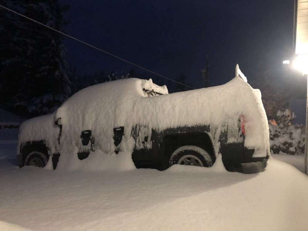
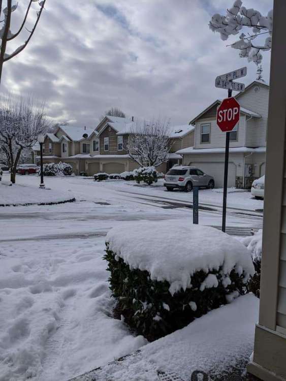
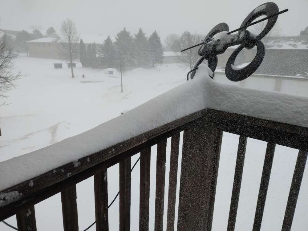
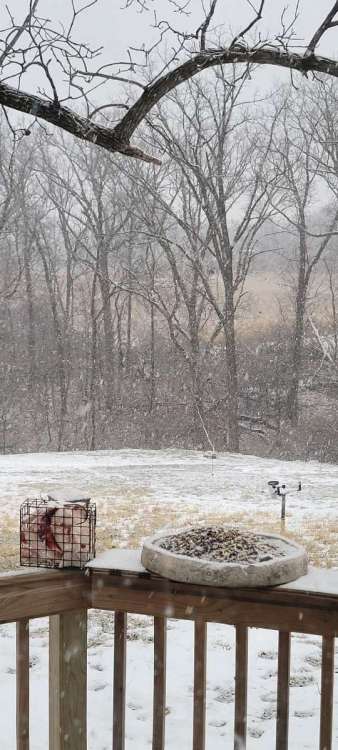
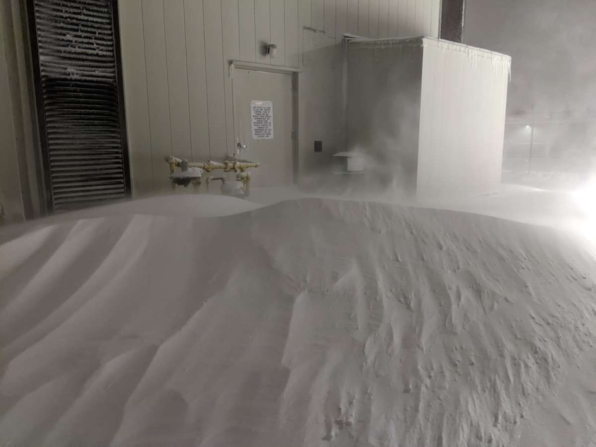
What it looks like on the deck and the nice drift off the roof!
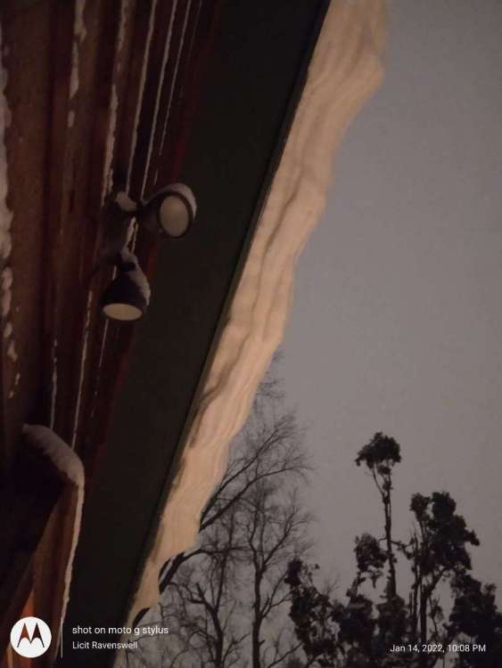 4 points
 -
Man, this back edge has been over performing. It’s been basically stationary for a few hours now. No way to measure accurately anymore, but I’d guess 2.5-3”. Enough on the ground to form some 1’ drifts in my backyard at least. Winds are gusting to 40 mph and the temp is down to 18 degrees so it’s all blowing around now and is pretty near looking like a blizzard at times. At the very least I’m hoping this will be enough so my girls can go sledding tomorrow’s like they’ve been begging to do all winter. IMG_0148.MOV4 points
-
2008-09 had a fairly cool and troughy February with a couple of snow events. Otherwise might have to go back to 1992-93, although Western WA got screwed pretty hard in February 1993 north of Clark County.4 points
-
I just drank some liquid morphine, I'm ready.4 points
-
Ya Gotta B-E-L-I-E-V-E !!!!4 points
-
I love nights, less managers over head.4 points
-
Was 34 just 10 mins ago, now 31F . Battle zone. PXL_20220115_015623293.mp44 points
-
Hard to measure with the wind but looks like 6". Snowing at a good clip yet.4 points
-
*sorry for the wall of text, i just love this stat stuff and i can go on and on abt it There is a mechanism that has driven the January average upward, and it's really a combination of several factors, mainly statistical. You must keep in mind that the graph reflects 30 year running averages, so it's just a composite of those 30 years. This means that the beginning of the time period, encompassing the late 1940s through 1970s, includes pretty much all of the great January tempests during the SeaTac POR, including January's '47, '49, '50, '54, '57, '63, '69, and '80. And those are just the "great" Januaries. Believe it or not, there was once a time when January regularly came in with a sub-40°F average, and the years in between were no exception. From 1946 to 1964; a sample size of 19 years; there were only four years where January averaged 40°F or more. In that same time span there were two years where January came in with a sub-30°F average. This means that during that stretch, you were only twice as likely to come across a 40°F January as you were a 20°F January! That would be unheard of during a 19 year stretch today. The next piece on the puzzle emerges when we look beyond January 1980. That month is a very important; not only is it the last "great" January, but it is also the last sub-35°F January KSEA has ever recorded. In fact, that month marks the end of the "great January" era, and from then on, most Jan's are 40°F+; it's as if that year was a sort of changing point in how January behaved in our climate. Putting it all together, this means that as we slide the 30 year average forward, starting in the 1949-78 package, we not only lose our best Januaries, but we also start factoring in our warmer, more modern Januaries. This essentially means that, as we slide forward year after year, we're replacing our coldest Januaries with our warmest ones. This has a profound effect on the graph, producing a warming trend which exceeds what you would normally expect from AGW. You might ask yourself then, wouldn't that insane warming trend in the 30 year Averages slow down after the 1980-2009 package, when the "great January" period leaves the 30yr focal point? Well, in short, it does. Since the late 2000's, the Jan warming trend has slowed down significantly on the graph, to a rate much closer to AGW. -- As for why it's been running warmer than February by a solid 2°F+, that answer lies in the latter. February's deal is pretty much the opposite of January. As it turns out, the 70's and 80's, with one massive fat exception, weren't all that kind to February. This last decade however has seen a few more sub-42°F's, and of course Feb 2019. For the last decade or two, we've stalled the graph by replacing the warmer Februaries with the cooler ones, allowing January to play catch-up. I do not think it is physically possible for January to beat out December, let alone lose much more ground. In the coming decades, February's luck will run out, and January's more moderate rise will prevail. December will start warming more regularly. That's just my guess though. Perhaps there are certain mechanisms in a warming climate that have promoted cooler weather patterns during February and warmer ones during January. I have no earthly idea.
 4 points
 -
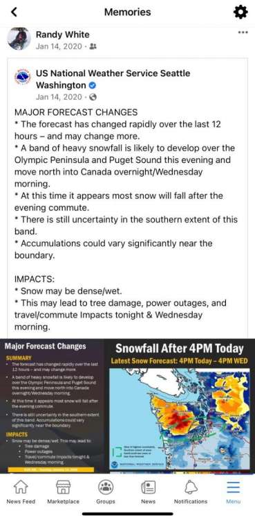
It was awesome when the forecast suddenly and last minute changed for the better up here 2yrs ago today.
 4 points
 -
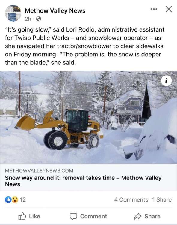
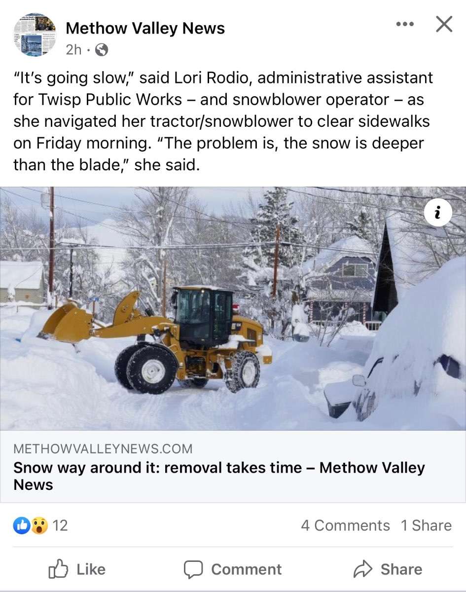
https://methowvalleynews.com/2022/01/12/snow-way-around-it-removal-takes-time/?fbclid=IwAR08I1UVXdZp_jMokbIeDWCq2pp7FzEtzd7nt5srcVMiTSTq509kZd2rGfw Sounds like a ton of work but it also sounds like they are taking it in stride. Wish we were living there right now.
 4 points
 -
I have 1.1" as of 1pm.4 points
-
All 2 of them!4 points
-
Florida has snowplows?!!!! Wtf4 points
-
That climb in January average temperatures is astounding. I just don't see why January would warm so much while February (and December to a lesser extent) stay cool. If anything, due to the maritime climate, sun angles, and a touch of seasonal lag, January should stay our coldest month of the year. And even if La Niña's tend to have the flip switched later in the winter there's no reason we should be experiencing more of them in a warming climate. I wonder if it's truly down to luck or if there's something else at play that has become dominant for our Januaries.4 points
-
First band came straight to OTM. Bodes well long duration here. 20220114_084027.mp4
 4 points
 -
I think I’ll be recommending that we send employees to work from home today for the afternoon. Due to safety reasons. Not for my own personal desire to watch the snow…4 points
-
4 points
-
We will have snow next month. That is all.4 points
-
Rain has changed to snow in KC about 2 hours ahead of schedule. I would think this is a good thing.3 points
-
Pounding now. This needs to keep up.3 points
-
There have been some 12"+ totals up in ND...
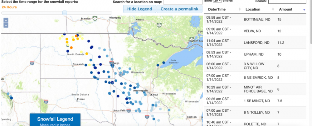 3 points
 -
Beautiful sunrise coming up.3 points
-
3 points


.thumb.jpeg.e3014abf99ef08a9f9ac2c0cd31b485b.jpeg)


.png.ace22ff19d26b96d70b5a49f5e602b3b.png)
This leaderboard is set to Vancouver/GMT-07:00