
Leaderboard


Popular Content
Showing content with the highest reputation on 02/11/22 in all areas
-
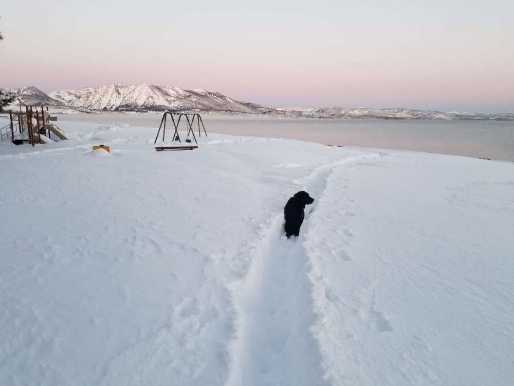
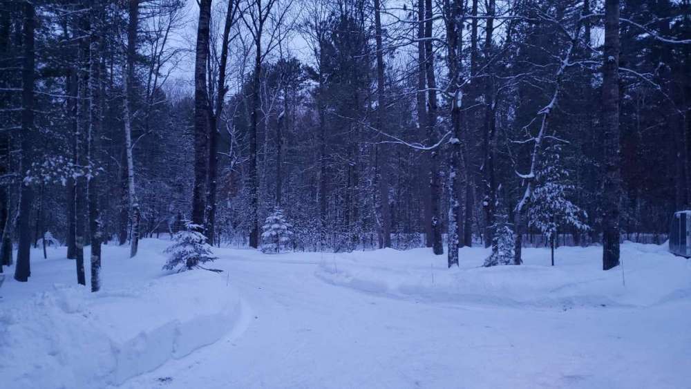
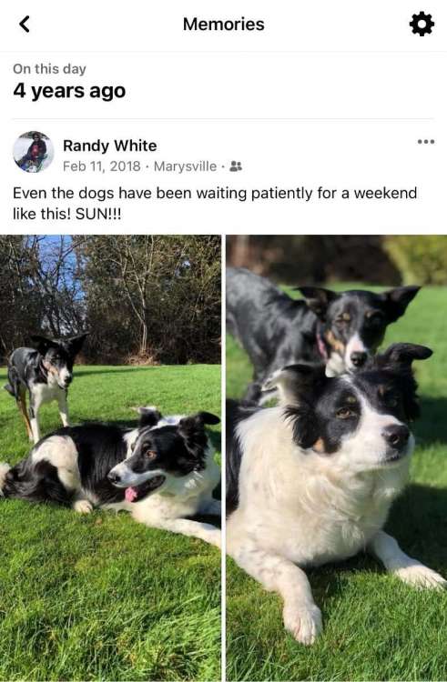
Loved that month. 2/11/19 on my morning dog walk.
 11 points
 -
Last February. Wow. It can get cold and snow here. Not this year though.
 7 points
 -
He didn't even mention western WA in his post, so your reply was pointless. You are the one who is implying we don't understand the big picture. You don't need to repeat your downplaying every time the drought is mentioned. It was already getting old a year ago.7 points
-
Frontal passage overperformed last night. Had only a 30% chance of rain with mainly sprinkles expected, and instead woke up this morning to .24" of rainfall from last night. Dry streak ends at 27 days.7 points
-
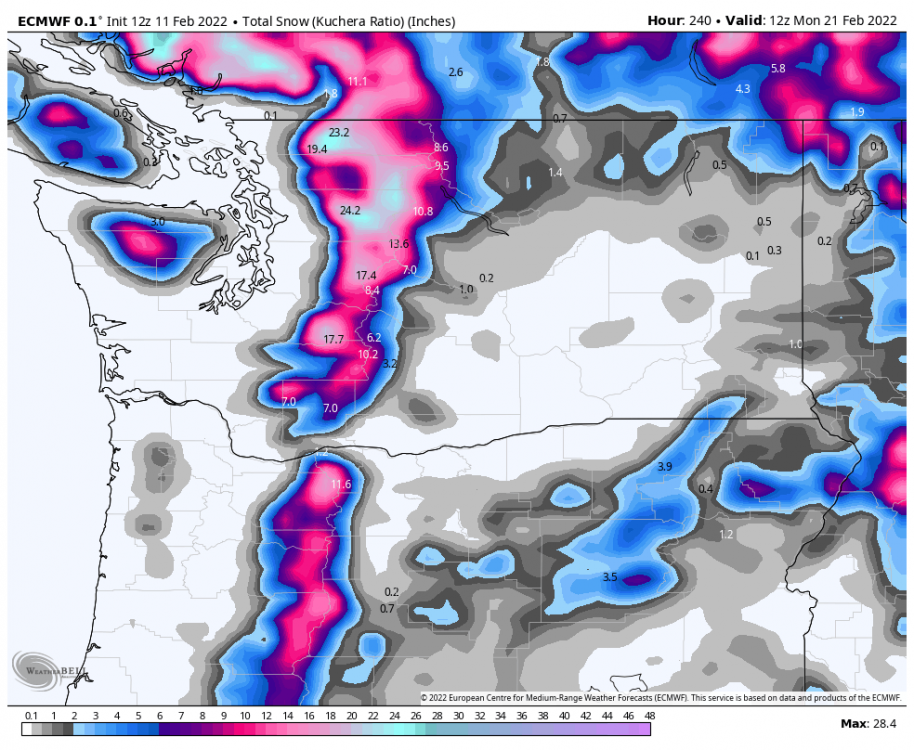
Decent mountain snow...
 6 points
 -
12z Euro looking better as well6 points
-
mikfresh 3". looks great, not sure its enough for the weekend traffic. TGIF
 6 points
 -
What saves us is irrigation. However, that is expensive with fuel, center pivot costs, and the water charge. With friends and relatives that farm, I have deep respect and admiration for what they do.5 points
-
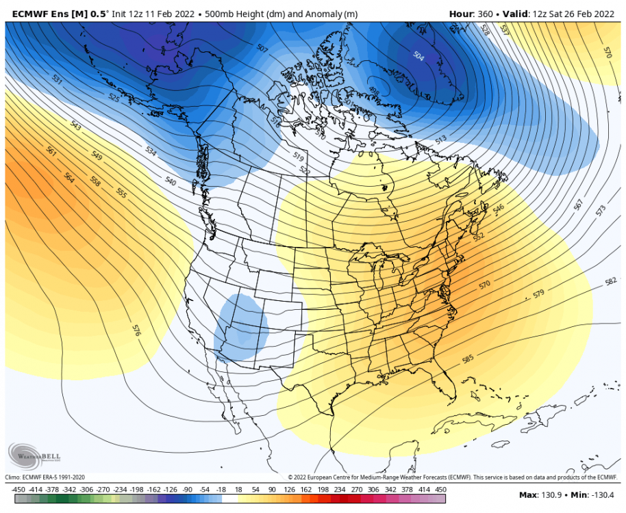
12z EPS: Now back to your regularly scheduled La Niña programming. Won’t break any cold records, but maybe it’ll prevent the West from spontaneously combusting. Or at least delay it a few weeks?
 5 points
 -
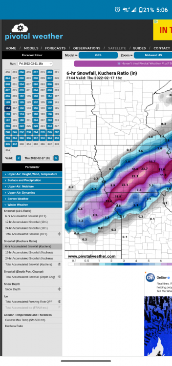
Models had Iowa getting clobbered 5-6 days before the last storm, but we got nothing. We'll have a better idea by Sunday. I wish someone would develop a more accurate ratio formula that takes everything into account, including wind. For this upcoming storm, 10:1 is probably more accurate.5 points
-
Normally I'd be giddy about a potential snowstorm. But it's been cold and not a fun winter. My twin boys just turned 3 and we have a huge backyard and they got a bunch of new toys to play with outside!5 points
-
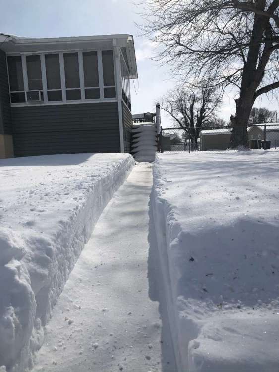
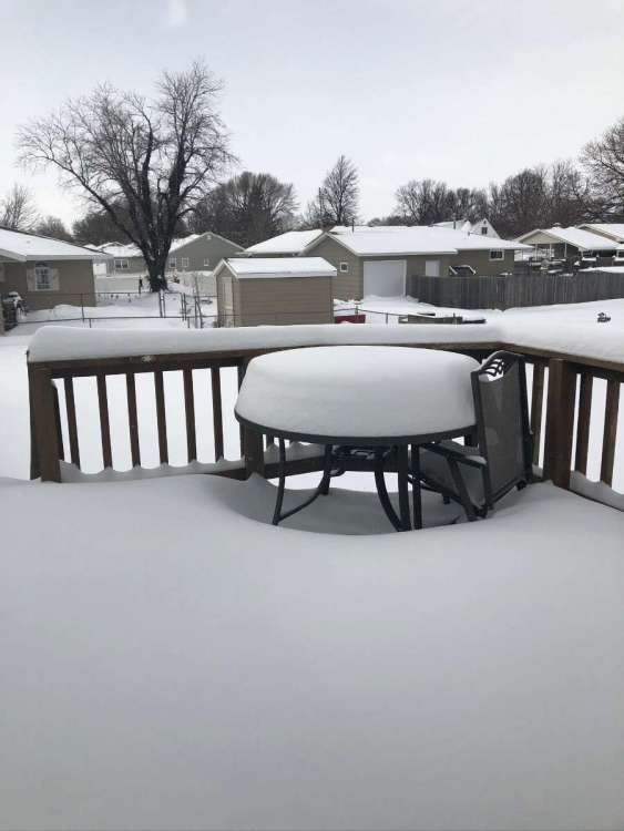
Just cleared a small path in the driveway and there is 3" new wet heavy snow. The total on the ground is now back up to 5" At this time it is cloudy and 34 here.5 points
-
I still would not rule a N shift out - and not just a 25-50 mile one. I mean significant. Flowers yday did a video basically explaining tips and tricks he uses at long range and seeing if said model is making sense with itself. He was using the nose of the dry air at 500mb that most times is just S of the surface low and was kind of hinting (at least the way I took it) that Southward trends may be the outliers. Since 06Z and 18Z don't use upper air (at least updated soundings), it's typical for them to do what they are doing and if we don't see a South tick with todays 12Z runs (an adjustment from 06Z) I would bet this thing is trending hard to the N. Hope I'am wrong, but at least I laid a few reasons why I think so.5 points
-
23 inches of snow in 6 hours...yeah..sure..happens all the time in iowa.
 4 points
 -
Just keeps getting stronger.
 4 points
 -
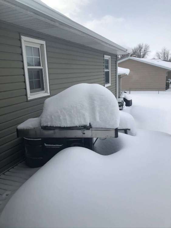
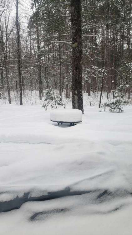
Haven't measured...I'll get out there in the woods later today or tomorrow. This is a pretty good representation.
 4 points
 -
As the saying goes, “there’s always next year”….on a side note, I hope that a drought does not transpire in the central AG belt this summer. Hopefully there will be enough moisture this Spring that can eleviate the dry conditions.4 points
-
Fun Fact Time! Topeka is officially sitting at 9.7" of snow this winter and was at 9.6" last winter at this same time. That is a breathtaking increase of roughly 1% over last year!4 points
-
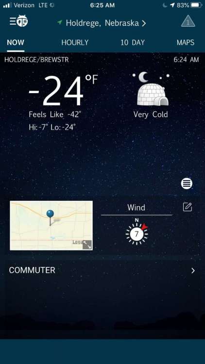
Well at least there is a little action in Nebraska. Snow Squall Warning SNOW SQUALL WARNING NWS NORTH PLATTE NE 1046 AM CST FRI FEB 11 2022 NEC009-041-115-111715- /O.NEW.KLBF.SQ.W.0003.220211T1646Z-220211T1715Z/ 1046 AM CST FRI FEB 11 2022 Blaine County-Custer County-Loup County- The National Weather Service in North Platte has issued a * Snow Squall Warning for... Southwestern Loup County in north central Nebraska... Northeastern Custer County in central Nebraska... Blaine County in north central Nebraska... * Until 1115 AM CST. * At 1045 AM CST, a dangerous snow squall was located along a line extending from 10 miles north of Dunning to 6 miles south of Brewster to 12 miles northwest of Taylor, moving southeast at 35 mph. HAZARD...Poor visibility in snow and blowing snow. Wind gusts greater than 30 mph.4 points
-
I don't even click on kuchera anymore. Its a ridiculous method in most storms.4 points
-
All the random bands of 30”+ lol4 points
-
I was not talking to you or implying anything about you or your community. Just stop making everything about you.4 points
-
I posted a pic earlier in the week. Phil threw up because there are palm trees here.4 points
-
Meanwhile in SoCal...4 points
-
Just like the previous 2 cycles there will be a nasty severe weather component to this system. The SPC in day 7 seems to be targeting the same areas that were hit back in Dec with deadly tornadoes. I have no idea what type of precip I will get but this will be a fascinating storm. Day 6 Day 74 points
-
BIG pattern change is on the way as we move towards the 20th.4 points
-
It is absolutely ripping outside right now. Its been a while since I've seen it snow so hard on powerful southerly winds. Nearly a whiteout at times. I'm right under the yellow blips on radar in N COOK. Wild stuff this morning!
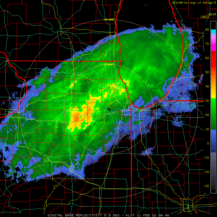 4 points
 -
Nice pre sunset earlier. Think it’s time to take down the Christmas lights.
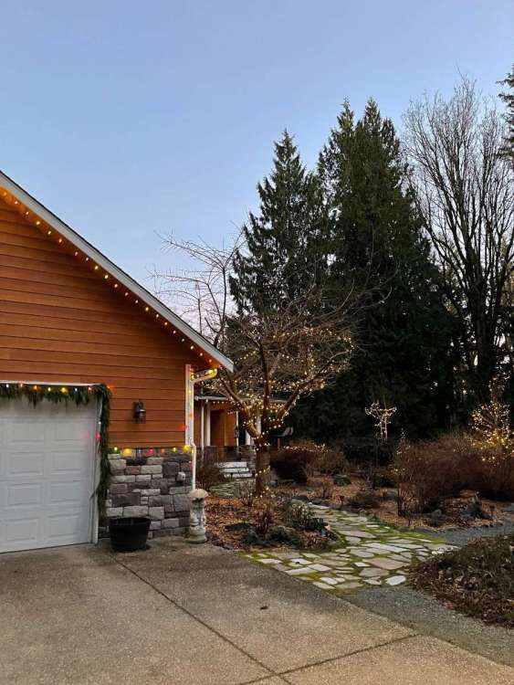 3 points
 -
Is that Tom from MySpace?
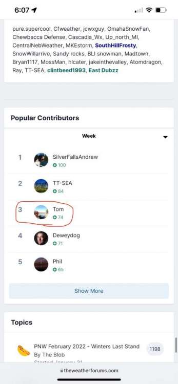 3 points
 -
Up to sexty-three at PDX.3 points
-
LNK sitting at 3.7" vs. 42.7" at this time last year LOL3 points
-
Jim Flowers video about next week. We'll see what develops. Trend today wasn't good for Nebraska for sure. https://www.facebook.com/JimFlowersForecaster/videos/4678190717031903 points
-
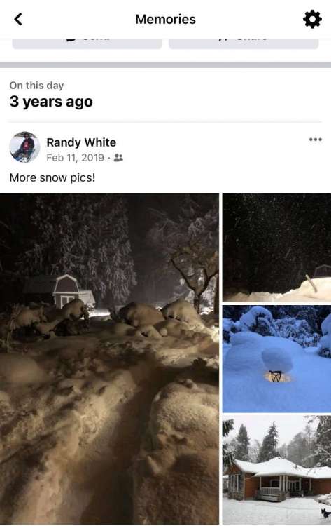
4yrs ago it was coming. 3yrs ago it came.
 3 points
 -
Some more mountain snow would be really nice for a variety of reasons.3 points
-
Awkward time to mention the 12z wasn’t a total disaster.3 points
-
At least we have a little spice on the forum…This weather situation we are in has no Pulse. Though I might get some yard work done this weekend.3 points
-
Graupel or small hail here. CAA aloft must be pretty serious...3 points
-
Read your post... it sounds like you are saying that FB weather group really understands what is going on which implies this group does not.3 points
-
A little bit of light rain this morning, not a lot but every little bit helps.3 points
-
Aaaaaaaand mother nature says "hold my beer"2 points
-
66 today in Ashland! Heat wave, for one day. Tomorrow might not even break 40.2 points
-
365 days ago right now the snow flurries were about to start.2 points
-
Yep... today is the 3 year anniversary of the epic snowstorm that left our area completely buried in almost 4 feet of snow. 3 years ago tomorrow we managed to make it out through a one-lane tunnel along our road and weave through many abandoned semi trucks on the service road below our house and on I-90 between NB and Snoqualmie Parkway to get to SEA for our flight out. It was like a scene right out of The Day After Tomorrow.2 points
-
Dec 10th and 11th.2 points
-
Apparently this storm is actually correlating to the "wet cycle" storm cycle that occurred back in October. Even though we had the tornado outbreak and a big line of storms with snow on the backside of the December storm, that was part of the dry cycle LRC cycle every other cycle cycle... cycle.2 points
-
I wouldn't laugh, but I never thought I'd see the year when Californians wanted to be Oklahoman so badly. Our weather belongs out there right now. Pretty days.2 points
-
So far this is an unusual system to follow, not in the extreme amounts of precip modeled, but in how the thickness vaules on the N edge hit a serious brick wall and than retreat S with the CAA. It's usually a much warmer solution( especially with Gulf warmth/moisture advecting in ) once you get S of the 540 line here in C.IA which usually ='s a rainer. Don't wanna be on the N edge of this as the dry/cold air is going to produce serious cutoffs.2 points
-
0z EPS members...
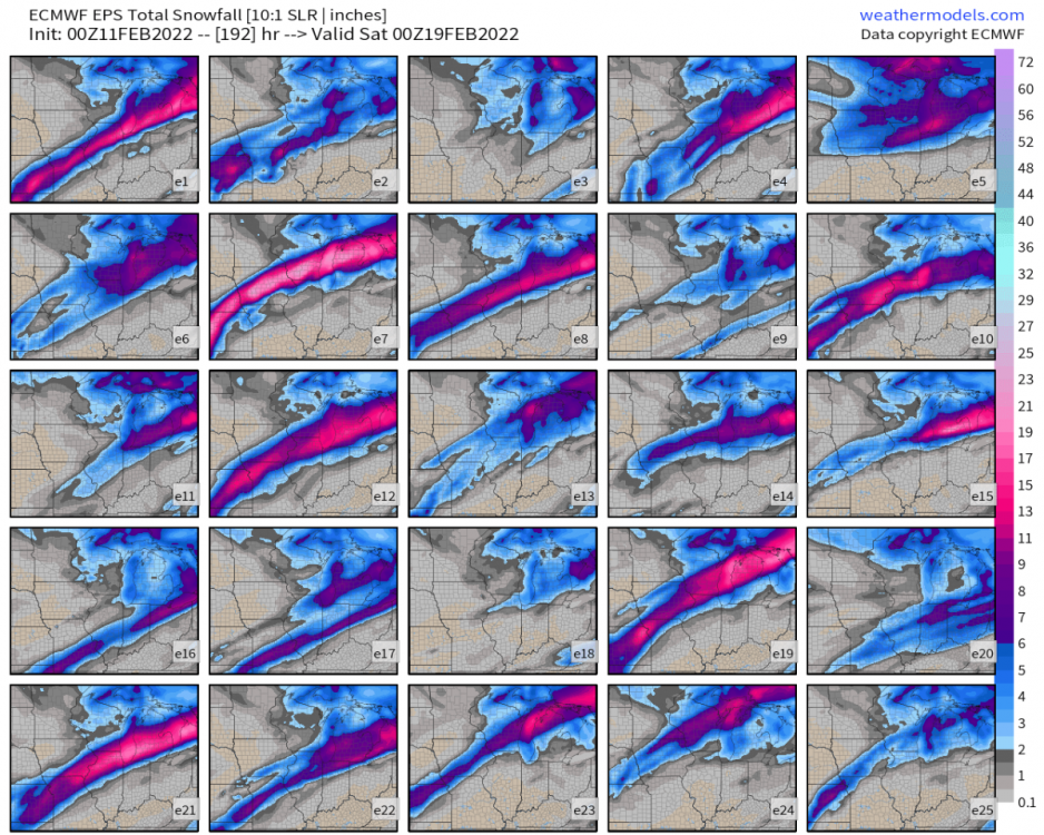
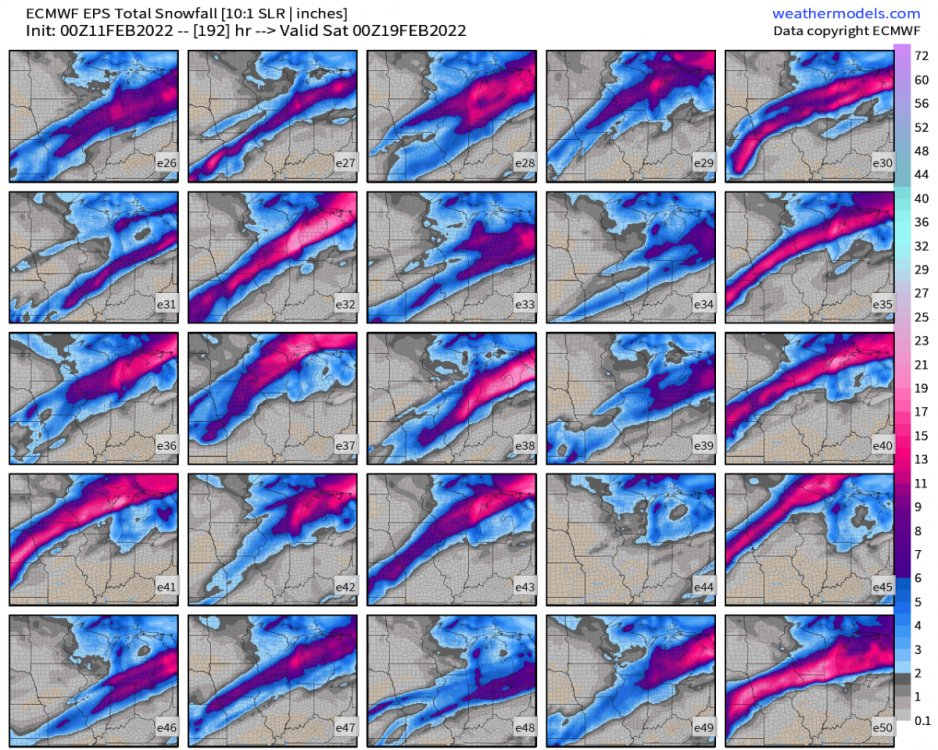 2 points


This leaderboard is set to Vancouver/GMT-07:00