
Leaderboard


Popular Content
Showing content with the highest reputation on 05/08/22 in all areas
-
33.3 moderate snow. lol10 points
-
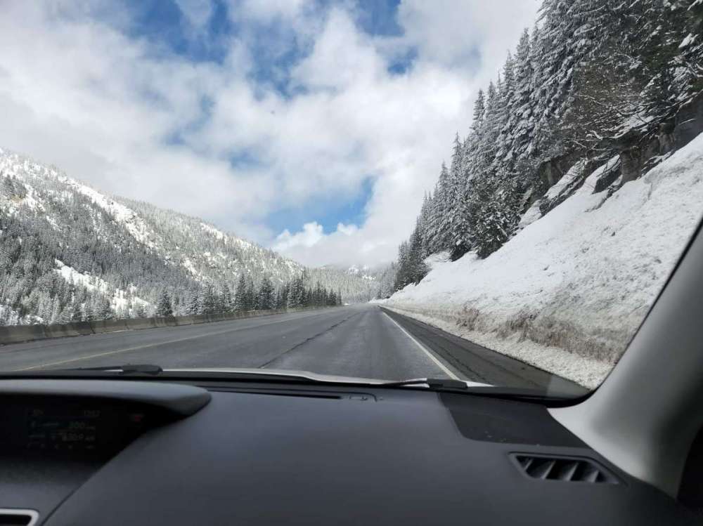
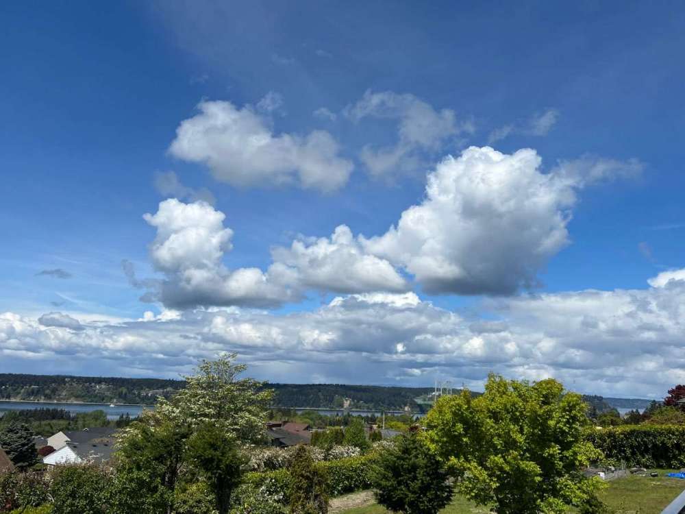
Stevens Pass looks like it could stay open another few weeks lol. Don't remember the last time there was a 100" base in May. Leavenworth is cozy and the mountains are snowcapped.
 9 points
 -
Pretty impressive midday accumulations on all surfaces for almost mid May! About 4" already.
 9 points
 -
Active weather out here!!! Baker City Oregon
 9 points
 -
A little chilly but hard to complain.

 9 points
 -
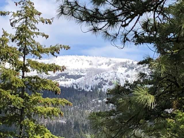
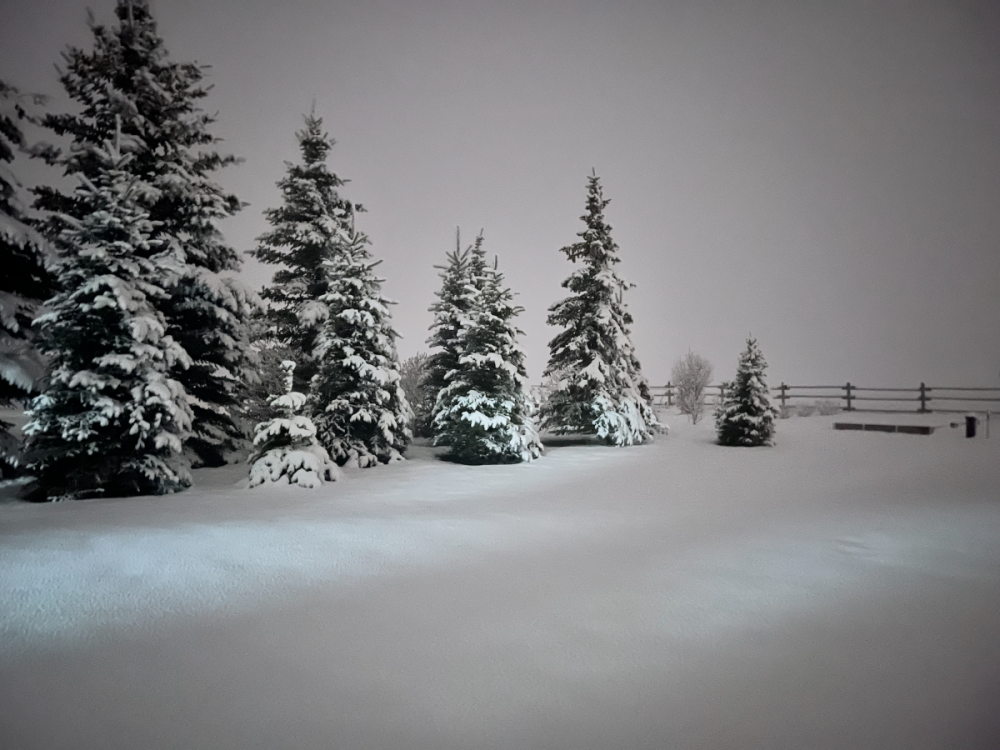
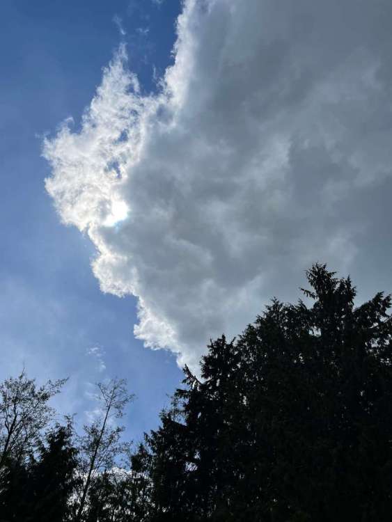
This what Table Mountain looked like from Nelson Hill yesterday which is where my mine is. Never seen the like in May. The Wenatchee Mountains are much drier than the Cascades so normally have a much earlier melt off.
 8 points
 -
8 points
-
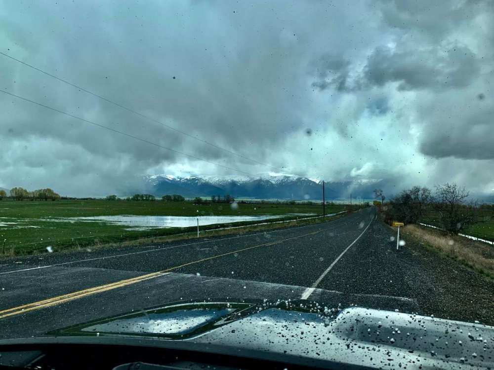
Loving this drive!!!! snow, wet snow and graupel 39*
 7 points
 -
Still only 46 degrees here at noon on May 8th. Pretty impressive!7 points
-
Snowpack ruler at Steven’s showing 115+ inches on the ground at 5K. Still dumping snow this morning. Pretty awesome.7 points
-
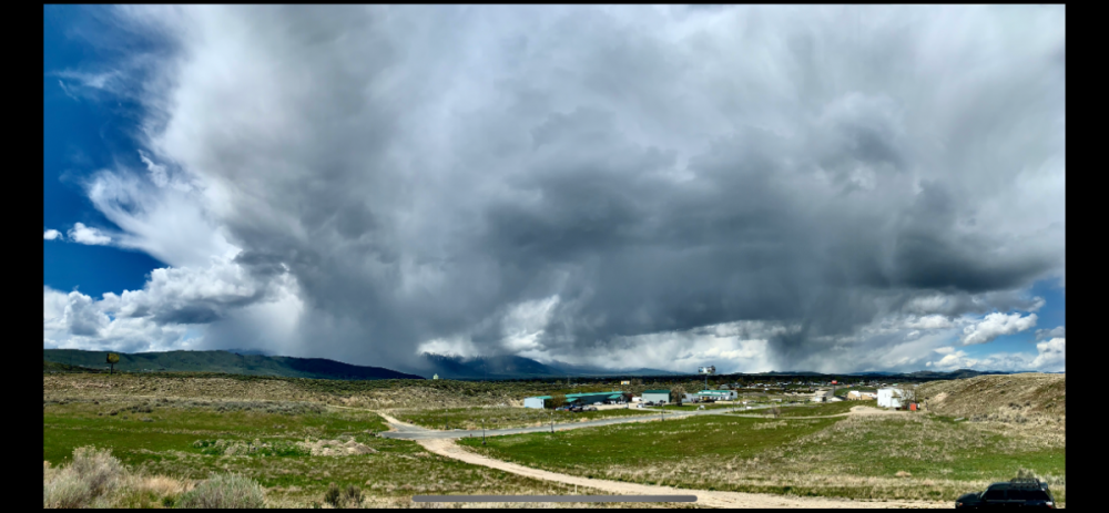
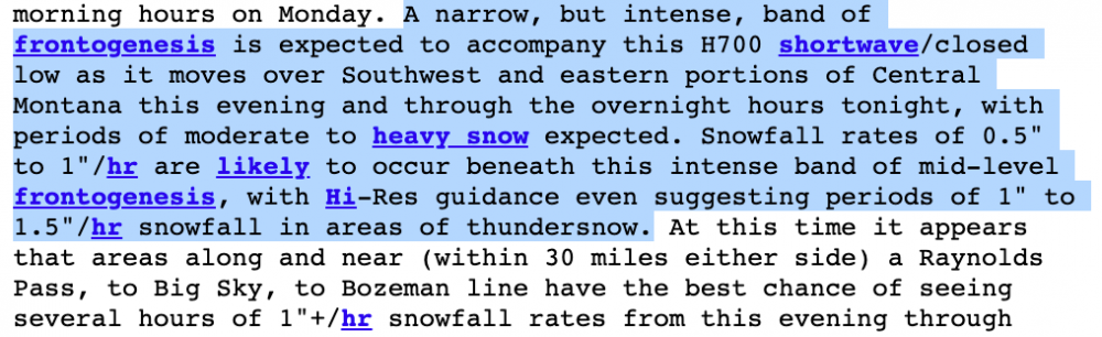
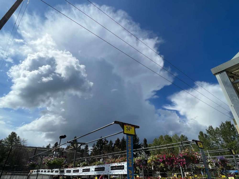
Don't think I've ever seen this good of a chance and ingredients for thundersnow for this area. Going to be an exciting afternoon/evening!
 7 points
 -
We finally did it and hit 102F at PHX yesterday...I have to say, it did feel noticeably Hotter yesterday, esp around 11:00am when I went out to the pool and it was already in the mid/upper 80's. It'll be a wonderful Mother's Day out here and for most of our Sub today. Happy Mother's Day to all of those wonderful Mom's out there!7 points
-
Just measured another 7" this evening since this second wave hit about 3 hours ago. 11" on the day now and absolutely pouring snow still. The first wave that brought 4" of snow this afternoon melted down to 0.51" of liquid so this system is once again packing some serious moisture. Garden boxes are just about buried again...
 6 points
 -
I'm hoping the region continues to see below normal temps and wetter than normal conditions into July and August.6 points
-
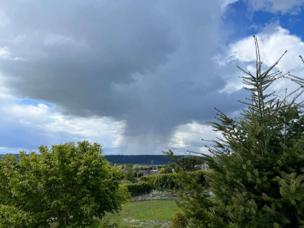
Rain is in the neighborhood.
 6 points
 -
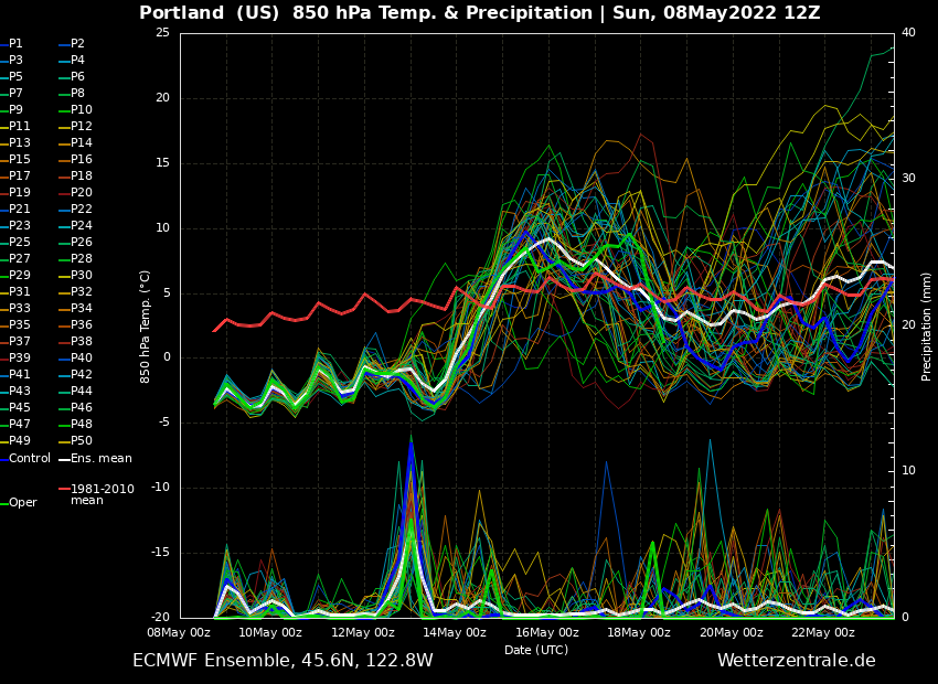
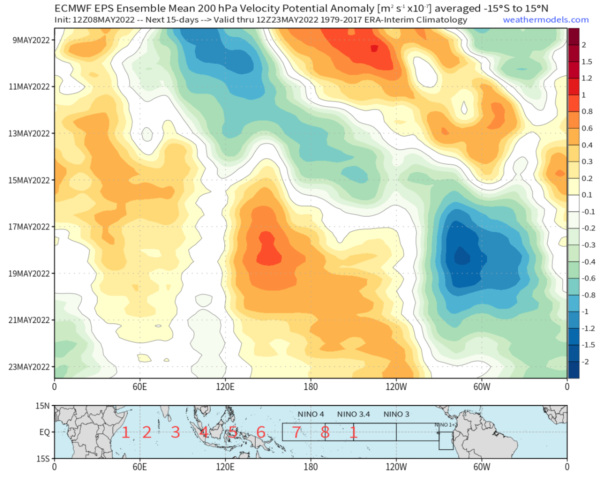
EPS looking good. A little break from the troughing later this week then we get another dip. Still no weeks of death ridging in sight, which sets this year apart from pretty much every year since 2013 at this point
 6 points
 -
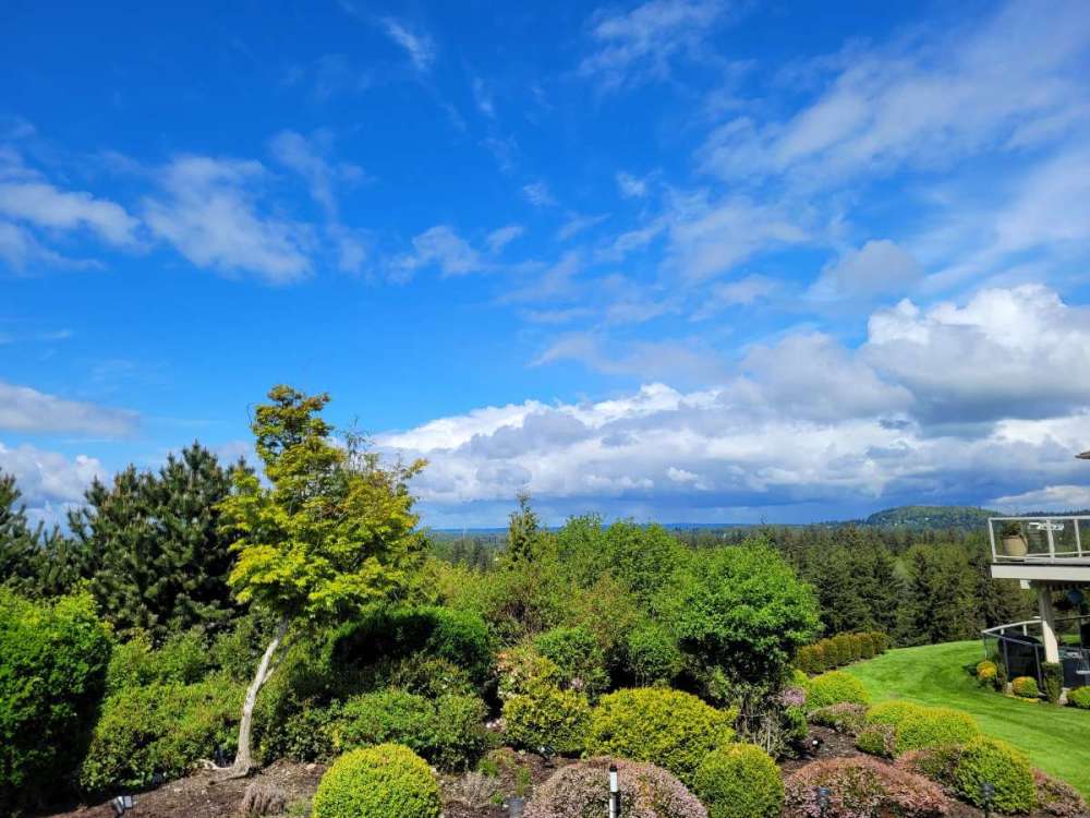
Gorgeous morning in Bellingham!
 6 points
 -
A very cool 54/43 day here yesterday with scattered chilly showers. Currently light rain and 44 this morning after a low of 40. Looks like some new snow fell on Larch overnight which is getting pretty low for this time of year. Happy Mother’s Day to all the moms on and off the forum!6 points
-
Timberline’s final total for yesterday was 19” of snow. That’s impressive for midwinter, let alone now.6 points
-
Federal Way 40* and 2.12 precipitation for the month. Twin Falls Idaho light wet snow currently and 37* Cold walk earlier…..yikes6 points
-
It's just physics. The further you stray from the poles, the more moderated Arctic airmasses will be, and warmer airmasses will be less of a moderation from average. These two inherent facts make living at a lower latitude produce less anomalous weather, especially on the west coast. Also, using NWS mapping, Springfield topped out around 51°F at the warmest. Most stations topped out in the upper 40s. Good for -15 to -20 on the day. That makes more physical sense than a -7 departure given the trajectory of this upper level system. A departure of -7 would imply a high temp in the low 60s, more than 10 degrees warmer than the rest of the Springfield area, and more akin to what was observed in Redding, CA today. No, I am not comparing to Mahlon Field. The bad news is that your sensor ran wayyyyyy warm today. Might have to move it out of the sun. The good news is that in actuality your area got a -15 on the day, at the warmest!
 5 points
 -
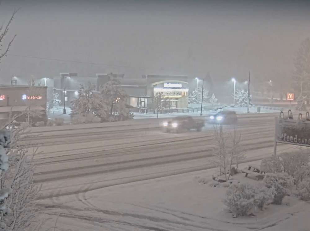
If anyone wants to follow along it is also dumping in town. https://www.americanbankmontana.com/bozeman-webcam
 5 points
 -
Assuming the 53 or 54 holds, today should end up PDX’s coldest high this late in the season since....2013 51/40 spread here with light rain in the morning giving way to scattered heavy showers and limited sunbreaks. Chilly day.5 points
-
Currently 33 with light snow at John Day, OR.5 points
-
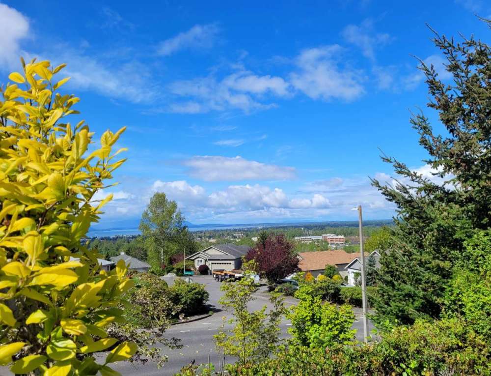
THE SUN!!!!! And now a sweltering 45 degrees!
 5 points
 -
Nice day here. Up to 51.5 points
-
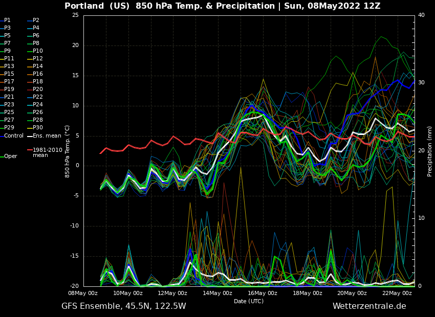
GFS ensembles looking good for another decent trough moving in around the 20th, after the current troughy period
 5 points
 -
5 points
-
Hopefully the last 6 weeks isn’t a blip on the radar and we can get back to some pre-2013 type stuff on a more consistent basis year round.4 points
-
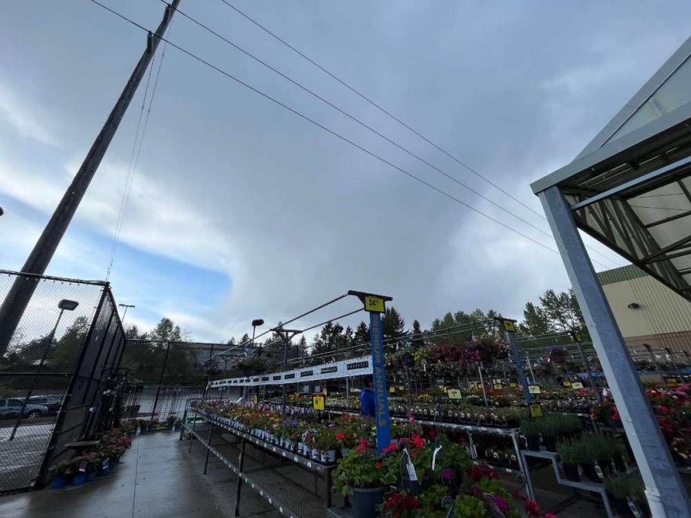
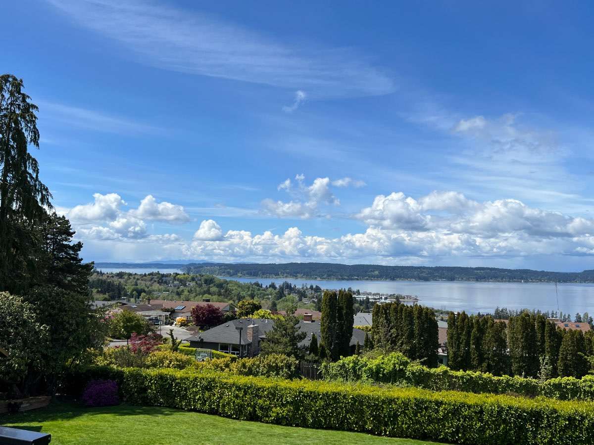
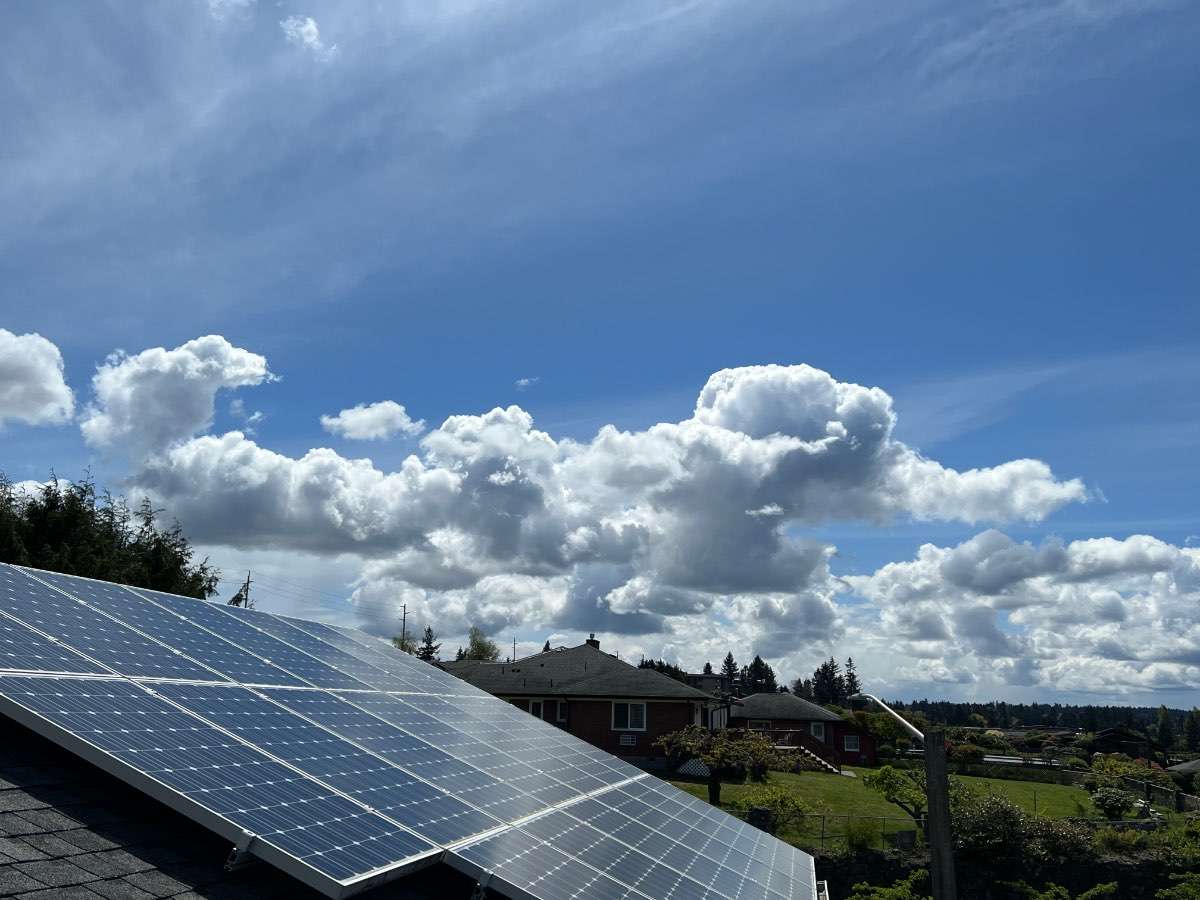
We had a brief rain a bit ago but mostly just some cool looking clouds.
 4 points
 -
Dropped to 36 with this most recent shower. High so far only 42.4 points
-
Might have to save a copy of this for the archives. Amazing!4 points
-
Looks like the really wet part of this trough is pretty much over. Now we can just enjoy the below normal temps if you're into that. Speaking of below normal temps...I went to Liberty yesterday and got flurried on off and on for much of the day at just under 4000 feet. No leafing out of any of the trees or bushes at that elevation and only very little in Liberty itself. Table mountain which is at 6500 feet looked like dead of winter on the top 2000 feet...will try to post a pic later. Nerer seen spring so retarded this time of year in all my years of going over there. Forgot to add it was snowing pretty hard and just starting to stick at Snoqualmie Summit coming home yesterday evening.4 points
-
A month’s worth of rain in a week. And more is probably on the way.4 points
-
This is a solid MJO/CCKW passage. In an ordinary year this would favor a substantial (albeit short lived) warm-up in the West. But I guess this isn’t an ordinary year. For some reason these have been failing to stimulate a clean response in the middle latitude pattern. Frankly I’m surprised. Both of the warm-ups I had anticipated over the last 3 weeks have failed.
 3 points
 -
We are over 16” of precip since April 1st now. Way more than February/March and a few more inches and we ll pass January-March.3 points
-
-15F departure for Medford, Oregon today with a 50/38 spread. Same spread for for Roseburg which put up a -14 departure. Biggest departure I could find in the area covered by NWS Medford was 19 degrees below the daily average in Montague, CA. That included a record low of 24 which beat the previous record of 27. Mount Shasta City also had a record low with their 27 beating the previous record of 29.3 points
-
Yeah, been raining pretty hard here. Down to 43 degrees too. Brrr.3 points
-
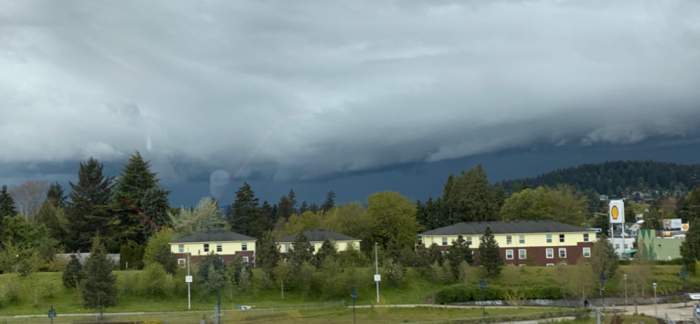
SE PDX just heavy rain and a little hail. Looks like the main energy slipped north of my parents place. Sure looked ominous though !!!
 3 points
 -
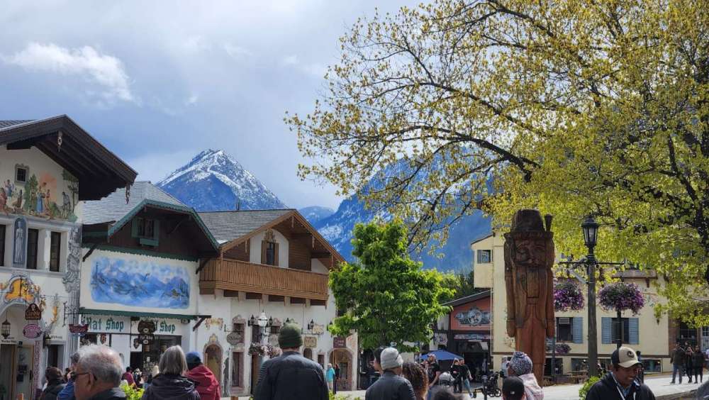
I think of Leavenworth has having a much more gentle climate than Bozeman. And I think it's much lower than your location. Good combo there of consistent snow and reliably long warm season.3 points
-
3 points
-
Up to 5.47" of rain on the month. Average for the entire month is about 4.25", This is already our wettest May since 2013, May was wet every year 2009-2014 up here. All time wettest May is 1960 with 10.50", we'd need to get into the 7-8" range to hit the top 10.3 points
-
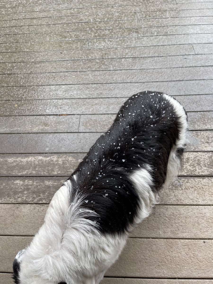
Almost fell asleep sitting in the sun on the deck. Felt amazing until this happened just now.
 3 points
 -
The models have been indicating our area specifically for shower activity later this afternoon…but yes today overall has been much better than yesterday. Dont have constant 30-40mph gusts this afternoon so it feels warmer.3 points
-
Meanwhile… Temp down to 39.
 3 points
 -
What a Sunday! Currently 36F and raining.3 points
-
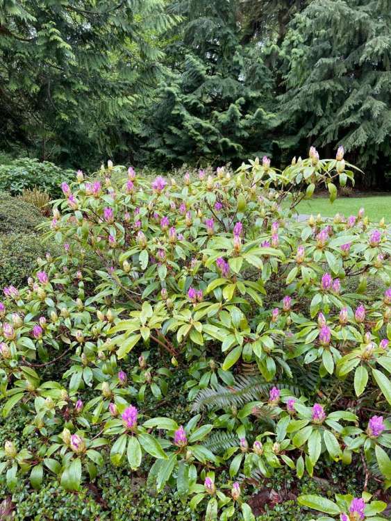
Had an intense shower around 12:30am or so, the temp dropped to 36 and it appeared to have positive splats in it. Anyway, currently 39 and cloudy. .07” so far on the day, 2.64” for the month. Sky has that “incoming snow” look about it right now. Just got done covering the hose bibs, and topped off the generator in case the snow load brings down branches. It’s coming!!! Oh and my yard color is definitely slightly delayed after looking at past pictures from this timeframe. My Rhododendrons are taking their time with fully blooming.
 3 points
 -
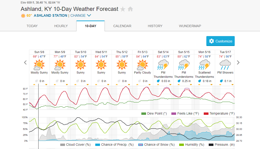
Had about 0.20” overnight as the line of storms came through. Going to be a warm week with possible record highs on Wednesday. Planting should really get going for everyone this week.3 points
-
No 90's yet, but its coming sooner or later. I already had a day very close to 90 last month.
 3 points
 -
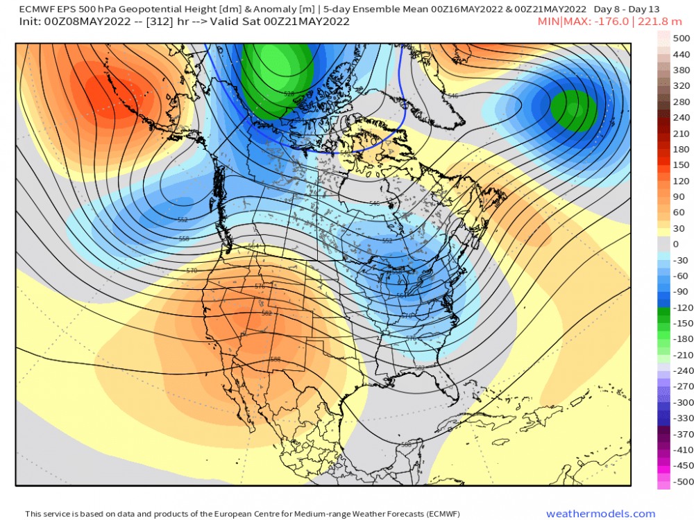
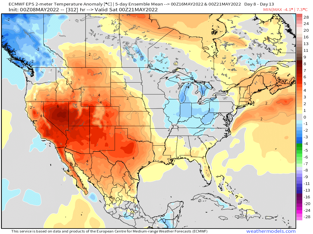
The 500mb pattern during the Week of the 15th is starting to align towards the idea I had in mind of a NW Flow pattern aloft. Could this spark a "Ring of Fire" pattern? Blazing early season Heat will likely build in the West/SW as Summer ignites into high gear I'm afraid. 0z Euro... 5-day temps are trending cooler the following week after a nice long stretch of Summer...a bit more seasonal generally speaking. I think most of us north of I-80 have avg highs near 70F by this time. 0z GEFS...
 3 points


This leaderboard is set to Vancouver/GMT-07:00