
Leaderboard


Popular Content
Showing content with the highest reputation on 05/09/22 in all areas
-
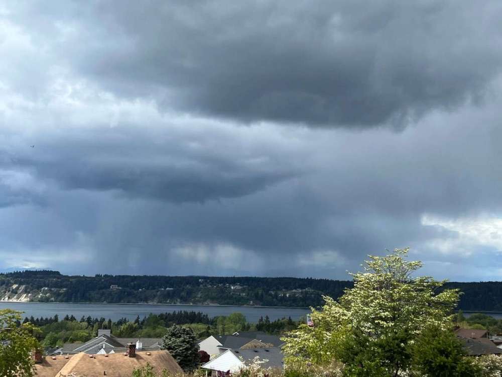
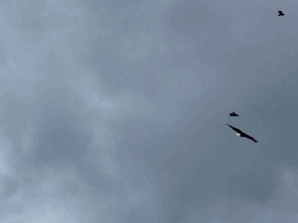
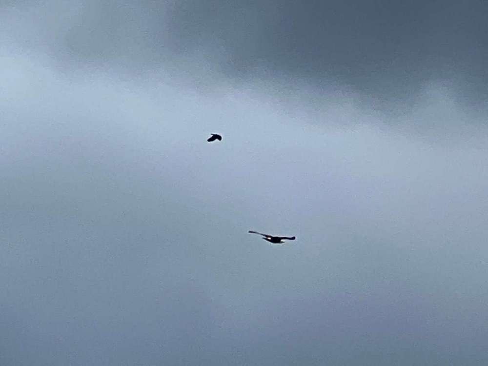
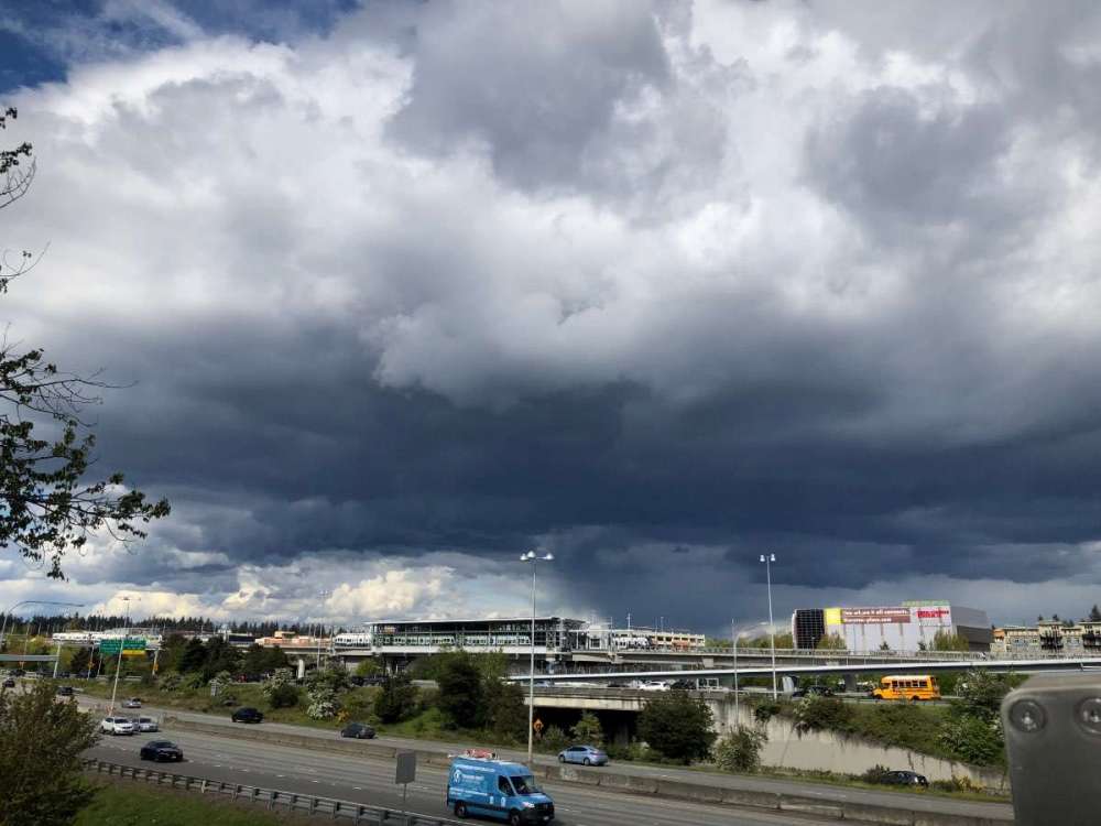
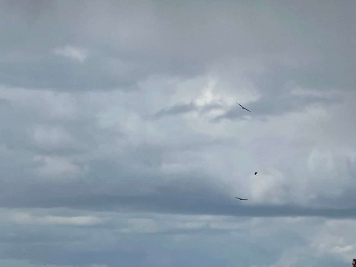
I went out to get a picture of the rain in the distance and found two bald eagles with the usual contingent of angry harassing crows.


 10 points
 -
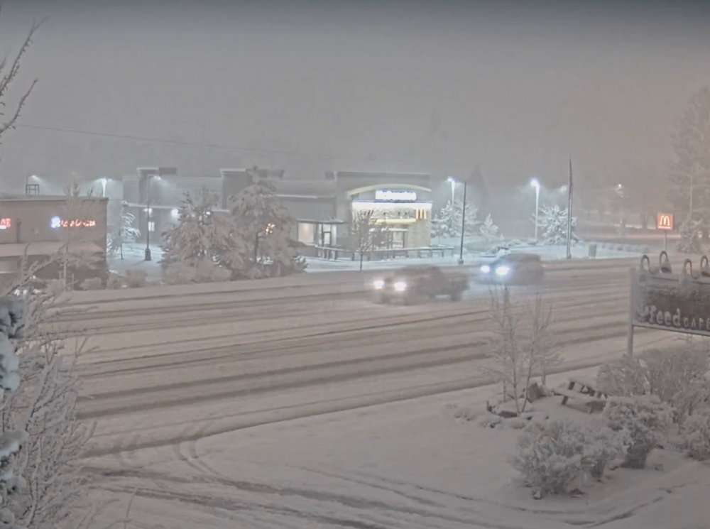
30” storm total at Timberline9 points
-
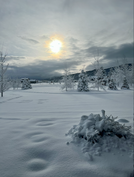
Ended up with 14" here in about 12 hours with a low of 27F this morning. If we can hold onto a good chunk of the snowpack today we could see some pretty impressive low temps tonight.
 8 points
 -
7 points
-
Keeps getting better
 7 points
 -
I definitely understand most people who aren’t weather weenies like us on this forum are wanting sunshine and warmth. It has been a chilly wet spring. Here in Tacoma overall we’ve still managed some pretty decent days mixed in the last few weeks…so I’ve actually found it to be pretty pleasant. I know some other places around the region haven’t fared as well. Can’t deny the benefits of the rains and mountain snows for the ecosystem so that’s a plus. I’m just a major rain/snow/cold fan so I’ve really enjoyed it.6 points
-
Totally agree. He's an insanely good writer too. Takes a smart person to be able to communicate complicated topics in an accessible way. Definitely helps people like me whos depth of knowledge in meteorology equates to about a puddle.6 points
-
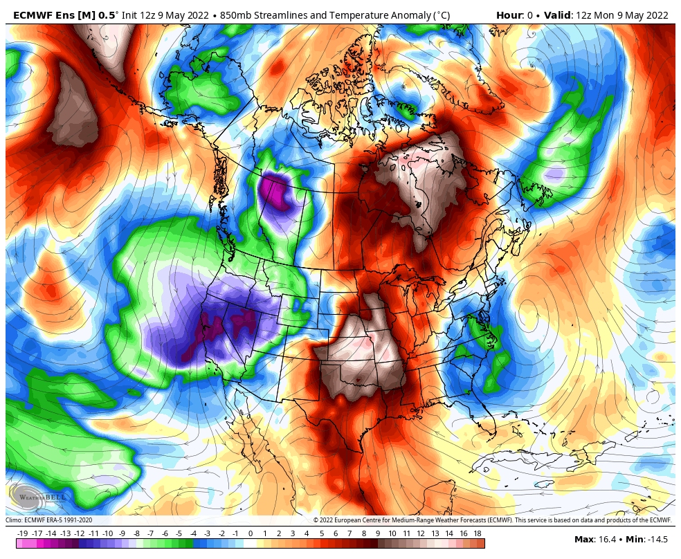
12z EPS. #LaNiña
 6 points
 -
23F and windy this morning with 2.5" of snow on the ground. very impressive cold for May.6 points
-
Pretty cool that you trained the dog to balance a ball on its back.5 points
-
I love his insight... best addition to the forum in years. I love reading his stuff even when he is talking about patterns that I don't like... he just sticks to the facts.5 points
-
Just got a pretty gnarly hail shower here. Dropped the temp to 45 in the middle of the afternoon. 53/37 so far today. Another notably chilly one for so late in the season.5 points
-
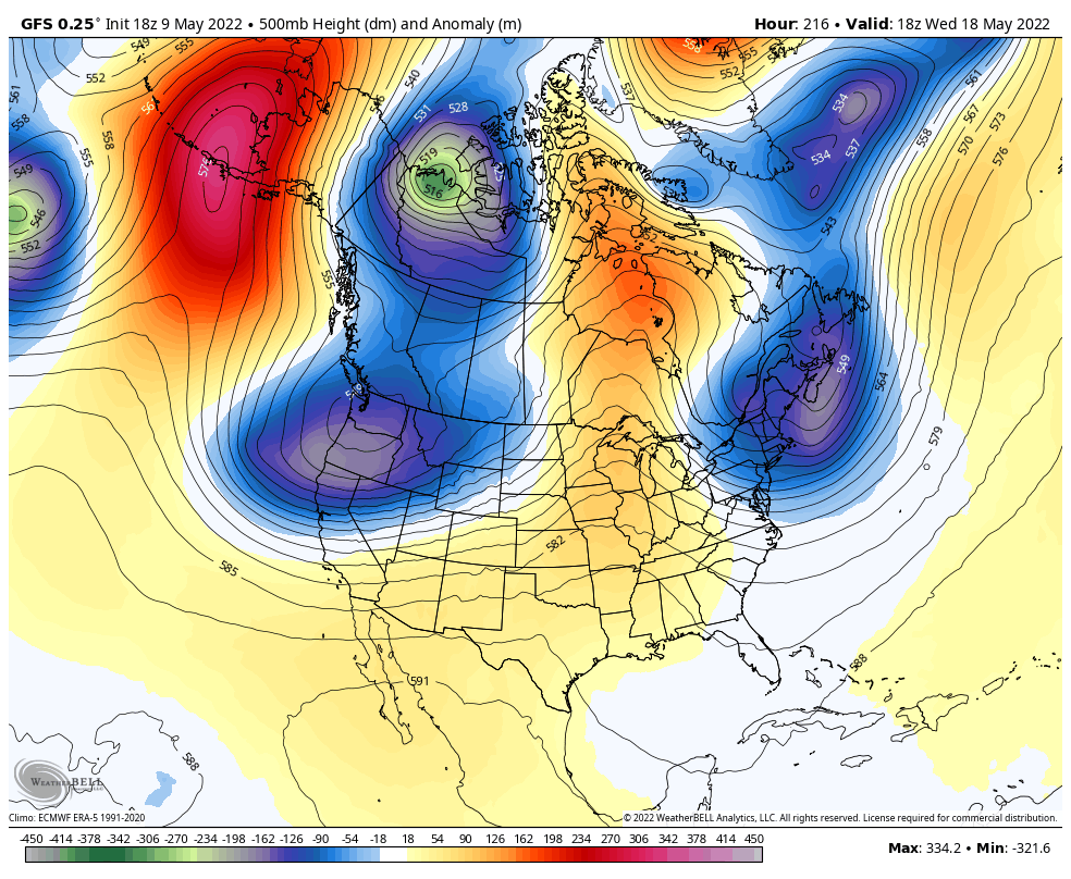
There is no pattern change coming. The 18Z GFS looks about the same in 9 days as what we have right now.
 5 points
 -
I think it might be raining at my house. Just a hunch.
 5 points
 -
That's the thing too, we've had a reasonable amount of -ENSO recently in 2017, 2018, and 2021. But transitions and sudden ENSO collapses/brief reversals during the warm season always threw a wrench in that coupling very well with the atmospheric circulation. So none of the AMJJA periods resembled what we'd commonly expect (and see as recently as the early 2010s). Nice to know after a decade that another truly entrenched and now deepening Nina can still do its job of overpowering anything else during this stretch of calendar.5 points
-
Yep. No high desert in the west, no cap over the plains, no severe thunderstorms. It's incredible how interconnected our country's weather is and even more incredible how much of a severe weather machine the plains are. Literally every ingredient comes together on a regular basis due to topography. The high desert for an energy building/storing EML, the warmest body of water on Earth between 20-30°N in the Gulf of Mexico, the highly active Pacific jet at 200mb ejecting and exiting over the plains, right where these prime ingredients meet. Nowhere else on earth do these ingredients come together as frequently and efficiently, and you'd probably be hard pressed to find a similar climate from a palaeoclimatological/palaeometeorological perspective.5 points
-
We’re way overdue for a washout Memorial Day weekend5 points
-
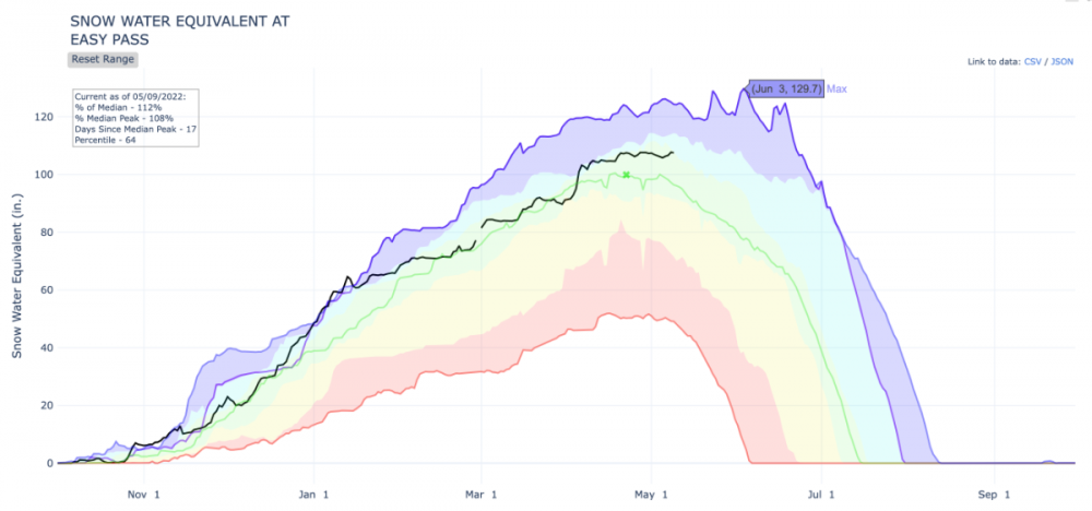
As unusual as the weather has been this spring (and as snowy in the mountains), we have a ways to go until we get to the craziness of 2012. The graph below is from Easy Pass which is just above 5,000' in the North Cascades. The graph shows snow depths for the last 13 years where the black line is the current year, and the highest purple line is 2012. The snow depth up there which normally peaks in late April, peaked on June 3, 2012. There were also three separate sets of storms in late May/early June that year that added at least 10" of snow water equivalent to the snowpack. It's also pretty amazing that 125" of SWE on June 18th had completely melted out only 40 days later. Meanwhile 2011 had the latest melt out with snow lasting until August 13, 2011.
 5 points
 -
gahdamn, intermountain west showing up big this morning!5 points
-
Good question, I'm not entirely sure myself, though I do have a good idea why ground observations in the intermountain west don't have as much of a lag. These stations are at ground level surrounded by similar or more prominent high elevation terrain, so there is lots of surface heating. A city like Denver for instance is going to be receiving air from upstream deserts where 100s of miles of high elevation terrain have warmed the 800-400mb column to the dry adiabat. This effect tracks most prominently with sun angles, thereby offsetting the upper level seasonal lag by few weeks. An influx of monsoonal moisture may play a significant role as well, since it comes in right around or just after the solstice, and lowers max heating potential considerably, especially in AZ, UT, and NV. I'd imagine prominent peaks along the coast such as Whitney or Shasta or Rainier max out in temperatures around August since they are consistently exposed to unmodified high altitude marine air. Pikes Peak in CO on the other hand may top out earlier, but I'm not sure.5 points
-
Low of 38 this morning…coldest May low in 9 years.5 points
-
My dad who got the colon cancer and ended up having an eliostomy started calling it his “semicolon”. Gotta love that guy. Dude’s in his 50s chugging away, still faster than me on the trail, bag or no bag.4 points
-
I can understand why those want warm weather… Though it would be disingenuous to say it hasn’t been beautiful. Convective Springlike weather with wintertime temperatures brings about very nice cumulus.
 4 points
 -
I haven’t heard anyone complain about the rain. I have heard several people mention how grateful they are for the bounty of the Lord.4 points
-
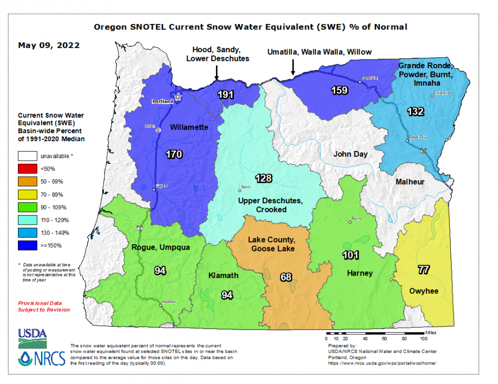
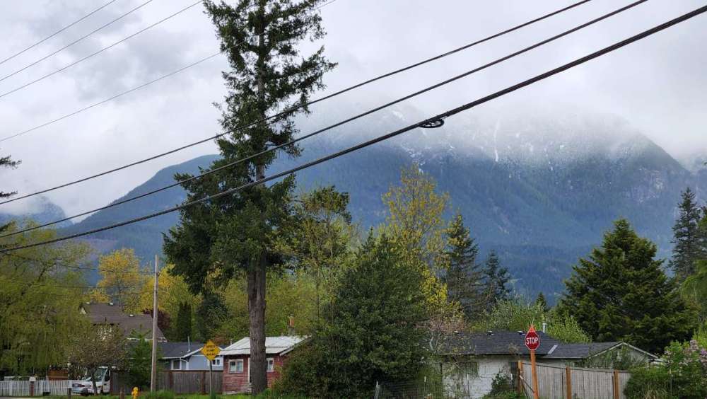
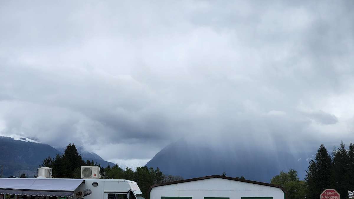
Now that the rain has passed, looking at the snow levels and depth, this looks more like early March than mid May.
 4 points
 -
Record high for the date is 96.
 4 points
 -
Last year was nutso dry in the spring and summer. PDX had 2.27" of precip between March 29 and September 16 (basically half of the year). Pretty extreme crap. And extremes tend to beget more extremes.4 points
-
That was also the year Yellowstone almost burned down. Pretty hot summer for most of the country and was the year the media really started sounding the alarm bells on AGW. We had an up and down affair that got warmer as it went along and peaked with a heat dome style airmass at the start of September. Then an October torchfest. Kind of odd considering the strong La Nina in place.4 points
-
Please make this crap end. By far the worst spring in my life here. I dont even need sunshine just dry weather.4 points
-
With a tiny bit of volcanic influence I think it's gonna be incredible. Lots of jet suppression with Arctic boundaries reaching northern California with surface lows also regularly coming in just a bit south of Cape Blanco.4 points
-
Looking good!! Regional cool and wet spring has been very much needed!!4 points
-
I don't see anything coming up over the next couple of weeks that looks anything like the past week. Looks fairly climo, though maybe a little on the cool side. Don't see any big warm ups on the horizon either.4 points
-
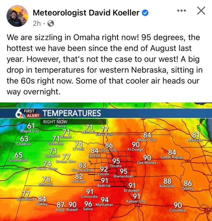
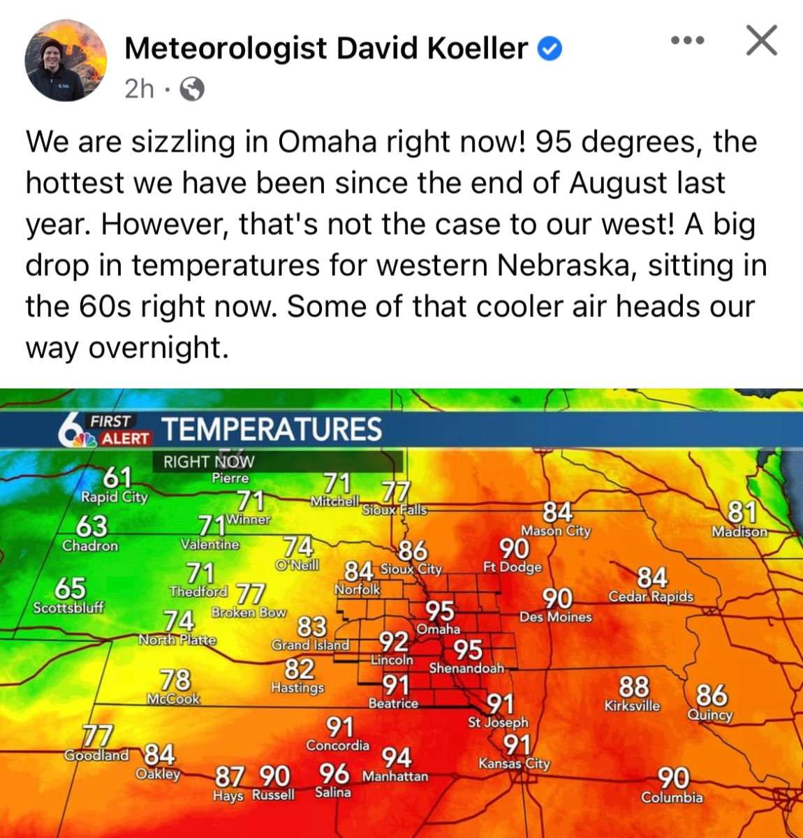
Record officially broke for KC. NWS Kansas City ✔@NWSKansasCity As of 2:10 PM, we reached 91° F at KCI. We are now tied for the record for highest temp on May 9th at KCI. Last set in 1963.4 points
-
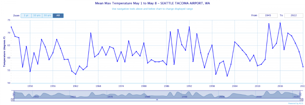
Average high temperatures to start the month are the lowest since 2002. Completely adjacent to what we've seen in the last decade. Something has fundamentally changed this Spring.
 4 points
 -
Yep. Air doesn't absorb visible or infrared light. Ground does, it absorbs the heat then gives it to the air. Lifted dust, ash, smoke, condensation, ect. of course do the same but aloft. Yeah it seems the high desert creates its own "bubble" within its mixed layer, which is admittedly very deep during the warm season. In that bubble, annual temperature trends are more dependent on sfc heating and sun angles than whatever airmasses wander in at that altitude above sea level. Above the mixed layer you get to the environmental temperature which reflects more on atmospheric temp budget. The more prominent the peak, and the higher up it is, the more dependent your warming is on that budget. Whatever proportion a location there is dependent on either thermal system is probably a linear relationship favoring elevation, given how relatively linear the dry adiabat transgresses across the isotherms. In other words, the desert floor will be within the mixed layer nearly all the time from when the sun first shows. Mt. Elbert on the other hand, standing proud at a cool 14,439', may only be within the mixed layer, oh I don't know, on the order of ~5% of the time? Maybe less? I don't have an exact figure, but I can guarantee it is much, much less than what you'd see in the Mojave desert. Therefore, the desert floor pretty much always warms based on sun angles, while Mt. Elbert is only affected by direct sfc warming (and consequently sun angles) ~5% of the time, therefore making it 5% dependent on sun angles and 95% dependent on temp budget. 100% and 0% for the desert floor respectively.4 points
-
Thermal energy takes time to propagate upwards and out into space. IIRC the Mesosphere is completely dipole to the solstice, peaking in temperature during boreal Winter. Could be wrong on that one though. Avg temperature at 850mb+ peaks around August simply because thermal energy reserves both in the atmosphere and in the hydrosphere peak then. During late June through August, sun angles are decreasing, yet energy is still being added to the system. Sun angles fall behind that equation in Sept and don't look back until early Mar.4 points
-
Yeah that’s how you get those EMLs over the Plains. High terrain heats the air around it which is subsequently advected eastward. I think upper level temps over the Pacific may warm more slowly because the Pacific itself warms more slowly (vs over land), and those cooler upper level temps are advected over the CONUS more readily at that altitude.4 points
-
Very good reflection on how delayed upper level warming is compared to sea level. A solid one month or so seasonal lag between the two, on top of an already present 20-50 day lag at sea level.4 points
-
It always amazes me how big of difference there is in early or late season heat waves at elevation. For example the Euro shows Sacramento at 100-105F next Tuesday. While we are only going to get upper 60's to low 70's. In July or Aug when Sacramento hits 100F we are in the upper 80's to near 90F.4 points
-
Low of 37 here this morning despite mostly overcast skies. Pretty impressive4 points
-
If anyone wants to follow along it is also dumping in town. https://www.americanbankmontana.com/bozeman-webcam
 4 points
 -
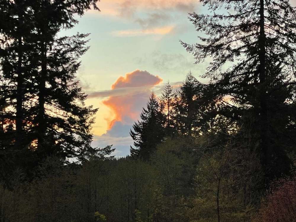
Nice sunset. Down to 40. This
 3 points
 -
Just some rain up here in the TC. Line didn't really get going til it got east of here. Perfect weather right now. Upper 70s with a light breeze. Got chicken breasts on the Weber and a cold one. Feels like summer finally.3 points
-
Let's hope we don't repeat 2012. Big difference though we've had rain this spring. NWS Kansas City ✔@NWSKansasCity Last time Kansas City reached 90° earlier in the season was in 2012 when we reached 90 for the first time on 4/25. We won't talk about the rest of that Summer3 points
-
You should be banned.....you have a lot of nerve coming on here and admitting you are wrong and correcting yourself. You are supposed to wait for your forum-mates to do that for you! Seriously thanks for all the info, I've only been able to skim it today, I look forward to sitting down tonight and fully read through all of the info/discussion.3 points
-
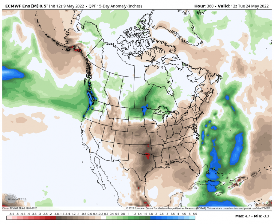
12z EPS 15 day precipitation anomalies. Looks like the PNW is the national oasis:
 3 points
 -
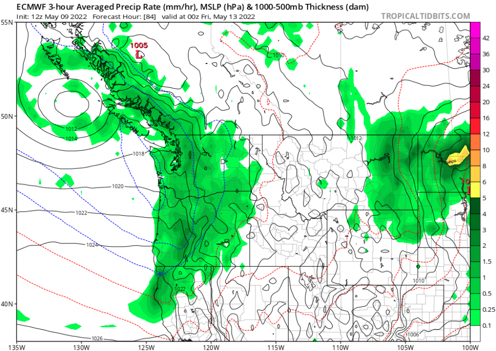
Not to mention this potent bugger coming in Thursday. It'll only stick around for a day or so, but it's got some bite.
 3 points
 -
Yep. Possibly the greatest severe thunderstorm generating machine to ever exist on Earth, and it's right in our backyards, so to speak.3 points
-
It's amazing how the default setting has been thicknesses around 534-538 for the last several weeks and even more amazing there is still no clear end in sight. Hopefully things flip in a real way the last 10 days of the month.3 points
-
Six hour lows come out around 11am3 points


.thumb.jpeg.e3014abf99ef08a9f9ac2c0cd31b485b.jpeg)


This leaderboard is set to Vancouver/GMT-07:00