
Leaderboard


Popular Content
Showing content with the highest reputation on 05/22/22 in all areas
-
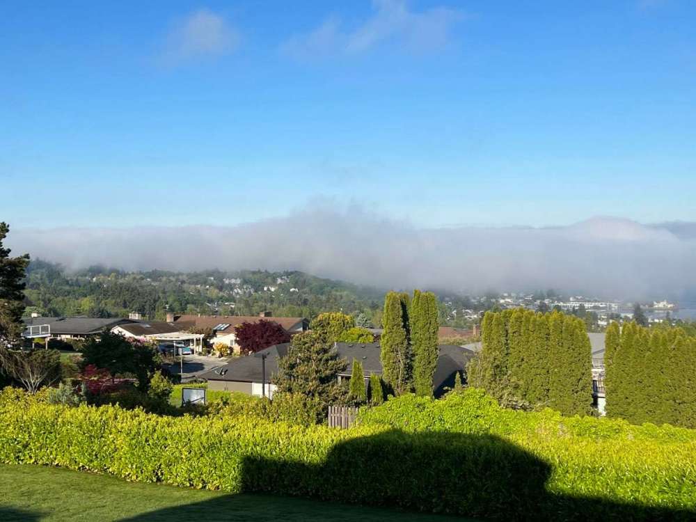
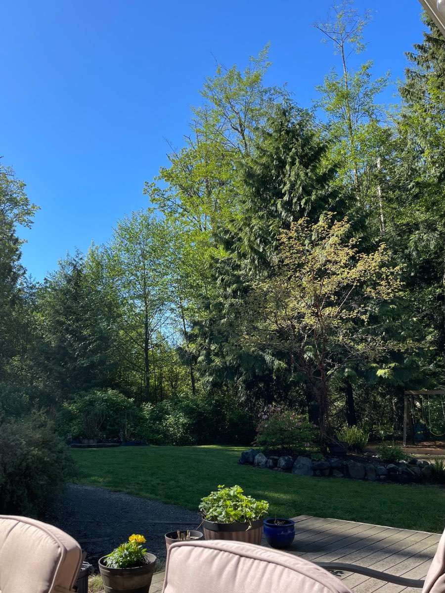
Fog made it here but has burned off. Nice day.
 9 points
 -
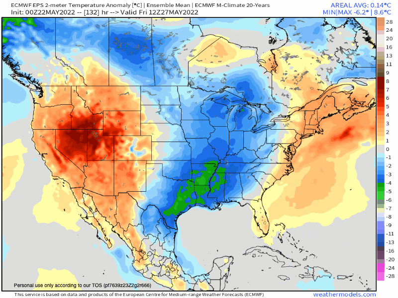
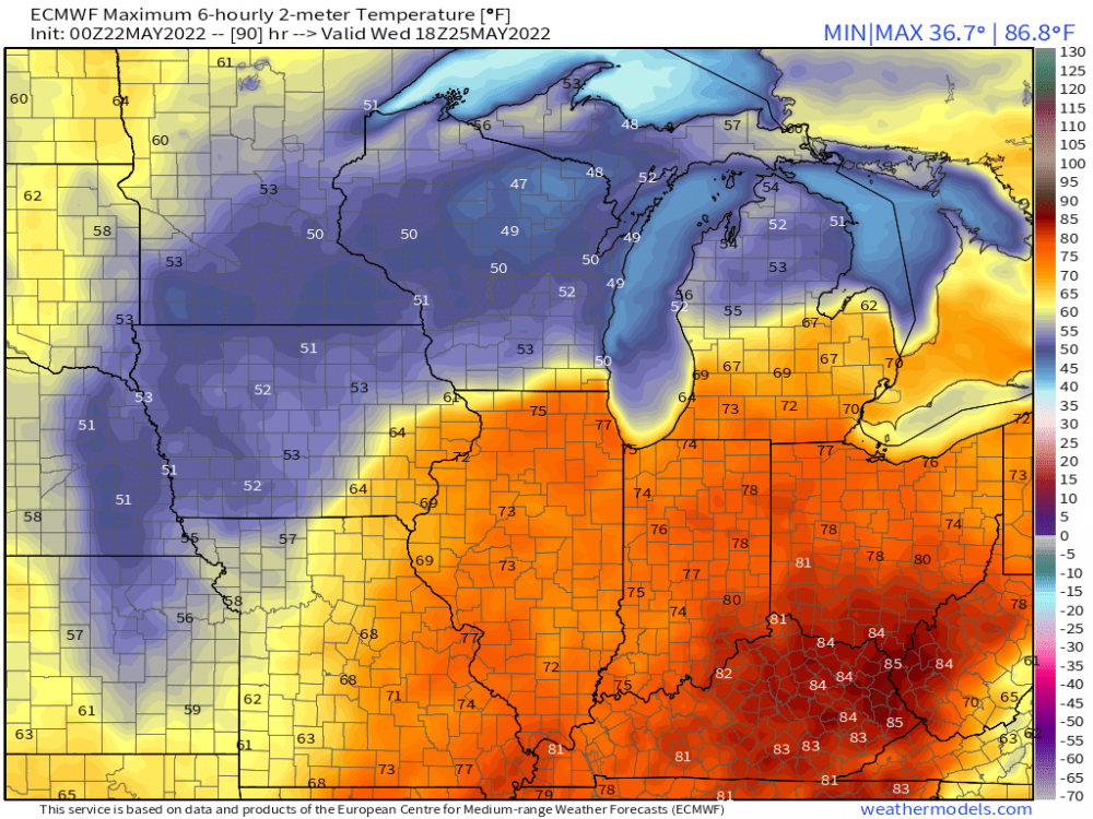
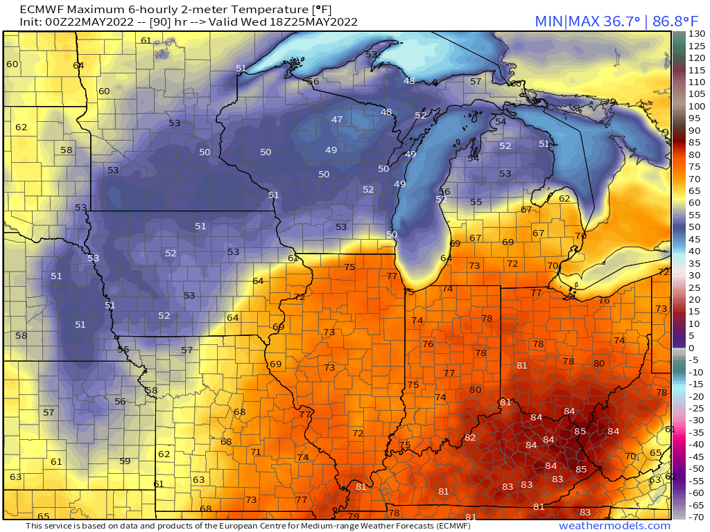
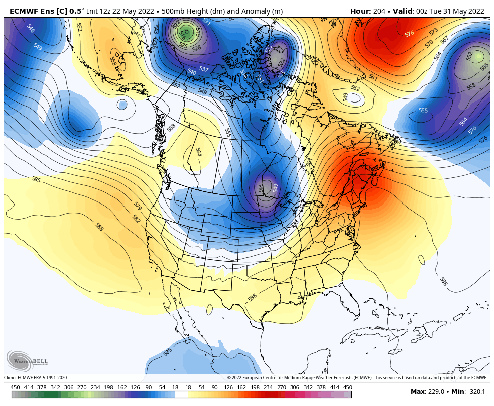
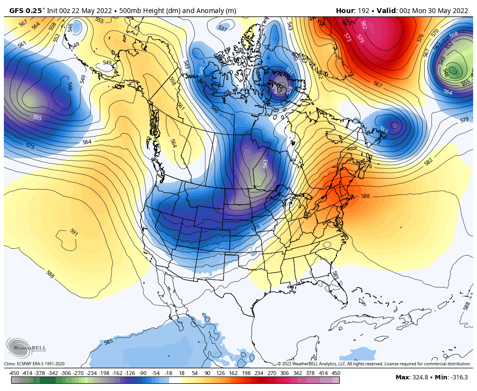
For the most part, it appears that it'll be a chilly and crisp start to Friday around these parts once the cutter departs. Nature is going to deliver a well-deserved and perfectly timed Summery wx pattern for the Unofficial start to Summer this Memorial Day weekend. I've been watching the models like a hawk over the last few weeks for the upcoming weekend. I remember long ago the EPS was suggesting a big trough over the GL's region and the GEFS had a ridge. Kuddos to the GEFS for winning this LR battle. So, here we go, who's ready for a very nice MDW?? It may start off rather HOT for those out west, but now, both the GEFS/EPS are showing a slow moving CF to settle south across the western SUB for Memorial Day. Memorial Day Boomers??? I'll try to dive into the Summer pattern a bit more when I get a chance, but something rather fascinating is going to develop in the high lat regions right as we open up MET Summer. Big Time Blocking. As a result, I've noticed how much wetter the C Plains could get, esp where the majority of the US wheat is grown in KS! #bullseye...I didn't realize that KS also exports a lot of Beef as well. This is all good news for our farmers, ranchers and those who are self-sufficient.
 8 points
 -
Nice day in silverton.
 5 points
 -
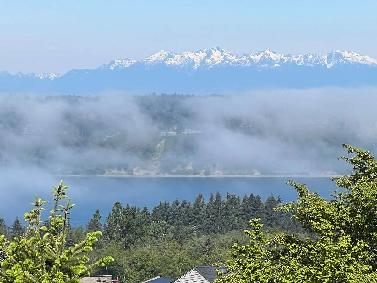
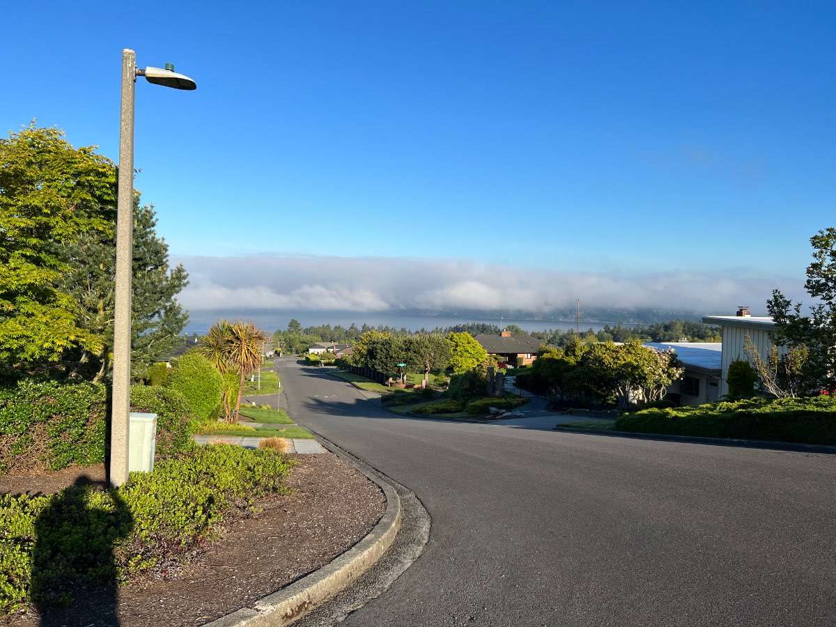
Fog is encroaching here.

 5 points
 -
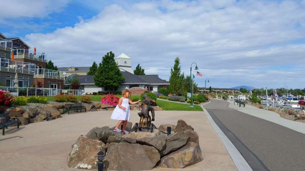
Facebook reminded me that we were in Richland WA 6 years ago today... slumming it right on the water with our boat parked in the marina. Miserable times.
 4 points
 -
I think it was a land MCS that tracked out over the gulf and became tropical.4 points
-
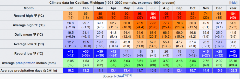
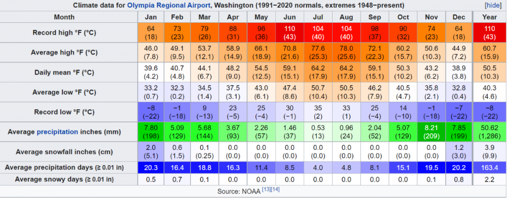
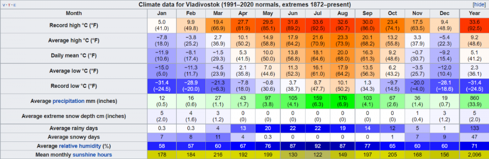
This is very interesting. Cadillac, MI sees about the same amount of precip days as Olympia, WA. MI sees a lot more precip days than I thought.
 4 points
 -
We had 60mph winds this evening. Your area does better than mine for severe I think, so yours should be coming. Snapped this pic as the wind front arrived. It was…loud.4 points
-
It’s a nice day. We can all agree on that. I’m not going to complain about a couple 70 degree days in late May.4 points
-
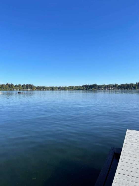
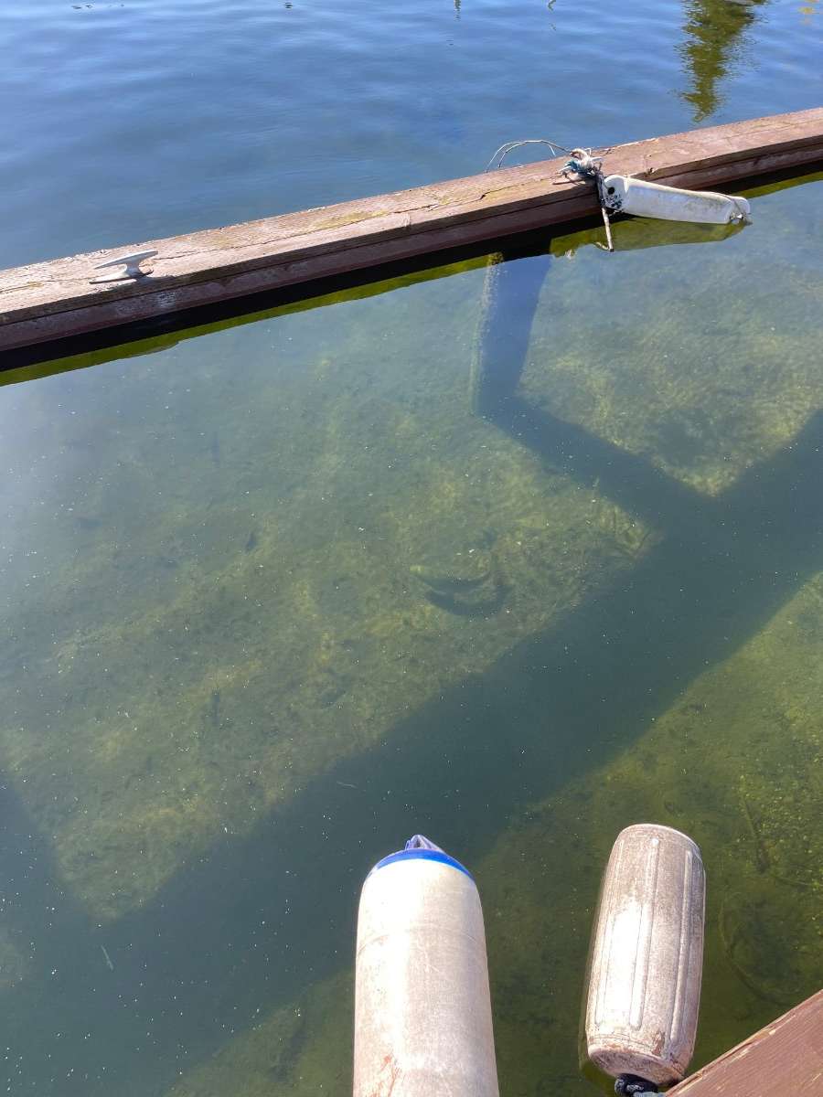
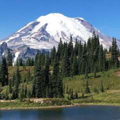
Now this is a weekend morning I can stand behind! Perfection! And this Bass (bigger than appears in the pic) really makes me want to start fishing again. The amount of hours logged on this dock as a kid fishing was well…A lot!! Now back at home sitting on the quiet deck with the kids still asleep…Ahhhhhh…WAY better than dark wet and cold. PREFERENCES!

 4 points
 -
I’m having a difficult time acclimating to the warmup this year. Haven’t had much warmth until now, so that’s probably part of it. Low 90s w/ upper 60s dews is not bad at all by midsummer standards, if anything would be less humid than average. But man, my body just ain’t having it right now.4 points
-
Yesterday actually had a -0.4 departure at PDX.4 points
-
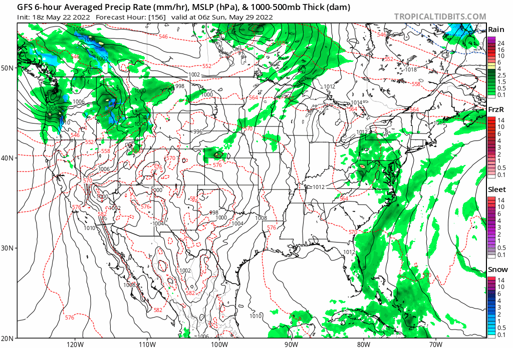
The models are shifting the slow moving cutter every-so-slightly west, thus, the warm front shall surge north around here allowing temps to surge well into the 70's. I'll take it. I hope the Euro is right for many reasons, esp to get moisture for those out west who need it more. We have been doing well in that dept. so to see nature "share" the moisture would be a nice deed! With the shift west, however, some of you in IA/NE/MN/WI will be stuck in some chilly temps for a few days next week. Wednesday highs... This corridor of precip would be nice for KS and E NE/IA peeps...
 4 points
 -
Well we did have the latest snowfall on record at PDX and wettest April. Has CVO set any records?3 points
-
I just had my first bigger t'storm last night in my new area. Overall eastern Kentucky gets less severe ones, and I think most of the tornadoes that make up the 21 average annually are up until you get to I-75 or just after. But a few noteworthy ones can happen. An EF3 happened in March 2012 within 50 miles of here. Mayfield was on the other side of the state. In fact, none of those big lines that came thru last Winter had any lightning here at my place.3 points
-
I've been unlucky this spring with thunderstorms at my house in Bethany, I hope we get some full on light shows at some point!3 points
-
70°F with hazy sunshine Corvallis3 points
-
3 points
-
Your moment of zen.
 3 points
 -
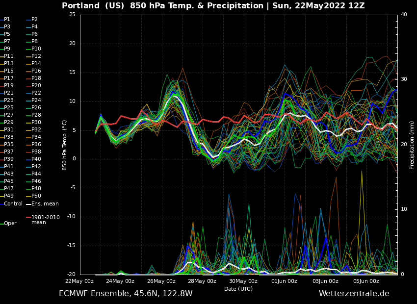
12Z EPS and control run are a little better moving the trough east by Memorial Day. The control run is significantly better. There might still be a small chance it gets better by Monday. Control run... 00Z run for Memorial Day on top and new 12 run on the bottom.
.thumb.png.898af2f798359a75afb7709565a2c281.png)
 3 points
 -
Looks like we got down to 41F. Nice morning currently 62F.3 points
-
12Z GFS completely different than it's 00Z run for next weekend. Looks cold and wet. And going east won't be any better.
 3 points
 -
-2 departure at SLE -3 at eug. It’s hard to remember the average highs are now in the low 70s south of pdx.3 points
-
A rare totally sunny morning. 06Z GFS moved towards the ECMWF... so probably won't get lucky again next weekend. Looking at ECMWF details... this coming week looks pretty cloudy overall before storms arrive again later in the week. Low clouds are back tomorrow and then a solid deck of mid-level clouds on Tuesday... then low clouds again for much of Wednesday and a solid mid-level deck again on Thursday. ECMWF also shows some rain tomorrow and Wednesday for western WA. So this "break" won't be much of a break after today for those north of Portland.

 3 points
 -
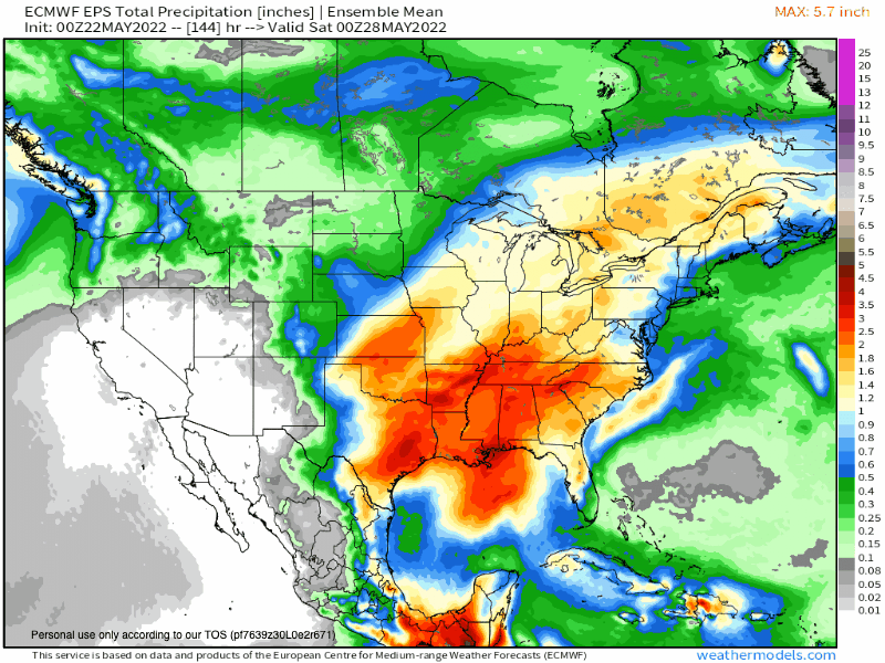
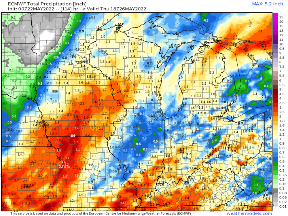
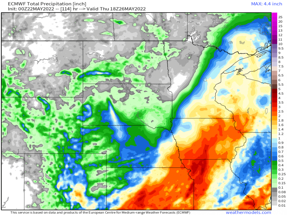
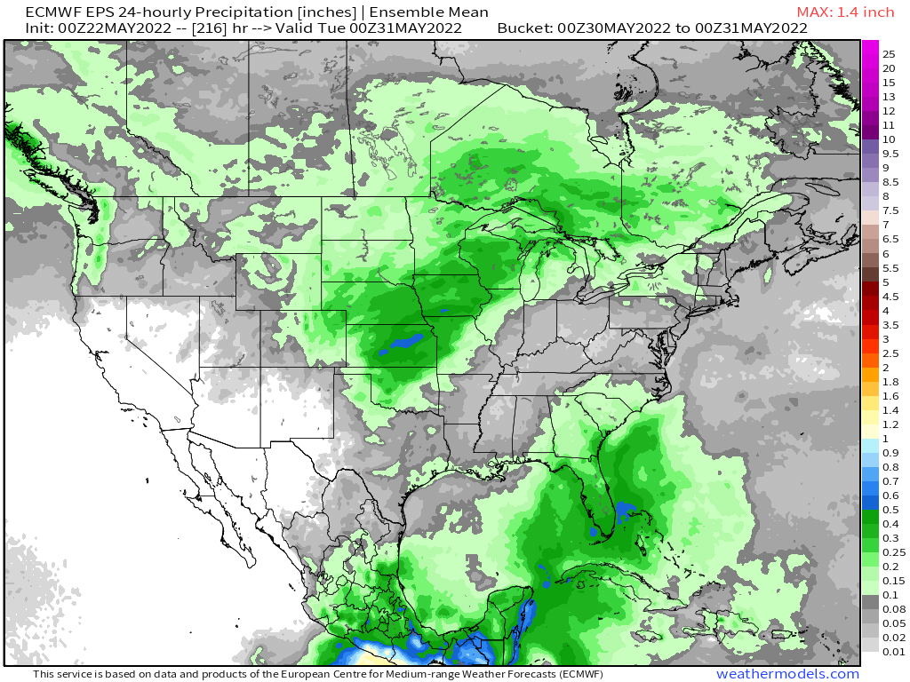
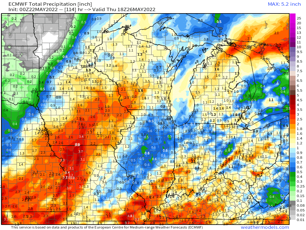
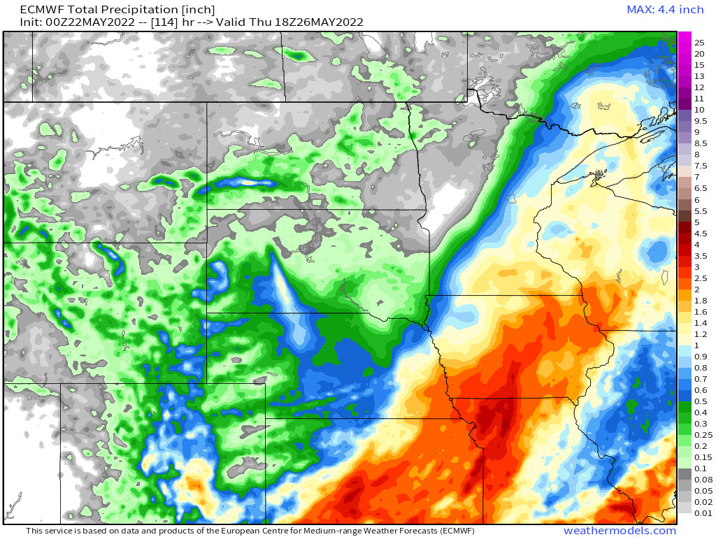
Look at those rainfall maps! Isn't that something beautiful? So very glad to see the rainfall spread west into TX/OK and NE where it is most badly needed. A lot of areas it is becoming beyond badly needed. In terms of weather on the whole runout, looks like I'm still in the rocking chair or washing machine of weather, water and windy chaos. These waves of storms and wind the last 45-60 days have to be something historic.3 points
-
Well there are pros and cons to global warming. As there are with most things. If we had to choose between warming and cooling, the latter would probably be more problematic for humanity. Though I admit I would probably enjoy it. Thing is, it’s a 100% guarantee that much larger/more abrupt climate changes will affect humanity at some point, regardless of what we do. Either we learn to deal, or we go the way or the dinosaurs. It’s the sad, brutal truth. If we can’t survive the next glacial or hothouse climate (the glacial will likely come first, ironically) then we’re probably never getting off this planet.3 points
-
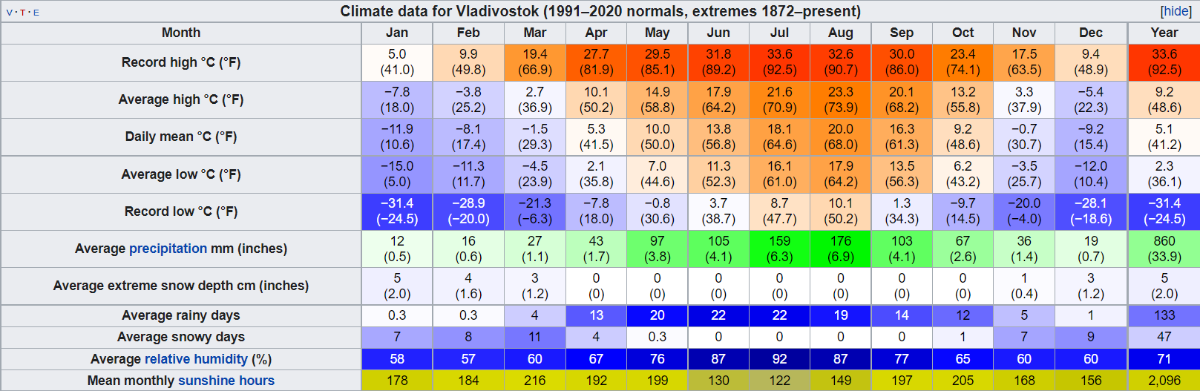
Cadillac is right downwind from Lake Michigan which while not like the Pacific is basically an inland sea. They are within the lake effect snowbelt. Nearby Traverse City gets about 100" of snow a year, probably a bit less in Cadillac. They still manage 12F average lows in January with 18 precip days, and they're at the same latitude as Eugene and just above 1000' elevation. Very cold winters for its latitude... but still warm compared to east Asia. Coastal city at the same latitude as Roseburg (their port requires icebreakers in winter!). If the Earth spun the other way, our climate might actually look something like this, although probably not quite as cold because of all the blocking mountain ranges.
 2 points
 -
weekends like this are just gross. Sunshine Saturday and Sunday? WOW! I hope we can break this streak and get some cold soaking rain for the upcoming three day weekend. fingers crossed2 points
-
First hail should be in the near future. There's been several times it sounds like hail wants to fall, stops and then its just a downpour when it starts dumping.2 points
-
Not going to lie though, tomorrow’s cooldown sounds nice. I am not acclimated at all for summer yet2 points
-
As well as the other strong and deadly twisters on the evening of 6/8/53, there was a deadly F4 in the far, far SE corner of Lower MI near Erie that somebody actually snapped a picture of. It's the only photo I am aware of during that outbreak. No photo of the F5 in Flint, but from descriptions of spectators this is probably a good example. All told, 126 people were killed by TORS in The Mitt that early summer evening. Just krazy to think about that today.2 points
-
Spokane still hasn't hit 70? That's impressive!2 points
-
PDX hit 75 on 4/7 and 5/4.2 points
-
71°F at KSEA. Still a -0.3°F departure on the day though lol with a 71/46 spread.2 points
-
Looks like 76 at PDX today. They were about a week away from tying their longest streak at or below 75 on record (last 75+ day there was September 25th) 74/44 here with a mix of sun and high clouds. Another nice day2 points
-
Breezy!
 2 points
 -
12z EPS is looking pretty good. The mean is in line with the operational for the troughing in the 5-8 day range
 2 points
 -
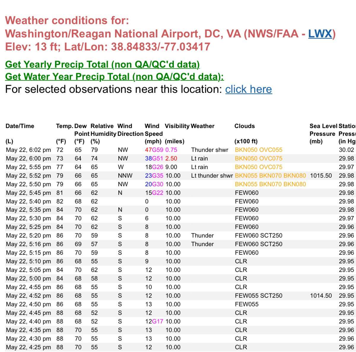
First significant microburst of the year. DCA currently sustained at 47mph, gusting to 59mph.
 2 points
 -
2 points
-
Today is pretty gorgeous. Yesterday was as well. Clear with a low of 44 this morning, and mostly sunny and up to 59 now.2 points
-
Interesting to read that some lakes in MN came close to the latest "Ice Out" on record... https://www.mprnews.org/story/2022/05/16/iceout-up-north-is-near-latest-on-record2 points
-
Joshua is back to complaining when the rain stops for 24 hours. Jesse is doing his usual silly dramatization that everyone who wants a 70 degree day also wants to kill every single tree. And Andrew is cheering them on. All is right with the world. I am just hoping for 10 dry days in June. Normal is 19 dry days here. I set my expectations appropriately low this year.2 points
-
Wow Tim’s having yet another Saturday night melt down.2 points
-
Hopefully the Tonga eruption warms our climate to the point of ecosystem death so we never have to experience a spring like this again2 points
-
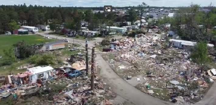
Just catching up with this event - been busy. Two dead now (both in that mobile home park that was leveled). There apparently was another twister that hit Gaylord roughly 25 years ago, but it's so rare of a threat that they have no siren system like is common downstate. Multiple fatality twister. Might be the first since the Sept of 2007 outbreak that killed that couple east of Lansing. The Dexter EF3 in 2012 there were no fatalities, despite some seriously damaged residences. During the June 8th, 1953 outbreak, there was a smaller twister (F3?) that hit near Oscoda right on the beach at lake Huron. My folks had a cottage near there they bought the very next year. I remember my dad casually mentioning one time that we were driving past the spot that twister came through, killing a couple who were strolling the beach that fateful June evening. Talk about being in the wrong place at the wrong time! Of course, all the news was focused on the Flint-Beecher devastation and huge loss of life. Nobody thought that amount of single twister death toll could happen in the modern (warned) era. Then the Joplin monster proved them wrong 58 years later! Flint (south side this time) also had an F4 twister rip through, just a few years later in '56. My older brother-in-law said he was at a drive-in that evening when it came over and lifted the car he was in a few feet off the ground. I think the last F4 was in the northern suburbs of Detroit (Bloomfield??) circa 1976. A very close call happened when I was working in TX back in the summer of 2010, with that EF4 that ripped through the west side of Toledo after dark iirc. This Gaylord twister happens, just as I was thinking we no longer have them here in The Mitt. Never say never (Niko?) Kentucky maybe??
 2 points
 -
Interestingly... the pattern on the 00Z GFS next Sunday is almost identical to the pattern today. I would be down for a repeat of today and tomorrow next Sunday and Monday.
 2 points
 -
This is the loudest thunder I can remember with such a non-threatening and quiet looking sky. The house has been shaking with these claps of thunder and you would never imagine there would be anything going on by looking at the sky. I saw a lightning bolt between here and Mt. Si that looked like it came out of blue sky. Very strange evening.2 points
-
2 points
-
Lots of drunk people here.2 points
-
This upcoming week is one of the cooler weeks I can remember for late May, no complaints from me and heavy rain is possible Tuesday.2 points


.png.4aedf77f4941e34399584ee3bdafc61d.png)


This leaderboard is set to Vancouver/GMT-07:00