
Leaderboard


Popular Content
Showing content with the highest reputation on 06/25/22 in all areas
-
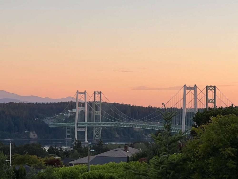
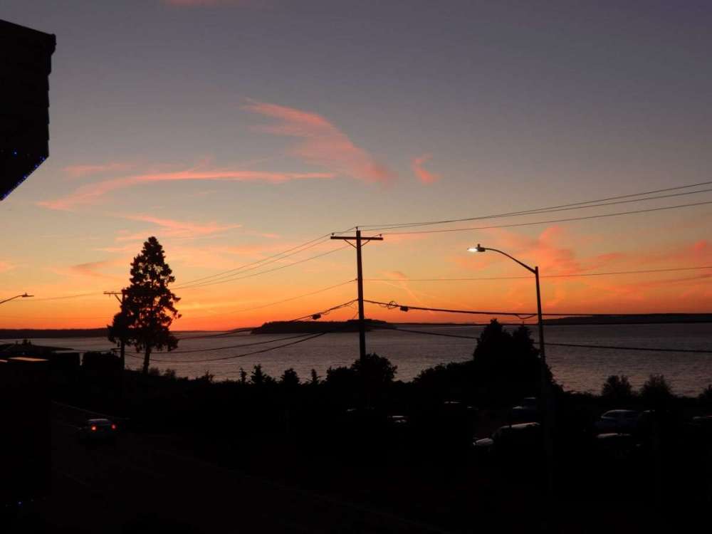
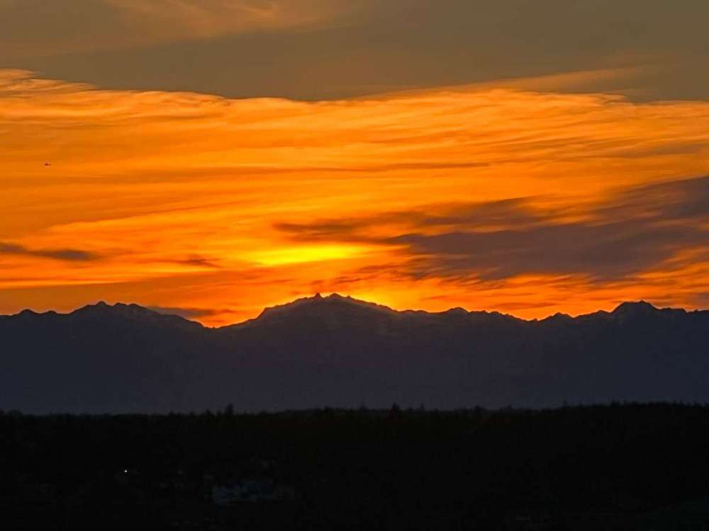
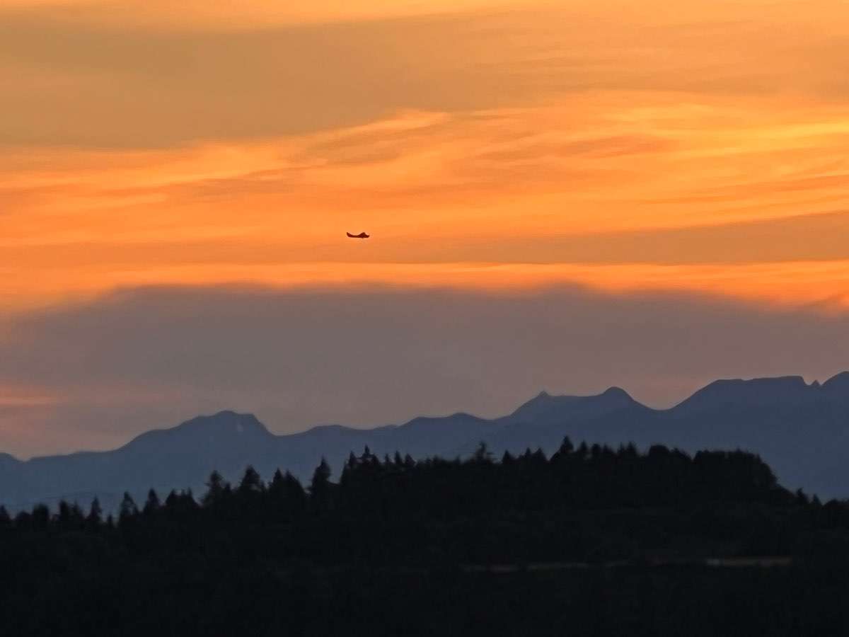
Sunrise this morning.
 11 points
 -
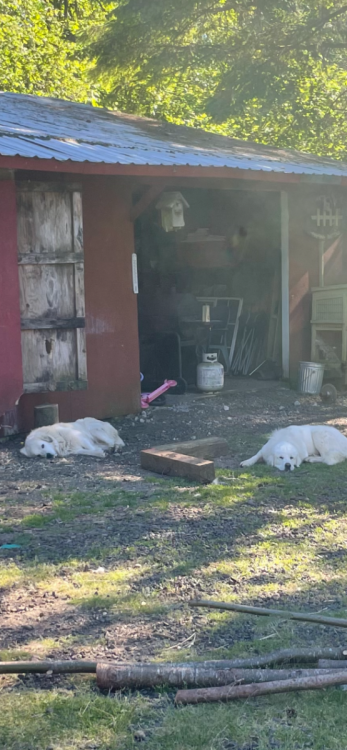
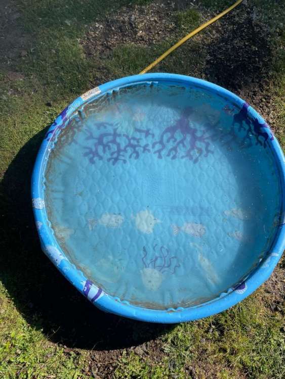
Here is my Lake Sammish. Kiddie pool I filled for the ducks. Dogs not loving the heat.
 7 points
 -
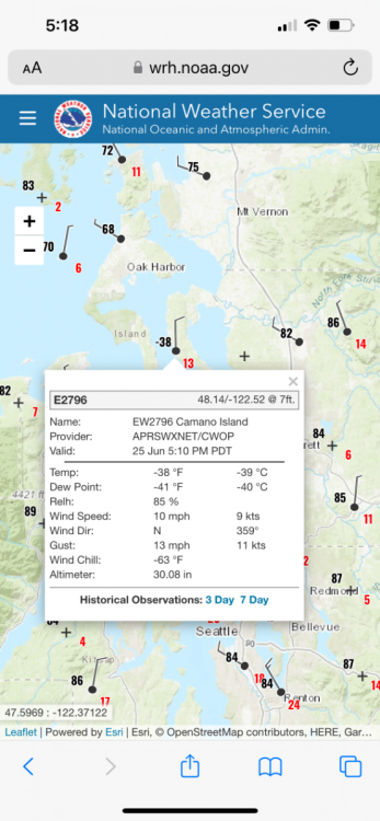
-38 with a wind chill of -63 on Camano Island. I do love our microclimates.
 7 points
 -
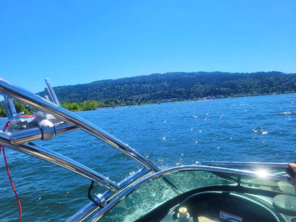
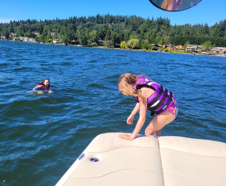
93 degree air temp and 70 degree water temp... everyone has been swimming. Almost prefer to be in the water.
 7 points
 -
I will be enjoying this heatwave on Sand Island (Columbia River across from Halloween town I think). Primitive campground with daughter and grandson. I’m assuming we will be in the water a lot! Enjoy all and stay safe out there! 55* with a NNW breeze7 points
-
87 at SEA... 9 degrees warmer than what the ECMWF showed for today just a few hours ago. 91 in North Bend. 93 here on Lake Sammamish...
 6 points
 -
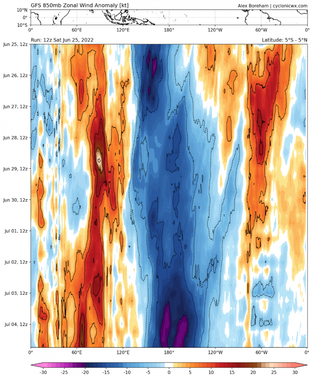
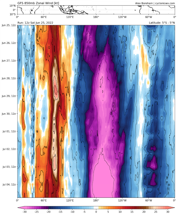
If this verifies it’d likely be the strongest trade wind burst ever observed in the satellite era in the month of June.
 6 points
 -
I went to Vegas last May. It was kind of boring. I blame Covid. Did see a woman jogging topless wearing a diaper.6 points
-
We’re long overdue for some decent thunderstorms…some areas got some earlier this month but I’m talking about a big regional outbreak. Hopefully we get lots of them this summer.6 points
-
My 17 year old step daughter is mad because she can't go to work. Must of done something right in the 5 years I've raised her.6 points
-
A good year to being back this classic! Enjoy every second of this nice weather!6 points
-
Spent the afternoon just downhill from Andrew at Silverton Reservoir paddleboarding with my better half and several hundred of our closest friends. 94f and a water temp of 64f. (Yes, I brought a thermometer) Everybody was in the water. Very windy. So glad to finally have some summer. Finished with a dinner and drinks on an outside deck in Silverton. Wonderful Saturday in the PNW5 points
-
92/54 day here. A lot windier than I was expecting, gusting 20-30mph here out of the east. Acting more like an early fall heatwave, mechanically. Hoping we can avoid 100 tomorrow but timing could be unfavorable with offshore flow potentially cranking most the night/morning then dying off right around peak heating.5 points
-
Well, Im happy for those who received rain in this vital time of the growing season. Here in the Ottumwa, IA area its looking more and more like dejavu 2017, that year we had about about or less than 3 inches may 15 thru mid September while many areas not far away were green and lush! These past few days of "opportunities" i got .26 a few sprinkles, but mostly a caboose cell on tail end of ne iowa downpours. So for June with much above normal temps im sitting at 1.57 and barely any for 15 days. I have read this book before and have studied the midwest climate records, Ottumwa, Kirksville, Peoria is the bermuda triangle of whats already a area of wild precip swings (midwest). SE Iowa, NE Mo has the wildest precip swings year to year month to month within the midwest. A very tough place to do lawn care and hobby farming of fruits, vegetables. Corn and beans genetics have seemed to get those crops through better. But this year with late planting from record cold soil temps, imo the bean crop may be heading for a disaster. I have spent maybe 20 hours watering 65 trees and acres of other plants. Im not happy. My only dislike about se iowa over my previous life in Pennsylvania and Maryland where 10 days with no precip is "extreme" here thats common, even 20 days no rain is common here!
 5 points
 -
70F with some morning clouds sounds like absolute heaven compared to today.4 points
-
I've been better. The weather is nice though. 34F this morning and 59F currently with not a cloud in the sky.4 points
-
October can’t come soon enough. This is BULL SHEET.4 points
-
Drunkly walked 13 miles yesterday on the strip with my friends. Didn’t expect to walk a half marathon4 points
-
Yesterday was the last day of school for me. Was a pretty rough year for a lot of reasons but Summers as a teacher always make up for it. Really looking forward to recharging!4 points
-
Mowed the yard this morning. 62 degrees with a north wind gusting to 35 mph. Dew in the low 50’s made it feel like late September. Even put on a sweatshirt and opened the windows. Only 0.25” last night as storms were moving at 45 mph, so not heavy rain producers.4 points
-
Tim is right about Lake Sammamish. It’s a fantastic lake for swimming and is always impressively warm in the Summer. I follow that buoy data closely because I spend a ton of time in the Summer swimming and boating and like to nerd out about it. Sammamish is always 3-4 degrees warmer than Lake Washington because it’s smaller, calmer, shallower, and sees slightly warmer air temps being further East. The strength of the sun and calmness of the lake allow the water temp to easily exceed average temperatures during the Summer and it is often near 80 degrees during our warmer Summers despite air temps being lower than that like 85+% of the time.4 points
-
2.38" in my gauge this morning , and that is one of the lowest totals in the Cedar Rapids area. A band of 3-4" initially fell just south of CR, then another stationary band formed on the north and east side that dumped 3-4". A town just southeast of CR (Solon) got 5.40". In addition to the heavy rain, there was lightning visible, at least in the distance, for seven straight hours. The final cell that moved through this morning was the strongest and had constant lightning with loud cracks of thunder. We haven't had thunder and lightning like that in a long time. I really love nights/mornings like this. It's the first time this year we've had anything like it.4 points
-
Wow did it rain hard here. My gauge has 2.2” in it from overnight. It’s raining again right now as well. There’s a newly formed pond in the field behind my house.4 points
-
Of course, I’m out of town for the best night of storms all year. Local station near my house has 3.86”. We really needed the rain.4 points
-
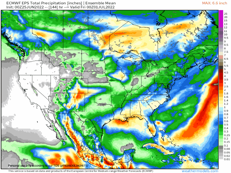
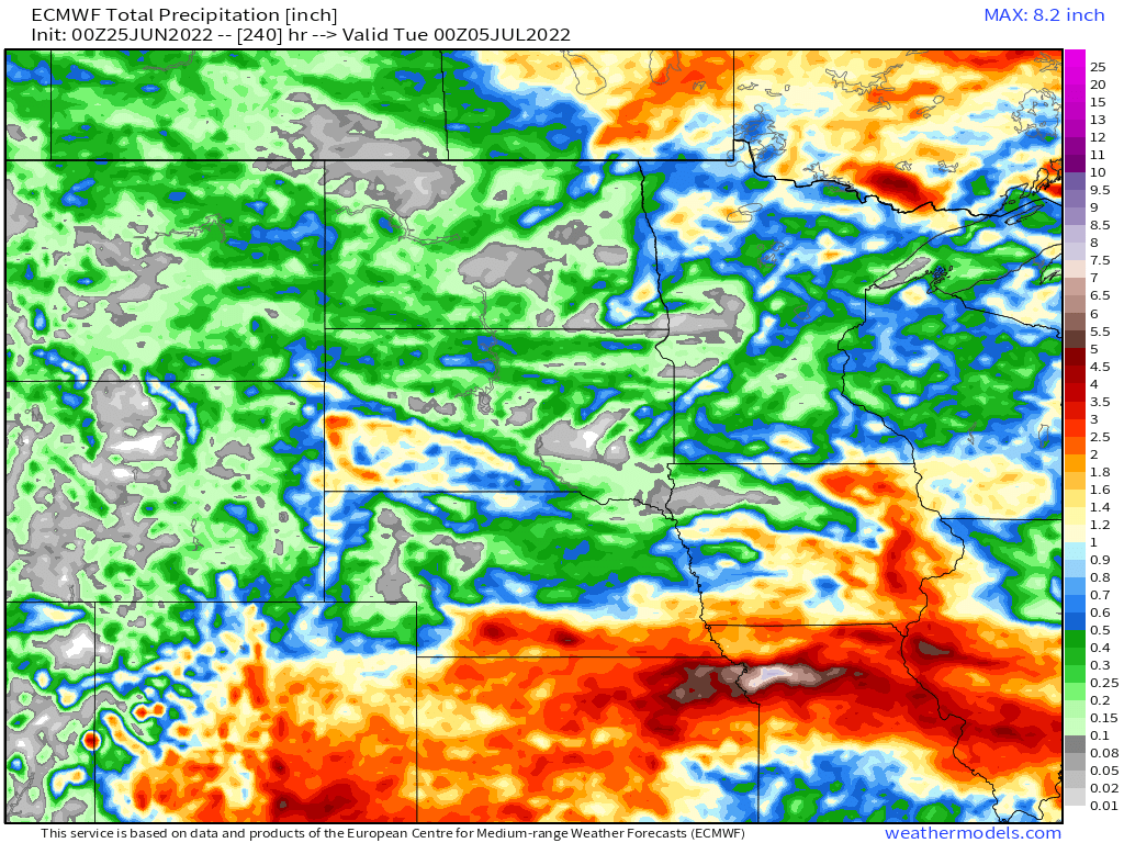
Parts of W KS have been left out for the most part until next weekend...the pattern looks ripe for a heavy precip event during the Holiday weekend. The 0z Euro/EPS look rather nice for most of the central ag belt regions.
 4 points
 -
I grew up with an upstairs bedroom in a hundred year old farm house. When I was about 15 my parents finally relented and got us a window AC unit.3 points
-
Peaked at 76.6F today so it looks like I was one of the cooler places in the state. The strong northwesterly wind was certainly doing wonders to cool it down. The next couple days should be warmer though.3 points
-
Feels so good!3 points
-
Water looks ice cold.3 points
-
Bend’s station runs 3-4 degrees too warm on most summer days. Think it’s too exposed. Most stations in the area were 82-85 I believe.3 points
-
Downslope will be considerably weaker tomorrow.3 points
-
It's not that hot. Palm Springs reached 123 F a few years ago.3 points
-
And there it is. EUG and Springfield with our first 90F of the year.3 points
-
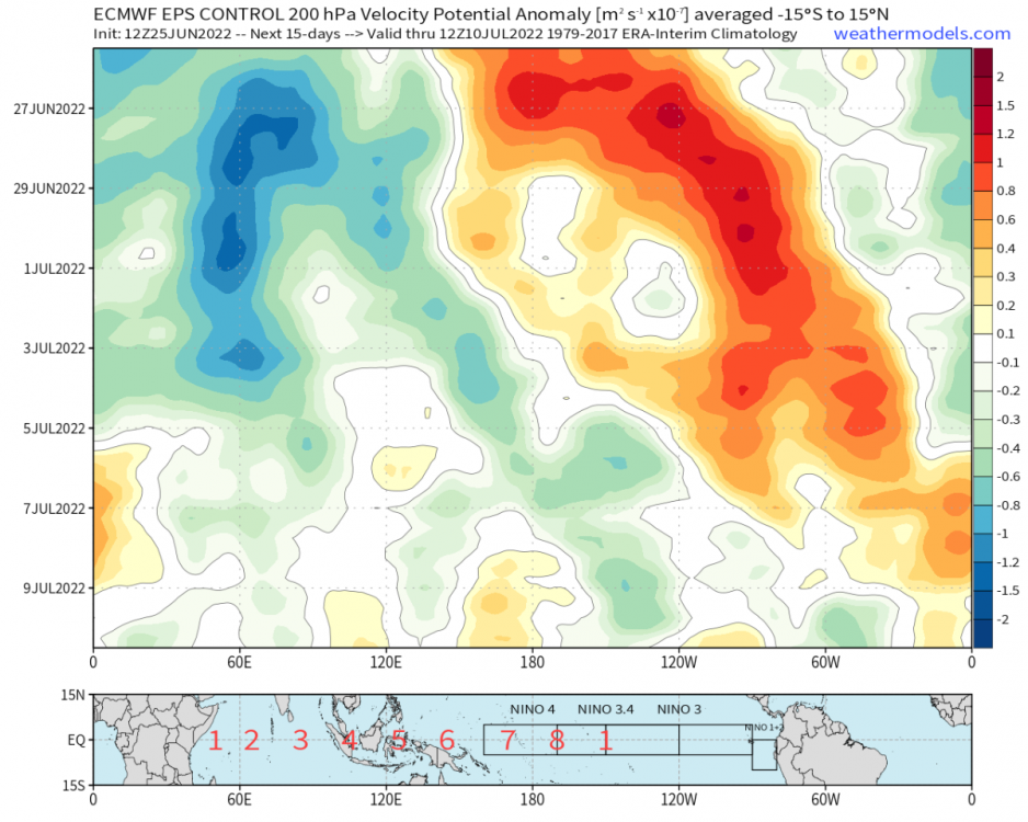
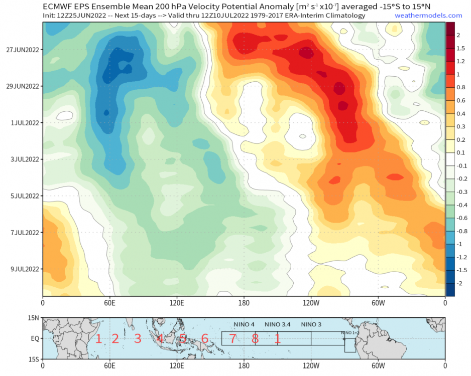
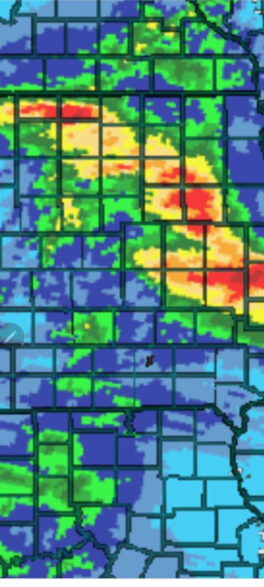
Though there is an interesting inflection point developing within the EPS. A growing number of members (including the control run, pictured below) do not bring a full blown MJO back through the W-Hem, and instead have a faster/CCKW type solution with some low pass element remaining back in the IO. If the CCKW route is realized (which *might* be dynamically favored under the -ENSO low pass), that may suggest a dampened dAAMt cycle and faster termination of the +TNH regime, but also a less anomalous -PNA/+NPO response in late July. In other words, as Tim puts it, a more “goldilox” outcome with less extreme heat or extreme troughing, and instead a mildly above average 1st half July followed by a mildly troughy 2nd half. Of course that outcome would be bad news for the Plains/Central US which would not receive as much of a break from the heat, where-as a full blown MJO wave could deliver some real troughing there. Below is the aforementioned control run (CCKW) versus the EPS mean (more MJO component, but also some CCKW dominant members). Hard to pick out via the naked eye but it’s a clear distinction. Interesting stuff.
 3 points
 -
Just hit 90 here as well. Definitely not humid though.3 points
-
The effect on the thermocline will be greater (and more important) than the effect on SSTAs. But neither will be “negligible”. What it will do is trigger an upwelling oceanic kelvin wave that’ll cool the subsurface (and SSTAs). In fact, this trade burst is timed perfectly to produce an upwelling wave because the previous downwelling wave that originally warmed the subsurface has already reached the EPAC. Any chance we had at ENSO neutral is now gone. Could very well have a strong La Niña heading into fall/winter 2022/23.3 points
-
Good thing this isn't happening in August or September and we just had that rain a bit ago, but if things continue to dry out fast like this then it could be bad later on.3 points
-
Lots of 40+ mph gusts this morning in the foothills which is getting into the top tier range for mid season-ish downslopes. Things are drying out fast.3 points
-
Three weeks ago RIGHT NOW it was atmospherically rivering.3 points
-
Toasty... 81 before 11 a.m.
 3 points
 -
How's everyone been? Work has been crazy so that's where I've been.3 points
-
I've never been much on pain meds but those perc 5 pills killed the body aches completely lol.3 points
-
Chelan is also the 3rd deepest lake in the US. Max depth is over 1,400 feet.3 points
-
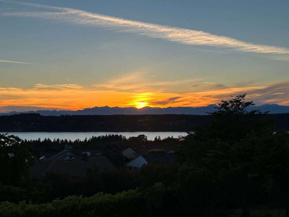
Still a very warm 67F outside and 75F inside. Yuck! Nice sunset though.
 2 points
 -
I had 4.0 in one gauge and 3.8 in the other on the south side of Waterloo. Had a quick 10 minute downpour this evening.2 points
-
Tillamook hit 93, when KPTV forecasted 84!2 points
-
2 points
-
I used to love Vegas when I could drink all day and half the night, wake up the next day and just drink my way past my hangover and do it all again. Father time has stepped in and those days are over.2 points
-
It has been storming for an hour, and there has been lightning for four hours. The real heavy rain, however, has passed just south of Cedar Rapids. A band of 3-4" has fallen down there. Stations near me are showing only an inch or a bit less. The far northeast side of CR has only received a quarter inch. I'm hoping a couple more bands can form back to the west and move through before it moves out.2 points
-
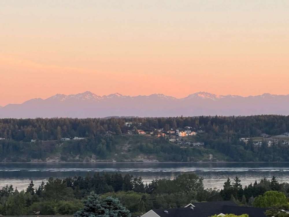
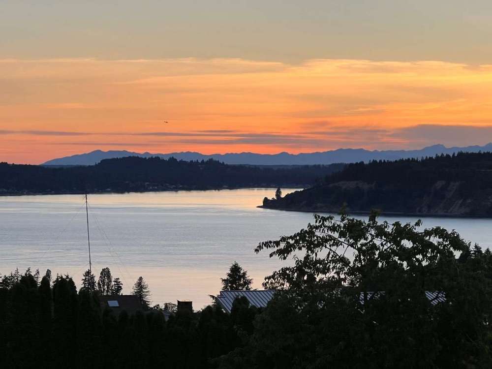
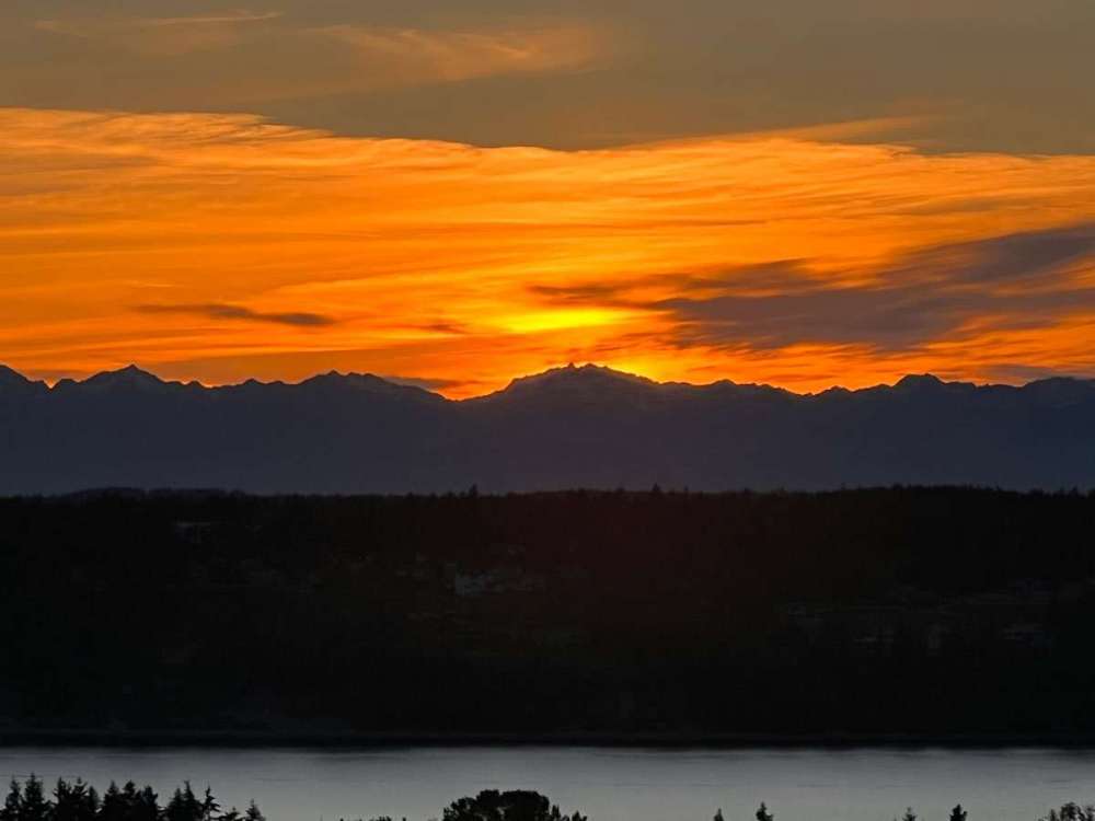
Sunset tonight.

 2 points


.thumb.jpeg.e3014abf99ef08a9f9ac2c0cd31b485b.jpeg)


This leaderboard is set to Vancouver/GMT-07:00