
Leaderboard


Popular Content
Showing content with the highest reputation on 06/30/22 in all areas
-
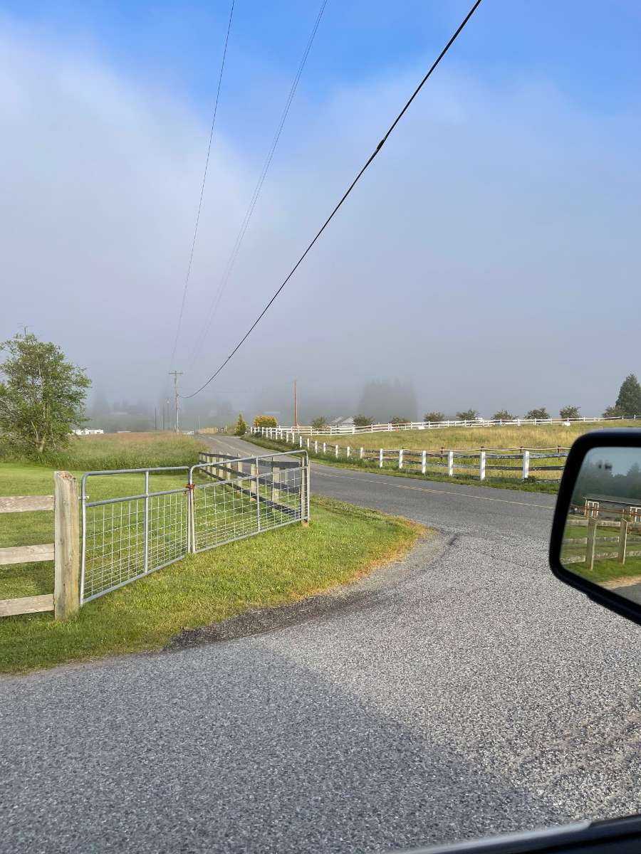
Gorgeous day today! High of 75 and currently 74* Cocktail on the patio !!! Hiked a little bit of Hurricane Ridge yesterday…I was expecting whiteout conditions from the marine layer but got a surprise

 13 points
 -
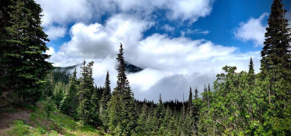
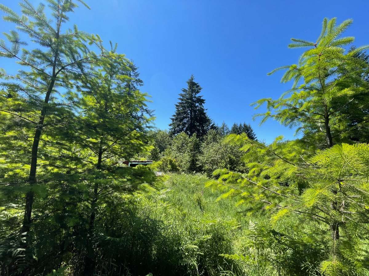
GOD’S COUNTRY
 10 points
 -
Nice day
 9 points
 -
The warming is a blessing. Jesus is firmly in control and knows exactly what is best for us. Embrace it.8 points
-
At this point last year there was already fires going. Gonna be a great day across the region. 65 here.
 8 points
 -
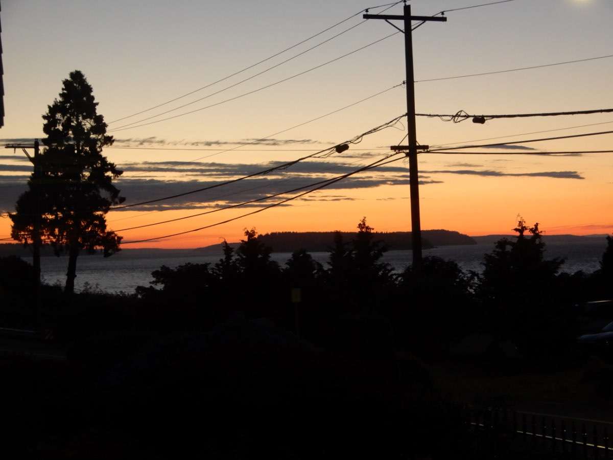
Nice sunset and twilight.

 7 points
 -
Dude what even are those websites? Do some basic insight into where you get your information man. Saying "climate change has been hyped" then citing Al Gore's presidential campaign trail and some really sketchy clickbait hubs is just a bad look and very lazy.6 points
-
Macy caught supper tonight.
 6 points
 -
People in my REAL LIFE are more worried about the failure of the current administration, homelessness, crime, inflation, and runaway fuel costs.6 points
-
6 points
-
I feel so bad for our BC posters who are going to have their 4th of July plans ruined.6 points
-
GFS ensembles look fantastic for goldilocks weather. No sign of significant rain down here, per usual for July. Could be our nicest summer in years while people 200 miles north whine and roll around in the mud because its not 105.6 points
-
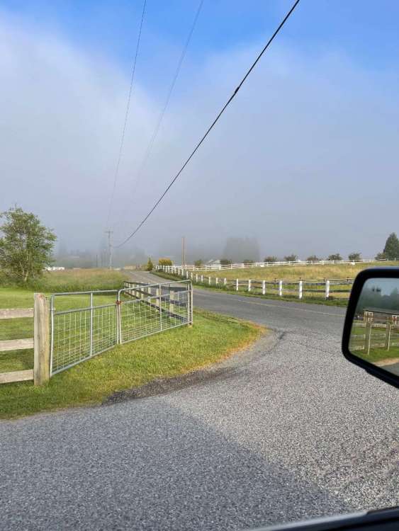
Some sun here this morning...
 6 points
 -
MLK 2019 2020 2021 2022 20235 points
-
Whatever it is, I'm loving it. No incessant torching.5 points
-
And I predict that there will be 65 more Tim posts about it before then.5 points
-
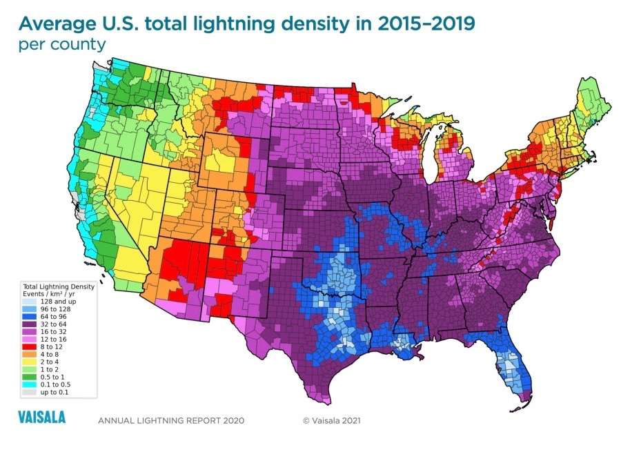
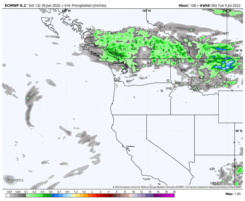
Some interesting extremes so far this year -overall very dry mid January-early April -Chilly late February blast 2/22-2/25 -Major rain event on 2/28 -1 day heat spike on 4/7 -historic lowland snowstorm on 4/11 along with lowland snow as late as 4/14 -very cool and wet April/May -very wet June with a significant AR on 6/9 -dynamic heatwave 6/25-6/28 with a significant crash following TBD-big rain event to start July5 points
-
We just had 3 days in the 90s many places and now people are talking about not having a summer. GIMME a break. Currently 54 after a low of 47. Some thin clouds burning off.5 points
-
looking increasingly convective this weekend5 points
-
Any degree or two of warming humans cause is meaningless in the grand scheme of things. Fewer people die because of climate now than ever before.4 points
-
I bet even Mossman would sacrifice the rest of summer for a 1949/50 repeat.4 points
-
Really bullish on a cold winter in the West given descending westerly QBO and what looks to be a bonafide strong La Niña. Not that it’ll happen, but verbatim this would be the year where, strictly on data, 1949/50 actually is an analog for once. Sucks for the Plains and SW US, though.4 points
-
It is beautiful. Stayton is a nice town, though not as nice as Silverton. But they do have the NF Santiam River and some really nice city parks. Stayton got really hosed for snow in December 2008. I know on the 20th, Silverton had about 4-5" of snow and Stayton had nothing, as the snow line hung up along the Waldo Hills south of Silverton. Stayton did well in February 2011 though, and was about the northern edge of the decent accumulations in December 2013.4 points
-
I'm not celebrating the 4th again anyway until we are living in a theocratic Christian nation.4 points
-
They say the definition of insanity is doing the same thing over again and expecting a different result. This is the 3rd time I’ve predicted a prolonged warmup this spring/summer and each time it’s ended up being a few days then back to cool. Clearly something is different this year. The same intraseasonal cycles in the tropics that have roasted the PNW since 2013 have not done so in 2022.4 points
-
That’s not the PNW…4 points
-
The summer without a summer. Go away Mr. Marine Layer!!
 4 points
 -
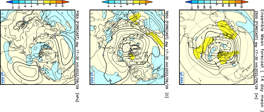
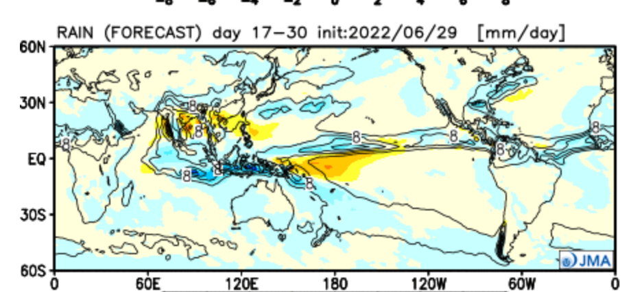
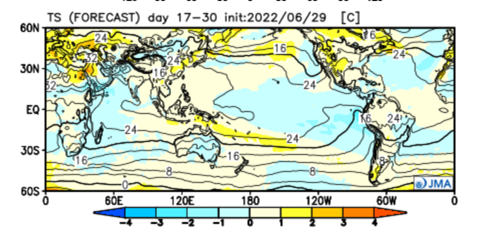
@Phil, your gonna like what the JMA weeklies are showing and lines up with everything I'm seeing in the LR and clues that have suggested for a major mid-month trough later next month. This has some legs...I gotta good feeling we'll see the Euro Weeklies also trend this way. Week 3-4... Precip/Temp...while not as HOT for the Lone Star state down south, I really feel that @Andie @OKwx2k4 @Iceresistancewill be seeing a break from the intense Heat by mid July, esp later in the month.
 4 points
 -
Yikes, that grass looks parched! I'm encouraged from what I'm seeing that IA will do good right around the 4th-7th period as there could very well be multiple MCS's or training storms that develop along a frontal boundary draped over the MW. Both the 0z UKIE/EURO are suggesting a very similar pattern...
 4 points
 -
Just saying... But that site's biggest funders are Scaife and Exxon. It's nice to see how civil everyone is about this discussion.3 points
-
It is true there’s natural cycles to things…and I don’t want to get too deep into it but there’s human caused global warming which is not part of the natural cycle…which is the problem that we ought to figure out and change. I’m not on the AOC train there’s definitely some climate alarmists that are over dramatizing things but there is a real problem.3 points
-
Yes the world warming up and climate change is just a figment of our imagination because Al gore and a couple people over exaggerated how rapidly it would happen. It definitely is a real thing and a few decades from now it probably won’t be a joke…the fact it’s even a debate is absolutely comical.3 points
-
Gorgeous out. Absolutely splendid. My preferences have RANGE and are FLUID3 points
-
I would posit that if it rains on the 4th, most people in "real life" will wake up on the 5th and start their days without giving a second thought to it. Quickly suppressing the unimaginable trauma and anguish from the day before.3 points
-
That must be South Tacoma, based on the vegetation.3 points
-
Curious what Tim's thoughts are on this issue.3 points
-
But apparently cool summer haven Kennnewick is? Kinda goofy.3 points
-
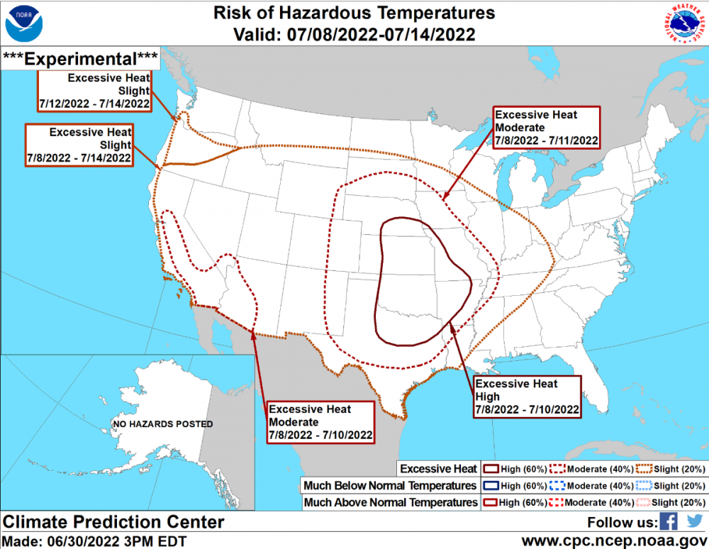
OR and SW WA aren't safe according to NWS's hazardous temps map
 3 points
 -
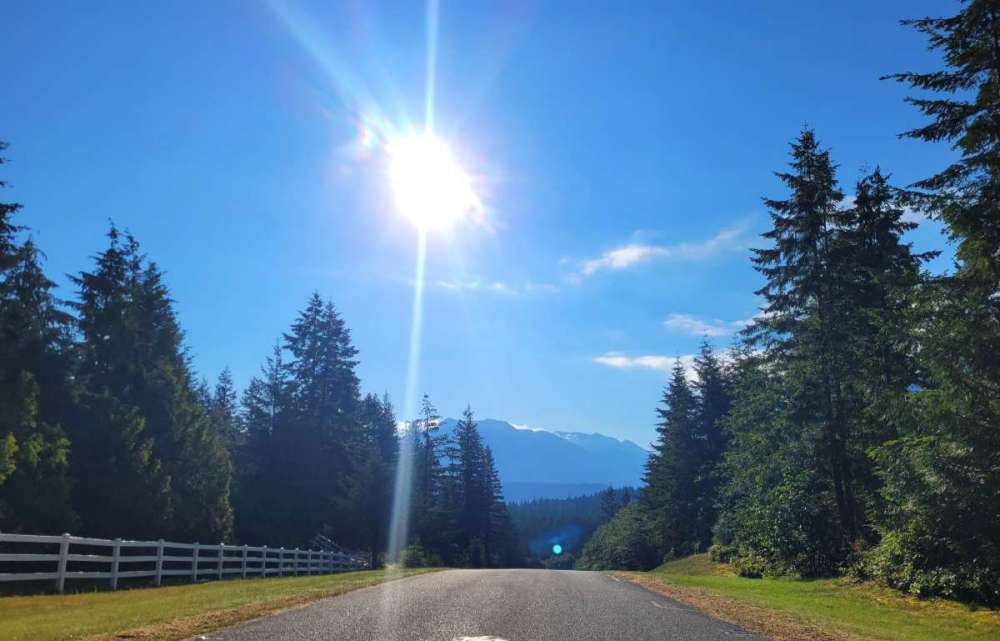
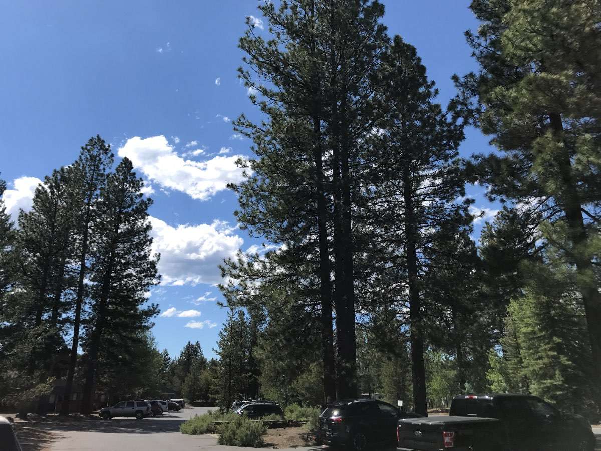
75 degrees and sunny. We got to share in some of that perfect western Oregon summer weather today.3 points
-
Ur just getting started, friend.
 3 points
 -
I did! Though I'll also enjoy a rainy and chilly one. Kind of a letdown for outdoor activities like fireworks, but when you're hanging out with good friends and other important people in your life, it fails to matter much.3 points
-
Good lord.3 points
-
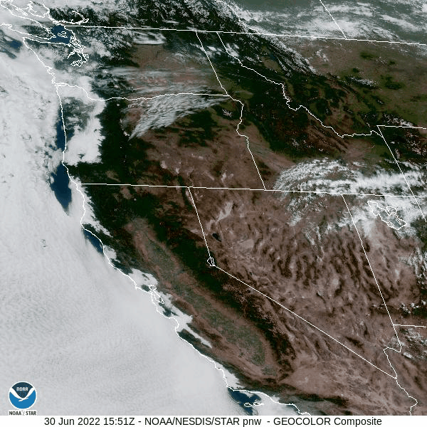
Well on a positive note could be a pretty quiet fire season in BC. California could be a problem later in the summer but fire season at the very least is getting delayed in our region even more with decent rain in the WA/OR cascades and some decent precip in central Oregon which still really needs it.
 3 points
 -
Monday from 2-5 p.m. Of course its perfect in western Oregon!
 3 points
 -
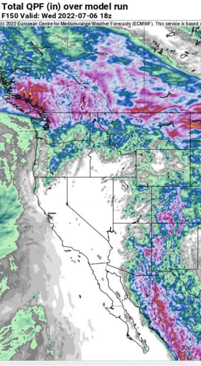
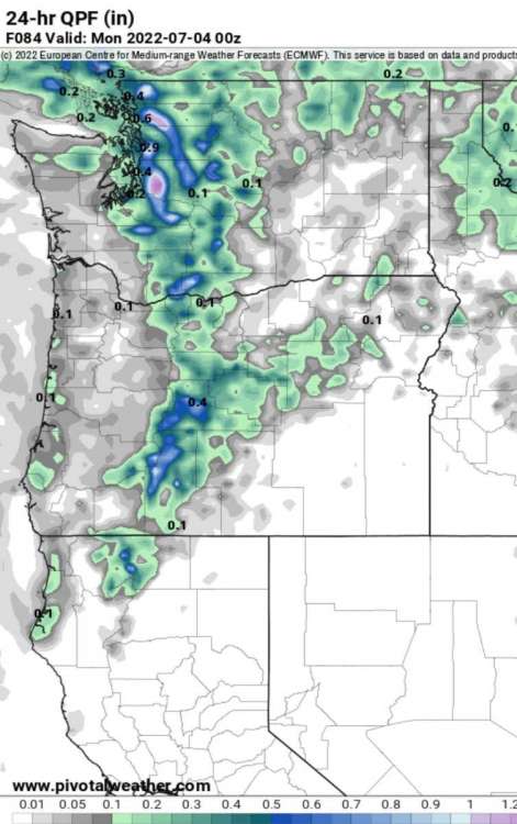
24 hour totals for sunday
 3 points
 -
And to think Phil said this was going to be the ridgier half of the month!!3 points
-
Neither is Oregon.3 points
-
The Euro and GFS in good agreement on the placement of thunderstorms in the middle of the country over the 4th of July weekend. For me I'm right on the edge between a whole lot and not much.3 points
-
My 3yr old picked this story for bedtime reading!
 3 points
 -
Super Computers to upgrade the GFS this fall. Great read today on Terry Swails blog. Tuesday, NOAA inaugurated the nation’s newest weather and climate supercomputers with an operational run of the National Blend of Models. The new supercomputers provide a significant upgrade to computing capacity, storage space and interconnect speed of the nation’s Weather and Climate Operational Supercomputing System. “This is a big day for NOAA and the state of weather forecasting,” said Ken Graham, director of NOAA’s National Weather Service. “Researchers are developing new ensemble-based forecast models at record speed, and now we have the computing power needed to implement many of these substantial advancements to improve weather and climate prediction.” Enhanced computing and storage capacity will allow NOAA to deploy higher-resolution models to better capture small-scale features like severe thunderstorms, more realistic model physics to better capture the formation of clouds and precipitation, and a larger number of individual model simulations to better quantify model certainty. The end result is even better forecasts and warnings to support public safety and the national economy. The new supercomputers will enable an upgrade to the U.S. Global Forecast System (GFS) this fall and the launch of a new hurricane forecast model called the Hurricane Analysis and Forecast System (HAFS), slated to be in operation for the 2023 hurricane season pending tests and evaluation.3 points


This leaderboard is set to Vancouver/GMT-07:00