
Leaderboard


Popular Content
Showing content with the highest reputation on 08/21/22 in all areas
-
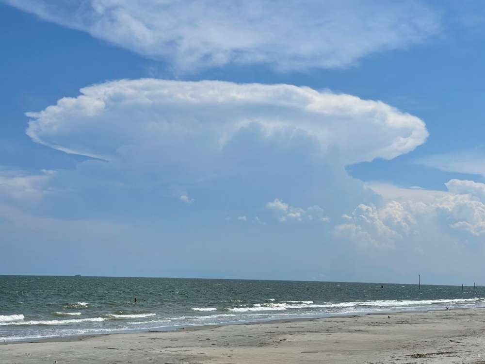
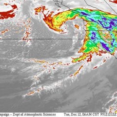
No joke… category 5
 11 points
 -
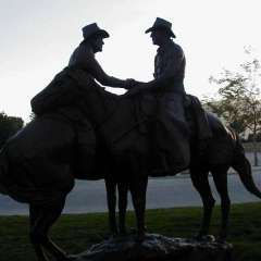
First tease of the season!
 9 points
 -
WILDFIRE UPDATE NEW Known Wildfires started today! 8/21/22 Washington - 9 (9 new fires today. Lightning went to town on the Blue Mountains in the SE corner of the state, east of Walla Walla. Crews have been dispatched to the fires. There are four large fires in the state. The total increases from 36 to 44.) Total: 44 Oregon - 11 (11 new fires in the state. We have increased from three large fires to now four. Welcome the Hat Top Fire in remote eastern Oregon, nearest to Vale. A new fire is burning close to populated places between Klamath Falls and Altamount. No crews at the time of posting have responded yet but they likely will soon. The total number of fires increases from 29 to 36.) Total: 36 Idaho - 12 (More fires sparked by lightning have been found on top of the 19 from yesterday. Today there was 12 new fires. There are three large fires in the state. Idaho is seeing spectacular growth of fires this week after a very quiet year prior. The total number of fires grows from 43 to 51.) Total: 51 California - 25 (25 new fires in the state of California. Monsoon season has blessed California with a real lack of fires this year. The total increases from 56 to 61.) Total: 61 British Columbia - 83 (83 new fires in the province. Lightning sparked fires are increasing in size around Revelstoke. As documented yesterday, there has been a massive cluster of fires around the city, blocking it from all sides. Crews have taken out fires close to the main highway, with the remaining fires being in more rugged locations. There are 28 separate fires surrounding Revelstoke. The total amount of fires continues to increase from 170 to 199.) Total: 170 Who Has had The Most Amount of Fires (Ranked by days in which they've had the most fires, only counting days we've kept track here.) 1. British Columbia - 27 days with the most wildfires 2. Oregon - 2 days with the most wildfires. SMOKE UPDATE Western Washington is clear with no smoke. Smoke has blown east for the entirety of Eastern Washington except for the Wenatchee Valley and Okanogan Valley. Wenatchee is dealing with smoke from nearby fires, and the Okanogan is dealing with BC wildfire smoke. Smoke has snuck past the Cascade crest from fires in the Cascade's between Eugene and Bend. Southern portions of the Willamette Valley, specifically Eugene are seeing some smoke and moderate air conditions. Bend is also seeing moderate conditions to the south of the city. Medford and Klamath Falls are having a break today thanks to smoke having blown eastward. Boise is smoke free today, but locations from Lewiston northward are under some smoke from British Columbia and California. This smoke is mostly trapped against the mountain ranges. It is much less than yesterday as winds are carrying the smoke east. Sandpoint and locations closest to the BC border may see more smoke as BC wildfire smoke is pouring southeast into the region. Salmon is also isolated in it's valley with smoke. Western Montana is under heavy to moderate smoke with lower air quality conditions. After Helena, air is clean throughout the eastern half of the state. Wind has blow most of Northern California's smoke away and it is now clustered around the Trinity National Forest area. Eureka is in the clear, but head inland into the mountains and conditions become smokey and hazardous. Smoke is aloft over Redding, but not low down to the ground. The northern end of the LA metro against the San Gabriel Mountains is seeing moderate air quality today, but coastal locations, and Inglewood south are all clear, all the way to San Diego. Air quality in Lower Mainland is clear. Locations near fires are seeing moderate to unhealthy conditions especially in deep valleys. Smoke aloft is also flowing into the Prairie Provinces and into Eastern Washington, Idaho's Panhandle, and Montana.8 points
-
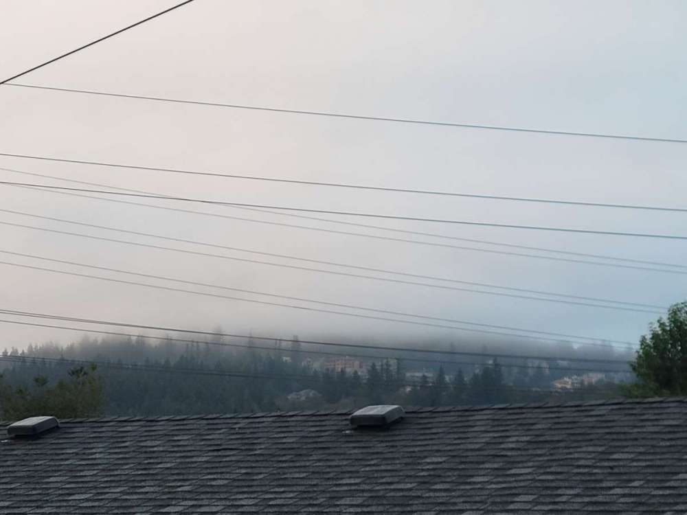
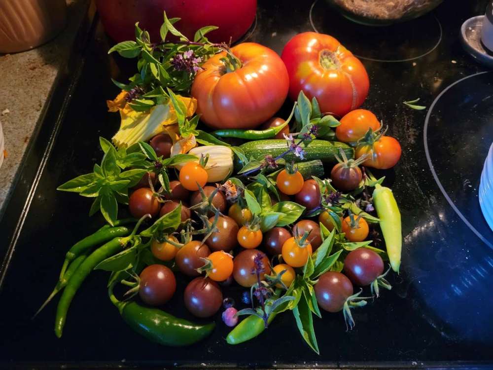
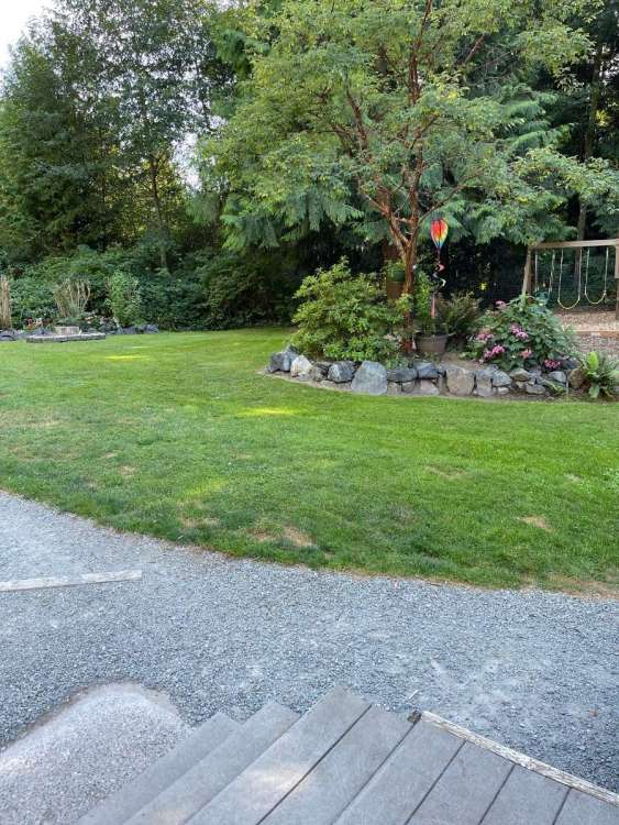
Nice weather this morning, the clouds are on top of Mt.Scot and the tomatoes are getting picked. I did come home to the garden hose running which meant it had been running for over 10hrs.
 8 points
 -
Dec 2008 KGEG. Brrr and snowy, last column is snow depth how about that 5/-18 on 12/20/08 12 straight days below 30. 2008-12-14 10 3 6.5 -22.3 58 0 T T 2 2008-12-15 13 0 6.5 -22.2 58 0 0.00 0.0 2 2008-12-16 8 -5 1.5 -27.1 63 0 0.00 0.0 2 2008-12-17 17 3 10.0 -18.4 55 0 0.74 12.5 2 2008-12-18 20 14 17.0 -11.3 48 0 0.61 11.1 16 2008-12-19 15 3 9.0 -19.2 56 0 0.06 1.4 18 2008-12-20 5 -18 -6.5 -34.7 71 0 T 0.2 17 2008-12-21 15 4 9.5 -18.6 55 0 0.24 5.1 16 2008-12-22 16 -2 7.0 -21.0 58 0 0.27 3.8 18 2008-12-23 12 -4 4.0 -24.0 61 0 T 1.6 18 2008-12-24 29 11 20.0 -8.0 45 0 0.29 6.1 18 2008-12-25 29 11 20.0 -8.0 45 0 0.03 1.2 20 2008-12-26 26 9 17.5 -10.4 47 0 0.09 1.4 186 points
-
In Jan 1957 EUG had a 7 day stretch with low temps of... 23F 14F 6F -4F 5F 2F 5F All of this with like 7"+ of snow on the ground.6 points
-
This behemoth is spitting out lightning like it’s the apocalypse.
 6 points
 -
The the other hand we are eating zucchini for breakfast lunch and dinner...
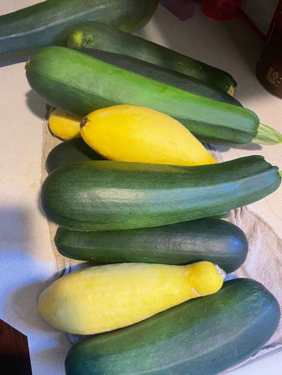 6 points
 -
January 1957 Sum 663 267 - - 1544 0 1.34 20.8 - Average 21.4 8.6 15.0 -14.6 - - - - 4.6 Normal 34.5 24.7 29.6 - 1097 0 1.97 12.3 - 1957-01-01 31 26 28.5 0.3 36 0 0.02 0.4 0 1957-01-02 32 26 29.0 0.8 36 0 0.02 0.5 T 1957-01-03 32 27 29.5 1.2 35 0 0.01 0.1 1 1957-01-04 29 25 27.0 -1.4 38 0 T T T 1957-01-05 28 23 25.5 -3.0 39 0 T T T 1957-01-06 31 20 25.5 -3.1 39 0 T T T 1957-01-07 35 29 32.0 3.3 33 0 T 0.1 T 1957-01-08 31 23 27.0 -1.8 38 0 0.07 1.2 T 1957-01-09 32 22 27.0 -1.9 38 0 T T 1 1957-01-10 31 26 28.5 -0.5 36 0 0.28 2.8 1 1957-01-11 36 30 33.0 3.9 32 0 0.25 2.6 4 1957-01-12 36 22 29.0 -0.2 36 0 T 0.0 5 1957-01-13 27 9 18.0 -11.3 47 0 0.00 0.0 4 1957-01-14 20 10 15.0 -14.4 50 0 0.01 0.1 4 1957-01-15 20 2 11.0 -18.5 54 0 0.02 0.6 4 1957-01-16 14 -3 5.5 -24.1 59 0 0.00 0.0 4 1957-01-17 16 -2 7.0 -22.7 58 0 0.00 0.0 4 1957-01-18 16 -2 7.0 -22.8 58 0 T T 4 1957-01-19 17 -1 8.0 -21.9 57 0 0.25 4.0 4 1957-01-20 18 7 12.5 -17.5 52 0 0.07 0.9 7 1957-01-21 16 0 8.0 -22.1 57 0 0.01 0.1 8 1957-01-22 14 6 10.0 -20.2 55 0 0.09 3.1 8 1957-01-23 14 -1 6.5 -23.8 58 0 0.01 0.4 11 1957-01-24 10 -11 -0.5 -30.9 65 0 0.00 0.0 9 1957-01-25 9 -12 -1.5 -32.0 66 0 0.00 0.0 9 1957-01-26 4 -16 -6.0 -36.6 71 0 0.00 0.0 8 1957-01-27 0 -18 -9.0 -39.7 74 0 0.02 0.4 8 1957-01-28 13 -10 1.5 -29.2 63 0 0.00 0.0 8 1957-01-29 9 -12 -1.5 -32.3 66 0 0.03 0.5 8 1957-01-30 19 7 13.0 -17.9 52 0 0.18 2.9 8 1957-01-31 23 15 19.0 -12.0 46 0 T 0.1 115 points
-
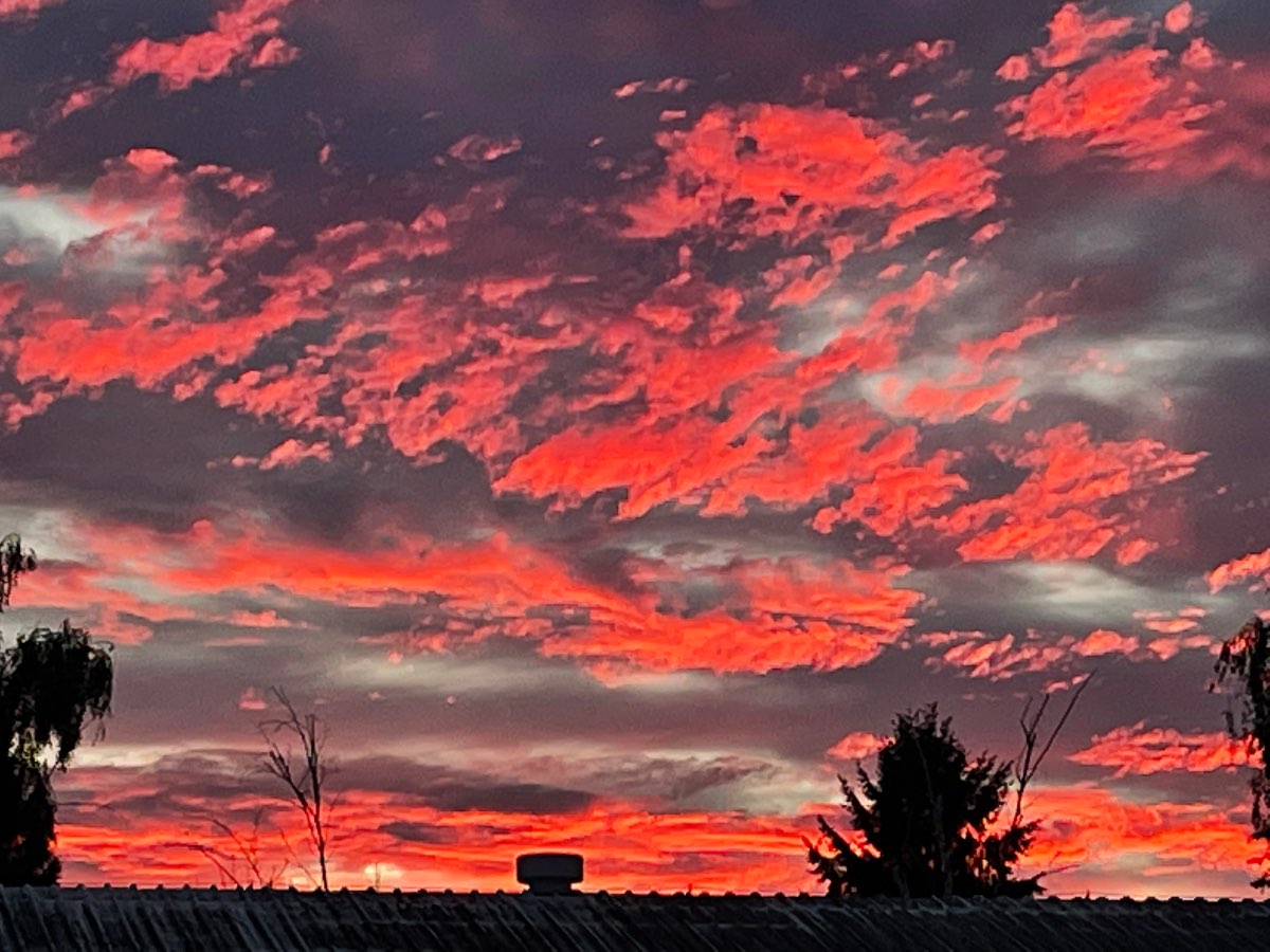
Whoaaa. Sunset alert
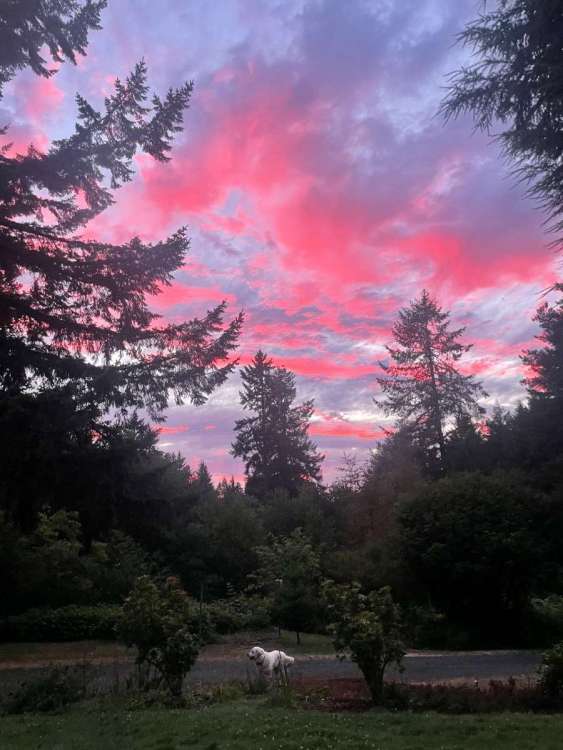 5 points
 -
Gonna be a BIG winter above the fray!5 points
-
Nice drop in dewpoint taking place now!
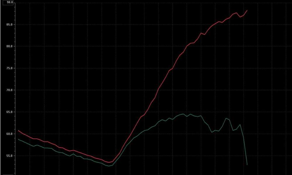 5 points
 -
Pretty benign pattern coming up. Really nothing for anyone to freak out about, although early-onset trough anxiety seems to be setting in.5 points
-
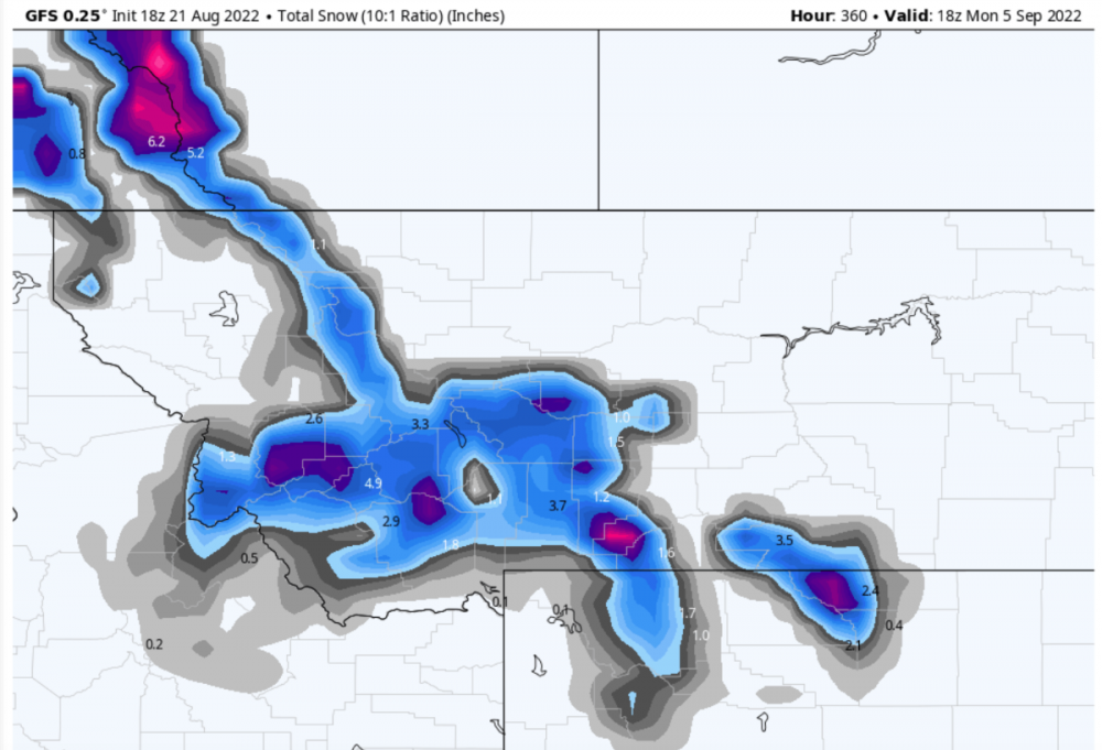
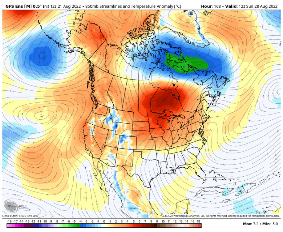
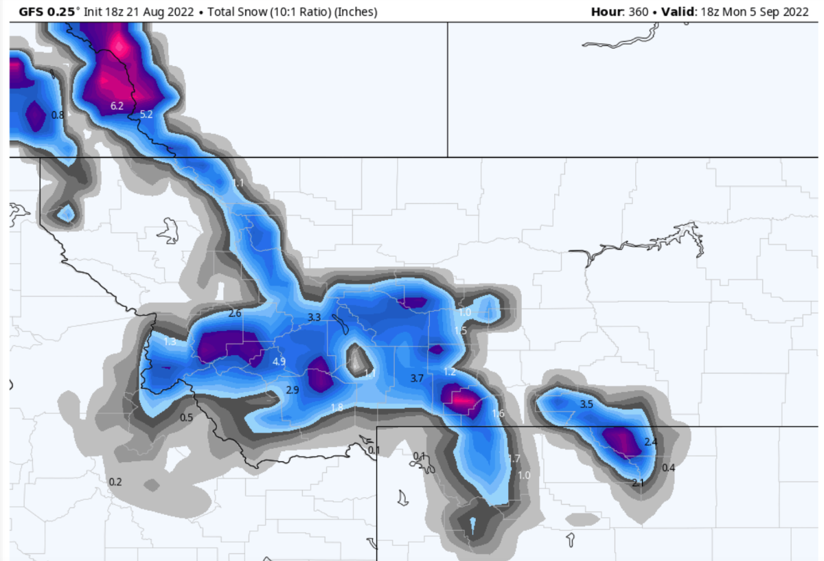
12Z GFS not backing down on the troughing next weekend. Pretty sure that is going to happen now. Probably not much rain... but definitely cool weather.5 points
-
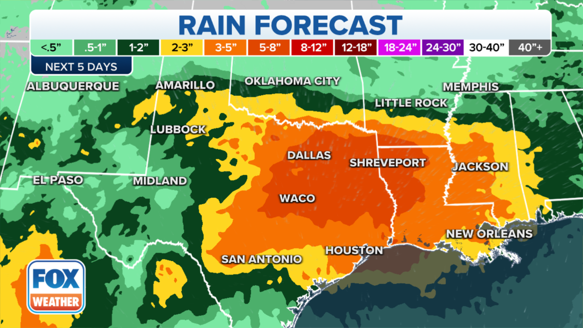
A lot of rain expected over a broad area.
 5 points
 -
I’m seeing constant lighting and rumbles of thunder on the backside of this large storm that just blew up as it tracked into the valley. Kinda wish it was dark outside to see the inter-cloud bolts light up the sky.
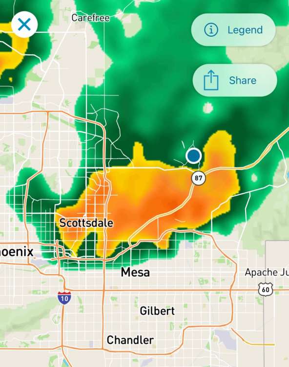 4 points
 -
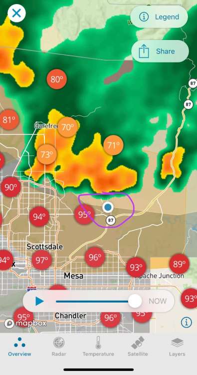
Big Desert Lightning Boomers are fun too! They can knock you outta bed! 8:40 Finally starting. Lots of lightning and thunder. Nice change. 100% chance of rain for 3 days.
 4 points
 -
All time January record low at EUG!4 points
-
We all know about December 2008 but January 1957 was also nice. The last half of the month PDX stayed mostly below freezing. Portland International Airport Temperature History January 1957

 4 points
 -
Very glad to see possible cooling in the models. I'm proud to be a Weenie, I've joined the 8-week club. 8 weeks of warm/hot is enough for me now that I'm past puberty. I don't mind dry but no more 90's please. 74 after a low of 63.4 points
-
Analogs used for Oregon department of agriculture fall forecast are 1956,1971, 2008. 2008 replaces 1975 this month.4 points
-
Just analyzing the 500mb pattern on the models. The divergence seems to come with how exactly the ULL splits away from the GOA trough later this week. Runs that do a complete cutoff well to the west give room for the low amp high along the coast and the high amplitude upstream high to merge into one complex around 150N, puts a trough over us. Runs that fail to split the ULL all the way drag the whole GOA trough to the SW, which pumps the 4CH back into the PNW and leaves the high amplitude high sitting up over western Alaska.4 points
-
Also you every time it’s right3 points
-
3 points
-
Gonna be a monster winter for all of us.3 points
-
Just got my first legit taste of a strong monsoon storm! IMG_2146.MOV IMG_2148.MOV IMG_2150.MOV
 3 points
 -
Yeah and as great as it was at EUG it was just as good at PDX! Great month. One of the all time January BLASTS!3 points
-
And that’s another 90F burger!!
 3 points
 -
Only 91 in othello. That’s a win.3 points
-
I drop acid for that.3 points
-
weather related anxiety is how i deal with real life anxiety3 points
-
The Monsoon produced some wild wx near Moab, UT yesterday....rivers flowing through the town center... https://www.fox13now.com/news/local-news/moab-streets-power-lines-trees-damaged-after-flooding3 points
-
Looks like my area had two of the heaver rain showers yesterday. The first one around 4PM had very heavy rain, wind and some thunder. The 2nd one around 9PM had heavy rain (not as heavy as the 1st one) and some thunder as well. A total of 1.36" of rain fell here in MBY. The official H/L at Grand Rapids yesterday was 79/63 with a official rain fall amount of just 0.35" there was just 5% of reported sunshine the top wind speed was a reported 41 MPH. The overnight low here in MBY was 62 with a low of 63 at GRR. At the current time there is some fog here with a temp of 64. For today the record high of 97 was set in 1916 and again in 1955. The record low of 44 was set in 1956.3 points
-
3 points
-
Canadian is just a tad different...highs barely get over 70 by day 10.2 points
-
Quite the roller coaster on the GFS... from 90s on Thursday to 60s on Friday and 70s over the weekend and then back to 90s by the middle of next week.2 points
-
Next best chance to get 12th 90F day this Thursday. GFS may be a bit on the warm side as usual. We'll see where the Euro leads us later tonight.
 2 points
 -
That’s how I deal with my weather related anxiety! edit: this is also the nicest thing anyones every said to me2 points
-
give me that 08-09 again. 97" of snow in Spokane, snowiest on record2 points
-
Portland saw 12 subfreezing highs in a row!2 points
-
Full sun and no HCS here. 79/60 on the day. Currently 75 degrees. I mowed again.
 2 points
 -
I’ll be very specific: I “disagreed” that the “mean was leaning towards warmer” since that implies its its own model and not just showing the average of the two distinct paths. Since OP was in the bottom path of course mean will show warmer than it. K I’m done2 points
-
12Z GEFS is actually warmer for next weekend compared to its 00Z run and much warmer than the 12Z operational. Does not show much of a cool down... 850mb temps stay warmer than normal.
 2 points
 -
Fall begins in 10 days according to arithmetic.2 points
-
T minus 5 days until the stratospheric PV develops. #ItsComing For whatever reason, this is often when the first changes in seasonal dynamics/wavelengths become evident.2 points
-
Perfectly stated.2 points
-
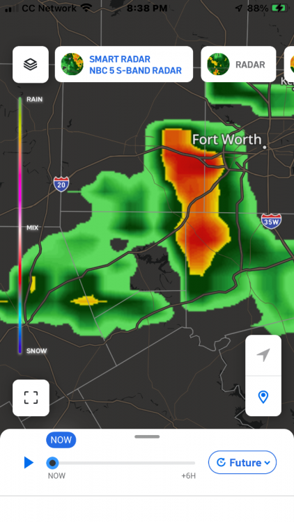
An unusually wet weather pattern for late August will set up over North Texas by late in the weekend. Numerous showers and thunderstorms are likely beginning Sunday and continuing through Tuesday. Heavy rain is likely and flooding could become an issue, as 3 to 4 inches of rain is likely across much of North Texas. Some locales could receive even more than that. A Flood Watch will begin for much of North Texas Sunday morning. Be aware of the possibility of flooding and stay up to date with the latest forecast. NBC/DFW woohoo2 points


This leaderboard is set to Vancouver/GMT-07:00