
Leaderboard


Popular Content
Showing content with the highest reputation on 09/17/22 in all areas
-
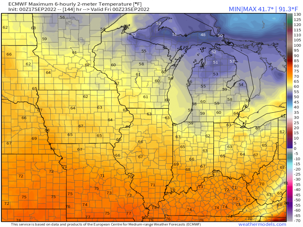
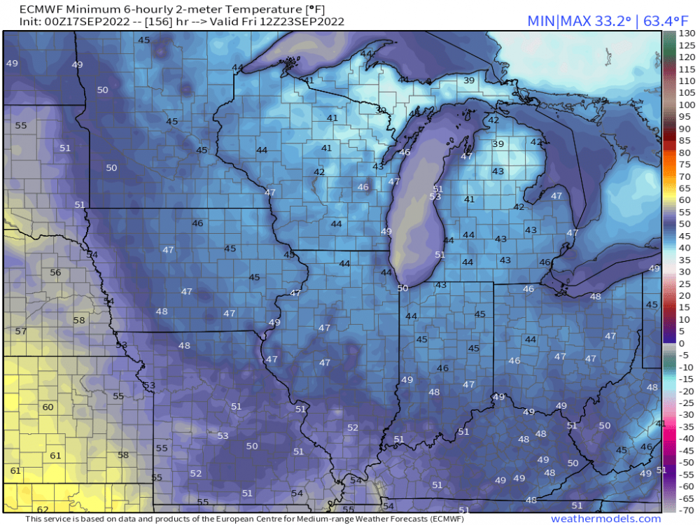
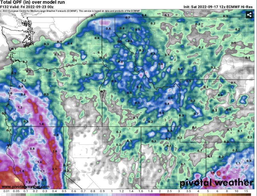
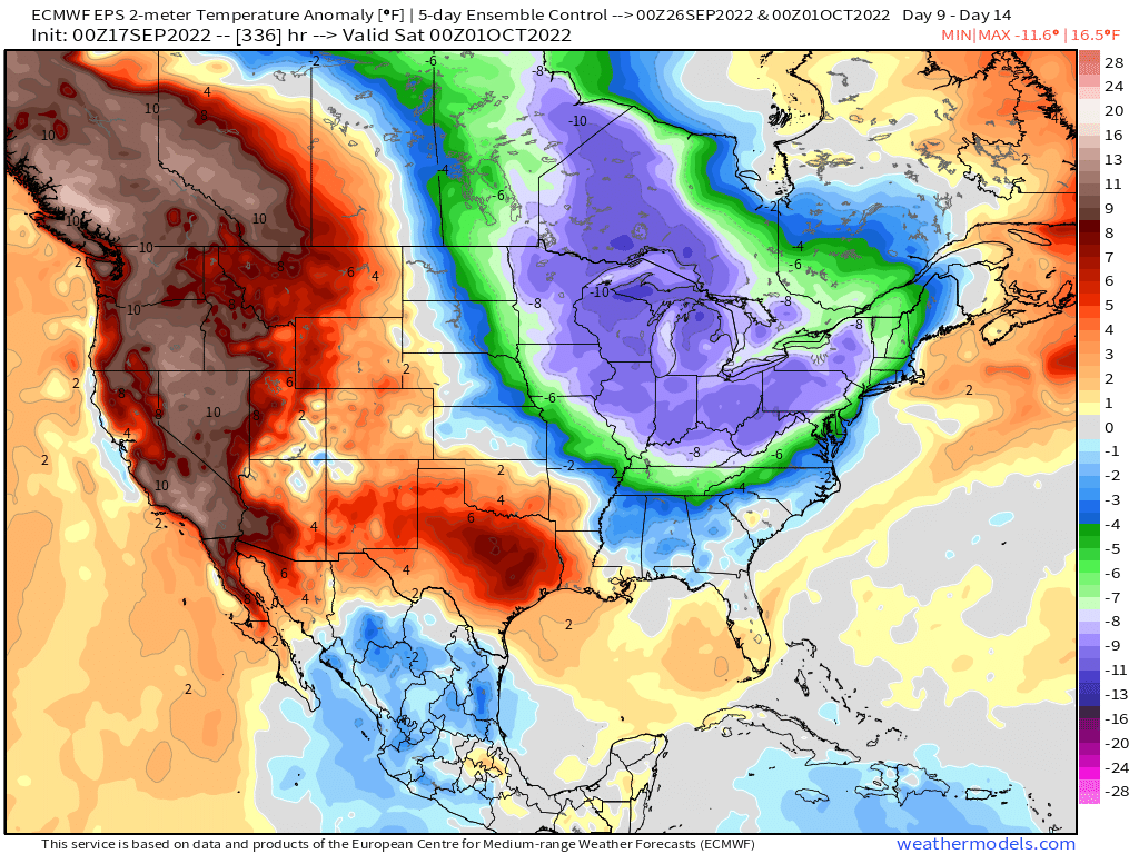
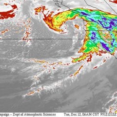
Now this is getting interesting....if the blocking up north locks and crashes a second major trough late month, this could very well usher in Frost/Freezes for our Northern members....0z Euro Control suggesting some wee bit chilly temps. 0z EPS showcasing widespread cool to rule post 21st.... For the model to "see" hints of snow into the panhandle of NE into Upper MW this far out, it must have some chilly members in the ensemble. Meanwhile, our friends up north in Canada start to fill up with Snow....

 5 points
 -
The ridging this week and early next is less and less impressive.4 points
-
‘Tis the season!!4 points
-
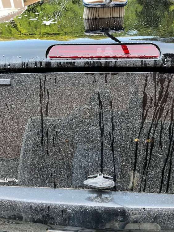
Always a sure sign that September is nearing the end when it’s time to wash the ash off the truck.
 4 points
 -
I believe this to be the front that ends summer, check out the 24hr temp change.4 points
-
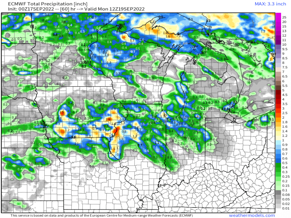
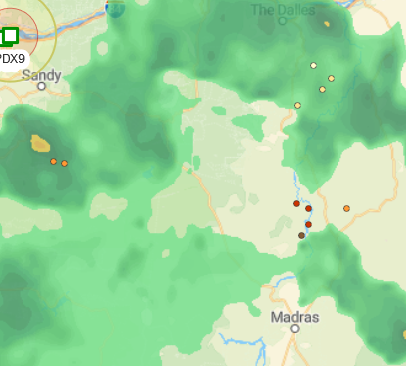
.20 so far today (since 5pm) and still raining. Not bad. Thought we’d get around .05. Glad it overachieved. Should put a huge dent in the fires one would think.3 points
-
Southern Iowa has had quite the day. Not many like this for past 10 months. Round after Round of thunder. I only have .37 but more still on the way. In lucas county near chariton i have game camera. And it literally hailed over 15 minutes! Heres the video. 72dda95b-611b-45cc-92e8-afa3fb064358.mp4 72dda95b-611b-45cc-92e8-afa3fb064358.mp4 72dda95b-611b-45cc-92e8-afa3fb064358.mp4 72dda95b-611b-45cc-92e8-afa3fb064358.mp43 points
-
Very warm and windy today as my high temperature toped out at 93. Record heat with temps in the mid to upper 90s possible starting tomorrow through Tuesday or Wednesday depending on the timing of the cold front. Things are also getting very dry here as precip the last 30 days is well below normal.3 points
-
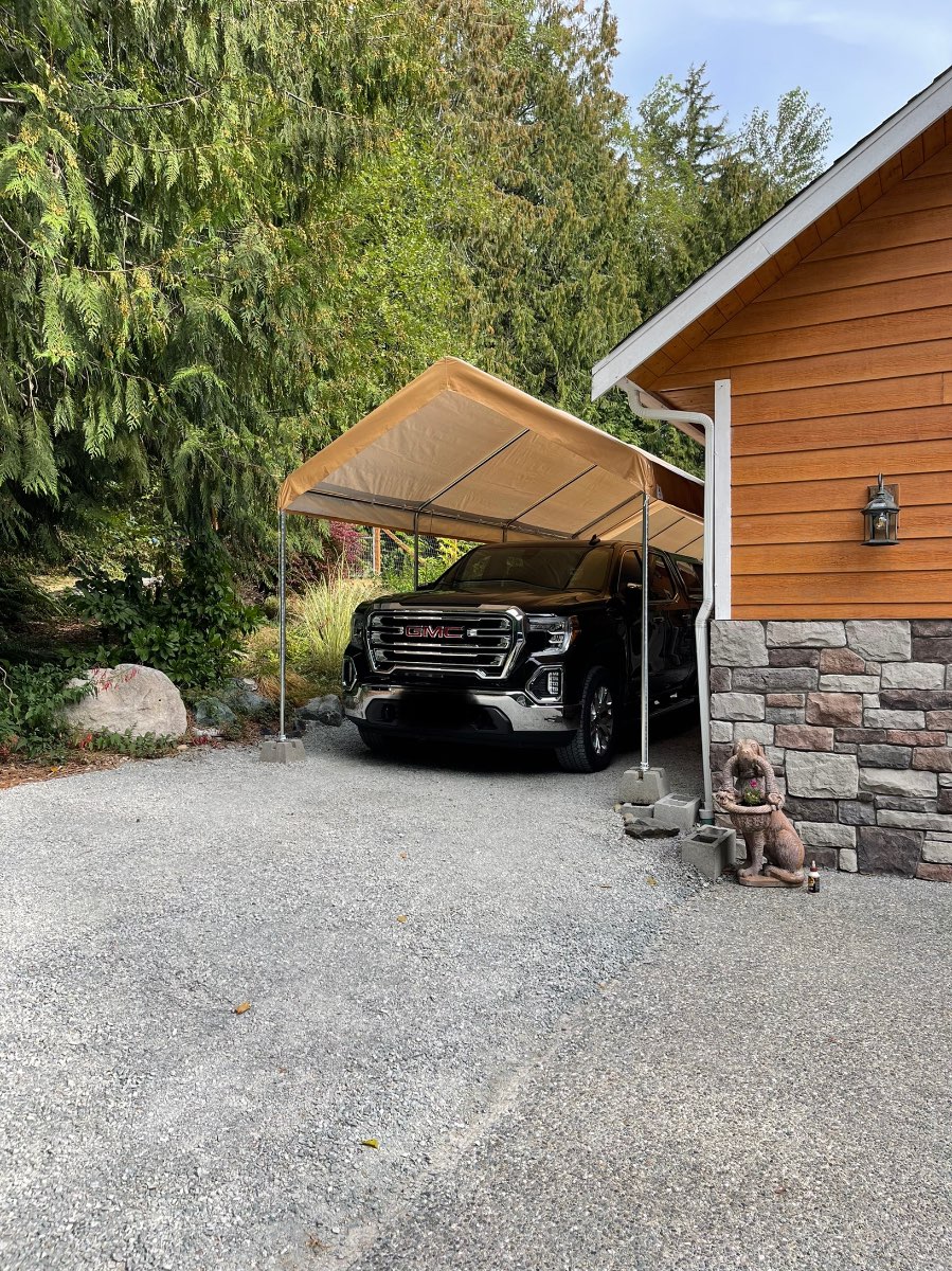
Fall project #3 is done! New and slightly improved carport is up!
 3 points
 -
The same thing happened one year where it snowed a bunch the following winter.3 points
-
1.13" of rain last night.....upper 70's early this week. 54 for a high Thurs. time to get fall prep in high gear. outta bed today so its a start3 points
-
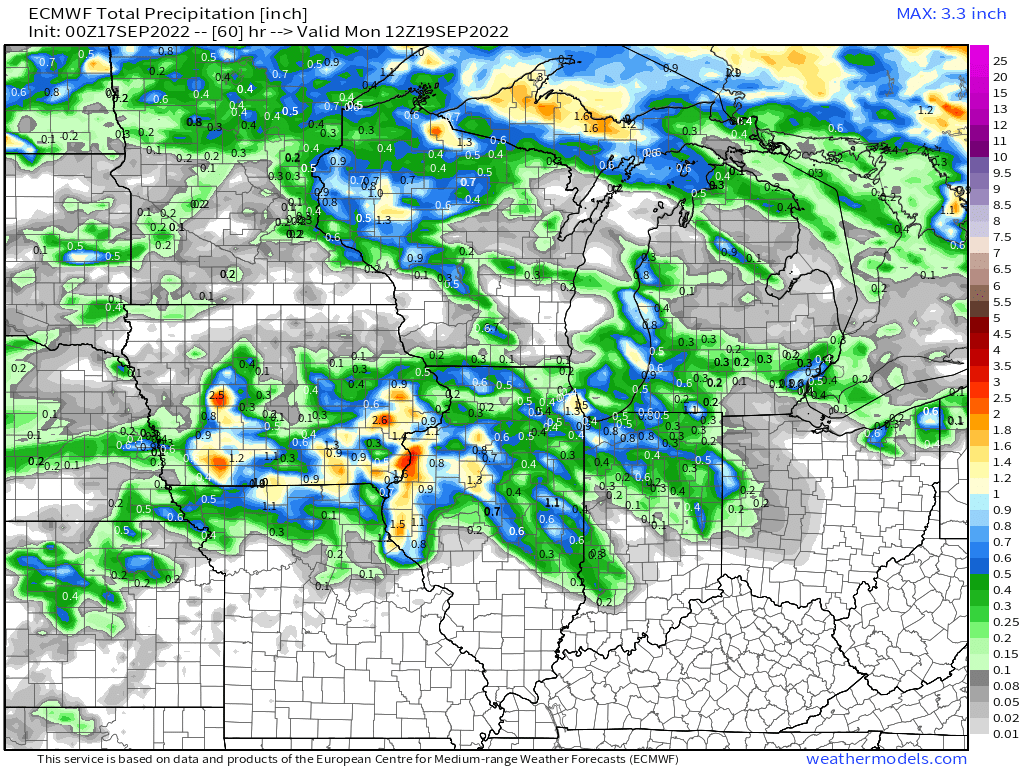
Models have converged on a nice rain for S.Iowa, looks like 1 inch plus amounts. Here's the WPCs forecast.3 points
-
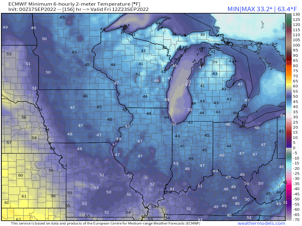
Woah, the 0z Euro crashes a major trough near the GL's next weekend...daytime highs in the low/mid 60's for next THU and 50's! Nighttime lows in the 30's for some??? IA peeps still looking good in terms of storms chances... @OttumwaSnomow @Hawkeye
 3 points
 -
The thought just came to me about the LRC and how the current Bearing Sea Storm could potentially correlate to the opening week of OCT. Using the Bearing Sea Rule (BSR) as guidance, if we extrapolate 17-21 days it would line up with Oct 3rd-7th and that is usually the 1st days of the new LRC cycle in the mid latitudes. Wouldn't that be a wild way to open up the month of OCT? My 1st guess at this range would be a hard cutter up into the Upper MW/GL's region given the track this storm is taking up into the Bearing Sea, however, IF there is sufficient high lat blocking it could very well target the central Plains. This storm certainly has caught my attn now that we are getting closer to OCT and knowing that the new LRC pattern typically sets up earlier in the higher latitudes. It has all the traits of being a colder storm with a wintry side to it. I'm sure this will benefit the Rockies with a major snowstorm.
 3 points
 -
Down to 49F. Pleasant and chilly.3 points
-
Bit of a tinge of crispness to the air tonight. Fall is nearing and I feel like this active weather season is going to surprise people in a really positive way.3 points
-
New GFS looks flatter with ridging.2 points
-
Gardner MT is the place to be per these prognostication2 points
-
Surprise thunderstorms in the Metro area??2 points
-
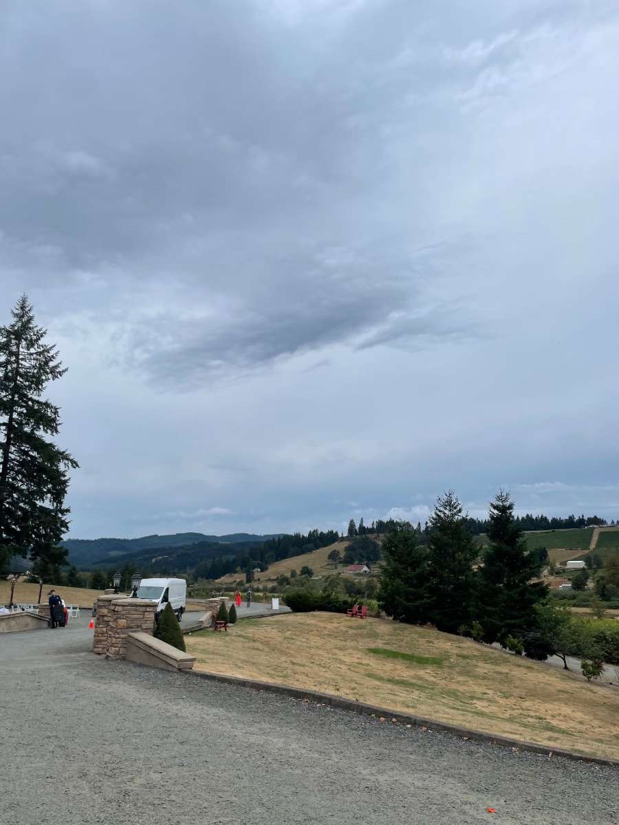
Beautiful evening south of Eugene.
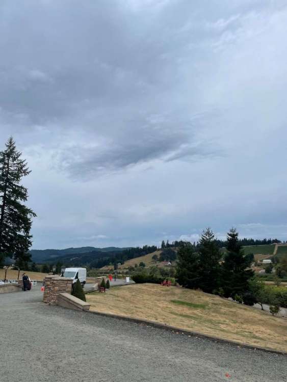
 2 points
 -
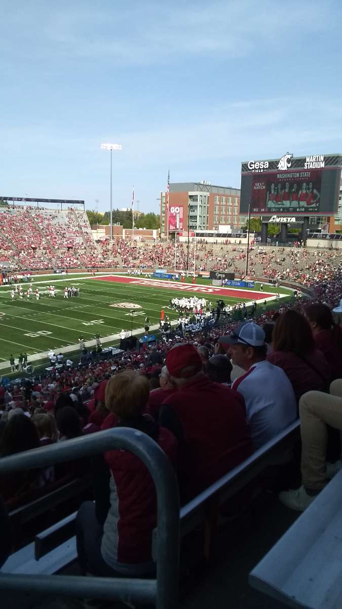
Huskies might be for real this year!2 points
-
Nice GFS run2 points
-
73F and sunny here in Pullman. Mostly sunny with very light clouds. WSU (Euro) making CSU look like the GFS but that's a story for a non weather thread.
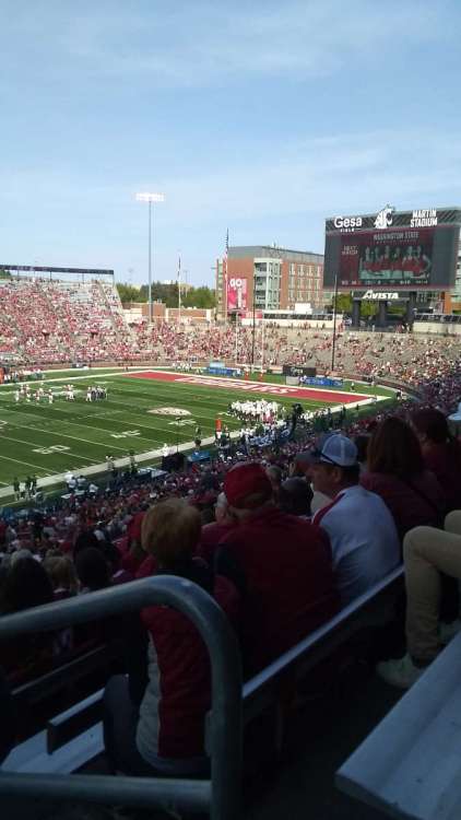 2 points
 -
We drove to Bellingham a couple hours ago and it was very obvious between Woodinville and Marysville. I was surprised that it came back so fast.2 points
-
Might end the fire season for the southern OR cascades and SW Oregon.2 points
-
Nice euro run…sneaks some rainfall up into the south sound too. Gfs doesn’t agree cmc shows rain later in the run not associated with that system down in California
 2 points
 -
2 points
-
Just got done mowing. Not liking the 65 dew with no wind. Big relief coming Wednesday on forward.2 points
-
2 points
-
54 already. Hot dang Bobby!!!
 2 points
 -
And the February snowstorms were really nice as well down here. On 2/6/2014 we had a temp of 18f at 6pm with probably 40mph+ gusts and blowing snow. 7S1A5067_2.mp42 points
-
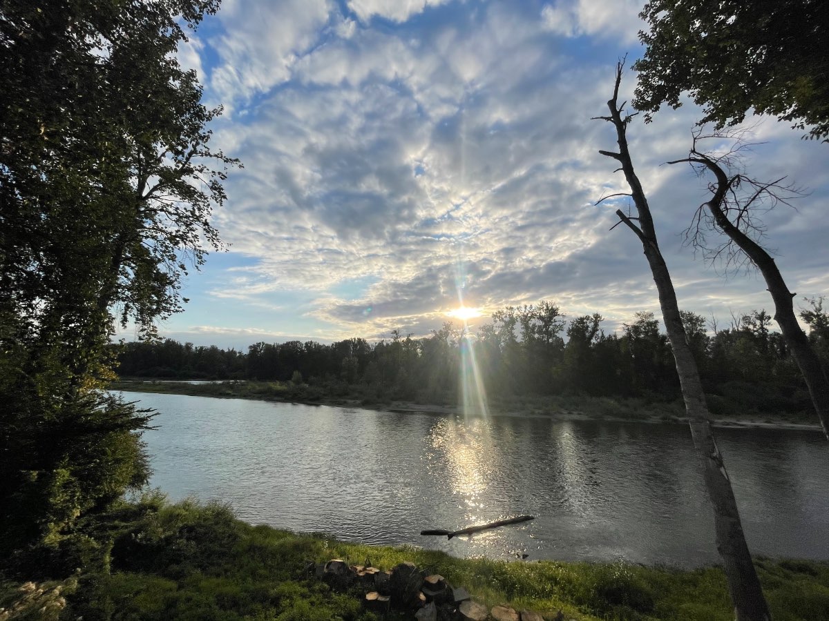
Best run of the fall. Pleasant evening about 15 miles SW of Eugenio.1 point
-
dipshiit kids next door were throwing rocks at my house earlier, so its definitely coming1 point
-
There is some, the map is backwards that the white is new and reds are older.
 1 point
 -
63/52 over here. That autumn chill definitely in the air and I'm having my second cozy mug of coffee.1 point
-
www.koin.com/news/wildfires/cedar-creek-fire-now-over-110k-acres-still-0-contained/1 point
-
Super typhoon Nanmadol is expected to sweep Japan’s length at 150 mph https://www.foxweather.com/weather-news/super-typhoon-nanmadol
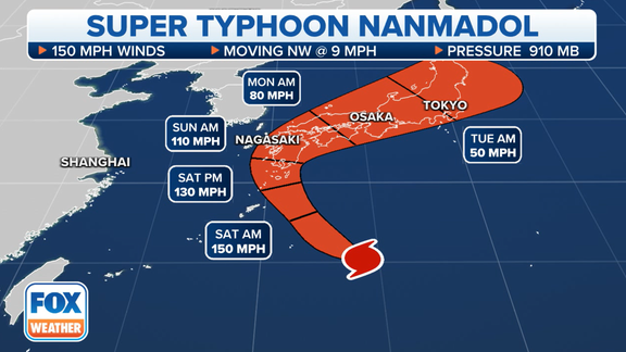 1 point
 -
We're coming close to the day when the shadow of the tip of a sundial will follow a straight line throughout the day. Other times of the year lt makes half a hyperbola.1 point
-
Skagit river flood correlation seems much stronger.1 point
-
Yeah....September doesn't have much of a correlation. As people have discussed on here before it almost appears precip anomalies in the autumn may actually be a better forecasting tool for the character of the coming winter than temperature.1 point
-
Already down to 49! ️1 point
-
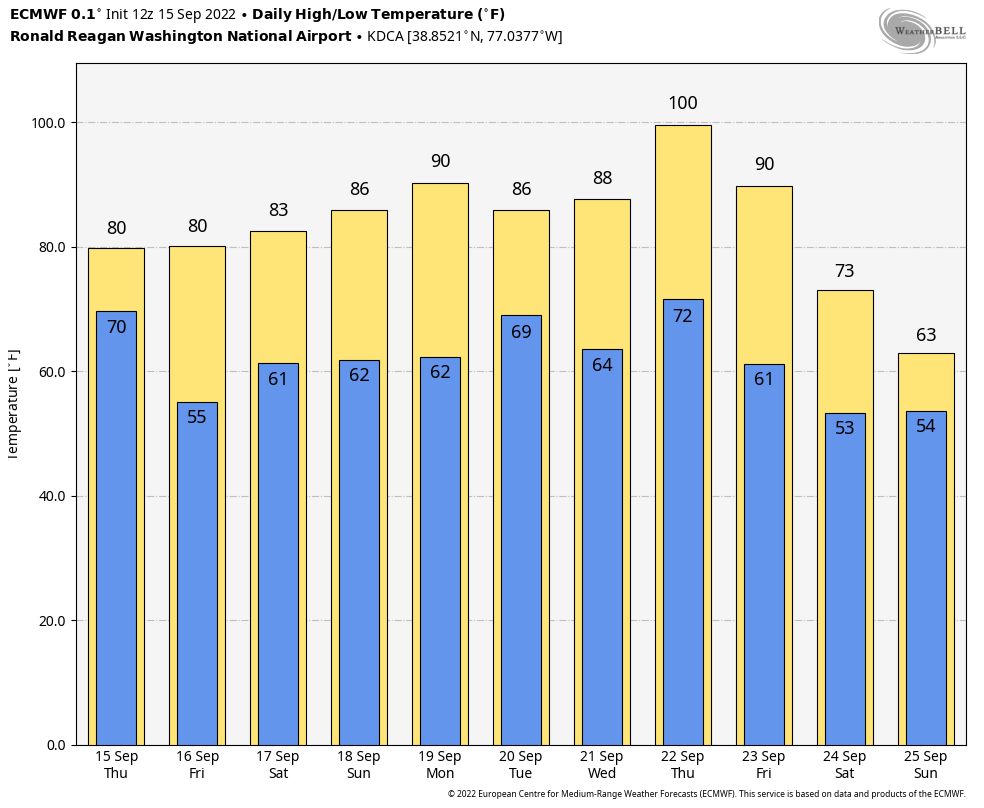
Euro now going for 100°F here next Thursday.
 1 point
 -
In case anyone doubts our situation here. As of this weeks monitor my county of Wapello is now the only county that in its entirely is now in severe drought in the state of Iowa. And again i simply cant find a location from north pole to old Mexico east of my location to the atlantic thats more frequently in drought. Why?
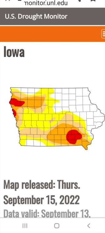 1 point
 -
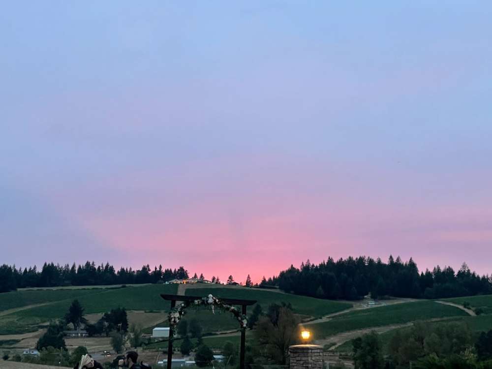
Beautiful evening from the weather deck.
 1 point
 -
I find your lack of faith in eighteenth century pseudoscience… disturbing.1 point
-
I don't get excited until water starts freezing1 point
-
00z GFS has highs in the low 50s with rain south of PDX on Saturday1 point
-
Jesus christ I gotta go inside
 1 point
 -
3 nights in the 40s here, dipped to 43 on the 8th.1 point
-
In a really crude, generalized manner the PDO is the inverse of the average anomalies in a box between 150w and 150e, 30n and 50n.1 point


This leaderboard is set to Vancouver/GMT-07:00