
Leaderboard


Popular Content
Showing content with the highest reputation on 09/26/22 in all areas
-
Pretty good article on the PV and how we may see disruptions later this fall. Also my same thoughts on why we may see a weakened jet stream this year (which isn't necessarily a bad thing for the PNW if you like cold!). https://www.severe-weather.eu/global-weather/polar-vortex-early-disruptive-event-winter-influence-united-states-europe-fa/8 points
-
7 points
-
7 points
-
But mass action starts at the individual level. Same argument applies for voting. We as a country need to match our GHG emissions with our environmental values, not just because we have faith in other countries joining us, but because we exert *some* kind of influence on the atmosphere, be it big or small. Because we can. Because it is who we are, and who we ought to be.6 points
-
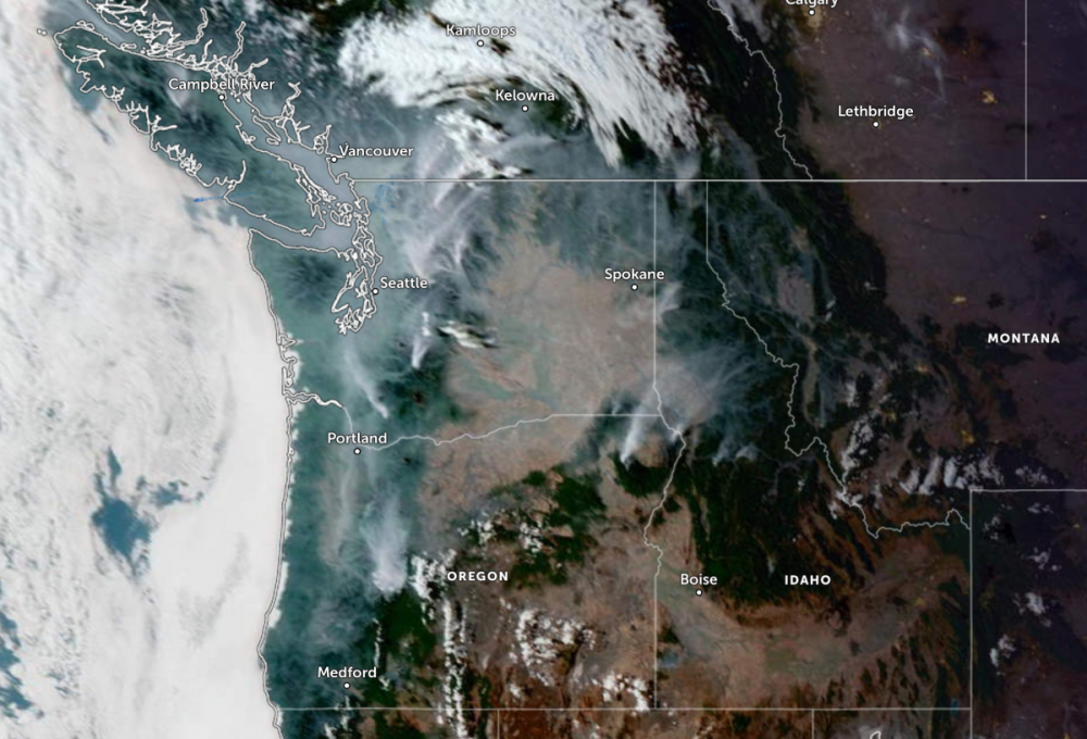
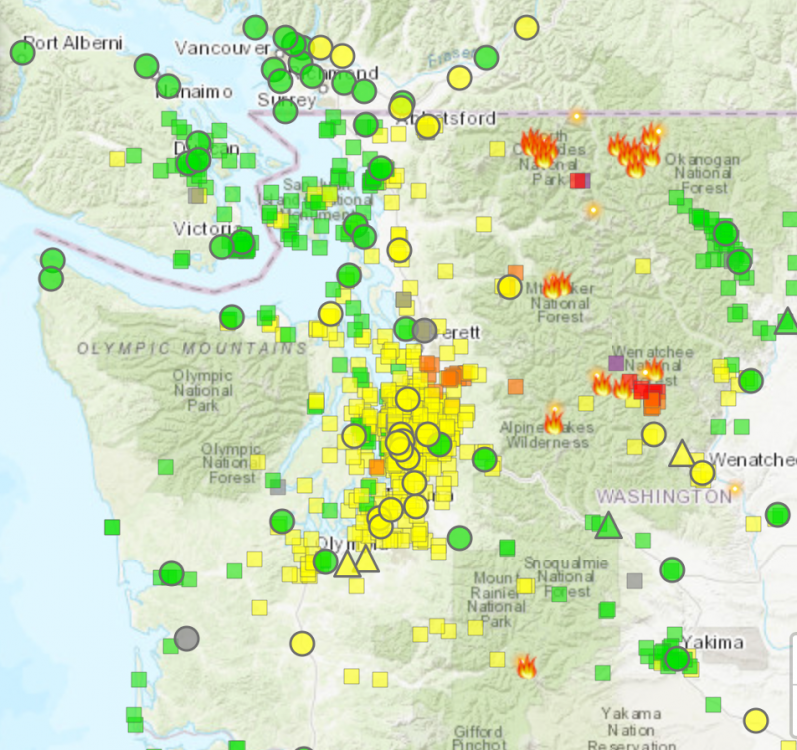
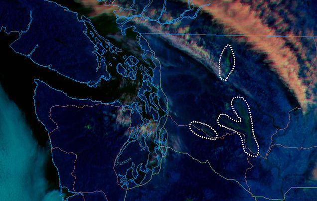
It seems like the rain and cooler air is never gonna come. Heat forever in the PNW now... In all seriousness, the smoke is back for the majority of the Puget Sound and parts of Western Oregon. Here are some maps and satellite images. Most locations are now at moderate with some unhealthy thrown in. Don't expect conditions to improve until we finally get this blasted heat away, some rain, and onshore flower. We've been promised rain for many weeks now, and it never comes as forecasted. I'm grumpy about this.
 5 points
 -
I would rather waste my October than key months in DJF. We had like 2 good weeks and 10 weeks of complete garbage last winter.5 points
-
18z GFS made a big move towards the Euro in the short term. First soaking rain of the fall could be on tap here.5 points
-
I think it can be summed up with "NAM".5 points
-
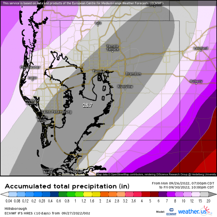
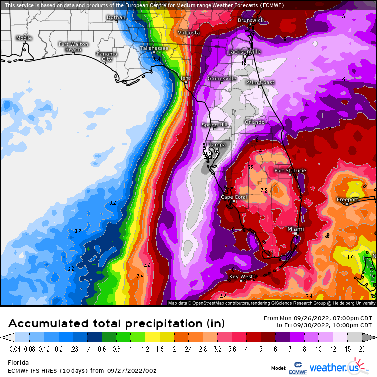
Bullseye right on Tampa Bay for the heaviest rainfall.
 4 points
 -
After over a year on the wait list it finally came today! In other news…80/53 on the day, currently 61.
 4 points
 -
Here’s some truly incredible PDX weather stats of late: No high temp below 70 degrees for 98 days. Not been below 50 degrees for 127 days. <.25’’ of rain in the past 99 days. 58 out of the last 63 days have been warmer than normal including a streak of 40 in a row. Hottest week ever in July, hottest month ever in August, hottest September ever.4 points
-
'shrooms are very important for communicating with nature. bummer on the season being a dud. do not like4 points
-
I see people complaining about aspects of winter or lamenting a possible dud...we haven't had a sub-freezing high here since the 2016-17 winter. No Arctic episodes since that point...none. Somehow I don't feel like this area is due for a dud. We've never gone this long without an outright Arctic air intrusion. Snow on the other hand has been plentiful. Very wet and heavy snow but I have enjoyed the fuckk out of it. It's just weird as hell to have gone this long without a true Arctic event.4 points
-
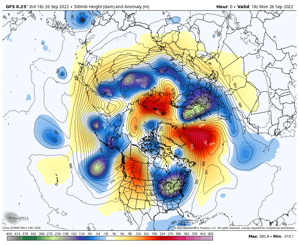
It actually is a La Niña like circulation..note the Aleutian High. Problem is it’s very west-based. For early season cold in Western North America you’d want a trough over the NW-Pacific.
 4 points
 -
4 points
-
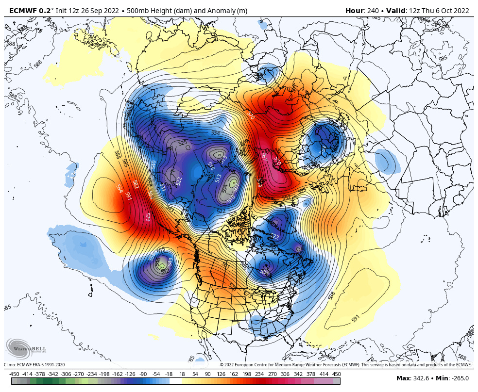
The pattern over Eurasia at the end of the 12z ECMWF is the first “positive” development I’ve seen so far.
 4 points
 -
We’ll be fine.4 points
-
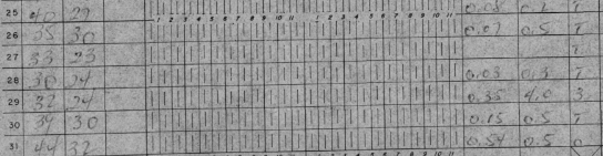
FYI here are the years at SLE that had less that 1" of rain in September AND less than 2" of rain in October. *denotes November having above average precip. 2018 2008 2006* 2002* 1993 1991* 1988* 1987 1983* 1964* 1952 1929 1928* 1915* 1903* 1902* Also, October CAN be a pretty dry month in the Willamette Valley. In fact in the 1892-present period of record SLE has had under 2" 36 times in October, or almost 1/3rd of the time. There have been a couple of October's with no rain or just a few hundredths as well.4 points
-
well if that early season PV interruption happens like in the article Kayla posted we'd might be looking at some fun in November4 points
-
Probably won't happen but wow!4 points
-
meh. nothing the dinosaurs didnt see already.4 points
-
First time my temps dipped into the 40s this season. I hit a low of 48 on my way to 74 today, perfect weather.4 points
-
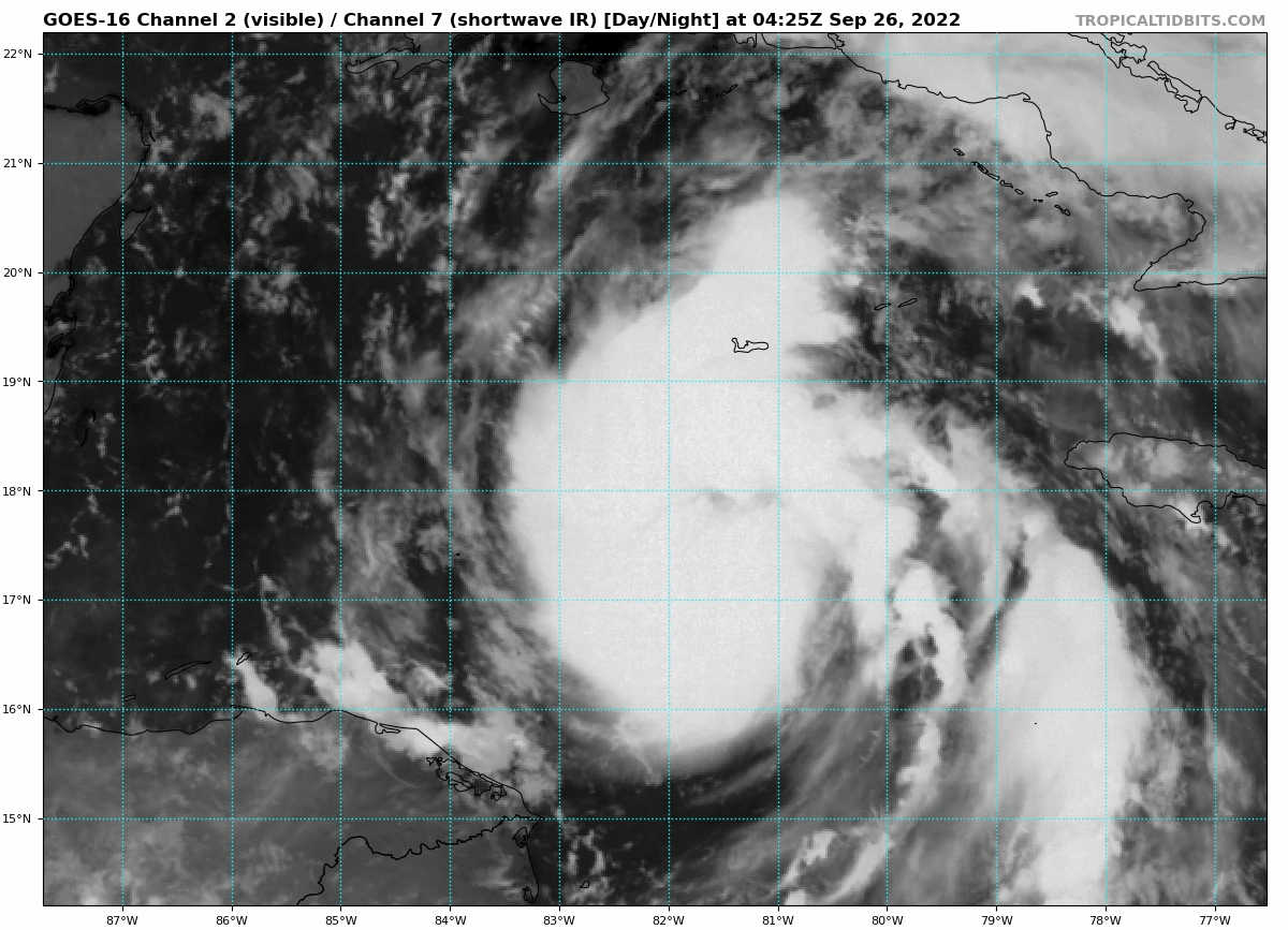
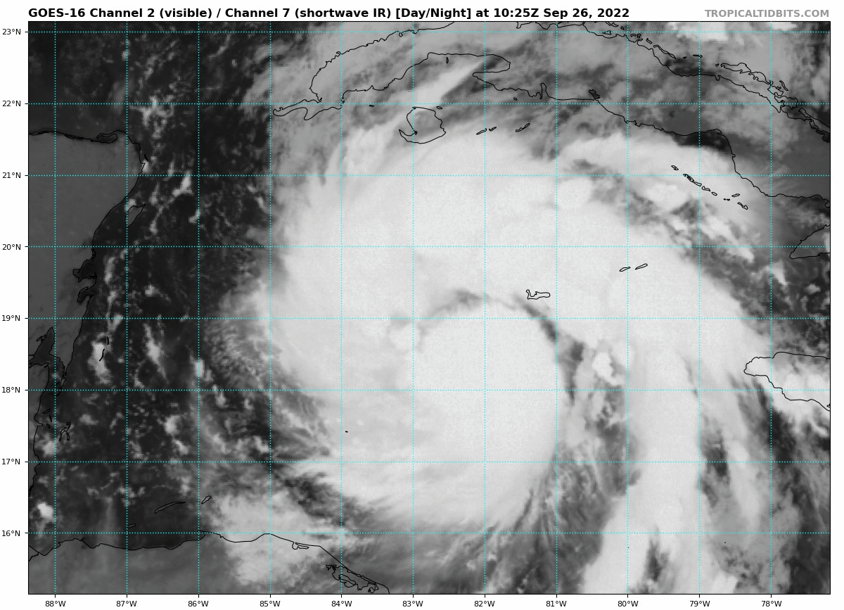
Ian is looking healthier by the minute. I wouldn't rule out rapid intensification over the next 6 hours.
 4 points
 -
Yikes. Breathing, ventilating quite well now. Ian might become quite dangerous today.
 4 points
 -
We’ve lost Jim. Things are looking up for a downturn.3 points
-
Tim would go jet-skiing.3 points
-
3 points
-
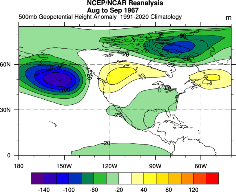
I think 1967 is a decent 500mb match, actually.
 3 points
 -
90 at PDX! #29, tying 2015 and behind 2018 (31)3 points
-
Looks like NOAA Gulfstream IV just finished a recon flight and is headed back to the barn. https://www.flightradar24.com/NOAA49/2d9dea7e3 points
-
There’s 1967 again.3 points
-
The 12z ECMWF Rainfall totals ending 5 PM Thursday The EURO has suddenly turned quite wet Wednesday-Thursday, especially for western Oregon. That figures I was going fishing in memory of my brother on that day. Cancelled now. Ensembles in agreement too. Oh well....
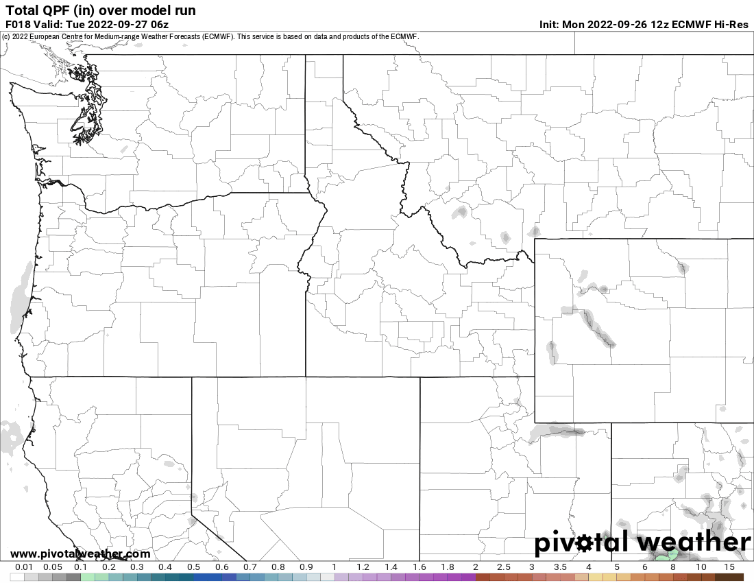 3 points
 -
PAYBACK FOR APRIL AND MAY.3 points
-
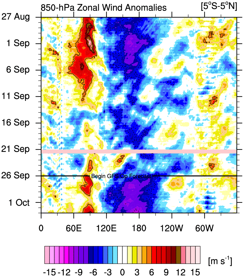
And this La Niña is about to get another steroid injection with the mammoth trade surge coming up. Might be the most intense of the event so far. Starting to wonder if the La Niña is part of the problem at this point. Certainly won’t help import westerly momentum where it would be helpful. Either way, the persistence of this base state is astounding.
 3 points
 -
3 points
-
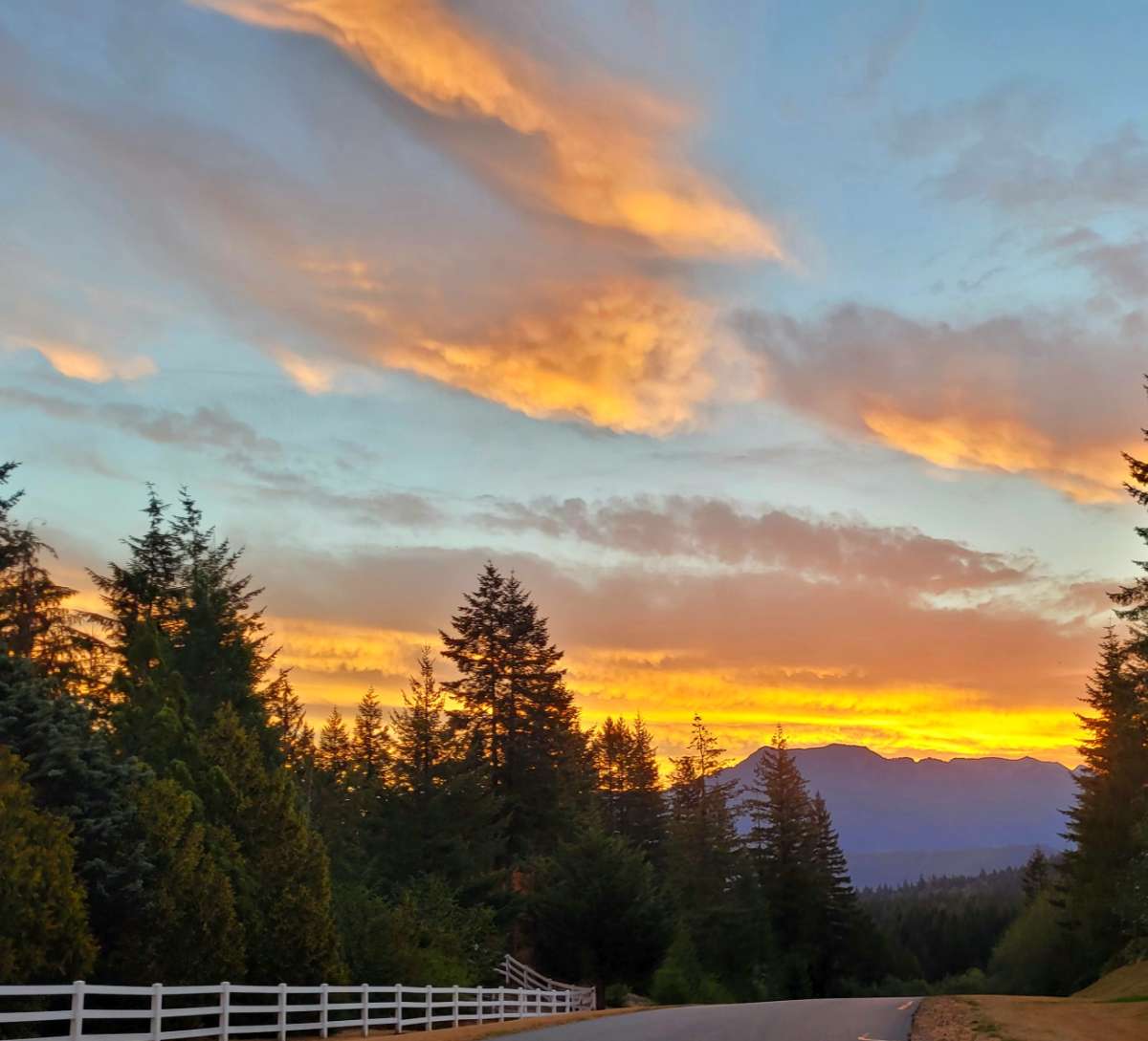
Cool sunrise in progress, mid and high level clouds getting lit up real nice.3 points
-
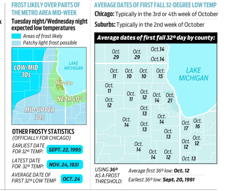
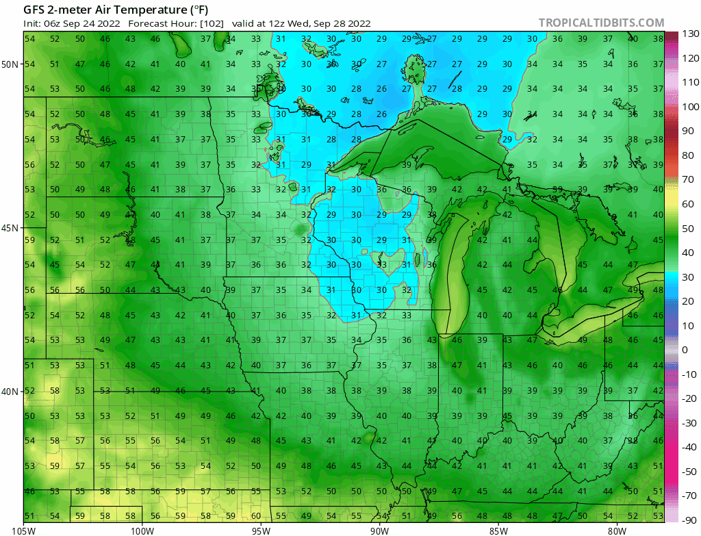
I anticipate Frost and Freeze advisories to be hoisted later this afternoon for parts of IA/MN/WI..maybe NW IL??? If parts of the area across the NW burbs do indeed see Frost it will be about 2 weeks early. Gosh, how many years has it been since we've seen Frost or Freeze's early in the season? Maybe our stat man @westMJimcan dig that up.

 3 points
 -
2 points
-
Decent snowstorm in January 1968 though. ~5" of snow and sustained east winds of 30mph at one point here from the COOP station.
 2 points
 -
Low clouds are already surging inland. Tomorrow should be quite a bit cooler.2 points
-
Now the 18z EURO has landfall just south of Tampa Bay.2 points
-
Saving it for winter.2 points
-
And another 90F burger...jeez.2 points
-
Raise your hand if you want it to rain at Tim’s house for the next 9 months.2 points
-
Yeah we’re in a very fall 2012 situation right now. It’s very bizarre how dry and warm it’s been. The last few Septembers haven’t been this way at all…which is why this year seems so weird. Of course this is also a much warmer and drier September than I’ve ever seen more so than 2012.2 points
-
The last time there was a wide spread lows of 32 or less in much of the area was in September of 1995 with lows of 32 or less at Grand Rapids, Milwaukee, Chicago, Rockford IL and many other areas. Here in Grand Rapids the last time it got down to 30 in September was on September 30th 1993 the last time it was below 30 in September was September 28th 1991 with a low of 27. I hope this gives you some idea. But for may it was in September of 19952 points
-
LOT's discussion for the risk of Lake Effect rain showers is neat to read for tomorrow/Wed...2 points
-
2 hours from the last recon, new one just went through what is shaping up to be a well-defined eye. Clear and sharp pressure drop with winds dropping to 10kts and a drop to zero precip in the center. Also clear signs of strengthening, extrapolated pressure drop to roughly 975 and a more consistent eye wall wind pattern.2 points
-
Does anyone else think the track of this hurricane is pretty bizarre? Never seen one come up from so far south and hit the US that I can remember. Just add it to the list of messed up sheit this year.2 points
-
46 after a few storms blew tgrough...high in the 50's today maybe only 40's tomorrow and Tues2 points


This leaderboard is set to Vancouver/GMT-07:00