
Leaderboard


Popular Content
Showing content with the highest reputation on 10/02/22 in Posts
-
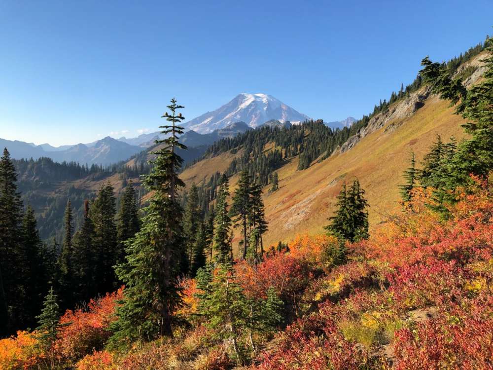
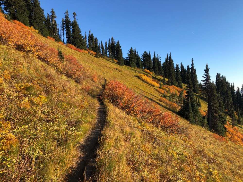
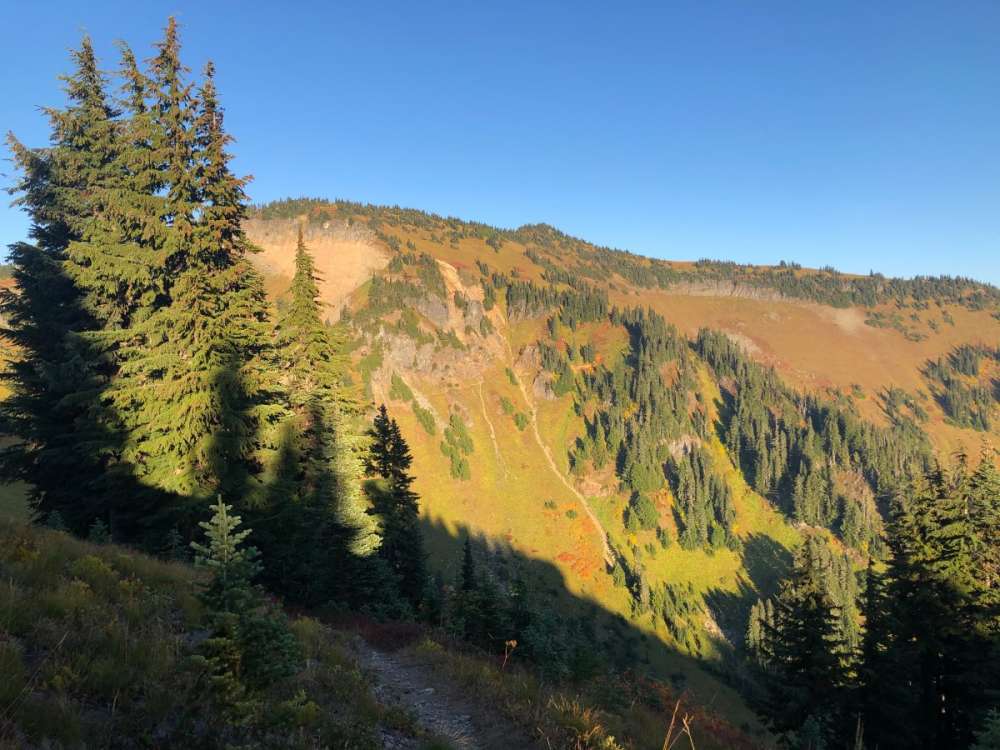
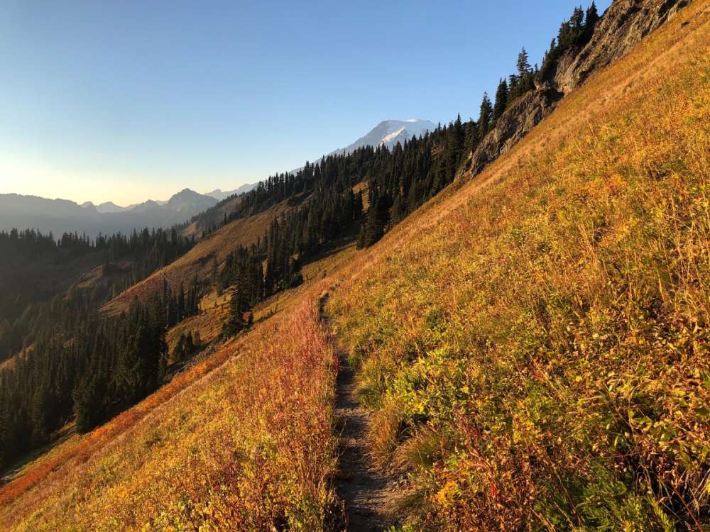
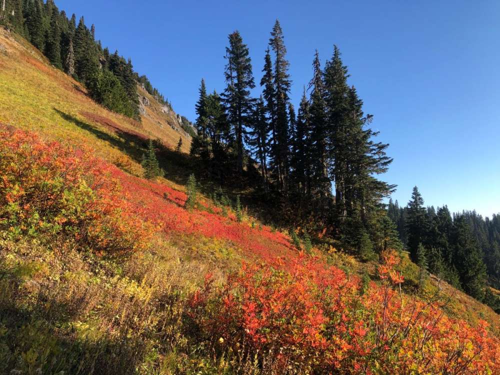
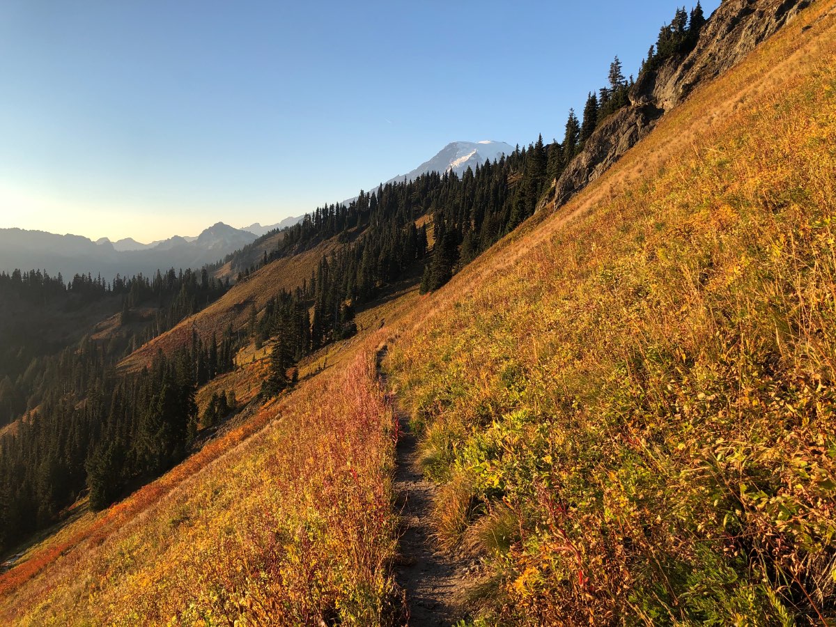
Caught some beautiful fall colors in the Tatoosh Range south of Mt Rainier yesterday.
 18 points
 -
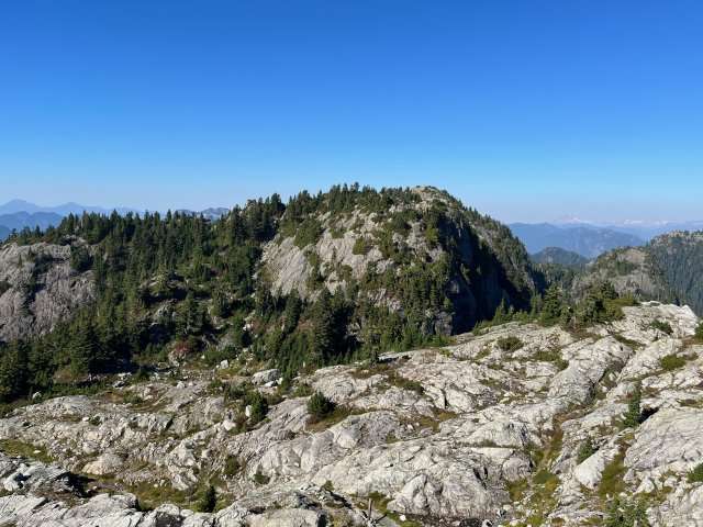
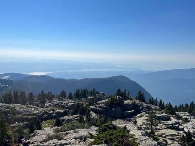
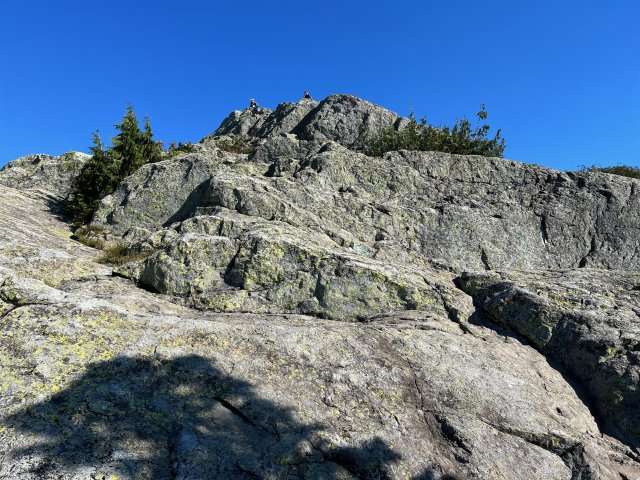
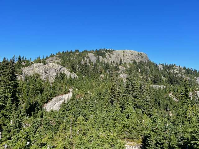
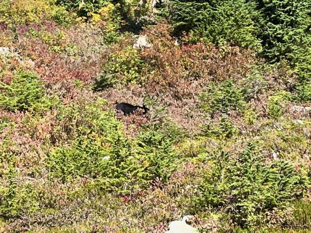
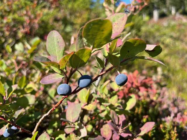
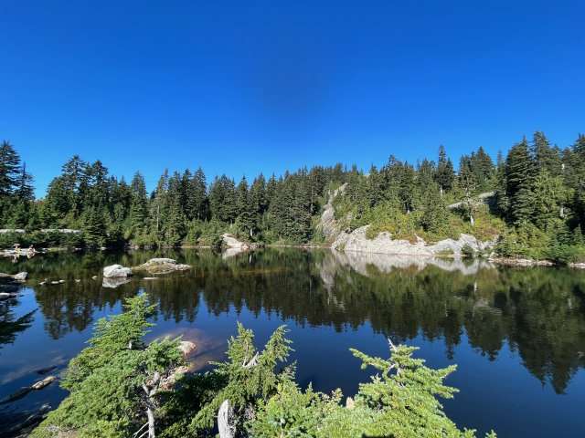
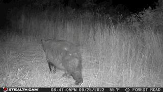
The worst of the smoke has dissipated. Looking towards the mountains this morning, it seemed as if the smoke was worse at lower levels, so I took a chance and drove up to Mount Seymour. I was correct: above 750 m elevation, it was much clearer. Some photos follow. Mystery Lake. People were swimming it. Swimming in an alpine lake in October. Something just seems wrong about that. Wild blueberries (Vaccinium deliciosum). They live up to their Latin name. That is a black bear just left of centre. Not the best of photos, but I did not have a telephoto lens and did not want to get any closer. Mount Seymour First Peak, aka Pump Peak Looking towards Vancouver from First Peak. Still very hazy! Second Peak, aka Mt. Seymour proper. Looking NE from First Peak. Crowded at the top.


 14 points
 -
October 2006 was super dry and then it rained over 2’ here in November.6 points
-
With wavelengths rapidly increasing it’s more likely to encounter strong baroclinic setups as we get further into October. That coupled with potential typhoon remnants makes it a good breeding ground.5 points
-
I'm just going to vent for a brief moment. It's been a month of smoke at my house, with US 2 being intermittently closed (which that part is fine by me, no pass traffic). I'm sick of it. Just need one decent wet system to run through and it just won't, and there's no relief in sight. This sucks and I kinda really hate it.5 points
-
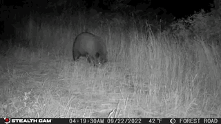
Nice pics. we’ve had so many bears (different ones) around in twisp relative to last two years it’s crazy. Don’t know if the extended warmth is good or bad for them. Maybe good since early alpine freeze would force them down to find more food before hibernation? Idk

 5 points
 -
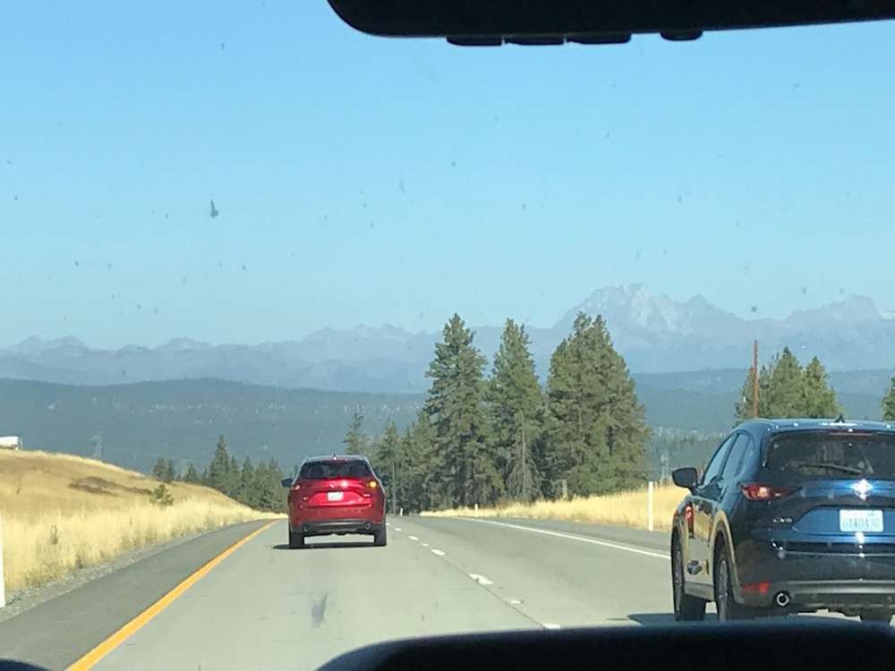
@snow_wizard Definitely understand your rave reviews about the Liberty Mountains now! May have to come back and explore them at some point. I-90 from Seattle to Ellensburg is definitely one of the top stretches of interstate in the US.
 5 points
 -
Jim says it’s only +0.2 compared to a 2141-2170 baseline.5 points
-
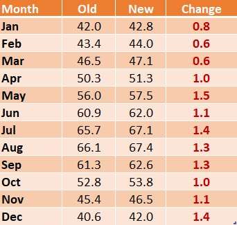
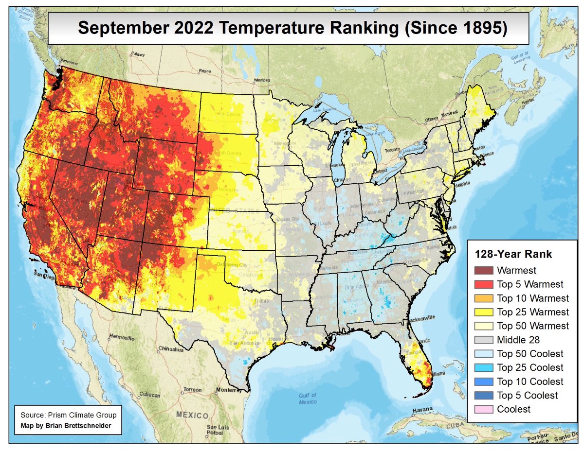
SEA ended the water year with 45.48 inches which is +6.14 compared to normal. Ending up much wetter than normal... despite setting records for the warmest and driest July - September period ever and a summer which also set a record the longest streak of 90+ degree days and the most 90+ days in total. When I was looking up the updated SEA average annual rainfall (which is higher than the long term average)... I found this chart which shows how the average temps changed by month with the 1991-2020 averages and its not correct to say that its really only summer that is has been getting warmer. Its probably more accurate to say that the January - March period has been warming more slowly. The increase in average temps was pretty consistent from April - December and not just focused on summer.
 5 points
 -
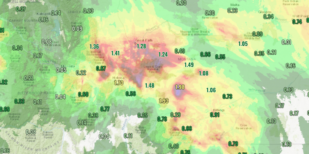
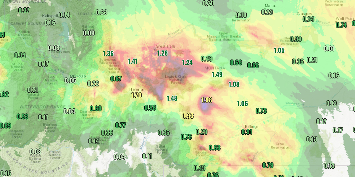
Looks like Bozeman ended up with 23.06" of precipitation for the water year which is a bit above the average of 20". Had a 51/45 day here yesterday with just 0.06" of rainfall. Already up to 0.42" on the day today though and it's still raining. currently 45F. It has been another really beneficial rainfall, especially for Central Montana.
 5 points
 -
Programming alert... on tonight's new episode of Family Guy the family travels to Bend, OR to visit the last Blockbuster Video store.4 points
-
150 hours in, and the only banging going on is the kind that involves both my head and the wall to my left.4 points
-
The GEFS actually had a decent number of members showing us getting clipped by a chilly airmass after the 10th.4 points
-
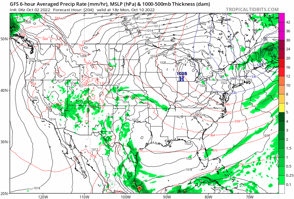
Who in the Central Plains is ready for this dryness to end, I know I am. Signs are showing up for a wet 2nd half of the month. GFS and Euro Control are showing a wet storm moving through in the long range and I know it's the long range. This could be the first major storm of the new LRC pattern and I'm ready for anything different than what we've had! 0z Euro Control precip forecast 6z GFS
 4 points
 -
Warmest October day in 34 years and a day at PDX.3 points
-
Did you know: Mt. Stuart is roughly 100 million years old, 50 million years older than the entire Cascade range! It's made of exotic rock that's been isotopically linked to Baja, Mexico. Really interesting geology there. (there's actually a ton of really interesting geography in Washington, really underrated)3 points
-
Considering you are made of it, that would not be good!3 points
-
Yes! Cannot have dead moss!3 points
-
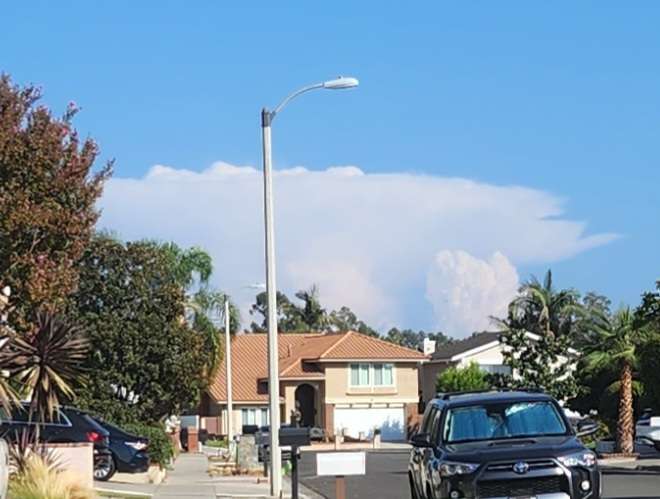
What amazes me is that what is being forecast is essentially a perma-heatwave, with high temps running 7-15F above average for days and days on end. Even with the heatwaves earlier this summer, the patterns themselves broke down within a week. There is no pattern breakdown upcoming... Every day looks to hit summertime levels into the indefinite future. Absolutely confounding, bizarre predictions for October. A complete displacement from our actual climate... A figurative jaunt 800 miles to the south for much of the region. For comparison, in July, this would mean highs above 90F for two plus weeks straight at KSEA. Only thing preventing a similar outcome now is the grace of lowering sun angles. The only even closely relevant precedent would be October 1991... And even then, there was a relatively even split between October climo and strong ridging, frequently trading between highs in the 70s and 60s. What is being forecast is 70F+ weather for....eternity?3 points
-
Yeah, looks nasty on the ground from pictures I've seen. We've been very lucky in the Portland area to have only had a few days with particularly bad smoke.3 points
-
Weather summary for British Columbia issued by Environment Canada at 12:07 a.m. PDT Sunday 2 October 2022. Discussion. A ridge of high pressure brought another warm autumn day. The following areas set a daily maximum temperature record on October 1, 2022 (temperature values given in degrees Celsius): Cache Creek Area (Ashcroft) New record of 26.6 Old record of 26.3 set in 2012 Records in this area have been kept since 1944 Clearwater Area (Clearwater Auto) New record of 24.8 Old record of 23.9 set in 1923 Records in this area have been kept since 1913 Comox Area (Comox A) New record of 23.0 Old record of 22.9 set in 1992 Records in this area have been kept since 1914 Courtenay Area (Comox A) New record of 23.0 Old record of 22.9 set in 1992 Records in this area have been kept since 1914 Hope Area (Hope Airport) New record of 28.8 Old record of 27.7 set in 1987 Records in this area have been kept since 1936 Lytton Area (Lytton RCS) New record of 27.3 Old record of 26.9 set in 2003 Records in this area have been kept since 1921 Merritt Area (Merritt) New record of 27.9 Old record of 27.8 set in 1975 Records in this area have been kept since 1918 Port Alberni Area (Port Alberni (AUT)) New record of 28.0 Old record of 26.5 set in 1987 Records in this area have been kept since 1900 Revelstoke Area (Revelstoke Airport Auto) New record of 23.1 Old record of 22.8 set in 2003 Records in this area have been kept since 18983 points
-
Happened in January and February this year. Both had very long dry stretches and would have been very dry months if not for one well-placed AR. Farther south in northern CA foothill and upslope areas that's kinda how winter precip works by default. Sometimes you get 2-3 weeks with nothing and then an AR comes and dumps 5" in two days.2 points
-
80 yesterday and 82 today. I was up on the roof painting our fascia boards today and it got pretty toasty.2 points
-
2 points
-
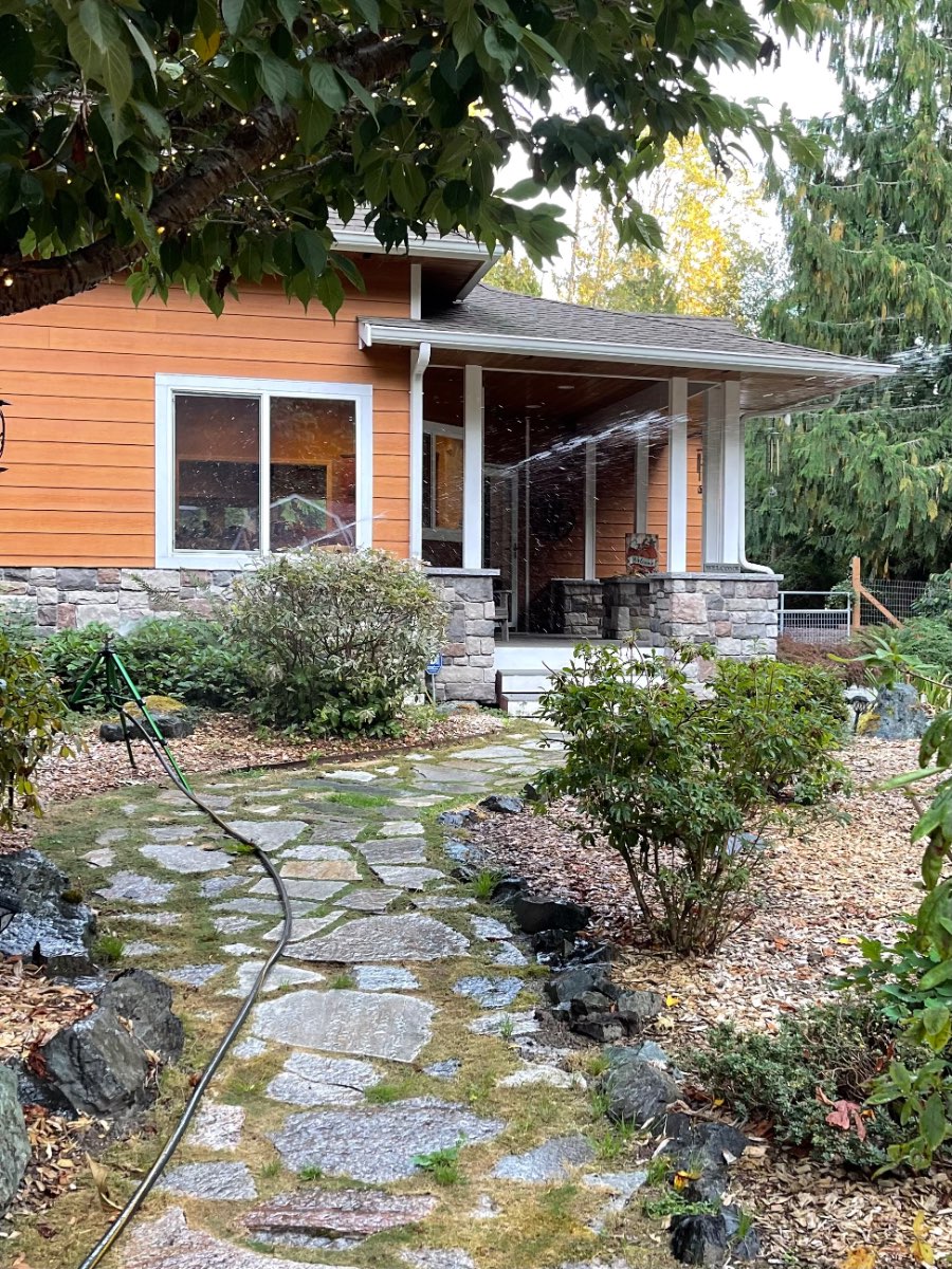
Still 70 degrees at nearly 6pm. And there is a sprinkler running in my yard…In October…Well okay then…
 2 points
 -
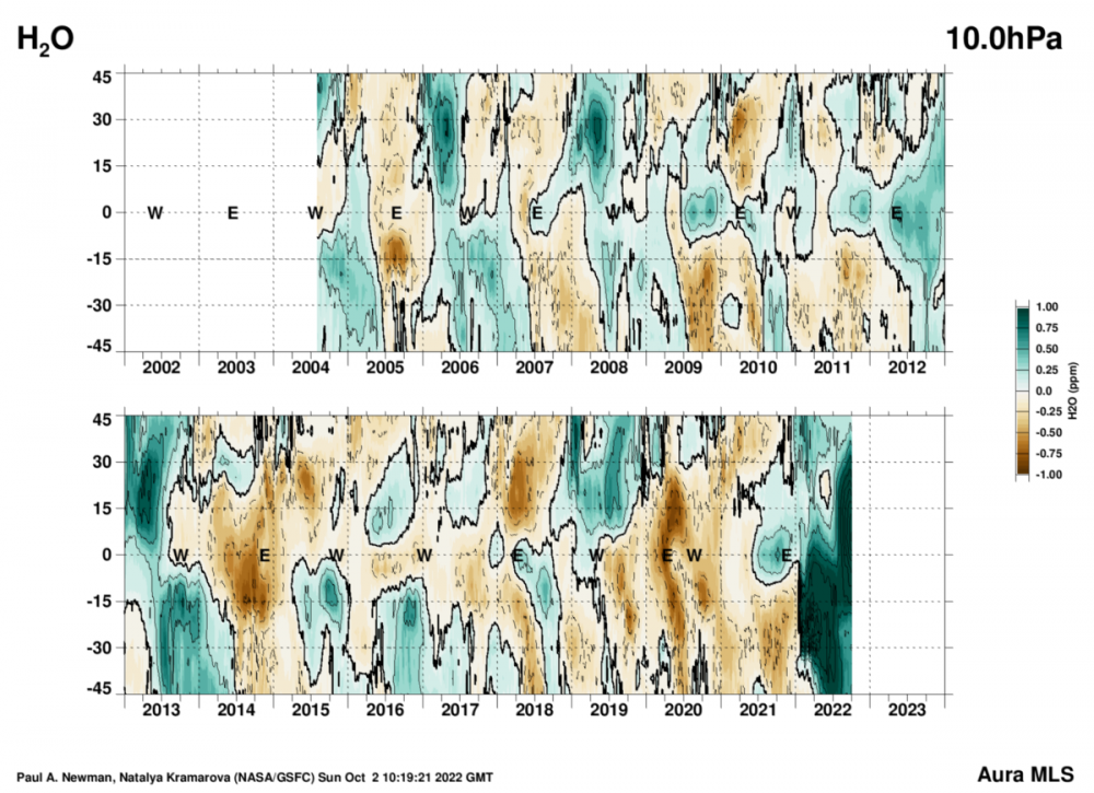
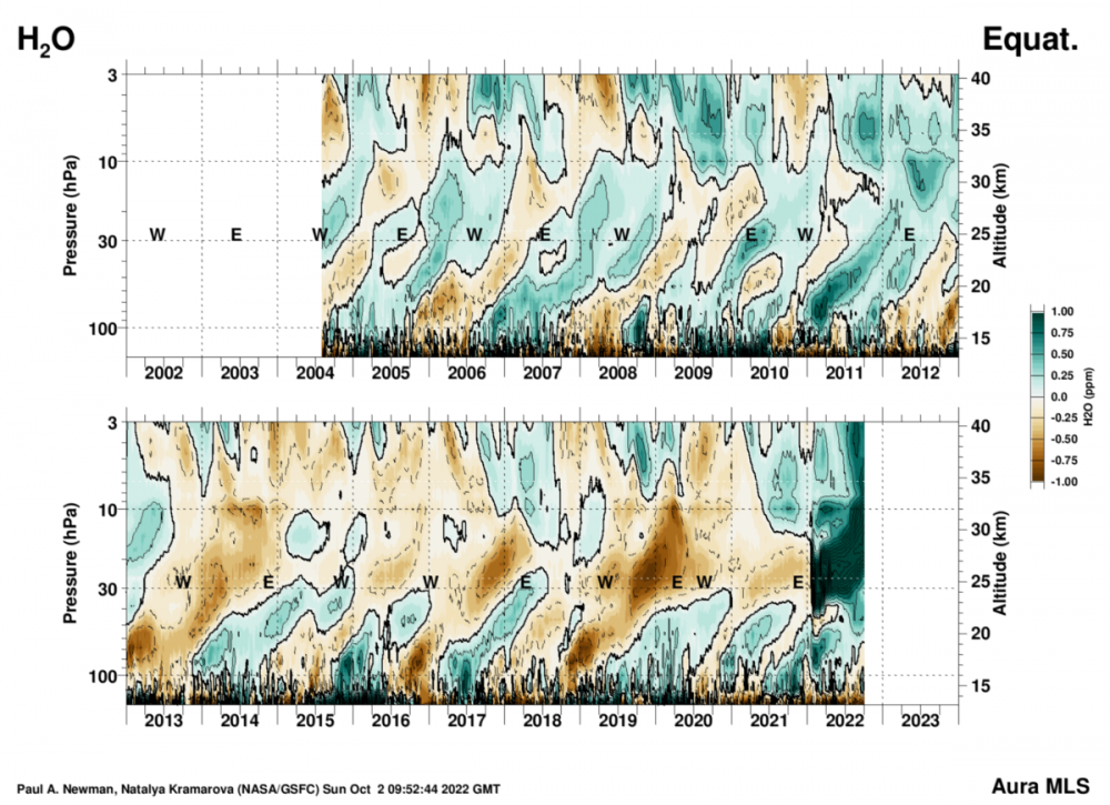
Tonga is almost certainly going to factor into the equation here. This is an absurd amount of H2O lingering up in the stratosphere.
 2 points
 -
Or, there could be no rhyme or reason at all and weather just happens? Sometimes you get heads, sometimes you get tails. Sometimes you get heads 3 times in a row. You could get heads 10 times in a row even though the odds are very much stacked against you. That feels like what we’re experiencing. Last June felt like heads 20 times in a row, although I know those odds are astronomically low.2 points
-
I usually get mocked for mentioning Tonga... but it just feels like everything has been out of whack since about March. And there is no end in sight. And Tonga sure seems like a smoking gun.2 points
-
I went back and looked at my backyard stats for the summer. Ended up with 50 days at or above 90 degrees. This included 3 days above 100 degrees. Normal is 34 days.2 points
-
Imagine scoring 48 and barely winning. Or scoring 45 and losing Absolutely a great high octane game. Someone said this game was the low budget version of the 2018 Rams/Chiefs game and I couldn't stop chuckling.2 points
-
The Russ sucks bandwagon is easier. But I love what I see in Geno. This season might still be a throw away because of our crappy defense but definitely not because of Geno.2 points
-
18z gonna be a banger, calling it now2 points
-
This year had far less smoke here than the past two. And a lot of new green shoots coming up after the rain this week. The worm will turn.2 points
-
You spelled Tim wrong.2 points
-
Glad we have Geno and not Russ. No joke. Geno is way better.2 points
-
I have a feeling it's going to crash hard in December.2 points
-
Something tells me Jim is super stoked by how weird things look right now!!!!!2 points
-
Euro decides to mix things up a little and put us under a massive ridge toward day 102 points
-
Temperature isn't the only way energy can be stored in a system. Given that stratospheric temperatures are at unprecedented record lows, multiple standard deviations below both running averages and previous records, it is demonstrably true that there is an energy imbalance in the atmosphere. Where that energy has gone, I don't know. Maybe the world temperature departure would be +0.1F instead of +0.2F, maybe the earth's oceans are a little warmer, or certain weather systems (ridges, large scale storms with tropical-midlatitude connections) are amplified. Maybe that energy is being put into evaporation, or glacial melt. Either way, it's there. If it weren't, the stratosphere wouldn't be so cold.2 points
-
Someone needs to tell the Lions’ ball throwing guy not to throw to that guy.2 points
-
Looks like a hard freeze for many of us by the end of the week. Bring it!2 points
-
I’m sure it will be a convenient scapegoat whatever happens2 points
-
No doubt this is some crazy shit caused by the volcano. 25S to 65S at the 30mb level is where it really shows up.2 points
-
No doubt something really weird is going on. I will say this is no more messed up than the 1930s were though. All I know is the pattern will change eventually. Huge potential for something epic later on.2 points
-
Hopefully that doesn't pan out. Can we have a classic fall for once?2 points


This leaderboard is set to Vancouver/GMT-07:00