
Leaderboard


Popular Content
Showing content with the highest reputation on 11/15/22 in all areas
-
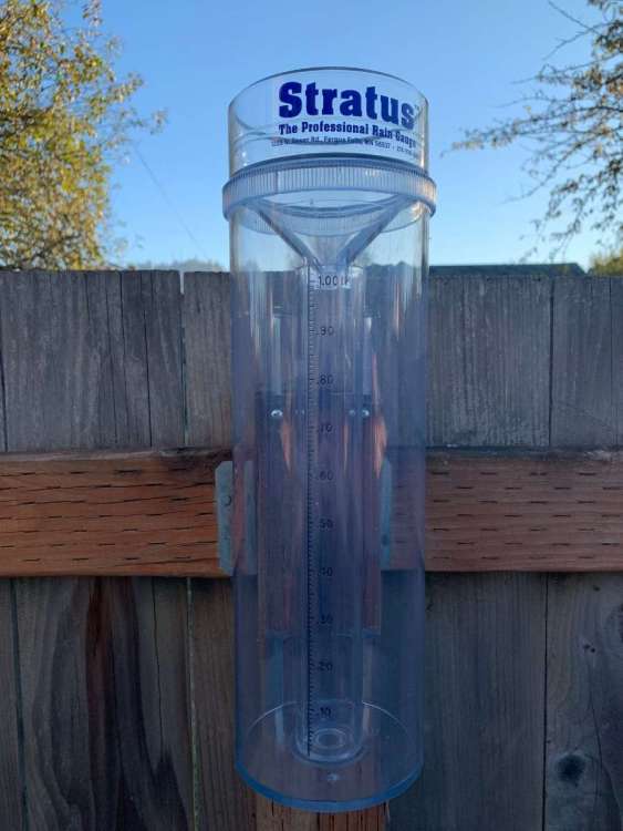
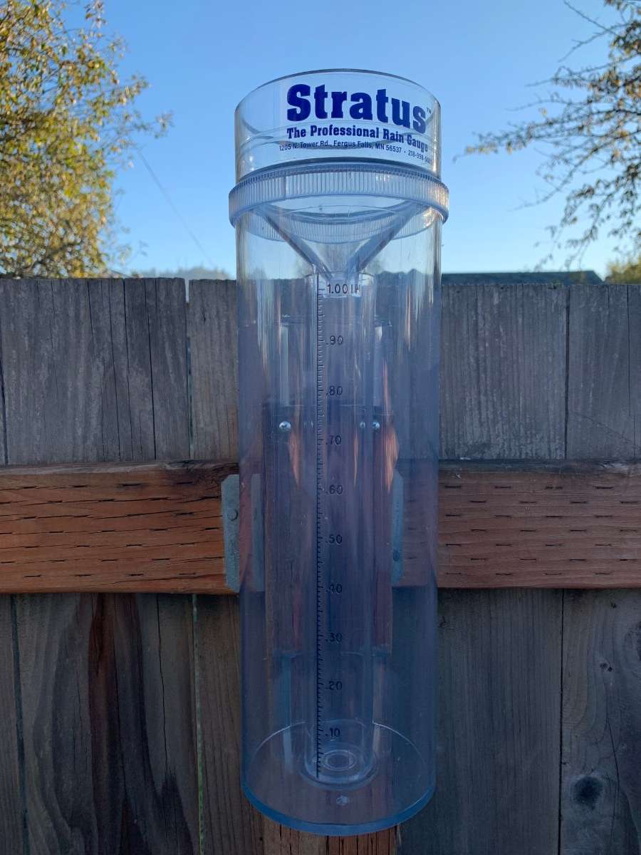
Thank y’all so much for helping me out with these rain gauges. I’ve mounted this one as high up on the fencepost that I can. Made sure it was as level as possible. Should ideally give a more accurate reading.
 14 points
 -
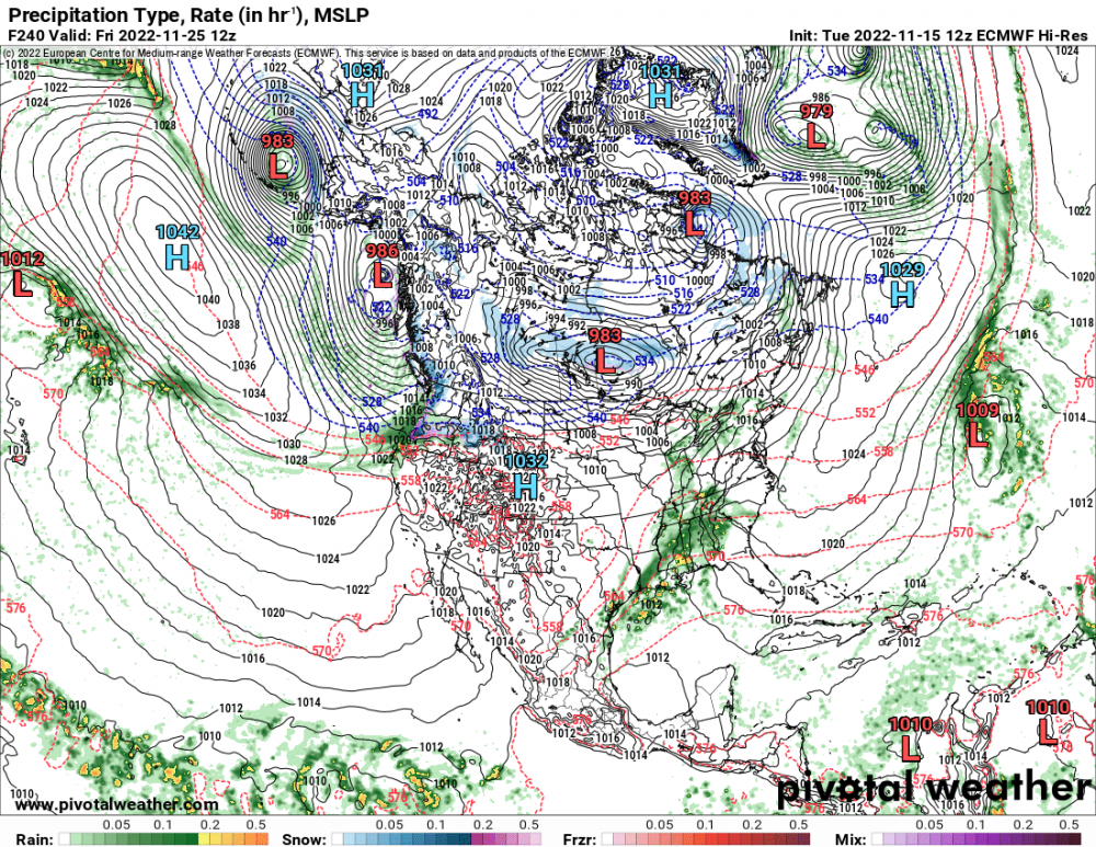
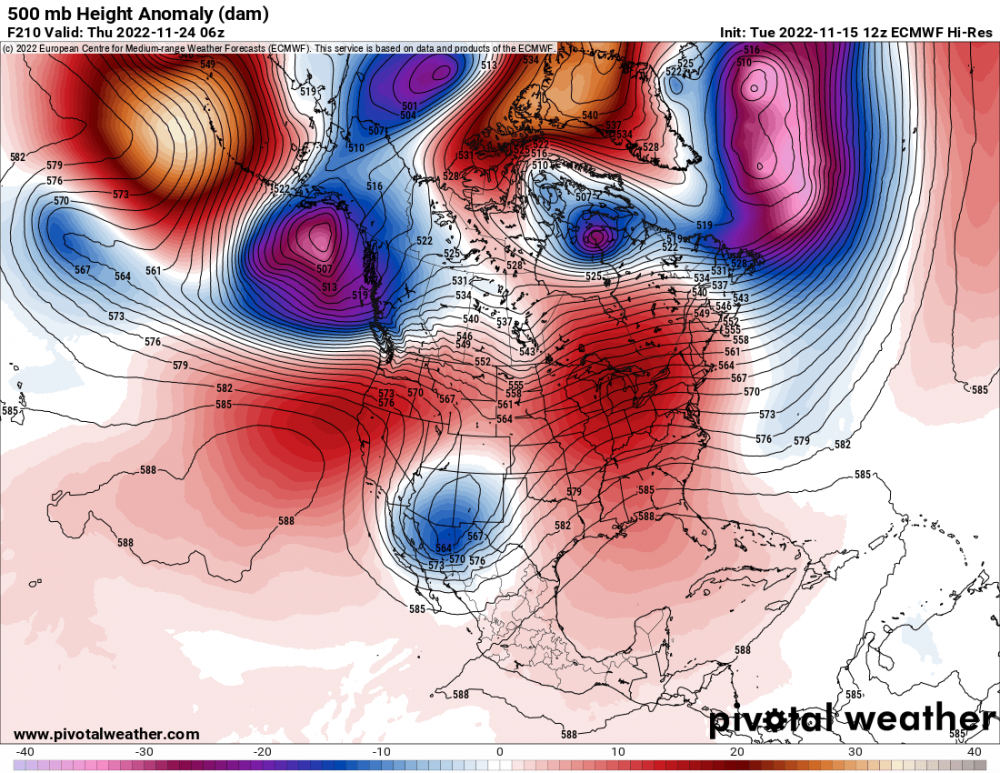
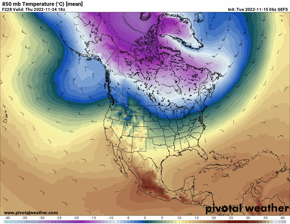
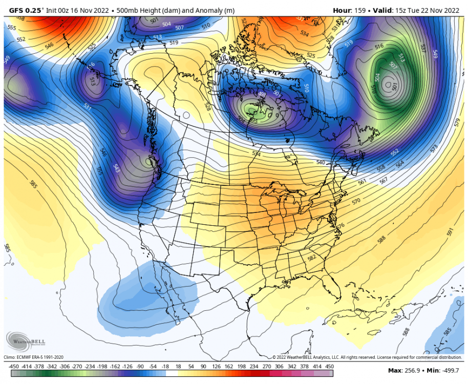
The ensembles have generally been showing a more active pattern than the operationals. Maybe the operationals will start to play catch-up.8 points
-
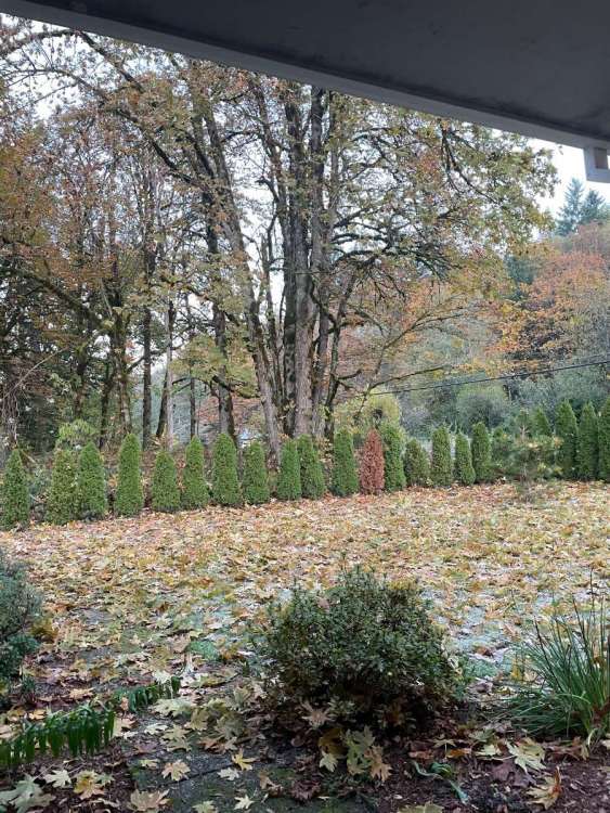
28f and thick frost. The maple leaves are really falling in this cold, dry air. It is a great fall morning.
 8 points
 -
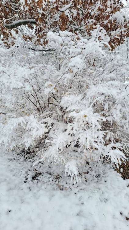
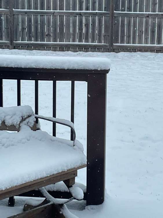
Surprisingly I have 2.5" on elevated surfaces like the patio chairs. Very little stuck on pavement surfaces. But northern part of Wapello county maybe a inch on some parking lots. Otherwise we got zero work from this. Temp hovered at 30 to 32 so far.

 7 points
 -
Got 3.25” here already this morning.
 7 points
 -
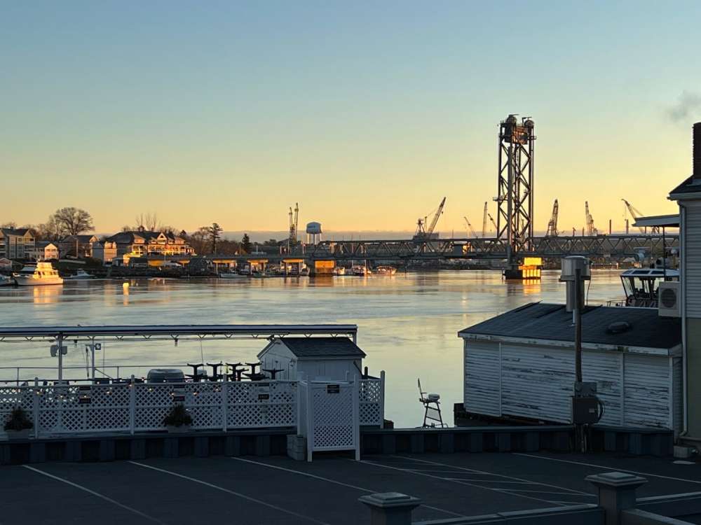
Beautiful morning here on the banks of the Piscataquah. 27 degrees on my morning walk. Storm coming in tomorrow but looks like we will be on the rainy side of it here.
 7 points
 -
March 2-3, 1960 almost certainly must have been the most widespread snowy day on record as well across the big American cities. Really amazing stuff. Portland and Seattle saw 5" of snow, Wichita saw 4", Kansas City saw 9", St. Louis saw 8", Chicago saw 4", Louisville saw 9", Cleveland saw 11", Washington D.C saw 8", New York City saw 15", and Boston saw 20". All in a single 24-36 hour period from several different storm systems.6 points
-
Still hanging on. 44/27 today.
 6 points
 -
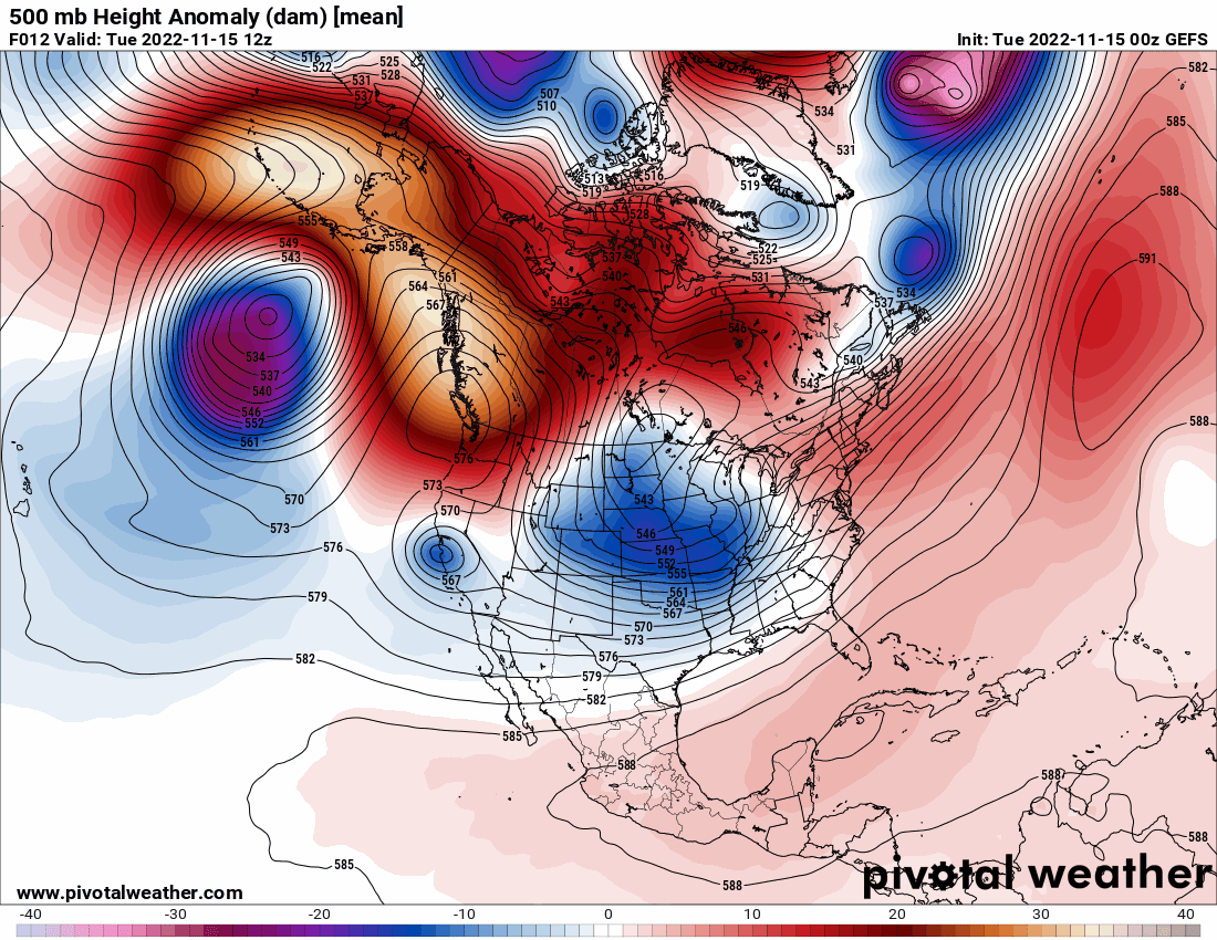
The Columbia Basin cold pool has both deepened and expanded significantly as high pressure continues to strengthen over the area. This is going to keep the east wind machine going strong especially Thursday-Friday.6 points
-
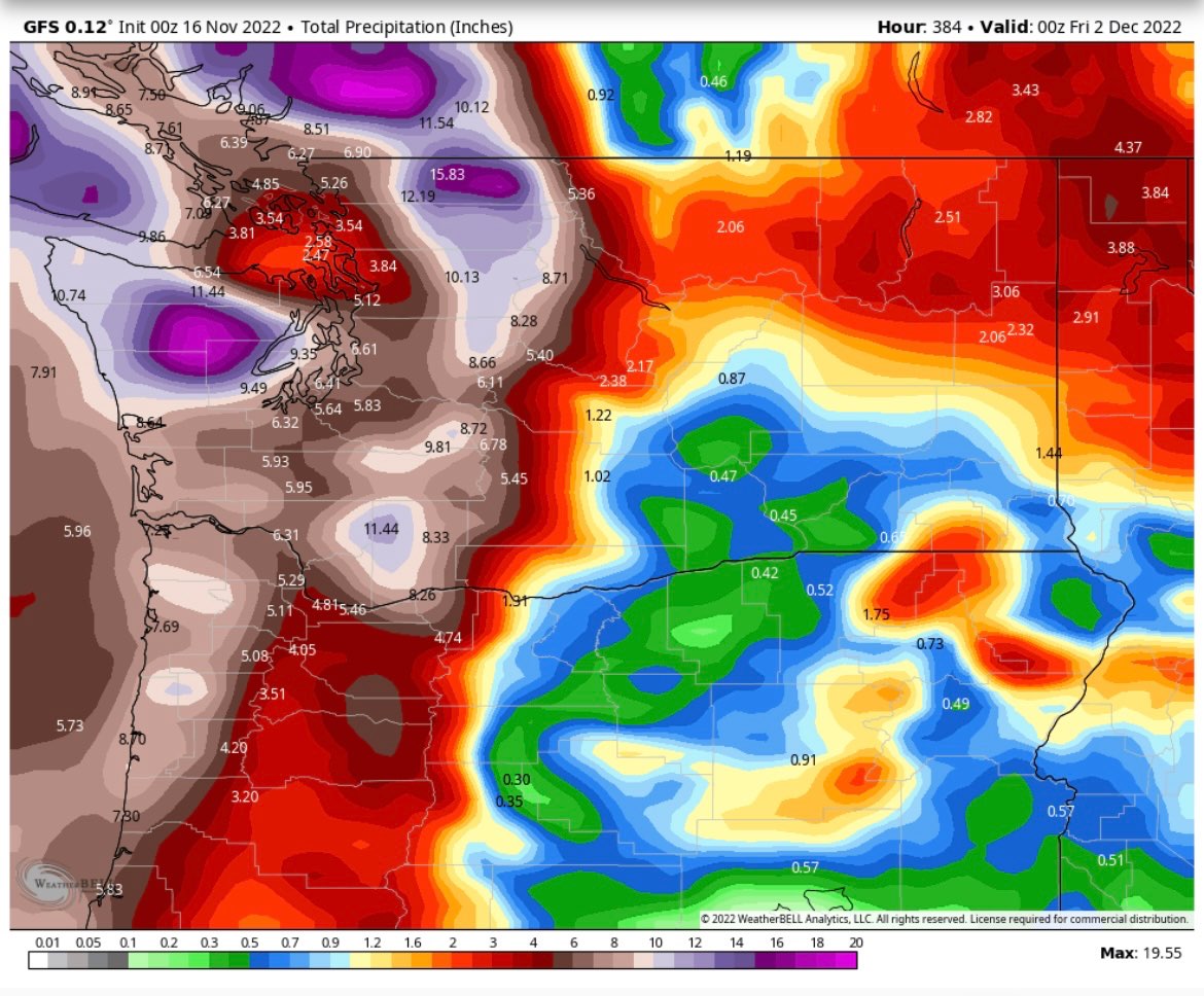
Total rain With more falling and on the way
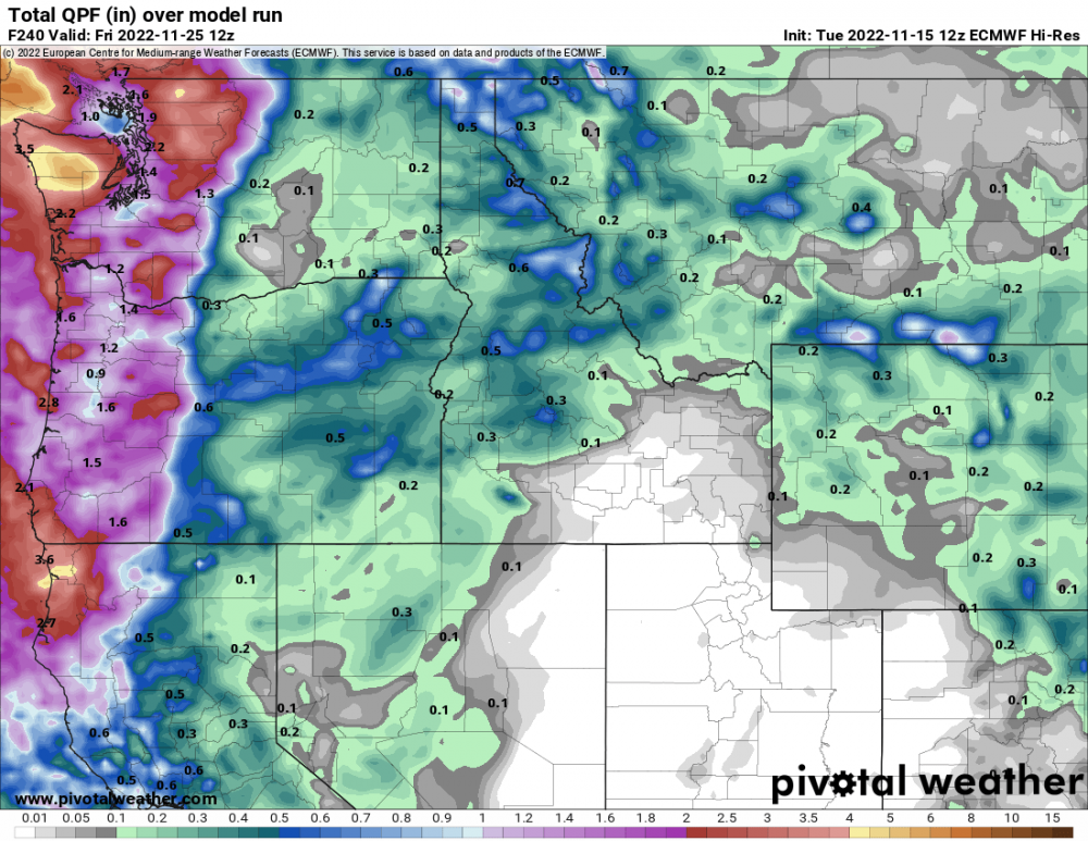 6 points
 -
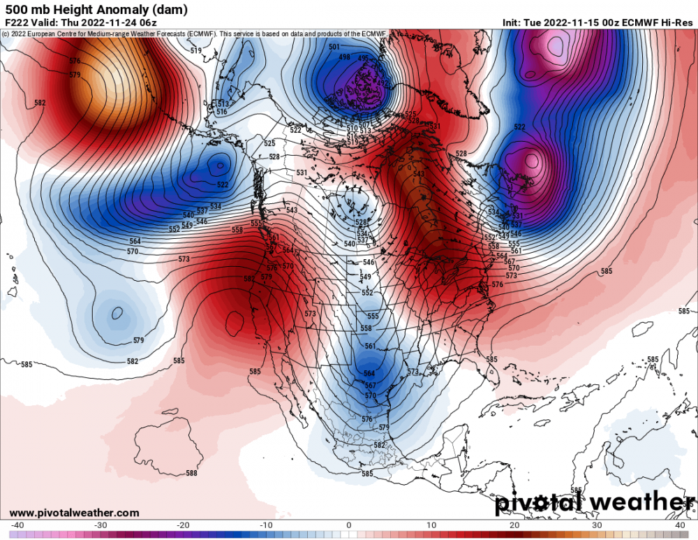
Today I am thankful for Euro looks way better days 7-10 than last night’s run.6 points
-
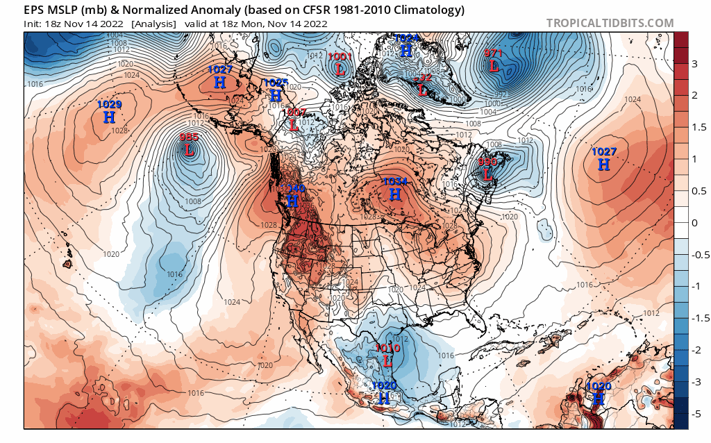
Euro is different from previous runs. Todays: Same hour from last night's run
 6 points
 -
How else is he supposed to fund his machine learning model that always predicts a cold east????6 points
-
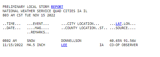
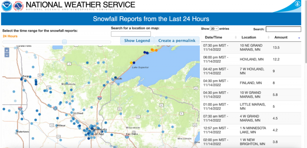
4.5" report in far SE Iowa. Wow.
 6 points
 -
Light snow is still falling this morning but it's melting faster than its falling now with a temp of 32. I don't think I ever had more than a 1 inch on the ground at any given time. It was good to see snow fall again and it has left a nice coating on the grass and trees. NWS office may have gotten a little more. NWS Kansas City 1.3" of snow here at the office in Pleasant Hill, MO so far. Still snowing as of midnight.6 points
-
Conflicting reports! But it’s coming.5 points
-
5 points
-
Glad to be back in the snow game this early. little over an inch so far5 points
-
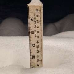
Officially 2" at KDSM for the event- -- 1.6" since midnight. Slowly starting to stick on concrete but one tell the latent heat remaining (69F just 5 days ago) . 4" soil depths are still just slightly above 0C so slow melting is occurring even on grassy areas. 1.6" was .19 of liquid . So about 8.5:1 ratio.5 points
-
1959-60 was actually a great winter for NW OR and SW WA. Four separate snow events and extended gorge driven cold in January and then a major event in early March from what was one of the great arctic airmasses of the 20th century for North America. Plus the mid November airmass, which despite being dwarfed by 1955, was still among the coldest on record for so early.4 points
-
Leaf cleanup is far more enjoyable in this weather. #sorrynotsorry4 points
-
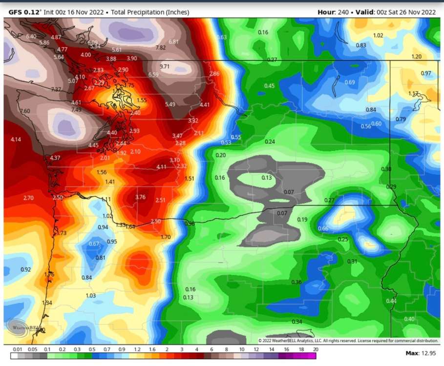
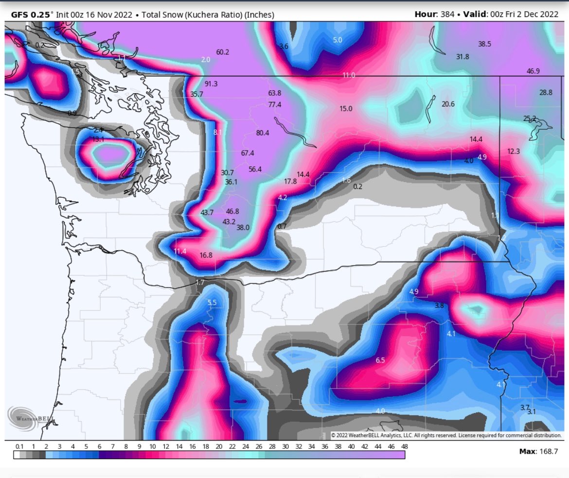
Some positive support near the end of GEFS range for mountain snowpack from around the start of December. Woo woo!
 4 points
 -
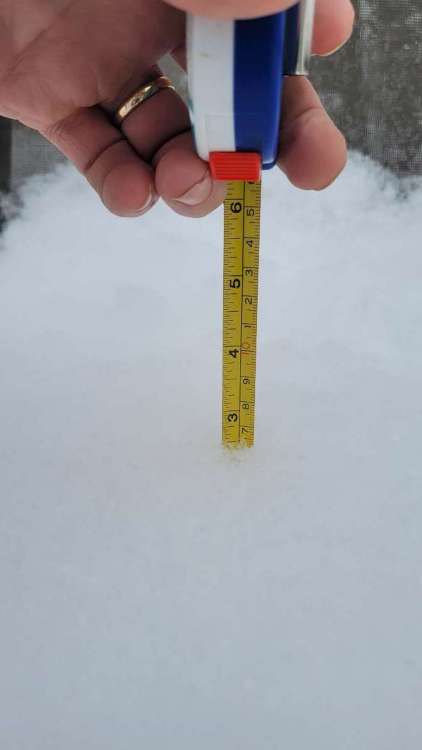
Took a quick measurement and lo and behold now have the first one inch of snow fall here in my yard. BTY the average first one inch snow fall at Grand Rapids is November 19th so just a little ahead this year.4 points
-
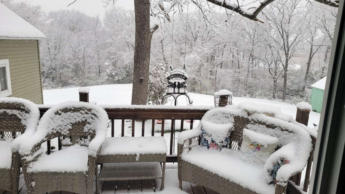
Well it snowed 2 inches overnight but only about .25 inches of it stuck on the ground due to warm ground temps. Oh well it was good to see flakes to get into the season!4 points
-
Tucked in the NE corner of the Arrowhead of MN, the LES hit the shores on a S/SE wind producing some heft totals!
 4 points
 -
Welcome to the suck, Jim. Your party sh*t the bed thanks to very low IQ approach.4 points
-
Omg were so far away from anything good gdi
 4 points
 -
00z GEFS nice pattern change as La Nina returns.
 4 points
 -
models are saying 3-4" here in C.IA just W of DSM. We will see. Flake size is going to have to improve if that is going to happen. Probably 3/4" on grassy areas as I drove into work. But this is over performing HRRR and RAP thus far.... Not big expectations for the first snow of the season... but take what nature throws down that's for sure!!!4 points
-
Significantly more precip on this run so far
 3 points
 -
3 points
-
Good hr 159 blue
 3 points
 -
I'm headed to Bend tomorrow for the next 11 days. Please, please, please can the pattern flip for at least the last few days of my trip. Some snow would be great.3 points
-
That's nuts. Looks like Denver saw a little bit of snow with that as well, and had 7" on the ground.3 points
-
Back-to-back lows of 23 in Arlington.3 points
-
It looks like SEA will probably come in at 42.7 for the first half of November. The coldest since 1959! That's 63 years ago for those keeping score. This is even more impressive when you consider the area around SEA is much more developed now than it was then. The top 5 years for cold first half of November for SEA are. 1946 - Cold winter 1948 - Very cold winter 1955 - Very cold winter 1959 - Average winter 1978 - Very cold winter3 points
-
27 this morning for our 10 straight sub freezing low. Beautiful day to drive the kids to the doctor.3 points
-
You don’t wanna be in the jackpot that far out. Lol.3 points
-
Stepped out at 7:15 to -SN and roofs cars and grass coated so technically I'm "on the board" with 0.1" for the season. Over-acheiver in mby for sure! At least we're lowering soil temps.3 points
-
Before Jesse tries to use my arborvitae to push his drought agenda. That one was a transplant this year to replace one that had died last year because I didn’t water enough. They do take a lot of water the first two years to get them established and because I put in like 60 of them if I am not diligent I lose a couple.3 points
-
Windy all night here with a low of just 41. Hoping things will slacken off later this evening for a midnight low.3 points
-
boring, looking like upper 40s and rain in Spokane for Turkey day. at least the mtns will get more snow pack3 points
-
Some bigger numbers coming out of the south suburbs Downers Grove 3.1 Bolingbrook 3.5 Clarendon Hills 33 points
-
44 in North Bend this morning... safe to assume an east wind there too. Not really a PDX issue this morning.3 points
-
I know I said it yesterday, but I am really loving these cold, cold nights. I'd be super pleased if we could keep this until the end of Winter. But, I feel like that would mean no (or very little) rain/snow, and that is just not a deal I am willing to make. lol 24.3* this morning.3 points
-
@jaster220, even though the closed low that tracked into the S Plains yesterday is beginning to weaken, I don't mind to see the Double Barrel Low that is forming and will ultimately lead into a long duration event over the GL's/OHV. The blocking south of Hudson Bay is a prime location to slow down systems and "seed the cold" as we move into the heart of winter. The 2 separate low's (Gulf States and MW) is something I've seen a couple times already since OCT over our region and it's showing me that this will create long duration events more often than not this season. I'm diggin' it my man!
 3 points
 -
Having spent a lot of time up there over years ice fishing/ winter camping etc. - about 3-4 times a winter. More than you think. The great storm of early JAN 1994 was mainly lake effect- The folllowing are MN records - and occurred at Finland,MN (more specific than just Lake County)-- Most snow, 24 hours 36 inches (91 cm) January 7, 1994 Lake County Most snow, one storm 47 inches (119 cm) January 6–8, 1994 Lake County3 points
-
Welcome to the start of Michigan’s fire-arm dear season. Boy how times have changed when I was younger today was almost like a state Holladay. Employers would ask who was going deer hunting and over on the east side of the state I 75 would see massive traffic jams. There were reports of over 750,000 hunters and would be hunters heading up north. On the weather front the official H/L at Grand Rapids yesterday was 39/29. There was no rain/snow fall and no sunshine. The overnight low here in MBY was 27 when some clearing took place and is now up to 32 with cloudy skies. For today the average H/L is 47/33 the record high of 68 was in 1969 and the record low of 10 was set in 1933. The record snow fall is 4.1” in 1969. Last year the H/L was 38/31 and a trace of snow fall was reported. We will now set back and see how much snow falls over the next several days.3 points


This leaderboard is set to Vancouver/GMT-07:00