
Leaderboard


Popular Content
Showing content with the highest reputation on 11/27/22 in all areas
-
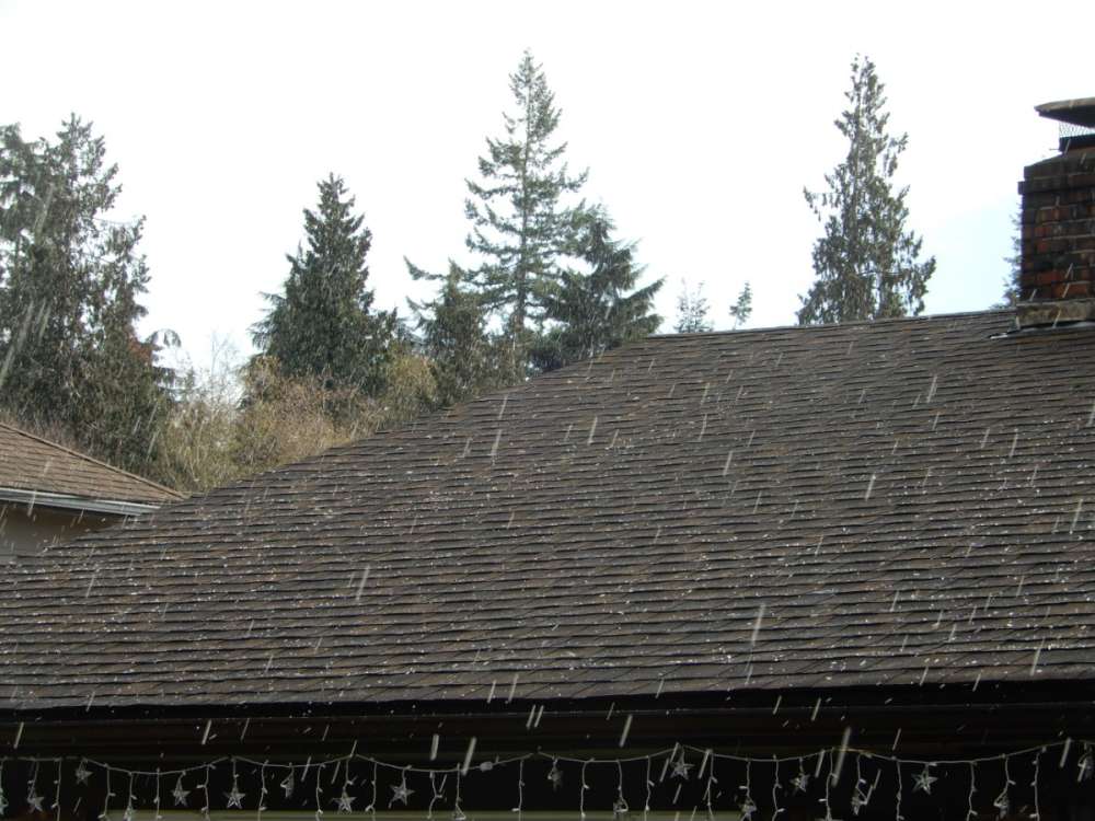
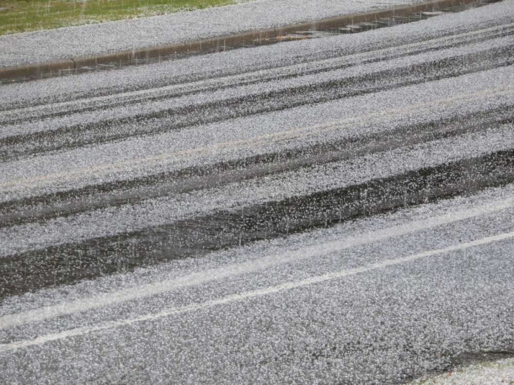
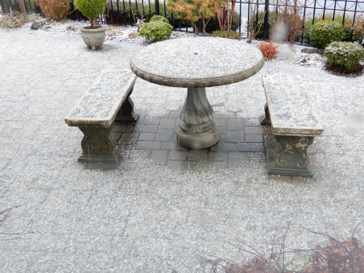
Throughout much of the morning and into the early afternoon, we kept getting very heavy hail storms! It was cool! By early afternoon, everything on the ground, roofs, and more were white.


 20 points
 -
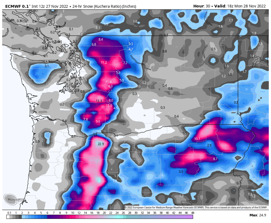
Sent by a friend who lives in Cannon Beach and has a paid subscription to a model site in a parallel universe where the GFS snow maps are accurate.
 13 points
 -
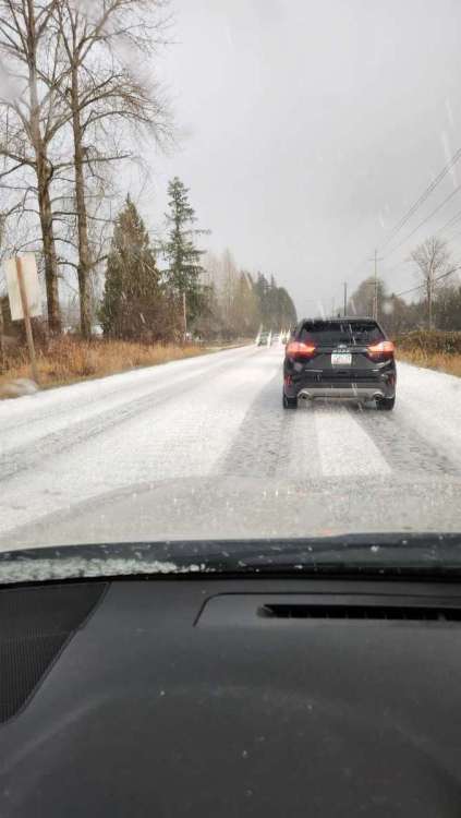
Starting to snow. Very wet and sloppy, temp down to 35.2 from 37.2 in the last 5 minutes.13 points
-
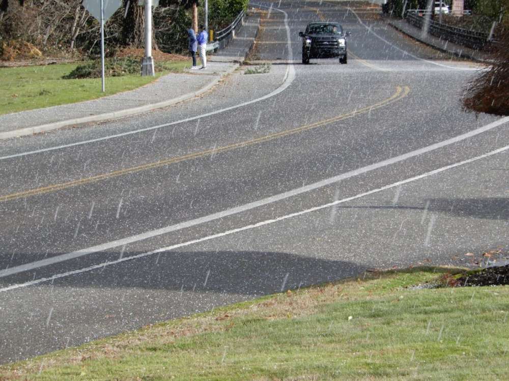
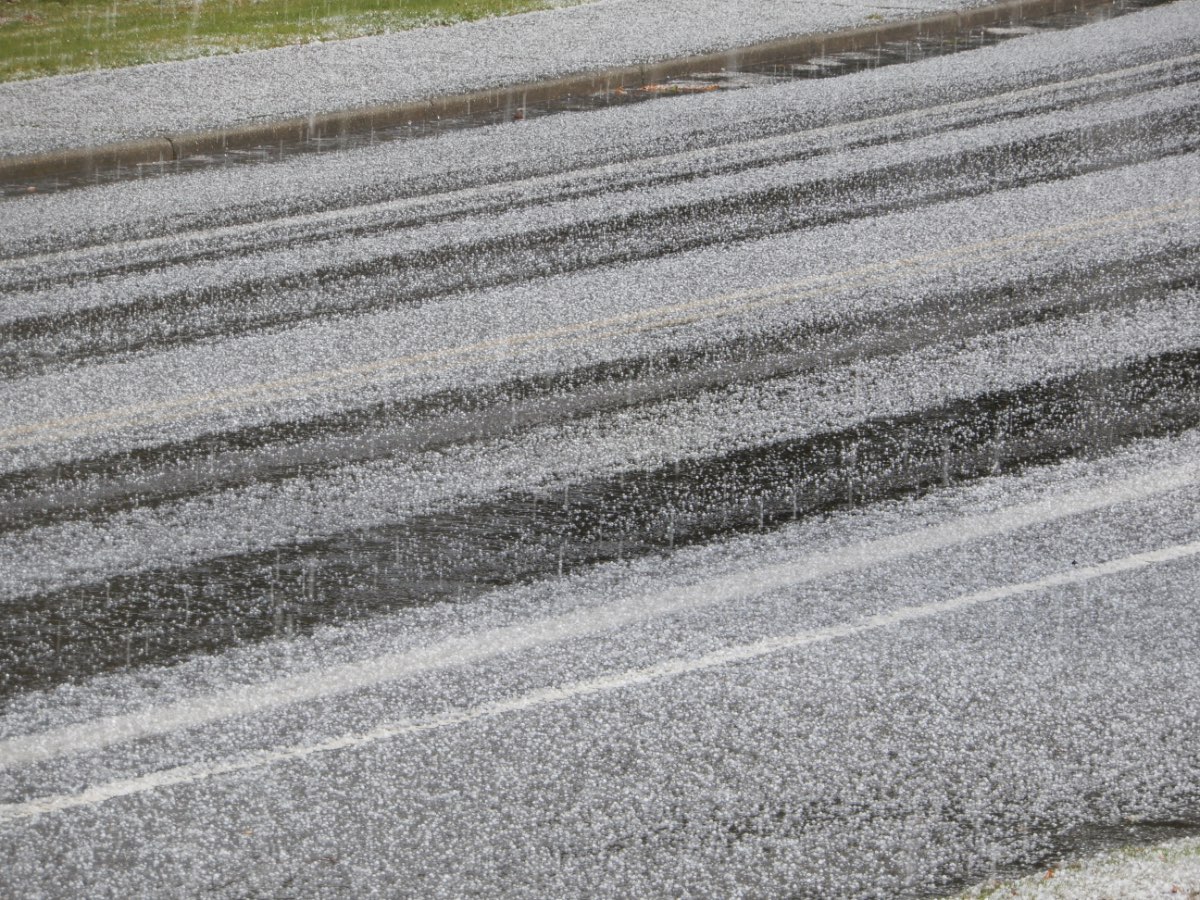
Over an inch of pecan to almond sized hail and its still pouring down. WOW Edit: unsure why there's also a broken video and I can't delete it...and we have wet snow in Sultan 20221127_135417.mp4 20221127_135417.mp413 points
-
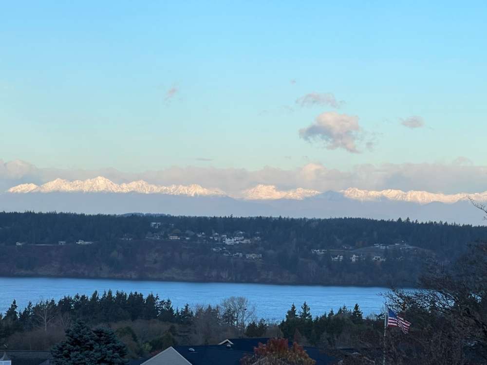
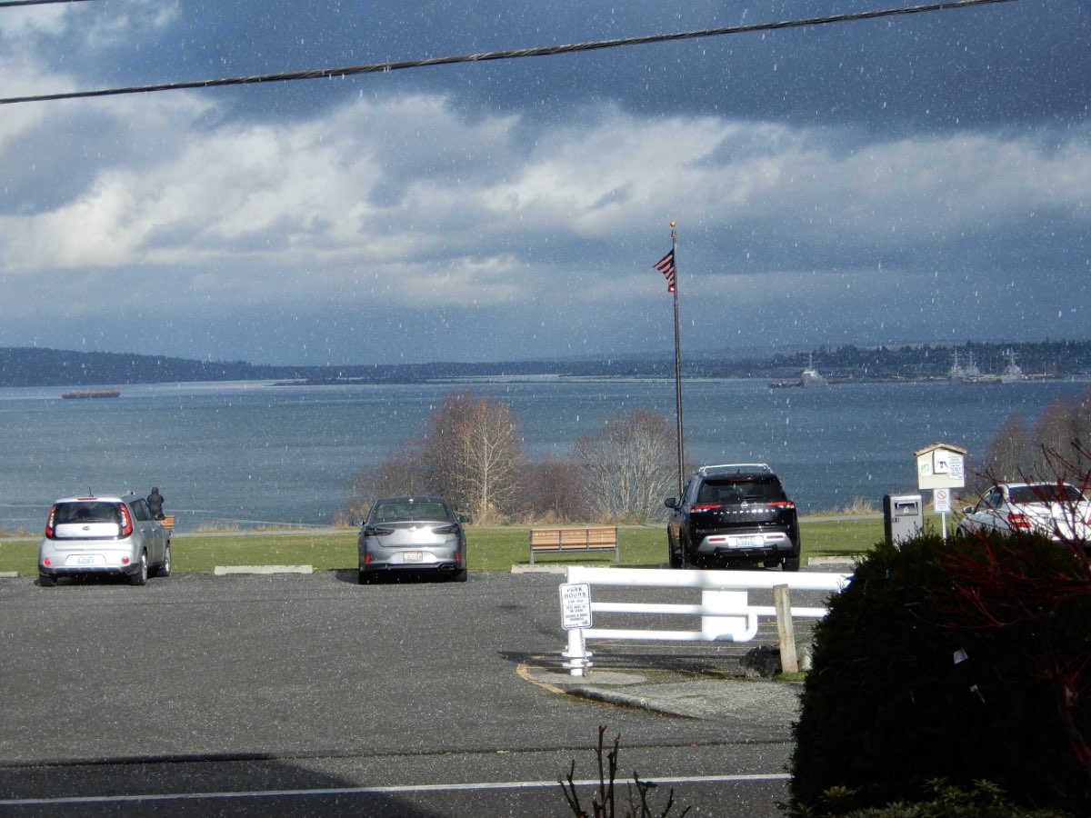
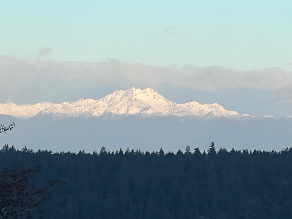
Olympics looking snowy this morning.
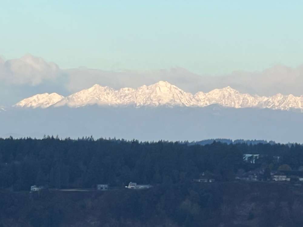
 13 points
 -
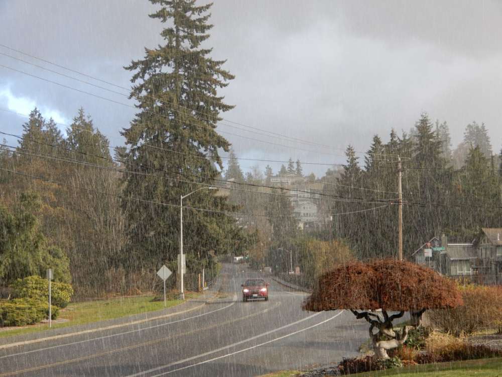
A few more seconds of hail and a pic as well. Probably the most impressive bout of hail I've gone through in years. 20221127_135505.mp4
 12 points
 -
Strike that. Noticed the ice pellet sound disappeared within a few seconds of writing that, so went out to check. Radar was right.
 11 points
 -
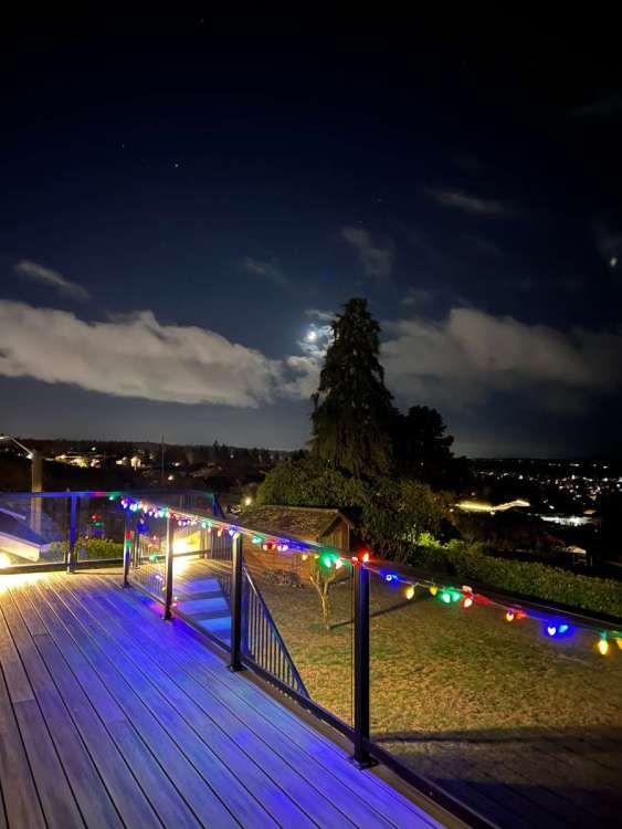
Nice evening.
 11 points
 -
This shot took a little work to get. CZ in background firing off (I’m somewhere on Whidbey).
 11 points
 -
Snow Extent in the Northern Hemisphere now Among the Highest in 56 years Increases the Likelihood of Cold Early Winter Forecast both in North America and Europe https://www.severe-weather.eu/global-weather/snow-extent-northern-hemisphere-highest-56-years-winter-cold-rrc/11 points
-
11 points
-
10 points
-
Think I might have a problem…
 9 points
 -
Some people scoring is better than nothing9 points
-
33 degrees and moderate snow - appears to be setting in for the night.9 points
-
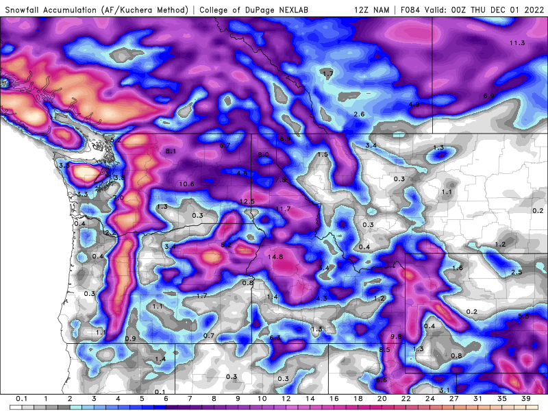
And Eastern Washington and Idaho. Lots of snow. Guessing there will be a Winter Storm Watches/Warnings all over our region We are benefitting from heavy snow over Stevens Pass making its way down to Leavenworth. Moderate to heavy snow now9 points
-
Winter Weather advisory for tomorrow: * WHAT...Snow expected. Total snow accumulations of up to one inch. Winds gusting as high as 40 mph. * WHERE...Lowlands of western Whatcom County, including Point Roberts, Lummi Island, Bellingham, and Sumas, Lowlands of western Skagit County, including Cypress Island, Guemes Island, Anacortes, Mount Vernon, and La Conner and Everett and vicinity, including Stanwood, Marysville, and Mountlake Terrace. * WHEN...From 10 PM this evening to 10 AM PST Monday. * IMPACTS...Plan on slippery road conditions. * ADDITIONAL DETAILS...Scattered snow showers tonight into Monday morning. Showers may be heavy at times decreasing visibility. Wind advisory too: * WHAT...Northeast winds 25 to 35 mph with gusts up to 50 mph expected. * WHERE...San Juan County and Western Whatcom County. * WHEN...From 4 AM to 10 PM PST Monday. * IMPACTS...Gusty winds could blow around unsecured objects. Tree limbs could be blown down and a few power outages may result.9 points
-
uptick in snow totals on the EPS
 9 points
 -
Next 24 hours... I think both of us have a chance at some snow by tomorrow morning.
 9 points
 -
Our little young souls sure do put us through some interesting times. I remember doing a escape to the coast with wife and baby as we were exhausted full time workers and broke. First night around 1 am our daughter began projectile vomiting over the entire bed including us. I remember just staring at my wife in shock with this crud (it was warm) everywhere and instead of crying or saying choice words we began that laughter you can only do when you go beyond the limit of your emotions ….Crazy stuff but you get through.9 points
-
Another really nice snowstorm for PDX north Friday night into Saturday.
 9 points
 -
Just so we're all on the same page of what the best possible setup is.9 points
-
No single model is a ride or die at this point. They are all a mess. Enjoy the ride!9 points
-
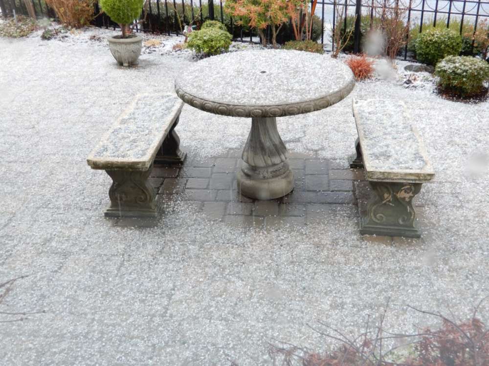
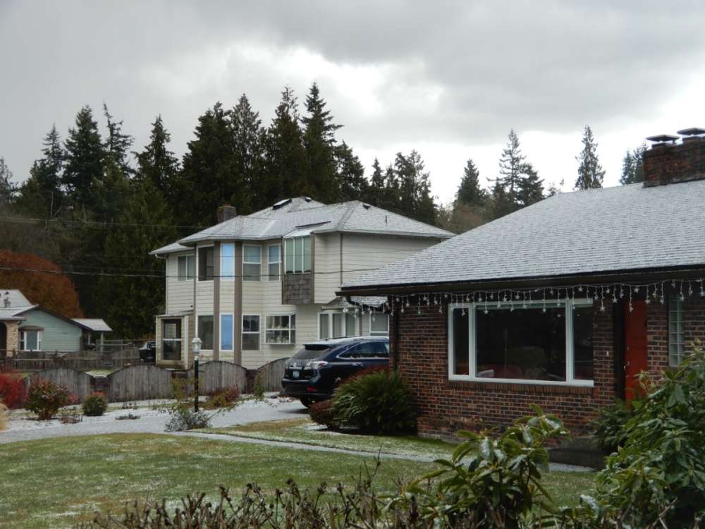
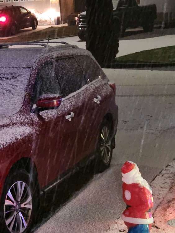
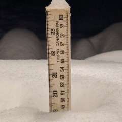
Snow starting to stick to the deck and landscaped areas. 32.98 points
-
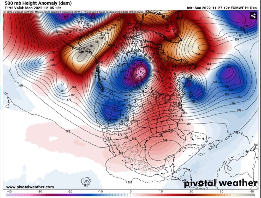
GFS still toying with the idea of beating up on the PV a bit. Since it can’t do anything right near the surface, perhaps it can at 40,000 feet…
 8 points
 -
Sumas highway cam.
 8 points
 -
Continued multiple chances for lowland snow in western Washington on this run.8 points
-
If things line up correctly, Tuesday evening has the potential to be something really special. A good slug of heavy precipitation coinciding with offshore gradients. Only problem is that's when the warm LLJ really gets cranking, so precip type will be really dependent on the depth of Cascade gap outflow. Right now it's highly variable. And to be honest I have no idea. I really don't. It's combination of our modeling usually being too overzealous with both outflow AND cold air scouring. How wrong is it? Which factor will take over??? I really do not envy the folks at Sandpoint right now.8 points
-
What my wife thinks of all of us…
 8 points
 -
Not if you live in Portland and like rain.8 points
-
Seattle north looks good Bham goes crazy
 8 points
 -
Temps here are 5° below modeled for 10 am IMBY. 35.6°. So I might not see 40°+ for 10 to 15 days! That's cool.8 points
-
All aboard the wishcast express!8 points
-
It’s rather lovely having the fireplace going to warm up the house on a chilly morning with the power being out. Everyone else is still asleep so I’m just relaxing on the couch. First time the fire has been on since the long power outage at the beginning of the month…Propane is not cheap right now. Sure wish we had a wood stove. Oh well.
 8 points
 -
Hey insomniacs! Little man woke me up for the 06z. He said its time to ride!8 points
-
Who could not love Rob, let's be real. The first winter he isn't here will be incomplete.8 points
-
It seems the next 5-6 days are a lock. We're not going to see arctic air in PDX metro. Perhaps Everett north. As long as the overall blocking theme continues and the bitter air is going nowhere up north, anything is possible after Day 5 in my opinion. 00z GFS in 22 minutes7 points
-
00z NAM is more south with the low.7 points
-
The potential later in the run is definitely still there. Good block with some cold air in BC and a trough coming down.
 7 points
 -
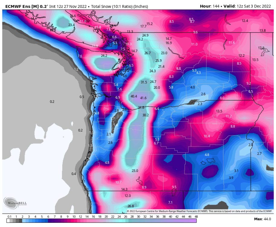
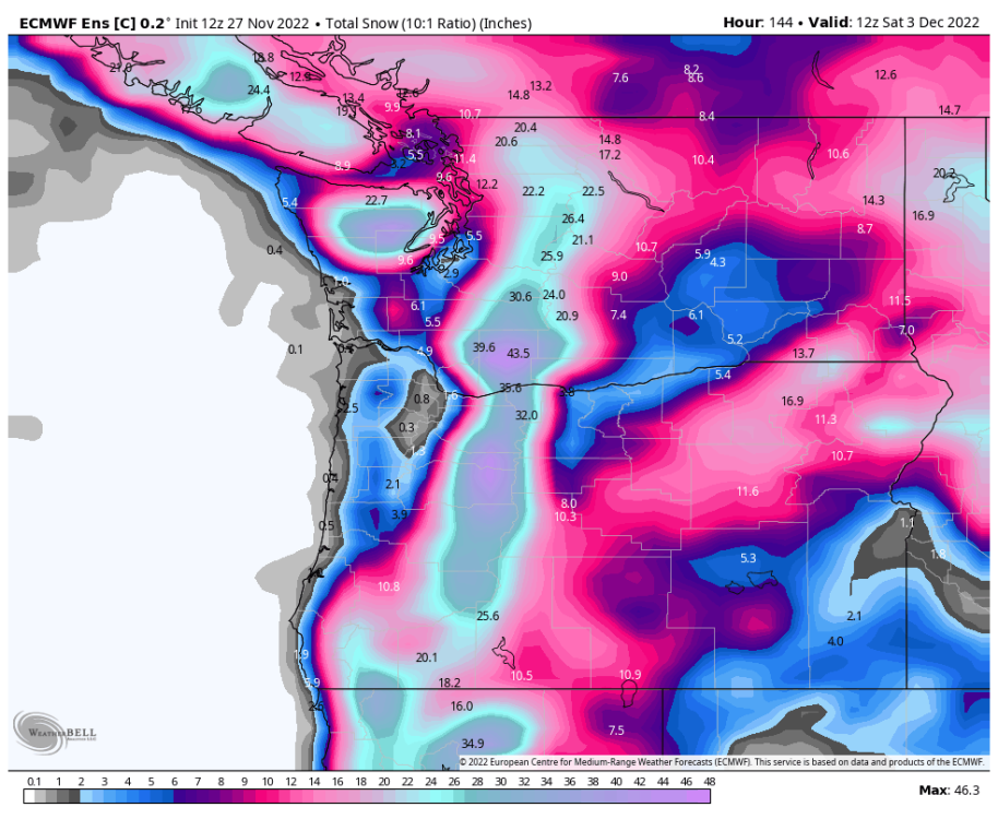
Actually the Euro is showing 17” here from hour 84-132. On pivotal with the 10:1, so probably wouldn’t really be that much… But it’s possible, we had 21” with the anafront in March 2012.7 points
-
Very high bust. Seattle could get nothing or 6 plus inches.7 points
-
12z NAM has a few inches for Seattle
 7 points
 -
12z Euro looking better for the Puget Sound.7 points
-
12z Euro has the low farther south but a bit stronger.
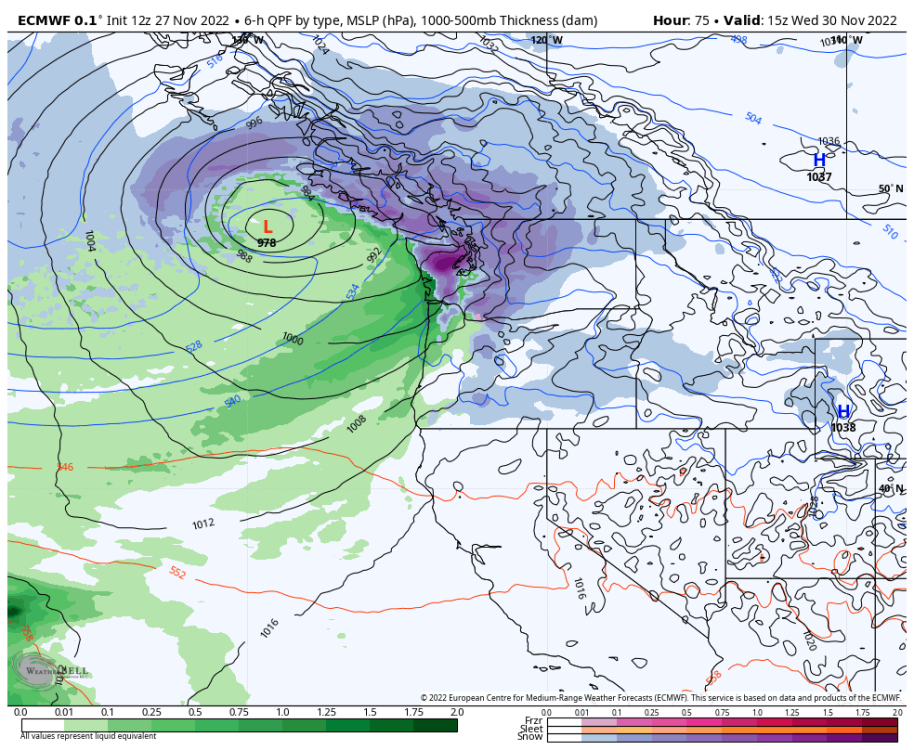 7 points
 -
what could go wrong?!7 points
-
72 members currently online...at 2:46 in the morning. Impressive!7 points
-
Seen it happen before. Models start getting better data input starting soon as the pattern takes shape up stream over Alaska. Pretty limited surface data out over the North Pacific and arctic7 points


.thumb.jpeg.e3014abf99ef08a9f9ac2c0cd31b485b.jpeg)


This leaderboard is set to Vancouver/GMT-07:00