
Leaderboard
.thumb.jpeg.e3014abf99ef08a9f9ac2c0cd31b485b.jpeg)


Popular Content
Showing content with the highest reputation on 12/03/22 in all areas
-
Live view here...
 21 points
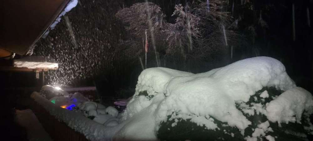
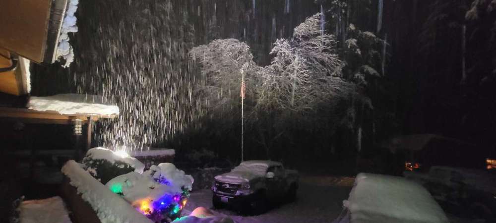
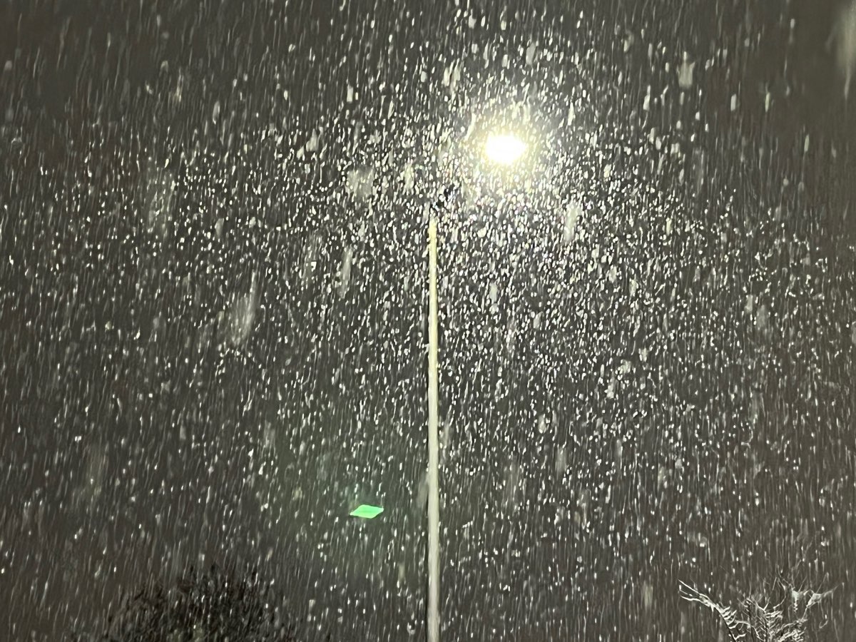
 -
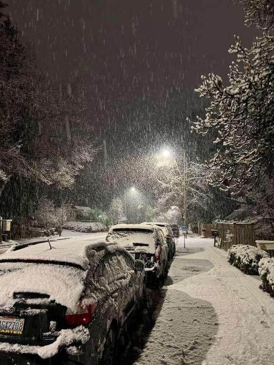
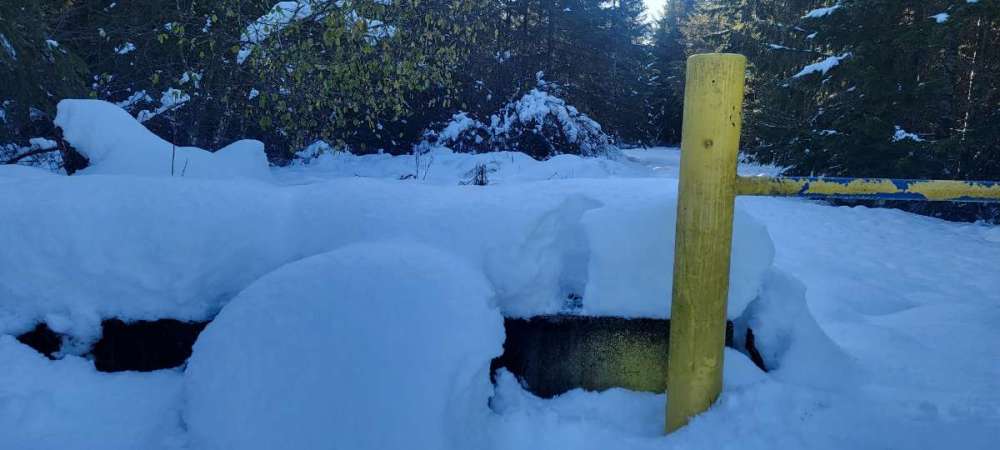
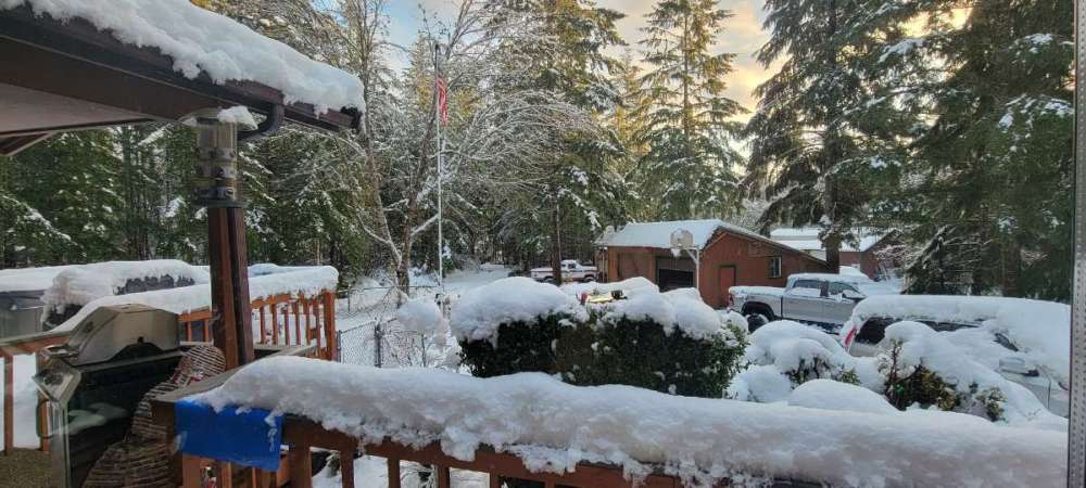
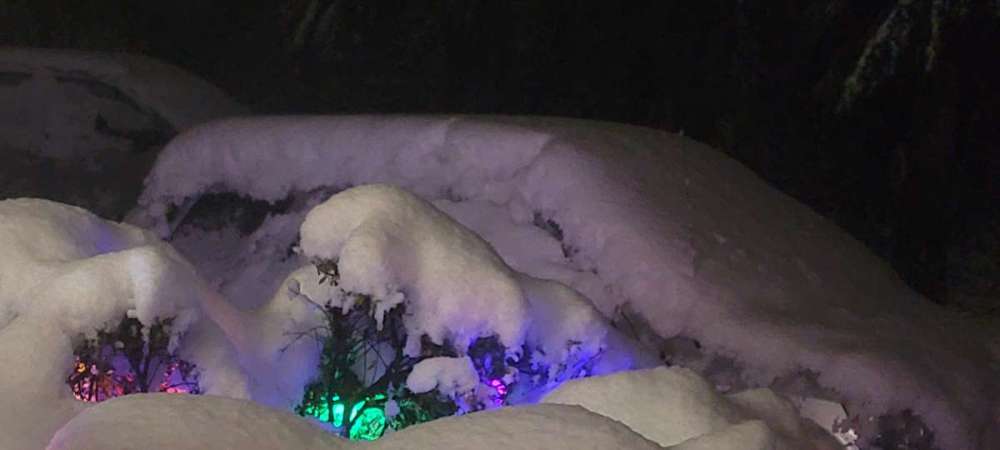
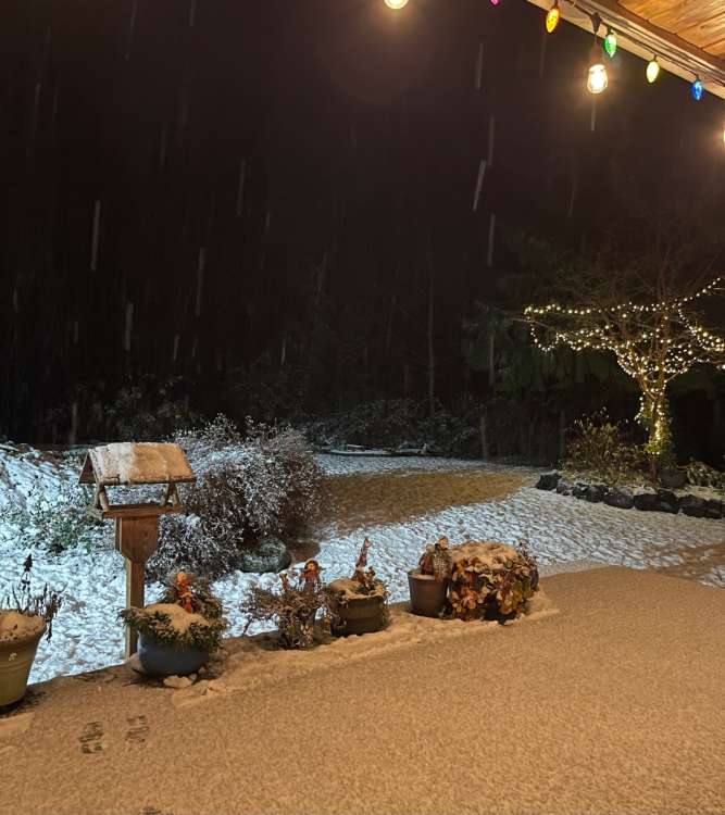
Just amazing. 13 inches on the ground. My little buddy always stays up with me watching the snow.

 18 points
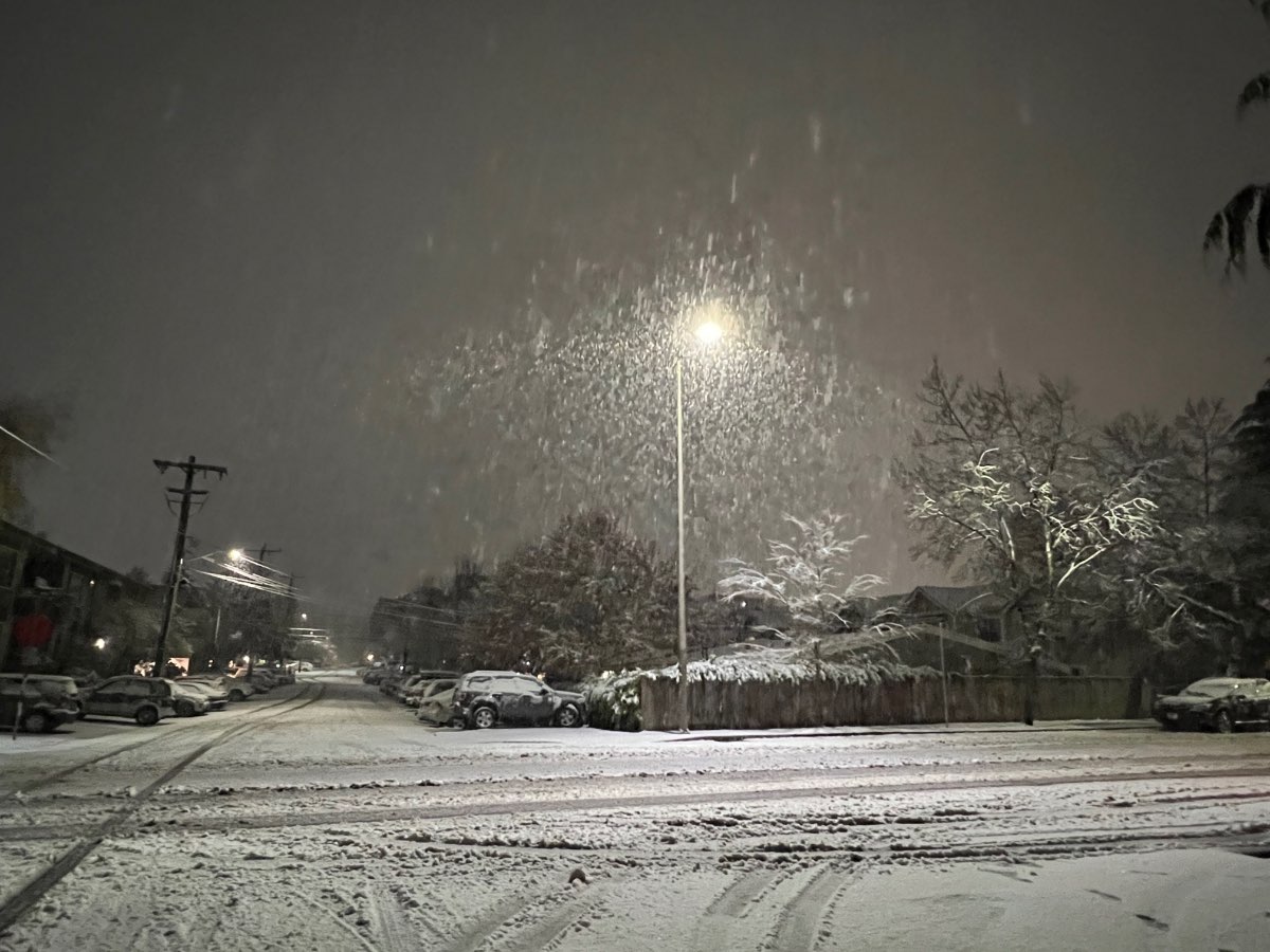
 -
Went on a walk. Still buzzed after a party I threw this evening. Phenomenal day and a fitting end to the night. I love this place, this is the stuff I live for. At my house there's about 75% of the snow I saw 200' up on top of the hill. Still white everywhere.
 14 points
 -
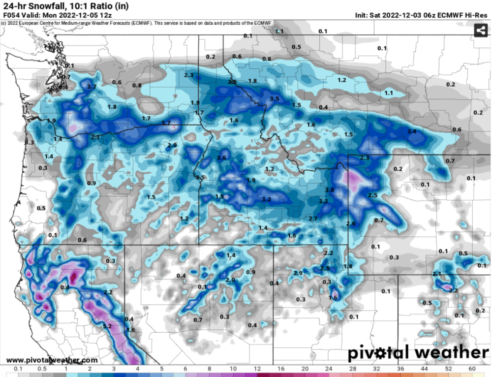
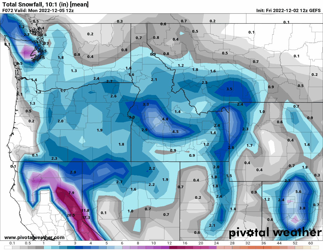
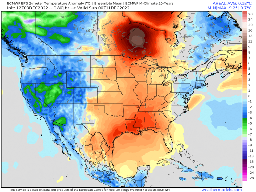
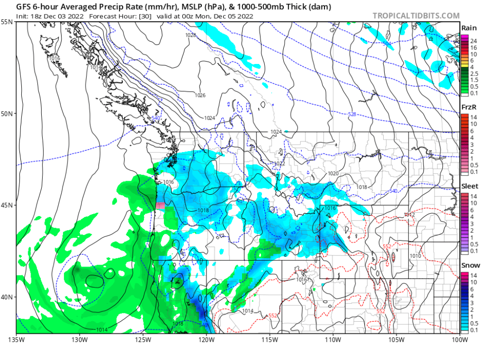
This is encouraging to see. The 00z GRAF came in way snowier than any of the previous runs. I don't think any previous run even showed 1.0 inch of snow or .38 in QPF for PDX. The new 00z GRAF pulled a GFS/GEM and is now going for 1.05 in QPF and 4.5 in of snow. The fact that the GFS, GEM and GRAF have all had a run today with 0.8-1.20 in QPF in PDX tomorrow suggests this setup is more dynamic and explosive than it may initially seem.13 points
-
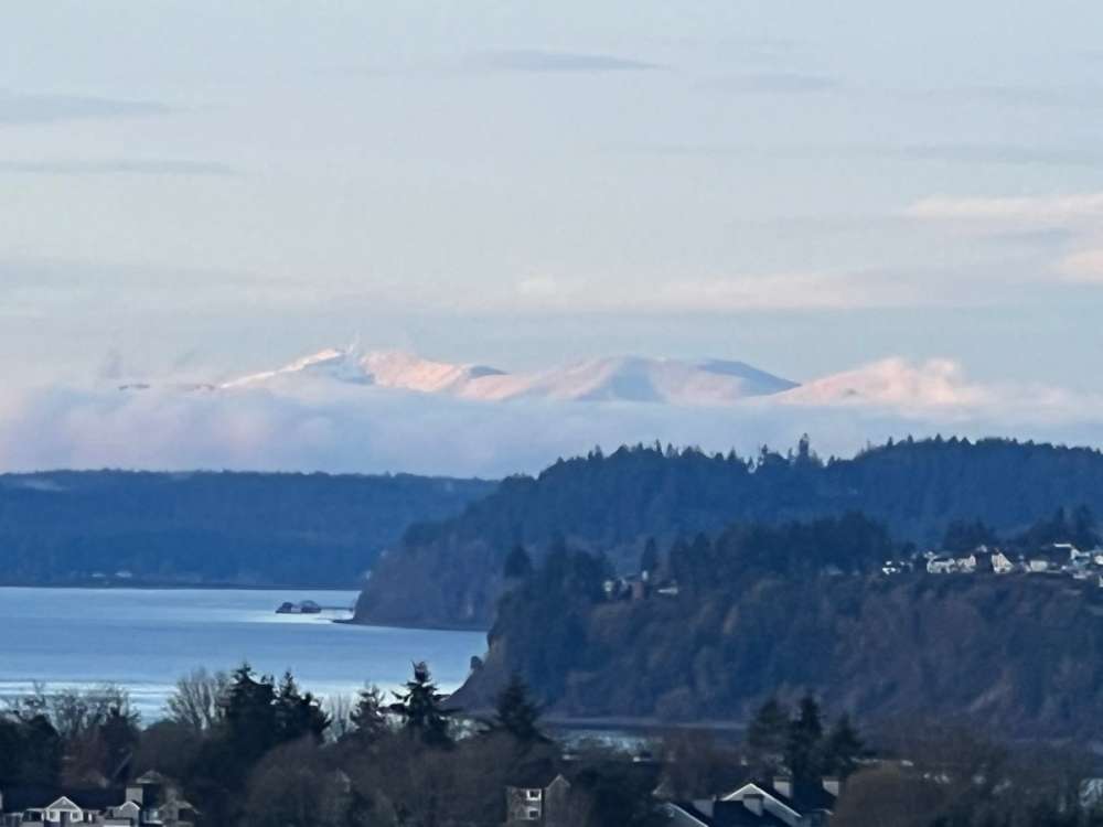
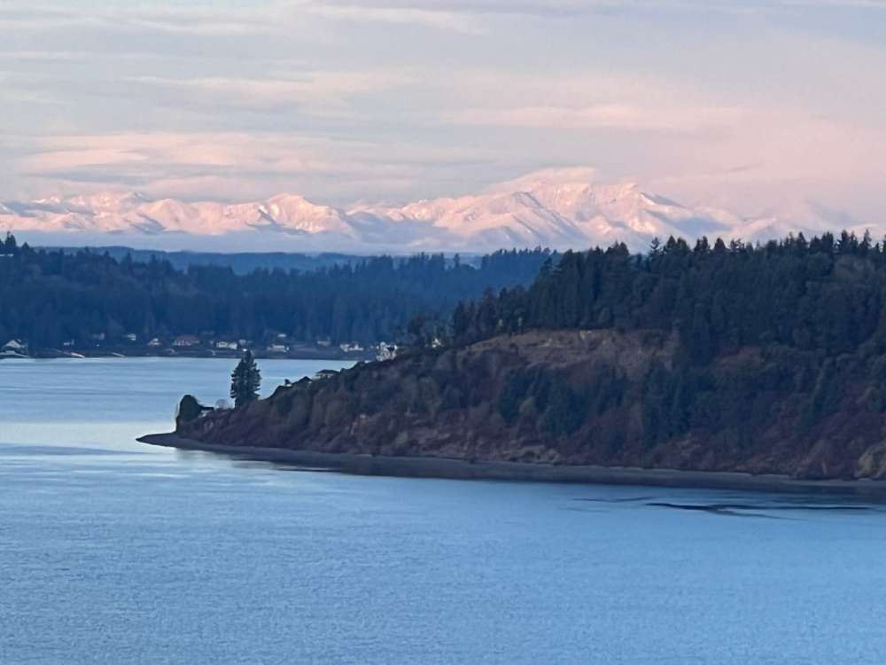
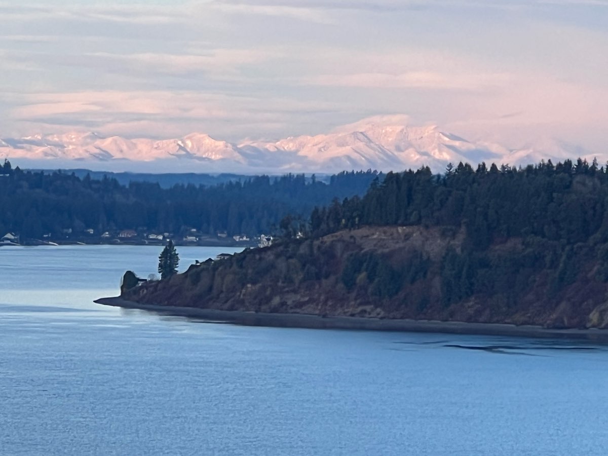
If you guys really want to see what the hood canal area is capable of then look at this! I'm right on the line of the hood canal sweet spot and normally my area does really good but this time the cold air dome just wasn't far enough east to really get me into the zone. This area between seabeck and lake tahuya is always the sweet spot and they are lower elevation than me but because they are closer to the Olympics the cold dome is deeper there sometimes. There is 18 on the ground. Lastnight there was 21 on the ground before it settled. Normally if they have 21 I would have 18 but not this time!
 13 points
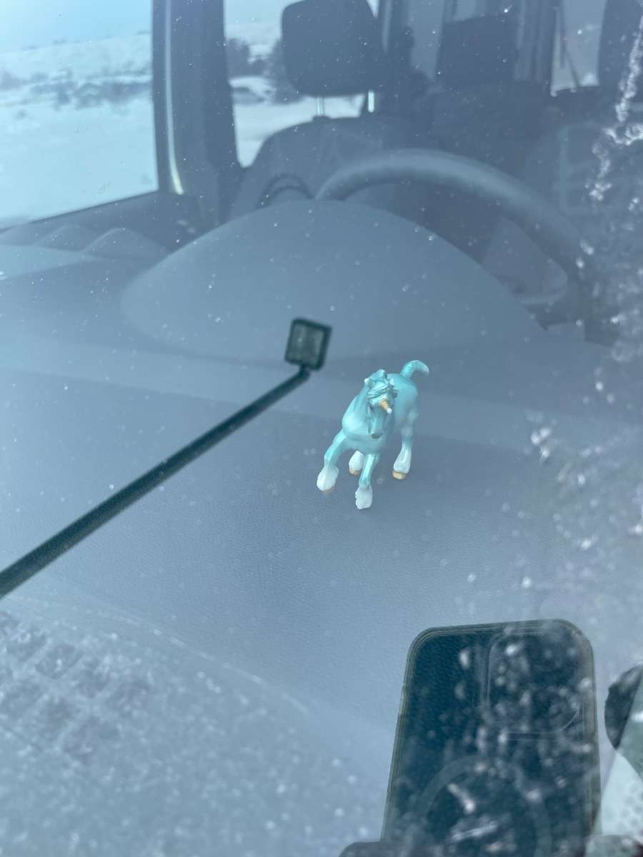
 -
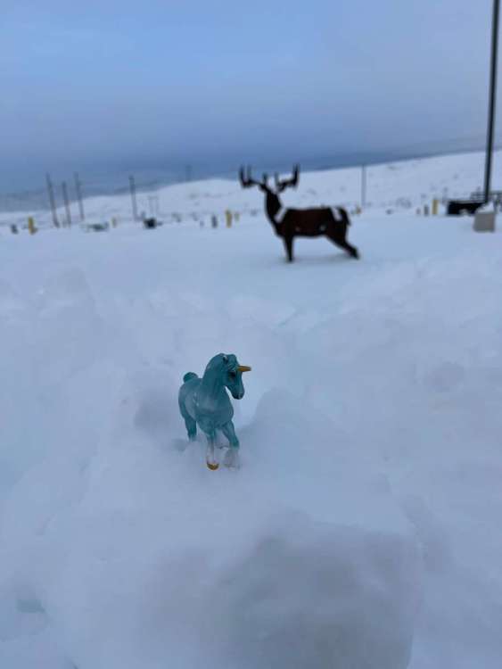
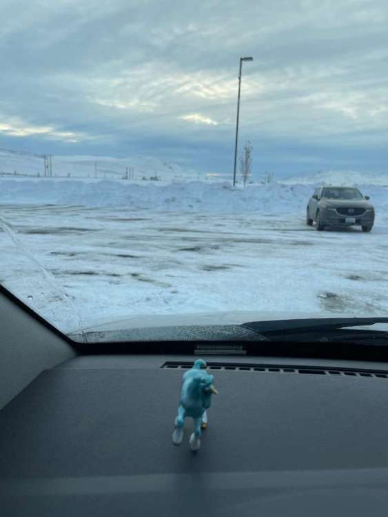
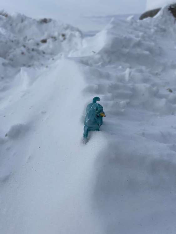
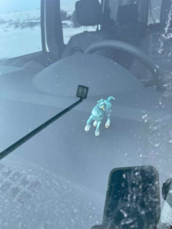
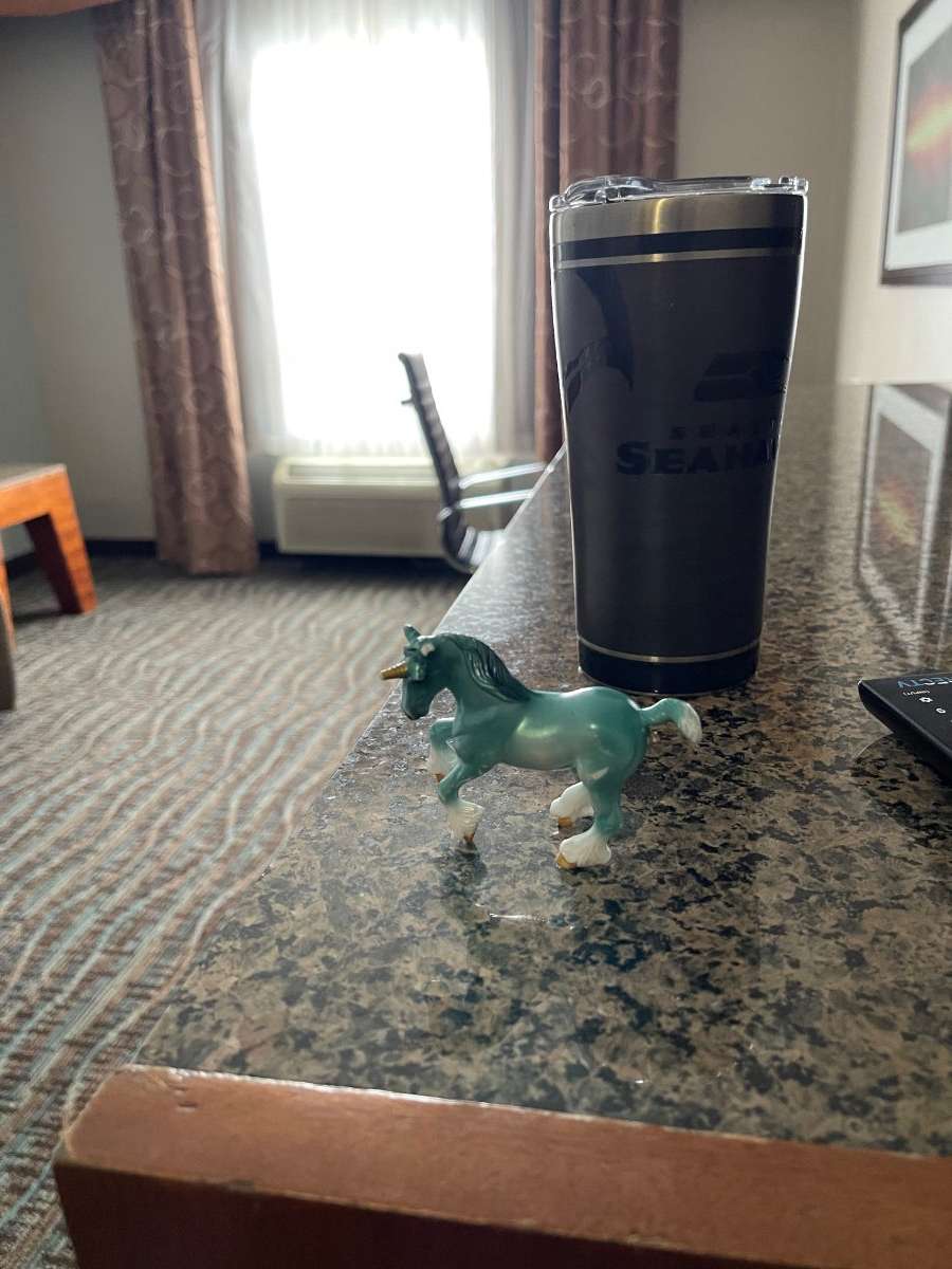
A few more pics from Omak. Before I left my 4yr old daughter wanted me to take her unicorn on my work trip so I decided to get pics of said unicorn enjoying the trip with me…Enjoy!
 12 points
 -
I honestly have no idea what timezone I'm in right now but I'm having so much fun tracking and seeing all the pictures from you guys! I'm really hoping Portland can get in on the fun Sunday night! It's looking very promising. I will say the ECMWF seems to have a dry bias thus far this season so I'm hopeful for my PDX peeps!11 points
-
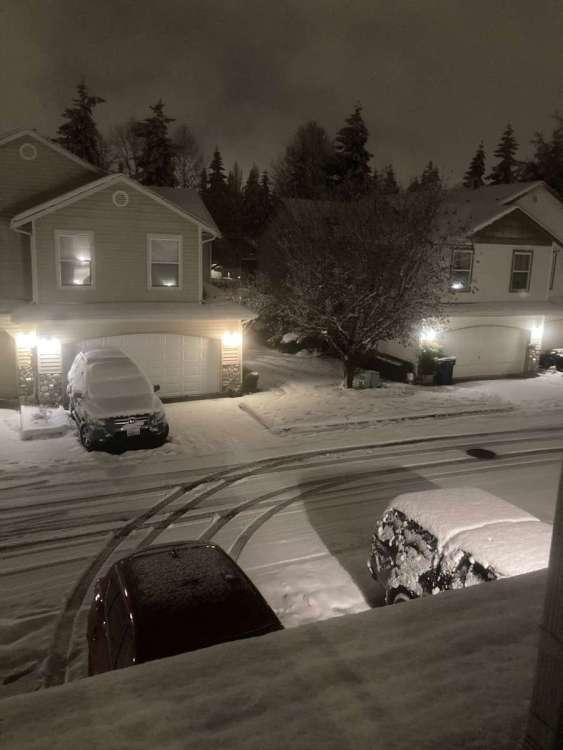
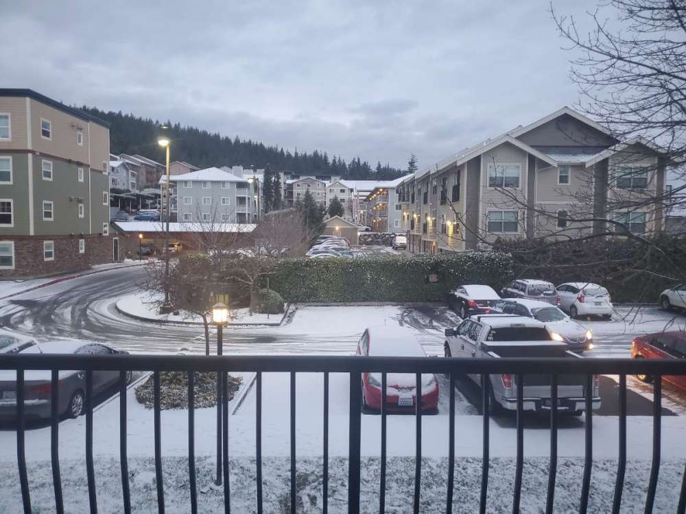
Just got home to South Everett and there’s 3” of new snow from tonight. 6 plus inches on the ground just about everywhere now and that’s already 8.5” on the season.
 11 points
 -
Nice sunrise earlier. Gusty east winds here this morning. Currently 36 with a DP of 20.
 10 points
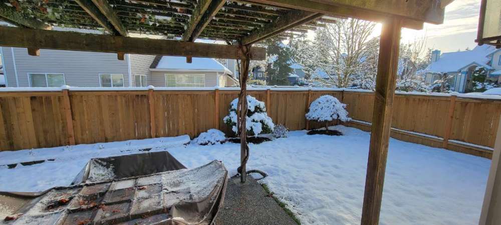
 -
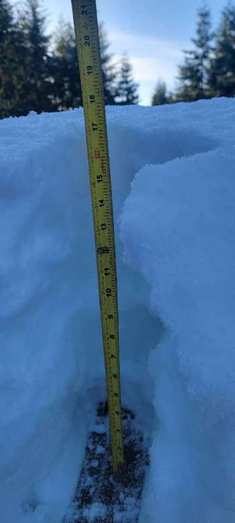
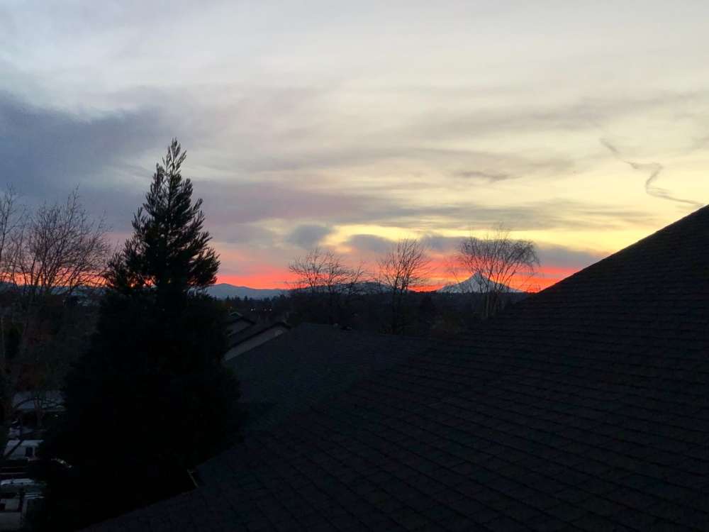
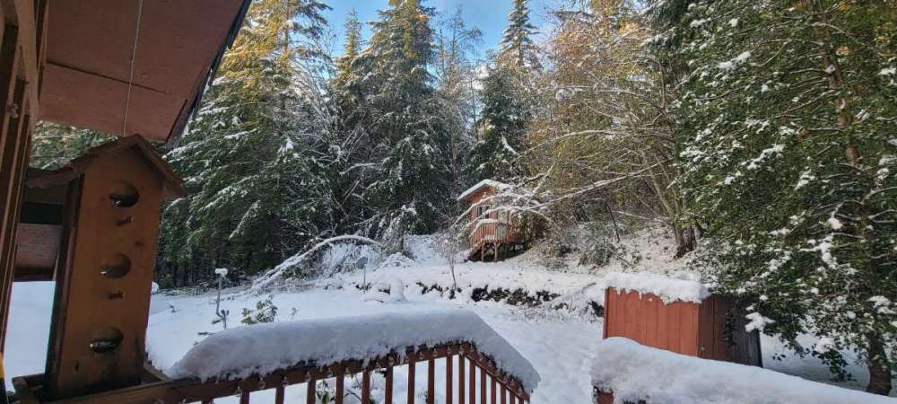
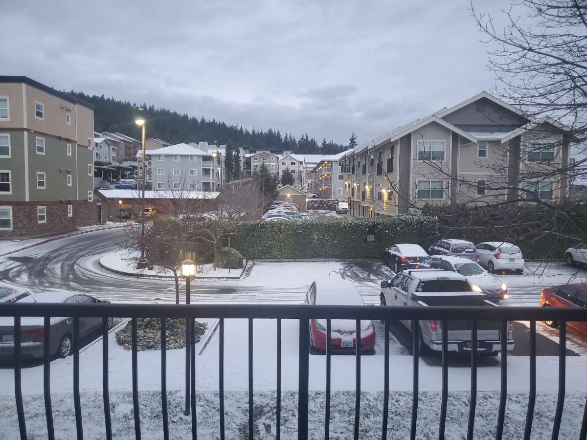
Time to clear a path on the porch again. Looks like about an address inch last night. And the beginning of a beautiful sunrise.
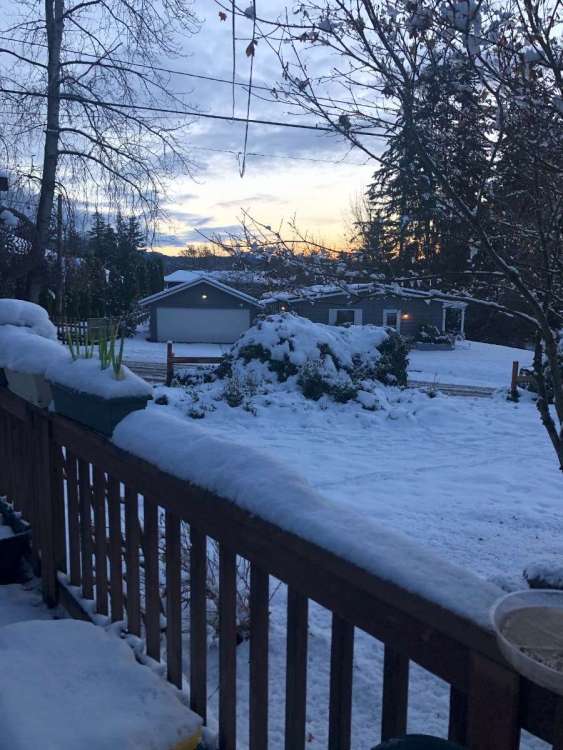
 10 points
 -
Judging by ensemble trends, mid-month looks like the next best chance for an Arctic outbreak in the lowlands.10 points
-
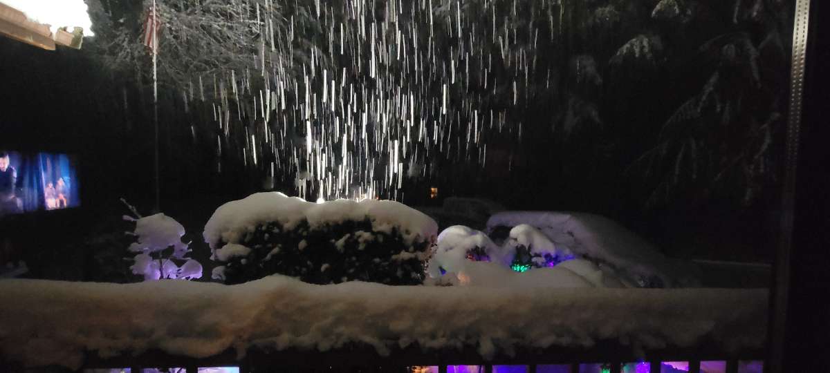
From last night.
 9 points
 -
I would like this weather for the rest of the month... with a snow event every 2 or 3 days to freshen things up. Can we make that happen? No roaring SW wind and rain for a few weeks.9 points
-
SEA did pretty good out of this event! They are up to 4.4” for the winter so far that’s pretty good for it only being Dec 3.9 points
-
Melting off the trees. 34 degrees, that storm from beginning to end dropped 8.5 inches here. Gfs did good.
 9 points
 -
Last 3 euro runs seem to be steps in the right direction
 9 points
 -
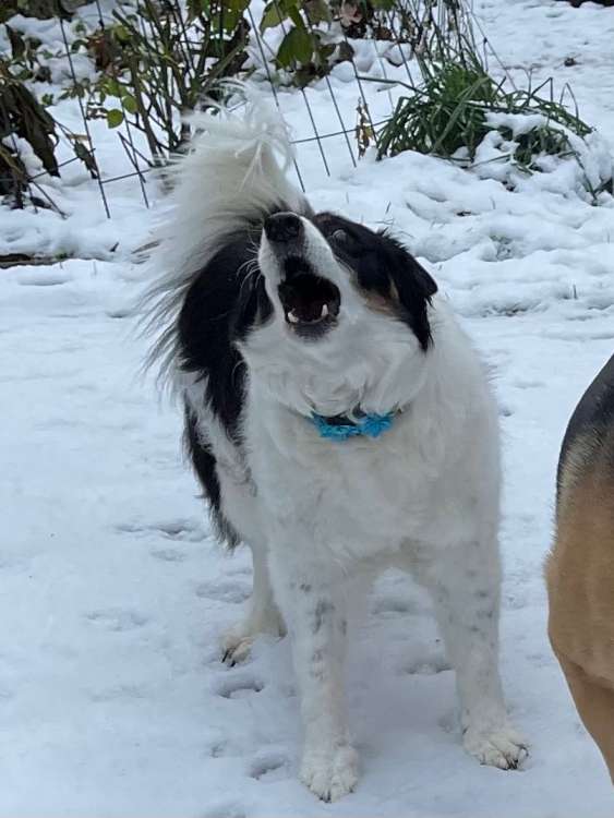
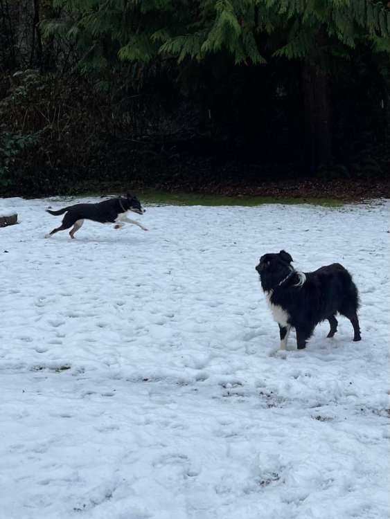
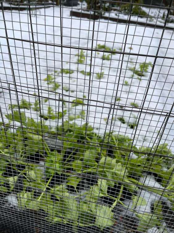
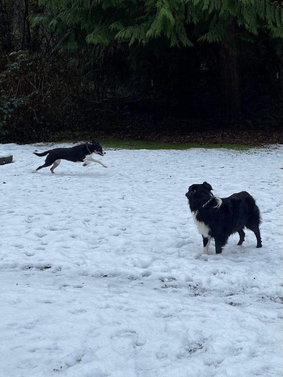
My 15yr old Border Collie is demanding more snow! The dogs sure do love the snow. Oh and if anyone would like some frozen celery, come on over!
 9 points
 -
I really really really hope this works out for Portland! Y'all deserve something out of this. Already got our fix of heavy, wet accumulating snow, around 1.5" here tonight.9 points
-
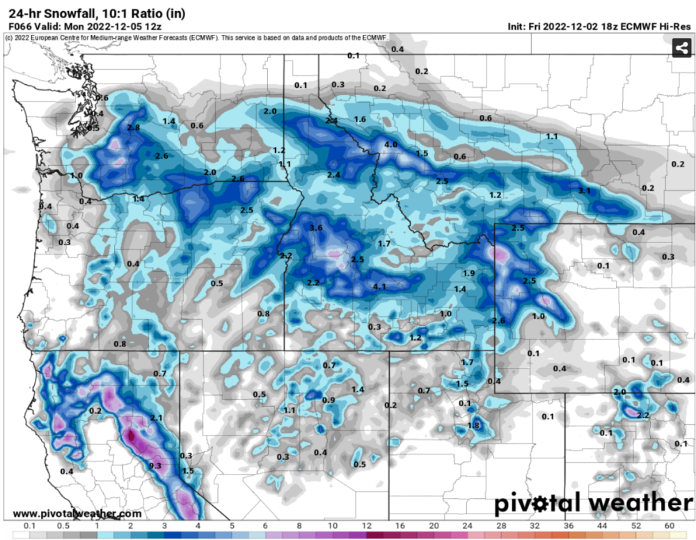
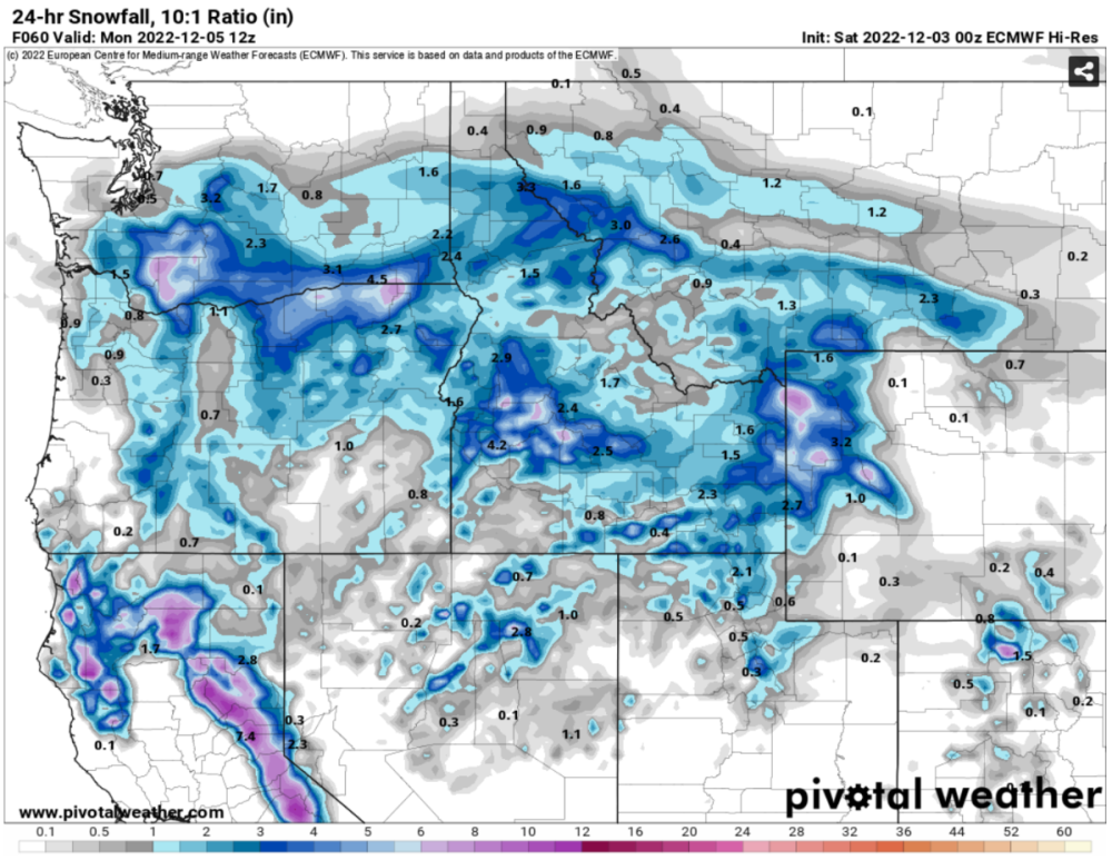
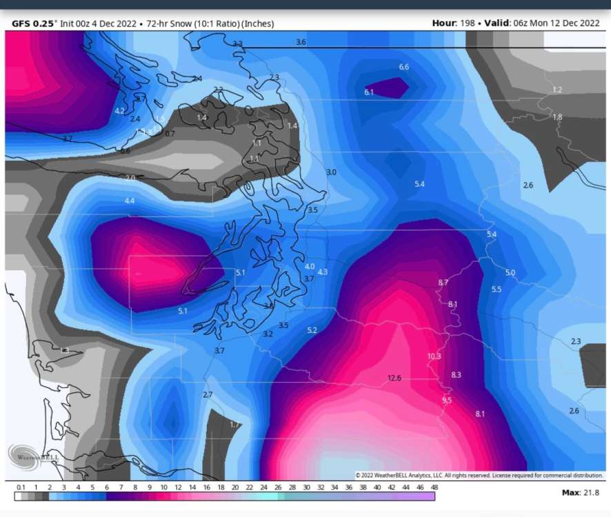
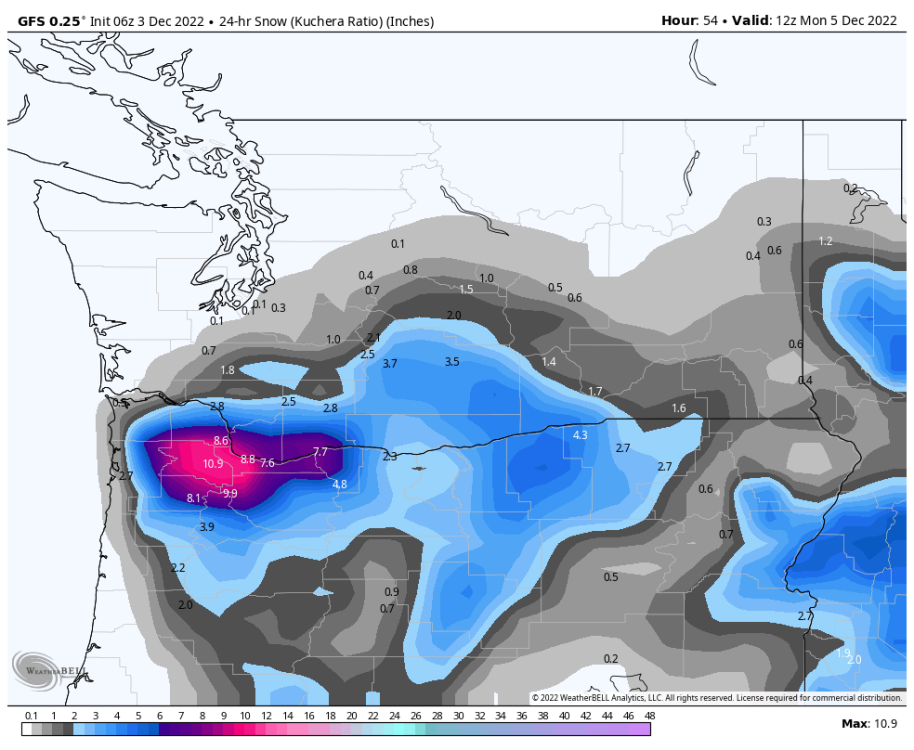
GEFS continues to trend snowier for Sunday! Hmmm.... Snowfall totals ending 4 AM Monday (4-run trend)
 9 points
 -
Deep on the old Honda crv
 9 points
 -
Feeling pretty decent for areas with a little elevation (above 150-200') from Portland to Castle Rock. I think 2-3" is a reasonable bet for those folks.8 points
-
Seahawks game looks snowy next Sunday… it has been pretty consistent about it also
 8 points
 -
Beautiful day to blow up cans in the woods.

 8 points
 -
EPS disagrees with the operational as far as next Saturday is concerned
 8 points
 -
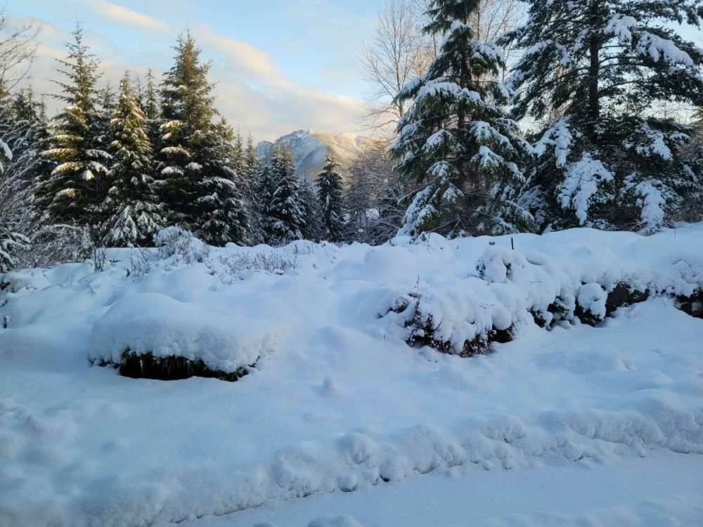
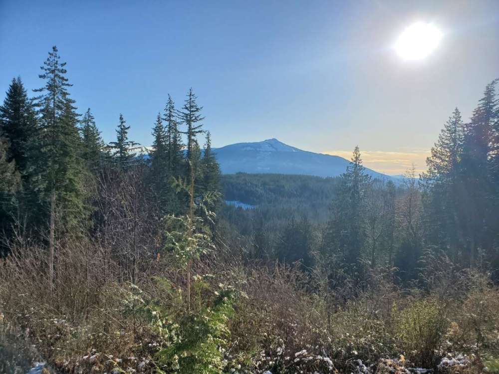
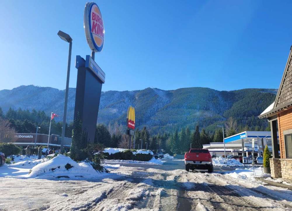
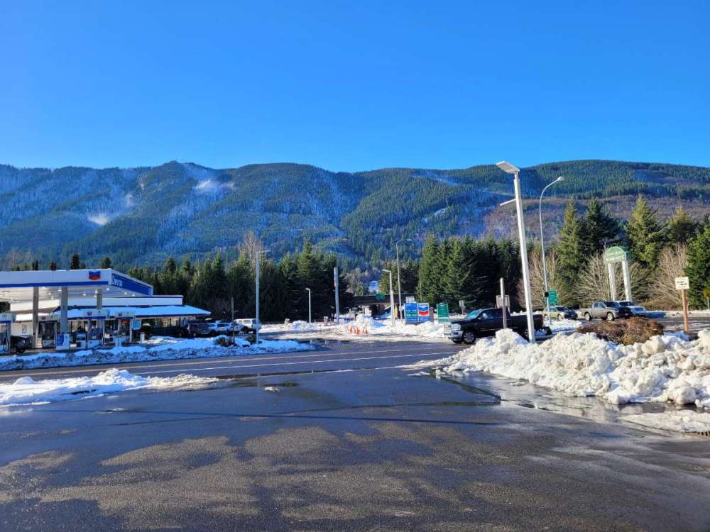
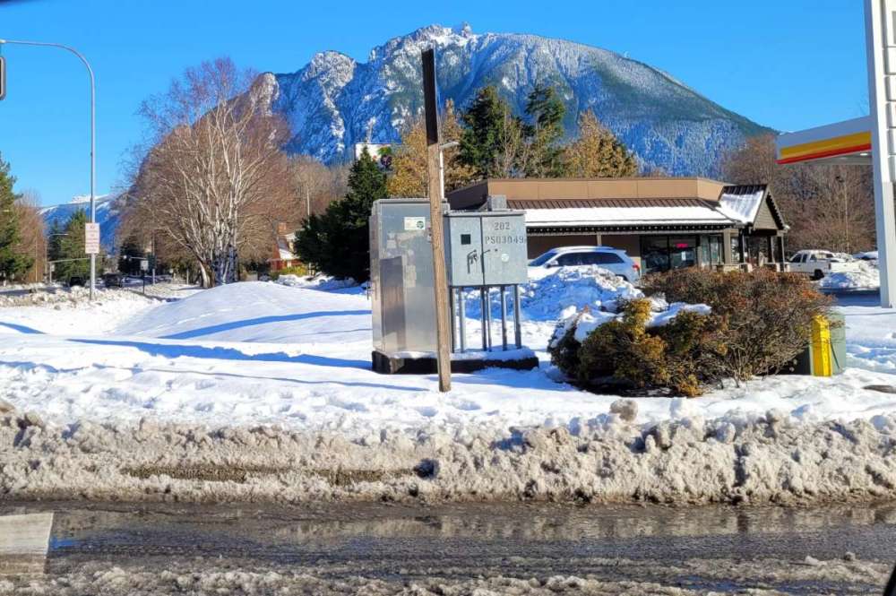
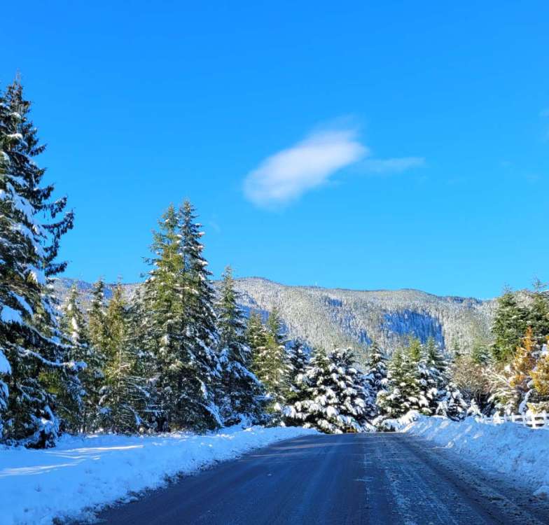
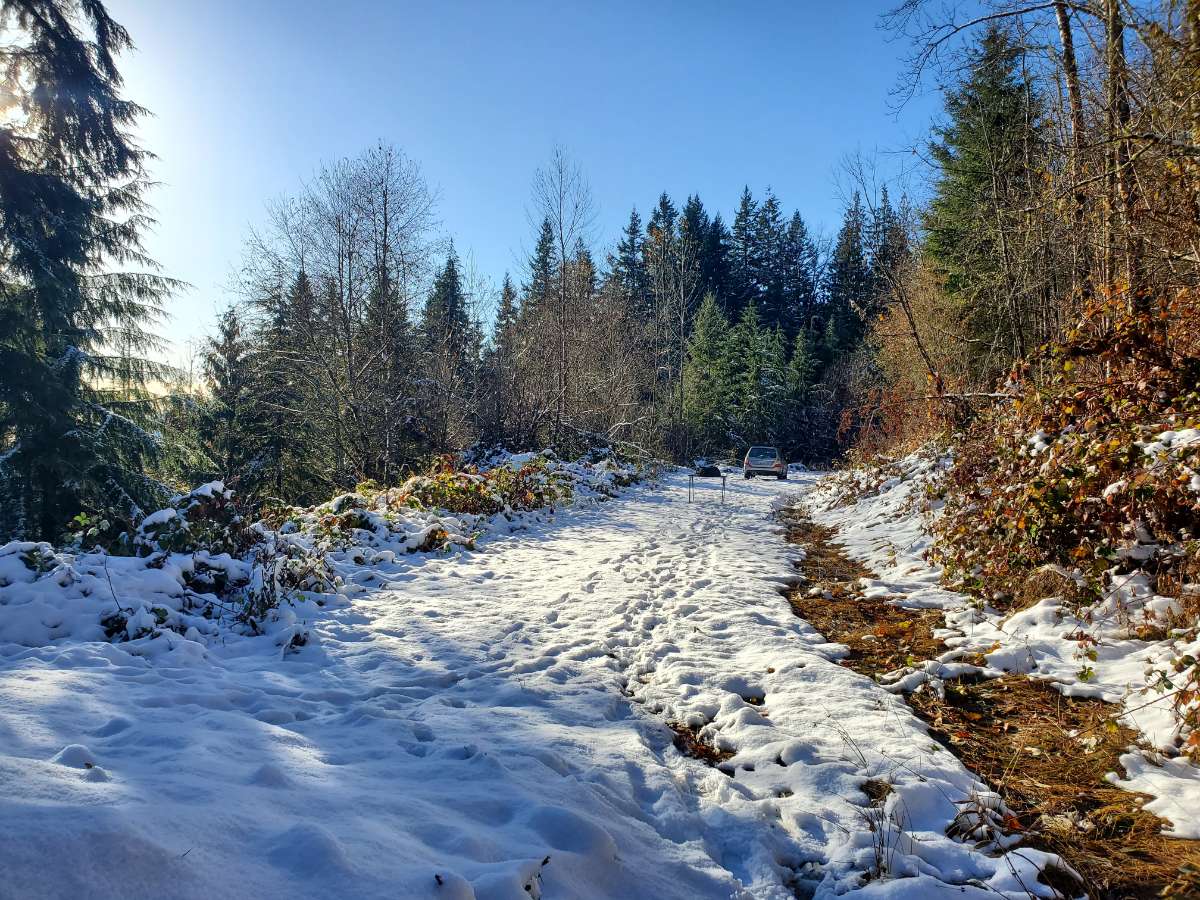
Live view from North Bend... east wind is too warm today but still a gorgeous day.
 8 points
 -
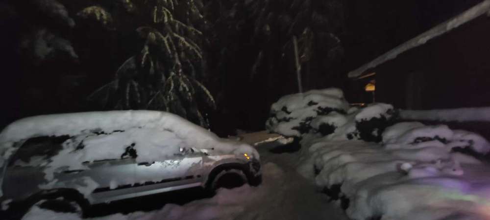
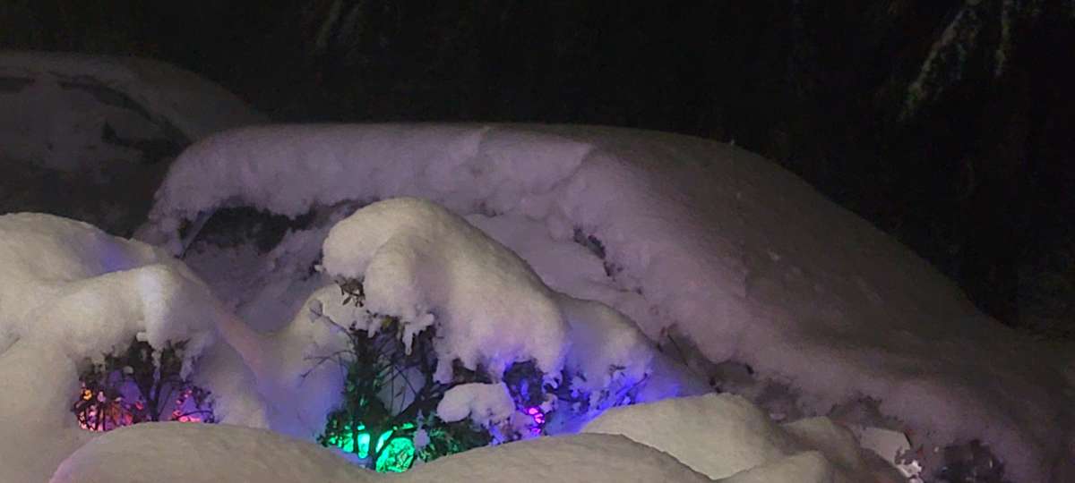
My favorite pic from lastnight.
 8 points
 -
Ready for more! Only Dec 3rd. Lots of winter left to go.
 8 points
 -
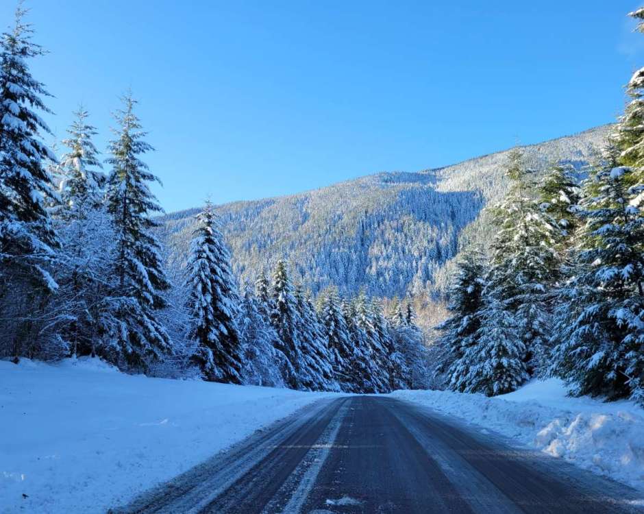
Bluebird conditions today...
 8 points
 -
Snowy hills this morning.
 8 points
 -
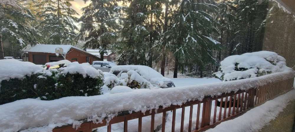
Lovely scene this morning. Maybe a half inch of wet frozen stuff, the most accumulation I've seen so far this season. Definitely taking a drive to the mountains today.
 8 points
 -
Still awake. And wow!! The 06Z GFS would be amazing for Portland.
 8 points
 -
Hi! Just got home from Omak. It’s snowing!
 8 points
 -
There is another large area of enhanced precip moving up towards Olympia now... if it extends east like the last band it could be pretty crazy for several more hours.8 points
-
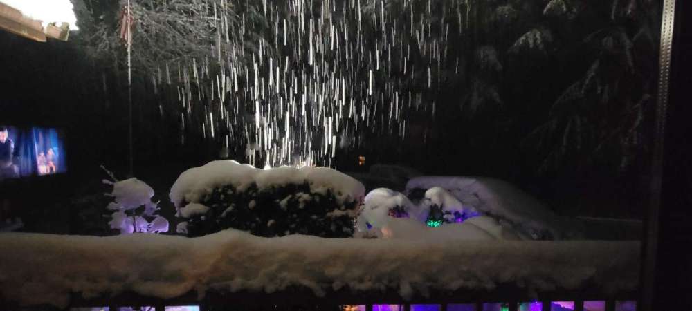
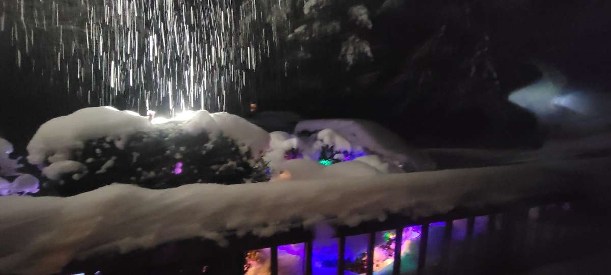
Escalated quickly!! Full on heavy snow now!!! Blowing in from straight north. First time I've seen this at night at the new house, this is great!!!7 points
-
After spending 2 weeks in Bend, I saw the same thing first hand with the dry air that is always there. The snow just didn't melt unless the sun hit it. Even if it got into the upper 30's, the snow was perfectly safe from melting. Also, the second it got to around the freezing level, everything immediately froze solid. Much different than what usually occurs on the west side of the Cascades. Dew points are almost as important as temps in many scenarios in the PNW because the margins are so slim.7 points
-
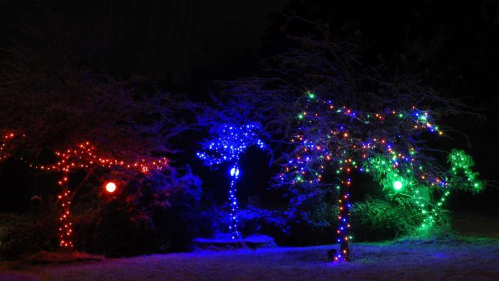
Starting to be real snow now. Really looking awesome with all my lights up. I may take a little walk down the neighborhood street. 22 degrees though, cold for this old man.7 points
-
Should be a fun afternoon. For perspective, the last time we had an earlier 2"+ event here was 11/19/2003. So it's been a long time and the season is very, very young.7 points
-
It's a tough spot, since they need deeper outflow to really score and just don't get that as often as Clark/Multnomah Counties. They also tend to get the southerly winds much faster in overrunning events and tend to get shadowed about equally in onshore flow events. So it takes a really particular setup for them to win out. Historically they can do quite well with the real arctic front ragers that smash through like February 1989 and December 1972, but we haven't been seeing that in recent years and just get the slow-bleeds pretty exclusively now.7 points
-
I would consider any measurable snow at PDX tomorrow a massive win. Still not super excited about the timing.7 points
-
And yes... we can feel good about snow because the GFS is likely have issues with moisture placement.7 points
-
The GFS will officially become the greatest scientific achievement of the human race if I get 2 inches of snow tomorrow.7 points
-
Amazing how far this has trended north the last few days. It would be cool to have it snowing from Seattle to Portland at the same time. If this was coming at night it would be snow for south sound no problem but with light precip rates and coming at peak heating during the day I just don't know about this one. I think between Seattle and tacoma it will be a light non sticking snow.
 7 points
 -
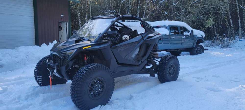
Time to take the little girl for a ride. She loves going in the utv.
 7 points
 -
This electric snow blower works really good. That pile in in front of shop is huge and it's cutting into it no problem.
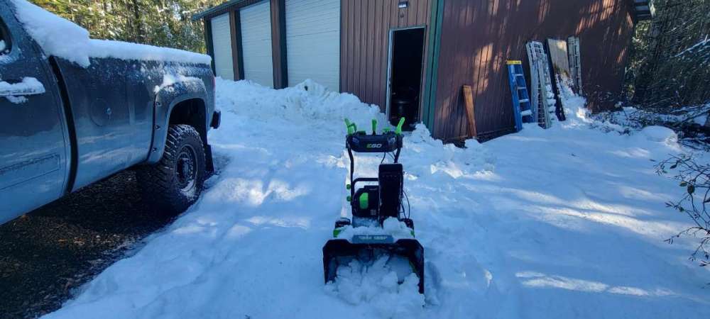
 7 points
 -
The 384 hour Kuchera always reminds me of discovering PornHub when I was a young lad.7 points
-
I have little doubt that system will make its way north enough to give light snow to Puget sound. I really would like Portland to score .7 points
-
Where were at so far this week. If a lot of this snow had managed to fall just 1-2 degrees cooler we probably would have double the snowfall this week. Think the only below freezing snowfall was yesterday mornings surprise snowfall. We’ve basically had 5 separate events Tuesday morning-0.7” Wednesday night-1.2” Thursday morning-0.8” Friday morning-0.7” Friday night/Saturday morning-0.7”7 points
-
Starting to look like Portland finally has a legit shot at this Sunday. Was starting to worry we would go through this whole week without oregon folks even having a chance. Hoping for the best down there.7 points
-
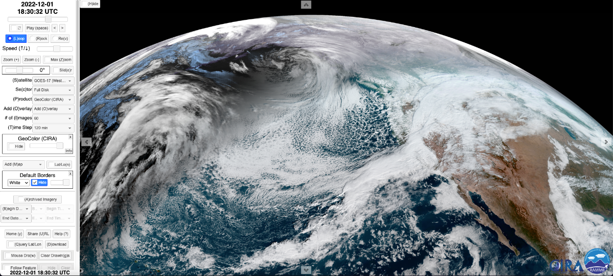
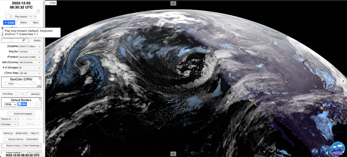
Evolution of the storm since 10 AM on Thursday 12/1. The final image is from 12:30 AM (30 minutes ago).

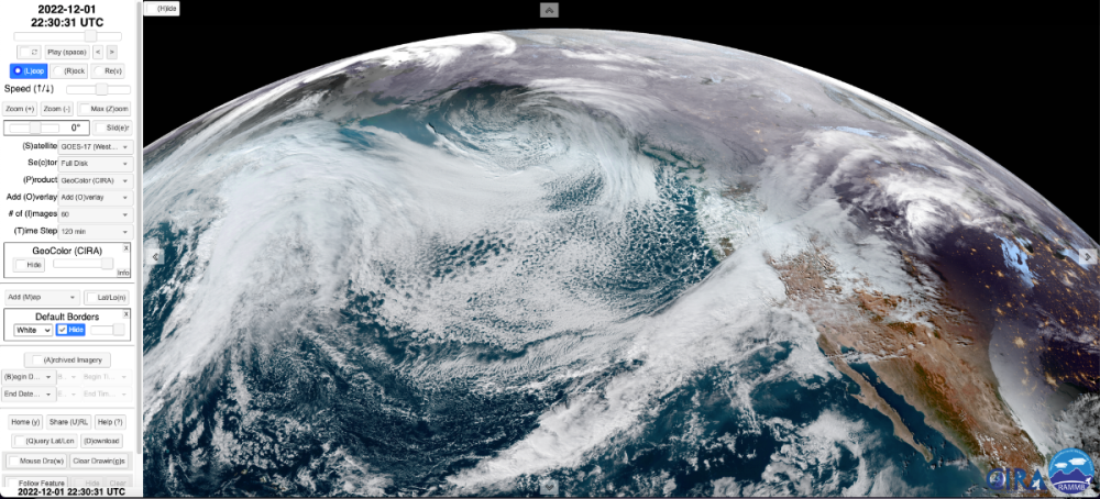
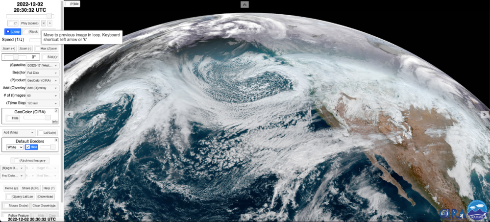
 7 points
 -
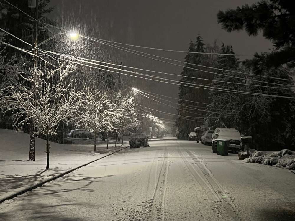
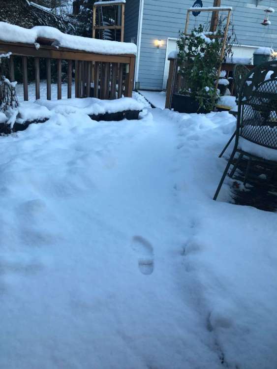
Seeing cars struggling to go up and down the street. Probably around 1-1.5 inches accumulation on the road.7 points


.thumb.jpeg.8bc2e9d6aa1b02cea603ad27e130f4fe.jpeg)


This leaderboard is set to Vancouver/GMT-07:00