
Leaderboard

.thumb.jpeg.e3014abf99ef08a9f9ac2c0cd31b485b.jpeg)


Popular Content
Showing content with the highest reputation on 12/05/22 in all areas
-
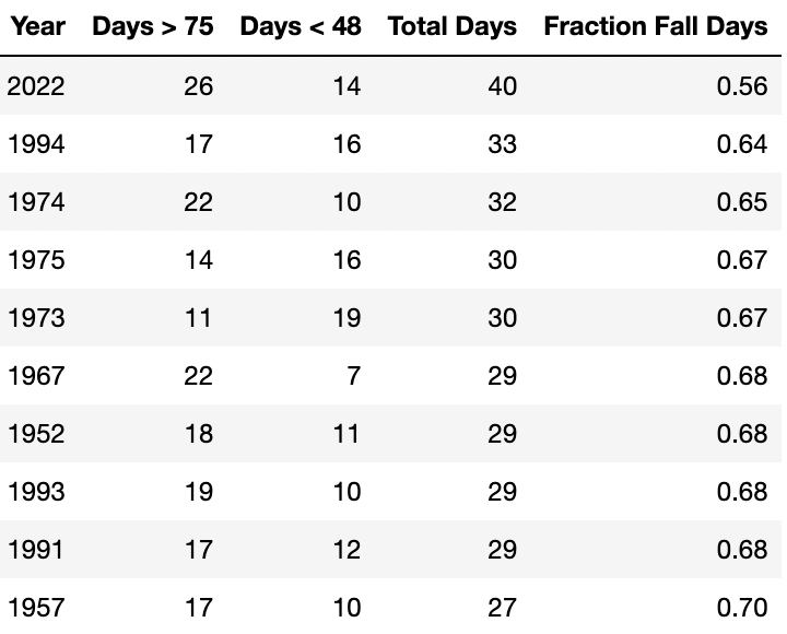
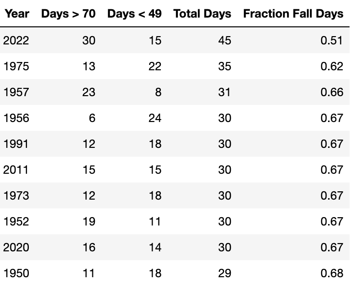
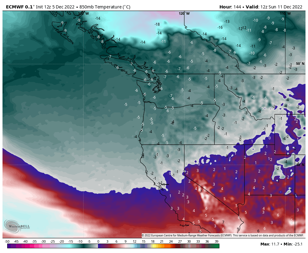
There was a discussion earlier of how this year was the "Year without a Fall" in the PNW as a result of the September/October torch and the November freeze. I was interested in if there was a way to actually quantify this for some cities in Western Washington (I'm too lazy to do Oregon, but the data and analysis is quite simple to find/complete if you're interested). I first wondered if I could look at monthly averages. If you have a steep drop off from September to October or October to November in average temperatures then it may suggest you "skipped fall." The problem with such coarse analysis is what happens if the pattern change happens midway through the month? Then October ends up average even if the first half of the month was significantly above average and the second half was significantly below. Instead I decided to look at individual highs for each day during the meteorological fall (September 1 to November 30) and compare them to average values. Clearly meteorological fall is a better measure than astronomical fall because by December 21st most of the area has already bottomed out for high temperatures. I only looked at high temperatures because as discussed on here before, the average person probably doesn't pay that much attention to the low for the day. I could have also looked at precipitation, but that would have made the analysis more difficult and I'm not sure how you would distinguish summer precipitation from fall precipitation from winter precipitation. For Seattle (SEA), Bellingham (BLI), and Olympia (OLM) I looked at how many days each station had where the high temperature was outside the bounds of the average high temperature between September 1st and November 30th. For example, the average high at SEA on September 1st is 75F and the average high at SEA on November 30th is 49F. So I counted up how many days in each year of record the high was 75F or above (I decided to include the boundary values) and how many days the high was below 50F. I've included the top 10 years for each city below. Seattle In the period of record, autumn 2022 was the least "fall-like" on record. Only 56% of the days (total of 40 out of 91) featured a high between 50F and 75F. The next closest year was 1994 with 59% of days being "fall-like." In case you're wondering, 2016 and 1954 were the most "fall-like" autumns in Seattle with 91% and 92% (respectively) of the high temperatures falling within the normal range. Bellingham Bellingham is cooler than Seattle by September 1st with an average high of 71F, and because of that the warm Sept/Oct were even more anomalous. 1/3 of the season featured highs warmer than the autumn maximum and almost 50% of all the days were outside of the 49-70 range. This was significantly more outlier days than any other year (1975 featured 62% of "fall-like" days) while 2018 was the most "fall-like" with 91% of days falling within the normal range. Olympia Olympia starts September with an average high of 76F and ends November with an average high of 47F. Once again, 2022 was the least "fall-like" by a wide margin with 40 days (56%) which fell outside of the normal bounds. 1994 was next closest with 64% of abnormally warm or cool days. The most "fall-like" year for Olympia was 1954 (same as Seattle) when a full 95% of autumn days had highs that were within the normal range.

 18 points
 -
Alright calling my shot now for January. Mid-month arctic blast that keeps temps north of the Columbia below freezing max for 8 days. South of will be balmy and early spring flowers will begin to bloom As for snow? Randy wins with 4 feet of powder and opens his own ski resort at home. Trace-2" at Jim's house, who calls it an all time bust. Tim's power will be out for 3 weeks and he will evac himself to the Bahamas until March.14 points
-
Something big is coming. Extreme..13 points
-
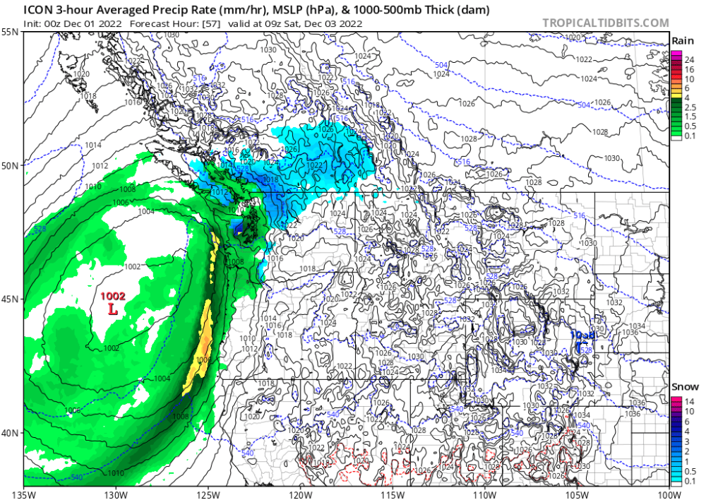
This is 1am Saturday morning the 3rd and the icon was showing rain and it was snowing all along the canal and almost the entire kitsap peninsula along with a bunch of other places. The forecast was created the day before the event. Icon has a really bad warm bias. The good news though is if it shows any snow at all it will be a blizzard.
 12 points
 -
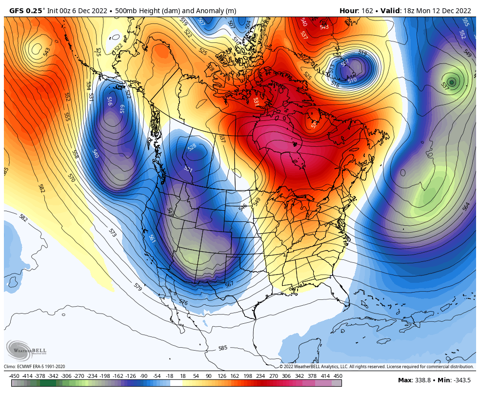
Always surprised when the majority of us swear off the GFS after it fumbles our snow plans, only to indulge in beautiful 18z GFS 100+ hour snow maps a week later. Weenies gonna weenie, I love it. Encouraging signs for sure in the 500 mb pattern. Definite improvement in the main models and ensembles for the next week or so. But, we've been here before with watering down cold, so I'd be cautious. I think BC is a slam dunk in this pattern for cold or snow or both.11 points
-
Compared to the 2 previous runs, Arctic air is much further south at Day 6
 11 points
 -
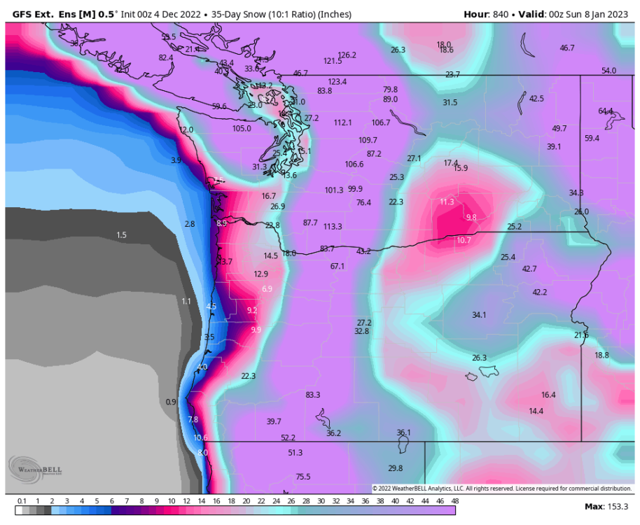
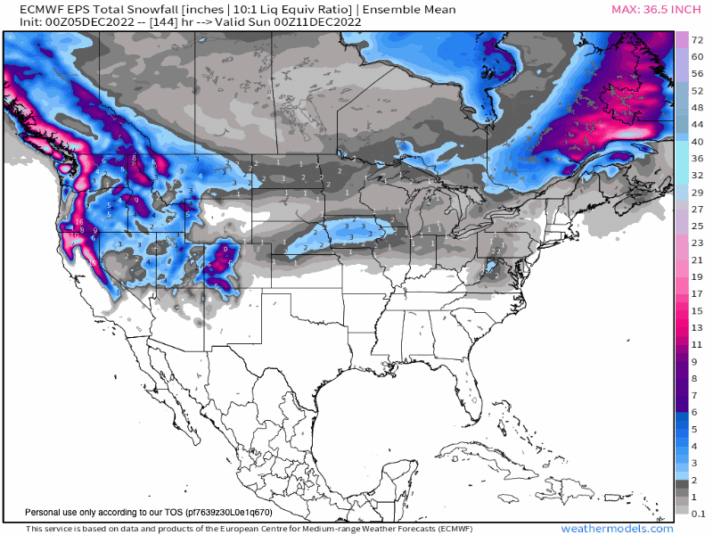
I'm bored waiting for tonight's 00z runs. Plenty of Pepto on the GEFS 35 day snowfall forecast. Lock it in?
 10 points
 -
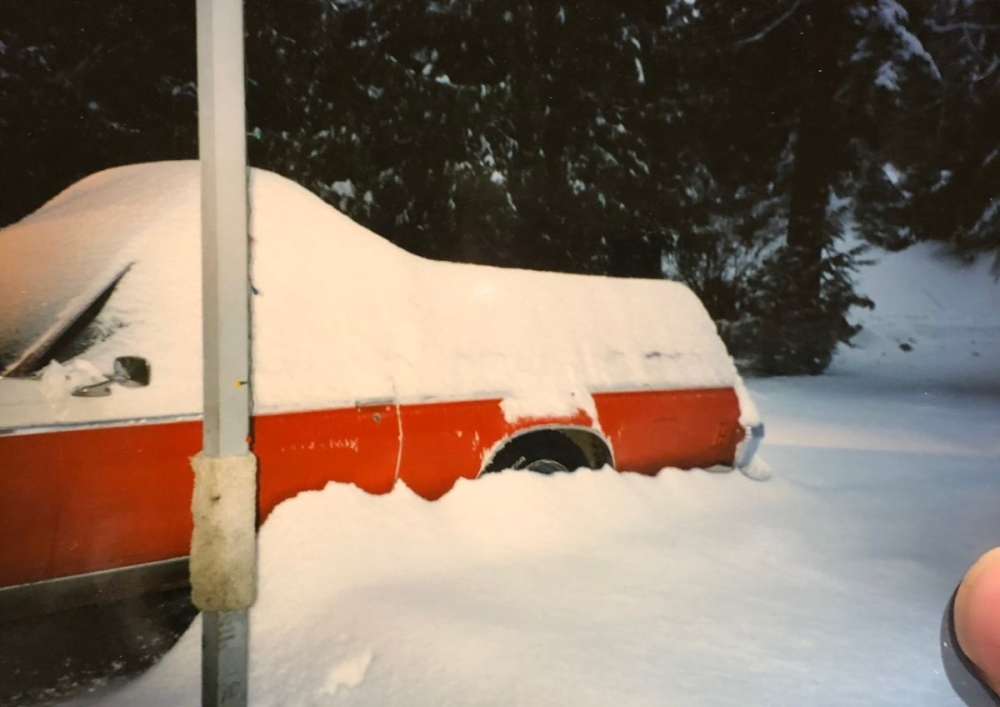
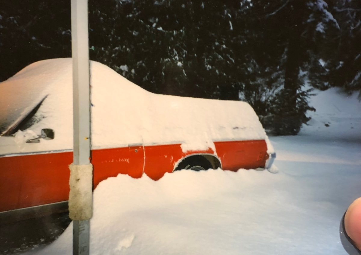
Someone earlier mentioned December 1996…That was quite the doozy up here. Seattle north mainly but south of there had major ice. Anyway, first off you had the element of surprise. We had a little snow on the 23rd I think it was but the forecast didn’t call for much the rest of the week. That changed in a huge way Christmas evening…I was at the family lake house, my grandparents lived there at that time and we were having Christmas dinner. My grandpa had the radio on in the background and they cut in to say the forecast had a big change and that there was a Winter Storm Watch issued for most of western Washington. That feeling of sudden excitement is something I will never forget. When I got home I turned on the weather channel and watched every “On the 8’s” with the WINTER STORM WATCH text…I was vibrating with excitement! Sure enough it snowed about a foot later the next day and into the 27th…and got cold! Then another Winter Storm Watch was issued for ALL of Washington State…Not sure if I have seen that happen since then. Anyway I started getting really nervous as the temp spiked to about 36 degrees mid day on the 28th…Then the clouds increased and the temp started plummeting! By the time the snow started that evening we were down to 14 degrees…It was AMAZING! Then a Blizzard warning was issued for my area and north, super heavy snow and wind all night! Lost power in the early morning hours and we had a massive amount of snow by daybreak of the 29th. Then it started mixing with rain around 9am and completely turned over by 10am. My grandparents called my dad saying their roof was starting to leak, the local news was starting to go nuts with all of the roof collapses in the area so we raced over to the lake house (the front of my dads blazer was plowing snow it was so deep) and started shoveling like crazy since it was a flat roof at the time. (We put a regular pitched roof on it the spring of 1997 because of that storm) It was complete madness and super fun at the same time! This pic was taken after it had started raining so the snow had compacted some. That storm caused massive damage region wide.
 10 points
 -
18Z GFS makes it all up for the north Sound folks who were screwed last week...
 10 points
 -
From the 400 pages here and the 1500 post's from me the important lesson here is snow will not stick to warm pavement. Cliff Mass for president!!10 points
-
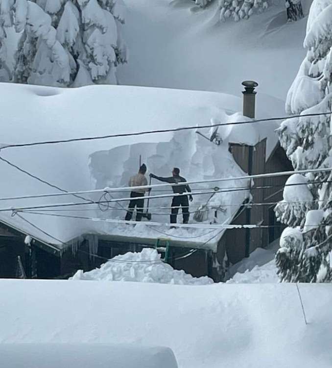
Last December here in town. I also shoveled my roof cause of an ice dam.
 9 points
 -
This must have hurt to publish.
 9 points
 -
Something like 1880 with today's population would be absolute insanity. The thought of a widespread 3-5ft on the ground is nutty.9 points
-
This what you guys want to see? Pepto for all
 9 points
 -
I really believe what i said last night, something big is coming this winter. Could be a mega windstorm or a mega ice storm or mega arctic air and snow but something historical is coming i feel.9 points
-
9 points
-
Playing around with the new AI tools... lol
 9 points
 -
Regional arctic outbreak in January only 40 days out8 points
-
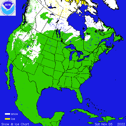
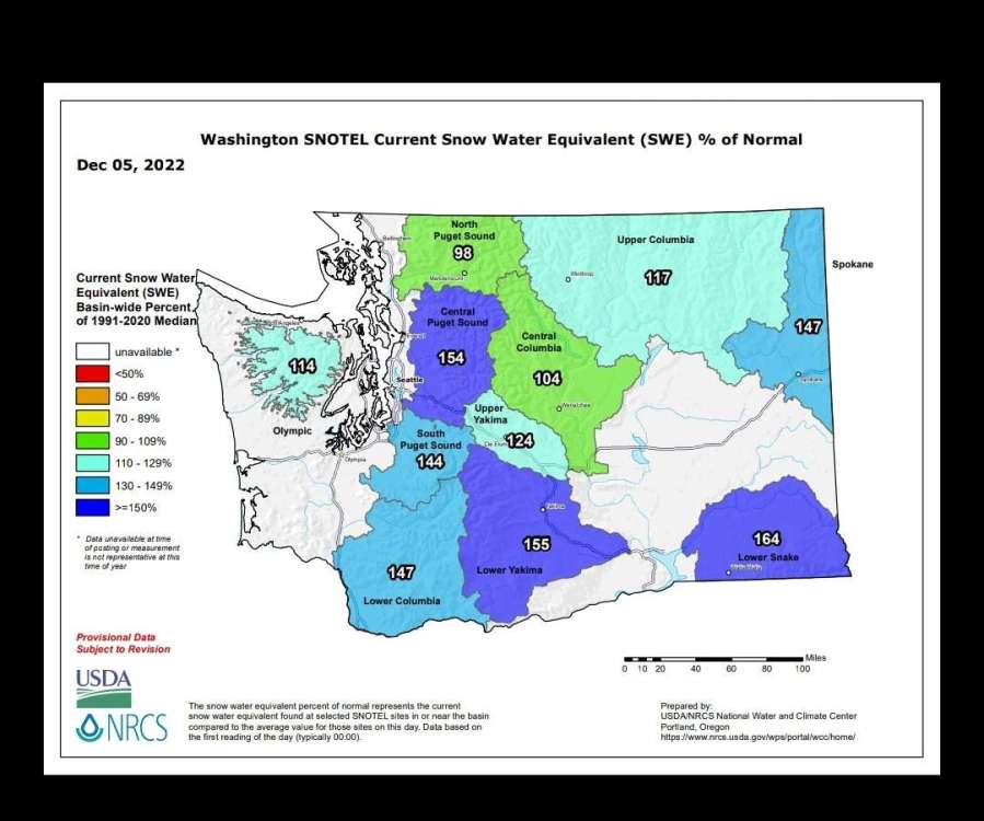
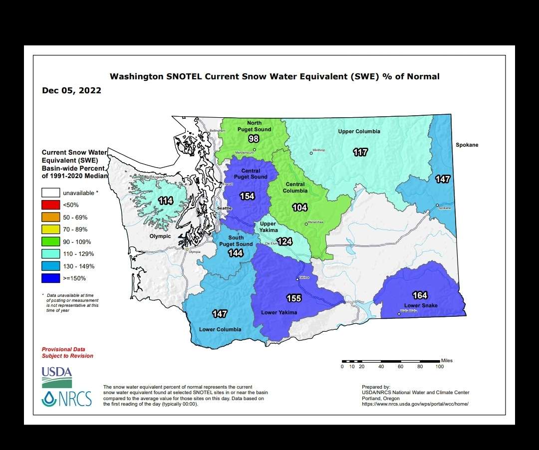
Big expansion in western snow cover over the last month. First image is Nov 5 and second is Dec 5 (today).
 8 points
 -
Best is probably something like 2008 which featured multiple events with multiple tracks, to the point that just about everyone scored well, even though not everyone scored from every event.8 points
-
We all get greedy with our snow but i don't enjoy watching other posters suffer because they miss out. WE are all pathetic when it comes to missing out on snow lol.8 points
-
I never do man, if anything i vote for it. I know how i feel when i get missed so why would i want people i care for to feel that way. Not my style.8 points
-
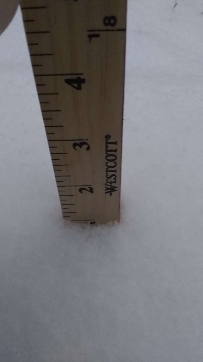
Still over forecasted but this morning we had an inch of new powder. Not quite the two inches I wanted but enough to play in (just barely).So far I'm at 1.20 for the event. I will reset the board at lunch when it is over.

 8 points
 -
Breaking news. Heaven and earth move and PDX scores a rare freeze.8 points
-
Here comes the next storm that will dump 4-5 feet on Seattle in 36 hours! Every trough is at least a foot of snow in Seattle... its basic climo.
 7 points
 -
Snow on Friday now for Seattle!!
 7 points
 -
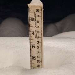
The snow is really not melting much here, it's so dense that the melt is very slow. Still 11.5 inches on the ground. High today was only 34.
 7 points
 -
If the GFS was believable, I wonder if the NFL would start making contingency Plans Pretty serious snow Saturday and Sunday7 points
-
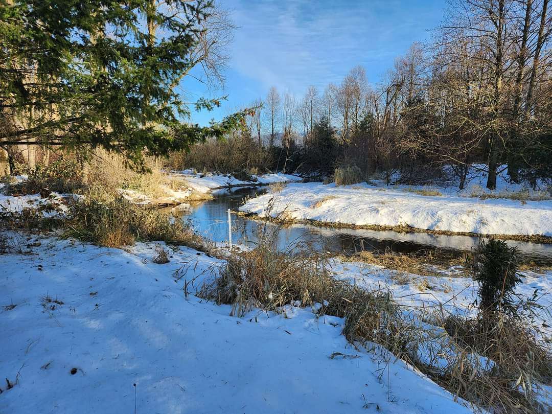
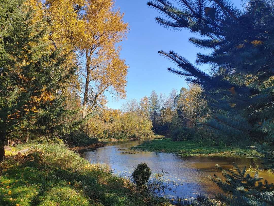
This is true. I was just commenting the other day that the creek behind my house is still in the channel, and not filling up the wider creek bed. Usually it spends the entirety of mid-October through about early-April overtopping the banks of the channel and filling from embankment to embankment. I think this is a good example of a mostly non-existent fall. Pictures taken (entirely by accident) in almost the exact same spot. One was this past weekend, with the creek still fully within the channel. The other taken last October. Outside of the channel, and filling the width of the bed. That's about typical (or perhaps a bit low) for average fall and winter water levels. Can't really tell in the photos, but the water's about three feet deeper in the second photo.

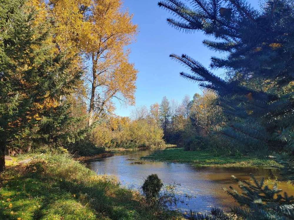 7 points
 -
I probably shouldn't have brought up my sour grapes. Just saying if we get a suppressed low here or there, W. Washington is still more of a favorable location overall, and with jet suppression its probably going to be colder up there. Even though whether or not the WV gets snow means little to snow up here, I still root hard for them.7 points
-
Enough for TWL to get a sub-freezing high at least.7 points
-
OMG. February 2014 redux.7 points
-
22 and very fine flurries/ice crystals falling. just shovelled and blowed the driveway, front steps and sidewalk. looks like about 1.5-2" from yesterday and last nights event. looks like constant flurries/showers through wednesday when a stormier pattern takes over. snow in the forecast through the foreseeable future. I'll take it. may start running out of places to put the snow piles though. we live in a garden home community so very little front yard. just a grass storm water ditch out by the street after our small yard fills up. I've been blowing a lot of it out in the street and this years plow guy luckily understands to plow it to the other side of the street where there is not a driveway and to avoid berms when possible. last year we got plowed in while out of town and it froze solid so high I couldn't get my car out for a month. had to drive the wife's subaru over the berm until it got warm and softened up to shovel. I've lined up my landscapers for snow removal this year while we're on the east coast for xmas > NYE. Hoping to avoid berms this season.7 points
-
Thank the ridge bridge for the success of this ECMWF run!6 points
-
You know what, for some reason I was looking at yesterday's 12z earlier. Much better! Hopefully tonight's continues the theme.6 points
-
00z GEFS Day 6.5 850s (4-run trend) trending colder.
 6 points
 -
Anyone in the mood for some warm light snow on Thursday night? 00z NAM is.
.thumb.png.4e66aeb7c525e06735d8d2d3e1af767d.png) 6 points
6 points -
We’ve had off and on flurries here. Solid frost cover on top of the dusting of snow we got a few days ago. 32*. Been nice here lately. Cold, mostly clear with some high clouds. Feels like winter. Like December should feel.6 points
-
Very good cold signal for late Dec / early Jan. PNA and EPO both solidly minus.6 points
-
Some still left. Been foggy and misty all day.
 6 points
 -
Like a big warm Christmas hug from squiggly lines. Kohls gift card for who can guess the date!
 6 points
 -
Wow just looked at 12z GFS, EURO. Wind potential, lowland snow potential, and backdoor arctic air. Crazy model riding ahead we are getting no break in that! Outstanding. 18z GFS in 1 hour 48 minutes6 points
-
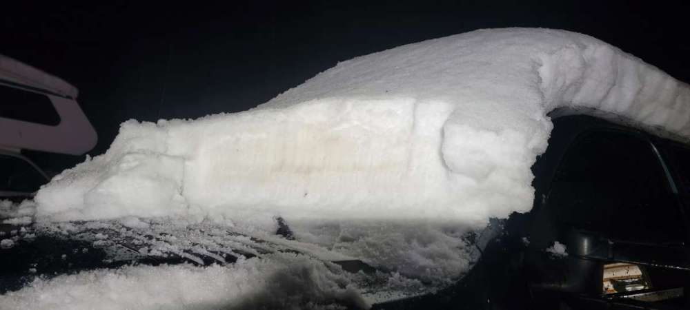
In case anyone is wondering the mountains are currently very happy
 6 points
 -
I may or may not be available for the 12z GFS in 50 minutes. It will be interesting to see if this run continues to show the possible southerly wind/event storm for Saturday. The pattern with the deep trough and axis near the coast does bare watching closely. I think we're all caught up on looking for the next cold trough and potential lowland snow chances and this possible wind event/storm may sneak up on us. We'll see.... Long range it would be nice to see a continued chilly NWLY flow or the ridge to become even more favorable yanking that bitter air in British Columbia southward over us.6 points
-
My goodness, this is getting rather fascinating...0z EPS going nuts on the active wave train and suggesting a lot of winter wx fans will reap in the rewards in the Snow Dept. Choo-Choo!!!
 6 points
 -
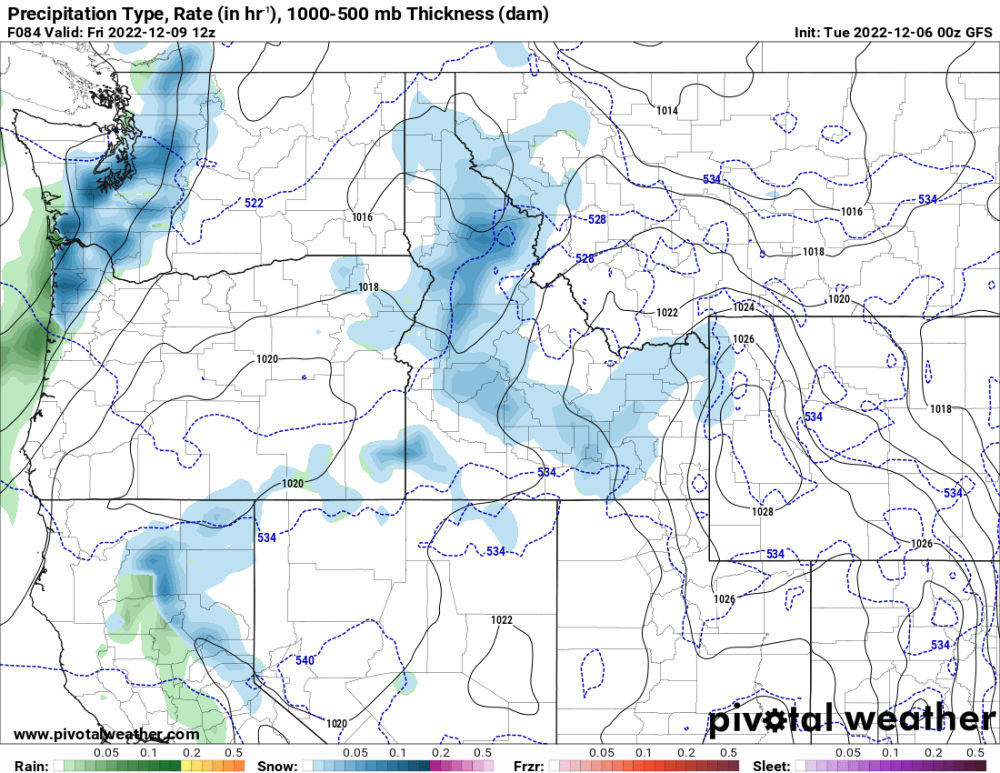
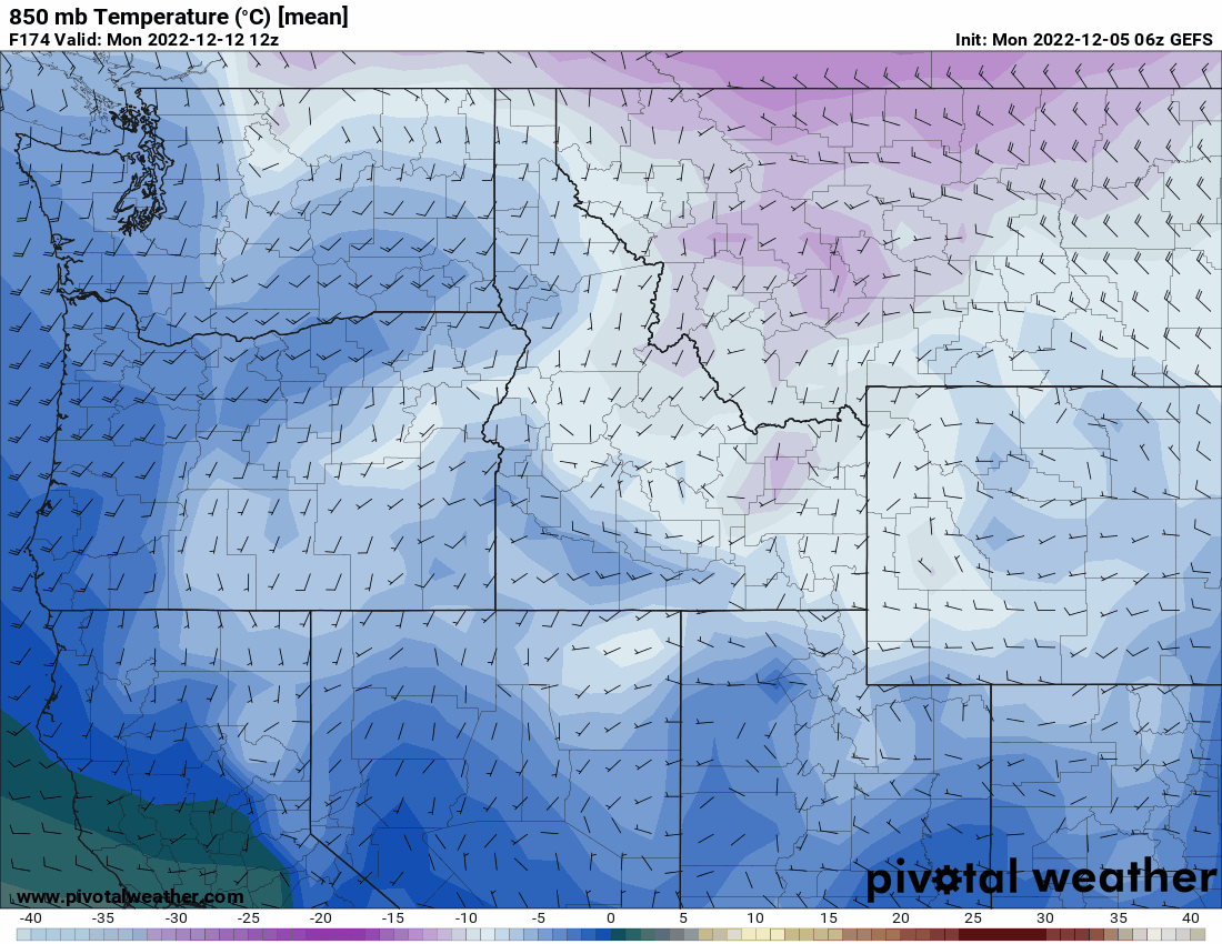
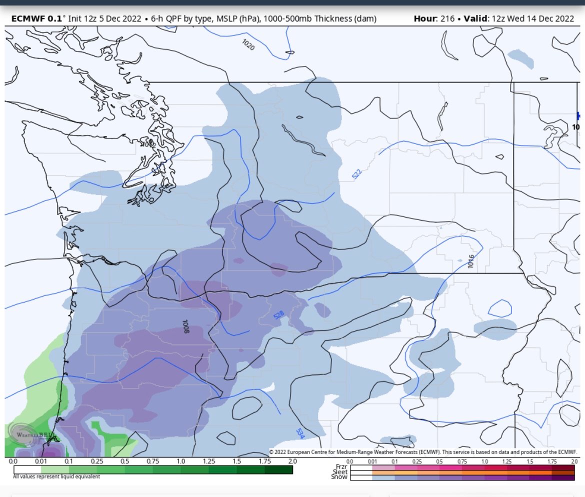
0z Euro is starting to show a colder storm on 12th and 13th. For some this could mean snow on top of snow. The EPS for that time period:6 points


.png.39118a8a04cef98f3eea70a73cf3bec0.png)


.png.10fc6bddc087e884506dd59f5cb16251.png)


.png.6bca88430f9780c8ba2bc8ac2d8899f1.png)


This leaderboard is set to Vancouver/GMT-07:00